|
Philip's Maps
Philip's The Cotswolds: Leisure and Tourist Map
Paperback / softback. New. A new edition of this double-sided map of the Cotswolds. Featuring places of tourist and historic interest in an easy-to-read style of mapping. 6 town centre plans. paperback
Bookseller reference : A9781849075381 ISBN : 1849075387 9781849075381

|
|
|
Philip's Maps
Philip's World Atlas: Paperback
Paperback / softback. New. An information-packed paperback world atlas from Philip's published in association with the Royal Geographical Society - fully revised and updated. paperback
Bookseller reference : A9781849075169 ISBN : 1849075166 9781849075169

|
|
|
Philip's Maps
Philip's World Atlas
2016-02-04. Good. Ships with Tracking Number! INTERNATIONAL WORLDWIDE Shipping available. May not contain Access Codes or Supplements. May be re-issue. May be ex-library. Shipping & Handling by region. Buy with confidence excellent customer service! unknown
Bookseller reference : 1849073937 ISBN : 1849073937 9781849073936

|
|
|
Philip's Maps and Atlases
Road Atlas: France Belgium Luxembourg
Philip's. Spiral-bound. Used; Good. Simply Brit Shipped with Premium postal service within 24 hours from the UK with impressive delivery time. We have dispatched from our book depository; items of good condition to over ten million satisfied customers worldwide. We are committed to providing you with reliable and efficient service at all times. 02/14/2006 Philip's unknown
Bookseller reference : mon0001566037 ISBN : 0540089540 9780540089543
|
|
|
Philip's Series of Travelling Maps
North America
London UK: George Philip & Son Ltd. Good. 0. Hardcover. Dark blue cloth boards with gilt title. Map folds out to 22 x 28 inches. No date circa 1900s. Boards worn on edges corners bumped spine starting to split.; Book; 12mo - over 6� - 7�" tall . George Philip & Son, Ltd. hardcover
Bookseller reference : 006893

|
|
|
Philip's Series of Travelling Maps
North America
London UK: George Philip & Son Ltd. Good. 0. Hardcover. Dark blue cloth boards with gilt title. Map folds out to 22 x 28 inches. No date circa 1900s. Boards worn on edges corners bumped spine starting to split.; Book; 12mo - over 6¾ - 7¾" tall . George Philip & Son, Ltd. hardcover books
Bookseller reference : 006893
|
|
|
PHILIP, George & Son
Philips' Mercantile Map of Europe
4to [29 x 25 cm, 11.5 x 9.7 inches]; large folding colored map measuring 78 x 122 cm or 37.5 x 48 inches that folds to 29 x 25 cm. original cloth covers, title lettering on cover and spine, joint cracked but firm, marbled endpapers, original ribbon ties, map near fine and clean, linen-backed sectional map as originally issued, in very good original cover. A picture of this book is av A very detailed map, showing all of Europe including Western Russia to Iceland, part of north Africa, Lebanon, most of Caspian Sea. It shows cities, railways, mail and other steamers routes, wireless stations, canals, Lloyd's signal states, each country is shown in different color, also shows altitudes, etc. The scale is 72 mile to the inch or 1:4,500,000.
|
|
|
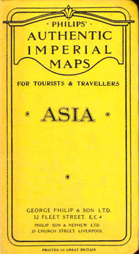
Philips Authentic Imperial Maps
Philips Authentic Imperial Maps For Tourists and Travelers: Asia
Liverpool: George Philip and Son nd. Hardcover. Very good. Boards rubbed and darkened cloth backing slightly tanned else very good. <br/><br/> George Philip and Son hardcover books
Bookseller reference : 43520
|
|
|
Philips Maps
Philips 2018 Motorists Road Atlas Britain and Ireland A3: Large-format paperback Philips Road Atlas
Philips 06/01/2017. Paperback. Used; Good. WE SHIP WITHIN 24 HRS FROM LONDON UK 98% OF OUR ORDERS ARE RECEIVED WITHIN 7-10 DAYS. We believe you will be completely satisfied with our quick and reliable service. All orders are dispatched as swiftly as possible! Buy with confidence! Philips paperback
Bookseller reference : 3765431 ISBN : 1849074607 9781849074605
|
|
|
Philips Maps
Philips 2018 Complete Road Atlas Europe: A4 with practical flexi cover Philips Road Atlas
Philips 04/06/2017. Flexibound. Used; Good. WE SHIP WITHIN 24 HRS FROM LONDON UK 98% OF OUR ORDERS ARE RECEIVED WITHIN 7-10 DAYS. We believe you will be completely satisfied with our quick and reliable service. All orders are dispatched as swiftly as possible! Buy with confidence! Philips unknown
Bookseller reference : 3725227 ISBN : 1849074232 9781849074230
|
|
|
Philips Maps
Philips 2018 Complete Road Atlas Britain and Ireland - Spiral: Spiral binding Philips Road Atlas
Philips. Spiral-bound. Used; Good. Simply Brit Shipped with Premium postal service within 24 hours from the UK with impressive delivery time. We have dispatched from our book depository; items of good condition to over ten million satisfied customers worldwide. We are committed to providing you with reliable and efficient service at all times. 06/01/2017 Philips unknown
Bookseller reference : 2976097 ISBN : 1849074577 9781849074575
|
|
|
Philips Maps
Philips Concise Atlas Britain: Spiral A5 Philips Road Atlas
Philips 03/07/2019. Paperback. Used; Good. WE SHIP WITHIN 24 HRS FROM LONDON UK 98% OF OUR ORDERS ARE RECEIVED WITHIN 7-10 DAYS. We believe you will be completely satisfied with our quick and reliable service. All orders are dispatched as swiftly as possible! Buy with confidence! Philips paperback
Bookseller reference : 3679754 ISBN : 1849075077 9781849075077
|
|
|
Philips Maps
Philips Drivers Atlas Britain: Paperback Road Atlas
Philips 10/06/2016. UK ed. Paperback. Used; Good. WE SHIP WITHIN 24 HRS FROM LONDON UK 98% OF OUR ORDERS ARE RECEIVED WITHIN 7-10 DAYS. We believe you will be completely satisfied with our quick and reliable service. All orders are dispatched as swiftly as possible! Buy with confidence! Philips paperback
Bookseller reference : 3234165 ISBN : 1849074186 9781849074186
|
|
|
Philips Maps
Philips Essential Road Atlas Britain and Ireland 2017: Spiral
Philips. Spiral-bound. Used; Good. Simply Brit Shipped with Premium postal service within 24 hours from the UK with impressive delivery time. We have dispatched from our book depository; items of good condition to over ten million satisfied customers worldwide. We are committed to providing you with reliable and efficient service at all times. 06/23/2016 Philips unknown
Bookseller reference : 2558563 ISBN : 1849074143 9781849074148
|
|
|
Philips Maps
Philips Europe Road Map Philips Road Maps
Philips 05/03/2018. Paperback. Used; Good. WE SHIP WITHIN 24 HRS FROM LONDON UK 98% OF OUR ORDERS ARE RECEIVED WITHIN 7-10 DAYS. We believe you will be completely satisfied with our quick and reliable service. All orders are dispatched as swiftly as possible! Buy with confidence! Philips paperback
Bookseller reference : 3626615 ISBN : 1849074356 9781849074353
|
|
|
Philips Maps
Philips Ireland Road Map
Philips 03/02/2015. Paperback. Used; Good. WE SHIP WITHIN 24 HRS FROM LONDON UK 98% OF OUR ORDERS ARE RECEIVED WITHIN 7-10 DAYS. We believe you will be completely satisfied with our quick and reliable service. All orders are dispatched as swiftly as possible! Buy with confidence! Philips paperback
Bookseller reference : 3549954 ISBN : 1849073597 9781849073592
|
|
|
Philips Maps
Philips Street Atlas Surrey: Spiral Edition
Philips 09/03/2015. Paperback. Used; Good. WE SHIP WITHIN 24 HRS FROM LONDON UK 98% OF OUR ORDERS ARE RECEIVED WITHIN 7-10 DAYS. We believe you will be completely satisfied with our quick and reliable service. All orders are dispatched as swiftly as possible! Buy with confidence! Philips paperback
Bookseller reference : 3761857 ISBN : 1849073694 9781849073691

|
|
|
Philips Maps
Philips Street Atlas Derbyshire: Spiral Edition
Philips. Paperback. Used; Good. Simply Brit Shipped with Premium postal service within 24 hours from the UK with impressive delivery time. We have dispatched from our book depository; items of good condition to over ten million satisfied customers worldwide. We are committed to providing you with reliable and efficient service at all times. 11/03/2016 Philips paperback
Bookseller reference : 3017903 ISBN : 1849074291 9781849074292
|
|
|
Philips Maps
Philips Start Chart 2014 Philips Star Chart
Philips. UK ed. Paperback. Used; Good. Simply Brit Shipped with Premium postal service within 24 hours from the UK with impressive delivery time. We have dispatched from our book depository; items of good condition to over ten million satisfied customers worldwide. We are committed to providing you with reliable and efficient service at all times. 09/01/2014 Philips paperback
Bookseller reference : 2970726 ISBN : 1849073295 9781849073295
|
|
|
Philips Maps and Atlases
Road Atlas: France Belgium Luxembourg
Philips 02/14/2006. Spiral-bound. Used; Good. WE SHIP WITHIN 24 HRS FROM LONDON UK 98% OF OUR ORDERS ARE RECEIVED WITHIN 7-10 DAYS. We believe you will be completely satisfied with our quick and reliable service. All orders are dispatched as swiftly as possible! Buy with confidence! Philips unknown
Bookseller reference : 1671229 ISBN : 0540089540 9780540089543
|
|
|
Philips' Companion Maps
PHILIPS' COMPANION MAPS FOR TOURISTS AND TRAVELLERS: EUROPE WITH INDEX
London: George Philip & Son. Good in Very Good dust jacket; Map in Shape Covers of Folder is . Worn/Scuffed. ca1910. Hardback. Map in Very Good Shape Covers of Folder is Worn/Scuffed . George Philip & Son hardcover
Bookseller reference : 87172
|
|
|
Philips' Travelling Maps
France
London UK: George Philip & Son Ltd. Good. Hardcover. Circa 1900 map of France. Cloth-mounted map folds out from pictorial red cloth boards to a size of 27 by 22 inches. Some tearing along spine edges rubbed corners bumped; marginalia from the previous owner in blue colored pencil and light foxing affecting the content. ; Book; 12mo - over 6� - 7�" tall . George Philip & Son, Ltd. hardcover
Bookseller reference : 006891

|
|
|
Phillips
Printed books, atlases & maps including travel, topography, art reference & architecture : to be sold by auction Thursday 20 February 1992 at 11 am and 2 pm
Auction catalogue. Fine pbk. 20135 eng
|
|
|
Phillips Philip Lee US. Library of Congress. Div. of Maps and Charts U. S.
A list of books magazine articles and maps relating to Brazil 1800-1900 1901 Leather Bound
2019. Leather Bound. New. Leather Binding on Spine and Corners with Golden Leaf Printing on round Spine. Reprinted in 2019 with the help of original edition published long back 1901. This book is printed in black & white sewing binding for longer life Printed on high quality Paper re-sized as per Current standards professionally processed without changing its contents. As these are old books we processed each page manually and make them readable but in some cases some pages which are blur or missing or black spots. If it is multi volume set then it is only single volume if you wish to order a specific or all the volumes you may contact us. We expect that you will understand our compulsion in these books. We found this book important for the readers who want to know more about our old treasure so we brought it back to the shelves. Hope you will like it and give your comments and suggestions. Lang: - eng Pages 158. EXTRA 10 DAYS APART FROM THE NORMAL SHIPPING PERIOD WILL BE REQUIRED FOR LEATHER BOUND BOOKS. FOLIO EDITION IS ALSO AVAILABLE. hardcover
Bookseller reference : LB1111005750501
|
|
|
Phillips Philip Lee US. Library of Congress. Div. of Maps and Charts U. S.
A list of books magazine articles and maps relating to Brazil 1800-1900 1901
2020. Paperback. New. Lang: - eng Pages 158. Reprinted in 2020 with the help of original edition published long back 1901. This book is Printed in black & white sewing binding for longer life with Matt laminated multi-Colour Soft Cover HARDCOVER EDITION IS ALSO AVAILABLE Printed on high quality Paper re-sized as per Current standards professionally processed without changing its contents. As these are old books we processed each page manually and make them readable but in some cases some pages which are blur or missing or black spots. If it is multi volume set then it is only single volume if you wish to order a specific or all the volumes you may contact us. We expect that you will understand our compulsion in these books. We found this book important for the readers who want to know more about our old treasure so we brought it back to the shelves. Any type of Customisation is possible with extra charges. Hope you will like it and give your comments and suggestions. paperback
Bookseller reference : PB1111005750501
|
|
|
Phillips Philip Lee US. Library of Congress. Div. of Maps and Charts U. S.
A list of books magazine articles and maps relating to Brazil 1800-1900 1901 Hardcover
2020. Hardcover. New. Lang: - eng Pages 158. Reprinted in 2020 with the help of original edition published long back 1901. This book is Printed in black & white Hardcover sewing binding for longer life with Matt laminated multi-Colour Dust Cover Printed on high quality Paper re-sized as per Current standards professionally processed without changing its contents. As these are old books we processed each page manually and make them readable but in some cases some pages which are blur or missing or black spots. If it is multi volume set then it is only single volume if you wish to order a specific or all the volumes you may contact us. We expect that you will understand our compulsion in these books. We found this book important for the readers who want to know more about our old treasure so we brought it back to the shelves. Any type of Customisation is possible with extra charges. Hope you will like it and give your comments and suggestions. hardcover
Bookseller reference : 1111005750501
|
|
|
PHILLIPS P. LEE / MAPS OF AMERICA
A List of Maps of America in the Library of Congress. Preceded By A List Of Works Relating To Cartography. First Edition
Washington: GPO 1901. HARDCOVER . Orig. burgundy buckram lightly rubbed and loosening first end paper loose pages uncut and partly unopened. VERY GOOD. This subject-chronological monograph constitutes he first comprehensive listing of all maps of America North Central and South a relating to the maps of America in the Library of Congress. copy t included anywhere in the Library of Congress Washington: GPO hardcover
Bookseller reference : 8162
|
|
|
Phillips Jonathan/Piggott Reginald maps
The Fourth Crusade and the Sack of Constantinople
NY: Viking 2004. 1st American printing. VG/VG dust jacket. xxvi 374 p. photos maps notes biblio index 8vo; Viking hardcover
Bookseller reference : 51021 ISBN : 0670033502 9780670033508

|
|
|
Phillips, Keith P
The Flinders in Colour
No marks or inscriptions. No creasing to covers or to spine. A very clean very tight copy with bright unmarked boards and bumping to upper front corner and spine ends. 32pp. Captioned colour photographs of the Flinders mountain range near Adelaide, South Australia.

|
|
|
PHIQUEPAL D'ARUSMONT ; BOISSY, M. de
Carte du Canton de Miradoux (Atlas Général du Gers)
Carte du Canton dressée sous l'Administration de M. de Boissy, préfet du Gers, par les soins et sous la direction de M. Phiquepal d'Arusmont, Ingénieur en chef des Ponts et Chaussées, revue, corrigée et mise à jour par l'Administration des Ponts et Chaussées, 1 carte en trois couleurs, 92 x 65 cm, L. Chanche, Paris, 1886, échelle 1/40 000, avec le plan de la ville de Miradoux en cartouche (échelle 1 / 5000) Bon état (pliure centrale habituelle, petits accrocs marginaux n'affectant pas l'impression). Français

|
|
|
PHIQUEPAL D'ARUSMONT ; DELATTE, G.
Carte du Canton d'Eauze (Atlas Général du Gers)
Carte du Canton dressée sous l'Administration de M. G. Delatte, préfet du Gers, par les soins et sous la direction de M. Phiquepal d'Arusmont, Ingénieur en chef des Ponts et Chaussées, revue, corrigée et mise à jour par l'Administration des Ponts et Chaussées, 1 carte en trois couleurs, 92 x 65 cm, gravée par A. Simon, Paris, Imp. Becquet, L. Chanche, Paris, 1881, échelle 1/40 000, avec le plan de la ville d'Eauze en cartouche (échelle 1 / 5000) Etat très satisfaisant (pliure centrale habituelle, accroc en bas de carte affectant légèrement l'impression). Français

|
|
|
PHIQUEPAL D'ARUSMONT ; DELATTE, G.
Carte du Canton de Fleurance (Atlas Général du Gers)
Carte du Canton dressée sous l'Administration de M. G. Delatte, préfet du Gers, par les soins et sous la direction de M. Phiquepal d'Arusmont, Ingénieur en chef des Ponts et Chaussées, revue, corrigée et mise à jour par l'Administration des Ponts et Chaussées, 1 carte en trois couleurs, 92 x 65 cm, L. Chanche, Paris, 1884, échelle 1/40 000, avec le plan de la ville de Fleurance en cartouche (échelle 1 / 10 000) Etat très satisfaisant (pliures centrales habituelles, petits frottements en marge n'affectant pas l'impression). Français

|
|
|
PHIQUEPAL D'ARUSMONT ; DELATTE, G.
Carte du Canton de Montesquiou (Atlas Général du Gers)
Carte du Canton dressée sous l'Administration de M. G. Delatte, préfet du Gers, par les soins et sous la direction de M. Phiquepal d'Arusmont, Ingénieur en chef des Ponts et Chaussées, revue, corrigée et mise à jour par l'Administration des Ponts et Chaussées, 1 carte en trois couleurs, 92 x 65 cm, gravée par Hausermann et A. Simon, Paris, Imp. Becquet, L. Chanche, Auch, 1882, échelle 1/40 000, avec le plan de la ville de Montesquiou en cartouche (échelle 1 / 5000) Bon état (pliure centrale habituelle, petits accrocs marginaux n'affectant pas l'impression). Français

|
|
|
PHIQUEPAL D'ARUSMONT ; JOUBERT, M. E.
Carte du Canton d'Aignan (Atlas Général du Gers)
Carte du Canton dressée sous l'Administration de M. E. Joubert, préfet du Gers, par les soins et sous la direction de M. Phiquepal d'Arusmont, Ingénieur en chef des Ponts et Chaussées, revue, corrigée et mise à jour par l'Administration des Ponts et Chaussées, 1 carte en trois couleurs, 92 x 65 cm, gravée par A. Simon, Paris, Imp. Becquet, L. Chanche, Auch, 1880, échelle 1/40 000, avec le plan de la ville d'Aignan en cartouche (échelle 1 / 5000) Bel état (pliure centrale habituelle, parfait état par ailleurs). Français

|
|
|
Photographie N&B
Lauren Bacall
Photographie N&B signée par l'actrice | Etat : Très bon état (Ref.: JCO12)
Bookseller reference : 4345
|
|
|
photographs; cartes de visite
Collection of Nineteenth Century Photographs Cartes-de-Visite Cabinet Cards
England 1800. Near Fine. Two custom cases gilt-stamped morocco containing 34 cabinet cards 4.25 by 6.5 inches and 45 cartes-de-visite 2.5 by 4 inches. Cases are in excellent condition just a little scuffed along the edges; images mostly albumens are remarkably crisp and clean some of them in original glassine envelopes. Produced by Cromack of Scarborough Brigham also Scarborough Elliott and Fry Portman Square Frank M. Sutcliffe Whitby Yorkshire and others these formal portraits include men women and children sometimes the same image is repeated and sometimes the same face is repeated though in a different setting or posture. <br/><br/> unknown
Bookseller reference : D4116
|
|
|
PHOTOGRAPHS OF MAPS SHOWING LAND USE IN PAKISTAN.
Pakistan: Land Forms and Land Use.
circa1970. Collection of 20 black and white photographic plates with their accompanying negatives of maps showing patterns of land use and land forms throughout Pakistan. These photographs are of two sets of maps prepared by the Canadian government covering the whole of Pakistan. A very useful set. From the collection of Professor Basil Johnson Emeritius Professor of Geography at the Australian National University Canberra. From the collection of geographer Professor Basil Johnson who was the author of a number of works on South Asia including "India Resources and Development" and "Geographical Dictionary of India". . unknown
Bookseller reference : 54789

|
|
|
photographs; cartes de visite
Collection of Nineteenth Century Photographs Cartes-de-Visite Cabinet Cards
England 1800. Near Fine. Two custom cases gilt-stamped morocco containing 34 cabinet cards 4.25 by 6.5 inches and 45 cartes-de-visite 2.5 by 4 inches. Cases are in excellent condition just a little scuffed along the edges; images mostly albumens are remarkably crisp and clean some of them in original glassine envelopes. Produced by Cromack of Scarborough Brigham also Scarborough Elliott and Fry Portman Square Frank M. Sutcliffe Whitby Yorkshire and others these formal portraits include men women and children sometimes the same image is repeated and sometimes the same face is repeated though in a different setting or posture. <br/><br/> unknown books
Bookseller reference : D4116
|
|
|
Photos & Maps Illustrator
Fort Snelling
St. Paul MN: Minnesota Outdoor Recreation Resources Com 1965-01-01. Paperback. Very Good. Fine glossy pictorial wraps; light rubbing along edges. Stapled binding secure; contents clean and unmarked. 111 xiv pages. Illustrated with drawings and b/w photographs. First edition. Includes Park Brochure. Additional photos available upon request. All items carefully packed to avoid damage from moisture and rough handling. Minnesota Outdoor Recreation Resources Com paperback
Bookseller reference : 020319

|
|
|
Photos and Many Maps Illustrator
The Physical Features of Carroll County and Frederick County
Board of Natural Res 1946-01-01. Hardcover. Very Good. NICE CONDITION THICK HARDCOVER BOOK. NO WRITING OR MARKINGS IN TEXT. ONLY LIGHT WEAR TO COVER. A CLEAN & SOLID BOOK. Board of Natural Res hardcover
Bookseller reference : B-1948
|
|
|
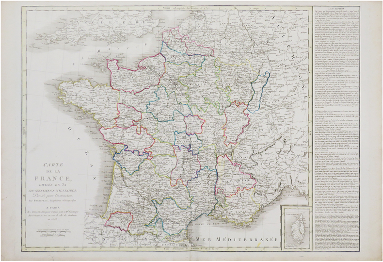
PHÉLIPEAU (René).
Carte de la France divisée en 32 gouvernemens militaires.
Paris, Basset, 1803. 527 x 729 mm.
Bookseller reference : LBW-7569
|
|
|
PICCOLI (Domenico).
[Plan d'une partie de la ville de Meduno et ses environs].
Venise, 1698. 49 x 73,5 cm, sur une feuille de 51 x 75 cm.
Bookseller reference : LBW-6637

|
|
|
PICART (Nicolas).
[PÔLE NORD] Pôle Arctique ou terre du septentrion.
[Paris, N. Picart, 1659]. 137 x 186 mm.
Bookseller reference : LBW-6204

|
|
|
PICQUET (Charles)
Carte de la Russie d'Europe donnant l'indication des Routes et Chemins de Poste, des Douanes avec la Division actuelle en Gouvernement, fidélement copiée sur celle Rédigée au Dépôt Impérial des Cartes à Saint Petersbourg en 1809.
1812 montées sur toile moutarde. carte en 4 feuilles, 115 x 117 cms, limites aquarellées. P. Librairie Géographique Hyacinthe Langlois, 1812,
Bookseller reference : 11795
|
|
|
PICQUET, Charles
Carte de Neubrisack au marquisat de Durlach ; Carte des Cantons de Bâle, de Soleure et de la principauté de Porrentrui. (2 cartes entoilées sous étui commun).
2 cartes entoilées sous chemise et étui, carte de la France n° 164 (Neuf-Brisach), 77 x 59 cm, et n°165 (Basle), 79 x 59 cm, Charles Picquet, Géographe graveur du cabinet topographique de S.M. L'Empereur, Paris, s.d. (vers 1805)
Bookseller reference : 5495
|
|
|
PICQUET, Charles
Carte de la région de Strasbourg ; Carte de la région de Colmar. (2 cartes entoilées sous étui commun).
2 cartes entoilées sous chemise et étui commun, carte de la France n° 162 (Strasbourg), 92 x 52 cm, et n°163 (Colmar), 77 x 59 cm, Charles Picquet, Géographe graveur du cabinet topographique de S.M. L'Empereur, Paris, s.d. (vers 1805)
Bookseller reference : 5496
|
|
|
PICQUET, Charles
Carte de la Principauté des Deux-Ponts jusqu'à Landau et Lauter-bourg ; Carte de Otlingen à Philisbourg ((2 cartes entoilées sous étui commun).
2 cartes entoilées sous chemise et étui commun, carte de la France n° 161 (Landau), 92 x 59 cm, et n°173 (Philipsbourg), 46 x 59 cm, Charles Picquet, Géographe graveur du cabinet topographique de S.M. L'Empereur, Paris, s.d. (vers 1805)
Bookseller reference : 5497
|
|
|
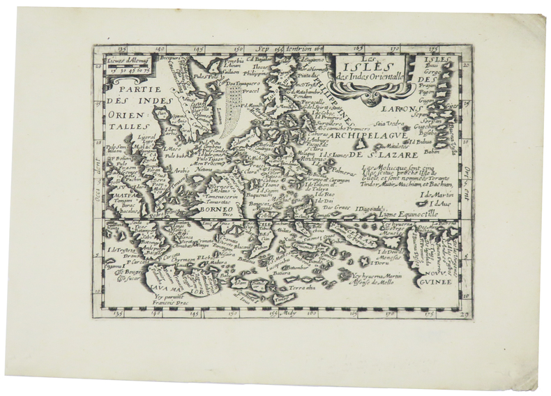
PICART (Nicolas).
Les isles des Indes Orientalle.
[Paris, N. Picart, 1659]. 133 x 185 mm.
Bookseller reference : LBW-5451
|
|
|
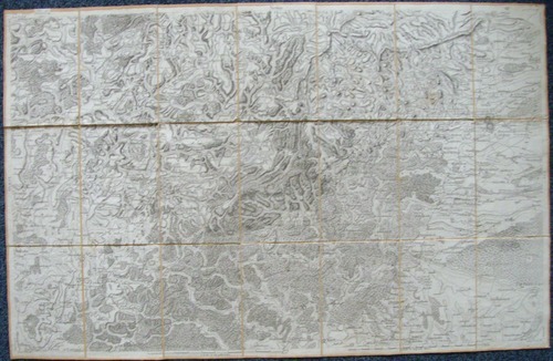
PICQUET (Charles).
Plan routier de la ville de Paris et de ses faubourgs, où se trouvent indiqués tous les changements opérés jusqu'à ce jour avec les projets d'embellissem.t arrêtés par le gouvernem.t.
Paris, Ch.les Picquet, 1er Frimaire An 13-22 nov.bre 1804. En 40 sections montées sur toile et pliées, formant une carte de 0,83 x 1,39 m, étiquette de l'éditeur au dos de la carte.
Bookseller reference : LBW-5881

|
|
|
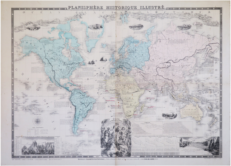
PICK (Eugène).
Planisphère historique illustré.
Paris, Eugène Pick, 1880. 0,76 x 1,02 m.
Bookseller reference : LBW-6284
|
|
 Receive by email
 Download as PDF document
 RSS feed


