|
Polgar BScHons MSc Stephen; Thomas DipPubPol PhD MAPS Shane A
Introduction to Research in the Health Sciences
Churchill Livingstone 2007-11-21. Paperback. Good. No CD Included. Access code may be previously used. Moderate dirt wear wrinkling or creasing on cover or spine. Good binding. Moderate writing and highlighting. Cover has used book stickers or residue. Marker on cover or bottom edge of book. Churchill Livingstone paperback
Bookseller reference : 0443074291-3 ISBN : 0443074291 9780443074295
|
|
|
Polgar BScHons MSc Stephen Thomas DipPubPol PhD MAPS Shane A.
Introduction to Research in the Health Sciences
Churchill Livingstone. Used - Good. Paperback This item shows wear from consistent use but remains in good readable condition. It may have marks on or in it and may show other signs of previous use or shelf wear. May have minor creases or signs of wear on dust jacket. Packed with care shipped promptly. Churchill Livingstone paperback
Bookseller reference : H-06-2551 ISBN : 0443074291 9780443074295
|
|
|
Polgar BScHons MSc Stephen Thomas DipPubPol PhD MAPS Shane A
Introduction to Research in the Health Sciences
Churchill Livingstone. Used - Acceptable. Used - Acceptable. Ships from UK in 48 hours or less usually same day. Your purchase helps support the African Children's Educational Trust A-CET. Ex-library with wear and barcode page may have been removed. 100% money back guarantee. We are a world class secondhand bookstore based in Hertfordshire United Kingdom and specialize in high quality textbooks across an enormous variety of subjects. We aim to provide a vast range of textbooks rare and collectible books at a great price. Through our work with A-CET we have helped give hundreds of young people in Africa the vital chance to get an education. We provide a 100% money back guarantee and are dedicated to providing our customers with the highest standards of service in the bookselling industry. Churchill Livingstone unknown
Bookseller reference : Z1-C-057-01815 ISBN : 0443074291 9780443074295
|
|
|
Polgar BScHons MSc Stephen; Thomas DipPubPol PhD MAPS Shane A
Introduction to Research in the Health Sciences by Polgar
Churchill Livingstone 2007-11-21. Paperback. Good. This listing is for Introduction to Research in the Health Sciences 5e. This edition is very similar to ISBN 0702041947 which is the most current updated edition. Please be sure to buy the earlier and much cheaper edition for your class and SAVE MONEY on your textbook expenses! We personally guarantee that you can use this edition for your class. If for some reason you're unhappy with any of our textbooks products you are welcome to return the book back to us within 14 days of delivery for a full refund. Churchill Livingstone paperback
Bookseller reference : SKU0443074291 ISBN : 0443074291 9780443074295
|
|
|
Polgar Bschons Msc Stephen & Thomas Dippubpol Phd Maps Shane A.
Introduction to Research in the Health Sciences
Churchill Livingstone 1995. 3. Paperback. Used; Good. Third edition. Covers creased. <p><i><strong>Fast Dispatch. Expedited UK Delivery Available. Excellent Customer Service. </strong></i> <br/><br/>Bookbarn International Inventory #3063613</p> Churchill Livingstone paperback
Bookseller reference : 3063613 ISBN : 0443050392 9780443050398
|
|
|
Polgar BScHons MSc Stephen; Thomas DipPubPol PhD MAPS Shane A.
Introduction to Research in the Health Sciences 6e
Churchill Livingstone. PAPERBACK. 0702041947 Brand new book.Buy with confidence. Money Back Guarantee.Expedite Shipping Available. International shipment available. . New. Churchill Livingstone paperback
Bookseller reference : AABEY00907 ISBN : 0702041947 9780702041945

|
|
|
Polgar BScHons MSc Stephen & Thomas DipPubPol PhD MAPS Shane A.
Introduction to Research in Health Sciences
Churchill Livingstone. 4. Paperback. Used; Good. Simply Brit Shipped with Premium postal service within 24 hours from the UK with impressive delivery time. We have dispatched from our book depository; items of good condition to over ten million satisfied customers worldwide. We are committed to providing you with reliable and efficient service at all times. 06/15/2000 Churchill Livingstone paperback
Bookseller reference : 1215817 ISBN : 044306265x 9780443062650

|
|
|
Polgar BScHons MSc Stephen; Thomas DipPubPol PhD MAPS Shane A
Introduction to Research in the Health Sciences 6e
Churchill Livingstone 2013-09-30. Paperback. Good. Churchill Livingstone paperback
Bookseller reference : 657973 ISBN : 0702041947 9780702041945
|
|
|
POLLACCHI (Cartes), DELONCLE (Index et glossaire) et CROUZET (Rapport Général)
Cartes-Index, Glossaire, Documents annexes, Rapport général - Cahiers du Centenaire de l'Algérie XII
Publications du Comité National Métropolitain du Centenaire de l'Algérie, 1930. In-8 broché, 72 p. + 5 cartes dépliantes en couleurs. Bon état.
Bookseller reference : 8678
|
|
|
Pool William C.; maps by Edward Triggs & Lance Wren
A HISTORICAL ATLAS OF TEXAS
Austin TX: Encino Press 1975. 1st edition. Hardcover. Very Good/DJ Very Good. oblong small quarto brown cloth SIGNED 1st ed. 1975 190 pages in Very Good a short tear Dust Jacket. Light speckles to textblock edge; otherwise clean / unmarked. The dj is now protected in a mylar sleeve. Signed presentation by the author "To John Hope Franklin with admiration and love Encino Press hardcover
Bookseller reference : CE235785 ISBN : 088426033x 9780884260332

|
|
|
Pool William C.; Maps by Edward Triggs and Lance Wren
A Historical Atlas of Texas
Austin TX: Encino Press 1975. Hardcover. Very Good/very good. hard cover with dust jacket jacket is worn closed tear. 8 vo oblong 190 pp. index <br/><br/>nl Encino Press hardcover
Bookseller reference : 16-1779 ISBN : 088426033X 9780884260332
|
|
|
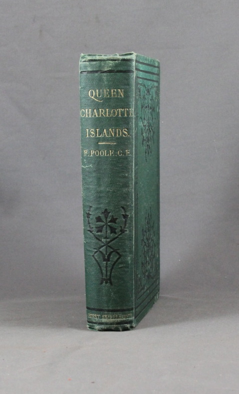
POOLE Francis; Lyndon, John W. (éditeur):
Queen Charlotte Islands, A Narrative of Discovery and Adventure in the North Pacific.
London, Hurst & Blackett, 1872. In-8 de XIV-[2]-347p. + 16p. de catalogue, pleine percaline verte d'éditeur ornée de fleurons à froid. Rousseurs sur la page de titre et le frontispice uniquement (à cause de la serpente).
Bookseller reference : 6193
|
|
|
Popout Maps Creator
Amsterdam Popout Map
Compass Maps Ltd 2017. Paperback. New. fol map re edition. 5.00x3.75x0.25 inches. Compass Maps Ltd paperback
Bookseller reference : __1910218324 ISBN : 1910218324 9781910218327
|
|
|
PopOut Maps
Amsterdam PopOut Map - handy pocket-size pop up map for Amsterdam Popout Maps
Compass Maps 01/17/2014. Fol Map. Map. Used; Good. WE SHIP WITHIN 24 HRS FROM LONDON UK 98% OF OUR ORDERS ARE RECEIVED WITHIN 7-10 DAYS. We believe you will be completely satisfied with our quick and reliable service. All orders are dispatched as swiftly as possible! Buy with confidence! Compass Maps unknown
Bookseller reference : 3582886 ISBN : 0711600302029 0711600302
|
|
|
PopOut Maps
Amsterdam PopOut Map - handy pocket-size pop up map for Amsterdam Popout Maps
Compass Maps 01/17/2014. Fol Map. Map. Used; Good. WE SHIP WITHIN 24 HRS FROM LONDON UK 98% OF OUR ORDERS ARE RECEIVED WITHIN 7-10 DAYS. We believe you will be completely satisfied with our quick and reliable service. All orders are dispatched as swiftly as possible! Buy with confidence! Compass Maps unknown
Bookseller reference : 3569250 ISBN : 0711600302029 0711600302
|
|
|
PopOut Maps
Amsterdam PopOut Map PopOut Maps
PopOut Maps. Used - Good. Shows some signs of wear and may have some markings on the inside. PopOut Maps unknown
Bookseller reference : GRP107593614 ISBN : 1845878175 9781845878177
|
|
|
PopOut Maps
Amsterdam PopOut Map: pop-up city street map of Amsterdam city center - folded pocket size travel map with transit map included PopOut Maps
2009-01-06. Good. Ships with Tracking Number! INTERNATIONAL WORLDWIDE Shipping available. May not contain Access Codes or Supplements. May be re-issue. May be ex-library. Shipping & Handling by region. Buy with confidence excellent customer service! unknown
Bookseller reference : 1845878175 ISBN : 1845878175 9781845878177

|
|
|
PopOut Maps
Amsterdam PopOut Map
Compass Maps Ltd 2009-05-01. Hardcover. Good. Compass Maps Ltd hardcover
Bookseller reference : SONG1845878175 ISBN : 1845878175 9781845878177
|
|
|
Popout Maps
Atlanta PopOut Map PopOut Maps
2012-04-02. New. Ships with Tracking Number! INTERNATIONAL WORLDWIDE Shipping available. May be re-issue. Buy with confidence excellent customer service! unknown
Bookseller reference : 1845879155n ISBN : 1845879155 9781845879150

|
|
|
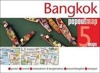
Popout Maps
Bangkok PopOut Map PopOut Maps
2012-01-01. New. Ships with Tracking Number! INTERNATIONAL WORLDWIDE Shipping available. May be re-issue. Buy with confidence excellent customer service! unknown
Bookseller reference : 1845879082n ISBN : 1845879082 9781845879082

|
|
|
Popout Maps Corporate Author
Bangkok Popout Map: Handy Pocket-size Pop-up Map of Bangkok
Compass Maps Ltd 2015. Map. New. fol map re edition. 1 pages. 4.00x5.00x0.25 inches. Compass Maps Ltd unknown
Bookseller reference : __1910218073 ISBN : 1910218073 9781910218075
|
|
|
Popout Maps
Bangkok PopOut Map PopOut Maps
2012-01-01. Good. Ships with Tracking Number! INTERNATIONAL WORLDWIDE Shipping available. May not contain Access Codes or Supplements. May be re-issue. May be ex-library. Shipping & Handling by region. Buy with confidence excellent customer service! unknown
Bookseller reference : 1845879082 ISBN : 1845879082 9781845879082

|
|
|
Popout Maps
Bangkok PopOut Map PopOut Maps
2015-04-05. New. Ships with Tracking Number! INTERNATIONAL WORLDWIDE Shipping available. May be re-issue. Buy with confidence excellent customer service! unknown
Bookseller reference : 1910218073n ISBN : 1910218073 9781910218075
|
|
|
Popout Maps Creator
Barcelona Popout Map
Compass Maps Ltd 2017. Paperback. New. fol map edition. 3.75x5.25x0.25 inches. Compass Maps Ltd paperback
Bookseller reference : 2-1910218413 ISBN : 1910218413 9781910218419
|
|
|
PopOut Maps Creator
Barcelona PopOut Map PopOut Maps
Pop Out 2017-05-01. Map. Used:Good. Pop Out unknown
Bookseller reference : DADAX1910218413 ISBN : 1910218413 9781910218419
|
|
|
Popout Maps
Barcelona PopOut Maps
Footprint PopOut Maps. 1e. Map. Used; Good. Simply Brit Shipped with Premium postal service within 24 hours from the UK with impressive delivery time. We have dispatched from our book depository; items of good condition to over ten million satisfied customers worldwide. We are committed to providing you with reliable and efficient service at all times. 09/16/2011 Footprint PopOut Maps unknown
Bookseller reference : 2544724 ISBN : 1845878590 9781845878597
|
|
|
Popout Maps
Barcelona PopOut Map: pop-up city street map of Barcelona city center - folded pocket size travel map with transit map included PopOut Maps
2011-02-04. Good. Ships with Tracking Number! INTERNATIONAL WORLDWIDE Shipping available. May not contain Access Codes or Supplements. May be re-issue. May be ex-library. Shipping & Handling by region. Buy with confidence excellent customer service! unknown
Bookseller reference : 1845878590 ISBN : 1845878590 9781845878597

|
|
|
Popout Maps
Barcelona PopOut Map PopOut Maps
2014-05-08. New. Ships with Tracking Number! INTERNATIONAL WORLDWIDE Shipping available. May be re-issue. Buy with confidence excellent customer service! unknown
Bookseller reference : 184587966Xn ISBN : 184587966x 9781845879662

|
|
|
PopOut Maps
Bath Popout Map PopOut Maps
2013-04-07. Good. Ships with Tracking Number! INTERNATIONAL WORLDWIDE Shipping available. May not contain Access Codes or Supplements. May be re-issue. May be ex-library. Shipping & Handling by region. Buy with confidence excellent customer service! unknown
Bookseller reference : 1845879333 ISBN : 1845879333 9781845879334

|
|
|
PopOut Maps
Beijing PopOut Map
2008-07-01. Good. Ships with Tracking Number! INTERNATIONAL WORLDWIDE Shipping available. May not contain Access Codes or Supplements. May be re-issue. May be ex-library. Shipping & Handling by region. Buy with confidence excellent customer service! unknown
Bookseller reference : 1845876237 ISBN : 1845876237 9781845876234
|
|
|
PopOut Maps
Beijing PopOut Map
2008-07-01. New. Ships with Tracking Number! INTERNATIONAL WORLDWIDE Shipping available. May be re-issue. Buy with confidence excellent customer service! unknown
Bookseller reference : 1845876237n ISBN : 1845876237 9781845876234
|
|
|
Popout Maps
Beijing PopOut Map PopOut Maps
2012-04-04. New. Ships with Tracking Number! INTERNATIONAL WORLDWIDE Shipping available. May be re-issue. Buy with confidence excellent customer service! unknown
Bookseller reference : 1845879007n ISBN : 1845879007 9781845879006

|
|
|
Popout Maps
Berlin PopOut Map: pop-up city street map of Berlin city center - folded pocket size travel map with transit map included PopOut Maps
2011-08-02. New. Ships with Tracking Number! INTERNATIONAL WORLDWIDE Shipping available. May be re-issue. Buy with confidence excellent customer service! unknown
Bookseller reference : 1845878612n ISBN : 1845878612 9781845878610

|
|
|
Popout Maps Corporate Author
Berlin Popout Map
Compass Maps Ltd 2017. Paperback. New. fol map re edition. 3.75x5.25x0.25 inches. Compass Maps Ltd paperback
Bookseller reference : 2-1910218464 ISBN : 1910218464 9781910218464
|
|
|
PopOut Maps
Berlin PopOut Map: pop-up city street map of Berlin city centre - folded pocket size travel map with transit map included Popout Maps
Compass Maps 03/07/2014. Map. Map. Used; Good. WE SHIP WITHIN 24 HRS FROM LONDON UK 98% OF OUR ORDERS ARE RECEIVED WITHIN 7-10 DAYS. We believe you will be completely satisfied with our quick and reliable service. All orders are dispatched as swiftly as possible! Buy with confidence! Compass Maps unknown
Bookseller reference : 3682951 ISBN : 0711600302049 0711600302
|
|
|
Popout Maps
Berlin PopOut Map PopOut Maps
2014-03-03. New. Ships with Tracking Number! INTERNATIONAL WORLDWIDE Shipping available. May be re-issue. Buy with confidence excellent customer service! unknown
Bookseller reference : 1845879775n ISBN : 1845879775 9781845879778

|
|
|
Popout Maps
Berlin PopOut Map Popout Maps
Footprint PopOut Maps 09/16/2011. 1e. Paperback. Used; Good. WE SHIP WITHIN 24 HRS FROM LONDON UK 98% OF OUR ORDERS ARE RECEIVED WITHIN 7-10 DAYS. We believe you will be completely satisfied with our quick and reliable service. All orders are dispatched as swiftly as possible! Buy with confidence! Footprint PopOut Maps paperback
Bookseller reference : 2510840 ISBN : 1845878612 9781845878610
|
|
|
PopOut Maps
Boston PopOut Map
Sheet map folded. New. Explore the historic city of Boston birthplace of the American Revolution with this handy pop-up map. This genuinely pocket-sized Boston city map includes 2 PopOut maps: a street map of downtown an overview map of greater Boston a detailed map of Beacon Hill Harvard Square & the subway. Ideal to pop in a pocket for quick reference. unknown
Bookseller reference : A9781910218624 ISBN : 1910218626 9781910218624

|
|
|
PopOut Maps
Boston PopOut Map PopOut Maps
PopOut Maps 2015-01-16. Map. Used:Good. PopOut Maps unknown
Bookseller reference : DADAX1910218006 ISBN : 1910218006 9781910218006

|
|
|
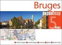
Popout Maps
Bruges PopOut Map PopOut Maps
Footprint PopOut Maps. Very good condition folding map. Unusual and highly practical design removing the need for awkward refolding after use. . Very Good. Soft cover. 2011. Footprint PopOut Maps paperback
Bookseller reference : 088605 ISBN : 1845878639 9781845878634
|
|
|
Popout Maps
Bruges PopOut Map PopOut Maps
2014-06-09. New. Ships with Tracking Number! INTERNATIONAL WORLDWIDE Shipping available. May be re-issue. Buy with confidence excellent customer service! unknown
Bookseller reference : 1845879767n ISBN : 1845879767 9781845879761
|
|
|
Popout Maps Corporate Author
Brussels Popout Map
Compass Maps Ltd 2017. Paperback. New. fol map edition. 3.75x5.25x0.25 inches. Compass Maps Ltd paperback
Bookseller reference : __191021843X ISBN : 191021843X 9781910218433
|
|
|
PopOut Maps Creator
Brussels PopOut Map PopOut Maps
Pop Out 2017-06-01. Map. Used:Good. Pop Out unknown
Bookseller reference : DADAX191021843X ISBN : 191021843X 9781910218433
|
|
|
PopOut Maps
Brussels PopOut Map Popout Maps
Compass Maps 01/10/2014. Map. Map. Used; Good. WE SHIP WITHIN 24 HRS FROM LONDON UK 98% OF OUR ORDERS ARE RECEIVED WITHIN 7-10 DAYS. We believe you will be completely satisfied with our quick and reliable service. All orders are dispatched as swiftly as possible! Buy with confidence! Compass Maps unknown
Bookseller reference : 3340425 ISBN : 1845879651 9781845879655

|
|
|
Popout Maps
Budapest PopOut Map: pop-up city street map of Budapest city center - folded pocket size travel map with transit map included PopOut Maps
2011-03-04. New. Ships with Tracking Number! INTERNATIONAL WORLDWIDE Shipping available. May be re-issue. Buy with confidence excellent customer service! unknown
Bookseller reference : 1845878841n ISBN : 1845878841 9781845878849

|
|
|
PopOut Maps
Budapest PopOut Map
Sheet map folded. New. Discover the UNESCO World Heritage-listed beauty of Budapest with this handy pop-up map. This genuinely pocket-sized city map includes 2 PopOut maps featuring: a street map of central Budapest an overview map of greater Budapest as well as a detail map of Varhegy Belvaros and the metro. Ideal to pop in a pocket or bag for quick reference. unknown
Bookseller reference : A9781910218587 ISBN : 1910218588 9781910218587

|
|
|
Popout Maps
Budapest PopOut Map Popout Maps
PopOut Maps 02/25/2015. Fol Map. Map. Used; Good. WE SHIP WITHIN 24 HRS FROM LONDON UK 98% OF OUR ORDERS ARE RECEIVED WITHIN 7-10 DAYS. We believe you will be completely satisfied with our quick and reliable service. All orders are dispatched as swiftly as possible! Buy with confidence! PopOut Maps unknown
Bookseller reference : 3763863 ISBN : 0711600302299 0711600302
|
|
|
PopOut Maps
Budapest PopOut Map PopOut Maps
2015-04-01. New. Ships with Tracking Number! INTERNATIONAL WORLDWIDE Shipping available. May be re-issue. Buy with confidence excellent customer service! unknown
Bookseller reference : 1910218049n ISBN : 1910218049 9781910218044

|
|
|
PopOut Maps
Cambridge PopOut Map
Paperback. New. Explore the academic gem of Cambridge with the help of this genuinely pocket-sized pop-up map. Small in size yet big on detail this compact dependable Cambridge city map will ensure you don't miss a thing. Includes a PopOut map featuring detailed street map of the central city area including paperback
Bookseller reference : ria9781910218198_new ISBN : 1910218197 9781910218198
|
|
|
PopOut Maps
Cambridge PopOut Map
Sheet map folded. New. Explore the academic gem of Cambridge with this handy pop-up map. This genuinely pocket-sized PopOut Map features a detailed street map of the central city area including all the colleges. Additional 'What To See.How To Get There' section helps identify all the key points of interest. Ideal to pop in a pocket or bag for quick reference. unknown
Bookseller reference : A9781910218198 ISBN : 1910218197 9781910218198

|
|
 Receive by email
 Download as PDF document
 RSS feed


