I Home page
Sort by : Relevance Author A - Z Author Z - A Title A - Z Title Z - A Ascending price Descending price Bookseller A - Z Bookseller Z - A Addition date
Streetwise Maps Inc
Streetwise Venice Water Bus Map - Laminated Water Bus Map of Venice Italy - Vaporetto: Folding Pocket Size Travel Map Streetwise Streetwise Maps
Streetwise Maps 2011-02. Map. Good. Streetwise Maps unknown
Bookseller reference : SONG193125754X ISBN : 193125754X 9781931257541
Ergodebooks United States Estados Unidos Estados Unidos États-Unis [Books from Ergodebooks]
€31.36 Buy
Streetwise Downtown Manhattan Map - Laminated Street Map of Downtown Manhattan NY Streetwise Streetwise Maps
Streetwise Maps Inc 2010-07-01. Map. Good. Streetwise Maps Inc unknown
Bookseller reference : SONG1931257469 ISBN : 1931257469 9781931257466
€22.50 Buy
Streetwise Maps
Streetwise Houston Map - Laminated City Center Street Map of Houston Texas - Folding pocket size travel map with metro light rail
Streetwise Maps 2007-12-27. Map. Good. Streetwise Maps unknown
Bookseller reference : SONG0935039899 ISBN : 0935039899 9780935039894
€31.41 Buy
Streetwise Atlanta Map - Laminated City Center Street Map of Atlanta Georgia - Folding pocket size travel map with Marta metro lines
Streetwise Maps 2006-12-31. Map. Good. Streetwise Maps unknown
Bookseller reference : SONG0935039643 ISBN : 0935039643 9780935039641
€17.35 Buy
Streetwise Madrid Map - Laminated City Center Street Map of Madrid Spain
Streetwise Maps 2008-12-27. Map. Good. Streetwise Maps unknown
Bookseller reference : SONG0935039635 ISBN : 0935039635 9780935039634
€7.11 Buy
Streetwise Northern New England Map - Laminated Area Road Map of Northern New England
Streetwise Maps 2004-01-21. Map. Good. Streetwise Maps unknown
Bookseller reference : SONG1886705690 ISBN : 1886705690 9781886705692
€33.05 Buy
Streetwise Provence Map - Laminated Regional Road Map of Provence France
Bookseller reference : SONG188670578X ISBN : 188670578X 9781886705784
€26.11 Buy
Streetwise New Jersey Map - Laminated State Road Map of New Jersey
Bookseller reference : SONG1886705372 ISBN : 1886705372 9781886705371
€19.43 Buy
Streetwise Berlin Map - Laminated City Center Street Map of Berlin Germany - Folding pocket size travel map with metro map including S-Bahn and U-Bahn
Streetwise Maps 2009-05-01. Map. Good. Streetwise Maps unknown
Bookseller reference : SONG1886705410 ISBN : 1886705410 9781886705418
€8.76 Buy
Streetwise Jerusalem Map - Laminated City Center Street Map of Jerusalem Israel - Folding pocket size travel map
Streetwise Maps 2009-06-01. Map. Good. Streetwise Maps unknown
Bookseller reference : SONG1886705232 ISBN : 1886705232 9781886705234
€9.45 Buy
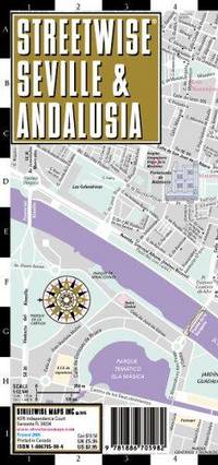
Streetwise Seville Map - Laminated City Center Street Map of Seville Spain - Folding pocket size travel map
Bookseller reference : SONG1886705984 ISBN : 1886705984 9781886705982
€148.90 Buy
Streetwise Austin Map - Laminated City Center Street Map of Austin Texas - Folding pocket size travel map
Bookseller reference : SONG1886705925 ISBN : 1886705925 9781886705920
€8.82 Buy
Streetwise Spain Map - Laminated Country Road Map of Spain
Streetwise Maps 2007-12-27. Map. Very Good. Streetwise Maps unknown
Bookseller reference : SONG1886705674 ISBN : 1886705674 9781886705678
€29.10 Buy
Streetwise Naples Map - Laminated City Center Street Map of Naples Italy - Folding pocket size travel map with metro lines & stations
Bookseller reference : SONG1886705968 ISBN : 1886705968 9781886705968
€28.70 Buy
Streetwise Pennsylvania Map - Laminated State Road Map of Pennsylvania
Bookseller reference : SONG1886705380 ISBN : 1886705380 9781886705388
€107.79 Buy
Streetwise Charleston Map - Laminated City Center Street Map of Charleston South Carolina - Folding pocket size travel map
Bookseller reference : SONG1886705534 ISBN : 1886705534 9781886705531
€30.08 Buy
Streetwise Barcelona Map - Laminated City Center Street Map of Barcelona Spain
Streetwise Maps 2009-01-01. Map. Good. Streetwise Maps unknown
Bookseller reference : SONG1886705119 ISBN : 1886705119 9781886705111
€8.16 Buy
Streetwise Florida Map - Laminated State Road Map of Florida
Bookseller reference : SONG1886705399 ISBN : 1886705399 9781886705395
€103.39 Buy
Streetwise Nashville Map - Laminated City Center Street Map of Nashville Tennessee - Folding pocket size travel map
Bookseller reference : SONG1886705550 ISBN : 1886705550 9781886705555
€35.63 Buy
Streetwise Athens Map - Laminated City Center Street Map of Athens Greece - Folding pocket size travel map with metro map
Streetwise Maps 2011-04-01. Map. Good. Streetwise Maps unknown
Bookseller reference : SONG1886705348 ISBN : 1886705348 9781886705340
€8.77 Buy
Streetwise Ireland Map - Laminated Country Road Map of Ireland
Bookseller reference : SONG1886705704 ISBN : 1886705704 9781886705708
€9.76 Buy
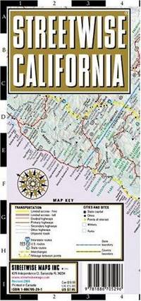
Streetwise California Map - Laminated State Road Map of California
Bookseller reference : SONG1886705291 ISBN : 1886705291 9781886705296
€14.21 Buy
Streetwise Milan Map - Laminated City Center Street Map of Milan Italy - Folding pocket size travel map with metro map
Bookseller reference : SONG1886705887 ISBN : 1886705887 9781886705883
€20.09 Buy
Streetwise Baltimore Map - Laminated City Center Street Map of Baltimore Maryland - Folding pocket size travel map with light rail & metro
Bookseller reference : SONG1931257051 ISBN : 1931257051 9781931257053
€93.05 Buy
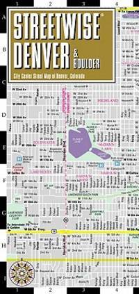
Streetwise Denver Map - Laminated City Center Street Map of Denver Colorado - Folding pocket size travel map with light rail map trolley Boulder inset
Streetwise Maps 2010-08-01. Map. Good. Streetwise Maps unknown
Bookseller reference : SONG1931257221 ISBN : 1931257221 9781931257220
€41.15 Buy
Streetwise Portland Map - Laminated City Center Street Map of Portland Oregon - Folding pocket size travel map with Max Light Rail map
Bookseller reference : SONG1886705518 ISBN : 1886705518 9781886705517
€6.84 Buy
Streetwise Dallas Map - Laminated City Center Street Map of Dallas Texas - Folding pocket size travel map with Dart & Trinity rail routes
StreetWise Maps 2007-12-27. Map. Good. StreetWise Maps unknown
Bookseller reference : SONG1886705895 ISBN : 1886705895 9781886705890
€22.37 Buy
Streetwise Italy Map - Laminated Country Road Map of Italy - Folding pocket size travel map with major city distance chart
Bookseller reference : SONG1886705569 ISBN : 1886705569 9781886705562
€29.77 Buy
Streetwise Umbria Map - Laminated Road Map of Umbria Italy - Folding pocket size travel map
Streetwise Maps 2002-06-21. Map. Good. Streetwise Maps unknown
Bookseller reference : SONG1886705542 ISBN : 1886705542 9781886705548
€31.34 Buy
Streetwise Italian Lake District Map - Laminated Regional Map of the Italian Lake District
Bookseller reference : SONG1931257329 ISBN : 1931257329 9781931257329
€615.95 Buy
Streetwise Phoenix Map - Laminated City Center Street Map of Phoenix Arizona - Folding pocket size travel map with Scottsdale trolley routes
Bookseller reference : SONG1886705860 ISBN : 1886705860 9781886705869
€134.69 Buy
Streetwise Zurich Map - Laminated City Center Street Map of Zurich Switzerland - Folding pocket size travel map with metro map
Bookseller reference : SONG1886705712 ISBN : 1886705712 9781886705715
€203.00 Buy
Streetwise Cuba Map - Laminated Country Road Map of Cuba
Streetwise Maps 2005-02-24. Map. Good. Streetwise Maps unknown
Bookseller reference : SONG1931257078 ISBN : 1931257078 9781931257077
€10.69 Buy
Streetwise Tuscany Map - Laminated Road Map of Tuscany Italy - Folding pocket size travel map
Bookseller reference : SONG188670595X ISBN : 188670595X 9781886705951
€19.53 Buy
Streetwise Prague Map - Laminated City Center Street Map of Prague Czech Republic
Streetwise Maps 2010-01-01. Map. Good. Streetwise Maps unknown
Bookseller reference : SONG1886705208 ISBN : 1886705208 9781886705203
€7.45 Buy
Streetwise Munich Map - Laminated City Center Street Map of Munich Germany - Folding pocket size travel map with metro map including S-Bahn & U-Bahn
Bookseller reference : SONG1931257159 ISBN : 1931257159 9781931257152
€9.18 Buy
Streetwise Las Vegas Map - Laminated City Center Street Map of Las Vegas Nevada
Bookseller reference : SONG1886705852 ISBN : 1886705852 9781886705852
€8.97 Buy
Streetwise Budapest Map - Laminated City Center Street Map of Budapest Hungary - Folding pocket size travel map with metro map
Bookseller reference : SONG1886705224 ISBN : 1886705224 9781886705227
€7.78 Buy
Streetwise France Map - Laminated Country Road Map of France
Bookseller reference : SONG1886705666 ISBN : 1886705666 9781886705661
€15.43 Buy
Streetwise Maryland & the Virginias Laminated State Road Map
Bookseller reference : SONG1886705364 ISBN : 1886705364 9781886705364
€21.36 Buy
Streetwise French Riviera Map - Laminated Road Map of the French Riviera
Streetwise Maps 2011-07-01. Map. Good. Streetwise Maps unknown
Bookseller reference : SONG1886705798 ISBN : 1886705798 9781886705791
Streetwise Montreal Map - Laminated City Center Street Map of Montreal Canada - Folding pocket size travel map with metro map
Bookseller reference : SONG1886705879 ISBN : 1886705879 9781886705876
€14.23 Buy
Streetwise Southampton Map - Laminated City Street Map of Southampton New York
Bookseller reference : SONG1886705313 ISBN : 1886705313 9781886705319
€91.12 Buy
Streetwise Venice Map - Laminated City Center Street Map of Venice Italy
Bookseller reference : SONG0935039783 ISBN : 0935039783 9780935039788
€6.90 Buy
Streetwise Florence Map - Laminated City Center Street Map of Florence Italy - Folding pocket size travel map
Bookseller reference : SONG0935039651 ISBN : 0935039651 9780935039658
€8.87 Buy
Streetwise San Antonio Map - Laminated City Center Street Map of San Antonio Texas - Folding pocket size travel map
Bookseller reference : SONG1886705933 ISBN : 1886705933 9781886705937
€24.31 Buy
Streetwise Brooklyn Map - Laminated City Center Street Map of Brooklyn New York - Folding pocket size travel map with subway stations
Bookseller reference : SONG188670547X ISBN : 188670547X 9781886705470
€12.23 Buy
Streetwise San Diego Map - Laminated City Center Street Map of San Diego California - Folding pocket size travel map with trolley lines
Bookseller reference : SONG1886705801 ISBN : 1886705801 9781886705807
€7.27 Buy
Streetwise Europe Rail Map - Laminated Railroad Map of Europe
Bookseller reference : SONG1886705305 ISBN : 1886705305 9781886705302
€7.91 Buy
Streetwise Manhattan Map - Laminated City Street Map of Manhattan New York - Folding pocket size travel map with subway map bus map
Streetwise Maps 2011-06-01. Map. Good. Streetwise Maps unknown
Bookseller reference : SONG1886705976 ISBN : 1886705976 9781886705975
€6.60 Buy
English | Español | Português | Italiano | Deutsch | Français | Nederlands | Kiswahili | Dansk | 中文 | العربية | русский язык | 日本語
Marelibri's blog - Marelibri on your website - Credits - Free software - Information - Contact webmaster
A problem with this page?
 Receive by email
 Download as PDF document
 RSS feed