|
Vogelschauansicht der Stadt Zürich von 1576. Murer, Josef:
Der uralten wytbekannten Statt Zürich gestalt und gelägenheit, wie sy zu diser zyt in wäsen, ufgerissen und in grund gelegt, durch Josefen Murer und durch Christoffel Froschower, zu Eeren dem Vatterland getruckt, Im M.D.LXXVI Jar
Gattikon, Verlag Dorfpresse. 1966. Zehnfarben Lithografie auf festem Papier. Blattgrösse: 97 x 139 cm.
Referencia librero : 1123DG
|
|
|
Voges, Edmund
Briefe aus dem Norden - Verhandlungen mit dem Norden: Konstruktionen einer iberischen Moderne bei Angel Ganivet und Josep Pla. Imaginatio Borealis (5).
Frankfurt am Main; Berlin; Bern; Bruxelles; New York; Oxford; Wien: Peter Lang, 2004. 306 S. Softcover.
Referencia librero : 1190668
|
|
|
Voix ouvrière.
Voix ouvrière, supplément au n° 30 (7 juin 1968).
Paris Voix ouvrière 1968 1 vol. en feuilles Tract dactylographié daté du 7 juin. Protestation contre les violences policières de Flins, pointant du doigt la responsabilité de la CGT : "Qu'attendent les dirigeants de la CGT pour organiser la riposte ? Vont-ils continuer à prêcher le calme devant l'agression policière alors qu'ils déploient tout leur zèle à faire la chasse aux "gauchistes" ?".
Referencia librero : 93143
|
|
|
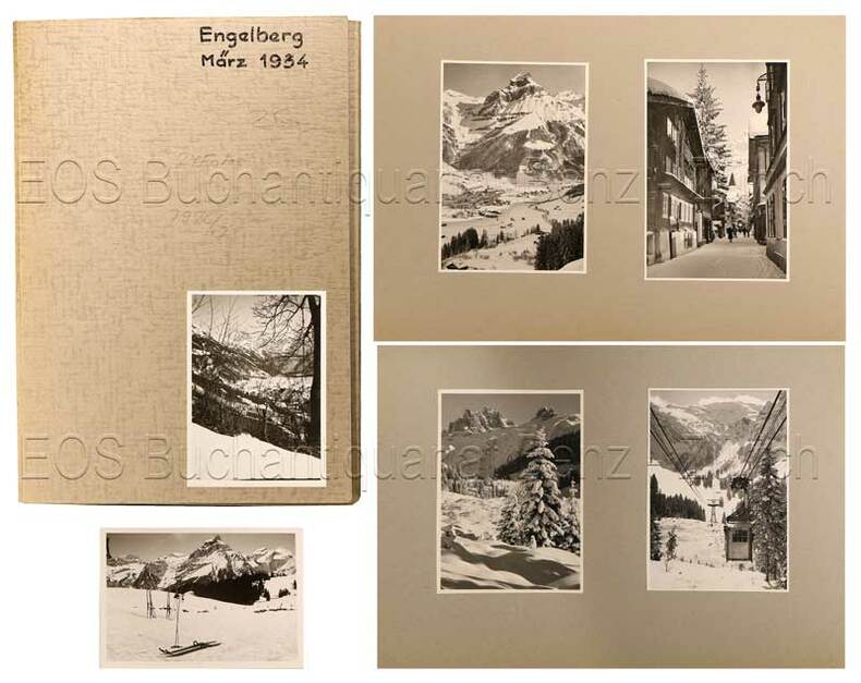
Volkart
Engelberg
1934. 24 Fotografien, montiert auf Halbkarton. Format: ca. 8 x 6 u. 6 x 8 cm. + Wichtig: Für unsere Kunden in der EU erfolgt der Versand alle 14 Tage verzollt ab Deutschland / Postbank-Konto in Deutschland vorhanden +, Fotos und Mappe
Referencia librero : 792CG

|
|
|
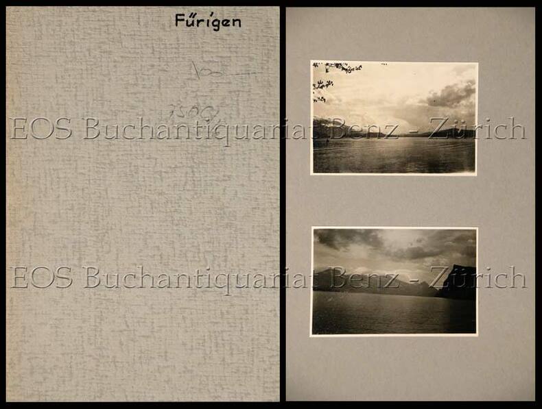
Volkart
Fürigen.
(um 1935). 7 Fotografien, montiert auf Halbkarton. Format: ca. 8 x 6 u. 6 x 8 cm. + Wichtig: Für unsere Kunden in der EU erfolgt der Versand alle 14 Tage verzollt ab Deutschland / Postbank-Konto in Deutschland vorhanden +, Mappe und Bilder
Referencia librero : 750CG

|
|
|
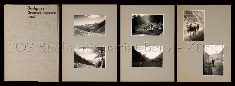
Volkart
Jochpass - Grimsel - Nufenen (im Sommer).
1937. 19 Fotografien, montiert auf Halbkarton. Format: ca. 8 x 6 u. 6 x 8 cm. + Wichtig: Für unsere Kunden in der EU erfolgt der Versand alle 14 Tage verzollt ab Deutschland / Postbank-Konto in Deutschland vorhanden +, Mappe u. Bilder
Referencia librero : 748CG

|
|
|
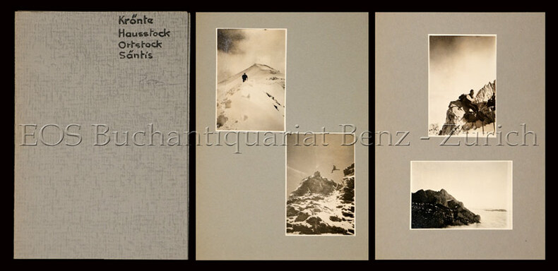
Volkart
Krönte - Hausstock - Ortstock - Säntis (meist im Sommer).
1937. 19 Fotografien, montiert auf Halbkarton. Format: ca. 8 x 6 u. 6 x 8 cm. + Wichtig: Für unsere Kunden in der EU erfolgt der Versand alle 14 Tage verzollt ab Deutschland / Postbank-Konto in Deutschland vorhanden +, Mappe und Bilder
Referencia librero : 747CG

|
|
|
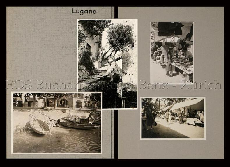
Volkart
Lugano.
(um 1935). 19 Fotografien, montiert auf Halbkarton. Format: ca. 8 x 6 u. 6 x 8 cm. + Wichtig: Für unsere Kunden in der EU erfolgt der Versand alle 14 Tage verzollt ab Deutschland / Postbank-Konto in Deutschland vorhanden +, Mappe u. Bilder
Referencia librero : 749CG

|
|
|
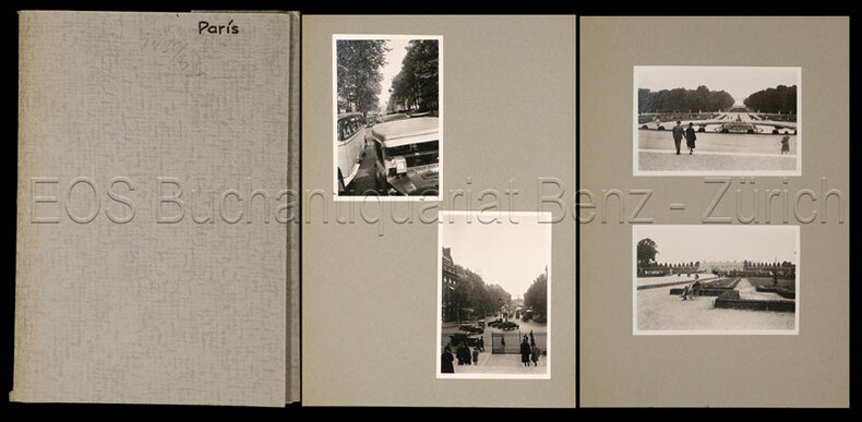
Volkart
Paris.
um 1930. 36 Fotografien, montiert auf farb. Halbkarton. Format: ca. 8 x 6 u. 6 x 8 cm. + Wichtig: Für unsere Kunden in der EU erfolgt der Versand alle 14 Tage verzollt ab Deutschland / Postbank-Konto in Deutschland vorhanden +, Fotos und Mappe
Referencia librero : 743CG

|
|
|
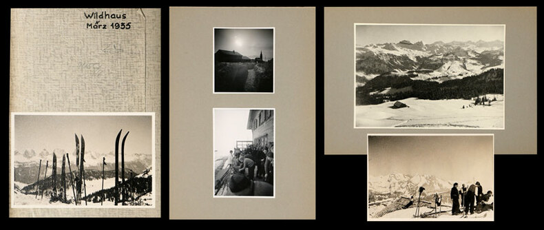
Volkart
Wildhaus (im Winter).
März, 1935. 22 Fotografien, montiert auf Halbkarton, 15 lose Fotografien und 6 (grössere) Fotografien, mont. auf Halbkarton. Format: ca. 8 x 6 u. 6 x 8 cm bzw. ca. 10 x 14 cm. + Wichtig: Für unsere Kunden in der EU erfolgt der Versand alle 14 Tage verzollt ab Deutschland / Postbank-Konto in Deutschland vorhanden +, Mappe und Fotos
Referencia librero : 745CG

|
|
|
Volkart:
Engelberg
1934. 24 Fotografien, montiert auf Halbkarton. Format: ca. 8 x 6 u. 6 x 8 cm.
Referencia librero : 792CG
|
|
|
Volkart:
Paris.
um 1930. 36 Fotografien, montiert auf farb. Halbkarton. Format: ca. 8 x 6 u. 6 x 8 cm.
Referencia librero : 743CG
|
|
|
Volkart;
Fürigen.
(um 1935). 7 Fotografien, montiert auf Halbkarton. Format: ca. 8 x 6 u. 6 x 8 cm.
Referencia librero : 750CG
|
|
|
Volkart;
Jochpass - Grimsel - Nufenen (im Sommer).
1937. 19 Fotografien, montiert auf Halbkarton. Format: ca. 8 x 6 u. 6 x 8 cm.
Referencia librero : 748CG
|
|
|
Volkart;
Krönte - Hausstock - Ortstock - Säntis (meist im Sommer).
1937. 19 Fotografien, montiert auf Halbkarton. Format: ca. 8 x 6 u. 6 x 8 cm.
Referencia librero : 747CG
|
|
|
Volkart;
Lugano.
(um 1935). 19 Fotografien, montiert auf Halbkarton. Format: ca. 8 x 6 u. 6 x 8 cm.
Referencia librero : 749CG
|
|
|
Volkart;
Wildhaus (im Winter).
März, 1935. 22 Fotografien, montiert auf Halbkarton, 15 lose Fotografien und 6 (grössere) Fotografien, mont. auf Halbkarton. Format: ca. 8 x 6 u. 6 x 8 cm bzw. ca. 10 x 14 cm.
Referencia librero : 745CG
|
|
|
Volkert, A. (Hrsg.)
Statistische Karte vom Königreiche Bayern. Zugleich Übersichts- und Postkarte von Südwestdeutschland. M: 1:600.000.
München 1837. Altkol. Kupferst. In 32 Segm. auf Ln. gezog. Landkarte in Schuber. 68x101 cm.
Referencia librero : 7857
|
|
|
Vollet, Hans
Weltbild und Kartographie im Hochstift Bamberg.
Kulmbach, Freunde der Plassenburg, 1988. 240 S. Mit 181 tls. farb. Abb und Karten. (= "Die Plassenburg" für Heimatforschung und Kulturpflege in Ostfranken, Bd. 47). 34 cm. OLn. m. SU.
Referencia librero : 89895

|
|
|
VOLMAT J.
La mer vue du ciel. Photographie a?rienne et cartes marines. Article (3 pages, 7 photos) dans l'illustration.
Num?ro complet.
|
|
|
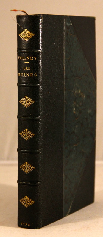
Volney (Constantin-François Chassebeuf de)
Les Ruines ou méditation sur les révolutions des empires.
Bourg, Louis Hyacinthe Goyffon 1791. Petit in-4 demi-cuir, sos plat orné. VIII - 242 pp. Trois planches hors-texte dont un frontispice et deux in fine :carte du monde ancien brunissures, petit manque angulaire avec restauration et tableau du ciel astrologique des anciens repliée.
Referencia librero : HIS4014M
|
|
|
VOLNEY M:
Les ruines, ou Méditation sur les révolutions des empires.
A Paris, Chez Desenne; Volland; Plassan, 1792. 1 vol. in-8 de XVI-392 p. Reliure moderne demi-maroquin noir à coins, dos à nerfs orné de fleurons dorés, tête dorée. Belle condition seuls les coins sont très légèrement frottés.
Referencia librero : 3813
|
|
|
Von Hagen Victor W. ; Tomeucci Adolfo Photographer ; Rigolo Dino Maps and Drawings
Roman Roads
Cleveland & New York: The World Publishing Company. Good with no dust jacket. 1966. Hardcover. There is a shallow dent on the front cover. The page edges are tanned. There is wear to the corners. . The World Publishing Company hardcover
Referencia librero : 221988
|
|
|
Von Rauch Georg; Illustrated by Maps. Illustrator
A History of Soviet Russia. 1st Am. Ed
Prager 1957 1957-01-01. Hardcover. Good. Good hardcover. No DJ. Pages are clean and unmarked slightly tanned. Covers show light edge wear. Small part of DJ stuck on front cover. Binding is tight hinges strong.; 100% Satisfaction Guaranteed! Ships same or next business day! Prager [1957] hardcover
Referencia librero : 1309100156
|
|
|
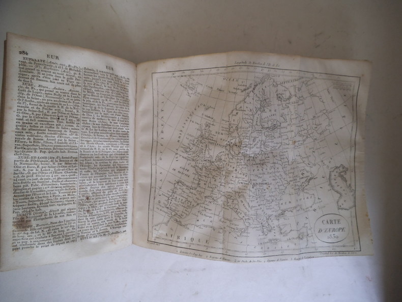
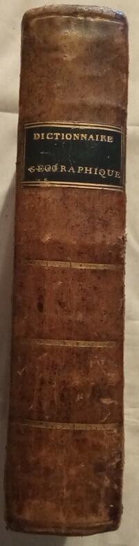
Vosgien
Dictionnaire géographique ou description de toutes les parties du monde
Ledentu, Ménard et Desenne, fils, libraires Relié 1821 In-8 (13x21 cm), reliure d'époque plein cuir, dos lisse avec dorures, fenêtre de titre rouge, tranches marbrées, nouvelle édition, entièrement refondue, revue et corrigée, enrichie de sept cartes (dépliantes) et de plusieurs planches représentant les Pavillons des principales Puissances maritimes, et des Monnaies françaises et étrangères ; coiffes, coins, bords et mors frottés, plats frottés, rares rousseurs à l'intérieur, bon état. Livraison a domicile (La Poste) ou en Mondial Relay sur simple demande.
Referencia librero : cw2
|
|
|
Vosgien
Dictionnaire géographique Vosgien, dictionnaire universel des cinq parties du monde, revu avec soin et rectifié sur les meilleurs ouvrages de géographie récemment publiés, et particulièrement sur le savant ouvrage de M.Balbi.
Description générale et particulière des Empires, Royaumes, États, Provinces, Villes, Bourgs et Villages principaux du Globe; la position astronomique en degrés de longitude et de latitude, la Distance d"un lieu à un autre le plus important du département, de la commune ou du canton: la Population, la Superficie en milles et lieues carrées; les Richesses minérales: les Religions; les Moeurs des différens peuples; la nature de la Culture des diverses régions et leurs produits; le genre de Commerce de chaque pays; les Monnaies réelles ou de compte, Poids et Mesures; les Usages pour Lettres de change; les Batailles mémorables, les Révolutions, les Conquêtes; les Monumens remarquables: le lieu de Naissance des Hommes illustres, et l"Indication des Pays pour lesquels l'affranchissement est libre ou forcé; Et pour la France, Les anciennes. Dénominations des Provinces; les nouvelles Divisions administratives, Militaires, Législatives, Ecclésiastiques et Judiciaires; les Routes, les Fleuves et Rivières navigables et flottables; les Canaux, etc.; les Relains de poste, les Bureaux de poste et l"Indication exacte de toutes les foires. Précédé d"un précis de géographie ou aperçu de l"état physique du monde. avec 9 cartes dressées avec soin par M.Desmaretz et gravées sur acier par Tardieu Mappemonde - France - Afrique - Amérique Méridionale - Amérique Septentrionale - Asie - Europe - Océanie - Monnaies Françaises & étrangères. avec 9 cartes dressées avec soin par M.Desmaretz et gravées sur acier par Tardieu vol grand in-8, 220x140, relié pleine basane époque, petits accrocs, 678pp, bon exemplaire Paris Felix Loquin, 1842 ref/26
Referencia librero : CZC-12642

|
|
|
Vosgien
Dictionnaire géographique Vosgien, dictionnaire universel des cinq parties du monde, revu avec soin et rectifié sur les meilleurs ouvrages de géographie récemment publiés, et particulièrement sur le savant ouvrage de M.Balbi.
Description générale et particulière des Empires, Royaumes, États, Provinces, Villes, Bourgs et Villages principaux du Globe; la position astronomique en degrés de longitude et de latitude, la Distance d"un lieu à un autre le plus important du département, de la commune ou du canton: la Population, la Superficie en milles et lieues carrées; les Richesses minérales: les Religions; les Moeurs des différens peuples; la nature de la Culture des diverses régions et leurs produits; le genre de Commerce de chaque pays; les Monnaies réelles ou de compte, Poids et Mesures; les Usages pour Lettres de change; les Batailles mémorables, les Révolutions, les Conquêtes; les Monumens remarquables: le lieu de Naissance des Hommes illustres, et l"Indication des Pays pour lesquels l'affranchissement est libre ou forcé; Et pour la France, Les anciennes. Dénominations des Provinces; les nouvelles Divisions administratives, Militaires, Législatives, Ecclésiastiques et Judiciaires; les Routes, les Fleuves et Rivières navigables et flottables; les Canaux, etc.; les Relains de poste, les Bureaux de poste et l"Indication exacte de toutes les foires. Précédé d"un précis de géographie ou aperçu de l"état physique du monde. avec 9 cartes dressées avec soin par M.Desmaretz et gravées sur acier par Tardieu Mappemonde - France - Afrique - Amérique Méridionale - Amérique Septentrionale - Asie - Europe - Océanie - Monnaies Françaises & étrangères. avec 9 cartes dressées avec soin par M.Desmaretz et gravées sur acier par Tardieu vol grand in-8, 220x140, relié pleine basane époque, petits accrocs, 678pp, bon exemplaire Paris Felix Loquin, 1842 ref/26
Referencia librero : CZC-12642
|
|
|
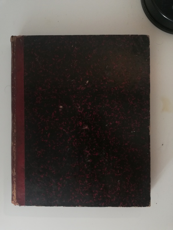
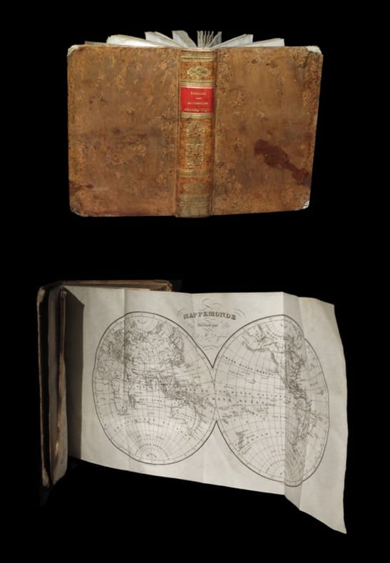
VOSGIEN
Nouveau dictionnaire géographique universel
rédigé sur un plan nouveau par M. le Chevalier de RONJOUX. Petit in 8 demi-cuir, titre, filets dors. Faux-titre, frontispice (tableau carte de l’Europe) titre illustré, gravé, titre, II, 694 pages, texte sur 2 colonnes, 6 cartes dont 5 dépliantes, 6 planches de monnaies, hors-texte en couleurs. Paris à la librairie classique élémentaire et catholique de BELIN-MANDAR et DEVAUX et à BRUXELLES, même maison 1829. Mouillure angle inférieur droit en début de volume, quelques pages légèrement poussiéreuses.
Referencia librero : 10192
|
|
|
VOSGIEN
Nouveau dictionnaire géographique universel
rédigé sur un plan nouveau par M. Le chevalier de Roujoux. In 8 plein cuir fauve , pièce de titre cuir bleu, roulette, fers dorés. Carte dépliante et pavillons des différentes puissances, titre, 694 pages, 6 pages de monnaies, texte sur 2 colonnes. 5 cartes dépliantes A Limoges chez Barbou frères 1846.
Referencia librero : 11994
|
|
|
VOSGIEN & GIRAUD
Dictionnaire Géographique,
ou description des quatre parties du monde, par Vosgien. Nouvelle édition augmentée et entièrement refondue, renfermant les changements survenus par suite des différents traités, jusques et y compris celui de Vienne, du mois d'octobre 1809 par Giraud. Cet ouvrage est orné de six Cartes géographiques, et suivi de Tableau de réduction des francs en livres tournois, et des livres tournois en francs. Lyon, Chez Tournachon-Molin, Libraire, 1810. Fort in-8 (21x5x13cm) relié demi veau marron, dos orné de filets dorés, titre doré sur cuir noir, coins légèrement écornés, et manque dans le coin supérieur de 4 pages. 788pp. 80€
Referencia librero : WOC-1373
|
|
|
VOSGIEN (François-Léopold) & LALLEMENT (F.).
Dictionnaire géographique universel des cinq parties du monde [...].
Paris, Félix Locquin et Cie, 1840. Un fort vol. au format in-8 (218 x 139 mm) de xxiv - 678 pp. et 1 f. n.fol. + 8 cartes dépliantes in fine. Reliure de l'époque de pleine basane flammée blonde, plats jansénistes, dos lisse orné de doubles filets gras dorés, doubles filets maigres doré, larges fleurons romantiques dorés, pièce de titre de maroquin carmin, titre doré, large palette dorée en queue, filet sinusoïdal doré sur les coupes, tranches jaspées.
Referencia librero : 28919
|
|
|
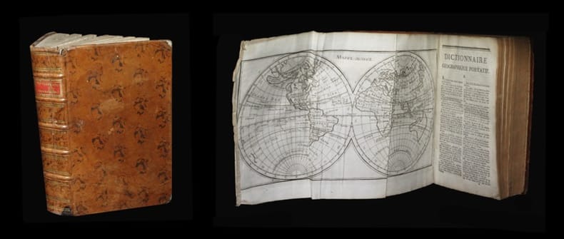
VOSGIEN (François-Léopold).
Dictionnaire géographique portatif des quatre parties du monde augmenté de plus de trois mille noms de villes, villages ou bourgs qui n'avaient pas encore paru dans ce Dictionnaire.
A Caen, chez G. Le Roy, 1795. Un fort vol. au format in-8 (198 x 125 mm) de 3 ff. n.fol. et 820 pp. Reliure de l'époque de pleine basane marbrée brune, plats jansénistes, dos à nerfs orné de filets gras à froid, doubles filets maigres dorés, pièce de titre de maroquin vieux-rouge, titre doré, tranches mouchetées.
Referencia librero : 27411
|
|
|
VOSGIEN [LADVOCAT Jean-Baptiste]:
Dictionnaire géographique, ou description de toutes les parties du monde. Nouvelle édition, entièrement refondue, revue et corrigée avec le plus grand soin, d'après les derniers traités de paix et les changemens politiques sruvenus jusqu'à ce jour [...].
A Paris, chez Menard et Desenne, fils, 1821. In-8 de [4]-672 pages, plein veau brun, dos lisse orné de roulettes, fleurons, filets, encadrement et titre dorés, étiquette de titre noire, roulette et double filet dorés encadrant les plats, roulette dorée sur les coupes. Mors fendus avec petits manques de peau, coins et coiffes frottés.
Referencia librero : 10296
|
|
|
VOSGIEN; NARDI Luigi (traducteur):
Nuovo Dizionario Geografico di Vosgien nuova edizione interamente rifusa, riveduta e corretta colla massima cura dietro gli ultimi trattati di pace ed i cambiamenti politici avvenuti fino al presente. Prima traduzione italiana fatta sulL'edizione di Parigi del 1822 da Luigi Nardi e da questo arricchita di copiose aggiunte, e singolarmente della nomenclatura di molti luoghi dell'Italia omessi dell'originale.
Livorno, Tipografia Vignozzi, 1823. 1 tome divisé en deux volumes de 352p. et de 353 à 739p., demi-vélin blanc à coins, dos lisse, pièce de titre en mar. vert.
Referencia librero : 6335
|
|
|
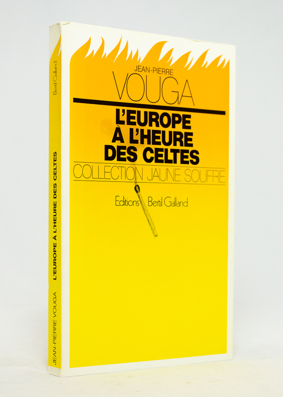
VOUGA Jean-Pierre:
L'Europe à l'heure des celtes.
Vevey, Editions Bertil Galland, Collection Jaune Soufre, 1981. In-8 broché de 176-[8] pages, couverture imprimée en couleurs.
Referencia librero : 17763
|
|
|
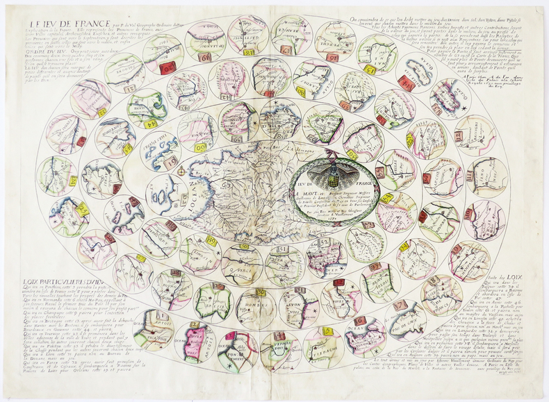
VOUILLEMONT (Estienne) & FER (Antoine de).
[JEU de l'OIE] Le Jeu de France.
Paris, A. de Fer, 1671. 380 x 525 mm.
Referencia librero : LBW-5776
|
|
|
VOUILLEMONT (Estienne).
[MALTE] Représentation des isles de Malthe, Goze et Comino, remparts de la chrestienté contre les Turcs, avec les fortifications des villes et austres places desdites isles.
Paris, Ant. de Fer, 1672. 378 x 521 mm.
Referencia librero : LBW-8413

|
|
|
VOYAGES & MAPS.
A New Collection of Voyages Discoveries and Travels : containing Whatever is Worthy of Notice in Europe Asia Africa and America: In respect to The Situation and Extent of Empires Kingdoms and Provinces; their Climates Soil Produce. Illustrated with a Variety of Maps Plans and Elegant Engravings
London.: J. Knox. 1767. 3 folding maps 4 engraved plates and a folding plan. Full calf with new calf spine light offsetting to endpapers but generally lovely clean rag-paper with cursive script. Volume 2 only. 21 x 12.5cm. There are detailed maps of the East Indies the West Indies and of North America from the Arctic Circle to Mexico or New Spain. Also a folding line-drawing showing 4 plans representing the different positions of British colonial soldiers fighting the Indians in North America. . J. Knox. unknown
Referencia librero : 165561

|
|
|
VOYATZIS].
Voyatzis.
Paris Les Arts Plastiques Modernes 1961 1 vol. broché plaquette in-8, agrafée, sous couverture imprimée, 4 pages, une reproduction en noir. Plaquette d'invitation à l'exposition du peintre grec Charis Voyatzis (1924-1981) à la Galerie Les Arts Plastiques Modernes de MM. Mouradian et Vallotton. Texte de Waldemar-George. Exemplaire provenant de la bibliothèque de Georges Bataille avec tampon à l'encre noire sur le premier feuillet "Bibliothèque de Georges Bataille".
Referencia librero : 104023
|
|
|
VRIENTS Johannes Baptiste (1552 - 1612)
(Diversi modi per descrivere le mappe, & tavole geografiche nelle quali la convessa s
Foglio (cm 30X46) tratto dall'introduzione del Teatrum Orbis Terrarum di Ortelius, edizione italiana curata da Johannes Baptiste Vrients, con tre carte geografiche incise a dimostrazione dei diversi modi di rappresentare in piano la superficie terrestre. Il Vrients, alla morte di Abrham Ortelius (1598) acquisto dalla tipografia Plantijn le lastre del Theatrum, che ristampò ampliandolo con proprie mappe.Al centro della pagina, due diversi modi di rappresentare il planisfero (cm 11x11), secondo il sistema di Tolomeo, e secondo il sistema di Arzachele, nella traduzione di Gemma Friusius. In basso, una Tavola d'Europa (cm 16,5x11), a illustrare la descrizione in piano di una parte specifica del globo terrestre. Lievi ossidazioni, per il resto in ottime condizioni Foglio (cm 30X46) tratto dall'introduzione del Teatrum Orbis Terrarum di Ortelius, edizione italiana curata da Johannes Baptiste Vrients, con tre carte geografiche incise a dimostrazione dei diversi modi di rappresentare in piano la superficie terrestre. Il Vrients, alla morte di Abrham Ortelius (1598) acquisto dalla tipografia Plantijn le lastre del Theatrum, che ristampò ampliandolo con proprie mappe.Al centro della pagina, due diversi modi di rappresentare il planisfero (cm 11x11), secondo il sistema di Tolomeo, e secondo il sistema di Arzachele, nella traduzione di Gemma Friusius. In basso, una Tavola d'Europa (cm 16,5x11), a illustrare la descrizione in piano di una parte specifica del globo terrestre. Lievi ossidazioni, per il resto in ottime condizioni.

|
|
|
VRIENTS Johannes Baptiste (1552 - 1612)
Globe Terrestre
Carta geografica del mondo nella classica rappresentazione dei due emisferi, tratta dall'Epitome Theatri Orteliani, edizione latina del 1601. Il Vrients, nel 1601, acquisisce da Ortelius le lastre dell’Epitome, ripubblicandola con qualche variante, includendo questa nuova carta del mondo. Incisione in rame, in ottimo stato di conservazione. Double hemisphere world map, from Epitome Theatri Orteliani, latin edition.In 1601 the plates for Ortelius’ Epitome were acquired to be printed by Jan Baptiste Vrients, which he did with small changes. The miniature oval world map introduced in 1588 was retained and an additional small double hemispherical world map introduced. Copperplate, in excellent conditions. Rare. Shirley, The Mapping of the World, 231.

|
|
|
Vrontis Anastassios
Rhodes
Athens: A. Erinis 1960 Locally produced pictorial guide for tourists. 67p.illus fold out map at rear. Printed Hardcover. Very Good. A. Erinis hardcover
Referencia librero : 19882
|
|
|
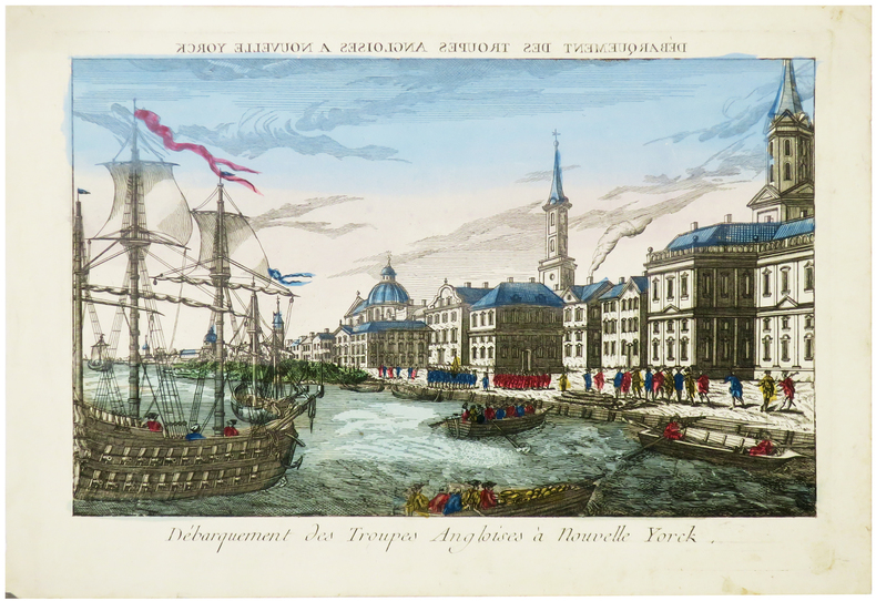
VUE d'OPTIQUE.
[NEW YORK/GUERRE d'INDÉPENDANCE] Débarquement des troupes angloises à Nouvelle Yorck.
[circa 1780]. 266 x 383 mm.
Referencia librero : LBW-6283
|
|
|
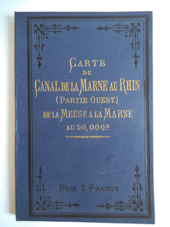
VUILLAUME R.
carte de la Marne au Rhin (partie ouest).
Cartonnage de l’éditeur pleine toile bleue, titre doré en long au dos et sur le premier plat. Dépliée 220x21 cm et pliée 8x21cm. Au bureau du journal Le Yatch 1889, très bon état proche de l’état de neuf
Referencia librero : 8740
|
|
|
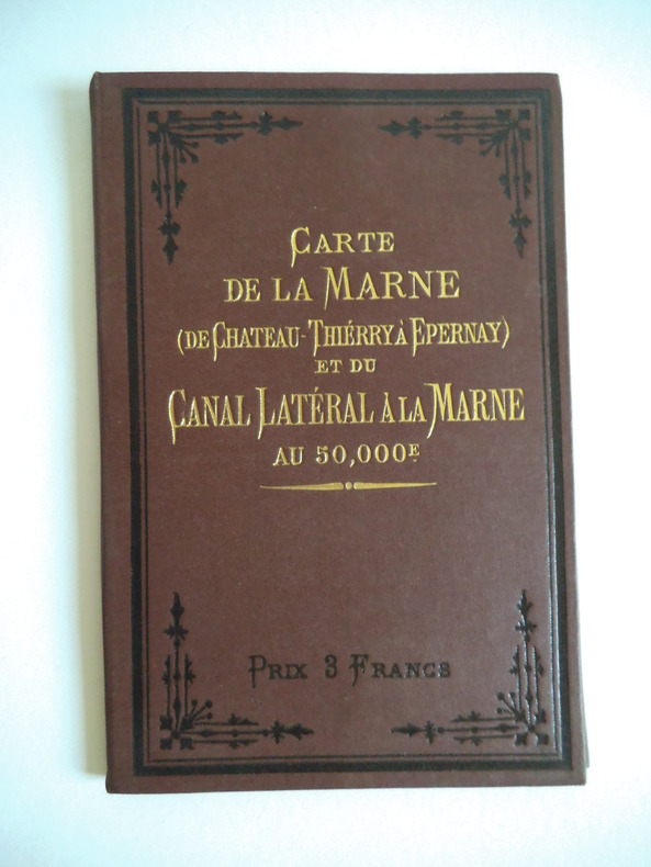
VUILLAUME R.
carte de la Marne de Château Thierry à Epernay.
Cartonnage de l’éditeur pleine toile brique, titre doré en long au dos et sur le premier plat. Dépliée 273x21 cm et pliée 8x21cm. Au bureau du journal Le Yatch 1910, très bon état proche de l’état de neuf.
Referencia librero : 8745
|
|
|
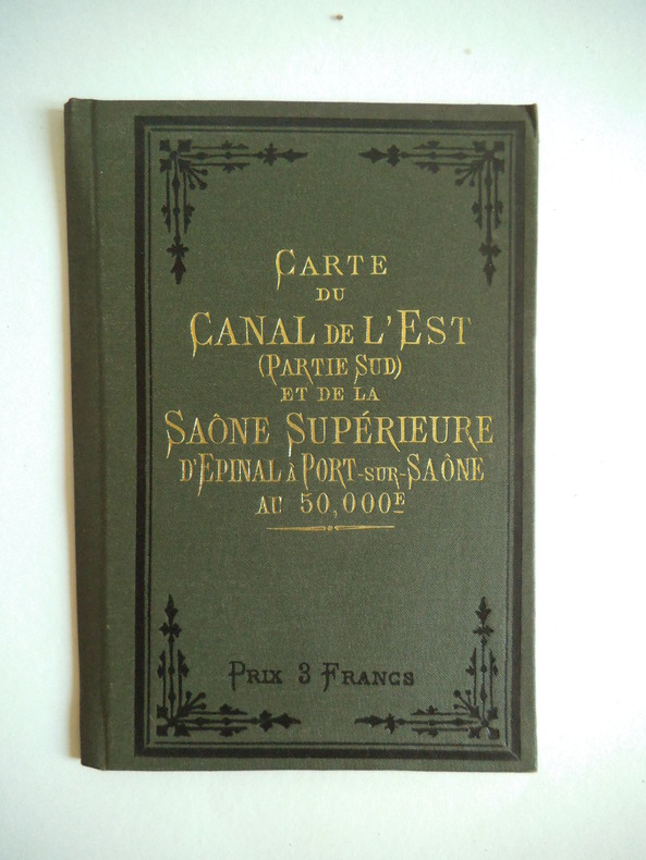
VUILLAUME R.
carte du canal de l’Est (partie sud) d’Epinal à ports sur Saône.
Cartonnage de l’éditeur pleine toile olive, titre doré en long au dos et sur le premier plat. Dépliée 178x21 cm et pliée 8x21cm. Au bureau du journal Le Yatch sans date, très bon état proche de l’état de neuf.
Referencia librero : 8741
|
|
|
VUILLAUME R.
carte du cours de la Marne de Château Thierry à la Seine.
Cartonnage de l’éditeur pleine toile bleue, titre doré en long au dos et sur le premier plat. Dépliée 202x21 cm et pliée 8x21cm. Au bureau du journal Le Yatch 1910, très bon état proche de l’état de neuf.
Referencia librero : 8737
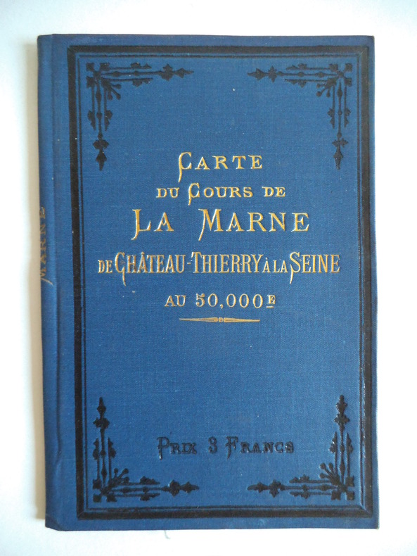
|
|
|
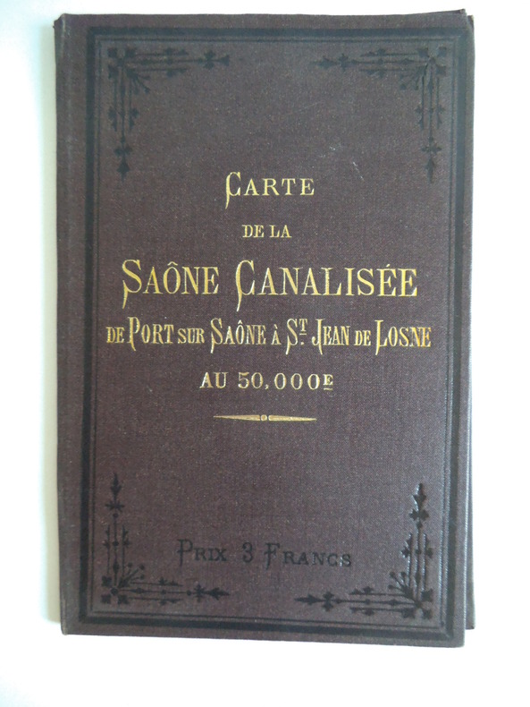
VUILLAUME R.
carte du cours de la Saône canalisée de port sur Saône à St Jean –de- Losne.
Cartonnage de l’éditeur pleine toile marron, titre doré en long au dos et sur le premier plat. Dépliée 273 x21 cm et pliée 8x21cm. Au bureau du journal Le Yatch sans date, très bon état proche de l’état de neuf
Referencia librero : 8744
|
|
 Recibir por correo electrónico
 Descargar en documento PDF
 Flujo RSS


