|
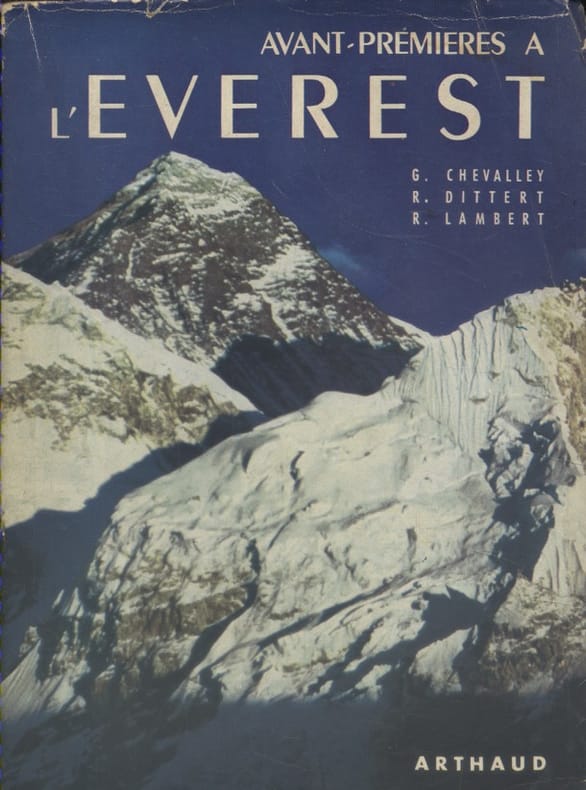
CHEVALLEY Gabriel - DITTERT René - LAMBERT Raymond 36 héliogravures hors texte. Cartes et dessins en 2 couleurs.
Avant-premières à l'Everest.
Couverture souple. Broché. Non coupé. 315 pages. Jaquette.
Referentie van de boekhandelaar : 133394
|
|
|
CHEVALIER Auguste
L'Afrique Centrale Française. Récit du voyage de la mission Chari-Lac Tchad, 1902-1904.
Paris Augustin Challamel 1907 Demi-reliure
Referentie van de boekhandelaar : 010199
|
|
|
CHEMINS DE FER DE PARIS A ORLEANS ET DU MIDI Cartes dressées par les établissements De Dion-Bouton.
Le tourisme sur le réseau des chemins de fer de Paris à Orléans. Touraine - Auvergne - Bretagne - Pyrénées.
Couverture souple. Brochure de 24 pages.
Referentie van de boekhandelaar : 26030

|
|
|
CHEVALLIER J.-P. & MARTIN-PREVEL P.
Le tennis à la Belle Epoque
Collection privée J.-P. Chevallier, Imprimerie Lerner, sans date, vers 1980. In-12. Broché, format à l' italienne. Couverture illustrée. 64 pages. Livret consacré à des reproductions de cartes postales anciennes concernant le tennis à la Belle Epoque. Très bon état. Envoi en tarif " lettre "
Referentie van de boekhandelaar : 3301
|
|
|
CHERON André
LE SYSTEME CULBERTSON ASSIMILABLE EN QUELQUES HEURES. BRIDGE.
Lausanne.Payot.1943.In-12 br.186 p.15 tableaux I-T.2ème édition augmentée.BE.
Referentie van de boekhandelaar : 49291
|
|
|
Chemical and Engineering News; Josephs Melvin J.; Sanders Howard J. b/w Illustrations Maps
Chemistry and the Environment: The Solid Earth the Oceans the Atmosphere
Washington: American Chemical Society 1967. First Edition. Hardcover. Very good with slight shelf wear/no dust jacket. Ex-college library with usual library features/ Very good with slight shelf wear/ no dust jacket/ Hardback/ 1967/ 1st editionB&R 150 Washington: American Chemical Society hardcover
Referentie van de boekhandelaar : 0706110094
|
|
|
CHINE et SZETSCHUAN par Eduard IMHOF.
Die Grossen Kalten Berge von SZETSCHUAN. Richement documenté (aquarelles, planches en couleurs, héliogravures, cartes dont une dépliante en couleurs).
Zürich, Orell Füssli Verlag 1974. Bel exemplaire relié, in-4, 228 pages + planches.
Referentie van de boekhandelaar : AUB-6031
|
|
|
CHINE par René GROUSSET et Vadime ELISSEEF.
Histoire de la Chine avec Vadime ELISSEEF et ses collaborateurs. Richement documenté (34 planches et 2 cartes).
Club des Libraires de France, éd. Fayard 1957. Bon exemplaire relié, reliure pleine toile ornée d'éd., fort in-8 numéroté, 354 pages + planches.
Referentie van de boekhandelaar : AUB-7107
|
|
|
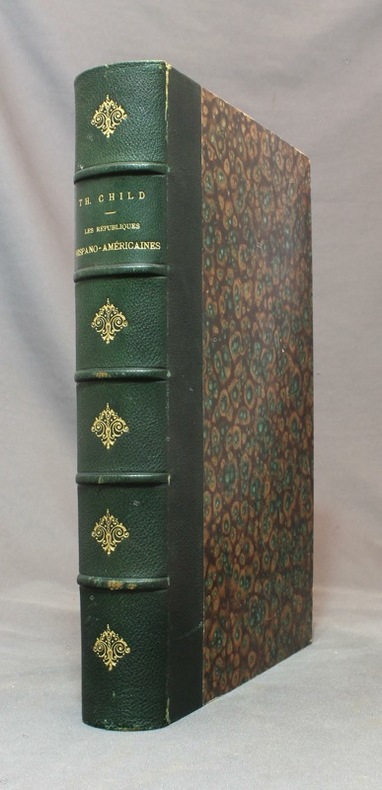
CHILD Théodore:
Les républiques hispano-américaines.
Paris, à la librairie illustrée, sans date [1891]. In-4 de [4]-480 pages, demi-chagrin vert empire, dos à nerfs orné de fleurons dorés, couvertures conservées.
Referentie van de boekhandelaar : 15492
|
|
|
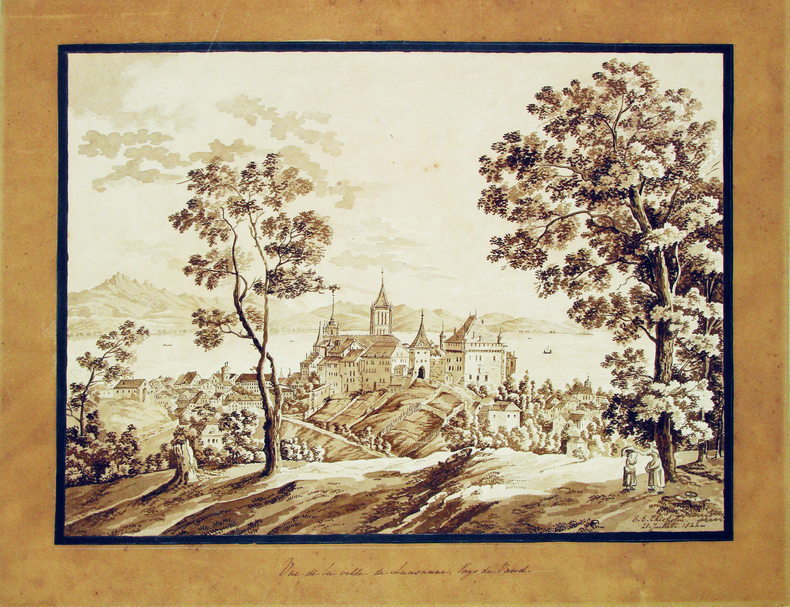
CHISHOLM (C. E.). [Lausanne] MANUSCRIT.
Vue de la ville de Lausanne, Pays de Vaud.
20 juillet 1822. 285 x 385 mm, monté sur carton.
Referentie van de boekhandelaar : LBW-4115
|
|
|
CHIAS Y CARBÓ, Benito.
Mapa de la Provincia de Oviedo. 1903.
Barcelona, Establecimiento Editorial de Alberto Martín, s.a. (1915) [Colección de Cartas Corográficas]. Un mapa de 35 x 45 cms., dibujado por Joaquín Ribera y litografiado en color por Martí Campaña, montado sobre tela, - con soporte exterior de cartoné
|
|
|
Chicago Ill.. Bureau of Maps and Plats
Report on proposed change of house numbering system for city of Chicago 1907 Leather Bound
2019. Leather Bound. New. Leather Binding on Spine and Corners with Golden Leaf Printing on round Spine. Reprinted in 2019 with the help of original edition published long back 1907. This book is printed in black & white sewing binding for longer life Printed on high quality Paper re-sized as per Current standards professionally processed without changing its contents. As these are old books we processed each page manually and make them readable but in some cases some pages which are blur or missing or black spots. If it is multi volume set then it is only single volume if you wish to order a specific or all the volumes you may contact us. We expect that you will understand our compulsion in these books. We found this book important for the readers who want to know more about our old treasure so we brought it back to the shelves. Hope you will like it and give your comments and suggestions. Lang: - eng Pages 40. EXTRA 10 DAYS APART FROM THE NORMAL SHIPPING PERIOD WILL BE REQUIRED FOR LEATHER BOUND BOOKS. FOLIO EDITION IS ALSO AVAILABLE. hardcover
Referentie van de boekhandelaar : LB1111001178494
|
|
|
Chicago Ill.. Bureau of Maps and Plats
Report on proposed change of house numbering system for city of Chicago 1907
2020. Paperback. New. Lang: - eng Pages 40. Reprinted in 2020 with the help of original edition published long back 1907. This book is Printed in black & white sewing binding for longer life with Matt laminated multi-Colour Soft Cover HARDCOVER EDITION IS ALSO AVAILABLE Printed on high quality Paper re-sized as per Current standards professionally processed without changing its contents. As these are old books we processed each page manually and make them readable but in some cases some pages which are blur or missing or black spots. If it is multi volume set then it is only single volume if you wish to order a specific or all the volumes you may contact us. We expect that you will understand our compulsion in these books. We found this book important for the readers who want to know more about our old treasure so we brought it back to the shelves. Any type of Customisation is possible with extra charges. Hope you will like it and give your comments and suggestions. paperback
Referentie van de boekhandelaar : PB1111001178494
|
|
|
Chicago Ill.. Bureau of Maps and Plats
Report on proposed change of house numbering system for city of Chicago 1907 Hardcover
2020. Hardcover. New. Lang: - eng Pages 40. Reprinted in 2020 with the help of original edition published long back 1907. This book is Printed in black & white Hardcover sewing binding for longer life with Matt laminated multi-Colour Dust Cover Printed on high quality Paper re-sized as per Current standards professionally processed without changing its contents. As these are old books we processed each page manually and make them readable but in some cases some pages which are blur or missing or black spots. If it is multi volume set then it is only single volume if you wish to order a specific or all the volumes you may contact us. We expect that you will understand our compulsion in these books. We found this book important for the readers who want to know more about our old treasure so we brought it back to the shelves. Any type of Customisation is possible with extra charges. Hope you will like it and give your comments and suggestions. hardcover
Referentie van de boekhandelaar : 1111001178494
|
|
|
Chichester Sir Francis Illustrated by Photos Maps
Gipsy Moth Circles The World
NY: Coward McCann. G. 1966. Hardcover. Near Fine/Very Good . Book Club BCE/BOMC. 8vo - over 7�" - 9�" tall . BOMC edition bound in blue cloth. Previous owner has penned the pric e date & place of purchase on the iner gutter of the 1/2 ti tle page. His namestamp appear at the edge of the bottom page block along with a line indicating the book had been read. Tight clean copy in lightly rubbed dj. . Coward McCann hardcover
Referentie van de boekhandelaar : 12034
|
|
|
CHINA HISTORICAL MAPS Uchiyama Tsunetomo editor.
Juhachi Shiryaku Ryaku Jirui taizen.
Kyoto. Meiji 23. 1890. 11 black and white woodblock maps Japanese binding 7 x 4 3/4 inches. Covers lightly soiled very good condition. Volume 4 of a series. Attractive and detailed maps showing China at different historical periods. . unknown
Referentie van de boekhandelaar : 41996

|
|
|
CHINESE MUSIC; MAPS OF THE BALTICS FRANCE GERMANY Urban Sylvanus David Henry Editor.
Gentleman's Magazine and Historical Chronicle January to December. 1757.
London.: D. Henry and R. Cave at St. John's Gate. Volume XXVII. 1757. Bound volume in leather binding spine perished; replaced with fabric covers badly worn the front cover and spine separated from the text block.; 8.75 x 5.25 inches; title page and preface; 608 pp including Supplement followed by unpaginated Index listing Essays Poetry Names etc. included in the 12 issues. Ex-library with bookplate on inside front cover perforated stamp on title page and stamped number with withdrawn stamp in lower margin of preface page. Pages 423 thru 436 are loose in binding. Pages 177 thru 180 are MISSING. In sum: a book the binding of which has not aged well; however the contents are in remarkably clean shape with some offsetting. There are a few plates missing and the "Map of that part of America which was the seat of war in the years 1755 and 1756." A chief feature of the volume is the numerous engraved copperplate maps. They are listed with sheet size as follows: 1 A Physical Planisphere wherein are represented all the known Lands and Seas wth. the Great Chains of Mountains wch. traverse the Globe from the North Pole. Adapted to Monsr: Buache's Memoire Read at the R. Academy of Sciences 14 x 12.25 inches; very clean; short marginal tears; 2 The Seat of WAR in the Circle of Westphalia 8.25 x 10.5 inches with very light off-set on one fold; 3 "A Draught of the Road and Harbour of Brest with the Adjacent Coast" 8.25 x 18 inches; 3 "Map of the Several Countries thro' which the Russians are to Pass in their March to Prussia" 8.25 x 10.25 Baltic Countries i.e. Pomerania Prussia Courland Livonia etc. 4 Map of the Mouths of the Ganges in the Bay of Bengal shewing the English Settlements lately Destroy'd by the Nabob of that Province 8.25 x 5 inches; 5 A map of the Coast of France from Rochelle & Rochfort with the Island of Ree Oleron & Aix 8.25 x 5.5; 6 Upper Saxony Comprehending that Part of Germany which is the Present Seat of War 8.25 x 11 inches; 7 A New Map of England and Wales by Thos. Jeffreys Geographer to his royal Highness the Prince of Wales 17 x 15 inches; two very short tears to margin otherwise excellent; A Map of the Island of Corsica 8 x 4 inches considerable offsetting from facing page. The volume also includes a folding plate of the Temple of the Eight Winds; three plates of shells; one plate of ancient coins; a folding plate of Two Imperfect Roman Alters discovered near Carlisle and two other plates of arcane interest. Unusual is the page denoting "A Chinese Air" a transcription of what is thought to have been "the earliest Chinese music performance in the West" See Early Music September 29 2010. Overall a volume of considerable interest in need of rebinding; however contents in remarkably good condition. . D. Henry and R. Cave at St. John's Gate. hardcover
Referentie van de boekhandelaar : 50818

|
|
|
CHIQUET Jacques (1673 - 1721)
Division du Globe Globe Terrestre par Zones Corespondantes ala Sphere Celeste / Correspondance du Globe Terrestre avec la Si
Questa tavola raffigura i due emisferi, che mostrano l'equatore, i tropici e le zone polari del mondo, nelle cuspidi e negli angoli ci sono sei diagrammi più piccoli che mostrano 'Disposition des Parallels' e 'Explication des Zones' ecc. Opera tratta da Le nouveau et curieux Atlas Geographique et historique pubblicato a Parigi nel 1719.All'inizio del XVIII secolo, la cartografia francese ha superato gli olandesi in termini di precisione e design. Il delizioso Nouveau et Curieux Atlas di Chiquet era un prodotto tipico dell'epoca.Acquaforte su rame, finemente colorata a mano, in buone condizioni. This plate shows two hemispheres, showing the equator, tropics and polar zones of the world, in the cusps and corners there are six smaller diagrams showing 'Disposition des Parallels' and 'Explication des Zones' etc. In the early eighteenth century, French cartography overtook the Dutch in terms of accuracy and design. Chiquet's delightful Nouveau et Curieux Atlas was typical product of the time.Work taken from Le nouveau et curieux Atlas Geographique et historique published in Paris in 1719.Copperplate, finely colored by hand, in good condition.

|
|
|
CHIQUET Jacques (1673 - 1721)
Le Globe Terrestre Rappresenté en Deux Plans-Hemispheres…
Mappa del mondo a doppio emisfero che presenta l'isola della California e un passaggio a nord-ovest. Date le picocle dimensioni, dono presenti solo pochi dettagli interni e solo le principali nazioni nominate. Dal punto di vista dell'innovazione cartografica Ter. de Jesso appare al largo della costa orientale dell'Asia, l'Australia è incompleta e ancora attaccata alla Nuova Guinea, appare solo la costa occidentale della Nuova Zelanda, e c'è ancora una costa parziale per Terres Australes. Il cartiglio del titolo decorativo e il testo in francese circondano la mappa.Opera tratta dal Le Nouveau et Curieux Atlas Geographique et Historique... di Jacques Chiquet.Acquaforte su rame, con una bella colorazione a mano, in buone condizioni. This delicately engraved double hemisphere world map features the island of California and a Northwest Passage. There is little interior detail with only major nations named. Ter. de Jesso appears off the east coast of Asia, Australia is incomplete and still attached to New Guinea, only the west coast of New Zealand appears, and there is still a partial coastline for Terres Australes. Decorative title cartouche and French text surrounds the map.From Le Nouveau et Curieux Atlas Geographique et Historique... by Jacques Chiquet.Copperplate, with fine hand colouring, good condition.

|
|
|
CHOCOLAT LOUIT
"Carte Postale du Chocolat Louit "" Le Caviar - Histoire Anecdotique de l'Alimentation """
LIBRAIRIE DU GLORIT. Non daté. In-12. Broché. Bon état, Couv. convenable, Dos satisfaisant, Intérieur frais. Une carte postale, vierge, illustrée en couleurs. 14.5 x 10 cm.. . . . Classification : 220-Cartes Postales Publicitaires
Referentie van de boekhandelaar : RO80093902
|
|
|
CHOCOLAT LOUIT
"Carte Postale du Chocolat Louit "" Les Grives - Histoire Anecdotique de l'Alimentation """
LIBRAIRIE DU GLORIT. Non daté. In-12. Broché. Bon état, Couv. convenable, Dos satisfaisant, Intérieur frais. Une carte postale, vierge, illustrée en couleurs. 14.5 x 10 cm.. . . . Classification : 220-Cartes Postales Publicitaires
Referentie van de boekhandelaar : RO80093903
|
|
|
CHOT (J.-M.).
Carte de voeux illustrée d'une gravure originale signée.
Paris Société des peintres-graveurs français 1997 1 vol. Broché Carte de voeux dépliante sur Arches illustrée d'une eau-forte (11 x 17 cm) signée par J.-M. Chot-Plassot. En parfait état.
Referentie van de boekhandelaar : 109097
|
|
|
CHOT (J.-M.).
Menu illustré d'une gravure originale signée.
Paris Société des peintres-graveurs français 1972 1 vol. Broché Menu dépliant sur Arches illustré d'une eau-forte (12 x 19 cm) justifiée et signée par J.-M. Chot. Dessin et ex-dono signé d'un autre artiste au verso. En parfait état.
Referentie van de boekhandelaar : 109086
|
|
|
Cholinet, Ch
Forèt et Environs de Fontainebleau. Cond.r (=conducteur) des Pons et Chaussées, Officier d'Academie, Continuateur de Denecourt.
Paris, Lanée, (1885). auf Leinwand aufgezogene Karte mehrfach gefaltet, 3 x 5 Segmente, mehrfach gefaltete Karte auf Leinwand mit augeklebtem Original-Verlagstitelschild, in marmorierter Einschubhülle und marmoriertem Original-Pappschuber mit goldgeprägtem Rückentitel auf rotem Schildchen. Zustand -1, Leinen minimal am Rand stockfleckig, Schuberränder berieben.
Referentie van de boekhandelaar : 0389Rf
|
|
|
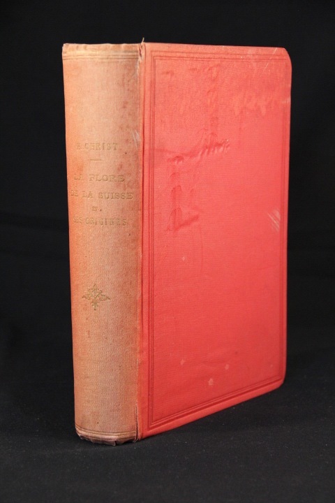
CHRIST H.; TIECHE E. (trad.):
La flore de la Suisse et ses origines.
Bâle, Genève, Lyon, H. Georg, 1883. 1 vol. in-8 de XIV-576 pages, pleine percaline rouge, dos lisse orné d’un fleuron doré. Dos passé, plats griffés.
Referentie van de boekhandelaar : 2693
|
|
|
CHRETIEN Henri
Les méthodes de prévision du temps
à courte et à longue échéance à l'usage des aviateurs civils et militaires, des Armées de Terre et de Mer, des agriculteurs, des hyygiénistes et des médecins, des membres de l'enseignement, au moyen des vents, des cartes, des nuages, des instruments, des astres, de la nature, de la T.S.F., etc
Referentie van de boekhandelaar : 3448
|
|
|
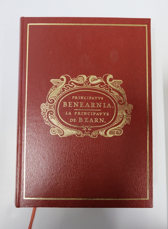
Christian Deplat, Pierre Tucco-Chala
Principatus Benearnia, Principauté du Béarn et Atlas Historique - 2 volumes
1980, SNERD, Pau. 2 volumes in-4 comprenant Principatus Benearnia et son Atlas historique. Principatus Benearnia, fort volume relié plein simili grenat, plats estampés, 637pp largement illustrées. Atlas Historique, cartographie Monique Morales, broché, plats marrons, 91pp. Page de titre épidermée sur volume Atlas. Bon ensemble en très bel état.
Referentie van de boekhandelaar : REG5303M
|
|
|
Chris Catling; Alison Merry
Gloucestershire and Hereford & Worcester (New Shell Guides)
No marks or inscriptions. No creasing to covers or to spine. A very clean very tight copy with bright unmarked boards and no bumping to corners. 224pp. History, architecture, travel through three English counties near the Welsh border. Well illustrated.

|
|
|
Christensen, Shane
Frommer's Grand Canyon National Park
No marks or inscriptions. No creasing to covers or to spine. A clean crisp very tight copy with bright covers and no bumping to corners. 203pp.

|
|
|
Christie's
Indonesian Pictures Watercolours and Drawings including the J. Daniels Collection of Sea-Charts, Maps, Prints and Books Relating to the Dutch East-Indies
This is a fine softcover copy with virtually no wear. Completely clean inside and out. Binding firm. This is a sale catalog for an auction held at Christie's in Amsterdam on Thursday April 17, 1997. The Sale Code is: Ionesco 2328. The sale consisted of Indonesian art and included the J. Daniels Collection of Sea-Charts, Maps, Prints and Books Relating to the Dutch East-Indies. 278 lots in the sale. Most illustrated, many in color. Short essay on the J. Daniels collection. Prices realized sheet included. 11" high X 8" wide, 112 pages. This book will be securely packed and shipped with tracking.
|
|
|
Christoffel, Udo
Berlin Wilmersdorf. Wilmersdorf, Schmargendorf Kolonie und Forst Grunewald dargestellt im Kartenbild der Jahre von 1588 bis 1938.
Berlin, Kunstamt Wilmersdorf 1983. Mit zahlr. überwieg. farb. Karten und Plänen. Unpag. Folio. OHLwd.
Referentie van de boekhandelaar : 81038
|
|
|
Christoforakis, J.M.
A Traveller's Guide to Crete with large size map
Locally produced guidebook to Crete with large fold out maps and plans Translated into English by Katerina Rooke. 68p.+12 pages of plates and a large fold out map.Slight scuffing to paper wraps. Book
|
|
|
Christophorakis JM. J. M.
Knossos : A Visitor's Guide
Heraklion: J.M.Christophorakis. Locally produced guidebook to Knossosincluding site plan and illustrations. Pbk. nd. 79p. illus plans diagrs.fold-out plan. 4th.Ed. Soft Cover. Very Good. J.M.Christophorakis. paperback
Referentie van de boekhandelaar : 14832
|
|
|
Christophorakis JM. J. M.
Knossos : A Visitor's Guide
Heraklion: J.M.Christophorakis. Locally produced guidebook to Knossosincluding site plan and illustrations. Pbk. nd. 79p. illus plans diagrs. . 4th.Ed. Soft Cover. Fine. J.M.Christophorakis. paperback
Referentie van de boekhandelaar : 12383
|
|
|
Christophorakis JM. J. M.
Knossos : Visitor's Guide
Heraklion: J.M.Christophorakis. Locally produced guidebook to Knossosincluding site plan and illustrations. Pbk. nd. 79p. illus plans diagrs. Clean crips text but paper cover creased. 4th.Ed. Soft Cover. Good. J.M.Christophorakis. paperback
Referentie van de boekhandelaar : 12447
|
|
|
Christophorakis JM. J. M.
Knossos : A Visitor's Guide
Heraklion: J.M.Christophorakis. Locally produced guidebook to Knossosincluding site plan and illustrations. Pbk. nd. 79p. illus plans diagrs. Condition : Good. 3rd.ed. Soft Cover. Good. J.M.Christophorakis. paperback
Referentie van de boekhandelaar : 12611
|
|
|
Christophorakis JM. Trans. Katerina Rooke J. M.
Traveller's Guide to Crete With Large Size Map
Heraklion: J.M.Christophorakis. Locally produced guidebookincluding good street maps of Heraklion and other towns. Pbk. nd. c.1970 68p. 12p.plates Condition : Good. Soft Cover. Very Good. J.M.Christophorakis. paperback
Referentie van de boekhandelaar : 14266
|
|
|
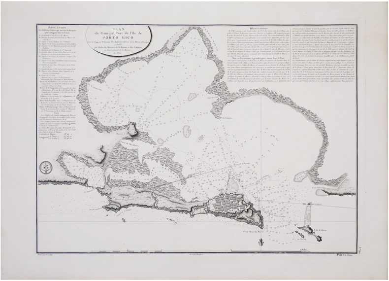
CHURRUCA y ELORZA (Cosme Damián de).
[PORTO RICO] Plan du principal port de l'île de Porto Rico levé en 1794 par D. Cosme de Churruca.
[Paris], Dépôt Général de la Marine, 1801. 397 x 557 mm.
Referentie van de boekhandelaar : LBW-7703
|
|
|
CHURCHILL CREIGHTON WITH MAPS BY MORGAN AVA
The World Of Wines
Collier Books New York: 1967. Softcover. Fair condition. A guide to all the good and great wines of Europe and the Americas. Covers in full detail all the factors and conditions vital to good winemaking and wine enjoyment. Includes an Index. "A delightful and useful book for both the connoisseur and the novice with a taste for the fruit of the world's vines." - Los Angeles Herald-Examiner Collier Books, New York: 1967 paperback
Referentie van de boekhandelaar : 68607X1
|
|
|
Churchill Creighton; with maps by Ava Morgan
WORLD OF WINES
New York NY: Macmillan Company. G/G. c1964. First Printing. Cloth/Boards. 8vo. 271 pp. Dj rubbed edges frayed yellowing owner's name on htitle page page edges yellowed . Macmillan Company hardcover
Referentie van de boekhandelaar : BOOKS237591
|
|
|
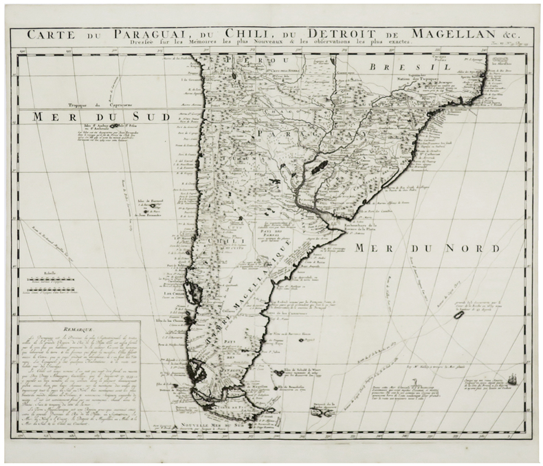
CHÂTELAIN (Henry Abraham).
[PARAGUAY/CHILI/TERRE DE FEU] Carte du Paraguai, du Chili, du Détroit de Magellan &c.
[Amsterdam, circa 1720]. 402 x 515 mm.
Referentie van de boekhandelaar : LBW-6083
|
|
|
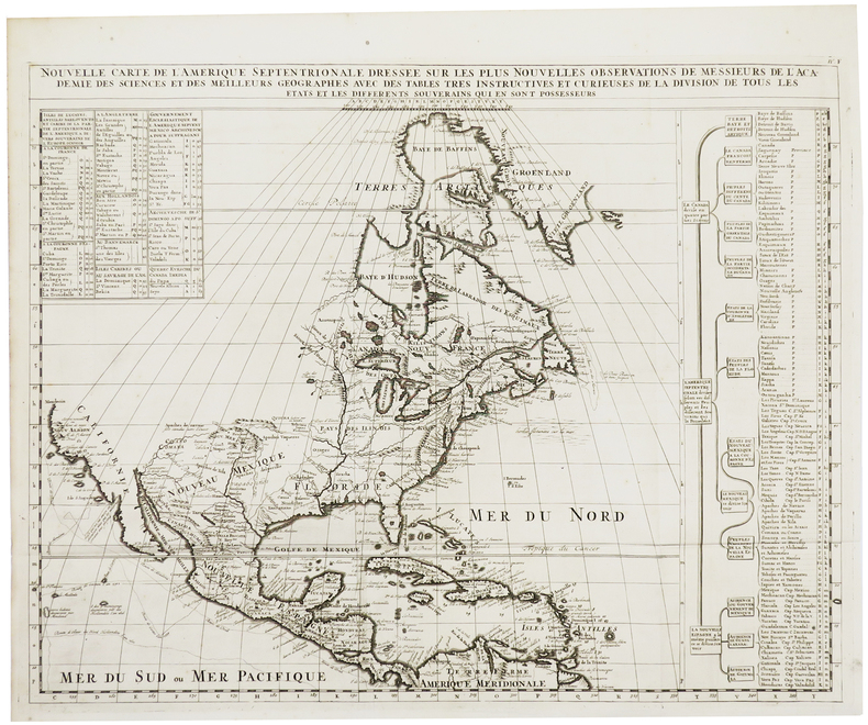
CHÂTELAIN (Henry Abraham).
Nouvelle carte de l'Amérique septentrionale dressée sur les plus nouvelles observations de Messieurs de l'Académie des Sciences et des meilleurs géographes avec des tables très instructives et curieuses de la division de tous les états et les différents souverains qui en sont possesseurs.
[Amsterdam, circa 1720]. 472 x 598 mm.
Referentie van de boekhandelaar : LBW-6107
|
|
|
CHÂTELAIN (Henry Abraham).
Nouvelle carte de géographie de la partie méridionale de l'Amérique suivant les plus nouvelles observations avec des tables et des remarques pour l'intelligence de l'Histoire et de la Géographie.
Amsterdam, [circa 1720]. 467 x 597 mm.
Referentie van de boekhandelaar : LBW-6519

|
|
|
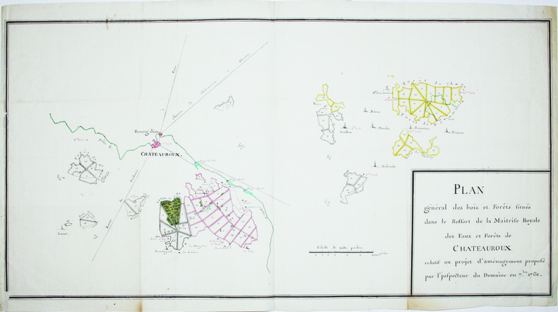
CHÂTEAUROUX. MANUSCRIT.
Plan général des bois et forêts situés dans le ressort de la Maîtrise Royale des Eaux et Forêts de Châteauroux relatif au projet d'aménagement proposé par l'inspecteur du domaine en 7.bre 1781.
Septembre 1781. En 2 feuilles jointes de 412 x 810 mm.
Referentie van de boekhandelaar : LBW-4191
|
|
|
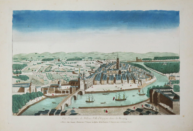
CHÉREAU (Jacques).
[BILBAO] Vue perspective de Bilbao, ville d'Espagne dans la Biscaÿe.
Paris, Jacques Chéreau, [circa 1780]. 275 x 408 mm.
Referentie van de boekhandelaar : LBW-3425
|
|
|
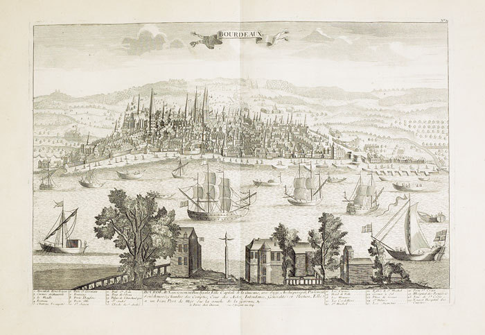
CHÉREAU (Jacques).
[BORDEAUX] Bourdeaux ancienement Burdigala, ville capitale de la Guienne.
Paris, Chéreau, [circa 1760]. 346 x 511 mm.
Referentie van de boekhandelaar : LBW-472
|
|
|
CHÉREAU (Jacques);
[CHAMBORD] Vüe de Chambor.
Paris Charpentier 1760 circa 338 x 505 mm.
Referentie van de boekhandelaar : LBW-416

|
|
|
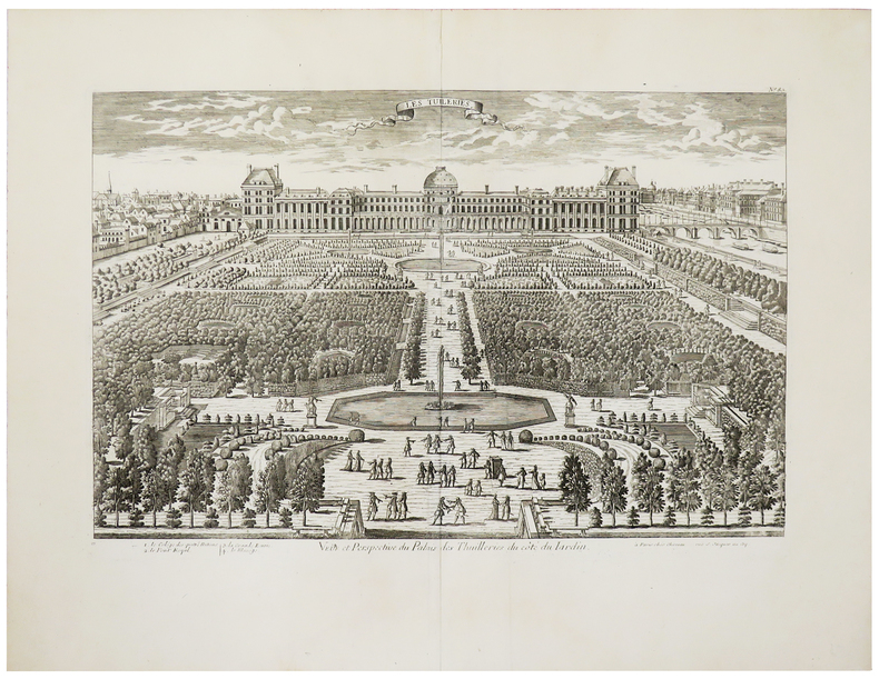
CHÉREAU (Jacques).
[JARDIN des TUILERIES] Veüe et perspective du Palais des Thuilleries du côté du jardin.
Paris, Chéreau, [circa 1760]. 344 x 515 mm.
Referentie van de boekhandelaar : LBW-961
|
|
 De zoekresultaten per email ontvangen
 Zoekresultaten downloaden als PDF
 RSS feed


