|
CHATELAIN (Henry Abraham).
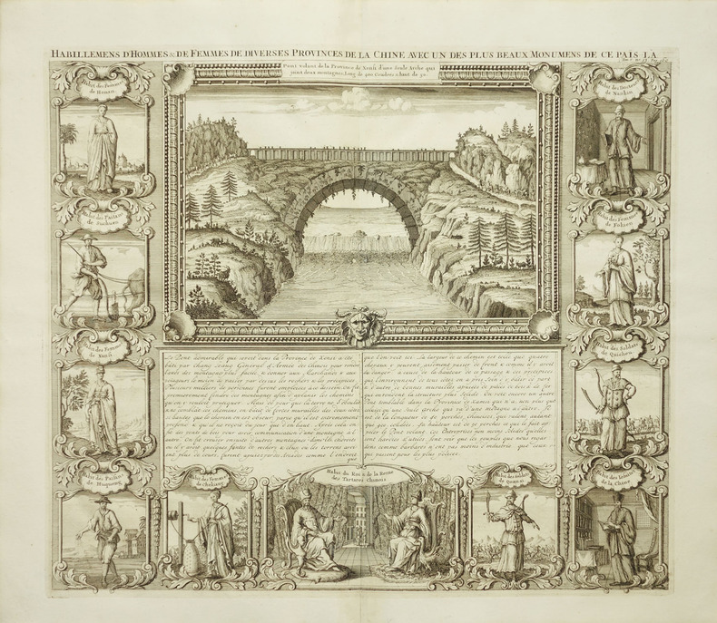
Habillemens d'hommes & de femmes de diverses provinces de la Chine avec un des plus beaux monumens de ce païs-là.
Amsterdam, circa 1720. 375 x 430 mm.
Bookseller reference : LBW-2039
|
|
|
CHATELAIN (Henry Abraham).
L’Empire du Japon, tiré des cartes des Japonnois.
[Amsterdam, circa 1720]. 373 x 436 mm.
Bookseller reference : LBW-4810

|
|
|
CHATELAIN (Henry Abraham).
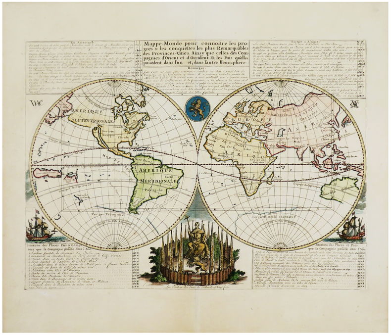
Mappe-monde pour connoitre les progrès & les conquestes les plus remarquables des Provinces-Unies, ainsy que celles des Compagnies d'Orient et d'Occident. Et les païs qu'elles possèdent dans l'un et dans l'autre hémisphère.
[Amsterdam, vers 1705]. 331 x 439 mm.
Bookseller reference : LBW-1716
|
|
|
CHATELAIN (Henry Abraham).
Nouvelle carte d'Angleterre, d'Ecosse et d'Irlande, avec des instructions pour connoitre les différents états de la Couronne d'Angleterre en Europe, Asie, Afrique, et Amérique.
[Amsterdam, 1708]. 354 x 462 mm.
Bookseller reference : LBW-3530

|
|
|
CHATELAIN (Henry Abraham).
Nouvelle carte de l'état présent de l'Italie.
Amsterdam, [circa 1720]. 331 x 654 mm.
Bookseller reference : LBW-1093

|
|
|
CHATELAIN (Henry Abraham).
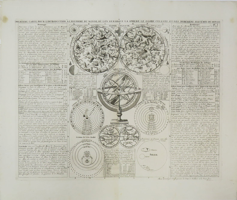
Première carte pour l'introduction à l'histoire du monde, où l'on remarque la sphère, le globe céleste, et les différens sistèmes du monde.
[Amsterdam, 1708]. 343 x 440 mm.
Bookseller reference : LBW-3447
|
|
|
CHATELAIN (Henry Abraham);
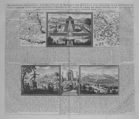
[MEXIQUE] Description, situation & vue de la ville de Mexique des deux lacs sur lesquels elle est bâtie, du grand temple de cette ville, des sacrifices d'hommes qu'on y faisoit, de l'idole des Mexicains, de leurs jeux, divertissemens, coutumes, superstitions & autres usages pratiquez parmi eux.
Amsterdam circa 1720 368 x 429 mm.
Bookseller reference : LBW02e5e
|
|
|
CHATELAIN (Henry Abraham);
Carte du royaume de Bohême, la chronologie de ses rois, les états de Silésie, Moravie et Lusace.
Amsterdam circa 1720 465 x 617 mm.
Bookseller reference : LBW-1094

|
|
|
CHATELAIN (Henry Abraham);
Nouvelle carte de la Hongrie, divisée selon ses différents états, avec une chronologie de ses ducs et de ses rois.
Amsterdam circa 1720 463 x 619 mm.
Bookseller reference : LBW-1083
|
|
|
CHATELAIN (Henry Abraham);
Nouvelle carte des différents états du roi de Prusse, et de ceux des autres princes de la Maison de Brandebourg.
Amsterdam circa 1720 380 x 477 mm.
Bookseller reference : LBW-1089
|
|
|
CHATELAIN Claude; Baud Georges:
"Habundantia". La vie au va d'Abondance à travers le temps.
Thonon-les-Bains, 1983. In-8 broché de 279 pages, couverture illustré d'une photographie en couleurs.
Bookseller reference : 16780
|
|
|
CHATELAIN Henri Abraham (1684 - 1743)
Nouveau Plan de la Ville de Rome tiré par ordre du Pape par Matteo Gregoria de Romans Tres Utille pour les Voiageurs
Pianta a proiezione mista, orientata con il nord a sinistra, 1706 circa. Basata sula pianta di Roma di Lievin Cruyl del 1665 e successiva ristampa del 1696. Per Scaccia Scarafoni prima e Marigliani poi “fu pubblicata ad Amsterdam nel 1706 senza alcun aggiornamento e raffigura pertanto Roma come si presentava alla fine del ‘600. In alto a sinistra è riportata la piantina dei dintorni di Roma” (cfr. Marigliani p. 252). La pianta è inclusa nell'Atlas Historique, pubblicato ad Amsterdam tra il 1705 e il 1720. L'atlante, in 7 volumi, è innovativo per la sua epoca perché combina le mappe geografiche con incisioni e informazioni di carattere geografico, storico, etnografico e araldico. Acquaforte, in ottimo stato di conservazione. Henri Abraham Chatelain (1684 - 1743) era un pastore ugonotto di origini parigine. È meglio conosciuto come cartografo olandese e più specificamente per il suo contributo cartografico nell’Atlas Historique in sette volumi, pubblicato ad Amsterdam tra il 1705 e il 1720. Innovativo per il suo tempo, l'Atlas Historique combinava incisioni e opere d'arte con studi di geografia, storia, etnologia, araldica e cosmografia. Alcuni studiosi suggeriscono che l'Atlas Historique non fu compilato esclusivamente da Henri Chatelain, come si crede comunemente, ma piuttosto fu un'impresa familiare che coinvolse Henri, suo padre Zacharie e suo fratello, sempre Zacharie. Bibliografia Scaccia Scarafoni (1939): p. 113, n. 213; Marigliani (2007): p. 252, n. 158. Mixed projection map of Rome, oriented with north to the left, circa 1706. Based on the map of Rome by Lievin Cruyl (1665) and subsequent reprint of 1696. For Scaccia Scarafoni first and then Marigliani was published in Amsterdam in 1706 without any update and therefore represents Rome as it was at the end of '600. At the top left is the map of the surroundings of Rome (see Marigliani p. 252). The map is included in the Atlas Historique, published in Amsterdam between 1705 and 1720. Henri Abraham Chatelain (1684 - 1743) was a Huguenot pastor of Parisian origins. He is best known as a Dutch cartographer and more specifically for his cartographic contribution in the seminal seven volume Atlas Historique, published in Amsterdam between 1705 and 1720. Innovative for its time, the Atlas Historique combined fine engraving and artwork with scholarly studies of geography, history, ethnology, heraldry, and cosmography. Some scholarship suggests that the Atlas Historique was not exclusively compiled by Henri Chatelain, as is commonly believed, but rather was a family enterprise involving Henri, his father Zacharie and his brother, also Zacharie. Etching, in excellent condition. Literature Scaccia Scarafoni (1939): p. 113, n. 213; Marigliani (2007): p. 252, n. 158.

|
|
|
CHATELAIN Henri Abraham (1684 - 1743)
Rome Ancienne et Moderne
Pianta a proiezione verticale, orientata con il nord a sinistra. "Questa pianta assai schematica deriva come base di rappresentazione dalla pianta grande del Falda e non da quella del De Rossi come sostenuto in passato dall'Huelsen. Raffigura Roma attorno al 1700: manca infatti non solo la scalinata di Trinità dei Monti realizzata tra il 1721 e il 1725 come notato da Scaccia Scarafoni ma anche il porto di Ripetta realizzato nel 1704 e gli interventi dovuti a Innocenzo XII ma la poca definizione del disegno non consente di verificarlo con certezza. I lotti edificati non hanno campitura ma una fitta serie di 320 numeri e varie lettere che rimandano alla legenda disposta ai due lati della pianta. è invece rappresentato con maggiore cura il disegno dei giardini e delle ville" (cfr. Marigliani p. 255). Opera tratta dall'Atlas Historique, pubblicato ad Amsterdam tra il 1705 e il 1720. Incisione in rame, finemente colorata a mano, in perfette condizioni. Henri Abraham Chatelain (1684 - 1743) era un pastore ugonotto di origini parigine. È meglio conosciuto come cartografo olandese e più specificamente per il suo contributo cartografico nell’Atlas Historique in sette volumi, pubblicato ad Amsterdam tra il 1705 e il 1720. Innovativo per il suo tempo, l'Atlas Historique combinava incisioni e opere d'arte con studi di geografia, storia, etnologia, araldica e cosmografia. Alcuni studiosi suggeriscono che l'Atlas Historique non fu compilato esclusivamente da Henri Chatelain, come si crede comunemente, ma piuttosto fu un'impresa familiare che coinvolse Henri, suo padre Zacharie e suo fratello, sempre Zacharie. Bibliografia Huelsen (1915): n. 129b; Scaccia Scarafoni (1939): n. 219; Marigliani (2007): p. 255, n. 162. Vertical projection map of Rome, oriented with the north on the left. This very schematic plan derives as a basis of representation from the large map of Falda and not from that of De Rossi as claimed in the past by Huelsen. It depicts Rome around 1700: in fact, not only the Spanish Steps are missing, made between 1721 and 1725 as noted by Scaccia Scarafoni, but also the port of Ripetta made in 1704 and the interventions due to Innocenzo XII, but the poor definition of the drawing does not allow to verify with certainty. The built lots do not have a field but a dense series of 320 numbers and various letters that refer to the legend placed on the two sides of the plan. It is instead represented with greater care the design of gardens and villas (cf. Marigliani p. 255). Taken from "Atlas Historique" , this sheet includes a small map of the northern hemisphere including all of Europe and Asia and most of Africa, above the horn. Henri Abraham Chatelain (1684 - 1743) was a Huguenot pastor of Parisian origins. He is best known as a Dutch cartographer and more specifically for his cartographic contribution in the seminal seven volume Atlas Historique, published in Amsterdam between 1705 and 1720. Innovative for its time, the Atlas Historique combined fine engraving and artwork with scholarly studies of geography, history, ethnology, heraldry, and cosmography. Some scholarship suggests that the Atlas Historique was not exclusively compiled by Henri Chatelain, as is commonly believed, but rather was a family enterprise involving Henri, his father Zacharie and his brother, also Zacharie. Copper engraving, with fine later hand colour, in excellent condition. Literature Huelsen (1915): n. 129b; Scaccia Scarafoni (1939): n. 219; Marigliani (2007): p. 255, n. 162.

|
|
|
CHATELAIN, Henri Abraham.
Atlas Historique, ou nouvelle introduction à l'histoire, Tome 6, Afrique seul
Amsterdam, Chez l’Honoré et Chatelain, 1719, in-folio, 1f.-IV-2ff.-74pp., titre en rouge et noir avec 20 gravures sur cuivre à double pages, comprenant les 3 cartes de l’Afrique, tableaux et descriptions des différents pays et peuples, relié plein percale, ex-libris Karl-Ferdinand Schädler, Ethnologue et économiste, spécialiste d'art africain, frottements, coiffes et coins usés.
Bookseller reference : PHO-1711

|
|
|
CHATILLON-SUR-SEINE
Carte au 1/200 000?.
1 feuille 32x49 cm.
|
|
|
CHAUCHARD (Capitaine)
Carte de la partie septentrionale de l'Italie par M. Chauchard, capitaine d'infanterie et ingénieur militaire de Monsieur le Comte d'Artois.
1780 toile bleu, Carte en 4 ff. , 96 x 166 cms, P. chez Dezauche, (ca. 1780)
Bookseller reference : 11798
|
|
|
CHAUCHARD (Paul)
- Carte Générale de l'Empire d'Allemagne par Mr. Chauchard, capitaine d'Infanterie et Ingénieur militaire.- Carte réduite de la Carte Générale d'Allemagne pour servir à rassembler les neuf Feuilles dont cette carte est composée.- Tableau d'assemblage de la Carte d'Allemagne en neuf-Feuilles Grand Aigle par M. Chauchard.- Carte d'une partie des Pays-Bas pour servir de supplément à la carte de l'Empire d'Allemagne.
1785 toilées, dans deux étuis en papier fort. Carte en 9 feuilles grand-aigle, 183 x 218 cms, 1 carte 64 x 73 cms et 1 petite 30 x 41, 1 carte de 42 x 43 cms. P. Dezauche, (ca. 1785),
Bookseller reference : 11803
|
|
|
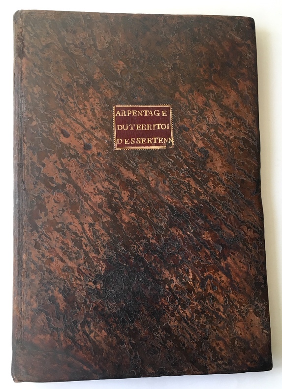
CHAUDRON (François) [Géomêtre Arpenteur du Roi].
Arpentage du territoire dEssertenne.
Gray, 8 janvier 1780. 1780 1 vol in-folio (436 x 300 mm.) de : 75 ff. numérotés en lettres dont [93] pp. manuscrites à l'encre brune, [3] pp. bl., [28] plans aquarellés tracés à l'encre rouge et noire dont 26 à pleine page et 2 sur une page; [4] ff. bl. Plein veau granité d'époque, dos lisse orné et titré sur piéce de maroquin brun, titre de maroquin rouge au centre du premier plat, double filet doré sur les coupes, tranches rouges. (Taches, salissures et défauts d'usage).
Bookseller reference : 4613
|
|
|
CHAUMIER (C. J.)
Carte routière du Théâtre de la Guerre contenant la Flandre, partie du Brabant et du Comté de Namur, dressée d'après la grande carte de Ferrari et le Département du Nord, divisé en 8 districts et 54 cantons, l'an II de la République Française.
1793 toilée. carte pliée, 77 x 91 cms. P. Basset, An II (1793)
Bookseller reference : 11800
|
|
|
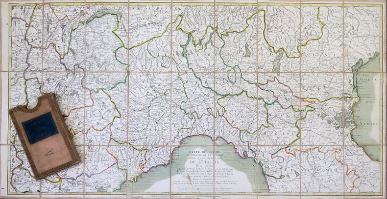
CHAUMIER (C.J.) & JAILLOT (Hubert).
Carte routière du théâtre de la guerre dans la partie septentrionale de l'Italie.
Paris, Basset An VII, [1799]. En 27 sections montées sur toile et pliées, formant une carte de 0,53 x 1,02 m, sous étui.
Bookseller reference : LBW-4321
|
|
|
CHAUMIER (C.J.).
Carte de la République Française suivant sa nouvelle division en 103 départements ; avec toutes les routes.
Paris, Basset, An 7 [1799]. En deux feuilles jointes, formant une carte de 556 x 895 mm.
Bookseller reference : LBW-6530

|
|
|
CHAUMONT
Carte au 1/80 000e.
Une feuille 64x92 cm. Plis r?par?s.
|
|
|
CHAUVEL (François) & MAILLARD (A.).
[NORMANDIE/FALAISE] La Foire de Guibray en Normandie près la ville de Fallaize.
Paris, G. Jollain, Caen, Mancel, 1658-1841. 576 x 424 mm.
Bookseller reference : LBW-6556

|
|
|
CHAVANNAZ.
Emprunt de la paix. Crédit Lyonnais. Affiche en couleurs (116 x 80 cm, imprimerie Crété, vers 1920).
1920 1 vol. broché Belle composition en couleurs par Bruno Chavannaz montrant un cultivateur derrière sa femme qui tient dans ses bras leur bébé. Affiche en lithographie de la campagne de collecte de fonds pour réparer les dommages de la guerre. Nombreuses déchirures aux plis, mais sans manque.
Bookseller reference : 72341
|
|
|
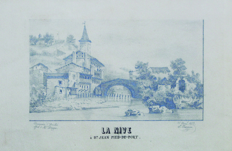
CHAZAUX (Al.).
La Nive à S.t Jean Pied-de-Port.
26 avril 1873 12 x 21 cm (hors titre), sur une feuille de 28 x 33 cm ; sous passe-partout.
Bookseller reference : LBW-6600
|
|
|
Chemical and Engineering News; Josephs Melvin J.; Sanders Howard J. b/w Illustrations Maps
Chemistry and the Environment: The Solid Earth the Oceans the Atmosphere
Washington: American Chemical Society 1967. First Edition. Hardcover. Very good with slight shelf wear/no dust jacket. Ex-college library with usual library features/ Very good with slight shelf wear/ no dust jacket/ Hardback/ 1967/ 1st editionB&R 150 Washington: American Chemical Society hardcover
Bookseller reference : 0706110094
|
|
|
CHEMINS DE FER DE PARIS A ORLEANS ET DU MIDI Cartes dressées par les établissements De Dion-Bouton.
Le tourisme sur le réseau des chemins de fer de Paris à Orléans. Touraine - Auvergne - Bretagne - Pyrénées.
Couverture souple. Brochure de 24 pages.
Bookseller reference : 26030

|
|
|
CHERET (Jules)
A partir du 29 novembre, lire dans le Gil Blas "L'Argent", roman inédit par E. Zola. Lithographie en couleurs (244 x 88 cm, en deux parties de 124 x 88 cm chaque).
Imp. Chaix, s.d. [1890] Spectaculaire affiche destinée aux colonnes Morris où la Justice aux yeux bandés déverse une pluie d'argent sur les spéculateurs qui s'affairent devant le Palais Brongniart. Exemplaire plié, en bon état malgré de petites déchirures au centre, sans manques.
Bookseller reference : 64630
|
|
|
CHERON André
LE SYSTEME CULBERTSON ASSIMILABLE EN QUELQUES HEURES. BRIDGE.
Lausanne.Payot.1943.In-12 br.186 p.15 tableaux I-T.2ème édition augmentée.BE.
Bookseller reference : 49291
|
|
|
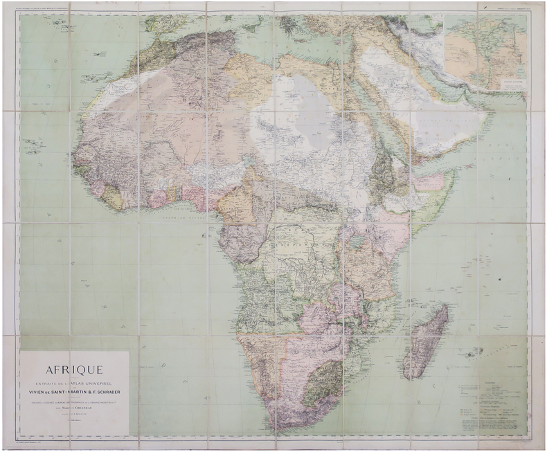
CHESNEAU (Marius).
Afrique extraite de l'Atlas Universel.
Paris, Librairie Hachette & Cie, 1896. En 32 sections montées sur toile et repliées, formant une carte de 0,90 x 1,07 m ; étiquette au dos du graveur-éditeur parisien de cartes géographiques Lanée, successeur de Longuet.
Bookseller reference : LBW-8146
|
|
|
CHEVALIER Auguste
L'Afrique Centrale Française. Récit du voyage de la mission Chari-Lac Tchad, 1902-1904.
Paris Augustin Challamel 1907 Demi-reliure
Bookseller reference : 010199
|
|
|
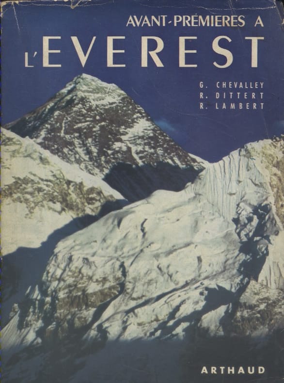
CHEVALLEY Gabriel - DITTERT René - LAMBERT Raymond 36 héliogravures hors texte. Cartes et dessins en 2 couleurs.
Avant-premières à l'Everest.
Couverture souple. Broché. Non coupé. 315 pages. Jaquette.
Bookseller reference : 133394
|
|
|
CHEVALLIER J.-P. & MARTIN-PREVEL P.
Le tennis à la Belle Epoque
Collection privée J.-P. Chevallier, Imprimerie Lerner, sans date, vers 1980. In-12. Broché, format à l' italienne. Couverture illustrée. 64 pages. Livret consacré à des reproductions de cartes postales anciennes concernant le tennis à la Belle Epoque. Très bon état. Envoi en tarif " lettre "
Bookseller reference : 3301
|
|
|
CHIAS Y CARBÓ, Benito.
Mapa de la Provincia de Oviedo. 1903.
Barcelona, Establecimiento Editorial de Alberto Martín, s.a. (1915) [Colección de Cartas Corográficas]. Un mapa de 35 x 45 cms., dibujado por Joaquín Ribera y litografiado en color por Martí Campaña, montado sobre tela, - con soporte exterior de cartoné
|
|
|
Chicago Ill.. Bureau of Maps and Plats
Report on proposed change of house numbering system for city of Chicago 1907 Leather Bound
2019. Leather Bound. New. Leather Binding on Spine and Corners with Golden Leaf Printing on round Spine. Reprinted in 2019 with the help of original edition published long back 1907. This book is printed in black & white sewing binding for longer life Printed on high quality Paper re-sized as per Current standards professionally processed without changing its contents. As these are old books we processed each page manually and make them readable but in some cases some pages which are blur or missing or black spots. If it is multi volume set then it is only single volume if you wish to order a specific or all the volumes you may contact us. We expect that you will understand our compulsion in these books. We found this book important for the readers who want to know more about our old treasure so we brought it back to the shelves. Hope you will like it and give your comments and suggestions. Lang: - eng Pages 40. EXTRA 10 DAYS APART FROM THE NORMAL SHIPPING PERIOD WILL BE REQUIRED FOR LEATHER BOUND BOOKS. FOLIO EDITION IS ALSO AVAILABLE. hardcover
Bookseller reference : LB1111001178494
|
|
|
Chicago Ill.. Bureau of Maps and Plats
Report on proposed change of house numbering system for city of Chicago 1907
2020. Paperback. New. Lang: - eng Pages 40. Reprinted in 2020 with the help of original edition published long back 1907. This book is Printed in black & white sewing binding for longer life with Matt laminated multi-Colour Soft Cover HARDCOVER EDITION IS ALSO AVAILABLE Printed on high quality Paper re-sized as per Current standards professionally processed without changing its contents. As these are old books we processed each page manually and make them readable but in some cases some pages which are blur or missing or black spots. If it is multi volume set then it is only single volume if you wish to order a specific or all the volumes you may contact us. We expect that you will understand our compulsion in these books. We found this book important for the readers who want to know more about our old treasure so we brought it back to the shelves. Any type of Customisation is possible with extra charges. Hope you will like it and give your comments and suggestions. paperback
Bookseller reference : PB1111001178494
|
|
|
Chicago Ill.. Bureau of Maps and Plats
Report on proposed change of house numbering system for city of Chicago 1907 Hardcover
2020. Hardcover. New. Lang: - eng Pages 40. Reprinted in 2020 with the help of original edition published long back 1907. This book is Printed in black & white Hardcover sewing binding for longer life with Matt laminated multi-Colour Dust Cover Printed on high quality Paper re-sized as per Current standards professionally processed without changing its contents. As these are old books we processed each page manually and make them readable but in some cases some pages which are blur or missing or black spots. If it is multi volume set then it is only single volume if you wish to order a specific or all the volumes you may contact us. We expect that you will understand our compulsion in these books. We found this book important for the readers who want to know more about our old treasure so we brought it back to the shelves. Any type of Customisation is possible with extra charges. Hope you will like it and give your comments and suggestions. hardcover
Bookseller reference : 1111001178494
|
|
|
Chichester Sir Francis Illustrated by Photos Maps
Gipsy Moth Circles The World
NY: Coward McCann. G. 1966. Hardcover. Near Fine/Very Good . Book Club BCE/BOMC. 8vo - over 7�" - 9�" tall . BOMC edition bound in blue cloth. Previous owner has penned the pric e date & place of purchase on the iner gutter of the 1/2 ti tle page. His namestamp appear at the edge of the bottom page block along with a line indicating the book had been read. Tight clean copy in lightly rubbed dj. . Coward McCann hardcover
Bookseller reference : 12034
|
|
|
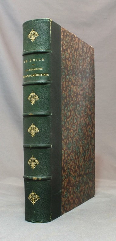
CHILD Théodore:
Les républiques hispano-américaines.
Paris, à la librairie illustrée, sans date [1891]. In-4 de [4]-480 pages, demi-chagrin vert empire, dos à nerfs orné de fleurons dorés, couvertures conservées.
Bookseller reference : 15492
|
|
|
CHINA HISTORICAL MAPS Uchiyama Tsunetomo editor.
Juhachi Shiryaku Ryaku Jirui taizen.
Kyoto. Meiji 23. 1890. 11 black and white woodblock maps Japanese binding 7 x 4 3/4 inches. Covers lightly soiled very good condition. Volume 4 of a series. Attractive and detailed maps showing China at different historical periods. . unknown
Bookseller reference : 41996

|
|
|
CHINE et SZETSCHUAN par Eduard IMHOF.
Die Grossen Kalten Berge von SZETSCHUAN. Richement documenté (aquarelles, planches en couleurs, héliogravures, cartes dont une dépliante en couleurs).
Zürich, Orell Füssli Verlag 1974. Bel exemplaire relié, in-4, 228 pages + planches.
Bookseller reference : AUB-6031
|
|
|
CHINE par René GROUSSET et Vadime ELISSEEF.
Histoire de la Chine avec Vadime ELISSEEF et ses collaborateurs. Richement documenté (34 planches et 2 cartes).
Club des Libraires de France, éd. Fayard 1957. Bon exemplaire relié, reliure pleine toile ornée d'éd., fort in-8 numéroté, 354 pages + planches.
Bookseller reference : AUB-7107
|
|
|
CHINESE MUSIC; MAPS OF THE BALTICS FRANCE GERMANY Urban Sylvanus David Henry Editor.
Gentleman's Magazine and Historical Chronicle January to December. 1757.
London.: D. Henry and R. Cave at St. John's Gate. Volume XXVII. 1757. Bound volume in leather binding spine perished; replaced with fabric covers badly worn the front cover and spine separated from the text block.; 8.75 x 5.25 inches; title page and preface; 608 pp including Supplement followed by unpaginated Index listing Essays Poetry Names etc. included in the 12 issues. Ex-library with bookplate on inside front cover perforated stamp on title page and stamped number with withdrawn stamp in lower margin of preface page. Pages 423 thru 436 are loose in binding. Pages 177 thru 180 are MISSING. In sum: a book the binding of which has not aged well; however the contents are in remarkably clean shape with some offsetting. There are a few plates missing and the "Map of that part of America which was the seat of war in the years 1755 and 1756." A chief feature of the volume is the numerous engraved copperplate maps. They are listed with sheet size as follows: 1 A Physical Planisphere wherein are represented all the known Lands and Seas wth. the Great Chains of Mountains wch. traverse the Globe from the North Pole. Adapted to Monsr: Buache's Memoire Read at the R. Academy of Sciences 14 x 12.25 inches; very clean; short marginal tears; 2 The Seat of WAR in the Circle of Westphalia 8.25 x 10.5 inches with very light off-set on one fold; 3 "A Draught of the Road and Harbour of Brest with the Adjacent Coast" 8.25 x 18 inches; 3 "Map of the Several Countries thro' which the Russians are to Pass in their March to Prussia" 8.25 x 10.25 Baltic Countries i.e. Pomerania Prussia Courland Livonia etc. 4 Map of the Mouths of the Ganges in the Bay of Bengal shewing the English Settlements lately Destroy'd by the Nabob of that Province 8.25 x 5 inches; 5 A map of the Coast of France from Rochelle & Rochfort with the Island of Ree Oleron & Aix 8.25 x 5.5; 6 Upper Saxony Comprehending that Part of Germany which is the Present Seat of War 8.25 x 11 inches; 7 A New Map of England and Wales by Thos. Jeffreys Geographer to his royal Highness the Prince of Wales 17 x 15 inches; two very short tears to margin otherwise excellent; A Map of the Island of Corsica 8 x 4 inches considerable offsetting from facing page. The volume also includes a folding plate of the Temple of the Eight Winds; three plates of shells; one plate of ancient coins; a folding plate of Two Imperfect Roman Alters discovered near Carlisle and two other plates of arcane interest. Unusual is the page denoting "A Chinese Air" a transcription of what is thought to have been "the earliest Chinese music performance in the West" See Early Music September 29 2010. Overall a volume of considerable interest in need of rebinding; however contents in remarkably good condition. . D. Henry and R. Cave at St. John's Gate. hardcover
Bookseller reference : 50818

|
|
|
CHIQUET Jacques (1673 - 1721)
Division du Globe Globe Terrestre par Zones Corespondantes ala Sphere Celeste / Correspondance du Globe Terrestre avec la Si
Questa tavola raffigura i due emisferi, che mostrano l'equatore, i tropici e le zone polari del mondo, nelle cuspidi e negli angoli ci sono sei diagrammi più piccoli che mostrano 'Disposition des Parallels' e 'Explication des Zones' ecc. Opera tratta da Le nouveau et curieux Atlas Geographique et historique pubblicato a Parigi nel 1719.All'inizio del XVIII secolo, la cartografia francese ha superato gli olandesi in termini di precisione e design. Il delizioso Nouveau et Curieux Atlas di Chiquet era un prodotto tipico dell'epoca.Acquaforte su rame, finemente colorata a mano, in buone condizioni. This plate shows two hemispheres, showing the equator, tropics and polar zones of the world, in the cusps and corners there are six smaller diagrams showing 'Disposition des Parallels' and 'Explication des Zones' etc. In the early eighteenth century, French cartography overtook the Dutch in terms of accuracy and design. Chiquet's delightful Nouveau et Curieux Atlas was typical product of the time.Work taken from Le nouveau et curieux Atlas Geographique et historique published in Paris in 1719.Copperplate, finely colored by hand, in good condition.

|
|
|
CHIQUET Jacques (1673 - 1721)
Le Globe Terrestre Rappresenté en Deux Plans-Hemispheres…
Mappa del mondo a doppio emisfero che presenta l'isola della California e un passaggio a nord-ovest. Date le picocle dimensioni, dono presenti solo pochi dettagli interni e solo le principali nazioni nominate. Dal punto di vista dell'innovazione cartografica Ter. de Jesso appare al largo della costa orientale dell'Asia, l'Australia è incompleta e ancora attaccata alla Nuova Guinea, appare solo la costa occidentale della Nuova Zelanda, e c'è ancora una costa parziale per Terres Australes. Il cartiglio del titolo decorativo e il testo in francese circondano la mappa.Opera tratta dal Le Nouveau et Curieux Atlas Geographique et Historique... di Jacques Chiquet.Acquaforte su rame, con una bella colorazione a mano, in buone condizioni. This delicately engraved double hemisphere world map features the island of California and a Northwest Passage. There is little interior detail with only major nations named. Ter. de Jesso appears off the east coast of Asia, Australia is incomplete and still attached to New Guinea, only the west coast of New Zealand appears, and there is still a partial coastline for Terres Australes. Decorative title cartouche and French text surrounds the map.From Le Nouveau et Curieux Atlas Geographique et Historique... by Jacques Chiquet.Copperplate, with fine hand colouring, good condition.

|
|
|
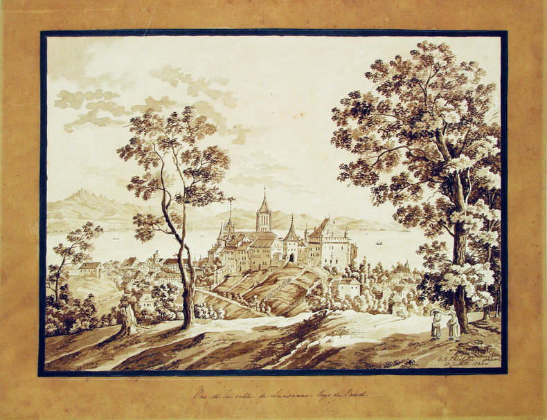
CHISHOLM (C. E.). [Lausanne] MANUSCRIT.
Vue de la ville de Lausanne, Pays de Vaud.
20 juillet 1822. 285 x 385 mm, monté sur carton.
Bookseller reference : LBW-4115
|
|
|
CHOCOLAT LOUIT
"Carte Postale du Chocolat Louit "" Le Caviar - Histoire Anecdotique de l'Alimentation """
LIBRAIRIE DU GLORIT. Non daté. In-12. Broché. Bon état, Couv. convenable, Dos satisfaisant, Intérieur frais. Une carte postale, vierge, illustrée en couleurs. 14.5 x 10 cm.. . . . Classification : 220-Cartes Postales Publicitaires
Bookseller reference : RO80093902
|
|
|
CHOCOLAT LOUIT
"Carte Postale du Chocolat Louit "" Les Grives - Histoire Anecdotique de l'Alimentation """
LIBRAIRIE DU GLORIT. Non daté. In-12. Broché. Bon état, Couv. convenable, Dos satisfaisant, Intérieur frais. Une carte postale, vierge, illustrée en couleurs. 14.5 x 10 cm.. . . . Classification : 220-Cartes Postales Publicitaires
Bookseller reference : RO80093903
|
|
 Receive by email
 Download as PDF document
 RSS feed


