|
Hema Maps PtyLtd y. Lt
Melbourne to Sydney 1:12.9K Hema 2016
Hema Maps Pty.Ltd 2016-02-01. Map. Used:Good. Hema Maps Pty.Ltd unknown
Bookseller reference : DADAX1925195988 ISBN : 1925195988 9781925195989
|
|
|
Hema Maps PtyLtd y. Lt
Melbourne to Adelaide 2014: HEMA
2014-04-06. New. Ships with Tracking Number! INTERNATIONAL WORLDWIDE Shipping available. May be re-issue. Buy with confidence excellent customer service! unknown
Bookseller reference : 1865007315n ISBN : 1865007315 9781865007311

|
|
|
Hema Maps PtyLtd y. Lt
Melbourne to Sydney 1:12.9K Hema 2016
2016-01-08. New. Ships with Tracking Number! INTERNATIONAL WORLDWIDE Shipping available. May be re-issue. Buy with confidence excellent customer service! unknown
Bookseller reference : 1925195988n ISBN : 1925195988 9781925195989

|
|
|
Hema Maps Pty LTD
New South Wales North-East NP r hema
Hema Maps Pty.Ltd. Map. New. Hema Maps Pty.Ltd unknown
Bookseller reference : 2-1865007226 ISBN : 1865007226 9781865007229
|
|
|
Hema Maps PtyLtd y. Lt
New South Wales State Handy 2015 Hema 1:1.5M
Hema Maps Pty.Ltd. MAP. 1925195325 Brand new book.Buy with confidence. Money Back Guarantee.Expedite Shipping Available. International shipment available. . New. Hema Maps Pty.Ltd unknown
Bookseller reference : ABYS02214 ISBN : 1925195325 9781925195323
|
|
|
Hema Maps Pty LTD
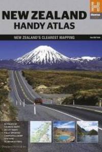
New Zealand handy atlas spir. NP hema
Hema Maps Pty LTD. Paperback. New. 5th revised edition edition. 144 pages. 9.69x7.09x0.47 inches. Hema Maps Pty LTD paperback
Bookseller reference : 2-1877302937 ISBN : 1877302937 9781877302930
|
|
|
Hema Maps PtyLtd y. Lt
New Zealand Touring Atlas 1:305K A5 Size 145Pages
Hema Maps New Zealand Ltd 2014-10-20. Paperback. New. Spiral-bound.New Inside and Outside. Clean and crisp pages w/no markings! You will be pleased. Excellent book! z1s170B Some minor shelf wear on cover. Fast Shipping Hema Maps New Zealand Ltd paperback
Bookseller reference : SKU1022886 ISBN : 1877302929 9781877302923
|
|
|
Hema Maps PtyLtd y. Lt
New Zealand Handy Atlas Hema Ring Bound
2014-03-03. New. Ships with Tracking Number! INTERNATIONAL WORLDWIDE Shipping available. May be re-issue. Buy with confidence excellent customer service! unknown
Bookseller reference : 1877302937n ISBN : 1877302937 9781877302930
|
|
|
Hema Maps PtyLtd y. Lt
New Zealand Touring Atlas 1:305K A5 Size 145Pages
2014-06-01. New. Ships with Tracking Number! INTERNATIONAL WORLDWIDE Shipping available. May be re-issue. Buy with confidence excellent customer service! unknown
Bookseller reference : 1877302929n ISBN : 1877302929 9781877302923

|
|
|
Hema Maps PtyLtd y. Lt
Northern Territory State Handy 2014 HEMA
2014-06-01. New. Ships with Tracking Number! INTERNATIONAL WORLDWIDE Shipping available. May be re-issue. Buy with confidence excellent customer service! unknown
Bookseller reference : 1865009768n ISBN : 1865009768 9781865009766

|
|
|
Hema Maps PtyLtd y. Lt
Northern Territory State Handy 2014 HEMA
2014-06-01. Good. Ships with Tracking Number! INTERNATIONAL WORLDWIDE Shipping available. May not contain Access Codes or Supplements. May be re-issue. May be ex-library. Shipping & Handling by region. Buy with confidence excellent customer service! unknown
Bookseller reference : 1865009768 ISBN : 1865009768 9781865009766

|
|
|
Hema Maps Staff
OECD Economic Surveys : New Zealand 1991
Houghton Mifflin Harcourt Publishing Company 1993. Paperback. Very Good. Disclaimer:A copy that has been read but remains in excellent condition. Pages are intact and are not marred by notes or highlighting but may contain a neat previous owner name. The spine remains undamaged. At ThriftBooks our motto is: Read More Spend Less.Dust jacket quality is not guaranteed. Houghton Mifflin Harcourt Publishing Company paperback
Bookseller reference : G0395661706I4N00 ISBN : 0395661706 9780395661703

|
|
|
Hema Maps Staff
OECD Economic Surveys : New Zealand 1991
Hunter Publishing Incorporated 1994. Paperback. Very Good. Disclaimer:A copy that has been read but remains in excellent condition. Pages are intact and are not marred by notes or highlighting but may contain a neat previous owner name. The spine remains undamaged. At ThriftBooks our motto is: Read More Spend Less.Dust jacket quality is not guaranteed. Hunter Publishing, Incorporated paperback
Bookseller reference : G1556506244I4N00 ISBN : 1556506244 9781556506246

|
|
|
Hema Maps PtyLtd y. Lt
Perth & Region Handy 2015: HEMA
Hema Maps Pty.Ltd. MAP. 1925195163 Brand new book.Buy with confidence. Money Back Guarantee.Expedite Shipping Available. International shipment available. . New. Hema Maps Pty.Ltd unknown
Bookseller reference : A2BEY01050 ISBN : 1925195163 9781925195163
|
|
|
Hema Maps PtyLtd y. Lt
Perth & Region Handy 2015: HEMA
Hema Maps Pty.Ltd. MAP. 1925195163 Brand new book.Buy with confidence. Money Back Guarantee.Expedite Shipping Available. International shipment available. . New. Hema Maps Pty.Ltd unknown
Bookseller reference : AABEY01051 ISBN : 1925195163 9781925195163
|
|
|
Hema Maps PtyLtd y. Lt
Perth & Region Handy 2015: HEMA
2015-05-04. New. Ships with Tracking Number! INTERNATIONAL WORLDWIDE Shipping available. May be re-issue. Buy with confidence excellent customer service! unknown
Bookseller reference : 1925195163n ISBN : 1925195163 9781925195163

|
|
|
Hema Maps Pty LTD
Pilbara & Coral Coast GPS r/v wp hema
Hema Maps Pty LTD. Map. New. Hema Maps Pty LTD unknown
Bookseller reference : 2-186500734X ISBN : 186500734X 9781865007342
|
|
|
Hema Maps Pty LTD
Queensland North r/v r hema
Hema Maps Pty LTD. Map. New. Hema Maps Pty LTD unknown
Bookseller reference : 2-1865007269 ISBN : 1865007269 9781865007267
|
|
|
Hema Maps Pty LTD
Queensland state NP handy r/v r hema
Hema Maps Pty LTD. Map. New. Hema Maps Pty LTD unknown
Bookseller reference : 2-1865007145 ISBN : 1865007145 9781865007144
|
|
|
Hema Maps Pty LTD
Queensland state NP handy r/v r hema
Hema Maps Pty LTD. Map. New. Hema Maps Pty LTD unknown
Bookseller reference : __1865007145 ISBN : 1865007145 9781865007144
|
|
|
Hema Maps PtyLtd y. Lt
Queensland State Handy Map 1:2.5M
2014-09-19. New. Ships with Tracking Number! INTERNATIONAL WORLDWIDE Shipping available. May be re-issue. Buy with confidence excellent customer service! unknown
Bookseller reference : 1865007145n ISBN : 1865007145 9781865007144

|
|
|
Hema Maps PtyLtd y. Lt
Queensland State Handy Map 1:2.5M
2014-09-19. Good. Ships with Tracking Number! INTERNATIONAL WORLDWIDE Shipping available. May not contain Access Codes or Supplements. May be re-issue. May be ex-library. Shipping & Handling by region. Buy with confidence excellent customer service! unknown
Bookseller reference : 1865007145 ISBN : 1865007145 9781865007144

|
|
|
Hema Maps Pty LTD
South Australia state handy r/v r hema Hema Maps
Hema Maps Pty LTD. Map. New. Hema Maps Pty LTD unknown
Bookseller reference : 2-1865008702 ISBN : 1865008702 9781865008707
|
|
|
Hema Maps PtyLtd y. Lt
South Australia State Handy Map 1:1.7M Hema 2014
2014-06-01. New. Ships with Tracking Number! INTERNATIONAL WORLDWIDE Shipping available. May be re-issue. Buy with confidence excellent customer service! unknown
Bookseller reference : 1865008702n ISBN : 1865008702 9781865008707

|
|
|
Hema Maps PtyLtd y. Lt
South Island- New Zealand 1:1M Hema 2016
2016-02-01. New. Ships with Tracking Number! INTERNATIONAL WORLDWIDE Shipping available. May be re-issue. Buy with confidence excellent customer service! unknown
Bookseller reference : 1876413077n ISBN : 1876413077 9781876413071

|
|
|
Hema Maps PtyLtd y. Lt
South Island- New Zealand 1:1M Hema 2016
2016-02-01. Good. Ships with Tracking Number! INTERNATIONAL WORLDWIDE Shipping available. May not contain Access Codes or Supplements. May be re-issue. May be ex-library. Shipping & Handling by region. Buy with confidence excellent customer service! unknown
Bookseller reference : 1876413077 ISBN : 1876413077 9781876413071

|
|
|
Hema Maps PtyLtd y. Lt
Sydney & Region Handy Map 1:100K- 2014: HEMA
Hema Maps Pty.Ltd. MAP. 1865007218 Brand new book.Buy with confidence. Money Back Guarantee.Expedite Shipping Available. International shipment available. . New. Hema Maps Pty.Ltd unknown
Bookseller reference : A2BYS08830 ISBN : 1865007218 9781865007212
|
|
|
Hema Maps PtyLtd y. Lt
Tasmania State NP Handy 2014: HEMA 1:650K
Hema Maps Pty.Ltd 2015-01-15. Map. Used:Good. Hema Maps Pty.Ltd unknown
Bookseller reference : DADAX1865009857 ISBN : 1865009857 9781865009858
|
|
|
Hema Maps PtyLtd y. Lt
Tasmania State NP Handy 2014: HEMA 1:650K
2015-03-07. New. Ships with Tracking Number! INTERNATIONAL WORLDWIDE Shipping available. May be re-issue. Buy with confidence excellent customer service! unknown
Bookseller reference : 1865009857n ISBN : 1865009857 9781865009858

|
|
|
Hema Maps PtyLtd y. Lt
Tasmania State 2014: HEMA.3.10L
2014-01-09. New. Ships with Tracking Number! INTERNATIONAL WORLDWIDE Shipping available. May be re-issue. Buy with confidence excellent customer service! unknown
Bookseller reference : 1865009725n ISBN : 1865009725 9781865009728

|
|
|
Hema Maps PtyLtd y. Lt
Tasmania State NP Handy 2014: HEMA 1:650K
Hema Maps Pty.Ltd. MAP. 1865009857 Brand new book.Buy with confidence. Money Back Guarantee.Expedite Shipping Available. International shipment available. . New. Hema Maps Pty.Ltd unknown
Bookseller reference : ABYS08055 ISBN : 1865009857 9781865009858
|
|
|
Hema Maps PtyLtd y. Lt
Tasmania State NP Handy 2014: HEMA 1:650K
2015-03-07. Good. Ships with Tracking Number! INTERNATIONAL WORLDWIDE Shipping available. May not contain Access Codes or Supplements. May be re-issue. May be ex-library. Shipping & Handling by region. Buy with confidence excellent customer service! unknown
Bookseller reference : 1865009857 ISBN : 1865009857 9781865009858

|
|
|
Hema Maps PtyLtd y. Lt
The Kimberley Atlas and Guide
Hema Maps Pty.Ltd Brisbane 2006. First Edition. Softcover Spiral Bound. Very Good Condition. Size: 4to Quarto. 128 pages. Text body is clean and free from previous owner annotation underlining and highlighting. Ring binding is in excellent condition. No foxing detected in this copy. All edges clean neat and free of foxing. This book is available and will be shipped within two business days. All items are tracked and details are available on request. . A self-drive touring guide and reference for travelling the Kimberley region of north-western Australia. Quantity Available: 1. Shipped Weight: Under 1 kilogram. Category: Travel & Places; Australia; Reference. ISBN: 1865003700. ISBN/EAN: 9781865003702. Pictures of this item not already displayed here available upon request. Inventory No: 5438. . 9781865003702 Hema Maps Pty.Ltd paperback
Bookseller reference : 5438 ISBN : 1865003700 9781865003702

|
|
|
Hema Maps Staff
The Ultimate United States Road Atlas
Hema Maps North America Incorporated Oct-2012. U. New. 2nd Edition Hema Maps North America, Incorporated unknown
Bookseller reference : 654547142 ISBN : 1934006890 9781934006894
|
|
|
Hema Maps Pty LTD
Top End & Gulf GPS r/v r wp hema
Hema Maps Pty LTD. Map. New. Hema Maps Pty LTD unknown
Bookseller reference : 2-1865008923 ISBN : 1865008923 9781865008929

|
|
|
Hema Maps Pty LTD
Victoria state handy r/v r hema
Hema Maps Pty LTD. Map. New. Hema Maps Pty LTD unknown
Bookseller reference : 2-1865009776 ISBN : 1865009776 9781865009773
|
|
|
Hema Maps Pty LTD
Victoria state handy r/v r hema
Hema Maps Pty LTD. Map. New. Hema Maps Pty LTD unknown
Bookseller reference : __1865009776 ISBN : 1865009776 9781865009773
|
|
|
Hema Maps PtyLtd y. Lt
Victoria State Handy 2014 1:2.5M
2014-04-06. New. Ships with Tracking Number! INTERNATIONAL WORLDWIDE Shipping available. May be re-issue. Buy with confidence excellent customer service! unknown
Bookseller reference : 1865009776n ISBN : 1865009776 9781865009773

|
|
|
Hema Maps Pty LTD
Western Australia Mid West r/v r hema
Hema Maps Pty LTD. Map. New. Hema Maps Pty LTD unknown
Bookseller reference : 2-1865006823 ISBN : 1865006823 9781865006826
|
|
|
Hema Maps Pty LTD
Western Australia South West NP r hema
Hema Maps Pty LTD. Map. New. Hema Maps Pty LTD unknown
Bookseller reference : 2-1865006718 ISBN : 1865006718 9781865006710
|
|
|
Hema Maps Pty LTD
Western Australia South West NP r hema
Hema Maps Pty LTD. Map. New. Hema Maps Pty LTD unknown
Bookseller reference : __1865006718 ISBN : 1865006718 9781865006710
|
|
|
Hema Maps Pty LTD
Western Australia Mid West r/v r hema
Hema Maps Pty LTD. Map. New. Hema Maps Pty LTD unknown
Bookseller reference : __1865006823 ISBN : 1865006823 9781865006826
|
|
|
Hema Maps PtyLtd y. Lt
Western Australia South West NP: HEMA.2.030
2013-10-18. New. Ships with Tracking Number! INTERNATIONAL WORLDWIDE Shipping available. May be re-issue. Buy with confidence excellent customer service! unknown
Bookseller reference : 1865006718n ISBN : 1865006718 9781865006710

|
|
|
Hema Maps PtyLtd y. Lt
Western Australia Handy Map Hema 2014
Hema Maps Pty.Ltd. MAP. 1865009881 Brand new book.Buy with confidence. Money Back Guarantee.Expedite Shipping Available. International shipment available. . New. Hema Maps Pty.Ltd unknown
Bookseller reference : AABEY01114 ISBN : 1865009881 9781865009889

|
|
|
Hema Maps PtyLtd y. Lt
Western Australia Handy Map Hema 2014
Hema Maps Pty.Ltd. MAP. 1865009881 Brand new book.Buy with confidence. Money Back Guarantee.Expedite Shipping Available. International shipment available. . New. Hema Maps Pty.Ltd unknown
Bookseller reference : A2BEY01113 ISBN : 1865009881 9781865009889
|
|
|
Hema Maps PtyLtd y. Lt
Western Australia Handy Map Hema 2014
2014-07-01. New. Ships with Tracking Number! INTERNATIONAL WORLDWIDE Shipping available. May be re-issue. Buy with confidence excellent customer service! unknown
Bookseller reference : 1865009881n ISBN : 1865009881 9781865009889

|
|
|
Hema Maps PtyLtd y. Lt
Western Australia State 2014: HEMA
2014-05-07. New. Ships with Tracking Number! INTERNATIONAL WORLDWIDE Shipping available. May be re-issue. Buy with confidence excellent customer service! unknown
Bookseller reference : 1865008753n ISBN : 1865008753 9781865008752

|
|
|
Hema Maps PtyLtd y. Lt
Western Australia Handy Map Hema 2014
2014-07-01. Good. Ships with Tracking Number! INTERNATIONAL WORLDWIDE Shipping available. May not contain Access Codes or Supplements. May be re-issue. May be ex-library. Shipping & Handling by region. Buy with confidence excellent customer service! unknown
Bookseller reference : 1865009881 ISBN : 1865009881 9781865009889

|
|
|
Hema Maps PtyLtd y. Lt
Western Australia South West NP: HEMA.2.030
2013-10-18. Good. Ships with Tracking Number! INTERNATIONAL WORLDWIDE Shipping available. May not contain Access Codes or Supplements. May be re-issue. May be ex-library. Shipping & Handling by region. Buy with confidence excellent customer service! unknown
Bookseller reference : 1865006718 ISBN : 1865006718 9781865006710

|
|
|
Hema Maps Staff
World Pocket Atlas
Hema Maps Pty Limited 2003. Paperback. Good. Disclaimer:A copy that has been read but remains in clean condition. All pages are intact and the cover is intact. The spine may show signs of wear. Pages can include limited notes and highlighting and the copy can include previous owner inscriptions. At ThriftBooks our motto is: Read More Spend Less.Dust jacket quality is not guaranteed. Hema Maps Pty, Limited paperback
Bookseller reference : G1865002259I3N00 ISBN : 1865002259 9781865002255

|
|
 Receive by email
 Download as PDF document
 RSS feed


