|
|
|
Hammond World Atlas Corporation
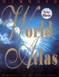
Hammond World Atlas 2000
Brand: Hammond World Atlas Corporation 2000-01-15. 3rd. hardcover. New. 11.25x1.25x14.75. Buy with confidence. Excellent Customer Service & Return policy. Brand: Hammond World Atlas Corporation hardcover
Bookseller reference : DADAX0843713526 ISBN : 0843713526 9780843713527
|
|
|
Hammond World Atlas Corporation
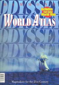
Odyssey World Atlas
paperback. Good. Access codes and supplements are not guaranteed with used items. May be an ex-library book. paperback
Bookseller reference : 0843714700.G ISBN : 0843714700 9780843714708
|
|
|
Hammond World Atlas Corporation
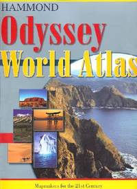
Odyssey World Atlas
paperback. Good. Access codes and supplements are not guaranteed with used items. May be an ex-library book. paperback
Bookseller reference : 0843709405.G ISBN : 0843709405 9780843709407
|
|
|
Hammond World Atlas Corporation
Odyssey World Atlas
Hammond World Atlas Corp. Paperback. New. New. In shrink wrap. Looks like an interesting title! Hammond World Atlas Corp paperback
Bookseller reference : Q-0843714700 ISBN : 0843714700 9780843714708
|
|
|
Hammond World Atlas Corporation
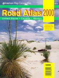
Road Atlas 2000: United States . Canada . Mexico
map. Good. Access codes and supplements are not guaranteed with used items. May be an ex-library book. unknown
Bookseller reference : 0841692653.G ISBN : 0841692653 9780841692657
|
|
|
Hammond World Atlas Corporation
Road Atlas and Vacation Guide/United States Southern Canada/1995 Hammond Road Atlas & Vacation Guide
paperback. Good. Access codes and supplements are not guaranteed with used items. May be an ex-library book. paperback
Bookseller reference : 0843727071.G ISBN : 0843727071 9780843727074
|
|
|
Hammond World Atlas Corporation
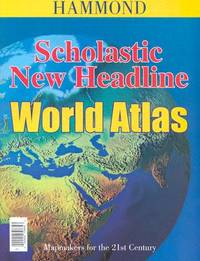
Scholastic New Headline World Atlas Hammond Atlases
New. paperback. New. Satisfaction Guaranteed or your money back. paperback
Bookseller reference : 0843708646 ISBN : 0843708646 9780843708646
|
|
|
Hammond World Atlas Corporation
Scholastic/new Headline World Atlas Hammond Atlases
Hammond World Atlas Corp 2004. Paperback. New. 2nd revised edition. 52 pages. 10.50x8.00x0.25 inches. Hammond World Atlas Corp paperback
Bookseller reference : 1-0843708646 ISBN : 0843708646 9780843708646
|
|
|
Hammond World Atlas Corporation
Scholastic New Headline World Atlas Hammond Atlases
Hammond World Atlas Corp 2004-12-15. Paperback. New. New. In shrink wrap. Looks like an interesting title! Hammond World Atlas Corp paperback
Bookseller reference : Q-0843708646 ISBN : 0843708646 9780843708646
|
|
|
Hammond World Atlas Corporation
Scholastic New Headline World Atlas Hammond Atlases
0000-00-00. Revised. paperback. New. 8.00x0.25x10.50. Buy with confidence. Excellent Customer Service & Return policy. paperback
Bookseller reference : DADAX0843708646 ISBN : 0843708646 9780843708646
|
|
|
Hammond World Atlas Corporation
Selected Prose of Alexander Pope
Paperback. New. New Book; Fast Shipping from UK; Not signed; Not First Edition; This anthology is intended to make Pope's major prose work more widely available. It includes the critical prefaces to his own work to Homer and to Shakespeare; the mock-critical treatises A Key to the Lock and The Art of Sinking in paperback
Bookseller reference : ria9780521271349_inp ISBN : 0521271347 9780521271349

|
|
|
Hammond World Atlas Corporation
Student World Atlas
New. paperback. New. Satisfaction Guaranteed or your money back. paperback
Bookseller reference : 0843709561 ISBN : 0843709561 9780843709568

|
|
|
Hammond World Atlas Corporation
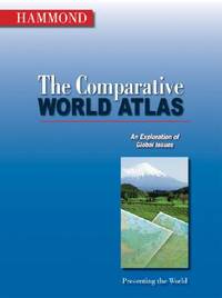
The Comparative World Atlas
New. paperback. New. Satisfaction Guaranteed or your money back. paperback
Bookseller reference : 0843709529 ISBN : 0843709529 9780843709520
|
|
|
Hammond World Atlas Corporation
The Comparative World Atlas
Hammond World Atlas Corporation 2007-04-13. Paperback. New. New. In shrink wrap. Looks like an interesting title! Hammond World Atlas Corporation paperback
Bookseller reference : Q-0843709529 ISBN : 0843709529 9780843709520
|
|
|
Hammond World Atlas Corporation
The Comparative World Atlas
Langenscheidt 2007-04-13. Revised 2007 Edition. paperback. New. 9.25x0.25x12.25. Buy with confidence. Excellent Customer Service & Return policy. Langenscheidt paperback
Bookseller reference : DADAX0843709529 ISBN : 0843709529 9780843709520
|
|
|
Hammond World Atlas Corporation
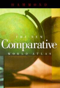
The New Comparative World Atlas
New. paperback. New. Satisfaction Guaranteed or your money back. paperback
Bookseller reference : 0843771003 ISBN : 0843771003 9780843771008
|
|
|
Hammond World Atlas Corp
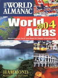
World Almanac 2004 World Atlas
New. map. New. Satisfaction Guaranteed or your money back. unknown
Bookseller reference : 0843719265 ISBN : 0843719265 9780843719260
|
|
|
Hammond World Atlas Corporation
World Almanac World Atlas
New. hardcover. New. Satisfaction Guaranteed or your money back. hardcover
Bookseller reference : 0843719249 ISBN : 0843719249 9780843719246
|
|
|
Hammond's New World Atlas
Containing New and Complete Historical Economic Political and Physical Maps of the Entire World in Full Colors With Complete Indexes and The Races of Mankind Illustrated Gazetteer of The World Illustrated Gazetteer of The United States and Territories. Garden City Publishing Company Inc.
Garden City New York 1948. Folio 505 x 34 cm. 344 s. Illustr. i farger og s/h. kart i farger og s/h. Orig. temmelig oppskrapet helsjirtingb. Kapitéler og ytre falser med noen rifter samt hjørnene noe støtt og med sÃ¥r. Indre falser sprukket i sjirtingen og løs. Noen fingermerker. Enkelte smÃ¥ bretter. “277 Maps - 183 in full color - 94 i black and white. Over 200 photographs - 32 in full color.â€. . unknown
Bookseller reference : 120816
|
|
|
HANN (J.)
Atlas der Meteorologie (Berghaus' Physikalischer Atlas, Abteilung III), 12 kolorierte Karten in kupferstich
Gotha, chez Justus Perthes, 1887 - pet. in-fol., 54 pp. - rel. percaline bleue, titre doré en belles cursives à chaud 1 er plat, cachet de l'armée allemande de la 2nde guerre mondiale
Bookseller reference : 2702
|
|
|
HANSEN J., DAUTREMER A.M. et M.
Carte de la Bourgogne.
SYNDICAT D'INITIATIVE de LA BOURGOGNE. Non daté.. In-Folio. En feuillets. Etat d'usage, Livré sans Couverture, Dos satisfaisant, Intérieur frais. Carte dépliante en noir et blanc, hors-texte de 35/47 cm.. . . . Classification Dewey : 912-Atlas, cartes et plans
Bookseller reference : RO80032073
|
|
|
Hanotaux Gabriel
Circuits des Champs de Bataille de France
L'Edition Française Illustrée. Non daté. In-12. Relié. Etat d'usage, Couv. convenable, Dos fané, Papier jauni. 516 pages. Quelques cartes monochromes dans le texte. En supplément deux cartes dépliantes. Tampon en page de titre. Trois photos disponibles.. . . . Classification Dewey : 912-Atlas, cartes et plans
Bookseller reference : RO80251344
|
|
|
Hannin Valérie & Collectif
L'Histoire, hors-série n°1 (mai-juin 2010) : Atlas de la Méditerranée
Sophia Publications. 2010. In-4. Broché. Bon état, Couv. convenable, Dos satisfaisant, Intérieur frais. 82 pages. Nombreuses cartes en couleurs dans et hors texte.. . . . Classification Dewey : 912-Atlas, cartes et plans
Bookseller reference : RO80243720
|
|
|
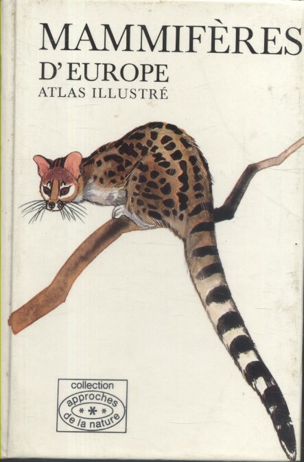
HANZAK Jan Illustrations de Dagmar Cerna.
Mammifères d'Europe. Atlas illustré.
Couverture rigide. Cartonné. 230 pages.
Bookseller reference : 206567
|
|
|
Handtke, F. (Bearb.)
Hand-Atlas des preussischen Staates in 36 Blättern. Nach den neuesten und besten Materialien bearbeitet (mit 34 v. 36 Karten).
Glogau, C. Flemming, 1846. Hardcoverband (buchbinderischer Handeinband) im Querformat 38 x 45 cm mit goldgeprägtem Deckeltitel. Enthalten sind 34 (v. 36) grenzkolorierte Karten. Es fehlen die Provinzkarte Pommern und die Karte von Neuenburg und Valendis sowie das Titelblatt. Hauptwerk des Kartographen Friedrich Handtke (1815 - 1879). Handtke war von 1838 an als Leiter der kartografischen Abteilung bei der Verlagsbuchhandlung Carl Flemming in Glogau tätig. Von den 260 Landkarten, die der Verlag bis 1874 herausgab, wurde 168 von Handtke selbst gezeichnet. Der preußische Hand-Atlas umfaßt neben einer Gesamtkarte des preußischen Staates Karten der zu diesem Zeitpunkt bestehenden preußischen Provinzen (Ostpreußen, Westpreußen, Pommern, Posen, Schlesien, Brandenburg, Sachsen, Westphalen, Rheinprovinz) und der preußischen Regierungsbezirke (Königsberg, Gumbinnen, Danzig, Marienwerder, Posen, Bromberg, Potsdam, Frankfurt, Stettin, Köslin, Stralsund, Breslau, Liegnitz, Oppeln, Magdeburg, Merseburg, Erfurt, Münster, Minden, Arnsberg, Köln, Düsseldorf, Coblenz, Trier, Aachen) sowie eine Karte von Neuenburg und Valendis (bis 1857 preußisches Fürstentum).
Bookseller reference : SB-23948
|
|
|
Handtke, Friedrich
Hand-Atlas des Preussischen Staates in 36 Blättern. Nach den neuesten und besten Materialien bearbeitet.
Braunschweig, Archiv Verlag 1999 (= Nachdruck der Ausgabe Glogau, C.Flemming, 1846). Titelblatt und 36 grenzkolorierte Karten in Faksimile mit Trennblättern, ca. 43 x 57 cm, Original-Kunstleder,
Bookseller reference : 209548

|
|
|
Hanle, Adolf
Brockhaus-Enzyklopädie; Teil: Weltatlas. hrsg. vom Geographisch-Kartographischen Institut Meyer unter Leitung von Adolf Hanle 2., neu bearb. Aufl. - Aktualiserter Nachdruck 1997
Leipzig ; Mannheim : Brockhaus 1997. 538 S. : zahlr. Kt. ; 39 cm + Beil. (1 Bl.) Hldr., gebundene Ausgabe, Halbleder im Schuber, Exemplar in gutem Erhaltungszustand, Neupreis in Euro: 152,00
Bookseller reference : 55378

|
|
|
Hanle, Adolf
Meyers grosser Weltatlas. hrsg. vom Geograph.-Kartograph. Inst. Meyer unter Leitung von Adolf Hanle
Mannheim, Wien, Zürich: Bibliographisches Institut 1979. 3., verb. u. erw. Aufl. VIII, 458, 140 S.: graph. Darst., Kt.; 38 cm + Beil. (1 Bl.) Leinen 0
Bookseller reference : 54195

|
|
|
Hanle, Adolf [Hrsg.]
Meyers neuer Weltatlas.
Mannheim/Leipzig/Wien/Zürich, Meyers Lexikonverl, 1991. 2., überarb. Aufl. 38 cm. 324 S., Ill., graph. Darst., Kt. Gewebe, OU. Vorsatz fehlt, sauber u. gut erhalten. Meyers neuer Weltatlas ; 2
Bookseller reference : 54991AB
|
|
|
Hansen, Dennis R.
Michigan Trail Atlas : The Guide to Michigan Cross Country Skiiing and Hiking Trails
381 pages. "The last word on hiking and cross-country skiing trails in Michigan. It's the most comprehensive publication of its kind yet published for our state." - Michigan Trails Alliance. Very light wear. Unmarked. Nice copy in glossy blue covers. Book
|
|
|
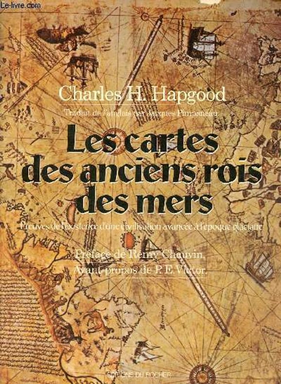
Hapgood Charles H.
Les cartes des anciens rois des mers - Preuves de l'existence d'une civilisation avancée à l'époque glaciaire.
Editions du Rocher. 1981. In-8. Broché. Etat d'usage, Coins frottés, Dos plié, Intérieur frais. 297 pages - nombreuses cartes en noir et blanc dans et hors texte.. . . . Classification Dewey : 912-Atlas, cartes et plans
Bookseller reference : R100062369
|
|
|
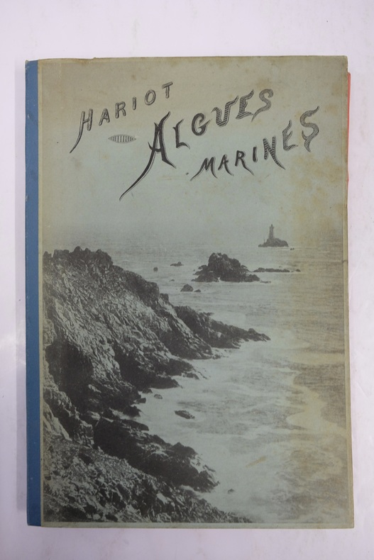
HARIOT, Paul (Auguste, 1853-1917).
Atlas des Algues Marines les plus rpandues des Ctes de France. 48 planches en Hliotypie Tires en couleur reprsentant 108 espces d'algues faciles rcolter. Avec leur description ainsi que celle des espces les plus voisines, les moyens de les prparer et de les conserver.
Paris, Paul Klincksieck éditeur, 1892, ensemble de 5 fascicules (5 livraisons) in-8 regroupés sous portefeuille cartonné d'édition à rabats rouge. Premier plat orné d'un dessin en noir. Dos toilé bleu. 48 planches tirées en héliotypie tirées en couleurs représentant 110 espèces d'algues facile à récolter avec leur description
Bookseller reference : ATLAS17M
|
|
|
HARIOT Paul / REGNIER A. L.
ATLAS DE POCHE DES FLEURS DE JARDINS LES PLUS FACILES A CULTIVER.
Paris, Libraire des Sciences Naturelles Paul Klincksieck, L. Lhomme succ., 1912. Bibliothèque de poche du naturaliste, XIV. Pt in-8 toile verte éditeur, tranches rouges. 128 planches coloriées représentant 137 plantes communes. Dessins par A. L. Regnier.
Bookseller reference : 675
|
|
|
HARTLEBENS, A.
Volks-Atlas. Enthaltend 72 Hauptkarten und 66 Nebenkarten in einhundert Kartenseiten, mit erläuterndem Text und vollständigem alphabetischem Register. Vierte, vollkommen umgearbeitete und erneuerte Auflage.
Wien und Leipzig, ohne Jahr, ca. 1900-1914, 395x270mm, 132Seiten, Halbfranzband. Bon état.
Bookseller reference : 29022

|
|
|
HARIOT, Paul.
Atlas de poche des fleurs de jardins les plus faciles à cultiver. 2ème édition.
in-12, VII-187 pages. Reliure éditeur pleine percaline gris bleu, dos lisse, titre en noir sur le premier plat. 128 planches en couleurs représentant 137 plantes communes, dessinées par A. L. REGNIER. Bon etat. [TX-16] Tome XIV de la collection "Bibliothèque de poche du Naturaliste".
|
|
|
HARITA DAIRESI.
[MAP] Ottoman map of Erzurum.
Very Good Turkish, Ottoman (1500-1928) Original color map of Erzurum city center and it environment. Folded. 69x42,5 cm. In Ottoman script. One sheet. Shows center of Erzurum city and topography environment. No scale info. Hegira: 1336 = Gregorian: 1920. Not description on map-maker. This is one the serie of the Bonn projection maps which are the first map series in modern techniques in Turkey and the Ottoman Empire. In order to produce these maps covering Turkish territory, Reconnaissance Branch was incorporated into The Mapping Commission. The maps were produced in the datum based on the latitude and longitude of Ayasofya Mosque in equal area Bonn Projection. The field works for the 123 sheets covering the country were conducted by 76 staff. The production was completed in 18 years starting from east west. Field works continued without stopping except in years 1914 and 1920. This map series called also reconnaissance maps contributed a lot to producing 1:25.000 scale maps. Extremely rare.
|
|
|
HARITA UMUM MÜDÜRLÜGÜ = MAP GENERAL DIRECTORY].
[MAP of TURKISH BALKANS, ALBANIA and GREECE] 52. Berat. 57. Arkeri. 23. Avlonya. 24. Himar (Heymar) (Ottoman Albania and Greece). Mübde-i Tûl Paris'den itibâr olunmusdur. [Berati, Vlora, Himara (Himarra)].
Very Good Turkish, Ottoman (1500-1928) Original color map on cloth. A little foxing on cloth. Very good. Folded. Oblong atlas folio. (66 x 72 cm). In Ottoman script. Scale: 1/210.000. Ottoman sanjaks in Albania and Greece. A rare Ottoman map of Balkans with Turkish place names for the period of pre-Balkan Wars, (1912-1913). Very important for onomastics and historical geography. Written 'Paris -French meridian- was accepted as the 0 meridian'. The Paris meridian is a meridian line running through the Paris Observatory in Paris, France-now longitude 2°20'14.03" east. It was a long-standing rival to the Greenwich meridian as the prime meridian of the world. Personal stamp of Muhiddin Pasha on cloth, under the printed descriptive texts. It's from the collection of him. Hasan Muhiddin Pasha [Çanga], (1866-1944), who was a lieutenant in Hedjaz Army of the Ottoman Empire in 1887. After he suppressed the rebellion in Yemen, 1891, his rank was promoted to the 'major'. After the Imam Yahya rebellion in Yemen, 1904, he prepared a report for the Ottoman government. He also took part in Ethiopia, Sudan, Yemen, Arabian Peninsula for various military duties. After promotion to division command, he was provincial president of CHP (Republican People's Party). He was a very important politic and diplomatic figure for the last period of Ottoman and early Republican Turkey. Not in Tooley. Extremely rare.
|
|
|
HARITA UMUM MÜDÜRLÜGÜ = MAP GENERAL DIRECTORY].
[MAP of TURKISH BALKANS, ALBANIA, MACEDONIA and GREECE] 44. Debre-i Bâlâ. 55. Ilbesan. 61. Lis. 62. Draç. Mübde-i Tûl Paris'den itibâr olunmusdur. [Debre, Elbasan, Drac, Lish].
Very Good Turkish, Ottoman (1500-1928) Original color map on cloth. A little foxing on cloth. Very good. Folded. Oblong atlas folio. (66 x 72 cm). In Ottoman script. Scale: 1/210.000. Ottoman sanjaks in Albania, Macedonia and Greece. A rare Ottoman map of Balkans with Turkish place names for the period of pre-Balkan Wars, (1912-1913). Very important for onomastics and historical geography.
|
|
|
HARITA UMUM MÜDÜRLÜGÜ = MAP GENERAL DIRECTORY].
[MAP of TURKISH BALKANS, BULGARIA] 15. Kazanlik. 16. Hasköy. 21. Karlova. 22. Filibe (Plovdiv). Mübde-i Tûl Paris'den itibâr olunmusdur. [Plovdiv, Karlovo, Haskovo, Kizanlik / Kazanlyk - Bulgaria].
Very Good Turkish, Ottoman (1500-1928) Original color map on cloth. A little foxing on cloth. Very good. Folded. Oblong atlas folio. (66 x 72 cm). In Ottoman script. Scale: 1/210.000. Ottoman cities in Bulgaria. A rare Ottoman map of Balkans with Turkish place names for the period of pre-Balkan Wars, (1912-1913). Very important for onomastics and historical geography. Written 'Paris -French meridian- was accepted as the 0 meridian'. The Paris meridian is a meridian line running through the Paris Observatory in Paris, France-now longitude 2°20'14.03" east. It was a long-standing rival to the Greenwich meridian as the prime meridian of the world. Personal stamp of Muhiddin Pasha on cloth, under the printed descriptive texts. It's from the collection of him. Hasan Muhiddin Pasha [Çanga], (1866-1944), who was a lieutenant in Hedjaz Army of the Ottoman Empire in 1887. After he suppressed the rebellion in Yemen, 1891, his rank was promoted to the 'major'. After the Imam Yahya rebellion in Yemen, 1904, he prepared a report for the Ottoman government. He also took part in Ethiopia, Sudan, Yemen, Arabian Peninsula for various military duties. After promotion to division command, he was provincial president of CHP (Republican People's Party). He was a very important politic and diplomatic figure for the last period of Ottoman and early Republican Turkey. Not in Tooley. Extremely rare.
|
|
|
HARITA UMUM MÜDÜRLÜGÜ = MAP GENERAL DIRECTORY].
[MAP of TURKISH BALKANS, BULGARIA] Eski Zagra. [Stara Zagora - Old Zagora].
Very Good Turkish, Ottoman (1500-1928) Original color map on cloth. A little foxing on cloth. Very good. Folded. Oblong atlas folio. (66 x 72 cm). In Ottoman script. Scale: 1/210.000. Ottoman sanjaks in Balkans, Bulgaria. A very detailed map of Old Zagora. A rare Ottoman map of Balkans with Turkish place names for the period of pre-Balkan Wars, (1912-1913). Very important for onomastics and historical geography. Extremely rare.
|
|
|
HARITA UMUM MÜDÜRLÜGÜ = MAP GENERAL DIRECTORY].
[MAP of TURKISH BALKANS, BULGARIA] Filibe - Hasköy. [Plovdiv - Haskovo].
Very Good Turkish, Ottoman (1500-1928) Original color map on cloth. A little foxing on cloth. Very good. Folded. Oblong atlas folio. (66 x 72 cm). In Ottoman script. Scale: 1/210.000. Ottoman sanjaks in Balkans, Bulgaria. A very detailed map of Plovdiv and Haskovo. A rare Ottoman map of Balkans with Turkish place names for the period of pre-Balkan Wars, (1912-1913). Very important for onomastics and historical geography. Extremely rare.
|
|
|
HARITA UMUM MÜDÜRLÜGÜ = MAP GENERAL DIRECTORY].
[MAP of TURKISH BALKANS, BULGARIA] Filibe. [Plovdiv].
Very Good Turkish, Ottoman (1500-1928) Original color map on cloth. A little foxing on cloth. Very good. Folded. Oblong atlas folio. (66 x 72 cm). In Ottoman script. Scale: 1/210.000. Ottoman sanjaks in Balkans, Bulgaria. A very detailed map of Plovdiv. A rare Ottoman map of Balkans with Turkish place names for the period of pre-Balkan Wars, (1912-1913). Very important for onomastics and historical geography. Extremely rare.
|
|
|
HARITA UMUM MÜDÜRLÜGÜ = MAP GENERAL DIRECTORY].
[MAP of TURKISH BALKANS, GREECE, MACEDONIA] 28. Nurekob. 29. Siroz. 34. Usturumçe (Macedonia). 35. Teviran. Mübde-i Tûl Paris'den itibâr olunmusdur. [Serres, Macedonia, Greece].
Very Good Turkish, Ottoman (1500-1928) Original color map on cloth. A little foxing on cloth. Very good. Folded. Oblong atlas folio. (66 x 72 cm). In Ottoman script. Scale: 1/210.000. Ottoman sanjaks in Greece, mostly in Greek Macedonia. A rare Ottoman map of Balkans with Turkish place names for the period of pre-Balkan Wars, (1912-1913). Very important for onomastics and historical geography. Written 'Paris -French meridian- was accepted as the 0 meridian'. The Paris meridian is a meridian line running through the Paris Observatory in Paris, France-now longitude 2°20'14.03" east. It was a long-standing rival to the Greenwich meridian as the prime meridian of the world. Personal stamp of Muhiddin Pasha on cloth, under the printed descriptive texts. It's from the collection of him. Hasan Muhiddin Pasha [Çanga], (1866-1944), who was a lieutenant in Hedjaz Army of the Ottoman Empire in 1887. After he suppressed the rebellion in Yemen, 1891, his rank was promoted to the 'major'. After the Imam Yahya rebellion in Yemen, 1904, he prepared a report for the Ottoman government. He also took part in Ethiopia, Sudan, Yemen, Arabian Peninsula for various military duties. After promotion to division command, he was provincial president of CHP (Republican People's Party). He was a very important politic and diplomatic figure for the last period of Ottoman and early Republican Turkey. Not in Tooley. Extremely rare.
|
|
|
HARITA UMUM MÜDÜRLÜGÜ = MAP GENERAL DIRECTORY].
[MAP of TURKISH BALKANS, GREECE, MACEDONIA] 40. Istib. 41. Vodina. 46. Kirçova. 47. Manastir. Mübde-i Tûl Paris'den itibâr olunmusdur. [Stip, Edessa, Adende, Monaster; Macedonia, Greece].
Very Good Turkish, Ottoman (1500-1928) Original color map on cloth. A little foxing on cloth. Very good. Folded. Oblong atlas folio. (66 x 72 cm). In Ottoman script. Scale: 1/210.000. Ottoman sanjaks in Greece, mostly in Greek Macedonia. A rare Ottoman map of Balkans with Turkish place names for the period of pre-Balkan Wars, (1912-1913). Very important for onomastics and historical geography. Written 'Paris -French meridian- was accepted as the 0 meridian'. The Paris meridian is a meridian line running through the Paris Observatory in Paris, France-now longitude 2°20'14.03" east. It was a long-standing rival to the Greenwich meridian as the prime meridian of the world. Personal stamp of Muhiddin Pasha on cloth, under the printed descriptive texts. It's from the collection of him. Hasan Muhiddin Pasha [Çanga], (1866-1944), who was a lieutenant in Hedjaz Army of the Ottoman Empire in 1887. After he suppressed the rebellion in Yemen, 1891, his rank was promoted to the 'major'. After the Imam Yahya rebellion in Yemen, 1904, he prepared a report for the Ottoman government. He also took part in Ethiopia, Sudan, Yemen, Arabian Peninsula for various military duties. After promotion to division command, he was provincial president of CHP (Republican People's Party). He was a very important politic and diplomatic figure for the last period of Ottoman and early Republican Turkey. Not in Tooley. Extremely rare.
|
|
|
HARITA UMUM MÜDÜRLÜGÜ = MAP GENERAL DIRECTORY].
[MAP of TURKISH BALKANS, GREECE, THESSALY] 50. Narda (Yunanistan). 51. Preveze (Yunanistan). 67. Tirhala (Yunanistan). 70. Agrinyon (Yunanistan-Teselya). Mübde-i Tûl Paris'den itibâr olunmusdur. [Arta (Yunanistan), Preveza (Greece), Sandjak of Tirhala (Thessaly-Greece), Agrinio (Thessaly-Greece)]
Very Good Turkish, Ottoman (1500-1928) Original color map on cloth. A little foxing on cloth. Very good. Folded. Oblong atlas folio. (66 x 72 cm). In Ottoman script. Scale: 1/210.000. Ottoman sanjaks in Greece, mostly in Thessaly. A rare Ottoman map of Balkans with Turkish place names for the period of pre-Balkan Wars, (1912-1913). Very important for onomastics and historical geography. Written 'Paris -French meridian- was accepted as the 0 meridian'. The Paris meridian is a meridian line running through the Paris Observatory in Paris, France-now longitude 2°20'14.03" east. It was a long-standing rival to the Greenwich meridian as the prime meridian of the world. Personal stamp of Muhiddin Pasha on cloth, under the printed descriptive texts. It's from the collection of him. Hasan Muhiddin Pasha [Çanga], (1866-1944), who was a lieutenant in Hedjaz Army of the Ottoman Empire in 1887. After he suppressed the rebellion in Yemen, 1891, his rank was promoted to the 'major'. After the Imam Yahya rebellion in Yemen, 1904, he prepared a report for the Ottoman government. He also took part in Ethiopia, Sudan, Yemen, Arabian Peninsula for various military duties. After promotion to division command, he was provincial president of CHP (Republican People's Party). He was a very important politic and diplomatic figure for the last period of Ottoman and early Republican Turkey. Not in Tooley. Extremely rare.
|
|
|
HARITA UMUM MÜDÜRLÜGÜ = MAP GENERAL DIRECTORY].
[MAP of TURKISH BALKANS, GREECE, THESSALY] 65. Iskoplus (Üsküplo-Uskublo) (Yunanistan). 66. Galos (Teselya, Yunanistan). 68. Egriboz. 69. Lami (Izdin) (Thesalya, Yunanistan). Mübde-i Tûl Paris'den itibâr olunmusdur. [Volos, Skopelos, Euboea, Lamia (Thessaly, Greece).
Very Good Turkish, Ottoman (1500-1928) Original color map on cloth. A little foxing on cloth. Very good. Folded. Oblong atlas folio. (66 x 72 cm). In Ottoman script. Scale: 1/210.000. Ottoman sanjaks in Greece, mostly in Thessaly. A rare Ottoman map of Balkans with Turkish place names for the period of pre-Balkan Wars, (1912-1913). Very important for onomastics and historical geography. Written 'Paris -French meridian- was accepted as the 0 meridian'. The Paris meridian is a meridian line running through the Paris Observatory in Paris, France-now longitude 2°20'14.03" east. It was a long-standing rival to the Greenwich meridian as the prime meridian of the world. Personal stamp of Muhiddin Pasha on cloth, under the printed descriptive texts. It's from the collection of him. Hasan Muhiddin Pasha [Çanga], (1866-1944), who was a lieutenant in Hedjaz Army of the Ottoman Empire in 1887. After he suppressed the rebellion in Yemen, 1891, his rank was promoted to the 'major'. After the Imam Yahya rebellion in Yemen, 1904, he prepared a report for the Ottoman government. He also took part in Ethiopia, Sudan, Yemen, Arabian Peninsula for various military duties. After promotion to division command, he was provincial president of CHP (Republican People's Party). He was a very important politic and diplomatic figure for the last period of Ottoman and early Republican Turkey. Not in Tooley. Extremely rare.
|
|
|
HARITA UMUM MÜDÜRLÜGÜ = MAP GENERAL DIRECTORY].
[MAP of TURKISH BALKANS, GREECE] 17. Gümülcine. 18. Karaagaç. 23. Pasmakli. 24. Kavala. Mübde-i Tûl Paris'den itibâr olunmusdur. [Komotini, Ftelia, Kavala, et alli].
Very Good Turkish, Ottoman (1500-1928) Original color map on cloth. A little foxing on cloth. Very good. Folded. Oblong atlas folio. (66 x 72 cm). In Ottoman script. Scale: 1/210.000. Ottoman sanjaks in Greece. A rare Ottoman map of Balkans with Turkish place names for the period of pre-Balkan Wars, (1912-1913). Very important for onomastics and historical geography. Written 'Paris -French meridian- was accepted as the 0 meridian'. The Paris meridian is a meridian line running through the Paris Observatory in Paris, France-now longitude 2°20'14.03" east. It was a long-standing rival to the Greenwich meridian as the prime meridian of the world. Personal stamp of Muhiddin Pasha on cloth, under the printed descriptive texts. It's from the collection of him. Hasan Muhiddin Pasha [Çanga], (1866-1944), who was a lieutenant in Hedjaz Army of the Ottoman Empire in 1887. After he suppressed the rebellion in Yemen, 1891, his rank was promoted to the 'major'. After the Imam Yahya rebellion in Yemen, 1904, he prepared a report for the Ottoman government. He also took part in Ethiopia, Sudan, Yemen, Arabian Peninsula for various military duties. After promotion to division command, he was provincial president of CHP (Republican People's Party). He was a very important politic and diplomatic figure for the last period of Ottoman and early Republican Turkey. Not in Tooley. Extremely rare.
|
|
|
HARITA UMUM MÜDÜRLÜGÜ = MAP GENERAL DIRECTORY].
[MAP of TURKISH BALKANS, GREECE] 25. Kareles. 30. Poliroz. 31. Kesendire. 36. Selânik. 37. Litohor. Mübde-i Tûl Paris'den itibâr olunmusdur. [Litochoro, Thessaloniki (Salonica-Salonique), Kassandra, Kassandreia, Polygyros, et alli.].
Very Good Turkish, Ottoman (1500-1928) Original color map on cloth. A little foxing on cloth. Very good. Folded. Oblong atlas folio. (66 x 72 cm). In Ottoman script. Scale: 1/210.000. Ottoman sanjaks in Greece. A rare Ottoman map of Balkans with Turkish place names for the period of pre-Balkan Wars, (1912-1913). Very important for onomastics and historical geography. Written 'Paris -French meridian- was accepted as the 0 meridian'. The Paris meridian is a meridian line running through the Paris Observatory in Paris, France-now longitude 2°20'14.03" east. It was a long-standing rival to the Greenwich meridian as the prime meridian of the world. Personal stamp of Muhiddin Pasha on cloth, under the printed descriptive texts. It's from the collection of him. Hasan Muhiddin Pasha [Çanga], (1866-1944), who was a lieutenant in Hedjaz Army of the Ottoman Empire in 1887. After he suppressed the rebellion in Yemen, 1891, his rank was promoted to the 'major'. After the Imam Yahya rebellion in Yemen, 1904, he prepared a report for the Ottoman government. He also took part in Ethiopia, Sudan, Yemen, Arabian Peninsula for various military duties. After promotion to division command, he was provincial president of CHP (Republican People's Party). He was a very important politic and diplomatic figure for the last period of Ottoman and early Republican Turkey. Not in Tooley. Extremely rare.
|
|
|
HARITA UMUM MÜDÜRLÜGÜ = MAP GENERAL DIRECTORY].
[MAP of TURKISH BALKANS, MACEDONIA] Usturumca (Strumica), Siroz (Serres), Toyran (Doyran), Nevre-i Kob.
Very Good Turkish, Ottoman (1500-1928) Original color map on cloth. A little foxing on cloth. Very good. Folded. Oblong atlas folio. (66 x 72 cm). In Ottoman script. Scale: 1/210.000. Ottoman sanjaks in Balkans, Macedonia. A very detailed map of Old Zagora. A rare Ottoman map of Balkans with Turkish place names for the period of pre-Balkan Wars, (1912-1913). Very important for onomastics and historical geography. Extremely rare.
|
|
|
HARITA UMUM MÜDÜRLÜGÜ = MAP GENERAL DIRECTORY].
[MAP of TURKISH BALKANS, MACEDONIAN GREECE, THESSALY] 42. Kirefrite. 43. Alasonya. 48. Nasliç, Naslig. 49. Yanya. Mübde-i Tûl Paris'den itibâr olunmusdur. [Elassona, Neapoli, Ioannina (Ottoman sandjakss in Thessaly, and Macedonian Greece).
Very Good Turkish, Ottoman (1500-1928) Original color map on cloth. A little foxing on cloth. Very good. Folded. Oblong atlas folio. (66 x 72 cm). In Ottoman script. Scale: 1/210.000. Ottoman sanjaks in Greece, mostly in Thessaly and Macedonian Greece. A rare Ottoman map of Balkans with Turkish place names for the period of pre-Balkan Wars, (1912-1913). Very important for onomastics and historical geography. Written 'Paris -French meridian- was accepted as the 0 meridian'. The Paris meridian is a meridian line running through the Paris Observatory in Paris, France-now longitude 2°20'14.03" east. It was a long-standing rival to the Greenwich meridian as the prime meridian of the world. Personal stamp of Muhiddin Pasha on cloth, under the printed descriptive texts. It's from the collection of him. Hasan Muhiddin Pasha [Çanga], (1866-1944), who was a lieutenant in Hedjaz Army of the Ottoman Empire in 1887. After he suppressed the rebellion in Yemen, 1891, his rank was promoted to the 'major'. After the Imam Yahya rebellion in Yemen, 1904, he prepared a report for the Ottoman government. He also took part in Ethiopia, Sudan, Yemen, Arabian Peninsula for various military duties. After promotion to division command, he was provincial president of CHP (Republican People's Party). He was a very important politic and diplomatic figure for the last period of Ottoman and early Republican Turkey. Not in Tooley. Extremely rare.
|
|
|

 Receive by email
 Download as PDF document
 RSS feed
 Permanent link


