|
Kindermann, Joseph Carl
Atlas von Inneroesterreich. Entworfen und gezeichnet von Joseph Carl Kindermann. Gestochen von Christoph Junker. Kommentiert von Gerhard M. Dienes und Bernd Schmidt.
(Wien), Archiv Verlag, (2005). Gr.-Fol. Mit Textillustrationen u. 12 (1 farb.) gefalt. Karten. 49 S., 1 Bl., OKunstldr. m. goldgepr. Deckeltitel.
Bookseller reference : 43864
|
|
|
Kingsbury Jerome b. States William Gaynor b. Jacobi Eduard. Atlas der Hautkrankheiten
Portfolio of dermochromes Volume 1 1921 Leather Bound
2019. Leather Bound. New. Leather Binding on Spine and Corners with Golden Leaf Printing on round Spine. Reprinted in 2019 with the help of original edition published long back 1921. This book is printed in black & white sewing binding for longer life Printed on high quality Paper re-sized as per Current standards professionally processed without changing its contents. As these are old books we processed each page manually and make them readable but in some cases some pages which are blur or missing or black spots. We expect that you will understand our compulsion in these books. We found this book important for the readers who want to know more about our old treasure so we brought it back to the shelves. Hope you will like it and give your comments and suggestions. Lang: - eng Vol: - Volume 1 Pages 252. EXTRA 10 DAYS APART FROM THE NORMAL SHIPPING PERIOD WILL BE REQUIRED FOR LEATHER BOUND BOOKS. FOLIO EDITION IS ALSO AVAILABLE. Volume 1 hardcover
Bookseller reference : LB1111005247499
|
|
|
Kingsbury Jerome b. States William Gaynor b. Jacobi Eduard. Atlas der Hautkrankheiten
Portfolio of dermochromes Volume 3 1921 Leather Bound
2019. Leather Bound. New. Leather Binding on Spine and Corners with Golden Leaf Printing on round Spine. Reprinted in 2019 with the help of original edition published long back 1921. This book is printed in black & white sewing binding for longer life Printed on high quality Paper re-sized as per Current standards professionally processed without changing its contents. As these are old books we processed each page manually and make them readable but in some cases some pages which are blur or missing or black spots. We expect that you will understand our compulsion in these books. We found this book important for the readers who want to know more about our old treasure so we brought it back to the shelves. Hope you will like it and give your comments and suggestions. Lang: - eng Vol: - Volume 3 Pages 290. EXTRA 10 DAYS APART FROM THE NORMAL SHIPPING PERIOD WILL BE REQUIRED FOR LEATHER BOUND BOOKS. FOLIO EDITION IS ALSO AVAILABLE. Volume 3 hardcover
Bookseller reference : LB1111005247680
|
|
|
Kingsbury Jerome b. States William Gaynor b. Jacobi Eduard. Atlas der Hautkrankheiten
Portfolio of dermochromes Volume 1 1921
2020. Paperback. New. Lang: - eng Vol: - Volume 1 Pages 252. Reprinted in 2020 with the help of original edition published long back 1921. This book is Printed in black & white sewing binding for longer life with Matt laminated multi-Colour Soft Cover HARDCOVER EDITION IS ALSO AVAILABLE Printed on high quality Paper re-sized as per Current standards professionally processed without changing its contents. As these are old books we processed each page manually and make them readable but in some cases some pages which are blur or missing or black spots. We expect that you will understand our compulsion in these books. We found this book important for the readers who want to know more about our old treasure so we brought it back to the shelves. Any type of Customisation is possible with extra charges. Hope you will like it and give your comments and suggestions. Volume 1 paperback
Bookseller reference : PB1111005247499
|
|
|
Kingsbury Jerome b. States William Gaynor b. Jacobi Eduard. Atlas der Hautkrankheiten
Portfolio of dermochromes Volume 3 1921
2020. Paperback. New. Lang: - eng Vol: - Volume 3 Pages 290. Reprinted in 2020 with the help of original edition published long back 1921. This book is Printed in black & white sewing binding for longer life with Matt laminated multi-Colour Soft Cover HARDCOVER EDITION IS ALSO AVAILABLE Printed on high quality Paper re-sized as per Current standards professionally processed without changing its contents. As these are old books we processed each page manually and make them readable but in some cases some pages which are blur or missing or black spots. We expect that you will understand our compulsion in these books. We found this book important for the readers who want to know more about our old treasure so we brought it back to the shelves. Any type of Customisation is possible with extra charges. Hope you will like it and give your comments and suggestions. Volume 3 paperback
Bookseller reference : PB1111005247680
|
|
|
Kingsbury Jerome b. States William Gaynor b. Jacobi Eduard. Atlas der Hautkrankheiten
Portfolio of dermochromes Volume 1 1921 Hardcover
2020. Hardcover. New. Lang: - eng Vol: - Volume 1 Pages 252. Reprinted in 2020 with the help of original edition published long back 1921. This book is printed in black & white Hardcover sewing binding for longer life with Matt laminated multi-Colour Dust Cover Printed on high quality Paper re-sized as per Current standards professionally processed without changing its contents. As these are old books we processed each page manually and make them readable but in some cases some pages which are blur or missing or black spots. We expect that you will understand our compulsion in these books. We found this book important for the readers who want to know more about our old treasure so we brought it back to the shelves. Any type of Customisation is possible with extra charges. Hope you will like it and give your comments and suggestions. Volume 1 hardcover
Bookseller reference : 1111005247499
|
|
|
Kingsbury Jerome b. States William Gaynor b. Jacobi Eduard. Atlas der Hautkrankheiten
Portfolio of dermochromes Volume 3 1921 Hardcover
2020. Hardcover. New. Lang: - eng Vol: - Volume 3 Pages 290. Reprinted in 2020 with the help of original edition published long back 1921. This book is printed in black & white Hardcover sewing binding for longer life with Matt laminated multi-Colour Dust Cover Printed on high quality Paper re-sized as per Current standards professionally processed without changing its contents. As these are old books we processed each page manually and make them readable but in some cases some pages which are blur or missing or black spots. We expect that you will understand our compulsion in these books. We found this book important for the readers who want to know more about our old treasure so we brought it back to the shelves. Any type of Customisation is possible with extra charges. Hope you will like it and give your comments and suggestions. Volume 3 hardcover
Bookseller reference : 1111005247680
|
|
|
Kipferling, Karl Joseph
Kleiner Atlas der neuen Geographie zum Gebrauche der österreichischen Schulen.
Wien u. Pesth, J. Riedl 1814. Folio (37,5 x 24,5 cm). Gest. doppelblattgr. Titel, 34 doppelblattgr. grenzkolorierte Kupfer-Karten (je 36,5 x 46,5). Ldr. d. Zt., die Karten mit Gebrauchsspuren, an den Rändern fallweise Einträge u. Fingerflecken. Eine Karte (Oesterreich) von Kinderhand stellenw. aquarelliert (die Adria blau bemalt) Dörflinger-Hühnel I/117. - Lediglich 7 Karten entsprechen der Jahresangabe des Titelblattes: Schweiz, Dänemark, Niedersachsen, Oberschlesien, Türkei u. Persien, America, Africa. Die Österreich-Kartei mit 1816, die übrigen 26 mit 1815 datiert. Offensichtlich wurde der Neuordnung Europas durch den Wiener Kongreß damit kartographisch Rechnung getragen. Die Niederösterreich--Karte (mit 35 x 44 geringfügig kleiner) wurde von J. M. Liechtenstern entworfen. - Differenzbesteuert
Bookseller reference : STAN0058
|
|
|
Kirsche, Hans-Joachim und Hans Müller
Eisenbahnatlas DDR. 1. Auflage
Freiburg [Breisgau] : Eisenbahn-Kurier, 1987. 328 S. : Illustr. (farb.), Kt. ; 26 cm; fadengeh., farb. illustr. Orig.-Pappband.
Bookseller reference : 1224106

|
|
|
KISH George
LA CARTE . Image des civilisations .
P, Seuil , 1980 , in4° toile , jaquette illustrée , 287pp 108 planches avec notes expliqatives.
Bookseller reference : M12417
|
|
|
Kiss, Ferenc und János Szentágothai
Anatomischer Atlas des menschlichen Körpers. 3 Bände. Mit einer spearaten Anlage zu: Schemata der Leitungsbahnen des Menschen. 3 Bände.,
Leipzig, Verlag Georg Thieme 1976. 286, 232 und 300 Seiten., 4°. blaue OLeinwand mit OSchutzumschlag (diese mit Gebrauchsspuren).,
Bookseller reference : 97755

|
|
|
KITABHANE-I SUDI COLLECTION (Published by).
[MAP of NEW EUROPE] Sudi Bey Yeni Harita Külliyatindan Yeni Avrupa.
Very Good Turkish, Ottoman (1500-1928) Original color map. Chipped on folded places. Folded. Slightly toning on paper. Oblong atlas folio. (62 x 89 cm). In Ottoman script. Map of New Europe. Scale: 1/10.000.000. Gregorian: 1927. It's printed from 'Sudi Bey' Map Corpus. This was a map serie printed in the early Republican period in Turkish with Arabic letters. Very decorative map with its color flags of various countries longitudinal on right and left sides of map. Sudi printing house was an Ottoman / Turkish publisher who was one of the longest-running of Turkish publishers.
|
|
|
KITABHANE-I SUDI COLLECTION (Published by).
[MAP of NEW OCEANIA] Sudi Bey Yeni Harita Külliyatindan Yeni Okyanusya.
Very Good Turkish, Ottoman (1500-1928) Original color map. Chipped on folded places. Folded. Slightly toning on paper. Oblong atlas folio. (63 x 94 cm). In Ottoman script. Map of New Oceania. It shows Australia, Bahr-i Muhit-i Kebir, Pacific Ocean, New Zealand, Micronesia et alli. Scale: 1/20.000.000. Gregorian: 1927. It's printed from 'Sudi Bey' Map Corpus. This was a map serie printed in the early Republican period in Turkish with Arabic letters. Very decorative map with its color flags of various countries longitudinal on right and left sides of map. Sudi printing house was an Ottoman / Turkish publisher who was one of the longest-running of Turkish publishers.
|
|
|
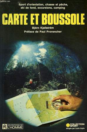
KJELLSTRÖM BJÖRN
CARTE ET BOUSSOLE
Editions de l'Homme. 1978. In-8. Broché. Etat d'usage, Couv. convenable, Coiffe en tête abîmée, Intérieur frais. 237 pages. Illustré de nombreux dessins en noir et blanc.. . . . Classification Dewey : 912-Atlas, cartes et plans
Bookseller reference : RO40125464 ISBN : 775905909
|
|
|
KJELLSTRÖM BJÖRN
CARTE ET BOUSSOLE
ISBN : 0775905909. Editions de l'Homme. 1978. In-8 Carré. Broché. Etat d'usage. Couv. convenable. Coiffe en tête abîmée. Intérieur frais. 237 pages. Illustré de nombreux dessins en noir et blanc. Collection 'Sport', dir. par Louis Arpin. Préface de Paul Provencher. Sport d'orientation, chasse et pêche, ski de fond, excursions, camping.

|
|
|
KLARIC & COLLECTIF
Carte Auto de Croatie.
OFFICE NATIONAL DE TOURISME. Non daté. In-12. En feuillets. Bon état, Couv. convenable, Dos satisfaisant, Intérieur frais. Carte dépliante de 49 / 59 cm, illustrée en couleurs. Légendes en anglais et croate.. . . . Classification Dewey : 912-Atlas, cartes et plans
Bookseller reference : RO80133317
|
|
|
Kleiner Atlas.:
Der am Haufigsten Vorkommenden Raupen.
Nothung-Verlag Leipzig circ 1930. Mit 121 Abbildungen in Naturgetreuen Farben mit Angabe der Deutschen und Lateinischen Namen. Card covers. G. Nothung-Verlag, Leipzig circ 1930. unknown
Bookseller reference : 39436
|
|
|
Kleiner Atlas.:
Der am Haufigsten Vorkommenden Schmetterlinge.
Nothung-Verlag Leipzig circ 1930. Mit 129 Abbildungen in Naturgetreuen Farben mit Angabe der Deutschen und Lateinischen Namen. Card covers. G. Nothung-Verlag, Leipzig circ 1930. unknown
Bookseller reference : 39435
|
|
|
KLINKE, Willibald (Bearb. & Hrsg.):
Atlas zur Heimatkunde von Zürich.
Zürich : Verlag der Schul- & Bureaumaterialverwaltung der Stadt Zürich. Bern & Zürich: Kümmerly + Frey, 1918, in-4to, farbiges Titelblatt (v. Linck) + 19 ill. S. (S. 14 Doppelblatt: Panorama-Karte von Zürich), kl. Gebrauchsspuren, Auf Spiegel ‘Stadtschule Zürich... Auszug Verordnung’ (hs. mit Bleistift sind 3 Schüler eingetragen), ill. Hlwd. (Umschlagbild v. LINCK identisch mit Titelbl. aber in Schwarz). Vorsatzbl. mit Klebstreifenflecken.
Bookseller reference : 126917aaf
|
|
|
Klinke, Willibald
Atlas zur Heimatkunde von Zürich. Bearbeitet und hrsg. von W(illibald) Klinke und erstellt von Kümmerly & Frey.
Zch., Verlag der Schul- u. Bureaumaterialverwaltung der Stadt, 1918. 19 S., mit mehrfarbigen Abbildungen und Plänen. Or.Hln., 4°. Mit Quartierwappen, Detailplänen der Quartiere, einem doppelblattgrossen facsimilierten "Murer"-Plan, einer doppelblattgrossen farbigen Panorama-Karte und einer doppelblattgrossen Wiedergabe des H(ans) F(elix) Luethold-Plans von 1850 und einigen Ansichten. Hardcover Einband berieben, Seiten etwas fingerfleckig.
Bookseller reference : 100351

|
|
|
Klitzing, Maren von (Illustrationen von Hans G. Schellenberger)
Der große Xenos-Tieratlas für Kinder.
Hamburg : Xenos, 2002. 48 S.; 31 cm Großformat, illustrierter Pappband
Bookseller reference : 1382
|
|
|
Knaur
Knaurs grosser Weltatlas. 260 Kartenseiten in achtfarbigem Offsetdruck, 231 Seiten register mit über 200 000 Namen. Sonbderteile: Sonnensystem, Weltraumfahrt, Mond- und Sternkarten ...
München, Droemer Knaur 1985.
Bookseller reference : 65811
|
|
|
Knippert, Ulrich / Stefan Wagner / Andreas Hempel u.a
Haack-Weltatlas.
Gotha : Klett-Perthes, 2008. Atlas mit CD-ROM. Ausgabe Baden-Württemberg (Sekundarstufe I). Mit Arbeitsheft Kartenlesen 224 S. + 1 CD-ROM (34 cm) Großformat, Pappband / gebundene Ausgabe
Bookseller reference : 14880
|
|
|
Knowles, R.. Stowe, P. W. E
Europe in Maps. Topographical Map Studies of Western Europe. Book one.
London, Harlow., Longman, Green & Co.., 1969. 96 Seiten mit 19 farbigen Karten, 22 Fotografien und 23 Figuren (Zeichnungen, Kartenskizzen) im Text. Zustand: Aus einer Institutsbibliothek ausgeschieden, Einbandkanten leicht berieben, vordere Eckkanten leicht gewölbt (eselsohrig), Titelblatt und letzte Seite mit Bibliotheksstempel. Quer-4°. S OBroschur / Okarton.
Bookseller reference : 047510
|
|
|
Knud Larsen; Amund Sinding-Larsen
The Lhasa Atlas: Traditional Tibetan Architecture and Townscape
180 pages. Bibliography. References. Index. "Focuses on the topography, environment, historical development, buildings, and townscape of old Lhasa. Introduces future plans and issues concerning the safeguarding of Lhasa's historical townscape in the face of urban development. Includes 25 new maps never before published, satellite photos, historical maps and photos, watercolours, information on old buildings, and many new colour photos." - dust jacket. Dust jacket attractive in glossy new archival-grade Brodart. Average wear and usual library markings to book bound in scarlet cloth with hinges taped. A worthy reference copy. Book

|
|
|
Koch, [Wilhelm] / Opitz, [Carl]
Verkehrsatlas von Europa - (Deckeltitel: Dr. W. Koch's Eisenbahn- und Verkehrs-Atlas von Europa) : Unter Benutzung von Dr. W. Koch und C. Opitz Eisenbahn- und Verkehrs-Atlas von Deutschland, Russland und der Schweiz herausgegeben von der Georgraphischen Anstalt J.J. Arnd in Leipzig. Enthaltend 67 Sektionen in dreifachem Farbendruck. Ein alphabetisches Stationsverzeichnis von Europa. Nebst einem Anhnage: Alphabetisches Stationsverzeichnis von Deutschland. Alphabetisches Ortsverzeichnis des Deutschen Reiches.
Leipzig, Verlag von J.J. Arnd, 1902 / 3. 4° (35x23), VIII, 67 doppelseitige (teils eingefaltete) Karten, 72 S. (Stations-Verzeichnis Europa), blaugrüner Oln gewachst mit Jugendstil-Prägung, [2 Warenabbildungen] 1. Aufl. vordVorsatz geöffnet (etwas gelockert), Vorsatzblatt etwas stockfleckig und leicht gewellt, die Seiten II (verso Titel) + III (Vorwort) zusammengeklebt, sonst schönes und gepflegtes Exemplar, dabei der gealterte Pappschuber,
Bookseller reference : 56153AB

|
|
|
Koch, Egmont R., und Fritz Vahrenholt
Die Lage der Nation : Umwelt-Atlas d. Bundesrepublik ; Daten, Analysen, Konsequenzen.
Hamburg : Gruner u. Jahr, 1983. 464 S. Ill. (z.T. farb.), graph. Darst., Kt. 8°. 2. Aufl. Ill. OBroschur. (Geo)
Bookseller reference : 28623 ISBN : 357003870
|
|
|
Koch, W. und C. Opitz
Eisenbahn- und Verkehrsatlas von Europa. Ausgabe von Mittel-Europa.
1912; Arndt; Leipzig 10. Aufl., Originalleinen mit schwarz- und goldgeprägter Deckelillustr., 34 x 22 cm, XIV, 110 S. mit 45 Karten in 8fachem Farbendruck, 3 Übersichtskarten und 24 Nebenkarten sowie einer Weltverkehrskarte und einer Verkehrsübersichtskarte von Europa, angebunden die Eisenbahn-Güter-Tarife in Deutschland und in Österreich-Ungarn 2. Aufl., 118 S. sowie 60 S. Inseraten-Anhang. Rücken abgegriffen, Ecken ganz minimal bestoßen, vorderes Gelenk angeplatzt, Textseiten papierbedingt etwas gebräunt, insgesamt aber solides und sauber erhaltenes Exemplar.
Bookseller reference : 14672
|
|
|
Koch, W. und C. Opitz
Verkehrs-Atlas von Europa. Mit einer in sechs Farben ausgeführten Weltverkehrs-Karte nebst einer Übersichtskarte der transsibirischen Eisenbahn. Unter Benutzung von Dr. W. Koch u. C. Opitz: Eisenbahn- und Verkehrsatlas von Deutschland, Rußland und der Schweiz. Und einem separaten Verkehrshandbuch enthaltend: Kilometertabellen Frachtentarif... 1. Aufl.
Leipzig: J. J. Arnd 1905. 1 Bl., VII, 95 S., 80 Sektionen in vier- bis achtfachem Farbdruck, 6 Übersichtskarten, 34 Nebenkarten, 51 S. mit einem alphabetischen Stationsverzeichnis von Europa, nebst einer alphabetischen Übersicht sebständiger Eisenbahen und Bahnbetriebe Europas. OLeinen 34x23 cm.
Bookseller reference : 38369

|
|
|
KOEHLER (Johann David, 1684-1785).
Descriptio Orbis Antiqui in XLIV. Tabulis exhibita a Io. Davide Koelero.
Nuremberg, Christoph Weigel, [1720] ; in-folio (35,5 x 23,5 cm). 2ff. (titre et index gravés sur cuivre)- 44 cartes, plans et vues gravés sur cuivre et partiellement coloriés à l'époque. Demi-basane brune, dos lisse muet, plats recouverts de papier imprimé de motifs dorés à décor de rinceaux parsemés d'instruments de musiques et d'armes, et aux centre du dieu mars entouré de canons, drapeaux, tambours... De la bibliothèque strasbourgeoise d'Henri Rasp, avec son ex-libris armorié sur le contreplat sup. (Gravé par Charles Muller).
Bookseller reference : 11874
|
|
|
Koennecke, Gustav
Bilderatlas zur Geschichte der deutschen Nationallitteratur.
Stuttgart, Stuttgarter Faksimile-Edition im Fackelverl, 1981. [Nachdr.], originalgetreue Wiedergabe d. 2. Aufl. Marburg, Elwert, 1895. numm. Exemplar: 499, limit. Aufl. v. 2980 Exemplaren. 41 x 30 cm. XXVI, 423 S. überwiegend Ill. (z.T. farb.). Pappband, Deckelillustr., sehr schöne gold. Verzierungen. sehr guter Zustand. 1895
Bookseller reference : 23373BB
|
|
|
Koerner, Karl R., Lloyd V. Tilt und Kenneth R. Johnson
Farbatlas der zahnärztlichen Chirurgie.
Köln : Deutscher Ärzte-Verlag, 1996. 350 S. (29 cm) illustrierter Pappband / gebundene Ausgabe
Bookseller reference : 44184
|
|
|
KOFFMAHN O.
Die Britischen Inseln in 3 Blättern. Cartes N° 36 à 39, extraites de Stielers Hand-Atlas. Une carte d'ensemble et les Iles britanniques en 3 feuilles.
- 4 cartes 40 x 50 cm, pliées en 2.
Bookseller reference : 70144
|
|
|
KOHLER PIERRE
LE CIEL - ATLAS GUIDE DE L'UNIVERS
HACHETTE. 1982. In-4. Relié. Bon état, Couv. convenable, Dos satisfaisant, Intérieur frais. 287 pages - nombreuses photos et illustrations en noir et blanc et en couleurs dans et hors texte.. Avec Jaquette. . . Classification Dewey : 912-Atlas, cartes et plans
Bookseller reference : RO20182935
|
|
|
Kohler Pierre
Le ciel . Atlas guide de l'univers
hachette. Non daté. In-4. Relié. Bon état, Couv. convenable, Dos satisfaisant, Intérieur frais. 287 pages - nombreuses photos et illustrations en noir et blanc et en couleurs dans et hors texte. Avec Jaquette. . . Classification Dewey : 912-Atlas, cartes et plans
Bookseller reference : RO80237010
|
|
|
Kohlus, Jörn [Red.]
Umweltatlas Wattenmeer (2 Bände) Band 1: Nordfriesisches und Dithmarscher Wattenmeer (107 farb. Karten, 166 farb. Fotos, Grafiken, Tabellen, 15 schw/w Abb.) Band 2: Wattenmeer zwischen Elb- und Emsmündung (80 farb. Karten, 168 Farbfotos und Farbgrafiken, 20 schw/w Abb., 14 Tabellen)
Stuttgart : Ulmer 1998. 270 S. + 200 S, 32cm x 24cm
Bookseller reference : 6029024
|
|
|
KOLLMANN, Julius:
Handatlas der Entwicklungsgeschichte des Menschen. Zweiter Teil: Embryologia intestinorum, embryologia cordis et vasorum, embryologia cerebri et nervorum, organa sensuum, nomina auctorum, index rerum, index auctorum. Mit 429 zum Teil mehrfarbigen Abb. und einem kurzgefassten erläuternden Texte.
Jena, Gustav Fischer, 1907, gr. in-8vo, VIII + 429 Tafeln + Text (ca. 670 S.), Bibl.-Stempel auf Vorsatzblatt, Original-Leinenband.
Bookseller reference : 107767aaf
|
|
|
KOLLEKTIV:
Schweizer. Verkehrs-Taschen-Atlas nebst alphabetischem Ortsverzeichnis. Masstab 1 : 400,000. Ausgabe 1910/1911.
Basel, 1911, in-8vo, ca. 150 S., reich ill. mit farbigen Karte, Original-Leinenband.
Bookseller reference : 129240aaf
|
|
|
KOLLEKTIV.-
Schweizer Weltatlas für die Volks- und Mittelschule. Ausgabe 1981.
Lehrmittelverlag des Kantons Zürich, 1981, in-4to, VIII + 188 S., reich farbig ill., Original-Pappband.
Bookseller reference : 116568aaf
|
|
|
Kollektiv Orangotango+ (Hrtsg.)
This is Not an Atlas - A Global Collection of Counter-Cartographies,
Bielefeld, transcript Verlag, 2018. 4°, 352 S. mit zahlr. Farb-Abb. und alternativen Kartendarstellungen, heller original Leineneinband mit blauer Deckel- und Rückenbeschriftung (Buch erschien ohne Schutzumschlag) sehr schönes, sauberes und sicher kaum je benutztes Exemplar (= Sozial- und Kulturgeographie, Volume 26)
Bookseller reference : 42350AB

|
|
|
Kollhoff, W. (Wilhelm)
Grundriß der Geschichte Hamburgs. Auf Veranlassung der Oberschulbehörde verfaßt.
Hamburg, Herold'sche Buchhandlung, 1888. 72 S. Kl.-8vo. OHLn.
Bookseller reference : 34647
|
|
|
Kolmorgen, Vasco Paul / Würdig, Thomas / Wall, Henning [Bearbeitung]
Eisenbahnatlas Deutschland.
Köln, Verlag Schweers + Wall, 2017. 28 cm, XVI, 254 Seiten, mit graphischen Darstellungen und zahlreichen Karten, weißer farbig illustrierter Hochglanzpappband, zwei Lesebändchen. 10. Auflage wenig gebraucht, gut bis sehr gut erhalten.
Bookseller reference : 43983AB
|
|
|
KONSTAM Angus
Atlas historique de l'épopée napoléonienne.
Maxi Livre, Succès du Livre, 2004, 191 p., cartonnage éditeur sous jaquette, bon état.
Bookseller reference : 87541

|
|
|
Konsbrück, Hermann (Hrsg.)
Großer Bilderatlas des Weltkrieges. Hier Band 1 und Band 2. (2 Bände).
München, F. Bruckmann Verlag, 1915 und 1916.
Bookseller reference : 226302

|
|
|
Konsbrück, Hermann (Hrsg.)
Großer Bilderatlas des Weltkrieges. Hier Band 1 und Band 2. (2 Bände).
München, F. Bruckmann Verlag, 1916.
Bookseller reference : 13771

|
|
|
Konsbrück, Hermann (Hrsg.)
Großer Bilderatlas des Weltkrieges. Hier Band 1 und Band 2. (2 Bände).
München, F. Bruckmann Verlag, 1915 und 1916.
Bookseller reference : 217641

|
|
|
Konstam, Angus
Atlas versunkener Schiffe. Schätze auf dem Meeresgrund.
Augsburg, Bechtermünz, c 1999. Dt. Erstausg. 192 S. zahlr. Ill., Kt. Pappband., m. illustr. Buchumschlag sehr guter Zustand. 1
Bookseller reference : 17196BB
|
|
|
Konzept Alfred Kren
Atlas. Weltkulturen im Dialog.
München, HVB, 2005. Origi.Broschur, kl.4°, 32 Seiten.
Bookseller reference : 72007
|
|
|
Kootz Wolfgang
Dresde - Plan de la ville avec circuit
B&V Verlag. Non daté. In-12. Broché. Bon état, Couv. convenable, Dos satisfaisant, Intérieur frais. 120 pages augmentées de nombreuses photos en couleurs, dans et hors texte.. . . . Classification Dewey : 912-Atlas, cartes et plans
Bookseller reference : R200102484

|
|
|
Korherr, Dr. Richard
Volk und Raum - Atlaswerk - Mit 98 z.T. farbigen Karten und Schaubildern und 3 losen durchsichtigen Deck-Karten
Würzburg, Universitätsdruckerei H. Stürtz, 1938. quer gr. Folio (48cmx35cm), mit langer hs. Widmung des Verfassers aus vorderem Vorsatz, 158 S. mit 101 (3 Deckkarten) teils ganzseitigen Karten im Text, OHln
Bookseller reference : 7-10-604
|
|
 Receive by email
 Download as PDF document
 RSS feed


