|
REYNAUD-DULAURIER Georges, FULLARD Harold, DARBY H. C.
Atlas général Larousse.
Paris, Librairie Larousse, 1978. 24 x 30, 128 pp., nombreuses cartes en couleurs, reliure d'édition + jaquette + rhodoïd, bon état.
Riferimento per il libraio : 73730 ISBN : 2030009229
|
|
|
REZA SHIRAZIAN.
Atlas of old Tehran.= Atlas-e Tehran-e qadîm. Introduction by Cyrus Alai.
New Persian Original bdg. HC. Folio. (34 x 24 cm). In Persian with abstracts in English. 392 p., color and b/w ills. Tehran became a major city of Iran after 1554 A.D. during the Safavid period when Shah Tahmasb I, son of Shah Ismail, ordered the implementation of two large-scale public works. The first project was the construction of ramparts and moats surrounding the entire city, which defined the city's perimeters and increased its defense. The rampart consisted of 114 towers, representing the 114 chapters within the Holy Quran and enclosed an area of 4.35 km2. The second project was the establishment of the bazaar, the heart of the industrial and commercial activities of the city, surrounded by numerous holy shrines. However, it was 240 years later in the Spring of 1796 A.D. that Tehran became the national capital of Iran, during Agha Mohammad Khan Qajar's reign. 2016 A.D. actually marks the 220th year since Tehran became the political centre of Iran. The first known map of Tehran (page 18), a Russian spy map, dates back to 1826 A.D. The next Russian map of Tehran (page 24) from 1852 A.D. was translated into Persian and presented as a gift to Naser al-Din Shah Qajar (page 29). After the establishment of the military polytechnic school in 1851 A.D. and the arrival of Europe an military instructors, the importance of accurate topographical maps was recognized by the nation's leaders. The Austrian artillery trainer for cannons, August Karl Krziz, coordinated in 1858 A.D. the preparation of the maps of Tehran (page 39) and its surrounding area (page 35). This was the beginning of scientific cartography in Iran. By 1863 A.D., maps of Tehran Province for the purpose of tax collection (page 58) were being produced by engineer Abdul Rasool Khan. Tehran dramatically expanded after a huge flood in 1867 A.D. destroyed a large portion of the Safavid period ramparts and moats, after which Alexander Bohler, a French military instructor, designed a new and enlarged rampart and moat enclosure. Within four years between 1867 A.D. and 1871 A.D., Tehran grew from 4 .35 km2 to 19.75 km2 with these new constructions. By 1891 A.D., a highly detailed and technical map of Tehran (page 64) had been produced by Abdul Ghafar Najmolmoq. During the reigning years of Mozafar al-Din Shah, Mohammad Ali Shah, and Ahmad Shah, maps for Tehran postal services (page 126) and Tehran provincial delineation (page 127) were produced. During these years, the Russian, British and French prepared several geopolitical maps of the region including Tehran. For example, the map on page 323 reproduces a map prepared in 1892 A.D. by the British Survey of India at the scale of 1:506,880. In 1914 A.D., German publisher Wagner & Debes prepared a touristic map of Tehran (page 134). In 1922 A.D. the Ministry of Culture's Investigation Section prepared a map of schools in Tehran (page 138). During the Pahlavi I period (1925~1941 A.D.), modernization of Tehran became a national priority. By 1930 A.D. a map for street enlargement in Tehran (page 158) had been published. In 1932 A.D., the demolition of the Naser al-Din Shah Qajar period ramparts began simultaneous to further expansion of urbanized Tehran. The 1936 A.D. military map of Tehran (page 169) is testimony to the changes in the urban morphology of this period. The creation of a dedicated military cartographic service in 1935 A.D. marked an important milestone in the history of cartography in Iran. The 1937 A.D. urban development plan of Tehran (page 170) clearly shows the new streets, squares and urban development envisioned. The first known aerial photograph of Tehran dating from 1940 A.D. (page 177) displays the realization of this urban development plan. After the invasions by the Russians, British and Americans in 1941 A.D., cartographic activities in Iran suddenly increased. Sergeant Mohammad Reza Ghaffari privately published maps of Tehran [.] The above mentioned maps are a few representative samples of the over 270 maps
|
|
|
RHEINWALD, Goetz:
Atlas der Vogelwelt.
Stuttgart, Unipart Verlag, 1994, in-4to, 270 S. illustr. mit zahlreichen farbigen Zeichnungen, Original-Pappband illustr.
Riferimento per il libraio : 82040aaf
|
|
|
Rheinhard, Arminius (Ed.)
Atlas Orbis Antiqui.
Stuttgart, C. Hoffmann, 1860. In usum scholarum ill. Halbleinen / gebundene Ausgabe
Riferimento per il libraio : 30293
|
|
|
RHODE, C.E.:
Historischer Schul-Atlas zur alten, mittleren und neueren Geschichte. 12. Aufl.
Glogau, Flemming, o.J. (ca. 1900), gr. in-8vo, 64 S. + 89 kol. Karten auf 30 Blättern, Original-Leinenband.
Riferimento per il libraio : 63667aaf
|
|
|
RHODES, Alessandro de / MACHAULT, Jacques de
Relation de la mission des Pères de la Compagnie de Jésus. Etablie dans le Royaume de Perse par le R. P. Alexandre de Rhodes. Edition originale de cette relation de voyage en Perse par le Père Alexandre de Rhodes
Édition originale de la plus grande rareté de cette relation de la mission entreprise en Perse par le Père Alexandre de Rhodes. Paris, Jean Henault, 1659.In-8 de (1) f.bl., (6) ff., 115 pp., (1) p., (1) f.bl. Relié en plein vélin souple de l’époque, dos lisse avec le titre manuscrit en tête. Reliure de l’époque. 162 x 116 mm.
Riferimento per il libraio : LCS-13109
|
|
|
RHODES, Alessandro de
Relazione de'félici successi della Santa Fede Predicata Da Padri della Compagnia di Giesu nel regno di Tunchino alla santita di N. S. PP Innocenzio Decimo. Oeuvre rare sur les missionnaires Jésuites en Chine
Récit des missions en Chine par un jésuite français alors que la France est profondément déchirée entre catholiques et protestants. Édition originale conservée dans son vélin de l'époque. Rome, 1650.In-4 de (I) f. bl, 8 ff. préliminaires, une carte dépliante, 326 pp., (I) f. de corrections avec restauration de papier en marge latérale sans atteinte au texte. Vélin ivoire souple. Reliure de l'époque. 222 x 153 mm.
Riferimento per il libraio : LCS-13350
|
|
|
Rhode, C. E
Historischer Schul-Atlas zur alten, mittleren und neueren Geschichte - 89 Karten auf 30 Blättern
Glogau, Flemming, ca1880. Ln, 63S. Text+ Karten, gutes Exemplar
Riferimento per il libraio : 05095

|
|
|
Rhode, C. E
Rhode's Historischer Schul- Atlas zur alten, mittleren und neueren Geschichte.
Glogau Verlag Carl Flemming, 1887. Orig.-Leinenbandt, Gr.-8°, 89 Karten auf 30 Blättern.
Riferimento per il libraio : 37263
|
|
|
RICHARD Tom G.
AIDE-MEMOIRE GENERAL ET ALPHABETIQUE DES INGENIEURS.
1848 Paris, Librairie Militaire, 1848-54, 3 vol. in-8, reliure demi-basane vert, dos à filets et titre dorés, 1531 pp, pagination de 2 vol. en continu : 1. A-E, 2. F-Z, 3. Atlas contenant 112 planches de dessins techniques. Rousseurs, couvertures frottés, mais bel ensemble.
Riferimento per il libraio : 173
|
|
|
RICHARD Ch. Th.
Orbis Terrarum Veteribus Cognitus. In usum juventutis exaratus atque descriptus operâ...
Norimbergae (Nüremberg), Campii, 1830. 205 X 320 mm. relié demi-toile à coins. Titre avec table des matières suivi de 21 cartes gravée sur double page, montées sur onglets. Quelques rousseurs, petites taches d'encre sur 4 cartes, mouillure sur les 2 dernieres cartes, 3 cartouches coloriés, reliure usée.
Riferimento per il libraio : 24685
|
|
|
Richard Bartha Ronald M. Atlas
Ecología Microbiana y Microbiología Ambiental
2001. Paperback. Very Good-New. Rare book paperback
Riferimento per il libraio : 453944 ISBN : 8478290397 9788478290390

|
|
|
Richard Bartha Ronald M. Atlas
Microbial Ecology: Fundamentals and Applications Fourth Edition
Pearson Education. 4th edition. Softcover. New. The leading text since its first edition the Fourth Edition retains its comprehensiveness covering both the principles of microbial ecology and the biotechnology applications critical to the field. Printed Pages: 704. Pearson Education paperback
Riferimento per il libraio : 20692 ISBN : 8131713849 9788131713846
|
|
|
Richard Bartha Ronald M. Atlas
Microbial Ecology: Fundamentals and Applications Fourth Edition
Pearson Education. 4th edition. Softcover. New. The leading text since its first edition the Fourth Edition retains its comprehensiveness covering both the principles of microbial ecology and the biotechnology applications critical to the field. Printed Pages: 704. Pearson Education paperback
Riferimento per il libraio : 20692
|
|
|
Richter J. W. Otto (Hrsg)
Atlas für höhere Schulen : 37 Karten mit 19 Nebenkarten. Ausgeführt in dem kartograph. Institut der Verlagshandlung.
Glogau, Verlag von Carl Flemming, (1881). 4° (29x20), VI S., + 30 Doppelblatt, einzeln montiert, etwas späterer schlichter brauner Ln ohne TitelPrägung, (1. Aufl.) kaum gelesen, schönes sauberes und gepflegtes Exemplar,
Riferimento per il libraio : 52421AB

|
|
|
Richter, Gerold, Wolfgang Linke und Lothar [Ill.] Kürten
Deutschland : Raum im Wandel - eine Bilanz im Luftbild / Hg.: Gerold Richter ; Wolfgang Linke. Luftbilder: Lothar Kürten.
Speyer : Zechner, 1988. [184] S. überwiegend Ill. Gr. 4°. 1. Aufl. Bibl.- Einbd.
Riferimento per il libraio : 39705
|
|
|
Richter, Isolde
Atlas für Heilpraktiker : Anatomie, Physiologie, Krankheitsbilder.
München ; Wien ; Baltimore : Urban und Schwarzenberg, 1994. 567 S. : Ill. ; 25 cm Pp.
Riferimento per il libraio : 34056
|
|
|
Richter, Isolde
Atlas für Heilpraktiker. Anatomie, Physiologie, Krankheitsbilder.
München: Urban und Schwarzenberg, 1994. 567 S., Ill. OPp., gebundene Ausgabe.
Riferimento per il libraio : 225248

|
|
|
RIESS Dr. RICARDO DE
ATLAS SCRIPTURAE SACRAE, DECEM TABULAE GEOGRAPHICAE
Herder. 1906. In-4. Relié. Bon état, Couv. convenable, Dos satisfaisant, Intérieur acceptable. 26 pages de texte (Index sur 3 colonns) et 10 cartes en couleur sur double-page. Tranche marbrée. Grand In-4°. Etiquette de code sur la couverture. Quelques tampons de bibliothèque.. . . . Classification Dewey : 912-Atlas, cartes et plans
Riferimento per il libraio : RO40256771
|
|
|
RIESS, Ricardo de:
Atlas scripturae sacrae. (Bibel-Atlas) Decem tabulae geograpicae cum indice locorum scripturae sacrae vulgatae editionis, scriptorum ecclesiasticorum et ethnicorum. 2. ed. recognita et collata, passim emendata et aucta labore et studion Caroli Rueckert. Dazu die Bibische Geographie. Vollst. Biblisch-Geogr. Verzeichniss als Wegweiser zum erläuternden Verständniss der Heiligen Schriften Alten und Neuen Testaments. Beigabe zum Bibel-Atlas des Verfassers R. Riess Freiburg im Breisgau 1872-.100 S., in-4°,
Friburgi Brisgovia (Freiburg), Sumptibus Herder, 1906, gr. in-4°, 3 ff. + 28 p. + 10 farb. Doppeltafeln (Karten), Stempeln a.d. Titelbl., Original-Leinenband.
Riferimento per il libraio : 34755aaf
|
|
|
Riedel, Glenn (Hrsg.)
Der grosse Wissen.de-Weltatlas.
Gütersloh ; München : Wissen-Media-Verlag, 2002. 488 S. Ill., Kt. 37 cm. OPp., gebundene Ausgabe, SU. Schuber.
Riferimento per il libraio : 179135

|
|
|
Riedl, Adrian von
Reise-Atlas von Baiern. HIER: FÜNFTE und letzte Lieferung. Faksimile-Nachdruck der zwischen 1796 und 1806 erschienenen Lieferungen.
Zirndorf, Leipold, 1988. Mit zahlreichen farbigen Karten (teilweise Faltkarten), ca. 150 Seiten 4°, Originalbroschur. 30 cm
Riferimento per il libraio : 299587

|
|
|
Riedl, Adrian von
Reise-Atlas von Baiern. HIER: Vierte (4.) Lieferung. Faksimile-Nachdruck der zwischen 1796 und 1806 erschienenen Lieferungen.
Zirndorf, Leipold, 1988. Mit zahlreichen farbigen Karten (teilweise Faltkarten), ca. 150 Seiten 4°, Originalbroschur. 30 cm
Riferimento per il libraio : 299586

|
|
|
RIESS DR. RICARDO DE
ATLAS SCRIPTURAE SACRAE, DECEM TABULAE GEOGRAPHICAE
Herder. 1906. In-4 Carré. Relié. Bon état. Couv. convenable. Dos satisfaisant. Intérieur acceptable. 26 pages de texte (Index sur 3 colonns) et 10 cartes en couleur sur double-page. Tranche marbrée. Grand In-4°. Etiquette de code sur la couverture. Quelques tampons de bibliothèque. Editio 2a Recognita et Collata, Passim Emendata et Aucta Labore et Studio. Cum Indice Locorum Scrip. Vulg. Edit., Scriptorum Eccles. et Ethnicorum.
|
|
|
RIJKENS RIJKO R. / ATLAS
Rijkens' schoolatlas van Nederland en zijne bezittingen. titelpagina 6e verbeterde dr. titelpagina
Groningen : J.B. Wolters 1882. HARDCOVER . Rebound one small stamp on title page and first blank page. Maps VERY GOOD. Titelpagina vermeldt 6e verbeterde druk 1882 Ook de inhoudsopgave 21 kaarten is van deze ed. maar de kaartinhoud 34 kaarten is van andere ed. maar waarschijnlijk wel van voor 1899 gezien gebruikte kaartprojectie door Wolters en lithografie door Van deWeyer te Groningen. Hoe dan ook ZEER ZELDZAAM. Groningen : J.B. Wolters hardcover
Riferimento per il libraio : 8060
|
|
|
Riley-Smith Jonathan
Atlas des croisades
Autrement 2005 192 pages collection Atlas/mémoires. Petit In-4. 2005. Cartonné/Jaquette. 192 pages.
Riferimento per il libraio : 22984

|
|
|
Riley-Smith, Jonathan S. C. (Hrsg.)
Grosser Bildatlas der Kreuzzüge. Sechs Jahrhunderte abendländischer Kultur- und Glaubensgeschichte. Herausgegeben von Jonathan Riley-Smith. Übersetzung aus dem Englischen Michaela Diers.
Gütersloh : Bertelsmann-Club - Wien : Buchgemeinschaft Donauland Kremayr und Scheriau - Zürich : Buchclub Ex Libris - Frankfurt/M. : Büchergilde Gutenberg - Freiburg : Herder-Buchgemeinde - Bonn : Bonner Buchgemeinde - Luzern : Schweizer Volks-Buchgem Ungekürzte Lizenzausgabe; 199 S. mit zahlreichen Abbildungen; 31 cm; gebunden, Orig.-Pappband mit Original-Schutzumschlag;
Riferimento per il libraio : 106432

|
|
|
RIMLI Eugène Th. / BONAPACE Umberto Dr
Nouvel Atlas Mondial.
STAUFFACHER S.A. 4ème édition. 1965. In-4. Cartonnage d'éditeurs. Bon état, Couv. convenable, Dos satisfaisant, Intérieur frais. 265 pages + 198. Nombreuses photos en héliogravures et cartes en couleurs, en hors-texte et en planches dépliantes.. . . . Classification Dewey : 912-Atlas, cartes et plans
Riferimento per il libraio : RO80073341
|
|
|
RIMLI EUGENE TH ET VICINTIN LOUIS.
NOUVEL ATLAS MONDIAL. 3em EDITION.
STAUFFACHER.. 1962. In-8. Cartonnage d'éditeurs. Bon état, Couv. convenable, Dos satisfaisant, Intérieur frais. Dans un classeur 500 pages environ + 198 pages d'index. Nombreuses illustrations et cartes en noir et blanc et en couleurs dans le texte et hors texte.. . . . Classification Dewey : 912-Atlas, cartes et plans
Riferimento per il libraio : R150169463
|
|
|
RIMLI DR EUGENE-TH., HABEL DR-ING. RUDOLF
NOUVEL ATLAS MONDIAL
Stauffacher S.A.. 1970. In-Folio Carré. Relié, Jaquette. Bon état. Couv. convenable. Dos satisfaisant. Intérieur frais. 400 pages. Illustré de nombreuses cartes en couleur hors texte, grand format. Jaquette légèrement abîmée. 104 cartes: Géographie, Relief, Economie, Division politique de tous les pays.

|
|
|
RIMLI DR EUGENE-TH., VISINTIN PR DR LOUIS
NOUVEL ATLAS MONDIAL
Stauffacher S.A.. 1962. In-4 Carré. Relié, Jaquette. Bon état. Couv. convenable. Dos satisfaisant. Intérieur frais. 264 + 198 pages. Illustré de nombreuses cartes en couleur et photos en noir et blanc sur planches dépliables. Jaquette très abîmée. 3e édition. 500 cartes, 500 illustrations. Géographie, économie, divisions politiques, climat, géologie, religions, plans des villes, paysages, peuples...

|
|
|
RIMLI EUGENE TH ET VICINTIN LOUIS.
NOUVEL ATLAS MONDIAL. 3em EDITION.
STAUFFACHER.. 1962. In-8 Carré. Cartonnage d'éditeurs. Bon état. Couv. convenable. Dos satisfaisant. Intérieur frais. Dans un classeur 500 pages environ + 198 pages d'index. Nombreuses illustrations et cartes en noir et blanc et en couleurs dans le texte et hors texte.

|
|
|
RIOU ANNE ET ALAIN
PARIS PAS CHER 1999
SEUIL. 1998. In-8. Broché. Etat d'usage, Couv. légèrement pliée, Dos satisfaisant, Intérieur frais. 584 Pages. . . . Classification Dewey : 912-Atlas, cartes et plans
Riferimento per il libraio : R160186529 ISBN : 202033836
|
|
|
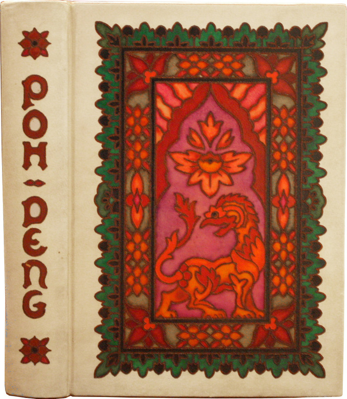
RIVIERE, Pierre-Louis.
Poh-Deng. Scènes de la vie siamoise. Illustrations de H. de La Nézière. Première édition de Poh Deng de Rivière, somptueusement illustrée par Joseph de la Nézière, et merveilleusement reliée par Georges Baudin.
Le présent exemplaire fait partie des 288 exemplaires imprimés sur papier vélin à la cuve des manufactures Blanchet et Kléber et porte le n°83. Paris, L’édition d’art, H. Piazza, s.d. [1913]. In-4 de (2) ff.bl., 179 pp., (3) ff. Couverture supérieure, pp. 51-52, p. 107 et pp. 35-36 répétées deux fois à la fin. Conservé dans une reliure très raffinée spécialement exécutée pour cet ouvrage, veau ivoire en box mosaïqué décoré sur chaque plat d'une grande composition figurative dans les tons rouge, rose, orange et vert, figurant une scène avec un dragon, dos lisse, non rogné, tranche supérieure dorée, couverture et dos conservés. Reliure signée Georges Baudin. 229 x 159 mm.
Riferimento per il libraio : LCS-17951
|
|
|
Rivista Italiana Di Musicologia Edited by Leo S. Olschki; Includes AW. Atlas: Provenienza Del Manoscritto Berlin 78C28: Firenze
Vol. 13 # 1 1978 Includes A.W. Atlas--Provenienza Del Manoscritto Berlin 78.C.28: Firenze O Napoli; R. Brown--Sperimentazione Ritmica in Dallapiccola Tra Liberta E Determinazione; P.E. Carapezza--Canzoni Popolari Alla Siciliana Cioe Alla Catanese Ed Alla Palermitana; J. Chater--Fonti Poetiche Per I Madrigali Di Luca Marenzio; P. Fabbri--Vita Musicale Nel Cinquecento Ravennate: Qualche Integrazione; D. Frosini--Antonio Cesti Da Volterra a Pisa Nel 1649.
Firenze: Societa Italiana Di Musicologia 0035-6867 0035-6867 1978. Periodical Very good plus. 199pp. Index table. Previous owner's name on cover. Note: if purchased in combination with other periodicals bearing this message we will discount the price depending on quantity ordered. Edited by Leo S. Olschki. Includes A.W. Atlas La Provenienza Del Manoscritto Berlin 78.C.28: Firenze O Napoli R. Brown La Sperimentazione Ritmica in Dallapiccola Tra Liberta E Determinazione P.E. Carapezza Canzoni Popolari Alla Siciliana Cioe Alla Catanese Ed Alla Palermitana J. Chater Fonti Poetiche Per I Madrigali Di Luca Marenzio P. Fabbri Vita Musicale Nel Cinquecento Ravennate: Qualche Integrazione & D. Frosini Antonio Cesti Da Volterra a Pisa Nel 1649. Article about Luca Marenzio. Text in Italian Language. Music. Societa Italiana Di Musicologia 0035-6867 Paperback
Riferimento per il libraio : 104705
|
|
|
RIZZI ZANNONI (Giovanni Antonio)
Atlas Géographique contenant la mappemonde et les quatre parties, avec les différents Etats d'Europe
Paris Lattré 1762
Riferimento per il libraio : 001893
|
|
|
Rizzi-Zannoni, Giovanni-Antonio.
Atlas géographique contenant la mappemonde et les quatres parties, avec les différents états d'Europe, dressée sous les yeux, de Mr Rizzi-Zannoni; de la société roïale de Gottingue.
Paris chez Lattré sd (1762), in-16 (12,5 X 8,5 cm), frontispice gravé, page de titre encadrée d'un décor gravé par Legrant, 2 pages d'avertissement, 2 pages de catalogue des cartes, 26 cartes colorées d'époque, le tout monté sur onglets. Maroquin bleu nuit, dos lisse décor doré, plats encadrés d'un triple filet doré et de fleurons dans les angles, tranches dorées. un Mors fendu sur 3 cm, petit manque à la coiffe supérieure, petite usure des coins. (LXX)-(150 gr.).
Riferimento per il libraio : DZN-1434
|
|
|
RIZZI-ZANNONI, (Giovanni Antonio):
Atlas géographique contenant la Mappemonde et les quatre Parties du monde, Avec les différents Etats D’Europe.
Paris, Lattré, 1762, pt. in-8vo, (13x9 cm), frontispice allégorique et le titre gravé aquarellé + 2 ff. (table) + 29 planches doubles (cartes) annoncées dans la table des illustrations, reliure en maroquin grenat d’époque, triple filet d’encadrement sur les plats, dos lisse richement orné or. Tranches dorées. Bel exemplaire.
Riferimento per il libraio : 115102aaf
|
|
|
RIZZI-ZANNONI, Giovanni Antonio ; DESNOS, Louis-Charles. ; M. M. B. B.
Atlas historique de la France Ancienne et Moderne [ ... ] Dressé pour servir à la Lecture de Mess. Velly et Villaret
Par M. Rizzi Zannoni, De l'Académie Rle des Sciences et Belles Lettres de Gottungue, mis au jour et dirigépar le S. Desnis, Ingr. Géogr. pour les Glôbes, sphères et Instrumens de Mathématique, Cet Atlas a été revu, corrigé et considérablement augmenté par MM. B.B. Ingénieurs-Géographes du Roi, 1 vol. in-4 (29 x 22 cm en marges) reliure de l'époque demi-basane marbrée, dos à 5 nerfs orné, s.n. [ Chez Desaint & Saillant ], Rue St Jacques au Glôbe, A Paris, 1782, 2 ff. doubles (titre gravé et dédicace gravée), 57 cartes doubles rehaussées en couleurs et 2 grandes cartes dépliantes rehaussées en couleurs
Riferimento per il libraio : 65686

|
|
|
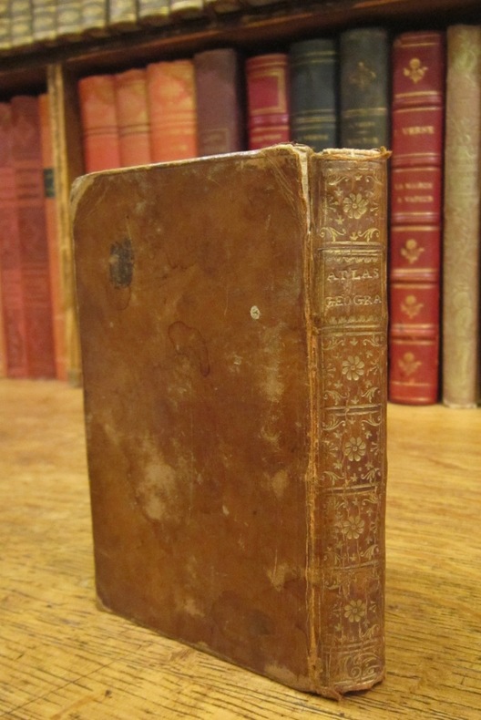
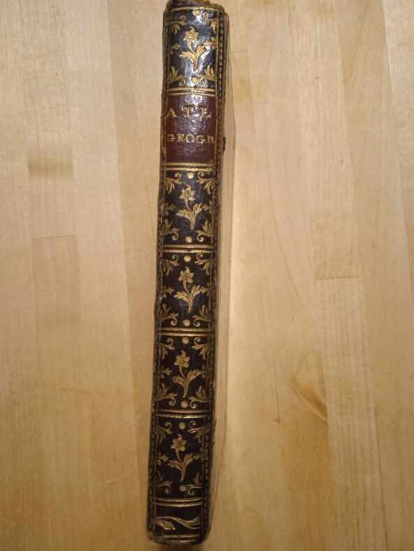
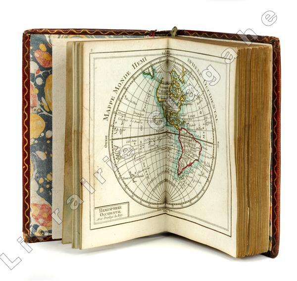
Rizzi-Zannoni (Giovanni Antonio) :
Atlas géographique contenant la Mappemonde et les quatre parties, avec les différents états d’Europe, dressés sous les yeux de Mr Rizzi Zannoni.
Paris, Charles Dien, s.d. (circa avant la Révolution française) ; in 16 (121 mm), maroquin grenat à grain long, filets et titre dorés au dos, filet doré d’encadrement des plats et filet ondulé d’intérieur, tranches dorées (reliure seconde moitié du XVIIIe), ouvrage entièrement monté sur onglets; titre gravé et 29 planches sur feuille double, la première sur les Sphères, en noir et blanc, toutes les autres sont aquarellées à la main, dont 2 mappemondes, l’Europe, l’Asie, l’Afrique, l’Amérique du Nord et l’Amérique du Sud, puis l’Europe et la France en quatre parties.
Riferimento per il libraio : 19883
|
|
|
RIZZI ZANNONI, Ioh. Ant. (aus: WALSER Atlas):
Nova Landgraviatus Turgoviae.... La Turgovie avec le Lac de Constance et des Pays circonvoisins, mit gest. Vignette: Rheni Cataracta infra A rcem Lauffen.
Nürnberg, Homann, 1766, 42x55 cm, Original-Kupferstichkarte, altkoloriert / carte coloriée d’époque, 1 Blatt / 1 feuille 57x62 cm. Schönes Exemplar.
Riferimento per il libraio : 123007aaf
|
|
|
Rizzi Zannoni M.
Les royaumes de Portugal et d'Algarve
1 53x75,5, su carta robusta, a colori, con ricco frontespizio floreale e bandiere a colori, carta ben realizzata e ben conservata, in francese.
|
|
|
ROAD ATLAS
ITALY
MICHELIN
Riferimento per il libraio : SVBLIVCN-9782067192454
|
|
|
ROAD ATLAS
SPAIN & PORTUGAL
MICHELIN
Riferimento per il libraio : SVBLIVCN-9782067192447
|
|
|
Road Atlas Uk
Great Britain Road Atlas 2002
2001-07-16. Good. Ships with Tracking Number! INTERNATIONAL WORLDWIDE Shipping available. May not contain Access Codes or Supplements. May be re-issue. May be ex-library. Shipping & Handling by region. Buy with confidence excellent customer service! unknown
Riferimento per il libraio : 0749529695 ISBN : 0749529695 9780749529697

|
|
|
ROAD ATLAS
Rand McNally Road Atlas for the United States Canada and Mexico. Jointly published with Leahy's Hotel Guide and Travel Atlas.
Chicago: Rand McNally & American Hotel Register Co. 1938. First edition of this merging of two American atlases. Folio 10 1/2 x 16 inches. The Rand McNally section is pp. 1-52 at the beginning and pp. 52-105 at the end. All maps printed in blue and red. The Leahy section starts in the middle and runs from p. 1 to p. 112 and with two more pages. These maps are entirely printed in black and much of the section is take up with listing for hotels in various states. Publisher's green cloth with gilt cover lettering Leahy's. The text block was originally stapled into the covers but has since come loose from the staples but the text block is entirely secure. A very good copy of an unusual publication.As both companies were headquartered in Chicago it is easy to imagine a friendly lunch at which this was discussed. Rand McNally & American Hotel Register Co. hardcover
Riferimento per il libraio : 72459
|
|
|
Road Atlas Uk
Road Atlas Britain Road Atlas
Automobile Association 07/31/2001. Spiral-bound. Used; Good. WE SHIP WITHIN 24 HRS FROM LONDON UK 98% OF OUR ORDERS ARE RECEIVED WITHIN 7-10 DAYS. We believe you will be completely satisfied with our quick and reliable service. All orders are dispatched as swiftly as possible! Buy with confidence! Automobile Association unknown
Riferimento per il libraio : mon0000701440 ISBN : 0749529733 9780749529734

|
|
|
ROBIN NELLY
ATLAS DES MIGRATIONS OUEST-AFRICAINES VERS L'EUROPE, 1985-1993
Eurostat - ORSTOM. 1996. In-4. Broché. Bon état, Couv. convenable, Dos satisfaisant, Intérieur frais. 109 pages. Illustré de nombreux graphiques et cartes en couleur dans et hors texte. Texte sur 2 colonnes. Etiquette de code sur le dos. Tampon et annotations de bibliothèque en page de titre.. . . A l'italienne. Classification Dewey : 912-Atlas, cartes et plans
Riferimento per il libraio : RO40180660 ISBN : 270991347

|
|
|
ROBINSON FRANCIS
ATLAS DU MONDE ISLAMIQUE DEPUIS 1500
EDITIONS DU FANAL. 1987. In-4. Relié. Bon état, Couv. convenable, Dos satisfaisant, Intérieur frais. 238 pages. Nombreuses illustrations en noir et blanc et en couleurs dans le texte et hors texte.. Avec Jaquette. . . Classification Dewey : 912-Atlas, cartes et plans
Riferimento per il libraio : RO30057066
|
|
|
Robinson Francis
Atlas du monde islamique depuis 1500.
Editions du Fanal. 1987. In-4. Relié. Bon état, Couv. convenable, Dos satisfaisant, Intérieur frais. 238 pages - jaquette en bon état - nombreuses illustrations en couleurs et en noir et blanc dans et hors texte - quelques cartes en couleurs dans et hors texte.. Avec Jaquette. . . Classification Dewey : 912-Atlas, cartes et plans
Riferimento per il libraio : R320144618

|
|
 Ricevere i risultati per e-mail
 Scaricare i risultati in PDF
 RSS feed


