|
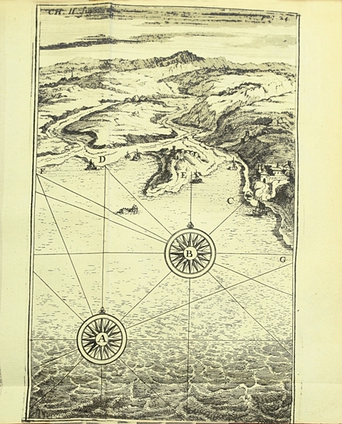
RECLUS ONESIME.
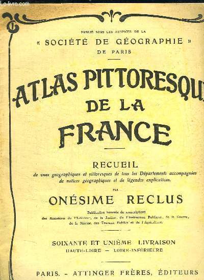
ATLAS PITTORESQUE DE LA FRANCE. RECEUIL DE VUES GEOGRAPHIQUES ET PITTORESQUES DE TOUS LES DEPARTEMENTS ACCOMPAGNES DE NOTICES GEOGRAPHIQUES ET DE LEGENDES EXPLICATIVES. 61em LIVRAISON: HAUTE LOIRE LOIRE INFERIEURE.
ATTINGER.. Non daté. In-4. Broché. Bon état, Couv. légèrement passée, Dos satisfaisant, Intérieur acceptable. De la page 337 à la page 352. Nombreuses photos en noir et blanc dans le texte.. . . . Classification Dewey : 912-Atlas, cartes et plans
Bookseller reference : R150166043
|
|
|
RECLUS ONESIME
ATLAS PITTORESQUE DE LA FRANCE - RECUEIL DE VUES GEOGRAPHIQUES ET PITTORESQUES DE TOUS LES DEPARTEMENTS, ACCOMPAGNEES DE NOTICES GEOGRAPHIQUES ET DE LEGENDES EXPLICATIVES - 3 VOLUMES- TOMES 1 A 3 - PUBLIE SOUS LES AUSPICES DE LA SOCIETE DE GEOGRAPHIE
ATTINGER FRERES. 19EME SIECLE. In-Folio. Relié. Etat d'usage, Couv. convenable, Dos abîmé, Quelques rousseurs. 623 + 639 + 655 Pages. Nombreuses photos et plans en noir et blanc dans et hors texte. Quelques rousseurs naturelles et mouillures sans conséquence pour la lecture. Accrocs sur les plats. Accrocs sur les dos. Tranches de couleurs noir.. . . . Classification Dewey : 912-Atlas, cartes et plans
Bookseller reference : RO80190008
|
|
|
RECLUS ONESIME
ATLAS PITTORESQUE DE LA FRANCE - EN DEUX TOMES - TOMES 1 + 2 - TOME 1 : AIN- COTE D'OR - TOME 2 : COTES DU NORD LOIRE INFERIEURE.
SOCIETE DES ATLAS PITTORESQUES (EDITIONS ATTINGER). NON DATE. In-4. Relié. Bon état, Couv. convenable, Dos satisfaisant, Intérieur frais. 399 pages + 399 pages - contre plats jaspés - nombreuses illustrations et cartes en noir et blanc dans le texte.. . . . Classification Dewey : 912-Atlas, cartes et plans
Bookseller reference : R240134074
|
|
|
Reclus Onésime
Atlas pittoresque de la France Recueil Tome quatrième haut-Rhin - Yonne
Société des atlas pittoresques - Attinger. non daté. In-4. Relié. Bon état, Couv. convenable, Coiffe en tête abîmée, Intérieur frais. 399 pages augmentées de nombreuses photos en noir et blanc dans texte.. . . . Classification Dewey : 912-Atlas, cartes et plans
Bookseller reference : R260273340
|
|
|
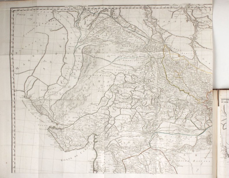
Reclus Onésime
Atlas de la plus grande France- Géographique, économique, politique, départemental, colonial
Attinger Frères. Non daté.. In-Folio. Relié demi-cuir. Etat passable, Coins frottés, Dos satisfaisant, Fortes mouillures. 160 pages+ 160 planches de cartes en couleurs. Contre-plats jaspés. Mouillures, parges partiellement collées. Nombreuses cartes en couleurs et en noir et blanc, in et hors texte. 3 colonnes de texte. Papier jauni.. . . . Classification Dewey : 912-Atlas, cartes et plans
Bookseller reference : RO30372787
|
|
|
Reclus Onésime
Atlas pittoresque de la France - Tome 2 : Côtes du Nord - Loire-Inférieure.
Attinger. non daté. In-4. Relié. Bon état, Couv. convenable, Dos satisfaisant, Intérieur frais. 399 pages - nombreuses photos, cartes en noir et blanc dans le texte.. . . . Classification Dewey : 912-Atlas, cartes et plans
Bookseller reference : RO80277621

|
|
|
RECLUS O.
ATLAS PITTORESQUE DE LA FRANCE 3 VOL.Recueil de vues geographiques et pittoresques de tous les departements, accompagnees de notices geographiques et de legendes explicatives.
ATTINGER. SD (vers 1910) 3 VOL. IN4 Reliure percaline rouge, titre or. Recueil de vues geographiques et pittoresques de tous les departements, accompagnees de notices geographiques et de legendes explicatives. Tome 1. Departements : Ain a Eure et Loir. Cartes et illustrations n&b dans le texte. 615 p. Tome 2. Departements : Finistere a Nord. Cartes et illustrations n&b dans le texte.: . 635 p. Tome 3. Departements : Oise a Yonne. Cartes et illustrations n&b dans le texte. 655 p..
Bookseller reference : 10709
|
|
|
RECLUS ELISEE
NOUVELLE GEOGRAPHIE UNIVERSESLLE - LA TERRE ET LES HOMMES - 2 TOMES - 1 : L'EUROPE MERIDIONALE - 2 : LA FRANCE
LIBRAIRIE HACHETTE ET CIE. 1876. In-4. Relié demi-cuir. Etat d'usage, Coins frottés, Dos satisfaisant, Intérieur frais. 1012 + 959 pages. Nombreuses gravures de cartes et de paysages en noir et blanc dans le texte et hors texte. Titre, auteur, tomaison, 4 fleurons dorés sur le dos cuir noir.. . . . Classification Dewey : 912-Atlas, cartes et plans
Bookseller reference : RO30092322
|
|
|
Reclus (Onésime)
La Terre à vol d'oiseau.
français 2 tomes en 2 volumes in-12 de 682 et 672 pp.; demi-toile bleue, plats imprimés de l'éditeur. Troisième édition, illustrée de 176 et 194 gravures sur bois. Exemplaire réformé de bibliothèque, quelques tampons.
|
|
|
RECLUS ONESIME.
ATLAS PITTORESQUE DE LA FRANCE 65e LIVRAISON : JURA.
ATTINGER.. Non daté. In-4 Carré. Broché. Bon état. Couv. remarquable. Dos satisfaisant. Intérieur acceptable. De la page 257 à la page 272. Nombreuses photos en noir et blanc dans le texte.

|
|
|
RECLUS ONESIME.
ATLAS PITTORESQUE DE LA FRANCE. RECEUIL DE VUES GEOGRAPHIQUES ET PITTORESQUES DE TOUS LES DEPARTEMENTS ACCOMPAGNES DE NOTICES GEOGRAPHIQUES ET DE LEGENDES EXPLICATIVES. 61em LIVRAISON: HAUTE LOIRE LOIRE INFERIEURE.
ATTINGER.. Non daté. In-4 Carré. Broché. Bon état. Couv. légèrement passée. Dos satisfaisant. Intérieur acceptable. De la page 337 à la page 352. Nombreuses photos en noir et blanc dans le texte.

|
|
|
RED GUIDE
LONDON WITH LARGE SECTION PLANS OF CENTRAL LONDON MAP OF LONDON AND TWELVE MILES ROUND RAILWAY MAP AND NUMEROUS OTHER PLANS
WAERD LOCK ET CO.. Non daté. In-8. Relié. Bon état, Couv. convenable, Dos satisfaisant, Intérieur frais. 287 pages avec quelques illustrations et photographies en noir et blanc dans le texte. De nombreuses cartes dépliantes en noir et blanc.. . . . Classification Dewey : 912-Atlas, cartes et plans
Bookseller reference : RO30115218
|
|
|
Reference Atlas Staff; Rand McNally Staff
Atlas World Atlas Hardback
Rand McNally 2004. Hardcover. Very Good. Disclaimer:A copy that has been read but remains in excellent condition. Pages are intact and are not marred by notes or highlighting but may contain a neat previous owner name. The spine remains undamaged. At ThriftBooks our motto is: Read More Spend Less.Dust jacket quality is not guaranteed. Rand McNally hardcover
Bookseller reference : G0528965808I4N00 ISBN : 0528965808 9780528965807

|
|
|
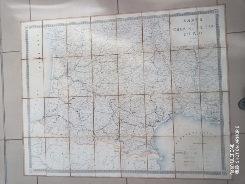
Regnier et Dourdet
Carte entoilée dépliante des chemins de fer du Midi - Lignes nouvelles
Chez l'auteur. 1875. In-Plano. En feuillets. Bon état, Tâchée, Dos satisfaisant, Quelques rousseurs. Une carte entoilée et colorée. Echelle 1/500000. Environ 136 x 104 cm. Trois photos disponibles.. . . . Classification Dewey : 912-Atlas, cartes et plans
Bookseller reference : RO80240269
|
|
|
REGIE AUTONOME DES TRANSPORTS PARISIENS
Plan Officiel de Paris Banlieue. Autobus - Métro
CHAIX. Non daté. In-16. Broché. Etat d'usage, Couv. convenable, Dos satisfaisant, Pliures. Carte dépliante en couleurs, de 52 / 33 cm.. . . . Classification Dewey : 912-Atlas, cartes et plans
Bookseller reference : RO80135599
|
|
|
REICHARD (Christian Gottlieb)
Orbis terrarum antiquus quondam in usum iuventutis descriptus.. Editio quinta. Denuo delineavit et commentario illustravit Albertus Forbiger
Nuremberg, Fr. Campe, 1853 in-4 oblong (36 x 41 cm), [2]-20 pp. de texte sur deux colonnes, et 20 cartes aux contours rehaussés de couleurs, chagrin vert, dos lisse muet, encadrements de filets à froid sur les plats, titre poussé en lettres dorées au centre du plat supérieur (reliure de l'éditeur). Rousseurs, mais bon exemplaire.
Bookseller reference : 179529
|
|
|
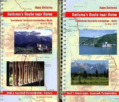
Reitsma Hans
Reistsma's route naar Rome Toeristische fietsroute Amsterdam - Rome 2 volumes Deel 1: Amsterdam - Garmisch-Partenkirchen 5è druk, 2019 Deel 2: Garmisch-Partenkirchen - Ferrara 4è druk, 2016
Chez l'auteur. 2018. In-8. Relié. Très bon état, Couv. convenable, Dos satisfaisant, Intérieur frais. 166 + 160 pages augmentées de quelques photos en couleurs dans texte. reliure spirale. Couverture 2ème plat contrepliée, en couleurs.. . . . Classification Dewey : 912-Atlas, cartes et plans
Bookseller reference : R260271759
|
|
|
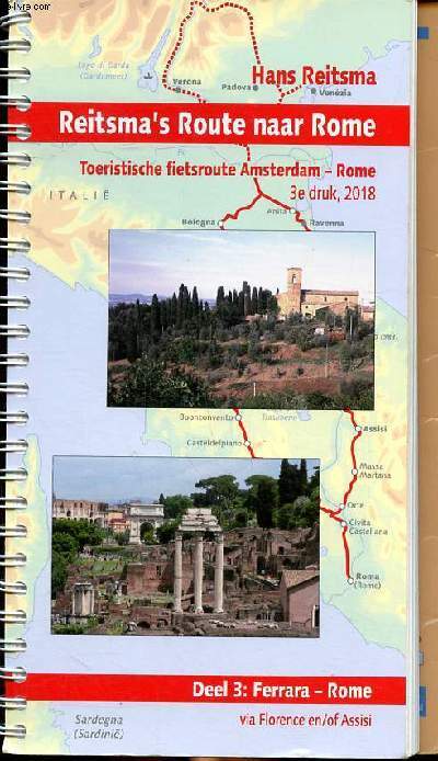
Reitsma Hans
Reitsma's Route naar Rome Toeristische fietsroute Amsterdam - Rome 3è druk 2018 Deel 3 Ferrara - Rome
Chez l'auteur. 2018. In-8. Relié. Très bon état, Couv. convenable, Dos satisfaisant, Intérieur frais. 166 pages augmentées de nombreuses photos et plans géographiques en couleurs dans texte. Reliure spirale.. . . . Classification Dewey : 912-Atlas, cartes et plans
Bookseller reference : R260271930 ISBN : 906455840
|
|
|
Reichard, Christian Gottlieb
Orbis terrarum antiquus a Christiano Theophilo Reichardo quondam in usum iuventutis descriptus. Denuo delineavit et commentario illustravit Albertus Forbiger. 6. Auflage !
Nürnberg, J. L. Lotzbeck ohne Jahr, (1861).
Bookseller reference : 100753

|
|
|
Reiche, Louise Remanna von
Etui-Atlas der Erde. Neudruck der Ausgabe von 1831. Mit einem Nachwort von Karl Heinz Jürgelt. 2. Auflage.,
Rostock, Hinstorff Verlag 1987. Mit 26 farbigen Abbildungen., ca. 50 unpaginierte Seiten., 7cm x 7,5cm. braunes goldgeprägtes OLeder im OPappschuber (dieser etwas berieben).,
Bookseller reference : 73434

|
|
|
Reichenbach H. G. Ludwig Heinrich Gottlieb Ludwig Reichenbach H. G. Ludwig Heinrich Gottlieb Ludwig. Central Atlas feur Zoolog
Die vollstèandigste Naturgeschichte der Affen Volume Abt.:Bad.2 Text 1862 1862 Leather Bound
2019. Leather Bound. New. Leather Binding on Spine and Corners with Golden Leaf Printing on round Spine. Reprinted in 2019 with the help of original edition published long back 1862. This book is printed in black & white sewing binding for longer life Printed on high quality Paper re-sized as per Current standards professionally processed without changing its contents. As these are old books we processed each page manually and make them readable but in some cases some pages which are blur or missing or black spots. We expect that you will understand our compulsion in these books. We found this book important for the readers who want to know more about our old treasure so we brought it back to the shelves. Hope you will like it and give your comments and suggestions. Lang: - ger Vol: - Volume Abt.:Bad.2 Text 1862 Pages 310. EXTRA 10 DAYS APART FROM THE NORMAL SHIPPING PERIOD WILL BE REQUIRED FOR LEATHER BOUND BOOKS. FOLIO EDITION IS ALSO AVAILABLE. Volume Abt.:Bad.2 Text 1862 hardcover
Bookseller reference : LB1111006214591
|
|
|
Reichenbach H. G. Ludwig Heinrich Gottlieb Ludwig Reichenbach H. G. Ludwig Heinrich Gottlieb Ludwig. Central Atlas feur Zoolog
Die vollst�andigste Naturgeschichte der Affen Volume Abt.:Bad.2 Text 1862 1862 Hardcover
2020. Hardcover. New. Lang: - ger Vol: - Volume Abt.:Bad.2 Text 1862 Pages 310. Reprinted in 2020 with the help of original edition published long back 1862. This book is printed in black & white Hardcover sewing binding for longer life with Matt laminated multi-Colour Dust Cover Printed on high quality Paper re-sized as per Current standards professionally processed without changing its contents. As these are old books we processed each page manually and make them readable but in some cases some pages which are blur or missing or black spots. We expect that you will understand our compulsion in these books. We found this book important for the readers who want to know more about our old treasure so we brought it back to the shelves. Any type of Customisation is possible with extra charges. Hope you will like it and give your comments and suggestions. Volume Abt.:Bad.2 Text 1862 hardcover
Bookseller reference : 1111006214591
|
|
|
Reichsamt für Wetterdienst (Hg.)
Internationaler Atlas der Wolken und Himmelsansichten. Auszug zum Gebrauch für den Beobachter aus der vollständigen Ausgabe. Neudruck der vom Internationalen Meteorologischen Komitee (Kommission für das Studium der Wolken) herausgegebenen ersten Auflage.
Berlin, 1940.
Bookseller reference : 17925

|
|
|
Reichsstelle für das Schul- und Unterrichtsschrifttum [Hrsg.]
Deutscher Schulatlas.
Dortmund [u.a.], Crüwell [u.a.], 1942. 4° 34 S. überwiegend Kt. brosch. Einband berieben und bestossen, am Rücken geklebt und mit kleinem Aufkleber, fleckig, innen Aufkleber.
Bookseller reference : 34277BB
|
|
|
REINOSO, José.
Atlas geográfico universal en veinte mapas arreglados al Meridiano de Madrid y grabados por... Edición novísima aumentada con un texto explicativo por D. Eugenio G. Barbarin.
Madrid, Sucesores de Hernando, s.a. (hacia 1900), 25,5 x 17 cm., 20 págs. + 20 mapas plegados en colores. (Falto de las cubiertas originales).
|
|
|
Reischl, P.Marcellino
Atlas Historicus, utramque ab orbe condito Historiam Ecclesiasticam et Profanam ac omnes scientias ad historiam necessarias complectens (...) atque ad haec usque tempra continuatus (..). ERSTAUSGABE.
Augustae Vindelicorum ( Augsburg), Rieger, 1758. 512 Seiten. Index rerum omnium memorabilium. Pappband der Zeit 20cm
Bookseller reference : 303047

|
|
|
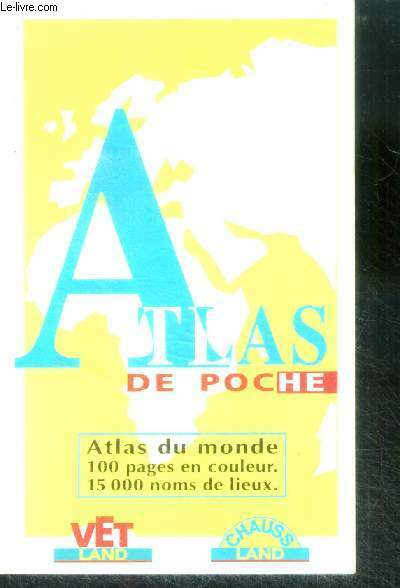
REKACEWICZ philippe (geographe) ,marin cecile
Atlas de poche, atlas du monde, 100 pages en couleur, 15000 noms de lieux
VET LAND / CHAUSS LAND / LE LIVRE DE POCHE. 1996. In-12. Broché. Bon état, Couv. convenable, Dos satisfaisant, Intérieur frais. Environ 110 pages. Nombreuses planches illustrées de cartes couleur.. . . . Classification Dewey : 912-Atlas, cartes et plans
Bookseller reference : RO40041587
|
|
|
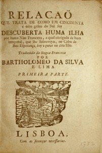
Relacao que trata de como em cincoenta e oito...
Relacao que trata de como em cincoenta e oito graos do Sul foy descuberta huma ilha por huma Nao Franceza, a qual obrigada de hum temporal, que lhe fobreveyo, no Cabo da Boa Esperança, foy a parar na dita Ilha. Traduzida da lingua Franceza por Bartholomeo Da Silva e Lima. Primera [- Segunda] Parte. Réunion de deux textes rares relatant les récentes découvertes de deux îles, par Français et Espagnols.
Très intéressante réunion de deux textes de la plus grande rareté relatant les récentes découvertes de deux iles, par les Français et les Espagnols. Lisbonne, s.d. [vers 1752]. -[Suivi de]: II/ Noticia Certa do Descobrimento de huma Nova Terra, modernamente apparecida, e descoberta por huma nao Hespanhola… Lisbonne, Domingos Rodrigues, 1757. 2 ouvrages en 1 volume petit in-4 de: I/ 8-8 pp., gravure d’un bateau avec une île dans le lointain répétée sur les 2 titres; II/ 8 pp. Petite déchirure au f. de titre du 2e ouvrage sans atteinte au texte, papier bruni. Conservé broché.
Bookseller reference : LCS-6946
|
|
|
REMOND RENE
ATLAS DE L'HISTOIRE DE FRANCE.
FRANCE LOISIRS / PERRIN. 1996. In-4. Relié. Bon état, Couv. convenable, Dos satisfaisant, Intérieur frais. 254 pages. Nombreuses cartes et illustrations en couleur dans le format texte et hors texte.. Avec Jaquette. . . Classification Dewey : 912-Atlas, cartes et plans
Bookseller reference : R240047323
|
|
|
RENE BOLZE (DRESSEE PAR)
"CARTE DE LA FRONTIERE AUSTRO-ITALIENNE. ""LA SCIENCE ET LA VIE""."
AU BUREAU DE LA REVUE. NON DATE. In-Folio. Broché. Etat d'usage, Couv. légèrement passée, Dos satisfaisant, Intérieur frais. Carte en couleurs de 45 x 60 cm à l'échelle 1/760 000e.. . . . Classification Dewey : 912-Atlas, cartes et plans
Bookseller reference : R260167563
|
|
|
RENAU D'ELISSAGARAY, Bernard
De la Théorie de la Manœuvre des vaisseaux. Édition originale rare du meilleur livre du « célèbre marin de Louis XIV »
Édition originale du traité de manœuvres navales du « célèbre marin de Louis XIV ». Exemplaire relié en maroquin ancien orné d’un décor à la grotesque. Paris, Estienne Michallet, 1689. In-8 de (6) ff. dont un frontispice, 117 pp., 25 pl. dépliantes hors texte. Maroquin rouge, triple filet doré sur les plats, dos lisse orné à la grotesque, pièce de titre de maroquin vert, coupes décorées, dentelle intérieure, tranches dorées. Reliure ancienne. 175 x 115 mm.
Bookseller reference : LCS-15776
|
|
|
Rennell, James
Description historique et géographique de l'Indostan, traduite de l'anglais par J.B. Bouscheseiche, sur la septième et dernière édition, à laquelle on a joint des Mélanges d'Histoire et de Statistique sur l'Inde, traduits par J. Castéra. + Atlas : Recueil de cartes géographiques pour la description de l'Indostan.
1800 Paris, Buisson, Bosange, Masson et Besson, Treuttel et Würtz (Imp. de Poignée), an VIII (1800). 4 volumes dont un d'atlas. Volumes de texte : 20,5 x 14 cm (R), in-8, XXXVIII - 299 (2) pp., 410 pp., 362 pp., reliure de l'époque en demi-basane fauve, dos lisses richement ornés, pièces de titre et de tomaison, toutes tranches jaunes. Volume d'Atlas : 29 x 23 cm (R), in-4, 39 pp. - 11 cartes, la plupart dépliantes et certaines finement rehaussées de couleurs, reliure de l'époque en demi veau glacé, dos lisse orne de filets et fleurons dorés, pièce de titre, tranches marbrées.
Bookseller reference : 651
|
|
|
René Euloge
Les fils de l'ombre
1932 Editions Berger Levrault broché, 176p. trés bon état.
Bookseller reference : 12033
|
|
|
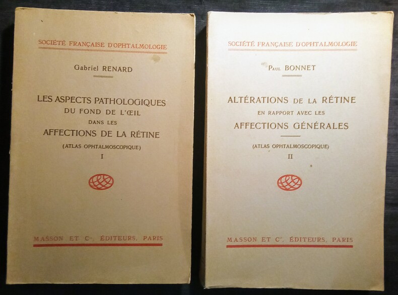
RENARD (Gabriel) & BONNET (Paul)
Les Aspects Pathologiques du Fond de l'Oeil dans les Affections de la Rétine (Atlas Ophtalmologique).- Altérations de la Rétine en Rapport avec les Affections Générales (Atlas Ophtalmologique).
Paris, Masson et Cie, Éditeur, 1946-1947. 2 volumes in-8 (25x17cm) brochés de couvertures de la maison d'édition. 170pp. +32 planches de 2 figures par planches. + 253pp. + 36 planches de 2 à 5 figures par planches.
Bookseller reference : WOC-2108
|
|
|
Renoüard Jeanne Tellier Marine
Mes vacances éco responsables
AKINOME 2021 40 pages 19x22x0 9cm. 2021. Broché. 40 pages.
Bookseller reference : 500114042

|
|
|
Renaud, Paul
Cartes géographiques anciennes. Atlas. Rares cartes d'Amérique et du Canada. Drouot-Richelieu - Salle 9. Le jeudi 28 octobre 1999 a 14 heurs. [By Paul Renaud and Béatrice Loeb-Larocque].
Paris: P. Renaud 1999. 52 Seiten. Mit vereinzelten Illustrationen. Gr. 8° (22,5-25 cm). Illustrierte Orig.-Broschur. [Softcover / Paperback].
Bookseller reference : 3122706

|
|
|
Renn, Manfred und Werner König
Kleiner bayerischer Sprachatlas. ZWETIE(2.), KORRIGIERTE Auflage.
München : Deutscher Taschenbuch-Verlag, 2006. 256 S., graphische Darstellungen, zahlreiche farbige Karten , 23 cm Originalkarton
Bookseller reference : 264315

|
|
|
RESTE (LIEUTENANT)
CARTE TOILEE EN NOIR ET BLANC DE : DAR CHAFAI - MAROC - BENI MESKINE - au 200.000e - d'apres l'itineraire levé avec la colonne TRIBALET du 17 au 27 juin 1910. / DE DIMENSION 56 Cm X 53 Cm environ.
NON PRECISE. VERS 1910. In-Plano. En feuillets. Etat d'usage, Livré sans Couverture, Dos satisfaisant, Intérieur frais. 1 CARTE TOILEE DEPLIANTE EN NOIR ET BLANC DE DIMENSION 56 Cm X 53 Cm environ. 2 PHOTOS DISPONIBLES - . . . . Classification Dewey : 912-Atlas, cartes et plans
Bookseller reference : R320072791
|
|
|
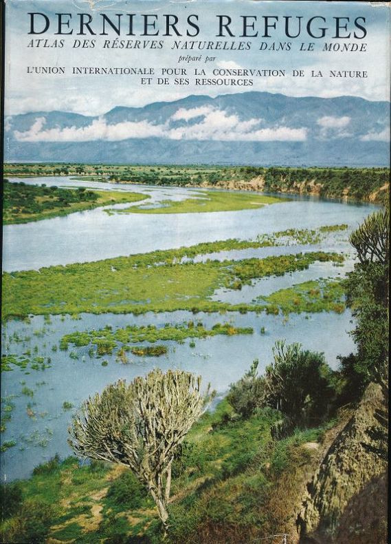
RESERVES NATURELLES ]
Derniers refuges. Atlas commenté des réserves naturelles dans le monde
Elsevier Paris, Elsevier, 1956. In-4 reliure éditeur sous jaquette de 214 pages illustrées. Préface de Roger Heim. Bel exemplaire.
Bookseller reference : 40911
|
|
|
Resen (Resenii), Peder Hansen (Petri)
Kobberstikkene fra Atlas Danicus 1677 (Atlas Danicus Dicatus Augustissimo Monarchae Christiano V., Anno M.DC.LXXVII. [1677]. Udgivet med efterskrift og kommentarer af Ib Rønne Kejlbo
København; Rosenkilde og Bagger, 1974. 109 S. (ausklappbar), 44 S. Gr.-4° (=35-40cm), Hardcover/Pappeinband (Pergament-Imitat)
Bookseller reference : 43247

|
|
|
Reutern, Gerhard-Michael von, Hans Joachim von Büdingen und Hans Joachim von Büdingen
Ultraschalldiagnostik der hirnversorgenden Arterien : Dopplersonographie der extra- und intrakraniellen Arterien, Duplex-Sonographie. Gerhard-Michael von Reutern ; Hans Joachim Büdingen. Geleitw. von Hans-Joachim Freund. [Zeichn. von Horst Schumacher u. Brigitte Zwickel-Nölle]
Stuttgart ; New York : Thieme. 1989. XVIII, 336 S. : 701 Ill. u graph. Darst. 27,5*20 cm. OPappband.
Bookseller reference : 138512

|
|
|
Reverdy (Georges)
Atlas historique des routes de France.
français Grand in-4 de 182 pp.; album toilé sous jaquette illustrée de l'éditeur.
|
|
|
REYNAUD-DULAURIER Georges, FULLARD Harold, DARBY H. C.
Atlas général Larousse.
Paris, Librairie Larousse, 1978. 24 x 30, 128 pp., nombreuses cartes en couleurs, reliure d'édition + jaquette + rhodoïd, bon état.
Bookseller reference : 73730 ISBN : 2030009229
|
|
|
REZA SHIRAZIAN.
Atlas of old Tehran.= Atlas-e Tehran-e qadîm. Introduction by Cyrus Alai.
New Persian Original bdg. HC. Folio. (34 x 24 cm). In Persian with abstracts in English. 392 p., color and b/w ills. Tehran became a major city of Iran after 1554 A.D. during the Safavid period when Shah Tahmasb I, son of Shah Ismail, ordered the implementation of two large-scale public works. The first project was the construction of ramparts and moats surrounding the entire city, which defined the city's perimeters and increased its defense. The rampart consisted of 114 towers, representing the 114 chapters within the Holy Quran and enclosed an area of 4.35 km2. The second project was the establishment of the bazaar, the heart of the industrial and commercial activities of the city, surrounded by numerous holy shrines. However, it was 240 years later in the Spring of 1796 A.D. that Tehran became the national capital of Iran, during Agha Mohammad Khan Qajar's reign. 2016 A.D. actually marks the 220th year since Tehran became the political centre of Iran. The first known map of Tehran (page 18), a Russian spy map, dates back to 1826 A.D. The next Russian map of Tehran (page 24) from 1852 A.D. was translated into Persian and presented as a gift to Naser al-Din Shah Qajar (page 29). After the establishment of the military polytechnic school in 1851 A.D. and the arrival of Europe an military instructors, the importance of accurate topographical maps was recognized by the nation's leaders. The Austrian artillery trainer for cannons, August Karl Krziz, coordinated in 1858 A.D. the preparation of the maps of Tehran (page 39) and its surrounding area (page 35). This was the beginning of scientific cartography in Iran. By 1863 A.D., maps of Tehran Province for the purpose of tax collection (page 58) were being produced by engineer Abdul Rasool Khan. Tehran dramatically expanded after a huge flood in 1867 A.D. destroyed a large portion of the Safavid period ramparts and moats, after which Alexander Bohler, a French military instructor, designed a new and enlarged rampart and moat enclosure. Within four years between 1867 A.D. and 1871 A.D., Tehran grew from 4 .35 km2 to 19.75 km2 with these new constructions. By 1891 A.D., a highly detailed and technical map of Tehran (page 64) had been produced by Abdul Ghafar Najmolmoq. During the reigning years of Mozafar al-Din Shah, Mohammad Ali Shah, and Ahmad Shah, maps for Tehran postal services (page 126) and Tehran provincial delineation (page 127) were produced. During these years, the Russian, British and French prepared several geopolitical maps of the region including Tehran. For example, the map on page 323 reproduces a map prepared in 1892 A.D. by the British Survey of India at the scale of 1:506,880. In 1914 A.D., German publisher Wagner & Debes prepared a touristic map of Tehran (page 134). In 1922 A.D. the Ministry of Culture's Investigation Section prepared a map of schools in Tehran (page 138). During the Pahlavi I period (1925~1941 A.D.), modernization of Tehran became a national priority. By 1930 A.D. a map for street enlargement in Tehran (page 158) had been published. In 1932 A.D., the demolition of the Naser al-Din Shah Qajar period ramparts began simultaneous to further expansion of urbanized Tehran. The 1936 A.D. military map of Tehran (page 169) is testimony to the changes in the urban morphology of this period. The creation of a dedicated military cartographic service in 1935 A.D. marked an important milestone in the history of cartography in Iran. The 1937 A.D. urban development plan of Tehran (page 170) clearly shows the new streets, squares and urban development envisioned. The first known aerial photograph of Tehran dating from 1940 A.D. (page 177) displays the realization of this urban development plan. After the invasions by the Russians, British and Americans in 1941 A.D., cartographic activities in Iran suddenly increased. Sergeant Mohammad Reza Ghaffari privately published maps of Tehran [.] The above mentioned maps are a few representative samples of the over 270 maps
|
|
|
RHEINWALD, Goetz:
Atlas der Vogelwelt.
Stuttgart, Unipart Verlag, 1994, in-4to, 270 S. illustr. mit zahlreichen farbigen Zeichnungen, Original-Pappband illustr.
Bookseller reference : 82040aaf
|
|
|
Rheinhard, Arminius (Ed.)
Atlas Orbis Antiqui.
Stuttgart, C. Hoffmann, 1860. In usum scholarum ill. Halbleinen / gebundene Ausgabe
Bookseller reference : 30293
|
|
|
RHODE, C.E.:
Historischer Schul-Atlas zur alten, mittleren und neueren Geschichte. 12. Aufl.
Glogau, Flemming, o.J. (ca. 1900), gr. in-8vo, 64 S. + 89 kol. Karten auf 30 Blättern, Original-Leinenband.
Bookseller reference : 63667aaf
|
|
|
RHODES, Alessandro de / MACHAULT, Jacques de
Relation de la mission des Pères de la Compagnie de Jésus. Etablie dans le Royaume de Perse par le R. P. Alexandre de Rhodes. Edition originale de cette relation de voyage en Perse par le Père Alexandre de Rhodes
Édition originale de la plus grande rareté de cette relation de la mission entreprise en Perse par le Père Alexandre de Rhodes. Paris, Jean Henault, 1659.In-8 de (1) f.bl., (6) ff., 115 pp., (1) p., (1) f.bl. Relié en plein vélin souple de l’époque, dos lisse avec le titre manuscrit en tête. Reliure de l’époque. 162 x 116 mm.
Bookseller reference : LCS-13109
|
|
|
RHODES, Alessandro de
Relazione de'félici successi della Santa Fede Predicata Da Padri della Compagnia di Giesu nel regno di Tunchino alla santita di N. S. PP Innocenzio Decimo. Oeuvre rare sur les missionnaires Jésuites en Chine
Récit des missions en Chine par un jésuite français alors que la France est profondément déchirée entre catholiques et protestants. Édition originale conservée dans son vélin de l'époque. Rome, 1650.In-4 de (I) f. bl, 8 ff. préliminaires, une carte dépliante, 326 pp., (I) f. de corrections avec restauration de papier en marge latérale sans atteinte au texte. Vélin ivoire souple. Reliure de l'époque. 222 x 153 mm.
Bookseller reference : LCS-13350
|
|
|
Rhode, C. E
Historischer Schul-Atlas zur alten, mittleren und neueren Geschichte - 89 Karten auf 30 Blättern
Glogau, Flemming, ca1880. Ln, 63S. Text+ Karten, gutes Exemplar
Bookseller reference : 05095

|
|
 Receive by email
 Download as PDF document
 RSS feed


