|
Kornerup, Andreas; Wanscher, J.H.
Reinhold Color Atlas
224 pages. "Here are 1,266 answers to your color problems: systematically arranged gallery of color swatches to guide you in comparing, matching or identifying color samples - as illustrated on the cover.... Of pocket size but encyclopaedic in scope. The introductory text outlines the organization and the use of the color atlas; the color dictionary and key to the plates in the back of the book provide a simple system of cross-reference and identification." - from dust jacket. Please note: Color finder tool not included. Card pocket inside front board. Ink stamps to front endpaper. No other markings. Binding sound. Average wear to book. Above-average wear to dust jacket which is missing from front panel both a 3"x1" chunk from top edge and a 1/2"x3/4" piece from the upper left corner. Half-inch tear to top edge of back panel. Overall, a sound working copy. Book

|
|
|
Korth, Carl
Atlas der klinischen Elektrokardiographie. Mit 333 Abbildungen im Text.
Berlin/München, Urban & Schwarzenberg, 1949. 4°. VII, 182 Seiten. Mit einem Sachverzeichnis. Grüner Originalleinenband mit goldgeprägten Titeln. (Schmaler Rand an Stehkante angeblasst. 0,5 cm einseitiger Einriss im Stehkapital). - 1. Auflage. Ansonsten ein gut erhaltenes und sauberes Exemplar; keine Eintragungen.
Bookseller reference : 30220AB
|
|
|
KOVALESKY PIERRE
ATLAS HISTORIQUE ET CULTUREL DE LA RUSSIE ET DU MONDE SLAVE.
ELSEVIER. 1961. In-Folio. Relié. Bon état, Couv. convenable, Dos satisfaisant, Intérieur frais. 216 pages - 15 cartes en couleurs hors texte - quelques cartes en noir et blanc dans le texte - nombreuses illustrations en noir et blanc - rares phrases soulignées au crayon à papier sans conséquence sur la lecture - quelques illustrations en noir et blanc hors texte légendées - 3 photos disponibles .. . . . Classification Dewey : 912-Atlas, cartes et plans
Bookseller reference : R240094325
|
|
|
KOVALEVSKY Pierre
Cultuurhistorische atlas van Rusland en de Slavische wereld
, Brussel, Meddens 1962, vi + 218pp + 629 zw/w.ills.+ 15 kaarten in kleur, linnen band, mooie staat, G22012
Bookseller reference : G22012
|
|
|
KOVALEVSKY Pierre
Cultuurhistorische atlas van Rusland en de Slavische wereld
Brussel, Meddens 1962, vi + 218pp + 629 zw/w.ills.+ 15 kaarten in kleur, linnen band, mooie staat, G22012
|
|
|
Kraack, Detlev
Der Flensburger »Atlas Major«.
Flensburg, Schriften der Landeszentralbibliothek Schleswig-Holstein 3, 1997. Ein Sammelatlas zum Großen Nordischen Krieg und zu den Türkenkriegen (Karten und Atlanten in der Landeszentralbibliothek Schleswig-Holstein, Band 1) 152, 23 S. (21x21,5 cm) illustrierter Pappband / gebundene Ausgabe
Bookseller reference : 60934
|
|
|
Krallert, Wilfried
Atlas zur Geschichte der deutschen Ostsiedlung / bearb. von Wilfried Krallert...
Bielefeld ; Berlin ; Hannover: Velhagen & Klasing, 1958. 24, 32 S. mit Abb., 24 S. Kt. 4°. Ill. OLwd. (Monographien zur Weltgeschichte : N.F. ; 4)
Bookseller reference : 45858
|
|
|
Krautwald, M.-E., B. Tellhelm E. F. Kaleta u. a
Atlas zur Röntgenanatomie und Röntgendiagnostik der Ziervögel. Ins Engl. übertr. von Walter G. Siller ; Andrew G. Burnie. Mit 163 Fotos, 114 Zeichnungen und 2 Tabellen.
Berlin und Hamburg : Paul Parey, 1992. 211 S. : zahlr. Ill. 4°, O.Pp.; ohne Schutzumschlag
Bookseller reference : 158371

|
|
|
Krejca, J. und A. Jakabova
Steingartenpflanzen - Ein farbiger Atlas der schönsten Steingartenpflanzen Mit 130 Farbtafeln und 11 Schwarzweißzeichnungen
Berlin, VEB Deutscher Landwirtschaftsverlag, 1987. 2., unveränderte Auflage 303 Seiten , 21 cm, Hardcover/Pappeinband
Bookseller reference : 43144

|
|
|
Kremling, Dr. Ernst
Grosser Weltatlas. PERMANENTAUSGABE. Mit 140 vielfarbigen Kartenseiten, meist ausklappbar; rund 178000 Namen. Spezialkarten von Mitteleuropa im Maßstab 1:750000. Thematische Spezialkarten. 9 Tafeln. Geographische Statistik, aktueller Teil, Länderlexikon. 52 Farbbilder aus aller Welt. Zwei Register. Gesamtumfang mehr als 400 Seiten.
München, JRO - Verlag München, 1958. 2°. ORIGINALganzleinen mit 6 Bünden, Schuber und GOLDGEPRÄGT. [4 Warenabbildungen]
Bookseller reference : 31423

|
|
|
Kremling, Ernst
JRO Atlas für Kraftfahrer und alle Reisenden - Nord-, West- und Süddeutschland, Nordostschweiz, Westösterreich Mit 108 6-farbigen Kartenseiten, 86 3-iarbigen Städtedurchfahrtsplänen und einem Ortsregister, Mit JRO-Führer der Westzonen
München, JRO-Verlag, 1949. 8. Auflage 299, 45 Seiten , 24 cm, Leinen
Bookseller reference : 39151

|
|
|
Kremling, Ernst
Russland. Union der sozialist. Sowjet-Republiken.
München, Iro-Verl., 1939. 8°. 55 S., Mit e. 5-farb. Kt. im Maßstab 1:18000000 u. 3 Spez. Kt. Schnitt und Seiten etwas nachgebräunt, ans. altersgem. guter Zustand Wirtschafts-geographische Iro-Schrift ; Nr 1.
Bookseller reference : 10553BB
|
|
|
Kremling, Ernst (Vorwort)
Großer JRO Weltatlas. Permanentausgabe. Teil I: Die ganze Welt. Teil II: Spezialkarten von Mitteleuropa. Teil III: Bevölkerungs-, Verkehrs- und Wirtschaftskarten.
München, IRO Verlag, 1960. Originalleinen. Folio
Bookseller reference : 259184

|
|
|
Kremling, Ernst . Herausgeber. Fochler-Hauke, G. . Bearbeiter
IRO Weltwirtschafts-Atlas. Atlas für Politik und Zeitgeschichte.
München., JRO-Verlag., 1961. Permanente Augabe. Band 1 und Band2. Lose-Blattsammlung, zwei Ordner enthalten 174 doppel- oder vierseitige auffaltbare Karten, teilweise mit zusätzlichen Statistikblätterrn, teilweise mit #Unterkarten-Bläzzer. Am Ende IX Karten (teilweise mehrfach ausfaltbar ) Weltereignisse 1956 - 1960. Zustand: Titelblatt, Titelblattrückseite und hinterer Einbandinnendeckel mit Bibliotheksstempel. Abgesehen hiervon sind die Karten in gutem Zustand (an der Lochung Leinenverstärkt). 4°. S ORingordner.
Bookseller reference : 037713
|
|
|
Kremling, Ernst Dr.; Kremling, Helmut (Hg)
Der grosse JRO-Weltatlas. Luxusausgabe. Allgemeiner Teil: Die Erde in Zahlen. Die Welt von heute. Der Weltraum. die Länder der Erde. Die Welt im Bild; Kartenteil I: Physische und politische Karten der Welt, der Kontinente und d. europ. Länder mit Register
München, JRO-Verlag, 1970. 4°; 280 S. Gesamtumfang, im Schuber; 112 vielfarbige Kartenseiten; Kartenteil II: Spezialkarten von Mitteleuropa im Maßstab 1:750000 mit Register; Bezahlung per PayPal möglich, we accept PayPal, ger. Gebr.sp., Pappband, gebunden
Bookseller reference : 34782
|
|
|
Kretschmer, Konrad
Die historischen Karten zur Entdeckung Amerikas. Überarbeitete Reprint-Ausgabe des Originals von 1892 hrsg. vom Institut für Iberoamerika-Kunde, Hamburg, in Zusammenarbeit mit der Gesellschaft für Erdkunde zu Berlin.
(Frankfurt), Umschau, (1991). 118 S., 1 Bl. 22 großteils doppelblattgr. farb. Tafeln. Gr.-Fol. OLwd. (kl Gebrssprn.) im OSchuber (leicht fleckig).
Bookseller reference : 13088
|
|
|
Krey, Hauke F. und Hans Bräuer
Chibret Augenatlas : eine Repetition für Ärzte mit Zeigetafeln für Patienten ; zur Physiologie und Pathophysiologie des Auges. H. F. Krey ; H. Bräuer. Vorw.: E. Lütjen-Drecoll / Edition Chibret
München : Med. Service 1998. 172 S. : überw. Ill., graph. Darst. 30,5*22,5 cm. OPappband.
Bookseller reference : 127077

|
|
|
Kruse (Chr. et Fr. ) Philippe Lebas et Felix Ansart
ATLAS HISTORIQUE UNIVERSEL composé d'une suite de cartes géographiques et de tableaux chronologiques et généalogiques destiné à faciliter la lecture et l'intelligence de tous les ouvrages relatif à l’histoire intérieure et extérieure des peuples anciens et modernes traduit de l’Atlas Historique des Etats Européens
Paris chez Louis Hachette, libraire de l'université royale de France In-folio (31,5 x 45,5 cm) , reliure demi basane rouge, un peu frottée, angle inférieur du premier plat accidenté.18 cartes couleurs sur double-page, 39 tableaux synchroniques et 17 tableaux généalogiques.
Bookseller reference : ARC-113117
|
|
|
KRUSE
ATLAS HISTORIQUE DES ETATS EUROPEENS, ET DE TOUS LES PAYS EN RAPPORT AVEC L'EUROPE, COMPOSE D'UNE SUITE DE CARTES GEOGRAPHIQUES ET DE TABLEAUX CHRONOLOGIQUES ET GENEALOGIQUES.
L. HACHETTE ; DEUXIEME EDITION. 1836. In-Folio. Cartonné. Etat d'usage, Couv. défraîchie, Dos satisfaisant, Intérieur frais. 61 pages. Nombreux tableaux généalogique. Cartes manquantes.. . . . Classification Dewey : 912-Atlas, cartes et plans
Bookseller reference : RO30109525
|
|
|
KRUSE.
Atlas historique des Etats Européens, composé d'une suite de cartes géographiques et de tableaux chronologiques et généalogiques, destiné à faciliter la lecture et l'intelligence de tous les ouvrages anciens et modernes relatifs à l'histoire de l'Europe, et rédigé d'après les meilleures sources, par Chr et Fr. KRUSE, traduit de l'allemand et continué jusqu'à l'année 1834, pour le texte, par Ph. Lebas, pour les cartes, par Fx Ansart.
A la Librairie Classique et Elémentaire de la L. Hachette, 1836, 1 volume de 310x460x25 mm environ, non paginé, 18 cartes couleurs double-page, 39 tableaux synchroniques, 16 tableaux généalogiques, demi reliure en veau vert amande, dos lisse portant titres dorés, orné de motifs dorés et noirs. Quelques rousseurs, petite mouillure dans la marge, frottements sur les coupes, et les mors, dos décoloré, bon état pour le reste.
Bookseller reference : 80431

|
|
|
KRÜCKEN, Wilhelm
Herrn Dr. Konrad Schilling aus Anlaß seiner Ehrenpromotion am 14. November 1994 überreicht: Gerhard Mercator - Atlas oder Kosmographische Gedanken über die Erschaffung der Welt Duisburg 1595. Herausgegeben und mit Anmerkungen versehen von Wilhelm Rücken. Als Manuskript gedruckt 1. September 1994.
(Ohne Ort. 1994). Typoskript. (2), 209, (1) Blätter. Geheftet in blauer Samt-Kassette mit Wappenvergoldung. 33x23 cm
Bookseller reference : 136578

|
|
|
Krüger, Marianne
Farbatlas Ulcus cruris.
Hannover : Schlüter, 2000. Mit Beiträgen von Jochen Staubesand und Yi Li, Gerald Hauer und Fayez Nasralla und einem Geleitwort von Christof Luderschmidt 104 S.; 27 cm Großformat, illustrierter Pappband / gebundene Ausgabe
Bookseller reference : 10718
|
|
|
Kublin, Lucyna
"Regni Poloniae ..." Jakuba Kantera z 1770 r.
Warschau, 1980. Querformat, ca. 29,5 x 43,5 cm. 42 Seiten (Textheft) und 16 faksimilierte, mehrfach gefaltete Karten sowie eine faksimilierte Tabelle. Original-Leinenmappe, inliegend - wie vorgesehen - die losen Karten und das Textheft.
Bookseller reference : 34140AB

|
|
|
Kulturgeografisk Atlas
Humlum Johannes
Bind I-II. Gyldendal K�benhavn 1969. Bind I. 16 sidor 136 sidor med kartor i f�rg 6=Sag- og navneregister sidor. Bind II. 70721 blank sidor 2 utvikbara kartor i f�rg originalkasett med monterat ryggtiteletikett. F�rlagets dekorerade r�da linneklotband med skyddsomslag. 27x20 cm. 6. udgave. Sixth edition 1944. Med f�rfattarens dedikation till Erik Bylund i b�da volymerna. R�ttelseblad monterat i bind II. Tv� volymer i fint skick. Bind 1. Atlas. Bind 2. Tekstbind. 1 29391 unknown
Bookseller reference : Geografi | Kulturgeografi
|
|
|
KUMMERLY H.
1 CARTE DEPLIANTE TOILEE EN COULEUR - SCHUL-KARTE DER SCHWEIZ - CARTE SCOLAIRE SUISSE - de dimension: 65 x 50 cm - ECHELLE: 1: 600.000
MUSGABE FUR MITTELSCHULEN. NON DATE. In-Plano. En feuillets. Bon état, Couv. convenable, Dos satisfaisant, Intérieur frais. 1 carte depliante toilée en couleur - de dimension: 65 x 50 cm environ - ECHELLE: 1: 600.000. . . . Classification Dewey : 912-Atlas, cartes et plans
Bookseller reference : RO20190903
|
|
|
KUMMERLY & FREY
1 CARTE DEPLIANTE EN COULEUR - EUROPE CARTE D'ENSEMBLE de dimension: 64 x 53.5 cm environs - ECHELLE. 1: 10 000 000
KUMMERLY & FREY. Non daté. In-Plano. En feuillets. Bon état, Couv. convenable, Dos satisfaisant, Intérieur frais. 1 carte depliante en couleur de dimension: 64 x 53.5 cm environs - ECHELLE. 1: 10 000 000. . . . Classification Dewey : 912-Atlas, cartes et plans
Bookseller reference : RO20191485
|
|
|
KUMMERLY & FREY
CARTE SCOLAIRE DE LA SUISSE
LIBRAIRIE PAYOT-LAUSANNE. non daté. In-Plano. En feuillets. Etat d'usage, Couv. convenable, Dos satisfaisant, Déchirures. 1 carte de 64 x 50 cm, dépliante, en couleurs. Déchirures dans les plis. Echelle 1/600000.. . . . Classification Dewey : 912-Atlas, cartes et plans
Bookseller reference : RO30067951

|
|
|
KUMMERLY+FREY BERN / COLLECTIF
SPEZIALKARTE DES JURA - CARTE DU JURA - BLATT III / BASEL - ECHELLE: 1: 50 000 - 1 CARTE DEPLIANTE COULEUR
SCHWEIZERISCHEN JURAVEREIN HERAUSGEBER.. NON DATE. In-Plano. En feuillets. Bon état, Couv. convenable, Dos satisfaisant, Intérieur frais. 1 carte depliante en couleur dimension: 90 x 76 cm environs - ECHELLE: 1: 50 000e. . . . Classification Dewey : 912-Atlas, cartes et plans
Bookseller reference : RO20188336
|
|
|
KUNZMANN Peter - BURKARD Franz-Peter - WIEDMANN Franz
Atlas de la Philosophie.
La pochothèque. Le Livre de Poche. 1993. In-12. Br. Nombreuses ills. 277 p. Bon état.
Bookseller reference : 37364
|
|
|
KUNZNANN Peter, BURKARD Franz-Peter et WIEDMANN Franz
Atlas de la philosophie.
Paris, France Loisirs, 1991 13 x 19, 279 pp., très nombreuses illustrations en couleurs, très bon état
Bookseller reference : 4125
|
|
|
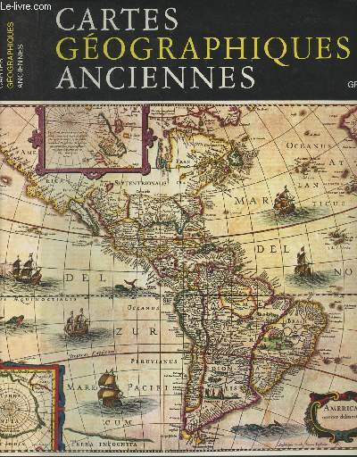
KUPCIK
BEAUX OBJETS D'AUTREFOIS - CARTES GEOGRAPHIQUES ANCIENNES - EVOLUTION DE LA REPRESENTATION CARTOGRAPHIQUE DU MONDE DE L'ANTIQUITE A LA FIN DU XIXE SIECLE.
GRUND. 1981. In-4. Relié. Bon état, Couv. convenable, Dos satisfaisant, Intérieur frais. 240 pages - jaquette en bon état - nombreuses cartes en couleurs et en noir et blanc dans et hors texte.. Avec Jaquette. . . Classification Dewey : 912-Atlas, cartes et plans
Bookseller reference : R240090172
|
|
|
Kupcik Ivan
Cartes géographiques anciennes - Evolution de la représentation cartographique du monde : de l'Antiquité à la fin du XIXe siècle
Gründ. 1984. In-4. Relié. Bon état, Couv. convenable, Dos satisfaisant, Intérieur frais. 240 pages - nombreuses cartes en noir et blanc et en couleurs dans et hors texte et sur les contreplats. Jaquette convenable.. . . A l'italienne. Classification Dewey : 912-Atlas, cartes et plans
Bookseller reference : R300280528
|
|
|
Kv. Spruner's histor. Schul ATLAS K. v.
MAP Atlas: Die Reiche der Mongolen im XIIIten und XIVten Jahrhundert.
Gotha: Justus Perthes MAP No. X . Clean original colour lithograph. Size: 24�x32. GOOD. Gotha: Justus Perthes unknown
Bookseller reference : 2769.P.10

|
|
|
KÂTIB ÇELEBI, HACI HALIFE MUSTAFA BIN ABDULLAH. [Hajji Khalifa, Kalfa] (1609-1657).
Kitab-i cihannûma li-Kâtib Çelebi. Vol. 1: Reprint. Vol. 2: Transcription. 2 volumes set. Editor-in-chief: Nevzat Bayhan.
New English In original Ottoman style full leather bounds. Folio. 2 volumes set: iii, [27], 698 p. reprint in Ottoman language, 40 color plts.; 700 p. transcription in Modern Turkish. Reprinted from 1732, Ibrahim Muteferrika Edition. (See Ozege for it's original: 3048.). A very heavy set. Ibrahim Muteferrika printed Katib Celebi's well-known book on geography and cosmography 'Cihannuma' in 1732 by adding a supplement containing new information on astronomy and Ottoman geography and maps, in which he relied mostly on Ebu Bekir b. Behram el-Dimaski's (d. 1691) work on the Cihannuma. The appendix in which Muteferrika explained the 'old' and the 'new' world systems produced by Tycho Brahe, Copernicus and Descartes as well as Galileo's theories of the moving bodies was extracted from Edmond Pourchot's (1651 - 1734) well-known work 'Institutiones philosophicae'. Pourchot himself was a reknowned philosopher and was elected rector of the University of Paris seven times. The text compiled by Muteferrika on the heliocentric system would represent comprehensive Turkish text on this subject for a century. Katip Celebi's book of Cihannuma (Jihannuma. View of the World) is a geographical work that makes the first use, in Turkey, of European atlases and other sources.
|
|
|
KÂTIP ÇELEBI (Hadji Khalifa), (1609-1657).
Levami'u'n-nur fi zulmet-i Atlas Minor. Inceleme-tipkibasim. Prep. by Ahmet Üstüner, H. Ahmet Arslantürk. [BOXED].
New New Turkish Original bdg. Dust wrapper. In special box. Folio. (32 x 22 cm). Text in Turkish with facsimile of original Ottoman manuscript. 1045, [2] p., [860] p., color plates, facsimile. Levami'u'n-nur fi zulmet-i Atlas Minor. Inceleme-tipkibasim. Prep. by Ahmet Üstüner, H. Ahmet Arslantürk. [BOXED]. Annotated translation of Gerardius Mercator, (1512-1594)'s latin work known as Atlas Minor.
|
|
|
KÄRCHER, KARL
Atlas der Alten Welt (Orbis Terrarum Antiquus)
Karlsruhe, bei Gottlieb Braun, 1824. "Halbleder, 4° (28 x 39 cm), große Ausgabe mit 23 Karten, einfarbig,Beschriftung des Titelblatts: »Orbis Terrarum Antiquus et Europa aevi Medii, in usum scholarum delineavit et descripsit Carolus Kaercher«,interessantes Freimaurer-Exlibris auf dem Inneneinband, dünnes Leder mit goldschrift, obeb bischofsmütze und unten aufrechtstehende Schlange, Inschrift ""IngenII preCLarI, VIrtVtIs aC InsIgnis DILIgentIae sIgnVM"", die großgeschriebenen Buchstaben bedeuten römische Ziffern und haben wohl mystische Bedeutung." [4 Warenabbildungen]
Bookseller reference : C2689

|
|
|
Kärcher, Karl
Orbis terrarum antiquus et Europa aevi medii. In usum scholarum.
Karlsruhe, Theophil Braun, ca. 1824. Ca. 19 x 26 cm. Doppelblattgr. typogr. Titel und 22 (statt 23) grezkolor. lithogr. Karten. Halblederband der Zeit.
Bookseller reference : 100093DB

|
|
|
Kögel, B., H. Siegmann und J. Weber
Harms Baden-Wüttemberg in Karte, Bild und Wort.
München, Paul List, 1955. Eine Heimatkunde 38 S. (30 cm) Großformat, Paperback / kartoniert mit Leinenrücken
Bookseller reference : 9871
|
|
|
Köhler, Johann David
Bequemer Schul- und Reisen-Atlas. Aller zu Erlernung der Alten, MIttlern und Neuen Geographie dienlichen Universal- und Particular-Charten. Alles mit grossen Fleiß und Kosten ausgefertigt von Christoph Weigeln [Weigel].
Nürnberg, Johann Ernst Adelbulner, 1719. 1 typograph. Titel, 1 Kupfertitel, 1 Privileg, 1 Kupfer-Inhaltsverzeichnis, 124 Kupferstichkarten bzw. Kupfertafeln und 6 typographische Erläuterungen (alles doppelblattgr. und zumeist altkoloriert). Fol. Ldr. der Zeit mit Rückenschild und Rückenvergoldung (etw. restauriert, Rücken mit Wurmspuren). [9 Warenabbildungen]
Bookseller reference : 15472

|
|
|
Köhler, Johann David
Kurze und gründliche Anleitung zu der alten und mittleren Geographie. Joh. David Köhler Reprintaufl. der Orig.-Ausg., Nürnberg, Weigel, 1730
Holzminden : Reprint-Verl. Leipzig [2000]. 107 S. :12 Landkarten; 25 cm Kunstleder, Roter Kunstledereinband , gebundene Ausgabe, Exemplar in gutem Erhaltungszustand
Bookseller reference : 17900

|
|
|
Köln (Umgebung) - Schwarz, Uwe und Werner Schäfke
Köln und sein Umland in alten Karten : von der Eifelkarte zur Generalstabskarte ; (1550 bis 1897). Uwe Schwarz. Hrsg. von Werner Schäfke
Köln : Emons 2005. 152 S. : Ill., zahlr. Kt. ; 33 cm, mit Schutzumschlag Top Zustand, Pp., gebundene Ausgabe, Hardcover/Pappeinband, im Schuber, Exemplar in sehr gutem Erhaltungszustand
Bookseller reference : 31359

|
|
|
Köln - Atlas - Wiktorin, Dorothea
Köln: der historisch-topographische Atlas. Dorothea Wiktorin, Jürgen Blenck, Josef Nipper, Manfred Nutz, Klaus Zehner (Autoren)
Köln : Emons 2001. 221 S. : Abb. ., Kt. ; 33 cm, mit Schutzumschlag Top Zustand, Gewebe, gebundene Ausgabe, Leinen, im Schuber,
Bookseller reference : 23047

|
|
|
Könnecke, Gustav
Bilderatlas zur Geschichte der deutschen Nationalliteratur - Eine Ergänzung zu jeder deutschen Literaturgeschichte enthaltend 2200 Abb. und 14 blattgroße Beilagen, wovon 2 in Heliogravüre und 5 in Farbendruck
Marburg, R. G. Elwert'sche Verlagsbuchhandlung, 1895. 2., verbesserte und vermehrte Auflage, 7.-11. tausend 423 Seiten , 42 cm, Hardcover/Pappeinband
Bookseller reference : 45540

|
|
|
Könnecke, Gustav
Deutscher Literaturatlas. Mit einer Einführung von Chrsitian Muff. Abbildungen zur Geschichte der deutschen Nationalliteratur: Mit 826 Abbildungen und 2 Beilagen (u.a.Titelporträt Goethe nach einem Oelbild von J.K. Stieler, 1828).
Marburg, Elwertsche Verlagsbuchhandlung, 1909. Gr.4°. XII, 156 Seiten. MKit einem alphabetischen Register. Frisch restaurierter Halbleinenband mit originalen Deckeln. (Gering bestoßen. Deckel etwas fleckig. Ohne Beilagen). - 1.-20. Tausend. Im übrigen gut erhaltenes, innen sehr frisches Exemplar.
Bookseller reference : 27646AB
|
|
|
Kühn, Arthur (Redaktion)
Deutscher Planungsatlas. Band X: Planungsatlas Saarland. Hg. von der Akademie für Raumforschung und Landesplanung und vom Minister für Öffentliche Arbeiten und Wohnungsbau Abteilung IV, Landesplanung (Saarland).
Hannover: Gebrüder Jänecke. 1965. 4 Bll., 13 Bll. mit Zwischentiteln, 46 Bll. Karten. Quer-Imperial-Folio (ca. 42,5 x 59,5 cm). Mit farbiger Wappenvignette auf dem Titel und 46 farbigen Kartenblättern. EA. OLeinen mit Wappenvignette, Messingschraubbindung.
Bookseller reference : 52491

|
|
|
Küppers, Harald
Farben Atlas. über 5500 Farbnuancen mit Kennzeichnungen und Mischanleitung.
Köln. DuMont. 1978. 2. verb. Aufl. 163 S. engl. broschiert, zahlr. Abb. guter Zustand, kl. Stempel a. Impressum u. Vortitel, Einband gering gebräunt, DuMont Dokumente: eine Sammlung von Originaltexten, Dokumenten u. grundsätzlichen Arbeiten zur Kunstgeschichte, Archäologie, Musikgeschichte u. Geisteswissenschaft. 2
Bookseller reference : 19669BB
|
|
|
L Vivien
Atlas Universel pour servir à l'étude de la géographie et de l'histoire anciennes et modernes
Paris Parent Desbarres 1849 In-plano - Complet des 48 cartes gravées par Giraldon-Bovinet et dressées par louis Vivien - coins rognés sinon bon état
Bookseller reference : Eb2-116

|
|
|
L Vivien
Atlas Universel pour servir à l'étude de la géographie et de l'histoire anciennes et modernes
Paris Parent Desbarres 1849 In-plano - Complet des 48 cartes gravées par Giraldon-Bovinet et dressées par louis Vivien - coins rognés sinon bon état
Bookseller reference : Eb2-116
|
|
|
L'abbé Delaporte
Atlas ou collection de cartes géographiques pour l'intelligence du voyageur françois ou la connoissance de l'ancien et du nouveau monde
A Paris, chez Moutard, imprimeur-Libraire de la Reine, de Madame, & de Madame Comtesse d'Artois, rue des Mathurins, Hôtel de Cluny. Relié 1787 Atlas au format de 13,5 * 20,4 cm. Tranches rouges. L'ouvrage est composé de la façon suivante : faux-titre, titre, table indicative des pages et des volumes où les planches de cet atlas correspondent, la plupart des cartes font 21,5 * 17,6 cm. Les cartes de l'Amérique du Nord sont importantes car très détaillées : carte de la Virginie et du Mariland (Chesapeak Baye est très détaillée), carte de la nouvelle Angleterre, nouvelle York, Nouvelle Jersey et Pensilvanie, Isle de la Jamaïque et golfe du Mexique également recueil complet de ses 26 cartes ; reliure très fatiguée, manques de cuir au dos, les plats de papier sont frottés, les cartes sont en bel état. Livraison a domicile (La Poste) ou en Mondial Relay sur simple demande.
Bookseller reference : vd1348
|
|
|
L'UNION VELOCIPEDIQUE DE FRANCE
1 CARTE TARIDE : SUD OUEST DE DE LA FRANCE N°20 - CARTE ROUTIERE POUR CYCLISTES ET AUTOMOBILES / DIMENSION : DIMENSION : 96 Cm X 70 Cm environ.
CARTES TARIDE. NON DATE. In-Plano. En feuillets. Etat d'usage, Couv. convenable, Dos satisfaisant, Intérieur acceptable. 1 GRANDE CARTE ENTOILEE en couleurs - manque 3 morceaux / DIMENSION : 96 Cm X 70 Cm environ - Toile tachée.. . . . Classification Dewey : 912-Atlas, cartes et plans
Bookseller reference : R320038471
|
|
 Receive by email
 Download as PDF document
 RSS feed


