|
MINISTRE DE L'INTERIEUR
1 CARTE COULEURS DEPLIANTE DE ATLANTICA - DE DIMENSION 100 Cm X 60 Cm ENVIRON - SCALE : 1/20000000.
THE NATIONAL GEOGRAPHIC MAGAZINE. 1939. In-Plano. En feuillets. Bon état, Couv. convenable, Dos satisfaisant, Intérieur frais. 1 CARTE COULEURS DEPLIANTE DE DIMENSION 100 Cm X 60 Cm ENVIRON.. . . . Classification Dewey : 912-Atlas, cartes et plans
Bookseller reference : R320051303
|
|
|
MINISTRE DE L'INTERIEUR
1 CARTE COULEURS DEPLIANTE DE CANADA - DE DIMENSION 100 Cm X 60 Cm ENVIRON - SCALE : 1/5892480
THE NATIONAL GEOGRAPHIC MAGAZINE. 1936. In-Plano. En feuillets. Bon état, Couv. convenable, Dos satisfaisant, Intérieur frais. 1 CARTE COULEURS DEPLIANTE DE DIMENSION 100 Cm X 60 Cm ENVIRON.. . . . Classification Dewey : 912-Atlas, cartes et plans
Bookseller reference : R320051302
|
|
|
MINISTRE DE L'INTERIEUR
1 CARTE COULEURS DEPLIANTE DE MENDE - DE DIMENSION 65 Cm X 45 Cm ENVIRON - - ECHELLE 1/100000 - FEUILLE XIX - 30 - TIRAGE DE 1899.
ERHARD. NON DATE. In-Plano. En feuillets. Etat d'usage, Couv. convenable, Dos satisfaisant, Intérieur frais. 1 CARTE COULEURS DEPLIANTE DE DIMENSION 65 Cm X 45 Cm ENVIRON.. . . . Classification Dewey : 912-Atlas, cartes et plans
Bookseller reference : R320051300
|
|
|
MINISTRE DE L'INTERIEUR
1 CARTE COULEURS DEPLIANTE DE MEXICO, CENTRAL AMERICA AND THE WEST INDIES - DE DIMENSION 100 Cm X 60 Cm ENVIRON - SCALE : 1/5702400.
THE NATIONAL GEOGRAPHIC MAGAZINE. 1934. In-Plano. En feuillets. Etat d'usage, Couv. convenable, Dos satisfaisant, Intérieur frais. 1 CARTE COULEURS DEPLIANTE DE DIMENSION 100 Cm X 60 Cm ENVIRON.. . . . Classification Dewey : 912-Atlas, cartes et plans
Bookseller reference : R320051301
|
|
|
MINISTRE DE L'INTERIEUR
1 CARTE COULEURS DEPLIANTE DE SANGUES - DE DIMENSION 65 Cm X 45 Cm ENVIRON - - ECHELLE 1/100000 - FEUILLE XIX - 29 - TIRAGE DE 1891.
ERHARD. NON DATE. In-Plano. En feuillets. Bon état, Couv. convenable, Dos satisfaisant, Intérieur frais. 1 CARTE COULEURS DEPLIANTE DE DIMENSION 65 Cm X 45 Cm ENVIRON.. . . . Classification Dewey : 912-Atlas, cartes et plans
Bookseller reference : R320051299
|
|
|
Ministre de L'Intérieur
Carnet/ Plan de Niort dépliant- Echelle : 1:100.000
Hachette et cie. 1904. In-Folio. Broché. Etat passable, Plats abîmés, Dos satisfaisant, Rousseurs. 1 plan dépliant en couleurs, attaché à un carnet. Nombreuses rousseurs. Papier un peu jauni. Légères déchirures.. . . . Classification Dewey : 912-Atlas, cartes et plans
Bookseller reference : RO30323596
|
|
|
Ministry of Tourism
Map of Israel
Ministry of Tourism. Non daté. In-Plano. Broché. Bon état, Couv. convenable, Dos satisfaisant, Intérieur acceptable. Une carte dépliante en couleurs.. . . . Classification Dewey : 912-Atlas, cartes et plans
Bookseller reference : RO80248892
|
|
|
Ministère de l'intérieur
Auch carte à 1/100.000
Hachette et cie. 1881. In-16. Cartonné. Etat passable, Coins frottés, Dos fané, Papier jauni. 1 carte dépliante en couleurs. Quelques tâches en plats. Couverture cartonnée rouge. Ex-libris à l'encre et étiquette en 1er contre-plat. Rousseurs.. . . . Classification Dewey : 912-Atlas, cartes et plans
Bookseller reference : RO30373129
|
|
|
Ministère de l'Intérieur
Carte en couleurs - Feuille X-26 : Royan (Mise à jour en Mars 1903), Echelle de 1:100.000 (1 cm pour 1 kilomètre)
Librairie Hachette et Cie. Non daté. In-12. Broché. Bon état, Couv. convenable, Dos satisfaisant, Intérieur frais. 1 carte dépliante en couleurs d'environ 50 * 60cm.. . . . Classification Dewey : 912-Atlas, cartes et plans
Bookseller reference : R200107528
|
|
|
Ministère de l'intérieur
L'Isle-Jourdain- Carte à 1/100.000
Hachette et cie. 1892. In-16. Cartonné. Etat d'usage, Coins frottés, Dos fané, Papier jauni. 1 carte dépliante en couleurs. Quelques tâches en plats. Couverture cartonnée rouge. Quelques rousseurs.. . . . Classification Dewey : 912-Atlas, cartes et plans
Bookseller reference : RO30373131
|
|
|
Ministère de l'intérieur
Le Haver Nord- Carte à 1/100000
Hachette et cie. Non daté.. In-16. Cartonné. Etat d'usage, Couv. défraîchie, Dos frotté, Papier jauni. 1 carte à 1/100000 dépliante en couleurs. Coins frottés. Rousseurs et mouillures. . . . Classification Dewey : 912-Atlas, cartes et plans
Bookseller reference : RO30366651
|
|
|
Ministère de l'intérieur
St Gaudens- Carte à 1/100.000
Hachette et cie.. 1893. In-16. Cartonné. Etat d'usage, Coins frottés, Dos fané, Papier jauni. 1 carte dépliante en couleurs. Quelques tâches en plats. Couverture cartonnée rouge. Rousseurs.. . . . Classification Dewey : 912-Atlas, cartes et plans
Bookseller reference : RO30373130
|
|
|
Ministère de l'intérieur
Villefranche-de-Lauragais- Carte à 1/100.000
Hachette et cie. 1898. In-16. Cartonnage d'éditeurs. Etat d'usage, Couv. partiel. décollorée, Dos satisfaisant, Papier jauni. 1 carte en couleurs à 1/100.000. Coins frottés. Rousseurs. Mouillures n'altérant que très peu la carte.. . . . Classification Dewey : 912-Atlas, cartes et plans
Bookseller reference : RO30374354

|
|
|
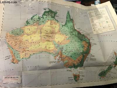
Ministère des finances et des affaires économiques
Carte économique de l'Australie et de la Nouvelle-Zélande- Carte n°74
Direction de la documentation/ Institut géographique national. Non daté. In-Plano. En feuillets. Etat passable, Couv. légèrement pliée, Dos satisfaisant, Papier jauni. 1 carte dépliante en couleurs. Echelle: 500km . Dimensions: Environ 100X70 cm. Rares rousseurs, quelques salissures. Légers accrocs.. . . A l'italienne. Classification Dewey : 912-Atlas, cartes et plans
Bookseller reference : RO30334503
|
|
|
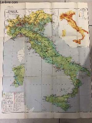
Ministère des finances et des affaires économiques
Carte économique de l'Italie- Carte n°56
Direction de la documentation/ Institut géographique national. 1951. In-Plano. En feuillets. Etat passable, Couv. légèrement pliée, Dos satisfaisant, Papier jauni. 1 carte dépliante en couleurs. Echelle: 1/1500000e. Dimensions: Environ 80X70 cm. Rares rousseurs, quelques salissures.. . . . Classification Dewey : 912-Atlas, cartes et plans
Bookseller reference : RO30334499
|
|
|
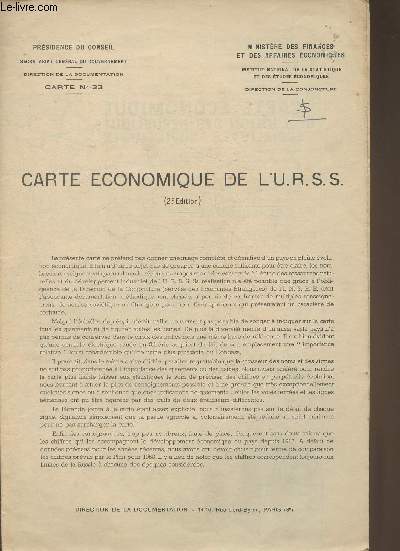
Ministère des finances et des affaires économiques
Carte économique de l'U.R.S.S.- Carte n°33
Direction de la documentation/ Institut géographique national. Non daté. In-Plano. En feuillets. Etat passable, Couv. légèrement pliée, Dos satisfaisant, Papier jauni. 1 carte dépliante en couleurs. Echelle: 1/10000000e . Dimensions: Environ 88X60cm. Rares rousseurs, quelques salissures. Légers accrocs.. . . A l'italienne. Classification Dewey : 912-Atlas, cartes et plans
Bookseller reference : RO30334504
|
|
|
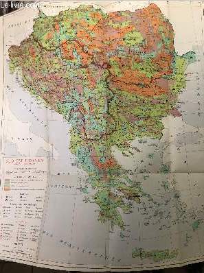
Ministère des finances et des affaires économiques
Carte économique du Sud-Est Européen - Carte n°75
Direction de la documentation/ Institut géographique national. 1956. In-Plano. En feuillets. Etat passable, Couv. légèrement pliée, Dos satisfaisant, Papier jauni. 1 carte dépliante en couleurs. Echelle: 1/2000000e . Dimensions: Environ 80X70 cm. Rares rousseurs, quelques salissures. Légers accrocs.. . . . Classification Dewey : 912-Atlas, cartes et plans
Bookseller reference : RO30334501
|
|
|
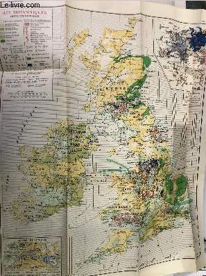
Ministère des finances et des affaires économiques
Iles Britanniques- Carte économique- N°61
Direction de la documentation/ Institut géographique national. Non daté. In-Plano. En feuillets. Etat passable, Couv. légèrement pliée, Dos satisfaisant, Papier jauni. 1 carte dépliante en couleurs. Echelle: 1/1500000e . Dimensions: Environ 80X60 cm. Rares rousseurs, quelques salissures. Légers accrocs.. . . . Classification Dewey : 912-Atlas, cartes et plans
Bookseller reference : RO30334502
|
|
|
Ministère des finances et des affaires économiques
Le Monde Malais ( Indonésie, Malaisie, Philippines)- Carte n°65-
Direction de la documentation/ Institut géographique national. Non daté. In-Plano. En feuillets. Etat passable, Couv. légèrement pliée, Dos satisfaisant, Papier jauni. 1 carte dépliante en couleurs. Echelle: 500km . Dimensions: Environ 95X70 cm. Rares rousseurs, quelques salissures. Légers accrocs.. . . A l'italienne. Classification Dewey : 912-Atlas, cartes et plans
Bookseller reference : RO30334500

|
|
|
Ministère des finances et des affaires économiques
Scandinavie et Finlande/ Carte économique et industrielle
Direction de la documentation/ Institut géographique national. Non daté. In-Plano. En feuillets. Etat passable, Couv. légèrement pliée, Dos satisfaisant, Papier jauni. 1 carte dépliante en couleurs. Echelle: 1/3000000e . Dimensions: Environ 70X60 cm. Quelques rousseurs, quelques salissures. Légers accrocs.. . . . Classification Dewey : 912-Atlas, cartes et plans
Bookseller reference : RO30334508

|
|
|
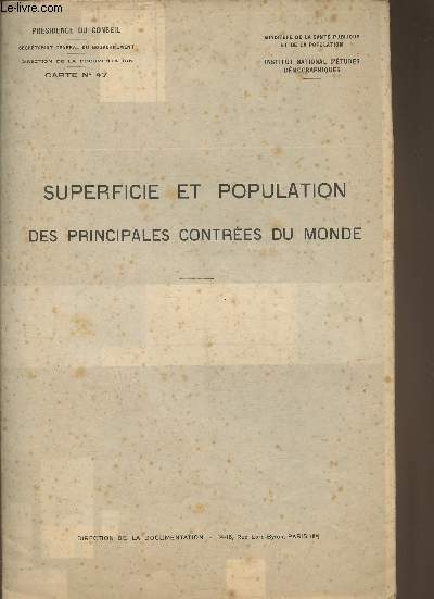
Ministère des finances et des affaires économiques
Superficie et population des principales contrées du monde-1950
Direction de la documentation/ Institut géographique national. 1950. In-Plano. En feuillets. Etat passable, Couv. légèrement pliée, Dos satisfaisant, Papier jauni. 2 cartes sur une page dépliante bicolore. Echelle: 1 million de km2 (1er carte) et 10 millions d'habitants( 2ème carte) . Dimensions: Environ 90X60 cm. Nombreuses rousseurs, quelques salissures. Légers accrocs. Tableaux et texte au verso.. . . . Classification Dewey : 912-Atlas, cartes et plans
Bookseller reference : RO30334509
|
|
|
Ministère des travaux publics
Les coupures exécutées à l'Escaut à l'amont d'Anvers (atlas).
Bruxelles, Reliure Ed. Sweegers, 1908. 16 x 24, 10 très grandes planches dépliantes sous étui imprimé, bon état.
Bookseller reference : 20229
|
|
|
Ministère des travaux publics
Routes nationales. Recensement de la circulation en 1882
Imprimerie Nationale Cartonné 1884 In-4, (33x26.5 cm), cartonné, atlas, 10 cartes en couleurs sur planches dépliantes, notice explicative en début d'ouvrage ; tampon sur la page de titre, traces dans le texte et sur les plats frottés, état correct. Livraison a domicile (La Poste) ou en Mondial Relay sur simple demande.
Bookseller reference : ca771
|
|
|
MINNESOTA ATLAS. ROBINSON Earl J. BEEM JS. & MB. Eds. J. S. M. B.
Agricultural and industrial review of Minnesota with world atlas. Containing newly engraved maps over every state. . . detailed maps of every country state and kingdom. . . index to all cities towns villages and post offices in the United States. . . together with Cram’s Superior map of Minnesota.
Chicago & New York: George F. Cram 1911. Folio. 3 d 1 276 pp. Over 100 photo illustrations maps colour maps with Cram’s Superior Minnesota 40 x 50 inch map in full colour laid-in minor tidemark w/ minor closed tear at fold affecting lower portion of 1 panel. Blue cloth white lettering on front cover tidemark to fore-edges of covers textblock some minor soiling shelfwear still G- sound copy. First edition of this scarce local Minnesota commercial atlas and history complete with the very scarce large Minnesota map. George F. Cram, hardcover
Bookseller reference : 47813
|
|
|
MIOTTO FREDERIC / PUTFIN MARIE-SOPHIE / BELZACQ R.
ATLAS GISSEROT DE FRANCE
JEAN-PAUL GISSEROT. VERS 2010. In-4. Broché. Bon état, Couv. convenable, Dos satisfaisant, Intérieur frais. 26 pages. 1 étiquette en dos ou 1er plat + tampon(s),annotation(s) et pochette de prêt de bibliothèque en contreplats et/ou page de titre. Nombreuses cartes en couleurs, hors texte.. . . . Classification Dewey : 912-Atlas, cartes et plans
Bookseller reference : R200082039
|
|
|
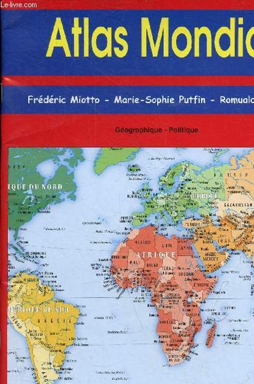
Miotto Frédéric & Putfin M.-S. & Belzacq Romuald
Atlas mondial - Géographique - Politique.
BK France. 2001. In-8. Broché. Bon état, Couv. convenable, Dos satisfaisant, Intérieur frais. 32 pages agrafées de cartes en couleurs.. . . . Classification Dewey : 912-Atlas, cartes et plans
Bookseller reference : RO80278119
|
|
|
Mirabeau, H.G. Riquetti Comte de
Atlas del la Monarchie Prussienne, entenant dix cartes géographiques, quatre-vingt-treize planche de tactique, & plus de cent tableaux numériques.
A Londres (Paris, Lejay), 1788. Folio. 2 Bl., 4 S. 10 dpblgr. Kupferkarten, 93 (davon 5 dpblgr.) Kupfer u. 76 Tabellen in unterschiedlicher Größe. Kart. Ber. u. best., Rü. geplatzt. Gebr. u. stockfl., kl. Stempel a. Tit.-Bl. Selten.
Bookseller reference : 40450AB
|
|
|
MIRLIVA ALI SEREF PASHA, (Author and mapmaker of 'Umûmî Cografya Atlasi' published in 1894 - Active between 1885-1905).
[ONE OF THE EARLIEST "USA" APPEARANCE IN AN OTTOMAN MAP] Cemâhîr-i Müttefikâ-i Amerika. Sâye-i Türkiye cenâb-i cihâniyâni [.] saltanât-i Osmânî veliünniamet-i alemiyân el-gazi Abdülhamid Hân-i Sâni'de meshur Haset sarfindan bittertîb Fransiz Encümen-i Cografya azalarindan mütesekkil komisyona mahsus tanzîm ettirilmis oldugu son def'a atlasi Maarif Umûmiye Nezâret-i Celîlesi ruhsatiyle Erkân-i Umûmiyye Dairesi Besinci Fen Subesi'ne me'mûr piyade mirlivâlarindan saâdetlü Ali Seref Pasa maarifetleriyle tersîm ve tercüme edilib tab' olunmusdur.
Very Good Turkish, Ottoman (1500-1928) Original color map. Folded. Oblong folio. (35 x 52 cm). In Ottoman script. Color lithograph. A very detailed and attractive Ottoman map of America. Scale: 1:12.000.000. Otherwise a very good copy. Slightly chipped extremities. Dated Hegira: 1311 = [Gregorian 1895]. Ali Seref Pasa or Hafiz Ali Esref. He was a soldier, who was schooled in Paris as a cartographer around 1862. Already in Paris he published his first atlas with 22 maps, called 'Yeni atlas'. Upon his return to Istanbul he became a chief cartographer at the Maatbaa-i amire Printing Press in Beyazit, which was the successor of the Muteferrika press from 1727. Among others he translated the large Kiepert map of Anatolia to Ottoman. He died in 1907, leaving his large project of a gigantic map of Anatolia in 100 sheets unfinished. Ali's name is often misunderstood or even listed as two different people: Ali Seref Pasa and Hafiz Ali Esref. Until the surname law adopted on June 21, 1934, Turks did not have surnames. They were born with one first name and were until the adulthood described only as sons or daughters of their parent's names. Later they were given titles such as Effendi (Sir), Bey (Chief) or Hanim (Madam) for higher classes, or they were given names according to their work or class. The names were not inherited by children until 1934, when the surname law was enforced. The map maker Ali received names Seref, the honourable, and Pasa, the dignitary. He was also known as Hafiz, the memorizer of Qur'an and Esref, Proud. So Ali Seref Pasa would have a meaning 'Honourable Dignitary Ali, and Hafiz Ali Esref, Memorizer of Qur'an, Proud Ali. Daruttibaa - Matbaa-I Amire Printing Press: The first press in the Muslim world, called Daruttibaa, was founded in Istanbul by Ibrahim Muteferrika in 1727, with a permission of Sultan Ahmeet III. It was located in Muteferrika's house. The first book was published in 1729 and until 1742 sixteen other works followed. After Muteferrika's death, the press was supressed for printing, as printed books were considered dangerous. In 1796 the press was purchased by the government and moved to Uskudar in Istanbul, and in 1831 finally to Beyazit, where it was renamed to Matbaa-i Amire in 1866. The press was closed in 1901 and was reopened in 1908 under the name 'Âmire' In 1927 the name changed to State Printing House. The press still exists and is known for publishing school and educational books. Extremely rare. Not in OCLC.; Not in TBMM Map Collection.
|
|
|
MIRLIVA ALI SEREF PASHA, (Author and mapmaker of 'Umûmî Cografya Atlasi' published in 1894 - Active between 1885-1905).
[OTTOMAN MAP of AUSTRIA-HUNGARY] Avusturya-Macaristan: Sâye-i Türkiye Hazret Gazi Sultan Abdülhamid Hân-i Sâni'de Maarif Umûmiye Nezâret-i Celîlesi ruhsatiyle Haset tarafindan Fransa Cemiyet-i Cografya âzâlarindan mütesekkil komisyona mahsûs tanzîm edilmis oldugu son atlasinin tercümesi olarak bu def'a Erkân-i Umûmiyye Dairesi Besinci Fen Subesi'ne me'mûr piyade mirlivâlarindan saâdetlü Ali Seref Pasa maarifetleriyle tersîm ettirilmistir.
Very Good Turkish, Ottoman (1500-1928) Original color chromo-lithograph map. Folded. Oblong folio. (40 x 50 cm). In Ottoman script. Color lithograph. An attractive map which shows Austria-Hungary land with Venice Bay and North Italy. Scale: 1:3.500.000. Dated Hegira: 1310 = [Gregorian 1894]. This uncommon map of Austria-Hungary in Ottoman script was published in an atlas, 'Yeni cografya atlasi', which was issued in Istanbul in the late 19th century. Ali Seref Pasa or Hafiz Ali Esref. He was a soldier, who was schooled in Paris as a cartographer around 1862. Already in Paris, he published his first atlas with 22 maps, called 'Yeni atlas'. Upon his return to Istanbul, he became a chief cartographer at the Matbaa-i Amire Printing Press in Beyazit, which was the successor of the Muteferrika press from 1727. Among others, he translated the large Kiepert map of Anatolia to Ottoman. He died in 1907, leaving his large project of a gigantic map of Anatolia in 100 sheets unfinished. Ali's name is often misunderstood or even listed as two different people: Ali Seref Pasa and Hafiz Ali Esref. Until the surname law adopted on June 21, 1934, Turks did not have surnames. They were born with one first name and were until adulthood described only as sons or daughters of their parent's names. Later they were given titles such as Effendi (Sir), Bey (Chief), or Hanim (Madam) for higher classes, or they were given names according to their work or class. The names were not inherited by children until 1934 when the surname law was enforced. The mapmaker Ali received names Seref, the honorable, and Pasa, the dignitary. He was also known as Hafiz, the memorizer of the Qur'an and Esref, Proud. So Ali Seref Pasa would have a meaning 'Honourable Dignitary Ali, and Hafiz Ali Esref, Memorizer of Qur'an, Proud Ali. Daruttibaa - Matbaa-I Amire Printing Press: The first press in the Muslim world, called Daruttibaa, was founded in Istanbul by Ibrahim Muteferrika in 1727, with permission of Sultan Ahmet III. It was located in Muteferrika's house. The first book was published in 1729 and until 1742 sixteen other works followed. After Muteferrika's death, the press was suppressed for printing, as printed books were considered dangerous. In 1796 the press was purchased by the government and moved to Uskudar in Istanbul, and in 1831 finally to Beyazit, where it was renamed to Matbaa-i Amire in 1866. The press was closed in 1901 and was reopened in 1908 under the name 'Âmire' In 1927 the name changed to State Printing House. The press still exists and is known for publishing school and educational books. Extremely rare. Not in OCLC.; Not in TBMM Map Collection.
|
|
|
MIRLIVA ALI SEREF PASHA, (Author and mapmaker of 'Umûmî Cografya Atlasi' published in 1894 - Active between 1885-1905).
[OTTOMAN MAP of SPAIN & PORTUGAL] Ispanya & Portekiz: Sâye-i Türkiye Hazret Gazi Sultan Abdülhamid Hân-i Sâni'de Maarif Umûmiye Nezâret-i Celîlesi ruhsatiyle Haset tarafindan Fransa Cemiyet-i Cografya âzâlarindan mütesekkil komisyona mahsûs tanzîm edilmis oldugu son atlasinin tercümesi olarak bu def'a Erkân-i Umûmiyye Dairesi Besinci Fen Subesi'ne me'mûr piyade mirlivâlarindan saâdetlü Ali Seref Pasa maarifetleriyle tersîm ettirilmistir.
Very Good Turkish, Ottoman (1500-1928) Original color chromo-lithograph map. Folded. Oblong folio. (40 x 50 cm). In Ottoman script. Color lithograph. It Portugal and Spain with Gibraltar and North African shores. Scale: 1:3.500.000. Dated Hegira: 1310 = [Gregorian 1894]. OTTOMAN MAP of SPAIN & PORTUGAL] Ispanya & Portekiz: Sâye-i Türkiye Hazret Gazi Sultan Abdülhamid Hân-i Sâni'de Maarif Umûmiye Nezâret-i Celîlesi ruhsatiyle Haset tarafindan Fransa Cemiyet-i Cografya âzâlarindan mütesekkil komisyona mahsûs tanzîm edilmis oldugu son atlasinin tercümesi olarak bu def'a Erkân-i Umûmiyye Dairesi Besinci Fen Subesi'ne me'mûr piyade mirlivâlarindan saâdetlü Ali Seref Pasa maarifetleriyle tersîm ettirilmistir. This uncommon map of Spain and Portugal in Ottoman script was published in an atlas, 'Yeni cografya atlasi', which was issued in Istanbul in the late 19th century. Ali Seref Pasa or Hafix Ali Esref. He was a soldier, who was schooled in Paris as a cartographer around 1862. Already in Paris he published his first atlas with 22 maps, called 'Yeni atlas'. Upon his return to Istanbul he became a chief cartographer at the Maatbaa-i amire Printing Press in Beyazit, which was the successor of the Muteferrika press from 1727. Among others he translated the large Kiepert map of Anatolia to Ottoman. He died in 1907, leaving his large project of a gigantic map of Anatolia in 100 sheets unfinished. Ali's name is often misunderstood or even listed as two different people: Ali Seref Pasa and Hafiz Ali Esref. Until the surname law adopted on June 21, 1934, Turks did not have surnames. They were born with one first name and were until the adulthood described only as sons or daughters of their parent's names. Later they were given titles such as Effendi (Sir), Bey (Chief) or Hanim (Madam) for higher classes, or they were given names according to their work or class. The names were not inherited by children until 1934, when the surname law was enforced. The map maker Ali received names Seref, the honourable, and Pasa, the dignitary. He was also known as Hafiz, the memorizer of Qur'an and Esref, Proud. So Ali Seref Pasa would have a meaning 'Honourable Dignitary Ali, and Hafiz Ali Esref, Memorizer of Qur'an, Proud Ali. Daruttibaa - Matbaa-I Amire Printing Press: The first press in the Muslim world, called Daruttibaa, was founded in Istanbul by Ibrahim Muteferrika in 1727, with a permission of Sultan Ahmeet III. It was located in Muteferrika's house. The first book was published in 1729 and until 1742 sixteen other works followed. After Muteferrika's death, the press was supressed for printing, as printed books were considered dangerous. In 1796 the press was purchased by the government and moved to Uskudar in Istanbul, and in 1831 finally to Beyazit, where it was renamed to Matbaa-i Amire in 1866. The press was closed in 1901 and was reopened in 1908 under the name 'Âmire' In 1927 the name changed to State Printing House. The press still exists and is known for publishing school and educational books. Extremely rare. Not in OCLC.; Not in TBMM Map Collection.
|
|
|
MISSIONNAIRES DE LA MONGOLIE
Carte du Pays des Tartares Ortous.
LES MISSIONS CATHOLIQUES. 1875. In-Folio. En feuillets. Bon état, Couv. convenable, Dos satisfaisant, Intérieur frais. Carte en noir et blanc de 44/30 cm. Pas de plats de couverture.. . . . Classification Dewey : 912-Atlas, cartes et plans
Bookseller reference : RO80006291
|
|
|
Missionsatlas - Grundemann, R
Neuer Missions-Atlas mit besonderer Berücksichtigung der Deutschen Missionen.
Stuttgart u. Calw, Verlag der Vereinsbuchhandlung 1896. 8 n. n. Textseiten und 35 teils doppelblattgroße, farbige Karten. Mit einem Beilagnblatt "Verzeichnis der Missionsgesellschaften". Original-Halbleder-Einband. (Einband am Rücken stark berieben u. mit ca. 4 cm großer Fehlstelle unten. Papier nur vereinzelt gering fleckig). 28x23 cm
Bookseller reference : 132570
|
|
|
Mit Texten von Ilja Masc und Saskia Scembeek
Atlas der Erlebniswelten.Jean Klare / Louise van Swaaij.
Frankfurt/M., Eichborn Verlag, 1999. Original Pappband mit Schutzumschlag, 4°, 95 Seiten und einer beiliegenden Karte.
Bookseller reference : 84407
|
|
|
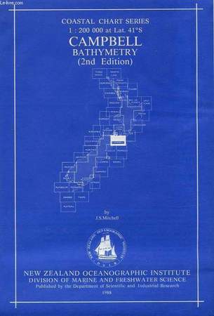
MITCHELL J. S.
CAMPBELL BATHYMETRY, COASTAL CHART SERIES, 1:200 000 at Lat. 41°S
New Zealand Oceanographic Institute - DSIR. 1988. In-8 Carré. En feuillets. Bon état. Couv. convenable. Dos satisfaisant. Intérieur frais. 1 carte dépliable très grand format en couleur dans sa pochette plastique d'origine. 2nd edition. N.Z. Ocean. Inst., Division of Marine and Freshwater Science.

|
|
|
MITCHELL J. S.
CAMPBELL BATHYMETRY, COASTAL CHART SERIES, 1:200 000 at Lat. 41°S
New Zealand Oceanographic Institute - DSIR. 1988. In-8. En feuillets. Bon état, Couv. convenable, Dos satisfaisant, Intérieur frais. 1 carte dépliable très grand format en couleur dans sa pochette plastique d'origine.. . . . Classification Dewey : 912-Atlas, cartes et plans
Bookseller reference : RO40107296
|
|
|
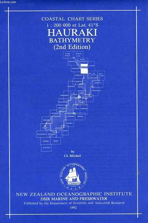
MITCHELL J. S.
HAURAKI BATHYMETRY, COASTAL CHART SERIES, 1:200 000 at Lat. 41°S
New Zealand Oceanographic Institute - DSIR. 1992. In-8 Carré. Broché. Très bon état. Couv. fraîche. Dos impeccable. Intérieur frais. 1 carte dépliable très grand format en couleur dans sa pochette plastique d'origine. 2nd edition. N.Z. Ocean. Inst., Division of Marine and Freshwater Science.

|
|
|
MITCHELL J. S.
HAURAKI BATHYMETRY, COASTAL CHART SERIES, 1:200 000 at Lat. 41°S
New Zealand Oceanographic Institute - DSIR. 1992. In-8. Broché. Très bon état, Couv. fraîche, Dos impeccable, Intérieur frais. 1 carte dépliable très grand format en couleur dans sa pochette plastique d'origine.. . . . Classification Dewey : 912-Atlas, cartes et plans
Bookseller reference : RO40107773
|
|
|
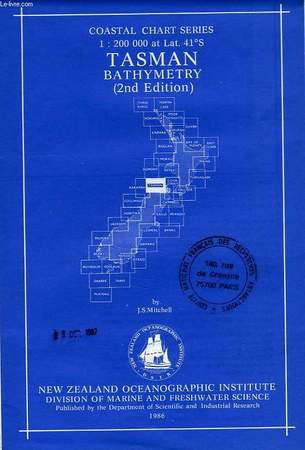
MITCHELL J. S.
TASMAN BATHYMETRY, COASTAL CHART SERIES, 1:200 000 at Lat. 41°S
New Zealand Oceanographic Institute - DSIR. 1986. In-8 Carré. En feuillets. Très bon état. Couv. fraîche. Dos impeccable. Intérieur frais. 1 carte dépliable très grand format en couleur. Tampons 'Comité National Français des Recherches Antarctiques' sur le 1er plat. 2nd edition. N.Z. Ocean. Inst., Division of Marine and Freshwater Science.

|
|
|
MITCHELL J. S.
TASMAN BATHYMETRY, COASTAL CHART SERIES, 1:200 000 at Lat. 41°S
New Zealand Oceanographic Institute - DSIR. 1986. In-8. En feuillets. Très bon état, Couv. fraîche, Dos impeccable, Intérieur frais. 1 carte dépliable très grand format en couleur. Tampons 'Comité National Français des Recherches Antarctiques' sur le 1er plat.. . . . Classification Dewey : 912-Atlas, cartes et plans
Bookseller reference : RO40107294
|
|
|
Mitchell's Universal Atlas
A Map of the State of Missouri
Size is 17" x 13.75". Entered 1850 Thomas Cowperthwait & Co. Clerk's Office Eastern District of Pennsylvania. Map is colored in pink green and yellow. Railroads stage lines canals etc. All very good c ondition. unknown
Bookseller reference : 002058

|
|
|
Mitchell's Universal Atlas
A New Map of Maine
Size is 16" x 12.75". with Counties and County towns with populations. Railroads stage routes and canals are noted. Map is colored in pink green and yellow. Entered 1850 Thomas Cowperthwait & Co. Clerk's Office Eastern Distraict of Pennsylvania. All very good condition. unknown
Bookseller reference : 002054

|
|
|
Mitchell's Universal Atlas
A New Map of Alabama
Size is 13" X16.50". with its Roads & Distances from place to place along the Stage and Steam Boat Routes. Entered 1850 Thomas Cowperthwait & Co. Clerk's Office Eastern District of Pennsylvania. Map is col ored in pink green and yellow. Railroads canals and steam boat routes are noted. Map is placed on acid-free whiteboard and shrink wrapped. All very good condition. unknown
Bookseller reference : 002050

|
|
|
Mitchell's Universal Atlas Illustrated by Thomas Cowperthwait & Co
A New Map of Germany
With a Table of the German States. Entered 1850 by Thomas Cowperthwait & Co. Clerk's Office District Court Eastern Dist. of Pennsylvania. Colored in pink green yellow and black and white. Decorat ive light green borders. Map measures 13.25" x 16.25" shrink wrapped on acid-free white board. All very good condition. Cartography maps geography history Germany exploration. unknown
Bookseller reference : 000251

|
|
|
Mitchell's Universal Atlas
A New Map of Louisiana
Size is 15.25" x 12.50". with canals roads and distances from place to place long the Stage and Steam Boat Routes. Map is colored in pink green and yellow. Inset of Mississippi River Front with street direc tory with references and locations of businesses.Entered 1850 Thomas Cowperthwait & Co. Clerk's Office Eastern District of Pennsylvania. All very good condition. unknown
Bookseller reference : 002051

|
|
|
Mitchell's Universal Atlas
A New Map of New York
Size is 14.50" x 12.50". with its canals roads and distances from place to place. Inset of "Profile of Erie Canal". Shows Steam Boat Routes from New York to Albany New York to Falls of Niagara and New York to Philadelphia. All very good condition. Entered 1850 Thomas Cowperthwait & Co. Clerk's Office Eastern District of Pennsylvania. unknown
Bookseller reference : 002055

|
|
|
Mitchell's Universal Atlas
A New Map of Georgia
Size is 16.50" x 13". Roads and distances railroads canals etc. Inset with Steamboat Routes Savannah to Augusta & return shows Fort Scott and the Okefinoke Swamp. Map is colored in pink yellow and green with decorative borders in green. Map is placed on acid-free whiteboard and shrink wrapped. All very good condition. Entered 1850 Thomas Cowperthwait Clerk's Office District of Eastern Pennsylvania. unknown
Bookseller reference : 002043

|
|
|
Mitchell's Universal Atlas
A New Map of Michigan
Size is 16.50" x 13". with its roads and distances from place to place with Stage and Steam Boat Routes. Map is colored in pink green and yellow. Entered 1850 Thomas Cowperthwait & Co. Clerk's Office East ern District of Pennsylvania. Inset of Western part of Michigan railroads etc. All very good condition. unknown
Bookseller reference : 002052

|
|
|
Mitchell's Universal Atlas
A New Map of Virginia
15.50" x 13". With its Canals Roads and Distances from place to place Stage and Steam Boat Routes. Shows "Profile of Chesapeake & Ohio Canal". Railroads canals roads etc. Insets of steam boat rout es and distances ' "Richmond to Norfolk"; "Richmond to Washington"; "Richmond to Baltimore"; "Wheeling to Pittsburg"; and "Wheeling to Cincinnati". Entered in 1850 by Thomas Cowperthwait Clerks Offic e Eastern District of Pennsylvania. There are some small ink marks on the interior of the map. Overall the map is in good condition. . unknown
Bookseller reference : 002038

|
|
|
Mitchell's Universal Atlas
A New Map of Mississippi
Size is 15" x 12.25". with its roads and distances from place to place. Steam Boat Routes are from Natchez to New Orleans and Natchez to Pittsburg. Map is colored in pinkgreen and yellow. Map is then placed on acid-free whiteboard and shrink wrapped. Railroads are indicated. Entered 1850 Thomas Cowperthwait & Co. Clerk's Office Eastern District of Pennsylvania. All very good condition. unknown
Bookseller reference : 002056

|
|
|
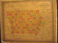
Mitchell's Universal Atlas
A New Map of the State of Iowa
Size is 17" x 13.75". Thomas Cowperthwait Entered 1850 Clerk's Office District of Eastern Pennsylvania. Colored in pink yellow and green. The map is placed on acid-free whiteboard and shrink wrapped. The map is dated 1852. Shows canals railroads and the State Capital is noted. Alll very good condition. unknown
Bookseller reference : 002044
|
|
 Receive by email
 Download as PDF document
 RSS feed


