|
WHITHEHOUSE (David et Ruth) -
Atlas archéologique universel -
Paris, Tallandier, 1975. In-8, reliure éditeur cartonnée pleine toile, sous jaquette illustrée en couleures, 290p. Avec 107 cartes dessinées par John Woodcock et Shalom Schotten. Très bon état.
Bookseller reference : 1566
|
|
|
WHITFIELD Philip
Atlas des mystères de la terre.
Paris, France Loisirs, 1990. 24 x 30, 240 pp., très nombreuses illustrations en couleurs et en N/B, cartonnage d'édition + jaquette, bon état.
Bookseller reference : 24841
|
|
|
WHITEHOUSE (David), WHITEHOUSE (Ruth)
Atlas archéologique universel.
P., Tallandier, 1978. In-8 rel. pleine toile éditeur sous jaquette ill. en couleurs, signet, 290 pp., 107 cartes dessinées par John Woodcock et Shalom Schotten, bibliographie, index.
Bookseller reference : 527845
|
|
|
Whico Atlas Company
Whico Oil / Gas and Marine Atlas Gulf Coast. South Texas - Texas Gulf Coast - South Louisiana - Offshore.
Whico Atlas Company. 1976. Book. Good. Soft cover. Softcover; ex-corporate library; edges of covers creased w/ several small tears along edges of covers; light foxing of front cover and endpage; o/w contents in good condition. This is a heavy volume; extra shipping might be required for priority mail or international orders. . Whico Atlas Company. Paperback
Bookseller reference : 033910
|
|
|
White Edmund; James Atlas Ed.
Marcel Proust: A Penguin Lives Biography
New York: Viking Press 1999. Hardcover. pp. 165. 8vo. Very good in very good dustjacket. <br/><br/> Viking Press hardcover
Bookseller reference : 051144 ISBN : 0670880574 9780670880577

|
|
|
Wichmann, E. H. [Ernst Heinrich] [Hrsg.]
Atlas zur Geschichte Hamburgs. Auf Veranlassung der Oberschulbehörde hrsg. 2. Aufl.
Hamburg, Herold'sche Buchhandlung, 1896. 4 nn. Text-Seiten. Mit 6 farb. lithogr. doppelblattgr. Ktn. Kl.-8vo. OPp.
Bookseller reference : 34644
|
|
|
Wichmann, E. H. [Ernst Heinrich] [Hrsg.]
Atlas zur Geschichte Hamburgs. Auf Veranlassung der Oberschulbehörde hrsg. 6. Auflage.
Hamburg, Herold'sche Buchhandlung, 1914. 4 nn. Text-Seiten. Mit 6 farb. lithogr. doppelblattgr. Ktn. im Maßstab 1:12000. Kl.-8vo. 19 cm. OHLn.
Bookseller reference : 17409

|
|
|
Wiegelmann, G. (Bearb.)
2. Arbeitstagung über Fragen des Atlas der deutschen Volkskunde im Institut für geschichtliche Landeskunde der Rheinlande an der Universität Bonn vom 23. bis 25. April 1959. Protokollmanuskript zusammengestellt von G. Wiegelmann.
Bonn: Arbeitsstelle des Atlas der deutschen Volkskunde 1959. 59 Seiten. 4° (25-35 cm). Leinenverstärkte Orig.-Broschur. [Softcover / Paperback].
Bookseller reference : 3113645

|
|
|
Wiegelmann, G. (Bearb.)
3. Arbeitstagung über Fragen des Atlas der deutschen Volkskunde im Institut für geschichtliche Landeskunde der Rheinlande an der Universität Bonn vom 27. April bis 29. April 1961. Protokollmanuskript (10 Karten u. Abb.) zusammengestellt von G. Wiegelmann.
Bonn: Arbeitsstelle des Atlas der deutschen Volkskunde 1961. (6), 108, (24) Seiten. 4° (25-35 cm). Leinenverstärkte Orig.-Broschur. [Softcover / Paperback].
Bookseller reference : 3113646

|
|
|
Wienecke-Janz, Detlef (Hrsg.)
Wissen.de-Pocket-Weltatlas. Die Welt in Karten ; Flaggen und Länder von A - Z.
Gütersloh ; München : Wissen.de-Verlag, 2003. 351 S. mit zahlreichen Abbildungen; 20 cm; gebunden, illustrierter Orig.-Pappband,
Bookseller reference : 103396

|
|
|
Wiese, Eigel und Maria Prechtl
Der neue Weltatlas
London, George Philip Ltd,, 1993. 160 Seiten , 32 cm , Hardcover/Pappeinband
Bookseller reference : 49613

|
|
|
WIHTOL de WENDEN (Catherine).
Atlas mondial des migrations. Réguler ou réprimer... gouverner.
Autrement, 2009, gr. in-8°, 79 pp, nouvelle édition, cartographie de Madeleine Benoit-Guyod, plus de 80 cartes et infographies en couleurs, glossaire, biblio, index, broché, couv. illustrée, bon état
Bookseller reference : 119440
|
|
|
Willem Jan Neutelings
Around the world in 200 globes, stories of the twentieth century
Antwerpen , Uitgeverij Luster, 2024 Hardcover, 264 pages, 30.5 x 25 cm, richly illustrated, English text. ISBN 9789460583674.
Bookseller reference : 66524
|
|
|
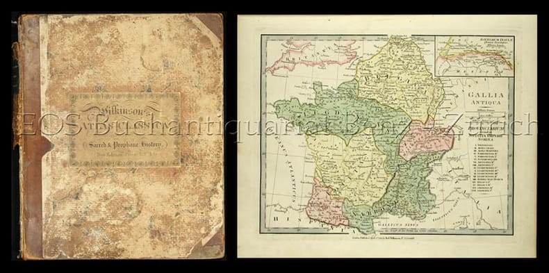
Wilkinson, (Robert):
Atlas Classica. Being a collection of maps of the countries mentioned on the ancient authors, both sacred and profane. With their various subdivisions at different periods.
London, Hamilton Adams, 1830. Folio. (2) S. Mit 1 gest. Titelblatt, 46 kol. (davon 7 doppelblattgr.) Karten, 7 kol. gest. (davon 1 doppelblattgr.) Zeittafeln. Halblederband der Zeit.
Bookseller reference : 2815DB
|
|
|
WILLIAM BRIAN
LE PETIT ATLAS DES PAYS DU MONDE
FRANCE LOISIRS. 1993. In-12. Relié. Bon état, Couv. convenable, Dos satisfaisant, Intérieur frais. 415 pages. Nombreuses illustrations en couleurs dans le texte. Reliure d'éditeur moderne.. . . . Classification Dewey : 912-Atlas, cartes et plans
Bookseller reference : RO30071532 ISBN : 272425743
|
|
|
Williams Brian
Le petit atlas des pays du monde
France Loisirs. 1996. In-8. Relié. Bon état, Couv. convenable, Dos satisfaisant, Intérieur frais. 415 pages. Nombreuses cartes en couleurs dans et hors texte.. . . . Classification Dewey : 912-Atlas, cartes et plans
Bookseller reference : RO80251682 ISBN : 272425743

|
|
|
Williams Brian
The Kingfisher Reference Atlas: An A-Z Guide to Countries of the World
Kingfisher Books 1993 21x26x2cm. 1993. Relié.
Bookseller reference : 500229329

|
|
|
Wildrose Mapping & Atlas Inc
Mountain View County Rural Atlas & Directory
Calgary Alberta: Wildrose Mapping & Atlas Inc 1998. 296pp. Quarto softcover in dark green wrappers with spiral binding. Slight wear on wrappers clean text with maps B&W photos local advertising. Very good condition. A rural atlas directory and local history for the county of Mountain View including areas of Bearberry Sundre Westward Harmattan Olds Mayton Bergen Elkton Wescott Didsbury Neapolis Garfiesd Carstairs Cremona Water Valley Stirlingville and Dog Pound. Contents include maps directories family histories and photos community information county history crop management storm guide county officials local advertisements. 1998 Wildrose Mapping & Atlas Inc paperback
Bookseller reference : 142020
|
|
|
Wilkinson, (Robert)
Atlas Classica. Being a collection of maps of the countries mentioned on the ancient authors, both sacred and profane. With their various subdivisions at different periods.
London, Hamilton Adams, 1830. Folio. (2) S. Mit 1 gest. Titelblatt, 46 kol. (davon 7 doppelblattgr.) Karten, 7 kol. gest. (davon 1 doppelblattgr.) Zeittafeln. Halblederband der Zeit. + Wichtig: Für unsere Kunden in der EU erfolgt der Versand alle 14 Tage verzollt ab Deutschland / Postbank-Konto in Deutschland vorhanden +, 2815D
Bookseller reference : 2815DB

|
|
|
William A. Wellman director; Leopold Atlas Guy Endore Philip Stevenson screenwriters; Burgess Meredith Robert Mitchum Freddi
Story of G.I. Joe Original pressbook for the 1945 film
Beverly Hills CA: United Artists 1945. Vintage pressbook for the 1945 film. <br/><br/>Ernie Pyle Meredith is a journalist who enlists in the US Army during WWII. During his tour of duty in Africa and Italy he documents the effects of war on the human condition illuminating catastrophe the consequences of combat and new partnerships in times of crisis all from a first-person narrative. The real Pyle won a Pulitzer Prize in 1944 for his war correspondence. <br/><br/>Nominated for four Academy Awards. <br/><br/>14x 21 inches. 22 pages and a laid-in ad sheet saddle stapled in monochrome wrappers folded horizontally as issued. Very Good plus with spine rubbing a few spine chips and light foxing overall. United Artists unknown books
Bookseller reference : 139955
|
|
|
William R. Wellnitz; Ronald M. Atlas
Microorganisms in Our World
Mosby Incorporated 1995. Paperback. Very Good. Disclaimer:A copy that has been read but remains in excellent condition. Pages are intact and are not marred by notes or highlighting but may contain a neat previous owner name. The spine remains undamaged. At ThriftBooks our motto is: Read More Spend Less.Dust jacket quality is not guaranteed. Mosby, Incorporated paperback
Bookseller reference : G0815103360I4N00 ISBN : 0815103360 9780815103363
|
|
|
Willis-O'Connor, Col. H.; Macbeth, Madge; Baxter, Beverley; Allen, Robert Thomas; Frayne, Trent; Rosenfeld, Max; Montagu, The Hon. Ewen E.S.; Herbert, F.Hugh; Sloman, Fred; Fraser, Blair; Gilmour, Clyde;
Maclean's, Canada's National Magazine, June 1, 1953
56 pages. Features: Nice colour ad for the 1953 Mercury Monterey Custom Coupe inside front cover; Life with Five Governors-General (part 1 of 2) - the Bessboroughs, the Byngs and the Willingdons; The Binghams Came to Blows (fiction); Who will succeed Sir Winston Churchill?; How to sell a house (humour); Tom Thomson - The Rebel Painter of the Pine Woods - article with photos and colour reproduction of "The Pointers"; The Keys to the Car (fiction); Barrister Arthur Martin, QC - His clients never hang; The Corpse That Hoaxed the Nazis (conclusion) - the elaborate story of how the Allies tricked the Nazis into thinking Sardinia would be invaded, rather than Sicily; Fantastic 'mom and apple pie' General Motors of Canada centerfold colour illustration shows a 'Happy Community" - smiling pedestrians, sunny sky and roads full of GM of Canada cars; Gorgeous full-page colour ad for a yellow Oldsmobile '98' Holiday Coupe; uncommon ad for IEL (Industrial Engineering Limited) power chain saws; Interesting colour ad for Atlas tires on back cover shows the 61 license plates of the US states and Canadian provinces; and more. Clean and unmarked with moderate wear. A quality vintage copy. Book

|
|
|
Willkomms, Moritz Dr
Bilder-Atlas des Pflanzenreichs. Nach dem Englerschen System neu herausgegeben von Prof. E. Köhne.
Eßlingen, München Schreiber 1927. 6. Aufl./unveränd. Neudr. der vollst. umgearb. 5. Aufl. 4° XXII/183 S., m. 526 Pflanzenbild. a. 124 Farbendr.-Taf., 1 Schwarzdr.-Taf. u. 205 S. Text m. 100 Abb. OL. Guter Zust. 5
Bookseller reference : 45677AB
|
|
|
Willoughby Jackie; Atlas Susan
The Healing Art of Beauty: Developing a Positive Self-Image Through Paramedic.
Keren Happuch Ltd 1989-12-01. Paperback. Good. pb 1989 cover has some shelf wear lite stain otherwise very nice clean text no underlining/highlighting binding tight SKU-A135 A small family business committed to BIG service! R2-4/19 Keren Happuch Ltd paperback
Bookseller reference : 6E-Q76T-UTJE ISBN : 9990800669 9789990800661
|
|
|
Wilson, Colin
Kultstätten der Menschheit : [ein Atlas zu den heiligen Orten und mythischen Plätzen unserer Erde].
Münster : Premio, 2006. 191 S. zahlr. Ill., Kt. ; 31 cm. OPp., gebundene Ausgabe.
Bookseller reference : 172094

|
|
|
Wilson, Peter W.F. (Ed.)
Atlas of Atherosclerosis: Risk Factors and Treatment (4 Bände im Schuber, komplett).
Philadelphia, Current Medicine, 2002. 57; 86; 62; 82 S. (31x25,5 cm) Großformat, Broschierte Ausgabe im gemeinsamen Schuber
Bookseller reference : 38124
|
|
|
WINKLER, Rainer
STOMATHERAPIE. - ATLAS UND LEITFADEN FÜR INTESTINALE STOMATA.
Stuttgart, Thieme, 1983. 104 s. Mit vielen, meist Farbigen illustrationen. Fester orig.-Einband mit Deckel- und Rückentitel; kl.-4to.
Bookseller reference : 2039xbvk
|
|
|
Winter, Rudolf [Hrsg.]
Geo-Satellitenbild-Atlas Deutschland.
Berlin/Gütersloh/Leipzig/München/Potsdam/Stuttgart, RV-Verl, 1992. 3. Aufl. 36 cm. 239 S., Ill., graph. Darst., überwiegend Kt. Pp., OU., OU etwas berieben u. m. kl. Randläsuren, innen einige Ecken geknickt, sonst sauber u. gut erhalten. 3
Bookseller reference : 57209AB
|
|
|
Winter, Rudolf [Hrsg.]
Geo-Satellitenbild-Atlas Deutschland. [8. Aufl.]
München ; Stuttgart : RV-Verl., [1998]. 239 S., Ill., graph. Darst., überw. Kt. OPp., gebundene Ausgabe, SU.
Bookseller reference : 89645

|
|
|
Winter, Rudolf und Lothar Beckel
Satellitenbild Atlas Deutschland
München, Stuttgart, RV Reise- und Verkehrsverlag GmbH, 1996. 239 Seiten , 36 cm, Hardcover/Pappeinband
Bookseller reference : 42835

|
|
|
Winter, Rudolf. Beckel, Lothar. Herausgeber
Satellitenbild Atlas Norddeutschlands.
Berlin, Gütersloh, u.a.., RV Verlag - Reise- und Verkehrsverlag., 1992. Herausgegeben von Rudolf Winter und Lothar Beckel in zusammenarbeit mit der Deutschen Forschungsanstalt für Luft- und Raumfahrt. 95(1)S. überwiegend Satellitenfotos, wenige Luftbildaufnahmen. Guter Zustand. 2°. OPappband.
Bookseller reference : 039722
|
|
|
Winter, Rudolf. Beckel, Lothar. Herrausgeber
Geo Satellitenbildatlas Deutschland.
Berlin, Gütersloh u.a.., RV Reise und Verkehrsverlag., 1991. In Zusammenarbeit mit der Deutschen Forschungsanstalt für Luft- und Raumfahrt. 239(1) Seiten mit zahlreichen Satellitenkarten meist im Maßstab 1 : 200 000. Zustand: Aus einer Institutsbibliothek ausgeschieden, Titelblatt mit Bibliotheksstempel und Inventarnummer. 2°. OPappband.
Bookseller reference : 051052
|
|
|
Witzig Fritz
Munich et ses environs. Un nouveau guide avec 30 photos en couleur et 4 schémas. Un plan des parkings, un plan du Métro et des Tramways
Witzig. 1972. In-12. Broché. Bon état, Couv. convenable, Dos satisfaisant, Papier jauni. 98 pages. Nombreuses planches d'illustrations en couleur, hors texte.. . . . Classification Dewey : 912-Atlas, cartes et plans
Bookseller reference : RO30342234

|
|
|
WITH COMPLIMENTS OF THE MINISTRY OF INFORMATION, KINGDOM OF SAUDI ARABIA.
Saudi Arabian map: The Kingdom of the Saudi Arabia.= Harita al-Mamlakat al-Arabiyya al-Saudiyya.
Very Good English Original folded color map. Oblong atlas folio. (60x91 cm). Bilingual in English and Arabic. Arabic map and texts with b/w photographs of some views from Saudi Arabia and English map and texts with b/w photos of Jeddah, Riyadh and Dhahran airports with legends and "distances in kilometers". It shows a very detailed landscape of entire Arabian Peninsula including Saudi Arabia, Aden, Oman, Muscat Qatar, Trucial Coast, Nafud, Dahna, Rub' Al-Khali, Najran, Asir, Yemen, Ramlat As Sab'atayn, Dhofar, Al Mahrah, Hadhramaut, Kuwait, Neutral Zone, and others.
|
|
|
Wittke, Anne-Maria/ Olshausen, Eckart/ Szydlak, Richard
Historischer Atlas der antiken Welt. (Der neue Pauly, Supplemente Band. 3).
Stuttgart Metzler (Liz. Darmstadt: WBG) um 2012. XIX, 308 S., 48 s/w Abb., 168 farb. Abb., 168 farbige Karten; 77 sw-Karten und Tabellen, Stammtaf. Gr 4° Kart.mS. *verlagsneu*.
Bookseller reference : 229465

|
|
|
WOERL, J. (Joseph Edmund).:
(Atlas) Karte der Schweiz. Lithographie von B. Herder in Freiburg im Breisgau.
(Freiburg i.Br., Herder), 1834-35), Quer-Gr.-Folio, lithographierter Titel und 19 lithographierte Karten, mit Rotdruck und Handkolorit, Papier gebräunt und stockfleckig, Randriss bei 2 Karten, Halblederband, Deckel mit Marmorpapier bezogen, etwas berieben.
Bookseller reference : 7222aaf
|
|
|
Wolff, Christian
Elfha-Stadtatlas Hamburg. [Werbedruck Schreyer Bürotechnik Hamburg].
[Hamburg], Cram, de Gruyter, o.J.[1962]. Kunststoffeinband, gr-8°, 46 S. Straßenverzeichnis, 13 gefaltete farbige Tafeln mit 24 Karten, 1 gefaltete s/w Tafel mit einer Luftbildaufnahme und 1 Umgebungsplan, 1 Innenstadtplan; -etwas berieben, gutes Exemplar.
Bookseller reference : 14435
|
|
|
Wolff, Hans (u.a.)
Philipp Apian und die Kartographie der Renaissance.
Weissenhorn, Anton H. Konrad, 1989. 237 S. Mit 175, teils farbigen Abb. (= Bayerische Staatsbibliothek: Ausstellungskataloge, 50). Quer-Gr.-8vo (23 x 27 cm). Engl. Brosch.
Bookseller reference : 94085
|
|
|
WOLVERTON ATLAS OF MONMOUTH COUNTY
MATAWAN 1889 MAP
1889. WOLVERTON ATLAS OF MONMOUTH COUNTY. MATAWAN 1889 MAP. A 15-inch by 22-inch hand-colored map showing Matawan depicting the area from the Matawan Creek to Atlantic Avenue. $100.00. <br/><br/> unknown
Bookseller reference : 26247

|
|
|
WOLVERTON ATLAS OF MONMOUTH COUNTY
MATAWAN 1889 MAP
1889. WOLVERTON ATLAS OF MONMOUTH COUNTY. MATAWAN 1889 MAP. A 15-inch by 22-inch hand-colored map showing Matawan depicting the area from the Matawan Creek to Atlantic Avenue. $100.00. <br/><br/> unknown books
Bookseller reference : 26247
|
|
|
WOLVERTON'S ATLAS OF MONMOUTH COUNTY
EATONTOWN MAP: 1889
1889. WOLVERTON'S ATLAS OF MONMOUTH COUNTY. EATONTOWN MAP 1889. A 20-inch by 30-inch hand-colored map of Eatontown also showing Monmouth Park and Oceanport. Probably one of the best early maps of Eatontown ever made. $125.00. <br/><br/> unknown
Bookseller reference : 26237

|
|
|
WOLVERTON'S ATLAS OF MONMOUTH COUNTY
HOWELL TOWNSHIP: 1889 MAP
1889. WOLVERTON'S ATLAS OF MONMOUTH COUNTY. HOWELL TOWNSHIP 1889 MAP. A 20-inch by 30-inch hand-colored map of Howell Township showing West Farms Fairfield Farmingdale Jerseyville Turkey Blue Ball Greenville Runyons Bethel and Squankum. $125.00. <br/><br/> unknown
Bookseller reference : 26242

|
|
|
WOLVERTON'S ATLAS OF MONMOUTH COUNTY
MILLSTONE TOWNSHIP MAP 1889
1889. WOLVERTON'S ATLAS OF MONMOUTH COUNTY. MILLSTONE TOWNSHIP 1889 MAP. A 20-inch by 30-inch hand-colored map of Millstone Township also showing the Navesink section of Middletown Township. $125.00. <br/><br/> unknown
Bookseller reference : 26238

|
|
|
WOLVERTON'S ATLAS OF MONMOUTH COUNTY
RARITAN 1889 MAP
1889. WOLVERTON'S ATLAS OF MONMOUTH COUNTY. RARITAN MAP 1889. A 15-inch by 18-inch hand-colored map of Raritan showing the Union Keyport Bethany Centerville and Granville school districts. $50.00. <br/><br/> unknown
Bookseller reference : 26248

|
|
|
WOLVERTON'S ATLAS OF MONMOUTH COUNTY
EATONTOWN MAP: 1889
1889. WOLVERTON'S ATLAS OF MONMOUTH COUNTY. EATONTOWN MAP 1889. A 20-inch by 30-inch hand-colored map of Eatontown also showing Monmouth Park and Oceanport. Probably one of the best early maps of Eatontown ever made. $150.00. unknown books
Bookseller reference : 26237
|
|
|
WOLVERTON'S ATLAS OF MONMOUTH COUNTY
HOWELL TOWNSHIP: 1889 MAP
1889. WOLVERTON'S ATLAS OF MONMOUTH COUNTY. HOWELL TOWNSHIP 1889 MAP. A 20-inch by 30-inch hand-colored map of Howell Township showing West Farms Fairfield Farmingdale Jerseyville Turkey Blue Ball Greenville Runyons Bethel and Squankum. $150.00. unknown books
Bookseller reference : 26242
|
|
|
WOLVERTON'S ATLAS OF MONMOUTH COUNTY
MILLSTONE TOWNSHIP MAP 1889
1889. WOLVERTON'S ATLAS OF MONMOUTH COUNTY. MILLSTONE TOWNSHIP 1889 MAP. A 20-inch by 30-inch hand-colored map of Millstone Township also showing the Navesink section of Middletown Township. $150.00. unknown books
Bookseller reference : 26238
|
|
|
WOLVERTON'S ATLAS OF MONMOUTH COUNTY
RARITAN 1889 MAP
1889. WOLVERTON'S ATLAS OF MONMOUTH COUNTY. RARITAN MAP 1889. A 15-inch by 18-inch hand-colored map of Raritan showing the Union Keyport Bethany Centerville and Granville school districts. $50.00. <br/><br/> unknown books
Bookseller reference : 26248
|
|
|
WOOD JENNY
ATLAS DES PAYS DU MONDE
CASTERMAN. 1994. In-Folio. Relié. Etat d'usage, Couv. convenable, Coiffe en tête abîmée, Intérieur frais. 95 pages augmentées de nombreuses illustrations et photos en couleur in et hors texte. . . . Classification Dewey : 912-Atlas, cartes et plans
Bookseller reference : R160203801
|
|
|
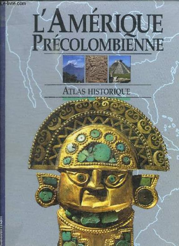
WOOD MARION
L'AMERIQUE PRECOLOMBIENNE - ATLAS HISTORIQUE
CASTERMAN. 1991. In-4. Relié. Bon état, Couv. convenable, Dos satisfaisant, Intérieur frais. 96 pages. Nombreuses illustrations en couleur dans et hors texte.. . . . Classification Dewey : 912-Atlas, cartes et plans
Bookseller reference : RO30133676
|
|
 Receive by email
 Download as PDF document
 RSS feed


