|
|
|
De Colange, Leo
Picturesque European Scenery. A Series of views of the most interesting and striking landscapes of the old World.
New York, Nims, 1883. 136 S., ca. 100 Woodcuts- Illustr., Or.-Ln., Schmuckeinb., guter Zust.(good condition)
Bookseller reference : 6365AB
|
|
|
De Coster Charles
La leggenda di Thyl Ulenspiegel A cura di Michele Rago (stampa 1991)
trad. di Umberto Fracchia n. 23 bross. edit. ill. con bandelle

|
|
|
DE COSTER L.
Explications faisant suite aux précédentes notices sur l'attribution à Charlemagne de quelques types monétaires
25pp.+ 1 planche, non coupé, br.orig., extrait de la "Revue de la numismatique belge" T.I 3e série, bel état
|
|
|
de Courcy Anne
Diana Mosley: Mitford Beauty British Fascist Hitler's Angel
New York: HarperCollins Publishers 2003. 432pp 24pp b/w photos bibliography two appendices index. Trace of old price sticker beneath the title on the front cover. A biography of 'the cleverest of the six Mitford sisters'. First US Paperback Edition. Soft Cover. Very Good. Trade Paperback. HarperCollins Publishers Paperback
Bookseller reference : 027230 ISBN : 0060565322 9780060565329

|
|
|
De Crescenzo, Luciano
Geschichte der griechischen Philosophie : von Sokrates bis Plotin / aus d. Ital. von Linde Birk.
Zürich : Diogenes, 1988. 244 S. Ill. 8°. Bibl.- Einbd.
Bookseller reference : 42196
|
|
|
DE CSIKAY Paul (& GIDE Charles, préface)
L'Europe centrale économique et sociale
ix + 160pp., br.orig., 19cm., cachet, bon état, E42073
|
|
|
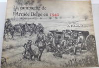
de Fabribeckers
La Campagne de l'Armée Belge en 1940
Lummen: Edité par l'Auteur. Softcover. Published Lummen: Edité par l'Auteur 1966. Oblong 4to. wrappers 9 1/2" x 12 1/4" 159pp. plus 14 folding 3-color maps illus. with 24 full-page drawings by James Thiriar. Text in French. Very good. . Very Good. Soft cover. 1966. Edité par l'Auteur paperback
Bookseller reference : 010592
|
|
|
De Felice, Renzo
Mussolini il rivoluzionario 1883-1920
Mm 135x210 Collana "Einaudi tascabili" - Volume nella sua brossura originale, xxx-773 pagine con indice dei nomi in chiusura. Copia eccellente e mai letta, solo una picola etichetta di biblioteca dismessa in apertura. Spedizione in 24 ore dalla conferma dell'ordine.
|
|
|
De Felice, Renzo
Mussolini il rivoluzionario 1883-1920
Mm 150x210 Collana "Biblioteca di cultura storica". Volume rilegato in tela, sovraccoperta originale con tracce del tempo, xxx-773 pagine con indice dei nomi in chiusura. Opera in ottime condizioni. Spedizione in 24 ore dalla conferma dell'ordine.

|
|
|
De Feller, Francois Xavier
SUPPLEMENT AU DICTIONNAIRE HISTORIQUE - VOLUME 1
Paris: Chez Mequignon. Good; Missing Cover Some Loose Pages. 1819. Paperback. 331 pages . Chez Mequignon paperback
Bookseller reference : 62331
|
|
|
DE FER Nicolas (1646-1720 circa)
Basle Ville Capitale du Canton du mene nom…
Pianta della città tratta dal celebre "les Forces des Europe…" pubblicazioni sulle principali città europee edita a Parigini all'inizio del XVIII secolo. Incisione in rame, in buione condizioni. Fine bird's-eye plan details the walled city and surrounding countryside. The map is oriented with north at right by a compass rose. A key at left identifies 20 important buildings and gates. Nicolas de Fer held the title of Geographer at Louis XIV's court. He was one of the most prolific publishers of plans of European cities in the late seventeenth century.

|
|
|
DE FER Nicolas (1646-1720 circa)
La Mer Mediterranee et les Costes des Estats Qui La Borne Par N. de Fer Geographe de sa Majeste Catolique et de Monseigneur
Carta tratta da: Atlas ou Recueil de cartes geographiques Dressées Sur les Nouvelles Observations de Mrs de l’Academie Royale des Sciences Par N. de Fer, Geographe de sa Majesté Catolique et de Monseigneur le Dauphin. A Paris, chez l’Auteur dans l’Isle du Palais sur le Quay de l’Orloge a la Sphere Royale. Avec privilege du Roy 1709.Acquaforte, dimensioni 360x755 mm. Titolo nel cartiglio in basso a destra; imprint editoriale nel cartiglio in alto a sinistra, che contiene anche la scala metrica: A Paris, Chez l’Auteur dans l’Isle du Palais sur le Quay de l’Orloge à a la Spere Royale. Avec Privilege du Roy. 1709. In basso a destra, la firma dell’incisore Johannes van Loon. Carta nautica del Mediterraneo pubblicata nell’Atlas ou Recueil de cartes geographiques di Nicolas de Fer, dedicata a Luigi di Francia le “Grand Dauphine”, erede al trono di Luigi XIV. Bell'esemplare in coloritura antica.Bibliografia: Mare Nostrum, a historic voyage across the Mediterranean Sea, Lussemburgo, 2003, p. 40; M. Pastoureau, Les Atlas Francais XVIe-XVIIe siècles, Parigi, 1984, pp. 167-223, FER II A (77). Etching, with fine old colour, very good condition.Map taken from: Atlas ou Recueil de cartes geographiques Dressées Sur les Nouvelles Observations de Mrs de l’Academie Royale des Sciences Par N. de Fer, Geographe de sa Majesté Catolique et de Monseigneur le Dauphin. A Paris, chez l’Auteur dans l’Isle du Palais sur le Quay de l’Orloge a la Sphere Royale. Avec privilege du Roy 1709.Title in the cartouche below right; imprint editorial in the cartouche at the top left, which also contains the metric scale: A Paris, Chez l'Auteur dans l'Isle du Palais sur le Quay de l'Orloge à a la Spere Royale. Avec Privilege du Roy. 1709. At the bottom right, the signature of the engraver Johannes van Loon.Chart of the Mediterranean published in the "Atlas ou Recueil de cartes geographiques" of Nicolas de Fer, dedicated to Louis of France the "Grand Dauphine", heir to the throne of Louis XIV.Bibliografia: Mare Nostrum, a historic voyage across the Mediterranean Sea, Lussemburgo, 2003, p. 40; M. Pastoureau, Les Atlas Francais XVIe-XVIIe siècles, Parigi, 1984, pp. 167-223, FER II A (77). S. Bifolco, "Mare Nostrum, Cartografia nautica a stampa del Mar Mediterraneo" (2020), pp. 256-257, tav. 119.

|
|
|
DE FER Nicolas (1646-1720 circa)
Les Suisses Leurs Sujets et Leurs Alliez
Bell'esemplare della mappa della Svizzera di De Fer, aggiornata e corretta dal suo successore, Guillaume Danet. Mappa superbamente dettagliata, con 13 stemmi dei cantoni svizzeri e 11 stemmi degli alleati. Nicolas de Fer (1646-1720) era il figlio più giovane del venditore di stampe e mappe parigino Antoine de Fer [morto nel 1673]. Divenne un geografo ufficiale di entrambi i re francesi e spagnoli. Dopo la sua morte nel 1720, l'attività passò ai suoi generi, Guillaume Danet e Jacques-Francois Benard. Acquaforte, con colore di contorno originale, buone condizioni. A nice example of De Fer's map of Switzerland, as updated and corrected by his successor, Guillaume Danet. Superbly detailed map, with 13 coats of arms for the Swiss Cantons and 11 coats of arms for the allies and 7 "Sujets." Nicolas de Fer (1646-1720) was the youngest son of Parisian print and map seller, Antoine de Fer [d.1673]. He became an official geographer to both French and Spanish kings. After his death in 1720, the business passed to his sons-in-law, Guillaume Danet and Jacques-Francois Benard. Etching, with original outline colour, good condition.

|
|
|
De Fer Nicolas edit.
L'Europe Suivant les Nouvelles Observations...
Raffigurazione geografica dell'Europa. Interessante notare la rappresentazione del primo meridiano considerato dai francesi passante per l'isola del Ferro

|
|
|
De Fereal V.
Misteri dell'inquisizione ed altre società secrete di Spagna – con note storiche ed una introduzione di M. De Cuendias e con estratti di una lettera relativa a quest'epoca di E. Quinet
Ottima copia.
|
|
|
de Fortemps, Jean-Luc Duvivier; Marc Fasol (photographs)
Waterloo: Battlefield for Europe
Neufchateau Belgium: Weyrich Edition 2010. Book. As New. Hardcover. 1st Edition. 8vo - over 7¾" - 9¾" tall. Glossy color pictorial boards oblong format. New/as issued color pictorial dust jacket now in mylar. 160 pp. illus. w/ color photographs. 1st ed. Very scarce. Weyrich Edition Hardcover
Bookseller reference : 068685 ISBN : 2874890839 9782874890833
|
|
|
De Franciscis Alfonso & Bragantini Irene
Pompeii-Herculaneum and Capri : Past and Present with reconstructions
Rome Italy: Vision S.R.L. 2002 Book. New. Book with DVD. Revised Edition. Monuments Past & Present series Archaeological guide to Pompeii and Herculaneum and the island of Capri. Photographs of the monuments today are overlaid with transparent sheets showing how they would have looked originally. New CD DVD sealed inside front cover. 100p Illus. maps Transparencies . Vision S.R.L. unknown
Bookseller reference : 044466 ISBN : 8881621851 9788881621859
|
|
|
De Fusco Renato
Architettura come mass medium. Note per una semiologia architettonica
illustrazioni in bianco e nero
|
|
|
De Gasperi Alcide; De Gasperi M. R. (cur.)
L'Europa. Scritti e discorsi
br. «Una nuova edizione dei discorsi europei di Alcide De Gasperi, dopo più di sessanta anni dalla sua scomparsa, ci richiama a meditare quanto la sua eredità politica sia stata troppe volte dimenticata. Egli aveva iniziato e in parte percorso, assieme a Schuman e Adenauer, quella strada verso l'unità che attende ancora il nostro convinto e definitivo apporto. Nel 1954 di fronte ai Ministri degli Esteri dei sei paesi, primo nucleo di una futura unità, aveva dichiarato: "Se l'Europa non si fa oggi la si dovrà fare tra qualche lustro, ma cosa passerà tra oggi e quel giorno Dio solo lo sa". I discorsi qui raccolti restano una delle fondamenta dell'idea unitaria. Rivisti oggi nulla hanno perduto del loro smalto, né della profondità di pensiero o dello slancio coraggioso verso un avvenire tanto differente da quello che il nostro continente aveva vissuto per secoli. Riscopriamo allora come l'Unità d'Europa, perché diventi una forza reale nel mondo, abbia bisogno di quella coesione morale e quella fede nell'uomo che De Gasperi aveva tanto sognato.» (dalla Premessa di Maria Romana De Gasperi)

|
|
|
De Gaulle Charles
Memorie della speranza Il rinnovamento: 1958-1962
trad. di Lydia Magliano, Giovanni Borsa, Alberto Pozzolini, Domenico Tarizzo tela edit. con sovrac. ill.

|
|
|
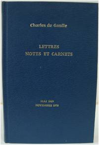
de Gaulle, Charles
Lettres notes et carnets: Mai 1969 - Novembre 1970 COMPLEMENTS de 1908 A 1968
Paris: Plon 1988. Hardcover without jacket; gilt lettering on front board and spine. Very good condition. Text in French. Bump to spine head and a couple of other minor marks to boards. Pages are clean and sound. TA. Hardcover. Very Good. Used. Plon Hardcover
Bookseller reference : 512803 ISBN : 2259018203 9782259018203
|
|
|
de Gaulle, Charles; Jonathan Griffin, Richard Howard (transl.)
The Complete War Memoirs of Charles de Gaulle 3 Volumes in 1
New York: Clarion-Simon and Schuster 1968. Book. Good. Soft cover. First Thus. 8vo - over 7¾" - 9¾" tall. Stiff black pictorial wraps 2nd ptg. thus. 1048 pp. Rubbed front joint one stress crease along firm square binding. Mild dampstaining to back cover final two leaves and fore- and bottom edges of latter text block interior not otherwise affected with mild wrinkling along bottom edges of latter text block as well. Technically thus Good only but a solid reading copy scarce in this edition. Clarion-Simon and Schuster Paperback
Bookseller reference : 068142
|
|
|
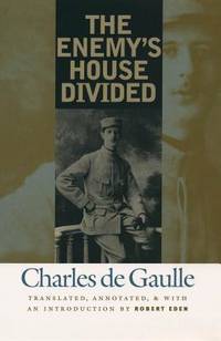
De Gaulle, Charles; Eden, Robert
The Enemy's House Divided
Chapel Hill North Carolina U.S.A.: Univ of North Carolina Pr 2002. 232 pp. 13 maps appends. notes index Originally published in 1924 and available here in English for the first time The Enemy's House Divided is de Gaulle's analysis of the major errors that led the Germans to disaster in World War I. His first book it is also a key document of de Gaulle's philosophy of action introducing his statesmanship to the world with its deliberate and studied critique of the perils of Nietzsche's philosophical initiative. Clean. Cloth. As New/As New. 8vo - over 7¾" - 9¾" tall. Univ of North Carolina Pr hardcover
Bookseller reference : 003725 ISBN : 0807826669 9780807826669
|
|
|
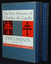
De Gaulle, Charles
The War Memoirs of Charles de Gaulle -- Documents; Translated from the French by Joyce Murchie and Hamish Erskine 2 volumes
New York: Simon and Schuster 1960. Hardcover. Near Fine. 2 volumes in slipcase -- Unity: 1942-1944 Documents 1959; Salvation 1944-1946 Documents 1960. 424 p.; 404 p.; 22 cm. Dark blue cloth with gilt spine titles. Grey slipcase; red and grey label on the front with title: The War Memoirs of Charles de Gaulle Documents volumes 2 and 3. Each volume has an index. In Near Fine Condition: black remainder marks on lower page edges; otherwise clean and tight. Slipcase is in Very Good Condition: corners are slightly rubbed; clean and solid. Simon and Schuster hardcover
Bookseller reference : 010386
|
|
|
de Gaulle, Charles
Lettres, notes et carnets: Mai 1969 - Novembre 1970, COMPLEMENTS de 1908 A 1968
Hardcover without jacket; gilt lettering on front board and spine. Very good condition. Text in French. Bump to spine head and a couple of other minor marks to boards. Pages are clean and sound. TA Used
|
|
|
De Girardin Emile
Journal d'un Journaliste au secret – Francia
Ottima copia gr 200
|
|
|
DE GIRARDIN Emile
L'empereur Napoléon III et l'Europe
54pp., 23cm., br., qqs.rousseurs, cachet, br.orig.(dos restauré), G68773
|
|
|
De Goncourt, translated by Alys Hallard
Renee Mauperin The French Classical Romances
New York: P.F. Collier & Son 1902 Book. Very Good -. Hardcover. With a critical introduction by James Fitzmaurice-Kelly. Illustrated with a frontispiece and numerous other portraits with descriptive notes by Octave Uzanne. Has some foxing marks on back cover. P.F. Collier & Son hardcover
Bookseller reference : 102320
|
|
|
de Gontaut, Duchesse; Mrs. J. W. Davis (transl.)
Memoirs of the Duchesse de Gontaut Gouvernante to the Children of France during the Restoration 1773-1836 Vol. I of 2
New York: Dodd Mead and Co. 1894. Book. VG-. Hardcover. 1st Edition. 8vo - over 7¾" - 9¾" tall. NOTE!: Volume I only of 2 bound in tan cloth lettered/decorated in orange and gilt deckled text block edges with top edge in gilt. x11-226 pp. illus. w/ guarded b&w plates. Minor binding lean spine panel toned to brown cover cloth partially foxed/soiled. Firm binding a few minor interior marks. Dodd, Mead and Co. Hardcover
Bookseller reference : 068641
|
|
|
De Grada Raffaele - Le Cannu Marc - Henze Anton - Penny Nicholas B.
Giornale di viaggio in Italia. L'attività dei pittori europei in Italia nell'800: occasioni e memorie [Italiano/Français/Deutsch/English]
134 illustrazioni in nero e a colori

|
|
|
De Grada Raffaele - Scotti Aurora - Zannier Italo - Magni Marica
Pittura '800
illustrazioni a colori e in nero

|
|
|
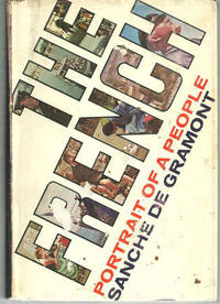
De Gramont, Sanche
FRENCH Portrait of a People
New York NY: G. P. Putnam's. 1969. Book Club Edition. Hardcover. Very Good in Very Good dust jacket; Edgewear. DJ is worn and torn at edges. DJ price clipped. Sticker tears on front of DJ; 479 pages . G. P. Putnam's hardcover
Bookseller reference : 21581
|
|
|
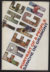
De Gramont, Sanche
FRENCH Portrait of a People
New York NY: G. P. Putnams. 1969. Book Club Edition. Hardcover. Very Good in Very Good dust jacket; DJ is worn at edges. ; 479 pages . G. P. Putnams hardcover
Bookseller reference : 3939
|
|
|
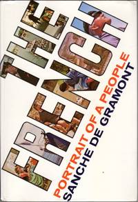
de Gramont Sanche
The French: Portrait of a People
NY: G>P Putnam's Sons 1969. Textblock very clean and tight; Binding lightly edge and corner rubbed; Dust jacket in mylar lightly edge and corner worn. 479p. including index. Book Club Edition. Cloth. Very Good/Very Good in mylar. 8vo - 7 3/4" - 9 3/4 " Tall. Hardcover. G>P Putnam's Sons Hardcover
Bookseller reference : EW6986
|
|
|
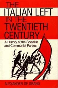
De Grand, Alexander J
The Italian Left in the Twentieth Century
Indiana University Press 1989. 182pp. Cover slightly warped o/w very good in slightly worn dj. Hardback. Indiana University Press hardcover
Bookseller reference : 010132 ISBN : 0253331072 9780253331076
|
|
|
De Grauwe, P. and Peeters, T. (Eds.)
The ECU and European Monetary Integration
Palgrave Macmillan 1988. This is an ex-library book and may have the usual library/used-book markings inside.This book has hardback covers. In good all round condition. Please note the Image in this listing is a stock photo and may not match the covers of the actual item500grams ISBN:0333464427 Palgrave Macmillan hardcover
Bookseller reference : 9552818 ISBN : 0333464427 9780333464427
|
|
|
De Grazia, Victoria
How Fascism Ruled Women : Italy 1922-1945
Berkeley CA: University of California Press. 1993. Large octavo size 16x24cm approx. Very Good condition.Illustrated with Black and White Photographs. Previous owner's details to preliminary pages. Robust professional packaging and tracking provided for all parcels. 350 pages. . 1st Paperback Edition. Softcover. University of California Press paperback
Bookseller reference : BIB325084 ISBN : 0520074572 9780520074576
|
|
|
De Grazia, Victoria
How Fascism Ruled Women: Italy 1922-1945
USA: Univ of California Press 1992. Book. Good. Hardcover. First Edition. 8vo - over 7¾" - 9¾" tall. 350 pages. Index. Footnotes. Several black and white illustrations. "The first study of women's experience under Italian fascism this book offers a compelling treatment of the making of contemporary Italian society." - from dust jacket. Average wear. Binding intact. Usual library markings. Front free endpaper removed. A sound working copy. Univ of California Press Hardcover
Bookseller reference : 113c6012 ISBN : 0520074564 9780520074569
|
|
|
DE GRECE, Michel.
Quand Napoléon faisait trembler l’Europe.
in-8, 402 pp., illustrations, carte, broché. Bel exemplaire. [CA33-5]
|
|
|
De Grunwald, Constantin. (trans Atkinson, C. F.)
Baron Stein. Enemy of Napoleon
London: Jonathan Cape 1940. 321pp index bibliography bw plates folding map. Or red cloth. Spine and edges faded top corner bumped. Biography of Baron Stein of Prussia. Includes his service as a Knight of the Holy Roman Empire his service to Prussia his relationship with Napoleon the relationship between Germany and France during the French revolution and much more. Reprint. Hard Cover. Near Very Good/No Jacket. 8vo. Jonathan Cape Hardcover
Bookseller reference : 009672
|
|
|
DE GUBERNATIS A.
STORIA COMPARATA DEGLI USI FUNEBRI IN ITALIA E PRESSO GLI ALTRI POPOLI INDO-EUROPEI. Terza edizione.
In-16, bross. muta mod., conserv. bross. orig., pp. 138. Testo in buono stato (text in good condition).
|
|
|
De Heidenstam, O.-G. (editor); Stephens, Winifred; Jackson, Mrs. Wilfred (translators)
The Letters of Marie Antoinette Fersen and Barnave
London: John Lane the Bodley Head. 1926. xiii 244pp index bw ills. Or blue cloth lacking jacket. Spine slightly faded. Some toning and foxing old price blacked out on front free endpaper. Letters of Marie Antoinette in translation from the French. First English Language Edition. Hard Cover. Good/No Jacket. 8vo. John Lane the Bodley Head. Hardcover
Bookseller reference : 029786
|
|
|
de Hooghe Romeyn
Carte Nouvelle De La Mer Mediterranee
Carte Nouvelle De La Mer Mediterranee ou sont Exactement Remarques tous les Ports, Golfes, Rochers, Banks, de Sable &c: a l’usage des Arméès, du Roy de la Grande Bretagne. Dressé sur le Memoires les Plus Nouveaux par le Sr. Romain de Hooge.Acquaforte e bulino, dimensioni 585x1390 mm, firmata in lastra nel cartiglio in basso, dove figura l’imprint: A Amsterdam chez Pierre Mortier. Avec Privilége 1694.Esemplare nel raro primo stato di quattro, con la data 1694 e prima della correzione del titolo, dove si legge Mediteranee al luogo di Mediterranee. Magnifica coloritura coeva, in perfetto stato di conservazione.Opera tratta da: Cartes Marines a l'Usage des Armées du Roy de la Grande Bretagne: Faites sur les Memoires les plus nouveaux, des plus experts Ingenieurs et Pilotes, et enrichies des porfils des plus fameaux Ports de Mer et villes Maritimes de l'Europe. (…) Gravéès et recuillies par le Sr. Romain De Hooge Commissaire de Sa Majesté. A Amsterdam. Chez Pierre Mortier Libraire sur le Vygen Dam. M.DC. LXXXXIII. Avec Privilege de Nos Seigneurs les Etats de Hollande et West-Frise. Monumentale carta nautica del Mar Mediterraneo di Romeyn De Hooghe (1645 - 1708). L’opera è impreziosita da 38 mappe e vedute dei principali porti del Mediterraneo, ed è decorata da numerosi galeoni, galee, figure allegoriche e mostri marini. La carta è inserita in una sezione speciale del Neptune François di Pierre Mortier, intitolata Cartes Marines a l’Usage des Armées du Roy de la Grande Bretagne; le nove carte che compongono questa sezione, tutte incise dallo stesso de Hooghe, sono descritte da Koeman come “la più spettacolare cartografia nauica mai prodotta ad Amsterdam del XVII secolo”. La carta del Mediterraneo è la più grande, decorata e spettacolare della serie. Pierre Mortier fece stampare l’atlante in onore di Guglielmo III d’Orange (in olandese Willem Hendrik van Oranje-Nassau, anche noto come Guglielmo III d’Inghilterra), re olandese sul trono britannico. Le dimensioni dell’atlante, senza precedenti, e il ricorso ad artisti del calibro di de Hooghe hanno reso questa raccolta una delle più sontuose dell’epoca. Koeman lo definisce “l’atlante nautico più costoso del periodo”, inteso più come pubblicazione spettacolare che come un reale strumento ad uso dei navigatori. La carta è conosciuta in diverse edizioni o stati: la prima stesura reca nel titolo la parola Mediteranée con una sola “R”. Il termine viene corretto successivamente, mentre nella terza stesura la data è abrasa. L’ultima edizione della tavola ha l’imprint editorial corretto in: A Amsterdam chez J. Covens & C. Mortier. Le edizioni successive alle prime due ricorrono ne Le Neptune françois, ou Atlas nouveau des cartes marines: leveés et gravées par ordre exprés du Roy, pour lª usage de ses armées de mer dans lequel on voit la description exacte de toutes les côtes de la Mer Oceane, & de la Mer Baltique, depuis la Norwege au Detroit de Gibraltar. Où sont exactement marquées les routes quªil faut tenir, les bancs de sables, rochers & brasses dªeau; & generalement tout ce qui concerne la navigation reveu et mis en meilleur ordre par les Sieurs Pene, Cassini & autres.Bibliografia: T. Campbell, Early Maps, New York, 1981, pp. 96-7; C. Koeman, Atlantes Neerlandici: Bibliography of Terrestrial, Maritime and Celestial Atlases and Pilot Books Published in the Netherlands up to 1880 Vol. IV, pp. 423-431, M. Mor 5 (9); Mare Nostrum, a historic voyage across the Mediterranean Sea, Lussemburgo, 2003, p. 38; National Maritime Museum, Catalogue of the Library - Vol. Three, Atlas & Cartography, Londra, 1971, pp. 282-284, n. 238 (38); R. Putman, Early Sea Charts, New York, 1983, pp. 22-3, tav. 7; cfr. R. Shirley, Maps in the Atlases of the British Library, Londra, 2004, pp. 1236-1241; P. Whitfield, The Charting of the Oceans: Ten Centuries of Maritime Maps, British Library, 1996, pp. 86-7. Carte Nouvelle De La Mer Mediterranee ou sont Exactement Remarques tous les Ports, Golfes, Rochers, Banks, de Sable &c: a l’usage des Arméès, du Roy de la Grande Bretagne. Dressé sur le Memoires les Plus Nouveaux par le Sr. Romain de Hooge.Etching and engraving, 585x1390, signed in the lower cartouche with the imprint: A Amsterdam chez Pierre Mortier. Avec Privilége 1694.RARE FIRST STATE, of four, dated 1694, before the correction of the title.Magnificient example with fine original colouring, in excellent condition.The map is embellished with 38 inset maps and views of the major ports and harbors of the Meditereanean Sea, and numeorus galleons, allegorical figures and sea monsters.From: Cartes Marines a l'Usage des Armées du Roy de la Grande Bretagne: Faites sur les Memoires les plus nouveaux, des plus experts Ingenieurs et Pilotes, et enrichies des porfils des plus fameaux Ports de Mer et villes Maritimes de l'Europe. (…) Gravéès et recuillies par le Sr. Romain De Hooge Commissaire de Sa Majesté. A Amsterdam. Chez Pierre Mortier Libraire sur le Vygen Dam. M.DC. LXXXXIII. Avec Privilege de Nos Seigneurs les Etats de Hollande et West-Frise. This chart is the most decorative map of the Mediterranean issued for inclusion in an atlas.This beautiful map is included in a special section of the Neptune François by Pierre Mortier, titled Cartes Marines a l’Usage des Armées du Roy de la Grande Bretagne, that contains maps engraved by de Hooghe; these charts were judged by Koeman to be the most spectacular type of maritime cartography ever produced.According to Koeman the Neptune François was: …the most expensive sea-atlas ever published in Amsterdam.. Its charts are larger and more lavishly decorated than those of any preceding book of this kind. For the engraving and etching Mortier had recruited the most qualified artists. This magnificent work was intended more as a show piece than something to be used by pilots at sea.Bibliografia: T. Campbell, Early Maps, New York, 1981, pp. 96-7; C. Koeman, Atlantes Neerlandici: Bibliography of Terrestrial, Maritime and Celestial Atlases and Pilot Books Published in the Netherlands up to 1880 Vol. IV, pp. 423-431, M. Mor 5 (9); Mare Nostrum, a historic voyage across the Mediterranean Sea, Lussemburgo, 2003, p. 38; National Maritime Museum, Catalogue of the Library - Vol. Three, Atlas & Cartography, Londra, 1971, pp. 282-284, n. 238 (38); R. Putman, Early Sea Charts, New York, 1983, pp. 22-3, tav. 7; cfr. R. Shirley, Maps in the Atlases of the British Library, Londra, 2004, pp. 1236-1241; P. Whitfield, The Charting of the Oceans: Ten Centuries of Maritime Maps, British Library, 1996, pp. 86-7. S. Bifolco, "Mare Nostrum, Cartografia nautica a stampa del Mar Mediterraneo" (2020), pp. 158-159, tav. 68.

|
|
|
DE JODE Cornelis (c. 1509 - 91)
Nova Exactissimaqve Descriptio Danvbii…
Rara carta geografica del corso del Danubio tratta dalla seconda edizione dell'atlante del De Jode, curata dal figlio Cornelis e denominata Speculum Orbis Terrae, 1593. Il foglio raffigura solo la parte occidentale del corso del Danubio. La carta venne disegnata da Christian Sgrooten.Incisione in rame, firmata in lastra dai fratelli van Deutecum, in perfetto stato di conservazione. Rare map taken from the second edition of the atlas of De Jode, edited by his son Cornelis and called Speculum Orbis Terrae, 1593. The depiction of Croatia on the map Nova exactissimaqve descriptio Danvbii, was made by Christian Sgrooten.Egraved by Lucas & Johannes van Deutecum. Copper engraving, whit full margins, in perfect condition. D. Mlinari?, J. Fari?i?, L. Miroševi? p. 163.

|
|
|
DE JODE Gerard (1509 - 1591)
Europa Totius Orbis Partium amoenissima commoda iam recens absolutaque Descriptio
Acquaforte e bulino, prima del 1573, firmata in lastra nel cartiglio da Joannes e Lucas Doetecum. Esemplare nel secondo stato, pubblicato nella prima edizione del 1578. Magnifica prova, con bellissima coloritura coeva, con margini, in perfetto stato di conservazione. Al verso, testo latino e numero di pagina in carattere romano, V. Gerard de Jode, era cartografo, incisore, tipografo ed editore nella città di Anversa, attivo all’incirca nello stesso periodo di Ortelius. Nel 1547 ottenne il privilegio per l’attività editoriale, tuttavia non fu mai in grado di rappresentare un’effettiva minaccia per il suo rivale in affari. Per ironia della sorte, pubblicò il famoso Mappamondo del rivale, in otto fogli, nel 1564. Il suo atlante più importante, lo Speculum Orbis Terrarum, oggi estremamente raro, non poté essere pubblicato fino al 1578, ovvero otto anni dopo il Theatrum Orbis Terraum di Ortelius, che aveva ottenuto il monopolio per l’editoria cartografica ad Anversa. Le carte del De Jode furono finemente tradotte su rame nel tipico stile fiammingo dai fratelli Joannes e Lucas van Doetecum, i migliori intagliatori di mappe del tempo. Alla morte di Gerard, il figlio Cornelis pubblicò, nel 1593, una ristampa accresciuta dell’atlante. - FIRST EDITIONS WITH CONTEMPORY COLOUR -Etching with engraving, before 1573, signed on plate in the title by Joannes and Lucas Doetecum. Example in the second state, published in the first edition of 1578. Magnificent proof, contemporary colour, with margins, in perfect condition. In verse, Latin text and page number in roman font, V. Gerard de Jode, was a cartographer, engraver, printer and publisher in Antwerp, active around the same period of Ortelius. In 1547 he obtained the privilege for the publishing business, but was never able to represent a real threat to his business rival. Ironically, he published a major rival of the Globe, in eight sheets, in 1564. His most important atlas, Speculum Orbis Terrarum, now extremely rare, could not be released until 1578, ie eight years after the Theatrum Orbis Terraum of Ortelius, who had obtained a monopoly for the Cartographic Publishing Antwerp. The maps of De Jode were finely translated copper in typical Flemish brothers Joannes and Lucas van Doetecum, the best engravers of maps of the time. On the death of Gerard, the son Cornelis published in 1593, a reprint of the atlas increased. The New Hollstein, The Doetecum Family part III, p. 37, 561.

|
|
|
DE JODE Gerard (1509 - 1591)
Palatinatum Superioris Seu Bavariae vera Descriptio Avtore Erhardo Reych/Wirtenberge:nsis Dvcatvs Elegans Delineatio Avtore
Acquaforte e bulino, prima del 1573. Esemplare pubblicato nella prima edizione del 1578. Magnifica prova, con bellissima coloritura coeva, con margini, in perfetto stato di conservazione. Al verso, testo latino e numero di pagina in carattere romano, XX. Gerard de Jode, era cartografo, incisore, tipografo ed editore nella città di Anversa, attivo all’incirca nello stesso periodo di Ortelius. Nel 1547 ottenne il privilegio per l’attività editoriale, tuttavia non fu mai in grado di rappresentare un’effettiva minaccia per il suo rivale in affari. Per ironia della sorte, pubblicò il famoso Mappamondo del rivale, in otto fogli, nel 1564. Il suo atlante più importante, lo Speculum Orbis Terrarum, oggi estremamente raro, non poté essere pubblicato fino al 1578, ovvero otto anni dopo il Theatrum Orbis Terraum di Ortelius, che aveva ottenuto il monopolio per l’editoria cartografica ad Anversa. Le carte del De Jode furono finemente tradotte su rame nel tipico stile fiammingo dai fratelli Joannes e Lucas van Doetecum, i migliori intagliatori di mappe del tempo. Alla morte di Gerard, il figlio Cornelis pubblicò, nel 1593, una ristampa accresciuta dell’atlante. Etching with engraving, before 1573. Exemple of the first edition published in 1578. Magnificent impression, with great contemporary coloring, with margins, in perfect condition. Latin text and page number in roman font, XX. Gerard de Jode, was a cartographer, engraver, printer and publisher in Antwerp, active around the same period of Ortelius. In 1547 he obtained the privilege for the publishing business, but was never able to represent a real threat to his business rival. Ironically, he published a major rival of the Globe, in eight sheets, in 1564. His most important atlas, Speculum Orbis Terrarum, now extremely rare, could not be released until 1578, ie eight years after the Theatrum Orbis Terraum of Ortelius, who had obtained a monopoly for the Cartographic Publishing Antwerp. The maps of De Jode were finely translated copper in typical Flemish brothers Joannes and Lucas van Doetecum, the best engravers of maps of the time. On the death of Gerard, the son Cornelis published in 1593, a reprint of the atlas increased .

|
|
|
DE JODE Gerard (1509 - 1591)
Wirtenberge:nsis Dvcatvs Elegans Delineatio Avtore Geogio Garner/Palatinatvm Svperioris Sev Bava:riae vera Descriptio Avtore
Rara carta geografica tratta dalla seconda edizione dell'atlante del De Jode, curata dal figlio Cornelis e denominata Speculum Orbis Terrae, 1593. Incisione in rame, in perfetto stato di conservazione. Rare map taken from the second edition of the atlas of De Jode, edited by his son Cornelis and called Speculum Orbis Terrae, 1593. Copper engraving, in perfect condition.

|
|
|
DE JONG Marijnke & VAN JOLE Marcelnke
The power of example: 20 years of Europa Nostra Awards, Le pouvoir de l'exemple: 20 ans prix Europa Nostra, Het voorbeeld aan de macht: 20 jaar Europa Nostra Awards
375pp., 30cm., cloth, illustrated dustwrapper, VG, [trilingual: English-French-Dutch], weight: 2.7kg., G61595
|
|
|
DE JONG Martien J.G.
Vadertaal en Moederland. Over het Nederlands in de Lage Landen en Europa
140pp., 21cm., gecart., mooie staat
|
|
|
De Jong, AP. A. P.
Verordend om Te Bestraffen - Bijbellezingen Over Den Profeet Elia
Netherlands: Publilsher 1930. Book. Fair. Hardcover. Reprint. 8vo - over 7¾" - 9¾" tall. 285 pages. Text in Dutch. Above-average wear. Home-made clear plastic cover protects boards. Some markings to contents. Binding intact. Year of publication uncertain - possibly 1930s. Publilsher Hardcover
Bookseller reference : 742a5942
|
|
|
 Receive by email
 Download as PDF document
 RSS feed


