|
Moch Jules.
ALERTE! Le problème crucial de la Communauté Européenne de Défense.
(Codice MD/1055) In 8° (20 cm) 303 pp. Première édition. Broché, non coupé. Très bon état. ~~~ SPEDIZIONE IN ITALIA SEMPRE TRACCIATA

|
|
|
Mochtarova, Monika
Erfolgreiche Geschäfte im östlichen Mitteleuropa. Polen, Tschechien, Ungarn.
Berlin Springer Verlag, 2000. 193 S. gr. 8° Kt. Bibliotheksexemplar mit der üblichen Signatur, sonst sehr gut erhalten.
Bookseller reference : 11600
|
|
|
Moczarski, Kazimierz; Fitzpatrick, Mariana (editor)
Conversations with an Executioner
Prentice Hall 1981. 282pp. Yellow hardback DJ VG with very light rubbing at corner tips and two small tears on back cover index chapter notes footnotes b&w photos Conversations with an Executioner : An incredible 255 day long interview with the man who destroyed the Warsaw Ghetto . Hard Cover. Very Good/Very Good. Prentice Hall Hardcover
Bookseller reference : w220831666 ISBN : 0131719181 9780131719187
|
|
|
Mode, H
Die Frau in der Indischen Kunst.
Leipzig, Edition Leipzig, 1970. 4°. M. 117 (teils farb.) Taf. u. mehr. Abb. 53 S. OLwd. m. illustr. Schutzumschlag im Pp.-Schuber (dieser lichtrandig u.m. Anm.). Sauberes Ex. (Das Bild der Frau).
Bookseller reference : 193537
|
|
|
Mode, H
La femme dans l'art de l'inde.
Leipzig), Edition, (1970). 4°. M. 117 (teils farb.) Taf. u. mehr. Abb. 55 S. OLwd. (L'image de la femme).
Bookseller reference : 125325
|
|
|
Mode, H
The woman in Indian art. (Engl. by M. Herzfeld.
Leipzig), Edition, (1970). 4°. M. 117 (teils farb.) Taf. u. mehr. Abb. 53 S. OLwd. (The image of woman).
Bookseller reference : 203834
|
|
|
Modiano Patrick
Dora Bruder
trad. di Francesco Bruno bross. edit. ill. con bandelle

|
|
|
MODIGLIANI Jeanne
TOSCANE.
Lausanne, Éditions Rencontre, L'atlas des voyages n° 45, 1965, grand in-8 cartonnage éditeur, riche iconographie, 191 pp. Couverture en état correct, intérieur en bon état.
Bookseller reference : 9431
|
|
|
MOELLER Georges
Éclaircissements Sur Les Derniers Mouvements Révolutionnaires De L'allemagne et De L'italie , Les Campagnes De 1848 et 1849 Dans La Péninsule, La vérité Sur Les Désastres De Novare
Genève Gruaz 1851 In-8 510 pp
Bookseller reference : 21453
|
|
|
Moeller Magdalena M. (Herausgeberin)
Die Brucke. Gemalde, Zeichnungen, Aquarelle und Drickgraphik von Ernst Ludwig Kirchner, Karl Schmidt-Rottluff, Erick Heckel, Max Pechstein, Emil Nolde und Otto Mueller aus der Sammlung des Brucke-Museums Berlin [Deutsch]

|
|
|
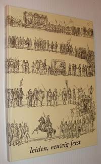
Moerman, Ingrid WL; Van Maanen, RCJ W L R C J
Leiden Eeuwig Feest
Netherlands: 3 October - Vereeniging 1986. Book. Very Good. Hardcover. First Edition. 4to - over 9¾" - 12" tall. 144 pages. Text in Dutch. Abundantly illustrated with archival black and white photos. Gift greetings of the Publisher upon front free endpaper otherwise clean and unmarked with light wear. A quality copy. Appears to be a first edition but we are not certain. Please inquire if you have any questions. 3 October - Vereeniging Hardcover
Bookseller reference : 742c7475 ISBN : 9090014004 9789090014005
|
|
|
Moerman, Ingrid W.L.; Van Maanen, R.C.J.
Leiden, Eeuwig Feest
144 pages. Text in Dutch. Abundantly illustrated with archival black and white photos. Gift greetings of the Publisher upon front free endpaper, otherwise clean and unmarked with light wear. A quality copy. Appears to be a first edition but we are not certain. Please inquire if you have any questions. Book

|
|
|
Mogford, J (pinx.t); Bradshaw, S. (sculp.t)
Bamborough Castle.
<p>Incisione su acciaio, impronta 27x19 cm, su foglio 31,5 x 23,5 cm. In primo piano, sulle rive di un mare in tempesta, si scorgono figure intente a recuperare i resti di un vascello arenato. In secondo piano, sulla cima di una parete rocciosa si erge il Castello di Bamburgh (Northumberland, Inghilterra). Tratto da "Picturesque Europe" 1875-1879. Esemplare ben conservato.</p>

|
|
|
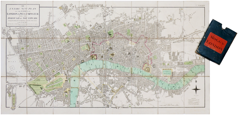
MOGG (Edward).
[LONDRES] An entire new plan of the cities of London & Westminster; with the borough of Southwark: comprehending the new buildings and other alterations, to the year 1807.
London, Edw.d Mogg, 1807. En deux feuilles coupées en 24 sections montées sur toile et pliées, formant une carte de 482 x 906 mm ; étui de papier bleu de l'époque avec pièce de titre de papier rouge.
Bookseller reference : LBW-7019
|
|
|
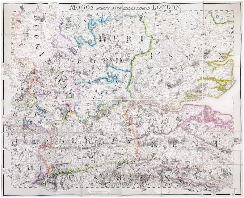
MOGG (Edward).
Mogg's forty-five miles round London.
London, Edward Mogg, June 1st 1821. En 36 sections montées sur toile et pliées, formant une carte de 0,96 x 1,16 m ; étiquette au dos de l'éditeur et marchand de cartes Charles Smith, actif entre 1800 et 1822.
Bookseller reference : LBW-6491
|
|
|
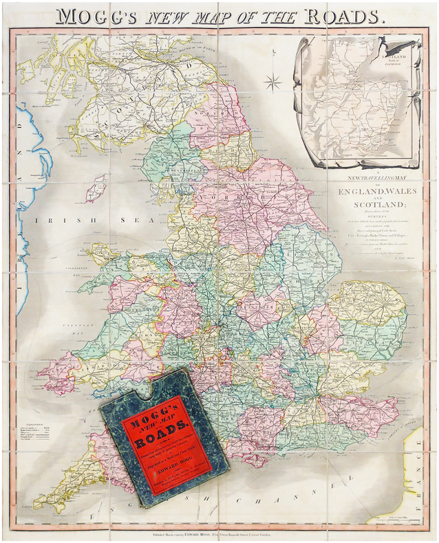
MOGG (Edward).
Mogg's new map of the roads - A new travelling map of England, Wales and Scotland.
Londres, Edward Mogg, 1830. En 24 sections montées sur toile et pliées, formant une carte de 770 x 630 mm ; sous étui de papier marbré vert de l'éditeur.
Bookseller reference : LBW-6506
|
|
|
MOHAMMAD ALI FOROUGHI, (1877-1942).
Seir-e hekmat dar Orupa. Az-zaman-i bastan ta maiyye-i heft e hom. [= Course of wisdom in Europe]. Cild-i evvel. (Vol. 1).
Very Good Persian Original blue cloth bdg. Roy. 8vo. (24 x 17 cm). In Persian. [2], 202 p. Seir-e hekmat dar Orupa. [= Course of wisdom in Europe]. Cild-i evvel. (Vol. 1). European philosophical history. Set is 4 volumes. This is only first volume from pre-Socratics to early 19th century including biography of Descartes. Just one copy in OCLC with no bibliographic details such printing house and with a mistake entry of author's name. Moshar 3123.
|
|
|
Mohn, H
Die Strömungen d. europäischen Nordmeeres.
Gotha, Perthes, 1885. 4°. M. 4 Ktn. 20 S. Ohne Umschl. Rücken m. Kleberest v. ehemaliger Bind. (Petermanns geogr. Mitteil. Erg.-H. 79).
Bookseller reference : 213845
|
|
|
Mohr, E.C.Jul
The Soils of Equatorial Regions. With Special Reference to the Netherlands East Indies.
J.W. Edwards, Ann Arbor 1944. 766 S. mit zahlreichen Abbildungen und Karten, 4°, Original-Leinen (Hardcover), Bibliotheks-Exemplar (ordnungsgemäß entwidmet) mit kleinem Papier-Rückenschild, Stempel auf Vorsatz und Titel, insgesamt gutes und innen sauberes Exemplar,
Bookseller reference : 70916

|
|
|
MOHR, P.M
Technische Normen und freier Warenverkehr in der EWG. Deutsche überbetriebliche technische Normen und ihre staatliche Rezeption als Maßnahmen gleicher Wirkung wie mengenmäßige Einfuhrbeschränkungen gemäß Art. 30, 36 EWG-Vertrag.
Köln, Heymanns, 1990. X, 170 S. OLwd.
Bookseller reference : 3624491
|
|
|
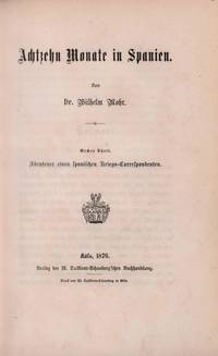
Mohr, Wilhelm
Achtzehn Monate in Spanien. 2 Bde. in 1 Bd. = komplett.
Köln M. Dumont-Schauberg 1876. . 1 Abenteuer eines spanischen Kriegs-Correspondenten / 2 Frühlingstage in Andalusien und Marokko. - Der Kritiker u. Journalist Wilhelm Mohr 1838-1888 war ein langjähriger Mitarbeiter der Kölnischen Zeitung. Er weilte als Berichterstatter 1874/1875 in Spanien wo er im Gefolge des Königs Alfons XII 1857-1885 die Feldzüge gegen die Karlisten mitmachte u. von wo aus er 1875 einen Streifzug längs der Westküste von Marokko unternahm vgl. Meyers Konversations-Lex. 4. Aufl. Bd. 13 S. 1026.- Einband berieben Papier aus unterschiedl. Produktionen leicht gebräunt vereinzelt schwach stock- u. fingerfleckig hint. flieg. Vors. fehlt; im Ganzen gutes Exemplar Köln, M. Dumont-Schauberg, 1876. unknown
Bookseller reference : 71532
|
|
|
Moia, Nelly.
Für die Katz'. [TWO VOLUMES].
Two volumes. I. Text Volume. Crown quarto. Pp. 533, b&w illustrations; II. Plate Volume. Tall quarto. Unpaginated. A photographic album, lavishly illustrated in colour. Both volumes bound in pictorial stiff wrappers and placed in the original hardcover portfolio, with a matching image on cover. In new condition. Excellent set, practically unused. ~ First edition. "Im Gegensatz zum Titel haben wir es hier nicht mit einem 'Katzenbuch' zu tun, sondern mit einem luxemburger Naturführer besonderer Art. Wenn der Titel sich durch eine eher realistisch-pessimistische Atmosphäre des Textbandes erklären lässt, so zeugt der Bildband davon, dass die Autorin doch selber nicht so recht glaubt, dass alles 'für die Katz' gewesen war. Der Textband veranschaulicht anhand von Pressenotizen (Leserbriefen, oft von der Autorin selbst) mehrere Jahrzehnte Tauziehen zwischen Natur- und Umweltschutzbegeisterten und den übrigen politischen und gesellschaftlichen Strukturen. Er erörtert verpasste (und in Zukunft noch zu verpassende) Gelegenheiten, das Spiessbürgertum und sonstiges materialistisches Denken in punkto hautnaher Umwelt etwas zu dämpfen. Für die an diesem Geschehen unfreiwillig beteiligten Militanten ein Denkstein, für andere (hoffentlich) ein Denkanstoss (.) Der Bildband, in der Form eines gedruckten Fotoalbums, zeigt Natur, vor allem in der Escher Gegend und im 'Minett'. Interessant sind vergleichende Aufnahmen von Tagebaugebieten in bis zu 20-jährigem Intervall, welche den Verbuschungsprozess dokumentieren." - Haus vun der Natur, Kockelscheuer.
|
|
|
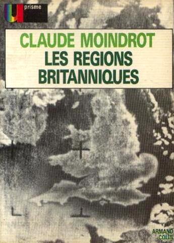
Moindrot Claude Moindrot Annie
Les régions britanniques
Prisme 1972 256 pages in12. 1972. broché. 256 pages.
Bookseller reference : 89746
|
|
|
MOIREAU A.
L'Angleterre et l'Irlande en 1886
- Extrait de la Revue des deux mondes, s.l. (Paris) (1886), 15,5x25cm, agrafé. - First edition. Plain paper cover. Rare. [FRENCH VERSION FOLLOWS] Edition originale. Sous couverture muette. Rare.
|
|
|
MOISANT, Xavier
La fortune de l'Irlande
PARIS, G. Beauchesne - 1920 - In-12 - Broché -Couverture illustrée - 144 pages - Bon exemplaire
|
|
|
MOISANT, Xavier
La fortune de l'Irlande
PARIS, G. Beauchesne - 1920 - In-12 - Broché -Couverture illustrée - 144 pages - Bon exemplaire
Bookseller reference : 8936
|
|
|
MOITHEY Maurille Antoine
L' Europe Divisee En Tous Ses Royaumes Et Subdivisee En Ses Principales Parties
Carta murla di tutta l'Europa che si estende da est a includere l'Armenia e la Russia occidentale. La mappa ha un grande cartiglio decorativo con il titolo in alto a sinistra, circondato dai stemmi dei principali paesi e sostenuto da due putti con un globo, su uno sfondo di attrezzi militari. La mappa è una versione modificata della carta di Guillaume de L'Isle (1723) pubblicata a Parigi da Maurille Antoine Moithey e Crépy. Moithey (1732-1810) è stato un ingegnere e cartografo per il Re di Francia ed ha collaborato con Crépy dal 1769 fino al 1777. Incisione in rame, stampata su due foglii, finemente colorata a mano, alcuni strappi e pieghe di carta perfettamente restaurati, tracce di colore sul Mare del Nord, per il resto in buone condizioni.Rara. A fine and uncommon separately issued wall-map of all Europe extending east to include Armenia and western Russia. The map which is attractively coloured has a large decorative title piece at top left surrounded by the coats of arms of major countries and supported by two cherubs examining a globe against a background of military implements.Printed on two joined sheets, paper folds and tears perfectly repaired, otheriwise good condition. In full body colours. Tooley, Mapmakers I, 314 u. III, 266

|
|
|
Molden, Ernst
Wien Mitte. Ein Wochenbuch.
Wien, Verlag v. Franz Deuticke, 2014. 8°; 316 Seiten; 1. Auflage; in Buchform Orig.-Pappband mit OU geringe Gebrauchsspuren
Bookseller reference : 70338

|
|
|
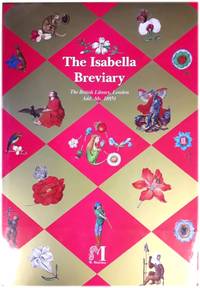
Moleiro, Manuel (ed)
The Isabella Breviary: The British Library London: Add. Ms. 18851
Barcelona Spain: M. Moleiro 2012. Hardcover. Dust jacket has one or two small indentations. One or two very small light marks on rear board but hardly noticeable. Integral ribbon bookmark. Binding is sound; pages are bright tight and clean; text and illustrations are crisp and clear. AF. hardcover. Very Good/Very Good. Used. M. Moleiro Hardcover
Bookseller reference : 410504 ISBN : 8496400638 9788496400634
|
|
|
Moleiro, Manuel (ed.)
The Isabella Breviary: The British Library, London: Add. Ms. 18851
Hardcover. Dust jacket has one or two small indentations. One or two very small, light marks on rear board, but hardly noticeable. Integral ribbon bookmark. Binding is sound; pages are bright, tight and clean; text and illustrations are crisp and clear. AF Used
|
|
|
Molengraaff, G.A.F. u. W.A.J.M.v. Waterschoot v.d. Gracht
Niederlande.
Heidelberg, Winter, 1913. 4°. M. einigen Abb. 98 S. Hlwd. M. Rsign. Etwas angeschmutzt. M. St. u. Sign. a. Einbd., Vorsatz u. einigen Seitenrändern. (Handbuch d. regionalen Geologie I/3/12).
Bookseller reference : 139644
|
|
|
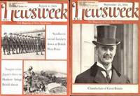
Moley, Raymond & Rex Smith; editors
NEWSWEEK 14 Issues 1938
New York: Malcolm Muir: Weekly Publications. Very Good. 1938. Magazine. 15 clean pictorial soft covers Condition: VG- to VG. Magazines tight clean & intact. Photo illustrations. 1938; June 20 & 27; July 4 & 18; August 8 & 22; September 5 19 & 26; October 17 24 & 31; November 14; December 5. Small mailing label on each issue. A fascinating look at the world in 1938 on the eve of World War II. Ephemera ; B&W Photos ; 8vo 8" - 9" tall . Malcolm Muir: Weekly Publications unknown
Bookseller reference : 10398
|
|
|
Molino, Jean (u.a.m.)
Les Fantastiques. Europe. Revue litteraire mensuelle. Mars 1980. 58. Annee; No 611. Dir. : Pierre Gamarra ...
Paris; Europe (u.a.), 1980. 248 S.; 21,5 cm; kart.
Bookseller reference : 1162895

|
|
|
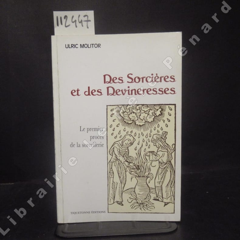
MOLITOR, Ulric
Des Sorcières et des Devineresses. Le premier procès de la sorcellerie. Reproduit en fac-similé d'après l'édition latine de Cologne 1489.
sd Tiquetonne Editions - Sans date - In-8, broché, couverture illustrée - 148 p. - Sept reproductions de bois gravés hors-texte
Bookseller reference : 112447
|
|
|
Molke ( maresciallo )
Lettere dalla Russia – La nuova Russia compendio de recenti studi di Molinari,Wesselowsky,Wallace,Trubetzkoy , ecc.
Ottima copia
|
|
|
MOLL H.F.
Découverte d'un maxillaire supérieur humain à la grotte de Cotencher ( commune de Rochefort, canton de Neuchâtel, Suisse)
- Imp. Magne, Périgueux 1977, 16x24,5cm, agrafé. - Edition originale imprimée à petit nombre de ce tiré à part. Brochure illustrée de 2 cartes et de 2 photographies hors-texte. Petites taches marginales sur le premier plat, sinon agréable état intérieur. [ENGLISH DESCRIPTION ON DEMAND]
|
|
|
MOLL Herman (1654? - 1732)
A Chart of the Mediterranean Sea According to Mon.sr Berthelot & c.
Acquaforte, 300x430 mm, firmata nel cartiglio con il titolo: By H. Moll Geographer.Carta nautica firmata da Hermann Moll, che si definisce “geografo” e, pertanto, potrebbe essere il compilatore, oltre che l’incisore, dell’opera. Esistono degli esemplari della carta che recano in basso l’imprint: Printed for The Bowles in S.t Pauls Church yard ar John Bowles ar the Black Horse in Cornhill; altri presentano, in alto a destra, la numerazione page 753. V1. In alto a sinistra, troviamo un piccolo cartiglio raffigurante Gibilterra, che era appena stata ceduta all’Inghilterra con il trattato di Utrecht del 1713. La carta non è inserita in nessuno dei numerosi atlanti di Moll descritti da Shirley.Herman Moll (1654 - 1732) fu uno dei più importanti editori dediti al commercio di mappe in Inghilterra tra la fine del XVII e l’inizio del XVIII secolo. Sembra probabile che provenisse dalla Germania, forse da Brema, e che fosse a Londra già nel 1678. Le poche notizie biografiche sono dedotte dalla produzione, notevole, di materiale cartografico, frutto dell’attività alla quale si dedicava - come uso all’epoca - in qualità di incisore, disegnatore o editore. Dalla sua morte, nel 1732, della casa editrice Moll non si hanno più tracce; suo figlio Gilles Hendrick scomparve, infatti, prematuramente mentre la figlia Henderina Amelia Moll, è poco più che un nome testamentario. Le prime notizie di Moll sono relative al 1678 dove, come incisore, lavora per l’English Atlas di Moses Pitt e Sir Robert Hooke, uno dei sostenitori del progetto. Gran parte della sua carriera fu dedicata all’attività di incisore per produttori di mappe e editori, in particolare per James Knapton, realizzando le mappe per i resoconti di viaggio. Nel 1707 Moll iniziò a lavorare alla sua pubblicazione più famosa, il The World Described, una raccolta di mappe del mondo. Fu uno dei più famosi atlanti inglesi del XVIII secolo e richiese un lungo periodo di lavorazione; l’atlante fu completato solo nel 1717. Moll usava riempire gli spazi vuoti delle sue mappe con pannelli di testo, spesso con descrizione della regione raffigurata; altre volte, invece, con commenti poco lusinghieri sui rivali: gli inglesi Jeremiah Seller e Charles Price, John Senex e in particolare il francese Guillaume Delisle. Herman Moll fu coinvolto in numerose pubblicazioni: il Thesaurus Geographicus (1695), ripubblicato in seguito con diverse altre forme e ampliato per formare l’Atlas Geographus (1711) il Twenty Four New and Accurate Maps of the Several Parts of Europe (1706) e A New Description of England and Wales (1724). Nel suo testamento, non si fa menzione di uno stock di lastre da stampa o altri beni aziendali. È probabile che gran parte del materiale a cui il suo nome è legato fosse posseduto e finanziato da altri editori.Bibliografia: cfr. National Maritime Museum, Catalogue of the Library - Vol. Three, Atlas & Cartography, Londra, 1971, pp. 453-458; cfr. The Compleat Plattmaker: essays on Chart, Map and Globe Making in England in the Seventeenth and Eighteenth Centuries, Berkeley, 1978; cfr. S. Tyacke, Chartmaking in England and Its Context, 1500 - 1600, in “History of Cartography”, Chicago, 2007, pp. 1722 – 1753. Etching, 300x430 mm, signed in the cartouche with the title: By H. Moll Geographer.Nautical chart by Hermann Moll, who calls himself a "geographer" and, therefore, could be the compiler, as well as the engraver, of the work. There are copies of the map that bear the imprint below: Printed for The Bowles in St. Pauls Church yard in John Bowles in the Black Horse in Cornhill; others present, at the top right, page number 753. V1. At the top left, we find a small cartouche depicting Gibraltar, which had just been given to England with the Treaty of Utrecht of 1713. The map is not inserted in any of the numerous Moll atlases described by Shirley.Herman Moll (1654 - 1732) was one of the most important publishers dedicated to the trade of maps in England between the end of the seventeenth and the beginning of the eighteenth century. It seems likely that it came from Germany, perhaps from Bremen, and that it was in London as early as 1678. The few biographical information is deduced from the remarkable production of cartographic material, the result of the activity to which he dedicated himself - as was the custom at the time - as an engraver, draftsman or publisher. Bibliografia: cfr. National Maritime Museum, Catalogue of the Library - Vol. Three, Atlas & Cartography, Londra, 1971, pp. 453-458; cfr. The Compleat Plattmaker: essays on Chart, Map and Globe Making in England in the Seventeenth and Eighteenth Centuries, Berkeley, 1978; cfr. S. Tyacke, Chartmaking in England and Its Context, 1500 - 1600, in “History of Cartography”, Chicago, 2007, pp. 1722 – 1753. S. Bifolco, "Mare Nostrum, Cartografia nautica a stampa del Mar Mediterraneo" (2020), p. 214, tav. 97.

|
|
|
MOLL Herman (1654? - 1732)
Sweden and Norway
Tratta dal "The Compleat Geography or the chorography and topography of all the known parts of the earth" pubblicato nel 1723. Incisione in rame, in ottimo stato di conservazione. Taken from "The Compleat Geography or the chorography and topography of all the known parts of the earth," published in 1723. Copper engraving, in excellent condition.

|
|
|
MOLL Herman (1654? - 1732)
The Spanish Netherlands
Tratta dal "The Compleat Geography or the chorography and topography of all the known parts of the earth" pubblicato nel 1723. Incisione in rame, in ottimo stato di conservazione. Taken from "The Compleat Geography or the chorography and topography of all the known parts of the earth," published in 1723. Copper engraving, in excellent condition.

|
|
|
Mollat du Jourdin Michel
L'Europe et la mer
Editions du Seuil Faire l'Europe Broché 1993 In-8 (13,5 x 21,5 cm), broché, 348 pages ; pliures sur le dos insolé, coiffes légèrement frottées, intérieur frais, bon état général. Livraison a domicile (La Poste) ou en Mondial Relay sur simple demande.
Bookseller reference : ys1974
|
|
|
MOLLAT DU JOURDIN MICHEL (1911 - 1996)
EUROPA E IL MARE DALL'ANTICHITA' A OGGI (L'EUROPE ET LA MER
Traduzione: Cataldi Villari Fausta dal francese . Pagine: 350 . Formato: 8° . Rilegatura: Brossura originale . Stato: Buono . Caratteristiche: Bruniture . Collana: Economica Laterza (EL) n°84 .
|
|
|
MOLLAT DU JOURDIN, Michel
L'Europa e il mare
349 pp., ill. n.t.; 21 cm. Cart. edit. con sovrac. Ex libris all'interno della copertina. Buono
|
|
|
MOLLAT, M. - WOLFF, P.
ONGLES BLEUS, JACQUES ET CIOMPI : les révolutions populaires en Europe aux XIVe et XVe siècles
[Paris] : Calmann-Lévy, 1970. Collection Les grandes vagues révolutionnaires. In-8 (21 cm), broché, couverture souple à rabats, cartes, tableaux, 333 pages, 382 gr.
Bookseller reference : 05317

|
|
|
Mollat, Michel
Die Armen im Mittelalter. [Aus d. Franz. übers. von Ursula Irsigler]
München : Beck 1984. 299 S. ; 23 cm kart., Softcover/Paperback, Exemplar in gutem Erhaltungszustand
Bookseller reference : 36482

|
|
|
Mollat, Michel
Die Armen im Mittelalter. Aus dem Französischen übersetzt von Ursula Irsigler.
München : Beck, 1984. 299 S. ; 23 cm; Orig.-Broschur;
Bookseller reference : 116481

|
|
|
Molle, Leen Van (Ed.) and Yves Segers (Ed.)
The Agro-Food Market: Production, Distribution and Consumption. Edited by Leen van Molle and Yves Segers. (= Rural Economy and Society in North-western Europe, 500-2000).
Turnhout: Brepols 2013. XXI, (1), 434 Seiten. With some Illustrations. Gr. 8° (22,5-25 cm). Orig.-Leinenband mit goldgeprägtem Rückentitel und illustriertem Orig.-Schutzumschlag. [Hardcover / fest gebunden].
Bookseller reference : 2135547

|
|
|
Mollenhauer, Hans P
Nahrungsmittel zu allen Zeiten aus aller Welt. Aus der Geschichte des Handels mit Nahrungsmitteln in Europa. [Von Hans P. Mollenhauer].
Hamburg: Verlag Dr. Kovac 1995. IV, 252, V-XI Seiten. 8° (17,5-22,5 cm). Orig.-Broschur. [Softcover / Paperback].
Bookseller reference : 149770

|
|
|
Mollenhauer, Hans P
Nahrungsmittel zu allen Zeiten aus aller Welt. Aus der Geschichte des Handels mit Nahrungsmitteln in Europa. [Von Hans P. Mollenhauer].
Hamburg: Verlag Dr. Kovac 1995. IV, 252, V-XI Seiten. 8° (17,5-22,5 cm). Orig.-Broschur. [Softcover / Paperback].
Bookseller reference : 149768

|
|
|
MOLLET, Guy
Comment les socialistes voient l'union européenne.
1951 Couverture souple Paris, Société de Papeterie et d'Imprimerie de Grenelle, 1951. Collection "les conférences des ambassadeurs / Grands discours français et internationaux", N°49. Plaquette in-8, 24 pages (dont 3 pages de publicités). Conférence prononcée le Vendredi 16 février 1951 à Pleyel. Dans son discours, Guy Mollet promeut les Etats-Unis Socialistes d'Europe, et s'affiche en faveur de la construction européenne telle qu'envisagée par Schuman. Bon exemplaire.
Bookseller reference : 696

|
|
|
Molloy, John
The Great Book of Caragh : Through the Arches of Time
Caragh Kildare Ireland: Caragh Local History Group 2009. No marks or inscriptions. Minor crease to lower edge of front cover none to spine. A very clean very tight copy with bright unmarked boards slightly sunned spine and no bumping to corners. 370pp. A very in-depth comprehensive account of the history of the village of Caragh in the Kildare district of Ireland. Well illustrated. Tucked in are two invitations to the launch of this book in 2009. An extremely scarce book. First Edition. Soft Cover. Near Fine. 9.5 x 6.5 inches. Caragh Local History Group Paperback
Bookseller reference : 029128

|
|

 Receive by email
 Download as PDF document
 RSS feed
 Permanent link


