|
|
|
ORTELIUS Abraham (1528 - 1598)
Angliae, Scotiae, Et Hiberniae Sive Britannicae Insularum Descriptio
Carta geografica delle Isole Britanniche tratta dall'edizione italiana del Theatrum Orbis Therrarum di Ortelius, 1606.Terzo stato della lastra di questa importante mappa basata sulla carta murale di Mercator del 1564. Il Theatrum Orbis Terrarum è considerato il primo vero “atlante” moderno. L’opera fu pubblicata in 7 lingue e 36 edizioni, per il quale – nel 1570 - Ortelius ottenne il privilegio, ovvero una sorta di diritto d'autore che impediva ad altri cartografi di pubblicare i propri lavori. Il Theatrum rappresentava il lavoro più avanzato del lavoro della descrizione cartografica. L’Ortelius vi raccolse il sapere geografico e cartografico del suo tempo, proponendo in 147 spettacolari tavole incise l’immagine più fedele del mondo allora conosciuto e, in alcune straordinarie “carte storiche”, regioni e itinerari tratti dalla letteratura, dalla mitologia, dalla tradizione. Ortelius fu anche il primo a citare le fonti, menzionando i nomi dei cartografi nel “catalogus auctorum”. Dal 1598 al 1612 le edizioni postume del Theatrum furono realizzate dal suo collaboratore Johannes Baptiste Vrients. Incisione in rame, eccellente coloritura coeva, in ottimo stato di conservazione. Attractive full color example of Ortelius' first map of the British Isles, from Ortelius' Theatrum Orbis Terrarum, the first modern atlas of the world.A state 3 of this classic, handsome and decorative map of ancient British Isles with north orientated to the east. Italian text on verso. From the Vrients edition of 1606.Based on Mercator's 1564 map of the British isles and improved by Saxton's 1579 map and the writings of the ancient classical writers. Embellishments include seven ships and three decorative strap work cartouches. Map taken from the Theatrum Orbis Terrarum, which is considered the first true modern "Atlas". The work was published in 7 languages and 36 editions, for which - in 1570 - Ortelius obtained the privilege, a kind of copyright that prevented other cartographers from publishing his works. The Theatrum represented the most advanced work of cartographic description. Ortelius collected in it the geographical and cartographic knowledge of his time, proposing in 147 spectacular engraved plates the most faithful image of the world then known and, in some extraordinary "historical maps", regions and routes taken from literature, mythology, tradition. Ortelius was also the first to cite sources, mentioning the names of cartographers in the "catalogus auctorum". From 1598 to 1612 the posthumous editions of the Theatrum were made by his collaborator Johannes Baptiste Vrients. Copper engraving, contemporary coloring, in good condition. Broecke, Ortelius 16, state 3. Shirley (1991), map 82, plate 42.

|
|
|
ORTELIUS Abraham (1528 - 1598)
Britannicarum Insularum Typus
Decorativa carta geografica delle Isole Britanniche, riferita al tempo degli antichi Romani.La carta, per la prima volta pubblicata da Ortelius nel suo Parergon del 1595, è basta su informazioni geografiche fornite dalla carta murale delle Isole Britanniche di Mercator (1564) e sugli aggiornamenti forniti da Saxton (1579). Le notizie storiche sono invece derivanti dalle fonti classiche quali Plinio, Tacito, Appiano e Strabone. Tratta dal Parergon, il primo atlante storico mai pubblicato. Fu inizialmente concepito da Ortelius come appendice del suo Theatrum Orbis Terrarum ma visto il notevole successo di queste carte storiche divenne in seguito un lavoro indipendente e rimase la fonte principale di tutti i lavori simili per tutto il XVII secolo. Come sottolinea Koeman “il Parergon deve essere considerato come lavoro personale di Ortelius. Per quest'opera, infatti, diversamente dal Theatrum, non copiò le mappe di altri cartografi, ma ne disegnò lui stesso di nuove ed originali…prese luoghi, regioni e territori delle civiltà classiche illustrandone e spiegandone la storia, una materia molto vicina al suo cuore. Le mappe e le lastre del Parergon devono essere valutate come le più importanti incisioni che rappresentano il diffuso interesse per la geografia classica nel XVI secolo”. Il Theatrum Orbis Terrarum e che è considerato il primo vero “atlante” moderno. L’opera fu pubblicata in 7 lingue e 36 edizioni, per il quale – nel 1570 - Ortelius ottenne il privilegio, ovvero una sorta di diritto d'autore che impediva ad altri cartografi di pubblicare i propri lavori. Il Theatrum rappresentava il lavoro più avanzato del lavoro della descrizione cartografica. L’Ortelius vi raccolse il sapere geografico e cartografico del suo tempo, proponendo in 147 spettacolari tavole incise l’immagine più fedele del mondo allora conosciuto e, in alcune straordinarie “carte storiche”, regioni e itinerari tratti dalla letteratura, dalla mitologia, dalla tradizione. Esemplare tratto dall'edizione latina del 1619. Incisione in rame, finemente colorata a mano, in ottimo stato di conservazione. Decorative and rare map of the British Isles in Roman times. The map was first published in the 1595 edition of Ortelius' atlas. The map was made based upon modern information from Mercator's 1564 map of the British Isles, improved by a new outline from Saxton's 1579 map (Meurer p. 197, Karrow 56/16, p. 387-388)nd ancient knowledge from Diodorus, Siculus, Plinius, Appianus, Tacitus, Cæsar and Strabo. The map is filled with ancient place names, Hadrian's Wall, and Wall of Pius (mislabeled Severi Imp. Murus).Richly embellished with three large strapwork cartouches and several sailing vessels. Map taken from the Parergon, the first historical atlas ever published. It was initially conceived by Ortelius as an appendix to his Theatrum Orbis Terrarum, but given the considerable success of these historical maps it later became an independent work and remained the main source of all similar works throughout the seventeenth century. Koeman wrote: "This atlas of ancient geography must be regarded as a personal work of Ortelius. For this work he did not, as in the Theatrum, copy other people's maps but drew the originals himself... He took many places and regions from the lands of classical civilization to illustrate and clarify their history, a subject very close to his heart... The maps and plates of the Parergon have to be evaluated as the most outstanding engravings depicting the wide-spread interest in classical geography in the 16th century." The Theatrum Orbis Terrarum, which is considered the first true modern "Atlas". The work was published in 7 languages and 36 editions, for which - in 1570 - Ortelius obtained the privilege, a kind of copyright that prevented other cartographers from publishing his works. The Theatrum represented the most advanced work of cartographic description. Ortelius collected in it the geographical and cartographic knowledge of his time, proposing in 147 spectacular engraved plates the most faithful image of the world then known and, in some extraordinary "historical maps", regions and routes taken from literature, mythology, tradition. Latin editon of 1619. Copperplate with fine hand colouring, very good condition. Van den Broecke #192; Shirley, R.W. (BI to 1650) 186, pl.42.

|
|
|
ORTELIUS Abraham (1528 - 1598)
Carinthiae Dvcatvs, et Goritiae Palatinatvs, Wolf. Lazio
Tre carte in un foglio tratto dal Theatrum Orbis Terrarum di Ortelius, raffiguranti la Carinzia, L'Istria e il Ducato di Zara. Le mappe derivano da Wolfgang Latius e Pietro Coppo. Il Theatrum Orbis Terrarum è considerato il primo vero “atlante” moderno. L’opera fu pubblicata in 7 lingue e 36 edizioni, per il quale – nel 1570 - Ortelius ottenne il privilegio, ovvero una sorta di diritto d'autore che impediva ad altri cartografi di pubblicare i propri lavori. Il Theatrum rappresentava il lavoro più avanzato del lavoro della descrizione cartografica. L’Ortelius vi raccolse il sapere geografico e cartografico del suo tempo, proponendo in 147 spettacolari tavole incise l’immagine più fedele del mondo allora conosciuto e, in alcune straordinarie “carte storiche”, regioni e itinerari tratti dalla letteratura, dalla mitologia, dalla tradizione. Ortelius fu anche il primo a citare le fonti, menzionando i nomi dei cartografi nel “catalogus auctorum”. Dal 1598 al 1612 le edizioni postume del Theatrum furono realizzate dal suo collaboratore Johannes Baptiste Vrients. Incisione in rame, eccellente coloritura, in ottimo stato di conservazione. Nice set of three maps on a single sheet, including the region around Villach on the Dravus River, the Gulf of Trieste and Quernero and the region around Zara and Sebenico. Very detailed regional maps, one of which even shows bridges across the river. A gorgeous full color example, with wide margins. After Wolfgang Latius & Pietro Coppo. Map taken from the Theatrum Orbis Terrarum, which is considered the first true modern "Atlas". The work was published in 7 languages and 36 editions, for which - in 1570 - Ortelius obtained the privilege, a kind of copyright that prevented other cartographers from publishing his works. The Theatrum represented the most advanced work of cartographic description. Ortelius collected in it the geographical and cartographic knowledge of his time, proposing in 147 spectacular engraved plates the most faithful image of the world then known and, in some extraordinary "historical maps", regions and routes taken from literature, mythology, tradition. Ortelius was also the first to cite sources, mentioning the names of cartographers in the "catalogus auctorum". From 1598 to 1612 the posthumous editions of the Theatrum were made by his collaborator Johannes Baptiste Vrients. Copper engraving, fine coloring, in good condition. M. Van den Broecke "Ortelius Atlas Maps" (2011), n. 143.

|
|
|
ORTELIUS Abraham (1528 - 1598)
Galliae Regni Potentiss: Nova Descriptio..
La mappa deriva dalla carta in quattro fogli realizzata da Jean Jolivet nel 1560. Carta tratta dal Theatrum Orbis Terrarum e che è considerato il primo vero “atlante” moderno. L’opera fu pubblicata in 7 lingue e 36 edizioni, per il quale – nel 1570 - Ortelius ottenne il privilegio, ovvero una sorta di diritto d'autore che impediva ad altri cartografi di pubblicare i propri lavori. Il Theatrum rappresentava il lavoro più avanzato del lavoro della descrizione cartografica. L’Ortelius vi raccolse il sapere geografico e cartografico del suo tempo, proponendo in 147 spettacolari tavole incise l’immagine più fedele del mondo allora conosciuto e, in alcune straordinarie “carte storiche”, regioni e itinerari tratti dalla letteratura, dalla mitologia, dalla tradizione. Ortelius fu anche il primo a citare le fonti, menzionando i nomi dei cartografi nel “catalogus auctorum”. Dal 1598 al 1612 le edizioni postume del Theatrum furono realizzate dal suo collaboratore Johannes Baptiste Vrients. Incisione in rame, finemente colorata in epoca, lievi restauri alla piega centrale, per il resto in ottimo stato di conservazione. Edizione latina del 1574. Map taken from the Theatrum Orbis Terrarum, Latina edition printed in 1574. The map derives from the four-sheets Jean Jolivet's woodcut map of 1560. Decorated with one large cartouche and one smaller royal crest. The map is very detailed including mountains, rivers, towns and cities. Map taken from the Theatrum Orbis Terrarum, which is considered the first true modern "Atlas". The work was published in 7 languages and 36 editions, for which - in 1570 - Ortelius obtained the privilege, a kind of copyright that prevented other cartographers from publishing his works. The Theatrum represented the most advanced work of cartographic description. Ortelius collected in it the geographical and cartographic knowledge of his time, proposing in 147 spectacular engraved plates the most faithful image of the world then known and, in some extraordinary "historical maps", regions and routes taken from literature, mythology, tradition. Ortelius was also the first to cite sources, mentioning the names of cartographers in the "catalogus auctorum". From 1598 to 1612 the posthumous editions of the Theatrum were made by his collaborator Johannes Baptiste Vrients. Copper engraving, fine contemporary colour, light repairs in the centre fold, otherwise in good condition. M. Van den Broecke "Ortelius Atlas Maps" (2011), n. 34.

|
|
|
ORTELIUS Abraham (1528 - 1598)
Germaniae veteris typus
Carta storica che mostra l'area tra il Mare del Nord e il Mar Baltico, a nord, e a sud tra le Alpi e il Mare Adriatico. A ovest si trovano l'Olanda e la foce del Reno. Ad est si trova il fiume Weichsel. Le città e i paesi sono elencati nella leggenda in basso a sinistra e segnati sulla mappa. Tratta dal Parergon, il primo atlante storico mai pubblicato. Fu inizialmente concepito da Ortelius come appendice del suo Theatrum Orbis Terrarum ma visto il notevole successo di queste carte storiche divenne in seguito un lavoro indipendente e rimase la fonte principale di tutti i lavori simili per tutto il XVII secolo. Come sottolinea Koeman “il Parergon deve essere considerato come lavoro personale di Ortelius. Per quest'opera, infatti, diversamente dal Theatrum, non copiò le mappe di altri cartografi, ma ne disegnò lui stesso di nuove ed originali…prese luoghi, regioni e territori delle civiltà classiche illustrandone e spiegandone la storia, una materia molto vicina al suo cuore. Le mappe e le lastre del Parergon devono essere valutate come le più importanti incisioni che rappresentano il diffuso interesse per la geografia classica nel XVI secolo”. Il Theatrum Orbis Terrarum e che è considerato il primo vero “atlante” moderno. L’opera fu pubblicata in 7 lingue e 36 edizioni, per il quale – nel 1570 - Ortelius ottenne il privilegio, ovvero una sorta di diritto d'autore che impediva ad altri cartografi di pubblicare i propri lavori. Il Theatrum rappresentava il lavoro più avanzato del lavoro della descrizione cartografica. L’Ortelius vi raccolse il sapere geografico e cartografico del suo tempo, proponendo in 147 spettacolari tavole incise l’immagine più fedele del mondo allora conosciuto e, in alcune straordinarie “carte storiche”, regioni e itinerari tratti dalla letteratura, dalla mitologia, dalla tradizione. Incisione in rame, in ottimo stato di conservazione. First included in Parergon, this example comes from Theatri Geographia Veteris by Bertius, Amsterdam 1619.It shows the area from the North Sea and Baltic Sea in the north to south of the alps and the Adriatic Sea in the south. In the west is Holland and the mouth of the Rhine. In the east is the Weichsel river. The towns and cities from the time of Charles the Great (8-9 centuries) are in the legend in the lower left and especially marked on the map. The Parergon is the first historical atlas ever published. It was initially conceived by Ortelius as an appendix to his Theatrum Orbis Terrarum, but given the considerable success of these historical maps it later became an independent work and remained the main source of all similar works throughout the seventeenth century. Koeman wrote: "This atlas of ancient geography must be regarded as a personal work of Ortelius. For this work he did not, as in the Theatrum, copy other people's maps but drew the originals himself... He took many places and regions from the lands of classical civilization to illustrate and clarify their history, a subject very close to his heart... The maps and plates of the Parergon have to be evaluated as the most outstanding engravings depicting the wide-spread interest in classical geography in the 16th century." The Theatrum Orbis Terrarum, which is considered the first true modern "Atlas". The work was published in 7 languages and 36 editions, for which - in 1570 - Ortelius obtained the privilege, a kind of copyright that prevented other cartographers from publishing his works. The Theatrum represented the most advanced work of cartographic description. Ortelius collected in it the geographical and cartographic knowledge of his time, proposing in 147 spectacular engraved plates the most faithful image of the world then known and, in some extraordinary "historical maps", regions and routes taken from literature, mythology, tradition. Copper engraving, contemporary coloring, in good condition. M. Van den Broecke "Ortelius Atlas Maps" (2011), n. 200

|
|
|
ORTELIUS Abraham (1528 - 1598)
Goritiae, Karstii, Chaczeolae, Carniolae, Histriae, et Windorum Marchea Descrip.
Carta geografica regionale tratta dal Theatrum Orbis Terrarum. Raffigura l'Istria e il nord della Dalmazia, la Slovenia e la parte meridionale dell'Austria. Il Theatrum Orbis Terrarum è considerato il primo vero “atlante” moderno. L’opera fu pubblicata in 7 lingue e 36 edizioni, per il quale – nel 1570 - Ortelius ottenne il privilegio, ovvero una sorta di diritto d'autore che impediva ad altri cartografi di pubblicare i propri lavori. Il Theatrum rappresentava il lavoro più avanzato del lavoro della descrizione cartografica. L’Ortelius vi raccolse il sapere geografico e cartografico del suo tempo, proponendo in 147 spettacolari tavole incise l’immagine più fedele del mondo allora conosciuto e, in alcune straordinarie “carte storiche”, regioni e itinerari tratti dalla letteratura, dalla mitologia, dalla tradizione. Ortelius fu anche il primo a citare le fonti, menzionando i nomi dei cartografi nel “catalogus auctorum”. Dal 1598 al 1612 le edizioni postume del Theatrum furono realizzate dal suo collaboratore Johannes Baptiste Vrients. Incisione in rame, eccellente coloritura coeva, in ottimo stato di conservazione. Map shows Istria, Slovenia, north Dalmatia and south Austria. Map taken from the Theatrum Orbis Terrarum, which is considered the first true modern "Atlas". The work was published in 7 languages and 36 editions, for which - in 1570 - Ortelius obtained the privilege, a kind of copyright that prevented other cartographers from publishing his works. The Theatrum represented the most advanced work of cartographic description. Ortelius collected in it the geographical and cartographic knowledge of his time, proposing in 147 spectacular engraved plates the most faithful image of the world then known and, in some extraordinary "historical maps", regions and routes taken from literature, mythology, tradition. Ortelius was also the first to cite sources, mentioning the names of cartographers in the "catalogus auctorum". From 1598 to 1612 the posthumous editions of the Theatrum were made by his collaborator Johannes Baptiste Vrients. Latin edition of 1573.Copperplate, fine original colouring, very good condition. Van den Broecke 116b.

|
|
|
ORTELIUS Abraham (1528 - 1598)
Hollandiae Antiquorum Catthorum sedis nova descriptio…
Basata sull'opera di Jacob van Deventer del 1550, la carta mostra l’Olanda in maniera molto dettagliata, comprese le piccolo cittadine, le città fortificate, fiumi, laghi (molti dei quali sono stati bonificati nel corso del diciassettesimo secolo e sono quindi scomparsi). In alto a sinistra è inciso uno stemma araldico, un’elaborata rosa dei venti si trova invece al centro in alto. Mappa altamente decorativa delle province olandesi di Friesland, Groningen e Drente e della provincia tedesca di Friesland. Edizione con testo latino. Carta tratta dal Theatrum Orbis Terrarum e che è considerato il primo vero “atlante” moderno. L’opera fu pubblicata in 7 lingue e 36 edizioni, per il quale – nel 1570 - Ortelius ottenne il privilegio, ovvero una sorta di diritto d'autore che impediva ad altri cartografi di pubblicare i propri lavori. Il Theatrum rappresentava il lavoro più avanzato del lavoro della descrizione cartografica. L’Ortelius vi raccolse il sapere geografico e cartografico del suo tempo, proponendo in 147 spettacolari tavole incise l’immagine più fedele del mondo allora conosciuto e, in alcune straordinarie “carte storiche”, regioni e itinerari tratti dalla letteratura, dalla mitologia, dalla tradizione. Ortelius fu anche il primo a citare le fonti, menzionando i nomi dei cartografi nel “catalogus auctorum”. Dal 1598 al 1612 le edizioni postume del Theatrum furono realizzate dal suo collaboratore Johannes Baptiste Vrients. Incisione in rame, eccellente coloritura coeva, in ottimo stato di conservazione. Bibliografia Van den Broecke, Ortelius Atlas maps, 79. Based on the map by Jacob van Deventer (1550). It shows Holland in great detail, including small towns, walled cities, rivers and lakes (many of which were reclaimed in the 17th century, and no longer exist). A coat of arms is in the upper left corner of the map image, an intricate compass rose is in the upper middle area, while in the ocean there are many sailing ships and smaller fishing boats. A very decorative map of the Dutch provinces of Friesland, Groningen and Drente and of the German Province of Friesland. Latin text edition. Map taken from the Theatrum Orbis Terrarum, which is considered the first true modern "Atlas". The work was published in 7 languages and 36 editions, for which - in 1570 - Ortelius obtained the privilege, a kind of copyright that prevented other cartographers from publishing his works. The Theatrum represented the most advanced work of cartographic description. Ortelius collected in it the geographical and cartographic knowledge of his time, proposing in 147 spectacular engraved plates the most faithful image of the world then known and, in some extraordinary "historical maps", regions and routes taken from literature, mythology, tradition. Ortelius was also the first to cite sources, mentioning the names of cartographers in the "catalogus auctorum". From 1598 to 1612 the posthumous editions of the Theatrum were made by his collaborator Johannes Baptiste Vrients. Copper engraving, contemporary coloring, in good condition. Bibliografia Van den Broecke, Ortelius Atlas maps, 79. M. Van den Broecke "Ortelius Atlas Maps" (2011), n. 79.

|
|
|
ORTELIUS Abraham (1528 - 1598)
Illyricum..
Mappa tratta dal Theatrum Orbis Terrarum di A. Ortelius, edizione latina del 1603. Il Theatrum Orbis Terrarum è considerato il primo vero “atlante” moderno. L’opera fu pubblicata in 7 lingue e 36 edizioni, per il quale – nel 1570 - Ortelius ottenne il privilegio, ovvero una sorta di diritto d'autore che impediva ad altri cartografi di pubblicare i propri lavori. Il Theatrum rappresentava il lavoro più avanzato del lavoro della descrizione cartografica. L’Ortelius vi raccolse il sapere geografico e cartografico del suo tempo, proponendo in 147 spettacolari tavole incise l’immagine più fedele del mondo allora conosciuto e, in alcune straordinarie “carte storiche”, regioni e itinerari tratti dalla letteratura, dalla mitologia, dalla tradizione. Ortelius fu anche il primo a citare le fonti, menzionando i nomi dei cartografi nel “catalogus auctorum”. Dal 1598 al 1612 le edizioni postume del Theatrum furono realizzate dal suo collaboratore Johannes Baptiste Vrients. Incisione in rame, finemente colorata a mano in epoca, leggera brunitura di colore e minimi restauri perfettamente eseguiti, nel complesso in buono stato di conservazione. Finely colored map of of Istria, Slovenia and Croatia by Abraham Ortelius. As noted in the lower right cartouche, this map was by Johann Sambucus in1572.Map of the region from Triest and Villach in the west to Brod in the east, along the course of the Sava, centered on Zagreb and Novograd.Includes nice detail along the Dalmatian Coast, including Zara, Alt Zara and Spalato, among othe coastal towns.From the rare Latin edition of Abraham Ortelius' Theatrum Orbis Terrarum, 1603, published by Vrients. The Theatrum Orbis Terrarum is considered the first true modern "Atlas". The work was published in 7 languages and 36 editions, for which - in 1570 - Ortelius obtained the privilege, a kind of copyright that prevented other cartographers from publishing his works. The Theatrum represented the most advanced work of cartographic description. Ortelius collected in it the geographical and cartographic knowledge of his time, proposing in 147 spectacular engraved plates the most faithful image of the world then known and, in some extraordinary "historical maps", regions and routes taken from literature, mythology, tradition. Ortelius was also the first to cite sources, mentioning the names of cartographers in the "catalogus auctorum". From 1598 to 1612 the posthumous editions of the Theatrum were made by his collaborator Johannes Baptiste Vrients. Copperplate with fine original hand colouring, light offset, small repairs perfectly executed, generally in good condition. Broecke, Ortelius 144.

|
|
|
ORTELIUS Abraham (1528 - 1598)
Italiae Novissima Descriptio Auctore Iacobo Castaldo Pedemontano
Questa carta generale dell'Italia si basa, come indicato nel cartiglio con il titolo, sul lavoro di Giacomo Gastaldi, in particolare su Il disegno della geografia moderna de tutta la provincia de la Italia, pubblicata dal Gastaldi nel 1561.Rispetto al modello, Ortelius inserì degli elementi decorativi; anch'essi però non sono originali, ma ricavati dalle raccolte di ornamentazioni e cartigli a stampa di Hans Vriedeman De Vries (da cui sono tratti il cartiglio del titolo e la sfinge seduta sulla scala grafica di questa carta), di Frans Floris e di Benedetto Battini, tutte pubblicate ad Anversa tra il 1550 ed il 1560 circa.Esemplare tratto dall'edizione latina del 1592 del Theatrum Orbis Terrarum, che è considerato il primo vero “atlante” moderno. L’opera fu pubblicata in 7 lingue e 36 edizioni, per il quale – nel 1570 - Ortelius ottenne il privilegio, ovvero una sorta di diritto d'autore che impediva ad altri cartografi di pubblicare i propri lavori. Il Theatrum rappresentava il lavoro più avanzato del lavoro della descrizione cartografica. L’Ortelius vi raccolse il sapere geografico e cartografico del suo tempo, proponendo in 147 spettacolari tavole incise l’immagine più fedele del mondo allora conosciuto e, in alcune straordinarie “carte storiche”, regioni e itinerari tratti dalla letteratura, dalla mitologia, dalla tradizione. Ortelius fu anche il primo a citare le fonti, menzionando i nomi dei cartografi nel “catalogus auctorum”. Dal 1598 al 1612 le edizioni postume del Theatrum furono realizzate dal suo collaboratore Johannes Baptiste Vrients. Acquaforte, bella coloritura coeva, in perfetto stato di conservazione. Map of Italy based on Il disegno della geografia moderna de tutta la provincia de la Italia, by Giacomo Gastaldi, published in 1561.Ortelius added some decorative elements, based on the works by Hans Vriedeman De Vries, Franz Floris and Benedetto Battini, all published between 1550 and 1560.Example from the 1592 Latin edition of Theatrum Orbis Terrarum, which is considered the first true modern "Atlas". The work was published in 7 languages and 36 editions, for which - in 1570 - Ortelius obtained the privilege, a kind of copyright that prevented other cartographers from publishing his works. The Theatrum represented the most advanced work of cartographic description. Ortelius collected in it the geographical and cartographic knowledge of his time, proposing in 147 spectacular engraved plates the most faithful image of the world then known and, in some extraordinary "historical maps", regions and routes taken from literature, mythology, tradition. Ortelius was also the first to cite sources, mentioning the names of cartographers in the "catalogus auctorum". From 1598 to 1612 the posthumous editions of the Theatrum were made by his collaborator Johannes Baptiste Vrients. Copper engraving, fine original colouring, in very good condition.

|
|
|
ORTELIUS Abraham (1528 - 1598)
Perusini agri, exactissima novissimaque descriptio: auctore Egnatio Dante
Bella mappa del territorio perugino, pubblicata nel Theatrum Orbis Terrarum di Ortelius. La carta si basa sul lavoro di Ignazio Danti del 1580, incisa da Mario Cartaro (Bifolco-Ronca, tav. 103; Meurer p. 136-137). Il Theatrum Orbis Terrarum è considerato il primo vero “atlante” moderno. L’opera fu pubblicata in 7 lingue e 36 edizioni, per il quale – nel 1570 - Ortelius ottenne il privilegio, ovvero una sorta di diritto d'autore che impediva ad altri cartografi di pubblicare i propri lavori. Il Theatrum rappresentava il lavoro più avanzato del lavoro della descrizione cartografica. L’Ortelius vi raccolse il sapere geografico e cartografico del suo tempo, proponendo in 147 spettacolari tavole incise l’immagine più fedele del mondo allora conosciuto e, in alcune straordinarie “carte storiche”, regioni e itinerari tratti dalla letteratura, dalla mitologia, dalla tradizione. Ortelius fu anche il primo a citare le fonti, menzionando i nomi dei cartografi nel “catalogus auctorum”. Dal 1598 al 1612 le edizioni postume del Theatrum furono realizzate dal suo collaboratore Johannes Baptiste Vrients. Esemplare tratto dall'edizione spagnola. Incisione su rame, magnifica coloritura coeva con ritocchi, in ottimo stato di conservazione. A nice map of Perugia, published in Theatrum Orbis Terrarum by Ortelius. The map is based on Egnatio Danti's 1580 Perugia map, engraved by Mario Cartaro (Bifolco - Ronca, tav. 103; Meurer p. 136-137). Map taken from the Theatrum Orbis Terrarum, which is considered the first true modern "Atlas". The work was published in 7 languages and 36 editions, for which - in 1570 - Ortelius obtained the privilege, a kind of copyright that prevented other cartographers from publishing his works. The Theatrum represented the most advanced work of cartographic description. Ortelius collected in it the geographical and cartographic knowledge of his time, proposing in 147 spectacular engraved plates the most faithful image of the world then known and, in some extraordinary "historical maps", regions and routes taken from literature, mythology, tradition. Ortelius was also the first to cite sources, mentioning the names of cartographers in the "catalogus auctorum". From 1598 to 1612 the posthumous editions of the Theatrum were made by his collaborator Johannes Baptiste Vrients. Copper engraving, with later hand colour, good condition. Spanish text on the verso.

|
|
|
ORTELIUS Abraham (1528 - 1598)
Pomeraniae, Wandalicae Regionis, Typ. & Livoniae Nova Descriptio & Ducatus Oswieczensis, et Zatoriensis, Descriptio.
Tre carte geografiche in un foglio, raffiguranti la Pomerania, la Lettonia e la Polonia meridionale. Mappa tratta dall'edizione italiana del 1608 del Theatrum Orbis Terrerum di Ortelius, che è considerato il primo vero “atlante” moderno. L’opera fu pubblicata in 7 lingue e 36 edizioni, per il quale – nel 1570 - Ortelius ottenne il privilegio, ovvero una sorta di diritto d'autore che impediva ad altri cartografi di pubblicare i propri lavori. Il Theatrum rappresentava il lavoro più avanzato del lavoro della descrizione cartografica. L’Ortelius vi raccolse il sapere geografico e cartografico del suo tempo, proponendo in 147 spettacolari tavole incise l’immagine più fedele del mondo allora conosciuto e, in alcune straordinarie “carte storiche”, regioni e itinerari tratti dalla letteratura, dalla mitologia, dalla tradizione. Ortelius fu anche il primo a citare le fonti, menzionando i nomi dei cartografi nel “catalogus auctorum”. Dal 1598 al 1612 le edizioni postume del Theatrum furono realizzate dal suo collaboratore Johannes Baptiste Vrients. Incisione in rame, finemente colorata a mano, in ottimo stato di conservazione. These maps of Pomerania, Livonia, and southern Poland are based on the cartography of Peter Artopaus; Marcus Ambrosius and Caspar Henneberger; and Stanislaw Porebski respectively. Three maps on one sheet, depicts complete Letland with the city Riga, Pommern ans little Poland with the city Wadowice. That map also shows the Baltic Sea coast from Rugen to Gdansk, the Baltic States of Estonia, Latvia and Lithuania, as well as parts of southern Poland north of the Carpathian Mountains.From Ortelius' Theatrum Orbis Therrarum, italian edition of 1608. On the back of the maps are descriptions of the regions. The Theatrum Orbis Terrarum is considered the first true modern "Atlas". The work was published in 7 languages and 36 editions, for which - in 1570 - Ortelius obtained the privilege, a kind of copyright that prevented other cartographers from publishing his works. The Theatrum represented the most advanced work of cartographic description. Ortelius collected in it the geographical and cartographic knowledge of his time, proposing in 147 spectacular engraved plates the most faithful image of the world then known and, in some extraordinary "historical maps", regions and routes taken from literature, mythology, tradition. Ortelius was also the first to cite sources, mentioning the names of cartographers in the "catalogus auctorum". From 1598 to 1612 the posthumous editions of the Theatrum were made by his collaborator Johannes Baptiste Vrients. Copper engraving, contemporary coloring, in good condition. Van Broecke, Ortelius 158.

|
|
|
ORTELIUS Abraham (1528 - 1598)
Rhetiae alpestris descriptio in qua hodie Tirolis Comitatus.
Mappa del Tirolo che si estende da Mantova, Verona e Vincenza a Furstenfeld, Mildorf e Wasserburg e si concentra su Innsburck. Nella Mappa troviamo anche Salisburgo.Tratta dall'edizione francese del 1587 del Theatrum Orbis Terrarum e che è considerato il primo vero “atlante” moderno. L’opera fu pubblicata in 7 lingue e 36 edizioni, per il quale – nel 1570 - Ortelius ottenne il privilegio, ovvero una sorta di diritto d'autore che impediva ad altri cartografi di pubblicare i propri lavori. Il Theatrum rappresentava il lavoro più avanzato del lavoro della descrizione cartografica. L’Ortelius vi raccolse il sapere geografico e cartografico del suo tempo, proponendo in 147 spettacolari tavole incise l’immagine più fedele del mondo allora conosciuto e, in alcune straordinarie “carte storiche”, regioni e itinerari tratti dalla letteratura, dalla mitologia, dalla tradizione. Ortelius fu anche il primo a citare le fonti, menzionando i nomi dei cartografi nel “catalogus auctorum”. Dal 1598 al 1612 le edizioni postume del Theatrum furono realizzate dal suo collaboratore Johannes Baptiste Vrients. Incisione in rame, eccellente coloritura coeva, in ottimo stato di conservazione. The Tirolian map extends from Mantua, Verona and Vincenza to Furstenfeld, Mildorf and Wasserburg and is centered on Innsburck. Salzburg also appears. From the 1587 French edition of Ortelius' Theatrum Orbis Terrarum, which is considered the first true modern "Atlas". The work was published in 7 languages and 36 editions, for which - in 1570 - Ortelius obtained the privilege, a kind of copyright that prevented other cartographers from publishing his works. The Theatrum represented the most advanced work of cartographic description. Ortelius collected in it the geographical and cartographic knowledge of his time, proposing in 147 spectacular engraved plates the most faithful image of the world then known and, in some extraordinary "historical maps", regions and routes taken from literature, mythology, tradition. Ortelius was also the first to cite sources, mentioning the names of cartographers in the "catalogus auctorum". From 1598 to 1612 the posthumous editions of the Theatrum were made by his collaborator Johannes Baptiste Vrients. Copper engraving, contemporary coloring, in good condition. Van Den Broecke, 116.

|
|
|
ORTELIUS Abraham (1528 - 1598)
Romaniae, (quae olim Thracia dicta) Vicinarvmq3 Regionvm, vti Bvlgariae, Walachiae, syrfiae, etc. Descriptio
Carta geografica della regione compresa tra Bessarabia, Valachia, Bulgaria, Moldavia, Romania, Dalmazia e Serbia. Dall'edizione spagnola del 1612 del "Theatrum Orbis Terrarum" di Ortelius, il primo Atlante moderno. Basata sulla mappa a due fogli di Jacob Gastaldi dell'area del Danubio nel 1559 e sulla mappa estesa e di quattro fogli dell'Europa sud-orientale del 1560.Incisione in rame, bellissima coloritura coeva,in ottimo stato di conservazione. A nice full color example of Ortelius' map of Romania and contiguous regions west of the Black Sea and north of the Adriatic Coast. Countries located include Bessarabia, Valachia, Bulgaria, Moldova, Syrfia, Romania, Dalmatia and Servia. From the 1612 Spanish edition of Ortelius' Theatrum Orbis Terrarum, the first modern Atlas. Based upon Jacob Gastaldi's two-sheet map of the Danube area in 1559 and extended and four-sheet map of Southeastern Europe in 1560. The Theatrum Orbis Terrarum is considered the first true modern "Atlas". The work was published in 7 languages and 36 editions, for which - in 1570 - Ortelius obtained the privilege, a kind of copyright that prevented other cartographers from publishing his works. The Theatrum represented the most advanced work of cartographic description. Ortelius collected in it the geographical and cartographic knowledge of his time, proposing in 147 spectacular engraved plates the most faithful image of the world then known and, in some extraordinary "historical maps", regions and routes taken from literature, mythology, tradition. Ortelius was also the first to cite sources, mentioning the names of cartographers in the "catalogus auctorum". From 1598 to 1612 the posthumous editions of the Theatrum were made by his collaborator Johannes Baptiste Vrients. Copper engraving, contemporary coloring, in good condition. M. Van den Broecke "Ortelius Atlas Maps" (2011), n. 159.

|
|
|
ORTELIUS Abraham (1528 - 1598)
Russiae, Moscoviae et Tartariae descriptio. Auctore Antonio Ienkesono Anglo, edita Londini Anno 1562…
Decorativa mappa della Russia basata, come espressamente dichiarato nel cartiglio con il titolo, sul lavoro di Anthony Jenkinson, edito a Londra nel 1562.Jenkinson compì diversi viaggi in Russia: nel 1559, 1561, 1566, 1567, e basò le sue mappe proprio sulle sue dirette osservazioni. Per la parte orientale di questa carta, si servì anche del lavoro di S. Herberstein, mentre per parte occidentale sulla mappa di A. Wied.La mappa è ricca di cartigli con testo di carattere storico ed etnografico. Decorano la mappa numerose vignette raffiguranti indigeni, animali e scene mitologiche. Carta tratta dal Theatrum Orbis Terrarum e che è considerato il primo vero “atlante” moderno. L’opera fu pubblicata in 7 lingue e 36 edizioni, per il quale – nel 1570 - Ortelius ottenne il privilegio, ovvero una sorta di diritto d'autore che impediva ad altri cartografi di pubblicare i propri lavori. Il Theatrum rappresentava il lavoro più avanzato del lavoro della descrizione cartografica. L’Ortelius vi raccolse il sapere geografico e cartografico del suo tempo, proponendo in 147 spettacolari tavole incise l’immagine più fedele del mondo allora conosciuto e, in alcune straordinarie “carte storiche”, regioni e itinerari tratti dalla letteratura, dalla mitologia, dalla tradizione. Ortelius fu anche il primo a citare le fonti, menzionando i nomi dei cartografi nel “catalogus auctorum”. Dal 1598 al 1612 le edizioni postume del Theatrum furono realizzate dal suo collaboratore Johannes Baptiste Vrients. Esemplare, pubblicato nell'edizione latina del 1603. Incisione su rame, finemente colorata a mano, in ottimo stato di conservazione. Decorative map of Russia by Ortelius. The cartographic source for this work, as declarated on the left cartouche, is Jenkinson's 1562 Russia map (Karrow 43/1, p. 318; Meurer p. 175-176). Anthony Jenkinson travelled in Russia in 1559, 1561, 1566 and 1567 and much was based on his own observations. Additionally, for the Eastern part of this map Jenkinson based himself on Herberstein, for the Western part on Wied. The vignettes include over a dozen indigenous and mythical scenes, costumed locals and animals. Map taken from the Theatrum Orbis Terrarum, which is considered the first true modern "Atlas". The work was published in 7 languages and 36 editions, for which - in 1570 - Ortelius obtained the privilege, a kind of copyright that prevented other cartographers from publishing his works. The Theatrum represented the most advanced work of cartographic description. Ortelius collected in it the geographical and cartographic knowledge of his time, proposing in 147 spectacular engraved plates the most faithful image of the world then known and, in some extraordinary "historical maps", regions and routes taken from literature, mythology, tradition. Ortelius was also the first to cite sources, mentioning the names of cartographers in the "catalogus auctorum". From 1598 to 1612 the posthumous editions of the Theatrum were made by his collaborator Johannes Baptiste Vrients. Copper engraving, contemporary coloring, in good condition. Example printed in the 1603, Latin edition. Ort 162 (Koeman/Meurer: 46, Karrow: 1/66, vdKrogtAN: 1800:31).

|
|
|
ORTELIUS Abraham (1528 - 1598)
Schlavoniae, Croatiae, Carniae, Istriae, finitimarumque regionum nova descriptio, auctore Augustino Hirsvogelio
La mappa deriva dal prototipo di Augustin Hirschvogel. Carta tratta dal Theatrum Orbis Terrarum e che è considerato il primo vero “atlante” moderno. L’opera fu pubblicata in 7 lingue e 36 edizioni, per il quale – nel 1570 - Ortelius ottenne il privilegio, ovvero una sorta di diritto d'autore che impediva ad altri cartografi di pubblicare i propri lavori. Il Theatrum rappresentava il lavoro più avanzato del lavoro della descrizione cartografica. L’Ortelius vi raccolse il sapere geografico e cartografico del suo tempo, proponendo in 147 spettacolari tavole incise l’immagine più fedele del mondo allora conosciuto e, in alcune straordinarie “carte storiche”, regioni e itinerari tratti dalla letteratura, dalla mitologia, dalla tradizione. Ortelius fu anche il primo a citare le fonti, menzionando i nomi dei cartografi nel “catalogus auctorum”. Dal 1598 al 1612 le edizioni postume del Theatrum furono realizzate dal suo collaboratore Johannes Baptiste Vrients. Incisione in rame, eccellente coloritura coeva, in ottimo stato di conservazione. Fine and early map of former Yugoslavia after a map of Hirschvogel (1552-1565). Nice full color example of Ortelius' map of the region from centered on the Drag and Sava Rivers, extending south to the Adriatic, near Zara, and east to the Danube and West to Triest, Meron, Villach and Karlsberg. From the Theatrum Orbis Terrarum, the first modern atlas of the world. Map taken from the Theatrum Orbis Terrarum, which is considered the first true modern "Atlas". The work was published in 7 languages and 36 editions, for which - in 1570 - Ortelius obtained the privilege, a kind of copyright that prevented other cartographers from publishing his works. The Theatrum represented the most advanced work of cartographic description. Ortelius collected in it the geographical and cartographic knowledge of his time, proposing in 147 spectacular engraved plates the most faithful image of the world then known and, in some extraordinary "historical maps", regions and routes taken from literature, mythology, tradition. Ortelius was also the first to cite sources, mentioning the names of cartographers in the "catalogus auctorum". From 1598 to 1612 the posthumous editions of the Theatrum were made by his collaborator Johannes Baptiste Vrients. Copper engraving, contemporary coloring, in good condition. M. Van den Broecke "Ortelius Atlas Maps" (2011), n. 145.

|
|
|
ORTELIUS Abraham (1528 - 1598)
Silesiae Typus A Martino Helwigio Sissense descriptus. Et Nobili doctoque viro Domino Nicolao Rhedingero ded.
La mappa è basata sulla carta di Martin Helwig (1516-1574). Helwig era un matematico esperto, linguista e geografo classico, che divenne il rettore della scuola di Santa Maria Magdalena a Breslavia (oggi Breslavia, in Polonia), nel 1552. Helwig produsse la prima mappa in legno della Slesia fatta sulla base di indagini raccolte localmente, pubblicandola nel 1561 con il titolo di "Silesiae Typus" e dedicandola la Nicolaus II Rehdiger, ricco mercante, banchiere, filantropo, governatore e patrono della Slesia, patrocinatore della mappa. Carta tratta dal Theatrum Orbis Terrarum e che è considerato il primo vero “atlante” moderno. L’opera fu pubblicata in 7 lingue e 36 edizioni, per il quale – nel 1570 - Ortelius ottenne il privilegio, ovvero una sorta di diritto d'autore che impediva ad altri cartografi di pubblicare i propri lavori. Il Theatrum rappresentava il lavoro più avanzato del lavoro della descrizione cartografica. L’Ortelius vi raccolse il sapere geografico e cartografico del suo tempo, proponendo in 147 spettacolari tavole incise l’immagine più fedele del mondo allora conosciuto e, in alcune straordinarie “carte storiche”, regioni e itinerari tratti dalla letteratura, dalla mitologia, dalla tradizione. Ortelius fu anche il primo a citare le fonti, menzionando i nomi dei cartografi nel “catalogus auctorum”. Dal 1598 al 1612 le edizioni postume del Theatrum furono realizzate dal suo collaboratore Johannes Baptiste Vrients. Incisione in rame, eccellente coloritura coeva, in ottimo stato di conservazione. Revised edition of Ortelius' map of Silesia, which has been enlarged and embellished with a much more elaborate cartoche and military scale. Taken from " Thetarum Orbis Terrarum". Spanish edition of 1612. Shows the region from Olomunz and Crackaw in the south to Krossen and Syratz and Kails in the North, centered on Breslaw and Oppelen. Prague also appears at the bottom of the map.The map is based upon an extremely rare map by Martin Helwig (1516-1574). Helwig was a trained mathematician, classical linguist and geographer, who became the Rector of St. Maria Magdalena School in Breslau (now Wrocław, in Poland), in 1552. Helwig produced the first woodcut map of Silesia made on the basis of locally collected surveys and data which he published in 1561, under the title Silesiae Typus. Helwig dedicated the map to Nicolaus II. Rehdiger, a wealthy Silesian merchant, banker, philanthropist, governor and patron of the principality of Breslau (Wrocław), who sponsored the map. Martin Helwig's map went on to receive acclaim in a public writing by Caspar Peucer, an eminent German scholar at the University of Wittenberg, ultimately receiving the notice of Ortelius, who incorporated the map into the Theatrum Orbis Terrarum, which is considered the first true modern "Atlas". The work was published in 7 languages and 36 editions, for which - in 1570 - Ortelius obtained the privilege, a kind of copyright that prevented other cartographers from publishing his works. The Theatrum represented the most advanced work of cartographic description. Ortelius collected in it the geographical and cartographic knowledge of his time, proposing in 147 spectacular engraved plates the most faithful image of the world then known and, in some extraordinary "historical maps", regions and routes taken from literature, mythology, tradition. Ortelius was also the first to cite sources, mentioning the names of cartographers in the "catalogus auctorum". From 1598 to 1612 the posthumous editions of the Theatrum were made by his collaborator Johannes Baptiste Vrients. Copper engraving, contemporary coloring, in good condition. M. Van den Broecke "Ortelius Atlas Maps" (2011), n. 103.

|
|
|
Ortelius, Abraham
Schlavoniae, Croatiae, Carniae, Istriae, Bosniae, Finitimarumque Regionum Nova Descriptio, Auctore Augustino Hirsvogelio. -
Antwerpen, [um 1580]. Kupferstich 33,5 x 46,5 cm, Blattgröße 39,5 x 53,5 cm.
Bookseller reference : 902211AG

|
|
|
Orthbandt, Eberhard
Illustrierte Geschichte Europas.
München, Südwest Verlag, 1965. gr. 8°, 510 S., mit zahlreichen s/w. Abb., OU min. beschabt, altersbedingte Bräunungen, sonst ger. Gebr.sp., Leinen
Bookseller reference : 13827
|
|
|
ORTIZ ECHAGÜE (José).
Espana, IV. Castillos y alcazares. Con 312 laminas en huecograbado, 14 planchas en color. Primera edicion
Madrid, Publicaciones Ortiz-Echagüé, 1956 in-4, 312 pp., texte sur deux colonnes, avec de nombreuses illustrations en noir dans le texte, et 14 planches hors texte (vignettes en couleurs contrecollées), toile cerise, couverture illustrée conservée (reliure de l'éditeur). Un mors abîmé.
Bookseller reference : 225902
|
|
|
Ortolani Serafini Laura.
EDUCAZIONE ALLA SOVRANAZIONALITA' esperienze pluridisciplinari in una scuola attiva.
(Codice PD/0689) In 8° 207 pp. Collana "Guide Didattiche" n. 2, con varie illustrazioni. Brossura editoriale. Buono stato. ~~~ SPEDIZIONE IN ITALIA SEMPRE TRACCIATA

|
|
|
Ortvay, Th
Geschichte d. Stadt Preßburg. Bd. 1, 2/1 u. 2/3.
Preßburg, Stampfel, 1892-1900. M. zahlr. Abb. OLwd. (1) Einbd. angeschmutzt. Rücken angerissen u. m. Fehlstellen. Deckel lose.u. OBr..2/3 Buchblock gebrochen u. Rücken angerissen u. mit Fehlstellen. Unaufgeschn. Ex..
Bookseller reference : 701030
|
|
|
Orwell George
1984 (Millenovecentottantaquattro) Nuova traduzione e postfazione di Nicola Gardini
bross. edit. ill. con bandelle

|
|
|
Orwell George
Giorni in Birmania Introduzione di Mario Maffi
trad. di Giovanna Caracciolo n. 124 in 16°, bross. edit. ill.

|
|
|
Orwell George
Millenovecentottantaquattro
trad. di Vincenzo Latronico bross. edit. ill. con bandelle

|
|
|
Osborn, Max
Die Kunst des Rokoko.
Bln., Propyläen-Vlg. (1929). 4°, 658(1) S., 1 Bl. m. Vlgsanz., mit 52, zumeist mont. Farbtaf. u. zahlr., tls. farb. Textabb., OHldr. m. gepr. Rü. 2 roten RüSch., gepr. Deckelvign., berieben, Kanten u.Ecken etwas abgewetzt u. leicht bestoß., Vorsätze leicht staub- bzw. fingerfl.. (= Propyläen Kunstgeschichte; 13).
Bookseller reference : EEzz5060K1
|
|
|
Osborne June Cornish Joe
Urbino: The Story of a Renaissance City
Frances Lincoln Publishers Ltd 2003 208 pages 25 8x2 8x29 8cm. 2003. Cartonné jaquette. 208 pages.
Bookseller reference : 100125916 ISBN : 711220867

|
|
|
Osborne, Albert B.
FINDING THE WORTH WHILE IN EUROPE
Spine lettering faded ; Originally published in 1913 and revised here to include changes wrought by the Great War ; B&W Photographs; 8vo; 253 pages
|
|
|
Osborne, Albert B.
PICTURE TOWNS OF EUROPE
DJ a bit darkened and with light chipping. Pages browned. Tape residue on page opposite title page ; 8vo 8" - 9" tall; viii, 246 pages
|
|
|
Osborne, June; Cornish, Joe; Mortimer, John
Urbino: The Story of a Renaissance City
London: Frances Lincoln 2003. Hardcover in unclipped dust jacket. Very good condition. Board and jacket spine ends and leading corners are a little worn. A few minor scores to jacket and boards remain very good. Pages are clean bright and clear. TA. Hardcover. Very Good. Used. Frances Lincoln Hardcover
Bookseller reference : 514290 ISBN : 0711220867 9780711220867

|
|
|
Osborne, June; Cornish, Joe; Mortimer, John
Urbino: The Story of a Renaissance City
Hardcover in unclipped dust jacket. Very good condition. Board and jacket spine ends and leading corners are a little worn. A few minor scores to jacket and boards remain very good. Pages are clean, bright and clear. TA Used
|
|
|
Osbourne, Albert B.
PICTURE TOWNS OF EUROPE
Boards with light wear to extremities. Slight foxing to ; In original brown, white, red and gilt decorative cloth. Titling blind-stamped on spine. Top edge gilt. Forty-nine illustrations and map of European towns in back; B&W Photographs; 8vo; xii, 247 pages
|
|
|
Osbourne, Albert B.
PICTURE TOWNS OF EUROPE
Boards with moderate wear and with spine lettering faded. ; B&W Photographs; 8vo; xii, 247 pages
|
|
|
OSCAR SANGUINETTI - IVO MUSAJO SOMMA
UN CUORE PER LA NUOVA EUROPA - Appunti per una biografia del beato Carlo d'Asburgo
Vol. in -8 (14,7 x 21 cm.), brossura editoriale illustrata a colori con titoli in bianco sul piatto e al dorso, pp. 223, (1) con diverse illustr. in nero nel testo e a p.pagina. In ottime condizioni. Invito alla lettura di Don Luigi Negri. Prefazione di Marco Invernizzi - Con un'intervista al postulatore della causa di beatificazione,avvocato Andrea Ambrosi - A cura dell'Istituto Storico dell'Insorgenza e per l'Identità Nazionle - Collana: BIBLIOTECA DI STORIA EUROPEA (N. 1).

|
|
|
Oscar Wilde
The Importance of Being Earnest: A Trivial Comedy for Serious People [Hardcover]
The Title 'The Importance of Being Earnest: A Trivial Comedy for Serious People written/authored/edited by Oscar Wilde', published in the year 2018. The ISBN 9788121214599 is assigned to the Hardcover version of this title. This book has total of pp. 191 (Pages). The publisher of this title is Gyan Publishing House. This Book is in English. The subject of this book is Humanities / History / Europe / English Literature. Size of the book is 14.34 x 22.59 cms Vol:-

|
|
|
Oscar Wilde
The Importance of Being Earnest: A Trivial Comedy for Serious People
The Title 'The Importance of Being Earnest: A Trivial Comedy for Serious People written/authored/edited by Oscar Wilde', published in the year 2018. The ISBN 9788121214605 is assigned to the Paperback version of this title. This book has total of pp. 191 (Pages). The publisher of this title is Gyan Publishing House. This Book is in English. The subject of this book is Humanities / History / Europe / English Literature. Size of the book is 13.34 x 21.59 cms Vol:-

|
|
|
Oscar Wilde - Beni Montresor
Il compleanno dell'Infanta e altri racconti illustrato da Beni Montresor
in 4°, cartone edit. ill. - prima edizione - illustrazioni a colori nel testo anche a doppia pagina

|
|
|
Oscar Wilde - scelta, traduzione e introduzione di Alex R. Falzon, con uno scritto di Umberto Eco
Aforismi
in 16°, bross. edit. ill., minima abrasione in cop.

|
|
|
OSCE - Organisation for Security and Co-operation in Europe
25 Years OSCE 1975 - 2000 Helsinki Final Act. Conference on Security and Co-operation in Europe
Organisation for Security and Co-operation in Europe, Vienna, 1999. 29,5 cm ; kart.
Bookseller reference : 110756

|
|
|
Osenbrüggen, Eduard
Die Schweizer. Daheim und in der Fremde.
Berlin, Hofmann 1875. 2. Aufl. 8°. 3 Bll.,363 S. gold- u. schwarzgepr., hellbraunes Ln. d. Zt. - gutes Expl.! 2 gold- u. schwarzgepr., hellbraunes Ln. d. Zt.
Bookseller reference : 36711AB
|
|
|
Osenbrüggen, Eduard (Hrsg.):
Monatsschrift des wissenschaftlichen Vereins in Zürich. Dritter Jahrgang.
386 Seiten, 1 Tafel. Halbleinen der Zeit. *Enthält 13 Beiträge versch. Autoren, u.a.: Hermann Meyer: Die menschliche Hand. - J. Vogel: Die französische Presse während des Jahres 1789. - Osenbrüggen: Die Rechtsalterthümer der Schweiz. - u.a. - Etwas gebräunt. Einige Seiten mit Randanstreichungen in Bleistift. Bücher de
|
|
|
Osenbrüggen, Eduard.:
Land und Leute der Urschweiz. 2. Auflage.
36 S. Heftstreifen. *Sammlung wissenschaftl. Vorträge, hrsg. von R. Virchow u. Holtzendorff. Bücher de
|
|
|
OSENBRÜGGER, Eduard
Die Schweizer. Daheim und in der Fremde.
Bln.,Hofmann 1875. 2. unveränd. Aufl. (2),364 S. Oln. mit goldgeprägtem Rücken- und Deckeltitel, Rücken etwas berieben, obere Kapitale gestaucht, Schnitt stockfleckig, innen ganz vereinzelt kleinere Stockfleckchen, insg. gut erhaltenes Exemplar. - Allgemeiner Verein für Deutsche Literatur 1.Serie
Bookseller reference : R1310-02

|
|
|
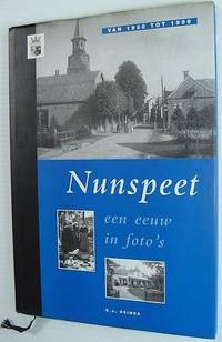
Osinga, D.J.
Nunspeet: Een Eeuw in Foto's Van 1900 Tot 1999
De luxe uitgave is genummerd: 110/ 083. 95 pages. Text in Dutch. Archival black and white photographs throughout. Book clean, bright and unmarked. Minor edgewear to dust jacket. Lovely copy. Book

|
|
|
Osinga, DJ D J
Nunspeet: Een Eeuw in Foto's Van 1900 Tot 1999
Netherlands: Osinga 1998. Book. Fine. Hardcover. Limited Edition. 4to - over 9¾" - 12" tall. De luxe uitgave is genummerd: 110/ 083. 95 pages. Text in Dutch. Archival black and white photographs throughout. Book clean bright and unmarked. Minor edgewear to dust jacket. Lovely copy. Osinga Hardcover
Bookseller reference : 147a5939 ISBN : 9076254036 9789076254036
|
|
|
Oskar Grünwald, Herbert Krämer
Die verstaatlichte österreichische Metallindustrie
Frankfurt a.M., Europäische Verlagsanstalt, 1966. -- Broschiert -- Gr. 8°
Bookseller reference : 004838
|
|
|
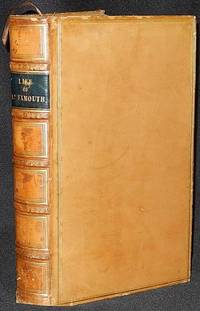
Osler, Edward
The Life of Admiral Viscount Exmouth
London: Smith Elder and Co 1835. Hardcover. Very Good . xvi 448 p.: frontispiece and 5 additional leaves of plates including 1 folded map; 23 cm. Contemporary full polished calf; six spine compartments between raised bands. Black leather label in second spine compartment with gilt-tooled title: Life of Ld. Exmouth. Gilt-tooled decoration in remaining compartments and on raised bands. Double gilt-ruled borders on both boards; gilt-tooled decoration on board edges and turn-ins. All page edges marbled; marbled endpapers. Brown ribbon bookmark separated from binding. The frontispiece portrait of Admiral Viscount Exmouth was engraved by W. Finden from a painting by W. Owen. The life of Admiral Edward Pellew 1st Viscount Exmouth 1757-1833 a British naval officer who fought during the American Revolution when he was taken prisoner at Saratoga the French Revolutionary wars and the Napoleonic wars. He is familiar to fans of C. S. Forester's Captain Horation Hornblower series. In Very Good Condition: edges lightly rubbed; loss of less than 1 cm. of leather at head of spine; foxing on plates and minimally on facing pages of text; otherwise clean and tight. A very attractive copy of this military biography. Smith, Elder and Co hardcover
Bookseller reference : 003186
|
|
|
Osservatorio Permanente sui giovani e l'alcool, a cura di
Young People And Alcohol In Europe A toll for monitoring consumption and institutional action policies. A study made in collaboration with Progetto Europa
Brossura filo refe, con buonissimo aspetto interno, copertina segnata da comun tracce di manipolazione e sfregamento evidenti alle estremità e a ridosso dei canaletti, ossidati i tagli. N. pag. 436 USATO

|
|
|
Ossia, Delle Vere Cagioni dell'Odio in Europa, Con
Discorso sull'Antica e Moderna Gesuitofobia Vol. 1
paperback. Good. Access codes and supplements are not guaranteed with used items. May be an ex-library book. paperback
Bookseller reference : 025916271X.G ISBN : 025916271X 9780259162711
|
|
|
OSTEN Sacken, Cornelia von der
San Lorenzo el real de el Escorial. Studien zur Baugeschichte und Ikonologie. (Studia Iconologica, 1).
Mittenwald: Mäander 1979. 320 S. + 12 Taf. Lit.verz. Br.
Bookseller reference : 59547
|
|
|
Osten, Renee Fersen-
DON'T THEY KNOW THE WORLD STOPPED BREATHING? Reminiscences of a French Child During the Holocaust Years
255 pages; (HOLO2-19-4)
|
|
|

 Receive by email
 Download as PDF document
 RSS feed
 Permanent link


