|
Wagemann, Eberhard
Verdrängte Geschichte. Verteidigung und Verfassung in Europa.
München:, Hase und Köhler, 1999. Gr.-8°. 1025 S., Bibliographie, Pappband 2 Bände. (gut erhalten)
Bookseller reference : 14444BB

|
|
|
Wagenaar, Cor
Town Planning in the Netherlands Since 1800
Rotterdam: 010 Publishers 2011. Paperback in very good condition. Very slight crease along lower edge of FEP and half-title page. Slight hinge break at page 175. No other faults clean throughout and pages exellent. AD. Paperback. Very Good. Used. 010 Publishers Paperback
Bookseller reference : 531230 ISBN : 9064506825 9789064506826
|
|
|
Wagenaar, Cor
Town Planning in the Netherlands Since 1800
Paperback in very good condition. Very slight crease along lower edge of FEP and half-title page. Slight hinge break at page 175. No other faults, clean throughout and pages exellent. AD Used
|
|
|
Wagenbach, Klaus
Kafka's Prague: A Travel Reader
Woodstock NY: Overlook Books 1996 Book. New. Cloth. 1st US Edition. Franz Kafka whose cool detached prose and vivid literary images of power and metamorphosis have left a lasting influence on almost all of the world's literatures ever hardly left his home city of Prague during his short life 1883-1924. This travel book-cum-reader provides a journey through both Kafka's reality and imagination permitting the reader or traveller to experience Kafka's milieu as he wrote such books as 'The Trial' and 'Metamorphosis'. Includes 8 maps and 150 B & W photographs - contemporary and vintage. A beautifully printed and bpund 125 p. illus.maps on endpapers. Overlook Books hardcover
Bookseller reference : 045969 ISBN : 0879516445 9780879516444

|
|
|
Wagenfeld, Karl
Das Bilderbuch von Münsterland Das Bilderbuch von Munsterland
Munster Germany: Verlag der Westfalischen Vereinsdruckerei 1939. Book. Illus. by Wilhelm Rosch photographs; Waldemar Mallek maps. Fine. Decorative Cloth. First Edition. 4to - over 9¾" - 12" tall. Royal blue dyed natural linen lettered and illus. in ivory. As issued. Gift inscription in German dated 1939 on front flyleaf; card of Direktor Wilhelm Schmitz Kreisrichter der NSDAP Ratsherr der Stadt Munster mounted on lower front pastedown. 64 pp. fully illus. w/ b&w photographs. Text in German. Exceptionally scarce. Verlag der Westfalischen Vereinsdruckerei Hardcover
Bookseller reference : 032774
|
|
|
Wagenführ, Horst
Handelsfürsten der Renaissance.
Stuttgart, Schuler Verlag, 1957. Groß 8°. Mit 23 farbigen Tafeln und 11 zweifarbigen Bildern im Text. 218 Seiten. Originaler goldgeprägter Halbledereinband im Schuber.
Bookseller reference : 31700

|
|
|
Wagenvoort H.
PIETAS Selected Studies in Roman Religion
E. J. Brill. Good. 1980. Softcover. 9004061959 . Scholar's name to ffep with his underlining and marginalia in red and black pen. Small stains to back wrap. No other defects. ; Studies in Greek and Roman Religion Vol 1; 264 pages; Collection of Wagenvoort's papers in an English translation. . E. J. Brill paperback
Bookseller reference : 9303 ISBN : 9004061959 9789004061958
|
|
|
Waggerl K.H.
L'AUTRICHE. Ses paysages, ses habitants et sa culture.
(Codice VR/0264) In 8°(27 cm) 8 pp.+ 104 planches-photo en noir légendées en allemand, anglais, français. Toile éditeur, sans jaquette. Très bon état. ~~~ SPEDIZIONE IN ITALIA SEMPRE TRACCIATA

|
|
|
Waggerl, Karl Heinrich, Eduard Widmoser u.a
Österreich. Landschaft, Mensch und Kultur. Geleit von Karl Heinrich Waggerl. Einführung von Eduard Widmoser. 9. Auflage.
Pinguin, Innsbruck u. Umschau, Frankfurt 1962. 8 S. u. 101 teils farbigen Tafeln, 1 Karte. 4°. Illustr.-Kart. Geringe Gebrsp. Gutes Exemplar.
Bookseller reference : 12761

|
|
|
WAGHENAER Lucas Janszoon (1533 – 1606 circa)
Universe Europe maritime eiusque navigationis descriptio
Universe Europe maritime eiusque navigationis descriptio = Generale Paschaerte van Europa, soe verre die Zeecusten ende Navigatien streckende zÿn. Gepractizeert Doer Lucas Jansz, Wagenaer va Enchusè. Met Privilegie tot 10. Iaren. 1.5.83. Acquaforte e bulino, 395x555 mm, firmata e datata in lastra in basso a destra Joannes à Doetecum. F.Dall'edizione tedesca dello Spieghel der Zeevaerdt. Terza edizione della carta, con la traduzione del nome di alcuni mari in latino, inserita nello Spieghel der Zeevaerdt a partire dal 1586.Magnifica prova, con piccoli restauri nei margini che interessano anche il bordo graduato, nel complesso in eccellente stato di conservazione.Carta nautica del Mediterraneo occidentale, estesa alle Isole Britanniche e all’Islanda, di Lucas Jansz. Waghenaer. Impreziosita da rose dei venti, mostri marini, velieri e stemmi araldici, la carta è inclusa nello Spieghel der Zeevaerdt di Waghenaer ed è caratterizzata dalla curiosa rappresentazione circolare dell’Islanda, che sarebbe stata rivista e corretta nella successiva versione. La tavola è conosciuta in tre diversi stati: il primo - avanti le aggiunte delle traduzioni in latino nel nome di alcuni dei mari e delle iscrizioni nelle barre della scala metrica - apparve solo nelle prime tre edizioni dello Spieghel der Zeevaerdt, pubblicate a Leida da Christophe Plantin nel 1583, 1584 e 1585; il secondo stato della lastra vede aggiunta l’isola di Rockall, un piccolo scoglio dell’Atlantico a ovest della Scozia, che viene rappresentato, senza il toponimo, a destra del vascello. Secondo Schilder questo stato della carta non sarebbe inserito in nessuna delle edizioni dello Spieghel der Zeevaerdt, ma sarebbe stato venduto separatamente a Leida da Van Raphelingen per la tipografia Plantin intorno al 1586. Il terzo stato della carta, pubblicato per la prima volta nella traduzione latina dello Spieghel der Zeevaerdt - stampata con il titolo di Speculum nauticum nel 1586 - vede alcuni nomi dei mari e delle scale grafiche tradotti per il mercato sud-europeo. Ad esempio, sotto al toponimo Midtlantse Zee, ad ovest della Sardegna, si legge, in piccolo, Mare Mediterraneum.Lo Spieghel di Waghenaer fu il primo atlante nautico a stampa; di conseguenza questa carta nautica dell’Europa e dell’Atlantico occidentale è la prima carta nautica stampata della regione. La data 1583 è incisa in piccolo riquadro sotto il cartiglio con il titolo; tuttavia, è possibile che Waghenaer avesse già realizzato questo carta portolano nel 1579, per venderla separatamente come strumento di navigazione. Incisa da Joannes van Doetecum la carta è impreziosita da numerose rappresentazioni di navi e ricoperta di linee direzionali che si irradiano da rose dei venti, decorazioni tipiche delle carte nautiche manoscritte, senza dubbio fonti cartografiche per questa mappa. I nomi dei luoghi vengono scritti continuamente verso l’interno intorno alla costa, da nord a sud, al fine di facilitarne la lettura al navigatore attraverso la ruotazione della mappa. Nella parte terrestre della tavola troviamo gli stemmi dei vari Paesi europei. La raffinatezza dello stile incisorio di Joannes van Doetecum è molto evidente in questa mappa. Joannes, insieme al fratello Lucas, proveniva da una famiglia di incisori originaria di Deventer, attiva ad Anversa, Haarlem e Amsterdam nella seconda metà del XVI secolo. Oltre alle mappe dello Spieghel, i fratelli Doetecum sono autori delle più belle carte pubblicate da Hieronymus Cock, Gerard de Jode e Abraham Ortelius. Una curiosità cartografica dell’opera è la presenza, a ovest delle coste irlandesi, della piccola isola del Brasile, o Hy Brasil, rappresentata nella consueta forma circolare con un fiume che la taglia in due. L’isola - qui denominata Brasiil – appartiene alla mitologia irlandese: coperta da un costante velo di nebbia, si dice che appaia per un giorno ogni sette anni. L’isola leggendaria apparve per la prima volta in una mappa di An... Universe Europe maritime eiusque navigationis descriptio = Generale Paschaerte van Europa, soe verre die Zeecusten ende Navigatien streckende zÿn. Gepractizeert Doer Lucas Jansz, Wagenaer va Enchusè. Met Privilegie tot 10. Iaren. 1.5.83. Etching with engraving, signed at lower right Joannes à Doetecum. F. From the German edition of the Spieghel der Zeevaerdt.A fine impression, printed on contemporary laid paper, small restorations in the margins that also affect the graduated edge, overall in excellent condition.Third state of Waghenaer's map of Europe, the British Isles, Iceland, and the western Mediterranean, including the Rockall Island and the Latin translation of some of the Sea’s names. Richly embellished with compass roses, sea monsters, sailing ships, coats of arms and rhumb lines, the chart appeared in an early edition of Waghenaer's Speigel der Zeevaerdt and is characterized by the curious circular representation of Iceland, which was revised in later reprints. Waghenaer's Spiegel was the first engraved sea atlas, making this sea chart of Europe and the Western Atlantic the earliest printed sea chart of the region. Because this chart was significantly larger than the others in the atlas, it rarely appears on the market in good condition. The fine engraving work of Joannes Doetecum is very much in evidence on this map. Doetcum came from a family of printmakers from Deventer, although Joannes and his brother Lucas moved to Antwerp. They engraved not only the maps in theS peigel, but also maps for Hieronymus Cock, Gerard de Jode, and Abraham Ortelius.Lucas Jansz Waghenaer (c. 1533–1606) was a navigator and the author of the ‘Spieghel der zeevaerdt’, the first pilot guide. He spent his early career as a naval officer between 1550 and 1579, interacting with other sailors and gaining vital experience for his later work. He then worked as a duties collector in Enkhuizen, before beginning to work on a project to combine accurate sailing directions with detailed maps. Sailors at the time generally relied on small books called rutters, which were often handwritten, or featured crude woodcut maps. They were wary of printed guides, as they could not be updated or personalised as easily as a manuscript and were thought to be less practical. Waghenaer aimed to change this attitude, and chose to do so by publishing his work as a large folio (rather than the traditional oblong), with copper engraved maps and typeset text. The first volume of the ‘Spieghel’ contains instructions on various navigation techniques and the use of the manual, and maps of coasts from Texel to Cadiz, each accompanied by a coastal profile. Portuguese navigators had pioneered the use of coastal profiles in navigation, but Waghenaer was the first to include them for every chart on a consistent scale. The second volume, published a year later, contained charts of the coasts north of Texel. They were engraved by Johannes van Doetecum, one of the finest workers of the age. The charts were based on Waghenaer’s own extensive experience, supplemented by manuscript and printed sources. The accompanying text was based on other sixteenth century navigation manuals. It was a revolutionary success, and was translated into German, Latin and French, as well as an unauthorised English edition. His work was so popular in England that the Anglicized version of his name, ‘Waggoner’, became a generic term referring to sea atlases and charts.Bibliografia: T. Campbell, Early Maps, New York, 1981, p. 86, tav. 39; B. Freitag, Hy Brasil: The Metamorphosis of an Island, From Cartographic Error to Celtic Elysium. Amsterdam, 2013; H.A.M. van der Heijden, De Oudste gedrukte kaarten van Europa, Utrecht, 1992, n. 12; C. Koeman, Lucas Janszoon Waghenaer: A Sixteenth Century Marine Cartographer, in “The Geographical Journal”, Vol. 131, No. 2 (June, 1965), pp. 202-212; C. Koeman, Atlantes Neerlandici: Bibliography of Terrestrial, Maritime and Celestial Atlases a... S. Bifolco, "Mare Nostrum, Cartografia nautica a stampa del Mar Mediterraneo" (2020), pp. 68-69, tav. 16.

|
|
|
Wagner Otto
Architettura moderna e altri scritti
illustrazioni

|
|
|
Wagner, Ernst.
Quellen zur Geschichte der Siebenbürger Sachsen 1191-1975.
429 S. mit Abb. Orig.-Leinen (wie neu). Bücher de
|
|
|
Wagner, Gretel [Nachw.]
Völkergallerie Europas. 60 Kostümtaf..
Dortmund, Harenberg, 1980. Nachdr. nach d. Buchausg. von 1830 / mit e. Nachw. von Gretel Wagner 18 cm. 141 S. : überwiegend Ill. (farb.) kart. sehr guter Zust. Die bibliophilen Taschenbücher ; Nr. 162 1830
Bookseller reference : 39196AB
|
|
|
Wagner, Hans
Taschenbuch der Käfer des mitteleuropäischen Verbreitungsgebiets.
Eßlingen am Neckar [u.a.] : Schreiber, c 1943. 24 Taf. in Farbendr. mit 467 Abb. u. 222 S. Text mit 27 Abb. 8°. 3. Aufl. Ill. OBroschur.
Bookseller reference : 44812
|
|
|
Wagner, Hermann
Das Erbe. Deutsche Volkslieder aus Mittel- und Osteuropa. Quellen und Dokumentation.
Bonn:, Voggenreiter;, 1972. 17 cm. 280 S., Notation. Okt. Rücken etw. knickspurig und Stempel auf Vorsatz.
Bookseller reference : 115798AB

|
|
|
Wagner, Horst-Günter
Der Mittelmeerraum. Geographie - Geschichte - Wirtschaft - Politik.
Wissenschaftliche Buchgesellschaft (WBG), 2001.
Bookseller reference : 191909

|
|
|
WAGNER, JOHANN CHRISTOPH.
Grundrichtige Beschreibung des ganzen Ausgangs / sonderlich aber des Hochlöblichen Königreichs Ungarn und der ganzen Türcken.
Reichlich in Schwarzweiß illustriert.
|
|
|
Wagner, Richard
Der leere Himmel : Reise in das Innere des Balkan. Richard Wagner 1. Aufl.
Berlin : Aufbau-Verl. 2003. 334 S. : Kt. ; 22 cm, mit Schutzumschlag Originalverschweißt, Top Zustand, Pp., gebundene Ausgabe, Hardcover/Pappeinband
Bookseller reference : 31460

|
|
|
Wagner, Rudolf:
Vom Halbmond zum Doppeladler. Ausgewählte Beiträge zur Geschichte der Bukowina und der Czernowitzer Universität "Francisco-Josephina".
24,5 x 16,5 cm. 535 Seiten. Pappband (wie neu). ISBN 3000009671 Bücher de
|
|
|
Wagnerova Magdalena
Old Prague Legends
Prague: Plot Publishing House 2008 Book. New. Hardcover. First Thus. A collection of twenty-nine tales or legends associated with several well-known sites of old Prague. These buildings landmarks and whole areas are woven through with stories that bear the weight of many long centuries of Bohemian history.Translated into English by Ivan Gutierrez. 135p. illus. B & W Map on endpapers . Plot Publishing House hardcover
Bookseller reference : 045928 ISBN : 808652387x 9788086523873
|
|
|
Wagnsson, C.
Security in a Greater Europe: The Possibility of a Pan-European Approach
Manchester University Press 2008. This is an ex-library book and may have the usual library/used-book markings inside.This book has hardback covers. In good all round condition. Dust jacket in good condition. Please note the Image in this listing is a stock photo and may not match the covers of the actual item550grams ISBN:9780719078828 Manchester University Press hardcover
Bookseller reference : 9092651 ISBN : 0719078822 9780719078828
|
|
|
WAHL, Adalbert.
Geschichte des Europäischen Staatensystems im Zeitalter der Französischen Revolution und der Freiheits-Kriege (1789-1815).“Handbuch der Mittelalterlichen und Neueren Geschichte.”
München - Berlin, R. Oldenbourg 1912, 250x165mm, VIII- 266Seiten, Verlegereinband. Schönes Exemplar.
Bookseller reference : 30992

|
|
|
Wahl, Fritz
Die strafrechtliche Haftung des verantwortlichen Redakteurs nach § 21 des Reichspreßgesetzes. Inaugural-Dissertation ... bei der Universität Leipzig.
Borna - Leipzig Druck bei Noske 1904. Original-Broschur mit papierverstärktem Rücken VIII, 54 Seiten, 1 Blatt. gering angestaubt und lichtrandig, Rücken mit kleinen Fehlstellen, innen sauber, insgesamt recht gut erhalten
Bookseller reference : 1120939
|
|
|
Wahl, Hans; Kippenberg, Anton, editors
Goethe und seine Welt: unter Mitwirkung von Ernst Beutler; herausgegeben von Hans Wahl und Anton Kippenberg
Leipzig: Im Insel-Verlag 1932. Hardcover. Very Good -/good -. 4 306 2 p.: 580 illustrations; 25 cm. Off-white linen with red and black spine and cover titles. White dust jacket printed in red and black. Publisher's advertisements on final unpaginated page and on both flaps and back section of dust jacket for other works by and about Goethe. Includes index. Pages 243-303 contain notes on the illustrations. Book is in Very Good- Condition: cover is slightly discolored; pages are slightly browned; otherwise clean and tight. Dust jacket is in Good- Condition: lightly soiled; brown along spine and two edges; loss at head of spine; creasing and chipping along upper edge of back section; loss along both flap folds. Im Insel-Verlag hardcover
Bookseller reference : 007827
|
|
|
Wahl, Horst
Der Kirchen-Vorstand im Königreich Sachsen. Inaugural-Dissertation ... bei der Universität Leipzig.
Leipzig Druck bei Klinkhardt 1909. Original-Broschur mit papierverstärktem Rücken VIII, 96 Seiten. angestaubt, wenig knickspurig, etwas vergilbt, Rücken mit kl. Fehlstellen, innen sauber
Bookseller reference : 1121313
|
|
|
Wahl, Rudolph
Kaiser Friedrich Barbarossa. Eine Historie.
Bruckmann, München 1941. 613 S. mit 8 Tafeln, 2 Karten u. 1 Stammtafel, Erratum liegt bei. Halbleinen. Titelbild des Schtzumschlags u. Teil des Klappentextes auf die Vorsätze montiert. Geringe Gebrsp. Sehr gutes Exemplar.
Bookseller reference : 16852

|
|
|
WAHLEN Auguste
MOEURS , USAGES ET COUTUMES DE TOUS LES PEUPLES DU MONDE.
Bruxelles , Librairie historique - artistique , 1844 , in4° 1/2 chagrin , dos orné , 361 pp . 48 planches hors texte . Quelques rousseurs . Langue: Français
Bookseller reference : M17509
|
|
|
Wahlen, Auguste
Moeurs, usages et costumes de tous les peuples du monde, d'apès des documents authentiques et les voyages les plus récents. Afrique. Amérique. Europe. Asie. Océanie. 4 in 3 vols.
Bruxelles, Librairie Historique-Artistique, 1843-1844. Large 8vo. (2), 368; (2), 591; (2), 365, (2); (2), 361, (2)pp. With 4 handcoloured title-vignettes and 206 handcoloured woodcut plates. Contemp. half calf, gilt.
Bookseller reference : 44858AB
|
|
|
Wahlöö, Claes und Margareta Alin
Kulturen 1998: Metropolis Daniae - Ett stycke Europa - Kulturen 1998 en arsbok till medlemmarna av kulturhistoriska föreningen för södra sverige
Lund, Tryck och repro: BTJ Tryck AB, 1998. 222 Seiten , 21 cm, Hardcover/Pappeinband
Bookseller reference : 43465 ISBN : 4545915

|
|
|
Wain John
Un cielo più piccolo
trad. di Bruno Fonzi n. 268 tela edit. con sovrac. ill.
|
|
|
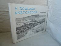
Wainwright, Alfred
A Bowland Sketchbook
Westmorland Gazette 1981. Hardback. Very Good hardback minimal edgewear pale foxing spots on shelf edge of back endpapers in Good dustwrapper light edgewear minor chipping. Landscape format green Rexene boards with gilt title to spine. With 69 illustrations by the author. The picture on the listing page is of the actual book for sale. Westmorland Gazette hardcover
Bookseller reference : 60903
|
|
|
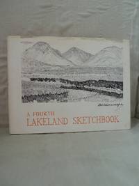
Wainwright, A
A Fourth Lakeland Sketchbook
Kendal.: Westmorland Gazette n.d. First Edition. Hardback. Very Good hardback light edgewear internally clean and unmarked Good dustwrapper light edgewear esp. to head of spine short list of numbers written inside front flap. Price on front flap �1.05. Landscape format orange cloth with square corners and gilt title on spine in dustwrapper. Illustrated by the author. The image on this page is of the actual book for sale. Westmorland Gazette hardcover
Bookseller reference : 57161
|
|
|
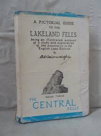
Wainwright, Alfred
A Pictorial Guide to the Lakeland Fells Book 3: The Central Fells
Henry Marshall 1958. Sixth/6th impression. Hardback. Bright blue leatherette binding with silver lettering and rounded corners. Priced at 15/0. The image on this listing page is of the actual book for sale. Good hardback light edgewear pages gently age-toned ownership sig. tight and bright in Fair dustwrapper edgeworn chipped esp. to head of spine with losses flaps taped on. Priced at 12/6. Henry Marshall hardcover
Bookseller reference : 56773
|
|
|
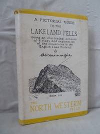
Wainwright, Alfred
A Pictorial Guide to the Lakeland Fells Book 6: The North Western Fells
Westmorland Gazette. Fourth/4th impression. Hardback. Yellow leatherette binding with blue lettering and rounded edges in dustwrapper. Priced at 12/6. The image on this listing page is of the actual book for sale. Good hardback some tiny dark marks on very edges of boards pale foxing to page edges clean and unmarked bright and tight in Good dustwrapper edgeworn and chipped esp. to head of spine lightly rubbed internally foxed. Westmorland Gazette hardcover
Bookseller reference : 56768
|
|
|
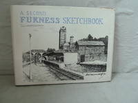
Wainwright, A
A Second Furness Sketchbook
Kendal.: Westmorland Gazette n.d. Hardback. Good hardback light edgewear page edges spotted in Good dustwrapper light edgewear minor chipping with �2.50 price sticker stuck inside front flap. Last book listed is 'Three Westmorland Rivers'. Landscape format dark green leatherette with square corners and gilt title on spine in dustwrapper. Illustrated. The image on the listing page is of the actual book for sale. Westmorland Gazette hardcover
Bookseller reference : 58330
|
|
|
Wainwright A.
Fellwalking with Wainwright - 18 of the Author's Favourite Walks in Lakeland
U.K.: Michael Joseph 1985. Book. Illus. by Brabbs Derry photographer. Fine. Hardcover. Reprint. 8vo - over 7¾" - 9¾" tall. 223 pages. "A unique portrait of England's countryside in all its moods a wonderful memento for those who have 'retired' from fellwalking or who live too far away and will treasure the memories invoked by this book and the many fortunate people who still have the excitement of the high places before them." - from dust jacket. Gift greetings upon illustrated front endpaper else clean bright and unmarked. Virtually zero wear to book. Very light wear to dust jacket. Lovely copy. Michael Joseph Hardcover
Bookseller reference : 74203265 ISBN : 0718124286 9780718124281

|
|
|
Wainwright, A.
Fellwalking with Wainwright - 18 of the Author's Favourite Walks in Lakeland
223 pages. "A unique portrait of England's countryside in all its moods, a wonderful memento for those who have 'retired' from fellwalking or who live too far away and will treasure the memories invoked by this book, and the many fortunate people who still have the excitement of the high places before them." - from dust jacket. Gift greetings upon illustrated front endpaper else clean, bright and unmarked. Virtually zero wear to book. Very light wear to dust jacket. Lovely copy. Book
|
|
|
WAINWRIGHT, Tom
Narconomics. Ein Drogenkartell erfolgreich führen.
(Mchn.),Blessing (2016). 351 S. Opbd. mit farbig illustr. OU., Schutzumschlag mit leichten Kratzspuren, sonst sehr gut erh.
Bookseller reference : 0170-22

|
|
|
Waissenberger, Robert (editor); Hans Bisanz, Kurt Blaukopf, Gunter Duriegl, Renata Kassal-Mikula, Harald Leupold-Lowenthal, Wend
Vienna 1890-1920
Secaucus NJ: Wellfleet Press 1984. Book. Fine. Hardcover. 1st Edition. 4to - over 9¾" - 12" tall. Burgundy cloth-effect boards lettered in gold foil. Minor foxing along top text block edge otherwise essentially as issued. Color illus. dust jacket as issued now in mylar. 276 pp. illus. 1st ed. Wellfleet Press Hardcover
Bookseller reference : 063722 ISBN : 1555212581 9781555212582
|
|
|
Waissenberger, Robert (editor)
Vienna in the Biedermeier Era 1815-1848
Mallard Press 1986. Book. Fine. Hardcover. 1st Edition. 4to - over 9¾" - 12" tall. Brown cloth-effect boards lettered in gold foil. As issued. Color illus. dust jacket shows slight surface wear to rear panel otherwise as issued now in mylar. 1st ed. 280 pp. 300 illus. including 80 color. Mallard Press Hardcover
Bookseller reference : 059345 ISBN : 0792457382 9780792457381
|
|
|
Waissenberger Robert editor
Vienna in the Biedermeier Era 1815-1848
New York: Mallard Press 196. 280 pages 300 illustrations 80 in color index. Remains of a price sticker by the upper corner of the front flyleaf. Cloth boards in dust-jacket. Eleven social and art historians examine a fascinating era in the history of one of Europe's most vibrant capitals. From the blurb 'Gottfried Biedermeier a humorous and popular fictional character from the journal Fliegende Blatter came to symbolize the new values giving his name to the style that would become popular among the nouveau riche throughout Europe and England. Emphasis was on the decorative arts -- on graceful furniture glass clock and porcelain. In painting genre scenes portraits and lyrical landscapes were in vogue while in music late-classical musicians Beethoven and Schubert delighted audiences and the Viennese waltzes of Johann Strauss the Elder had their debut. Biedermeier architecture which placed emphasis on the comfortable aspects of home decor is represented chiefly in the work of Josef Kornhausel'. First English Language Edition. Hard Cover. Very Good/Very Good. 4to. Mallard Press Hardcover
Bookseller reference : 019164
|
|
|
Waitzfelder, Monica
L'Oreal Took My Home
<p>Unread mint condition.</p> Arcadia Books paperback
Bookseller reference : biblio17 ISBN : 1905147546 9781905147540

|
|
|
Wake, Jehanne
Kleinwort Benson: The History of Two Families in Banking
Oxford: Oxford University Press 1997. Hardcover in very good condition with unclipped dust jacket in good condition. Jacket is slightly scuffed. Edges are creased and nicked with a tear at the spine foot rear side. Board corners and spine ends are slightly bumped. Previous owner's inscriptions on FEP. Binding is sound and pages are clear. LW. Hardcover. Very Good/Good. Used. Oxford University Press Hardcover
Bookseller reference : 618209 ISBN : 0198282990 9780198282990

|
|
|
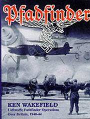
Wakefield, Ken
Pfadfinder: Luftwaffe Pathfinder Operations Over Britain 1940-44
Stroud: Tempus Publishing 1999. 251 pages notes on Luftwaffe Bomber Units eight appendices. Cloth boards in portected dust-jacket which has a piece of sellotape holding the front and rear plastic covers to the paste-downs. The book gives the history of the Luftwaffe's history and development of the technique of Pathfinding -- the illumination of a target area by a special force to guide less proficient or less well-equipped bomber squadrons -- over Britain during a critical period of the war. First Edition. Hard Cover. Near Fine/Near Fine. 4to. Tempus Publishing Hardcover
Bookseller reference : 023471 ISBN : 0752416928 9780752416922
|
|
|
Wakeman, Henry Offley
EUROPE - 1598-1715 - PERIOD V
London: Rivington Percival and Co. Good; Age wear and some edge spotting. 1894. Hardcover. 394 pages . Rivington, Percival and Co. hardcover
Bookseller reference : 95829
|
|
|
Wakeman, H O
Europe 1598-1715: Period V
Rivingtons 1894. This is an ex-library book and may have the usual library/used-book markings inside.This book has hardback covers. In fair condition suitable as a study copy. No dust jacket. Re-bound by library. Clothbound octavo gold stamped lettering on spine pen and pencil markings inside text and in margins foxing cover stained darker and a little worn on corners Please note the Image in this listing is a stock photo and may not match the covers of the actual item650grams ISBN: Rivingtons hardcover
Bookseller reference : 5936801
|
|
|
Wakeman, H. O.
THE REFORMATION IN GREAT BRITAIN
London: Rivingtons. Good; Spine Strip Slightly Torn. 1931. Fourth Edition. Hardback. 142 pages . Rivingtons hardcover
Bookseller reference : 80907
|
|
|
WALCH Johann Kempten 1757 - Augsburg 1815)
Boehmen Mahren, Schlefien, und die Lausitz
Carta geografica tratta dall'atlante edito ad Augsburg circa nel 1820. Incisione in rame, coloritura coeva, leggere ossidazioni, per il resto in buone condizioni. Non comune. Map taken form the Atlas printed in Augsburg, circa 1820.Copperplate, original colouring, good condition.

|
|
|
WALCH Johann Kempten 1757 - Augsburg 1815)
Charte vom Koenigreich Polen nach seinen ehemahligen (1773) und demahligen Grenzen 1820
Rarissima carta della Polonia e Lituania, stampata ad Ausburg (Augusta) da Johannes Walch nel 1820. Si tratta del sesto, sconosciuto stato della carta – la carto bibliografia “Imago Polonia” (Varsavia, 2002), che descrive l’incredibile collezione Niewodniczanski contempla solo 5 stati della carta, di cui l’ultimo stampato nel 1807 – per la prima volta edita nel 1793.Incisione in rame, coloritura coeva dei contorni, piccole macchie di umidità negli angoli inferiori, altrimenti in perfetto stato di conservazione.La città imperiale di Augusta era un importante centro di produzione di mappe per l'Europa centrale nel XVIII secolo. Gli incisori più noti erano i residenti Johann Stridbeck e Gabriel Bodenehr, e gli editori d'arte Matthäus Seutter e il suo successore Tobias Conrad Lotter, e Johann Michael Probst, tutti specializzati nella pubblicazione di cartografica e topografica. La graduale recessione economica di Augusta ha lasciato il segno sulla fiorente attività di tipografia ed editoria. Solo Johann Martin Will e soprattutto Johannes Walch hanno impedito la completa scomparsa della produzione di mappe alla fine del XVIII secolo. La continuità della casa editrice Walch fino al momento attuale, tuttavia, non garantisce ampi archivi per la stesura di una cronologia dettagliata dell’editore di mappe tedesco. La casa editrice bruciò durante la seconda guerra mondiale e la maggior parte dei documenti scritti e stampati furono distrutti.Johannes Walch divenne attivo dal 1790 circa come incisore dei propri disegni di carte, sposando la figlia dell’altro editore John Martin Will. Le mappe in formato folio sono l'obiettivo principale del lavoro cartografico di Walch. Alcuni di loro prendono il titolo in modo molto specifico, vale a dire promozione delle vendite, riferimento agli attuali eventi di guerra, come ad esempio la “Neue General-Kriegs- Karte des Rheinstrohms” (3 tavole, 1793), la “Kriegstheater oder Graenzkarte zwischen Frankreich und Italien” (1786) e la “Polen nach seiner ersten, und lezten, oder gaenzlichen Theilung” (1796). Walch, tenendo conto del gusto del tempo, rinunciava completamente agli ornamenti. Le sue carte sono chiare e belle. Sono scritti principalmente in tedesco, in parte anche nell'allora francese alla moda. Le carte del Walch, non essendo parte di un atlante, sono assolutamente rare nel mercato antiquario. A very rare map of Poland and Lithuania by Johannes Walch, first published in 1793, here in his sixt – unknown – state, dated 1820. Imago Poloniae (the carthobibliography of the maps form the Niewodniczanski collection, Warsaw 2002) listed only 5 states of the map, the latest with the date 1807.Copperplate, with fine original outline colouring, light waterstains at the lower corners, otherwise very good condition.The imperial city of Augsburg was a leading center of map production for Central Europe in the 18th Century. Many of the resident copper engravers such as Johann Stridbeck and Gabriel Bodenehr, and the art publishers Matthäus Seutter and his successor Tobias Conrad, and Johann Michael Probst were specialized in the publication of cartographica and topographica.The gradual economic recession of Augsburg left its mark on the once flourishing printing and Publishing business. Only Johann Martin Will and especially Johannes Walch prevented the complete disappearance of map production at the end of the 18th Century. The continuity of the Publishing house Walch up until the present time, however, does not guarantee extensive archives for writing a detailed history of a German map publisher. The Publishing house burned down during World War II and most of the written and printed documents were destroyed.Although Walch and Will also acted as independent publishers in the future, there seems to have been an intimate business combination between the two companies, especially in the area of map production.Johannes Walch became active from about 1790 as engraver of his own map designs. He published his own sheets, but they also appeared partly in Will. In some cases, both names are equal in the map titles. For example, Walch becomes author and publisher, Will called as publisher. So early on, the agreement seems to have existed that Walch would be the publisher's successor to his father-in-law. This is also supported by the common home and business address of the two publishers and in particular the fact that Will does not male successor and his inheritance would have to fall anyway to his daughter and her husband Walch. Maps in folio format are the main focus of Walch's cartographic work. Some of them take in the title very specifically, that is sales-promoting, reference to current events of war, such as Poland after its first, and last, or total division - 1796. Soon, however, his publishing house also found a broad standard program of maps from the regional to the hemispheric map. His engravings are almost entirely editions of foreign originals, and he confessed this only in a few cases in the card title Far more often Walch claimed to have designed a map according to the latest astronomical location rules, most reliable travelogues and most valued resources to have. Walch, taking into account the taste of the time, completely renounced ornamentation. His maps are clear and fine. They are mostly written in German, partly also in the then fashionable French language. The large maps by Walch are not part of an Atlas, so they are quite rare on the antiquarian market. Cfr. Imago Poloniae (2002), vol. II, pp. 123-124, K55 77/11 (ed. 1793-1807) Michael Ritter, Cartographica Helvetica: Fachzeitschrift für Kartengeschichte, nr. 25-26, 2002

|
|
|
Walch Johannes edit.
Karte von Europa
Coloritura coeva. Macchie

|
|
 Receive by email
 Download as PDF document
 RSS feed


