|
|
|
BORY (Jean-René)
Histoire de la Russie et de ses relations avec la Suisse.
Prégny-Genève, 1999. In-4° br., couv. ill. en couleurs, 296pp., nbr. ill. en noir, bibliogr.
Bookseller reference : 499024
|
|
|
BORSI (Franco)
L'Ordre monumental. Europe 1929-1939.
Hazan, 1986. In-4 relié sous jaquette illustrée (31 x 23,3 cm), 207 pages, nombreuses illustrations.- 1,5kg.- Très bon état.
Bookseller reference : 31482

|
|
|
BORY, Jean-René:
La Suisse à la rencontre de l'Europe. L'épopée du service étranger. Du concile de Bâle (1444) à la paix de Westphalie (1648). Préface du Duc de Castries.
Lausanne, David Perret, 1978, in-4°, 306 p., richement ill., reliure en simili-cuir. Jaquette couleur
Bookseller reference : 39128aaf
|
|
|
Born Wofgang
Le Soulier
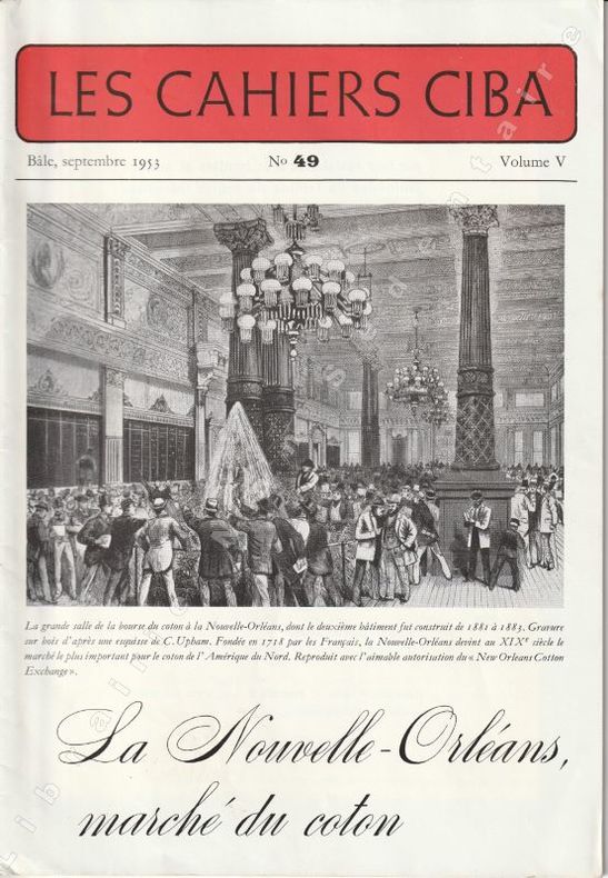
Bâle, Janvier 1955 LES CAHIERS CIBA- N° 57 Volume V Fascicule in octavo en feuillets agrafés de 58 pages en pagination continue de la série ( 1982-2020) , nombreuses ill en noir in text. Très bel exemplaire.
Bookseller reference : 15852
|
|
|
BORDES FRANCOIS
Leçons sur le paléolithique. Tome II. Paléolithique en Europe
CNRS Presses du CNRS 1992. In-8 broché de VIII + 459 pages illustrées. Quelques passaages soulignés au crayon de papier sinon parfait état
Bookseller reference : 122014

|
|
|
BORGHERS, A. & DUDOUIT, P.:
L’Europe au moyen age. Traduit de l’anglais de Henry Hallam. 5 tomes reliés en 2 volumes.
Bruxelles, N.-J. Gregoir, 1840, in-8vo, 249 p. + 256 p./ 250 p. + 238 p. + 268 p., reliure en d.-cuir, dos orné or.
Bookseller reference : 86699aaf

|
|
|
BORUWLASKI Joseph
Mémoires du célèbre Joseph Boruwlaski, gentilhomme polonais.
Flammarion Flammarion, 2008, 151 p., broché sous jaquette, bon état.
Bookseller reference : 107159
|
|
|
Borromeo Federico
Sacred Painting Museum (I TATTI RENAISSANCE LIBRARY Band 44)
Harvard University Press 2010 336 pages 14x21x2 6cm. 2010. Cartonné jaquette. 336 pages.
Bookseller reference : 100133998

|
|
|
Born, Ignaz von
Voyage minéralogique fait en Hongrie et en Transilvanie
1780 A Paris, 1780, sans nom d'éditeur. In-12 plein veau dos orné. (xx), 405 pages. Traduit de l'allemand par Monnet.
Bookseller reference : 1682
|
|
|
Boragina Piero - Marcenaro Giuseppe (a cura di)
Russia & Urss. Arte, letteratura, teatro. 1905-1940
illustrazioni a colori e in nero

|
|
|
Boraston, JH (editor) J H
SIR DOUGLAS HAIG'S DESPATCHES : December 1915-April 1919
J.M. Dent and Sons Ltd. 1920. 374pp. Red cloth hardback with gold type very light rubbing at corner and spine tips Seperate slipcase with 10 fold-out battle maps slipcase has wear along edges and ribbon tie missing Second printing of 1919 edition map in rear of book index b&w photos and maps small tear on page 307 The Despatches of Sir Douglas Haig who was a "senior officer of the British Army. During the First World War he commanded the British Expeditionary Force BEF on the Western Front from late 1915 until the end of the war. He was commander during the Battle of the Somme the Battle of Arras the Third Battle of Ypres the German Spring Offensive and the Hundred Days Offensive". Hard Cover. Very Good/No Jacket. J.M. Dent and Sons Ltd. Hardcover
Bookseller reference : w190126309
|
|
|
Borbone, Eulalia Di
Nelle Corti d'Europa
Mm 140x210 Traduzione di Emilia Durini, terza edizione, con 23 illustrazioni in bianco e nero fuori testo. Brossura editoriale di 281 pagine. Copertina un po' sporca ma buona copia. SPEDIZIONE IN 24 ORE DALLA CONFERMA DELL'ORDINE.
|
|
|
Borbonico, Esercito; Vocino, M (text)
Esercito Borbonico - Portfolio of 8 Plates
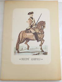
Napoli: Montanino. Softcover porfolio in glassine dust jacket of 8 color plates text by M. Vocino. Text in Italian. Published Napoli: Montanino no date c.1966. 8vo. 6 3/8" x 9" 8 recto printed loose color plates 3pp. text. Light foxing to inside covers title page and glassine dust jacket plates and text fine. Dust jacket has small closed tears/chipping. . Very Good Plus. Soft cover. 1st. 1966. Montanino paperback
Bookseller reference : 010880
|
|
|
BORCHERT Till-Holger
VAN EYCK TO DURER. The influence of early Netherlandish painting on European art, 1430-1530.
In-4 (cm. 29.70), cartonato editoriale, sovracoperta editoriale illustrata, pp. 552, con numerosissime illustrazioni in bianco e nero e a colori nel testo. With contributions by Julien Chapuis, Ingrid Ciulisova, Juliane Von Fircks, etc. Text in English. Minime tracce d’uso alle punte inferiori; peraltro, volume in ottimo stato (nice copy).
|
|
|
Bordeaux Henry
Andromeda e il mostro
trad. di Giuseppina Vighy bross. edit. ill., numero scritto in cop. e all'occhietto
|
|
|
BORDES FRANCOIS
Leçons sur le paléolithique. Tome II. Paléolithique en Europe
Presses du CNRS 1992. In-8 broché de VIII + 459 pages illustrées. Quelques passaages soulignés au crayon de papier sinon parfait état

|
|
|
BORDONE Benedetto (1460-1539)
[Carta nautica del Mediterraneo]
Opera tratta da: Libro di Benedetto Bordone nel qual si ragiona de tutte le isole del mondo con li lor nomi con li lor nomi antichi & moderni, historie, fauole, & modi del loro viuere, & in qual parte del mare stanno, & in qual parallelo & clima giacciono. Con il Breve di papa Leone. Et gratia & priviliegio della Illustrissima Signoria com’in quelli appare. M.D.XXVIII. Impresse in Vinegia per Nicolò d’Aristotele, detto Zoppino, nel mese di Giugno, del M.D.XXVIII.Xilografia, dimensioni 290x380.Carta nautica dell’Europa e del Mediterraneo, tagliato ad oriente ad ovest dell’isola di Cipro. Si tratta della prima carta a stampa dell’area, inserita nel celebre Libro di Benedetto Bordone. La carta è priva del reticolo geografico, l’orientamento è fornito da una schematica rosa di otto venti. Benedetto Bordon (Bordone), nato a Padova intorno al 1450, fu uomo di varia cultura e multiforme attività: miniatore, disegnatore, geografo, editore di classici e, forse, pittore. Dimorò fino alla fine del secolo nella sua città: e dunque la sua arte si formò sotto l’influsso del grande conterraneo Andrea Mantegna. Passò poi a Venezia e qui rimase per tutto il resto della vita, pur mantenendo sempre legami affettivi e di lavoro con Padova. Tralasciando le attività artistiche di miniatore, disegnatore e pittore, delle quali esistono diverse testimonianze, il Bordone fu impegnato attivamente anche nell’editoria, stampando in traduzione latina alcuni Dialoghi di Luciano. Verso la fine della sua vita si cimenta in un’opera geografica e di erudizione insieme, che pubblica a Venezia nel 1528 col titolo di Libro di Benedetto Bordone nel qual si ragiona de tutte le isole del mondo; era dedicata al nipote Baldassarre, che - apprendiamo dal proemio - aveva visitato molti dei luoghi descritti quando, probabilmente come medico militare, aveva navigato per tutto il Mediterraneo “sopra le potenti armate de segnori Venetiani e del chatolico re”. Il Libro di Benedetto Bordone è un lavoro composto di ottanta fogli, che descrive tutte le isole del mondo; progettato e curato dallo stesso autore, viene stampato da Niccolò Zoppino a Venezia nel 1528. Precede il testo un proemio di nove carte non numerate, dove vi sono disegnati un mappamondo con i soli circoli di riferimento, una bussola antica, una bussola moderna, una carta dell’Europa occidentale con le coste settentrionali dell’Africa, una del Mediterraneo orientale e un mappamondo ovale. Il testo è diviso in tre libri: il I comprende 21 mappe e descrizioni delle isole dell'Atlantico, nonché un piano urbanistico di Temistitan; il libro II descrive le isole del Mediterraneo e vedute di diverse città italiane e il libro III contiene le isole nell’Oceano Indiano e nel vicino Oriente. Le carte sono di puro tipo nautico, ad eccezione di una carta tolemaica della Gran Bretagna e di una della Sicilia, e delle piante prospettiche di Venezia, Murano, Mazzorbo, Chioggia e di Temistitan. I precedenti “isolari” veneziani, specie quello di Bartolomeo dalli Sonetti, offrirono modelli alle delineazioni del Bordone. Con il titolo Isolario, assunto nelle successive edizioni, l’opera ebbe abbastanza rapida diffusione; fu ristampata a Venezia nel 1534 “con la Gionta del Monte del Oro novamente ritrovato”, nel 1547 e ancora una volta, senza data, presso Francesco di Leno, di cui è nota l’attività di tipografo tra il 1559 e il 1570. Secondo Valerio “E’ il primo isolario a stampa nel quale compaiono oltre alle isole dell’Arcipelago, oggetto degli isolari manoscritti di Cristoforo Buondelmonti e di quello a stampa, del 1485, di Bartolomeo dalli Sonetti e altre isole del Mediterraneo e quelle da poco scoperte nel nuovo continente. […] L’idea di pubblicare un isolario risale ai primi anni venti, come è testimoniato da una copia manoscritta conservata alla Biblioteca Nazionale di Firenze, databile anteriormente al 1524, in quanto manca della pi... Woodcut, 290 x380, excellent condition. From: “Libro di Benedetto Bordone nel qual si ragiona de tutte le isole del mondo con li lor nomi con li lor nomi antichi & moderni, historie, fauole, & modi del loro viuere, & in qual parte del mare stanno, & in qual parallelo & clima giacciono. Con il Breve di papa Leone. Et gratia & priviliegio della Illustrissima Signoria com’in quelli appare. M.D.XXVIII. Impresse in Vinegia per Nicolò d’Aristotele, detto Zoppino, nel mese di Giugno, del M.D.XXVIII.”This is the first printed map of the area of the the Eastern Mediterranean, included in the famous Libro by Benedetto Bordone. Map without geographical grid, the orientation is provided by a schematic rose of eight winds.The author Bordone, born in Padua, worked in Venice as a geographer, cartographer, illuminator and wood-engraver. It is believed that he was the creator of the first globe printed in Italy. First published by Nicolò d'Aristotile detto Zoppino in 1528 under the title Libro di Benedetto Bordone nel qual si ragiona de tutte l'isole del mondo, the work, the second edition overall, marks the first appearance of the new title “Isolario”. The publisher re-used the same wood-blocks for the maps. An Aldine edition with the same title but different woodblocks followed in 1547. This work offers an illustrated guide to islands and peninsulas of the western ocean, the Mediterranean, the Indian Ocean and the Far East. As a cartographic form, Bordone's Isolario derives from two manuscript prototypes, Buondelmonti's Liber insularum Archipelagi of 1420 and Da Li Sonetti's Isolario of about 1485, whose maps were also drawn with eight windrays to establish orientation. Ptolemy's Geographia and nautical charts of the period are another source. This work is notable for its wide scope, spreading beyond the European/Western bounds of the well-known into the newly-discovered areas in the Americas. In addition to text which includes the first mention in book form of Pizarro's triumph, the maps of the area are also particularly important. These include a plan of the city of Mexico ("Temistitan"), showing it before its conquest by Cortes. The "Terra de Lavoratore" map on the verso of leaf VI contains what is considered the first printed map of continental North America. The verso of leaf XII contains a map of Hispaniola, and the following leaf bears a map of Jamaica on the recto and of Cuba on the verso. Other Caribbean islands depicted by maps include Guadeloupe, Dominica, and Martinique. Also of importance are the four double-page/folding maps: the World (one of the earliest oval projection world maps); Europe and north Africa; the eastern Mediterranean; and Venice and the surrounding lagoon. This work also includes one of the earliest European representations of Japan. The remaining majority of the maps illustrate islands in the Eastern Mediterranean.Bibliografia: R. Almagià, Padova e l'Ateneo Padovano nella storia della scienza geografica, in Rivista geografica italiana XIX, 1912, pp. 471 s., 502-505; R. Almagià, Intorno alle carte e figurazioni annesse all'Isolario di B. B., in Maso Finiguerra, II, 1937, pp. 170-186 M. Billanovich, Dizionario Biografico degli Italiani - Volume 12, 1971; S. Crinò, Lo schizzo originario ined. del mappamondo di Benedetto Bordone, in “Comptes rendus du Congrès international de géographie”, Amsterdam 1938, II, p. 124; R. Fulin, Documenti per servire alla storia della tipogr. venez., in Arch. veneto, XXIII, 1882, pp. 113, 154 s., 168, 206; Mare Nostrum, a historic voyage across the Mediterranean Sea, Lussemburgo, 2003, p. 10; National Maritime Museum, Catalogue of the Library - Vol. Three, Atlas & Cartography, Londra, 1971, p. 19, n. 34 (11). S. Bifolco, "Mare Nostrum, Cartografia nautica a stampa del Mar Mediterraneo" (2020), pp. 26-27, tav. 1.

|
|
|
BORDONOVE, G.
Les Templiers.
in-8°, 253 pages, rel. cartonnage decor. ed. Bel exemplaire. [CA-1]
|
|
|
BORDONOVE, Georges.
CHARLEMAGNE Empereur et Roi.
Hardcover grand in-8°, 318 pages, illustrations en noir, cartonnage de l'editeur, jaquette illustree. Tres bel exemplaire. [FL-19]
|
|
|
BORDONOVE, Georges.
CHARLES V, le sage (Les Valois).
Hardcover grand in-8°, 314 pages, illustrations en noir, cartonnage de l'editeur, jaquette illustree. Tres bel exemplaire. [FL-19]
|
|
|
BORDONOVE, Georges.
LOUIS XVIII, le désiré (Les Bourbons).
Hardcover grand in-8°, 318 pages, illustrations en noir, cartonnage de l'editeur, jaquette illustree. Tres bel exemplaire. [FL-19]
|
|
|
BOREJSZA JERZY W..
Il Fascismo e l'Europa Orientale. Dalla propaganda all'aggressione.
In 8°, brossura editoriale (modeste tracce d'uso), pp. 306, (6), collana "Biblioteca di Cultura Moderna 846", nota di possesso al frontesp., buon esemplare. (spedizione standard SEMPRE tracciata con raccomandata-piego di libri, eventuale FATTURA da richiedere all'ordine)
|
|
|
Borejsza, Jerzy W
Schulen des Hasses : faschistische Systeme in Europa. Aus dem Poln. von Beate Kosmala / Fischer ; 60160 : Europäische Geschichte. Orig.-Ausg.
Frankfurt am Main : Fischer-Taschenbuch-Verl., 1999. 320 S. ; 19 cm; kart.
Bookseller reference : 1134559

|
|
|
Borel d' Hauterive André (a cura)
Annuaire de la Noblesse de France et des Maisons Souveraines de l' Europe
In-16°, pp. VIII, (8) di calendario per il 1850, 416, legatura coeva m. pelle verde cupo con titolo, filetti e fregi in oro al dorso. 3 tavole di blasoni incise f.t., di cui una in antiporta. Numerosissimi blasoni intercalati n.t. Ottimo stato. Edizione originale. Settima annata di questo dettagliato annuario araldico-genealogico della nobiltà di Francia e delle famiglie reali europee (esso fu pubblicato ininterrottamente dal 1843 al 1957). Contiene anche cenni di diritto nobiliare e sugli ordini cavallereschi. Il Borel d'Hauterive (Lione, 1812-Parigi, 1896) "fonda la Revue historique de la noblesse de France (1841-1843) et publia l'Annuaire de la noblesse, qu'il avait fondé en 1843 sous le titre d'Annuaire de la pairie et qu'il dirigea jusqu'à sa mort survenue en mars 1896. Cette publication compte parmi les travaux les plus considérables publiés sur la noblesse, bien que certaines assertions, fournies par les familles, ne doivent pas être acceptées sans contrôle." (D.B.F.). Saffroy, Bibliographie des almanachs et annuaires, n. 734. Francese
|
|
|
Borelius, Johan Jakob
Skandinavien und Deutschland.
Berlin, Gustav Hempel 1876. * VIII, 102 Seiten. 21,5 x 14,5 cm. Halbleinenband der Zeit (hinteres Außengelenk etwas angerissen). [2 Warenabbildungen]
Bookseller reference : 12140

|
|
|
BORELLA FRANCOIS
LES PARTIS POLITIQUES DANS L'EUROPE DES NEUF
Paris, Seuil 1979. In-12 broché de 242 pages. Couverture illustrée. Bel exemplaire Collection POINTS POLITIQUE
|
|
|
BORELLI Vranska
La Tendre Nourrice. Costume dalmate (pl.66, La Gazette du Bon ton, 1914 n°7)
- Lucien Vogel éditeur, Paris Juillet 1914, 18x24cm, une feuille. - Original color print heightened with gold, printed on vergé paper, signed in the plate. An original print used to illustrate the Gazette du bon ton, one of the most attractive and influential 20th century fashion magazines, featuring the talents of French artists and other contributors from the burgeoning Art Deco movement. A celebrated fashion magazine established in 1912 by Lucien Vogel, La Gazette du bon ton appeared until 1925, with a hiatus from 1915 to 1920 due to the war (the editor-in-chief having been called up for service). It consisted of 69 issues printed in only 2,000 copies each and notably illustrated with 573 color plates and 148 sketches of the models of the great designers. Right from the start, this sumptuous publication "was aimed at bibliophiles and fashionable society," (Françoise Tétart-Vittu, "La Gazette du bon ton", in Dictionnaire de la mode, 2016) and was printed on fine vergé paper using a type cut specially for the magazine by Georges Peignot, known as Cochin, later used (in 1946) by Christian Dior. The prints were made using stencils, heightened in colors, some highlighted in gold or palladium. The story began in 1912, when Lucien Vogel, a man of the world involved in fashion (he had already been part of the fashion magazine Femina) decided, with his wife Cosette de Brunhoff - the sister of Jean, creator of Babar - to set up the Gazette du bon ton, subtitled at the time: "Art, fashion, frivolities." Georges Charensol noted the reasoning of the editor-in-chief: "'In 1910,' he observed, 'there was no really artistic fashion magazine, nothing representative of the spirit of the time. My dream was therefore to make a luxury magazine with truly modern artists...I was assured of success, because when it comes to fashion, no country on earth can compete with France.'" ("Un grand éditeur d'art. Lucien Vogel" in Les Nouvelles littéraires, no. 133, May 1925). The magazine was immediately successful, not only in France but also in the United States and Latin America. At first, Vogel put together a team of seven artists: André-Édouard Marty and Pierre Brissaud, followed by Georges Lepape and Dammicourt, as well as eventually his friends from school and the School of Fine Arts, like George Barbier, Bernard Boutet de Monvel and Charles Martin. Other talented people soon came flocking to join the team: Guy Arnoux, Léon Bakst, Benito, Boutet de Monvel, Umberto Brunelleschi, Chas Laborde, Jean-Gabriel Domergue, Raoul Dufy, Édouard Halouze, Alexandre Iacovleff, Jean Émile Laboureur, Charles Loupot, Chalres Martin, Maggie Salcedo. These artist, mostly unknown when Lucien Vogel sought them out, later became emblematic and sought-after artistic figures. It was also they who worked on the advertising drawings for the Gazette. The plates put the spotlight on, and celebrate, dresses by seven designers of the age: Lanvin, Doeuillet, Paquin, Poiret, Worth, Vionnet and Doucet. The designers provided exclusive models for each issue. Nonetheless, some of the illustrations are not based on real models, but simply on the illustrator's conception of the fashion of the day. The Gazette du bon ton was an important step in the history of fashion. Combining aesthetic demands with the physical whole, it brought together - for the first time - the great talents of the artistic, literary, and fashion worlds; and imposed, through this alchemy, a completely new image of women: slender, independent and daring, which was shared by the new generation of designers, including Coco Chanel, Jean Patou, Marcel Rochas, and so on... Taken over in 1920 by Condé Montrose Nast, the Gazette du bon ton was an important influence on the new layout and aesthetics of that "little dying paper" that Nast had bought a few years earlier: Vogue. [FRENCH VERSION FOLLOWS] Estampe originale en couleur rehaussée à l'or, tirée sur papier vergé, signée en bas à droite de la planch

|
|
|
Borelli, Anne, (Trans. Ed.); Passaro, Maria Pastore (Trans. Ed.); Beebe, Donald (Ex. Ed.)
Selected Writings of Girolamo Savonarola: Religion and Politics, 1490-1498
Good copy, no jacket. Cover is shelf worn; faded and rubbed, spine notably so. Leaves are well bound, content clean and bright. CN Used
|
|
|
BORGHI Bartolomeo (Monte del Lago 1750 - 1821)
Boemia
Carta geografica tratta dal raro "Atlante Geografico" dell'abate Bartolomeo Borghi (1750-1821), cartografo, incisore ed editore che tra l'altro pubblicò l'atlante del Pazzini Carli in Siena. Incisione in rame, coloritura coeva dei contorni, in ottimo stato di conservazione. An unusual map by Borghi, taken from the rare Atlante Geografico. Bartolomeo Borghi(1750-1821) was an italian cartographer, engraver and publisher (editor of Atlante Geografico by Pazzini Carli, Siena 1788/1800).Copperplate with original outline colour, in very good condition.

|
|
|
BORGHI Bartolomeo (Monte del Lago 1750 - 1821)
I Governi di Guascogna e di Guienna
Carta geografica tratta dal raro "Atlante Geografico" dell'abate Bartolomeo Borghi (1750-1821), cartografo, incisore ed editore che tra l'altro pubblicò l'atlante del Pazzini Carli in Siena. Incisione in rame, coloritura coeva dei contorni, in ottimo stato di conservazione. An unusual map by Borghi, taken from the rare Atlante Geografico.

|
|
|
BORGHI Bartolomeo (Monte del Lago 1750 - 1821)
Il Regno Belgico ovvero De Paesi Bassi
Carta geografica tratta dal raro "Atlante Geografico" dell'abate Bartolomeo Borghi (1750-1821), cartografo, incisore ed editore che tra l'altro pubblicò l'atlante del Pazzini Carli in Siena. Incisione in rame, coloritura coeva dei contorni, in ottimo stato di conservazione. A rare map from "Atlante Geografico" of priest Bartolomeo Borghi. Copperplate with original outline colour, in very good condition. Bartolomeo Borghi(1750-1821) was an italian cartographer, engraver and publisher (editor of Atlante Geografico by Pazzini Carli, Siena 1788/1800).

|
|
|
BORGHI Bartolomeo (Monte del Lago 1750 - 1821)
Il Regno di Danimarca
Carta geografica tratta dal raro "Atlante Geografico" dell'abate Bartolomeo Borghi (1750-1821), cartografo, incisore ed editore che tra l'altro pubblicò l'atlante del Pazzini Carli in Siena. Incisione in rame, coloritura coeva dei contorni, in ottimo stato di conservazione. A rare map from "Atlante Geografico" of priest Bartolomeo Borghi. Copperplate with original outline colour, in very good condition. Bartolomeo Borghi(1750-1821) was an italian cartographer, engraver and publisher (editor of Atlante Geografico by Pazzini Carli, Siena 1788/1800).

|
|
|
BORGHI Bartolomeo (Monte del Lago 1750 - 1821)
L'Impero Russo in Europa in quattro fogli
Carta geografica tratta dal raro "Atlante Geografico" dell'abate Bartolomeo Borghi (1750-1821), cartografo, incisore ed editore che tra l'altro pubblicò l'atlante del Pazzini Carli in Siena. Map taken from the rare "Atlas Geografico abbot Bartolomeo Borghi (1750-1821), cartographer, engraver and publisher, which also published the Atlas of Pazzini Carli in Siena.

|
|
|
BORGHI Bartolomeo (Monte del Lago 1750 - 1821)
L'Ingria e la Carelia Russa
Carta geografica tratta dal raro "Atlante Geografico" dell'abate Bartolomeo Borghi (1750-1821), cartografo, incisore ed editore che tra l'altro pubblicò l'atlante del Pazzini Carli in Siena. Incisione in rame, coloritura coeva dei contorni, in ottimo stato di conservazione. A rare map from "Atlante Geografico" of priest Bartolomeo Borghi. Copperplate with original outline colour, in very good condition. Bartolomeo Borghi(1750-1821) was an italian cartographer, engraver and publisher (editor of Atlante Geografico by Pazzini Carli, Siena 1788/1800).

|
|
|
BORGHI Bartolomeo (Monte del Lago 1750 - 1821)
La Scozia Meridionale
Carta geografica tratta dal raro "Atlante Geografico" dell'abate Bartolomeo Borghi (1750-1821), cartografo, incisore ed editore che tra l'altro pubblicò l'atlante del Pazzini Carli in Siena. Incisione in rame, coloritura coeva dei contorni, in ottimo stato di conservazione. A rare map from "Atlante Geografico" of priest Bartolomeo Borghi. Copperplate with original outline colour, in very good condition. Bartolomeo Borghi(1750-1821) was an italian cartographer, engraver and publisher (editor of Atlante Geografico by Pazzini Carli, Siena 1788/1800).

|
|
|
BORGHI Bartolomeo (Monte del Lago 1750 - 1821)
La Slesia Prussiana
Carta geografica tratta dal raro "Atlante Geografico" dell'abate Bartolomeo Borghi (1750-1821), cartografo, incisore ed editore che tra l'altro pubblicò l'atlante del Pazzini Carli in Siena. Incisione in rame, coloritura coeva dei contorni, in ottimo stato di conservazione. An unusual map by Borghi, taken from the rare Atlante Geografico. Bartolomeo Borghi(1750-1821) was an italian cartographer, engraver and publisher (editor of Atlante Geografico by Pazzini Carli, Siena 1788/1800).Copperplate with original outline colour, in very good condition.

|
|
|
BORGHI Bartolomeo (Monte del Lago 1750 - 1821)
La Svezia
Carta geografica tratta dal raro "Atlante Geografico" dell'abate Bartolomeo Borghi (1750-1821), cartografo, incisore ed editore che tra l'altro pubblicò l'atlante del Pazzini Carli in Siena. Incisione in rame, coloritura coeva dei contorni, in ottimo stato di conservazione. A rare map from "Atlante Geografico" of priest Bartolomeo Borghi. Copperplate with original outline colour, in very good condition. Bartolomeo Borghi(1750-1821) was an italian cartographer, engraver and publisher (editor of Atlante Geografico by Pazzini Carli, Siena 1788/1800).

|
|
|
BORGHI Bartolomeo (Monte del Lago 1750 - 1821)
La Svezia Novissima
Carta geografica tratta dal raro "Atlante Geografico" dell'abate Bartolomeo Borghi (1750-1821), cartografo, incisore ed editore che tra l'altro pubblicò l'atlante del Pazzini Carli in Siena. Incisione in rame, coloritura coeva dei contorni, in ottimo stato di conservazione. A rare map from "Atlante Geografico" of priest Bartolomeo Borghi. Copperplate with original outline colour, in very good condition. Bartolomeo Borghi(1750-1821) was an italian cartographer, engraver and publisher (editor of Atlante Geografico by Pazzini Carli, Siena 1788/1800).

|
|
|
BORGHI Bartolomeo (Monte del Lago 1750 - 1821)
Le Sette Provincie Unite ora parte Settentrionale del Regno Belgico
Carta geografica tratta dal raro "Atlante Geografico" dell'abate Bartolomeo Borghi (1750-1821), cartografo, incisore ed editore che tra l'altro pubblicò l'atlante del Pazzini Carli in Siena. Incisione in rame, coloritura coeva dei contorni, in ottimo stato di conservazione. An unusual map by Borghi, taken from the rare Atlante Geografico. Bartolomeo Borghi(1750-1821) was an Italian cartographer, engraver and publisher (editor of Atlante Geografico by Pazzini Carli, Siena 1788/1800).

|
|
|
BORGHI Bartolomeo (Monte del Lago 1750 - 1821)
Secondo Supplemento alla Carta Generale della Svezia ossia La Svezia Meridionale Divisa secondo il presente sistema politico
Carta geografica tratta dal raro "Atlante Geografico" dell'abate Bartolomeo Borghi (1750-1821), cartografo, incisore ed editore che tra l'altro pubblicò l'atlante del Pazzini Carli in Siena. Incisione in rame, coloritura coeva dei contorni, in ottimo stato di conservazione. A rare map from "Atlante Geografico" of priest Bartolomeo Borghi. Copperplate with original outline colour, in very good condition. Bartolomeo Borghi(1750-1821) was an italian cartographer, engraver and publisher (editor of Atlante Geografico by Pazzini Carli, Siena 1788/1800).

|
|
|
BORGHI Bartolomeo (Monte del Lago 1750 - 1821)
Terzo Supplemento alla carta di Svezia contenente La Norvegia
Carta geografica tratta dal raro "Atlante Geografico" dell'abate Bartolomeo Borghi (1750-1821), cartografo, incisore ed editore che tra l'altro pubblicò l'atlante del Pazzini Carli in Siena. Incisione in rame, coloritura coeva dei contorni, in ottimo stato di conservazione. A rare map from "Atlante Geografico" of priest Bartolomeo Borghi. Copperplate with original outline colour, in very good condition. Bartolomeo Borghi(1750-1821) was an italian cartographer, engraver and publisher (editor of Atlante Geografico by Pazzini Carli, Siena 1788/1800).

|
|
|
Borghi, Mario
Nicolò Maltraversi e le sue monete.
Reggio Emilia:, Edizioni Libreria Moderna, 1987. 65, (15) S., zahlreiche Textabbildungen, Bibliographie, Register, broschiert (gut erhalten)
Bookseller reference : 1725AB

|
|
|
BORGOLTE Michael (Hg.).
Polen und Deutschland vor 1000 Jahren. Die Berliner Tagung uber den "Akt von Gnesen". Europa im Mittelalter, Band 5. Redaktion: Benjamin Scheller.
in-8°, pp. 334 con 14 illustrazioni n.t. Leg. in cartonato edit. figurato al piatto ant. Stato di nuovo.
|
|
|
Borgolte, Michael
Christen, Juden, Muselmanen : die Erben der Antike und der Aufstieg des Abendlandes 300 bis 1400 n. Chr. Siedler Geschichte Europas 1. Aufl.
München : Siedler. 2006. 639 S. : Ill., Kt. ; 27*20 cm. OLeinenband, OSchu.
Bookseller reference : 152947

|
|
|
Borgolte, Michael
Europa entdeckt seine Vielfalt. 1050 - 1250.
Stuttgart:, Ulmer, 2002. 8°. 462 S., 11 Karten, broschiert (gut erhalten) (=UTB Handbuch der Geschichte Europas, Bd. 3)
Bookseller reference : 79017BB

|
|
|
Born, Joachim (Hrsg.) und Gerhard (Hrsg.) Stickel
Deutsch als Verkehrssprache in Europa.
Berlin, Walter de Gruyter, 1993. 342 S. 8° Oktav, Softcover/Paperback
Bookseller reference : 72254

|
|
|
Born, M
Siedlungsgenese u. Kulturlandschaftsentwicklung in Mitteleuropa. Ges. Beiträge. Hrsg. v. K. Fehn.
Wiesbaden, Steiner, 1980. M. 39 Ktn. u. 17 Abb. XL, 528 S. St. u. Sign. a. Tit. (Erdkundl. Wissen 53/ zugl. Geogr. Zs. Beih.).
Bookseller reference : 620741
|
|
|
BORNHAK, Conrad
Rußland und Finnland. Ein Beitrag zu der Lehre von den Staatenverbindungen.
Lpz.,Duncker & Humblot 1900. gr.8°. 58 S. Neues Hln. mit marmoriertem Überzugspapier und Rückentitel. sehr gut erhalten.
Bookseller reference : R0653-02

|
|
|
Bornhausen, K
Die christliche Aktivismus Nordamerikas in der Gegenwart.
Giessen, Töpelmann, 1925. 51 S. OBr. Unaufgeschn. Ex. Umschlag eingerissen, lichtrandig. (Hefte der theologischen Amerika-Bibliothek Heft 2).
Bookseller reference : 121367
|
|
|
Bornheim (gen. Schilling), Werner
Rheinische Höhenburgen. 1 Text- und 2 Tafelbände.
Neuss, Gesellschaft für Buchdruckerei, 1964. Gr. 8°. Mit 654 ganzseitigen Abbildungen. 393; 698 S. OKart. Rheinischer Verein für Denkmalpflege und Heimatschutz, Jahrbuch 1961/1963).
Bookseller reference : 12108AB
|
|
|

 Receive by email
 Download as PDF document
 RSS feed
 Permanent link


