|
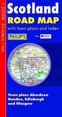
Philips Maps
Philips Scotland Road Map
Philips 04/07/2016. Paperback. Used; Good. WE SHIP WITHIN 24 HRS FROM LONDON UK 98% OF OUR ORDERS ARE RECEIVED WITHIN 7-10 DAYS. We believe you will be completely satisfied with our quick and reliable service. All orders are dispatched as swiftly as possible! Buy with confidence! Greener Books. Philips paperback
Bookseller reference : 4916392 ISBN : 1849074119 9781849074117
|
|
|
Philips Maps
Philips Scotland Road Map
Philips. Hardcover. Used; Very Good. Simply Brit welcome to our online used book store where affordability meets great quality. Dive into a world of captivating reads without breaking the bank. We take pride in offering a wide selection of used books from classics to hidden gems ensuring theres something for every literary palate. All orders are shipped within 24 hours and our lightning fast-delivery within 48 hours coupled with our prompt customer service ensures a smooth journey from ordering to delivery. Discover the joy of reading with us your trusted source for affordable books that do not compromise on quality. 10/25/2007 Philips hardcover
Bookseller reference : 3680095 ISBN : 0540091057 9780540091058
|
|
|
Philips Maps
Philips Star Chart
Philips 09/20/2018. Paperback. Used; Very Good. WE SHIP WITHIN 24 HRS FROM LONDON UK 98% OF OUR ORDERS ARE RECEIVED WITHIN 7-10 DAYS. We believe you will be completely satisfied with our quick and reliable service. All orders are dispatched as swiftly as possible! Buy with confidence! Greener Books. Philips paperback
Bookseller reference : 5019310 ISBN : 1849074879 9781849074872
|
|
|
Philips Maps
Philips Street Atlas Greater Manchester: Pocket Edition
Philips 09/02/2011. Paperback. Used; Very Good. WE SHIP WITHIN 24 HRS FROM LONDON UK 98% OF OUR ORDERS ARE RECEIVED WITHIN 7-10 DAYS. We believe you will be completely satisfied with our quick and reliable service. All orders are dispatched as swiftly as possible! Buy with confidence! Greener Books. Philips paperback
Bookseller reference : 4931057 ISBN : 184907139x 9781849071390
|
|
|
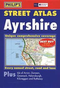
Philips Maps
Philips Street Atlas Ayrshire: Pocket
Philips. Paperback. Used; Very Good. Simply Brit welcome to our online used book store where affordability meets great quality. Dive into a world of captivating reads without breaking the bank. We take pride in offering a wide selection of used books from classics to hidden gems ensuring theres something for every literary palate. All orders are shipped within 24 hours and our lightning fast-delivery within 48 hours coupled with our prompt customer service ensures a smooth journey from ordering to delivery. Discover the joy of reading with us your trusted source for affordable books that do not compromise on quality. 03/11/2005 Philips paperback
Bookseller reference : 4123666 ISBN : 0540086754 9780540086757
|
|
|
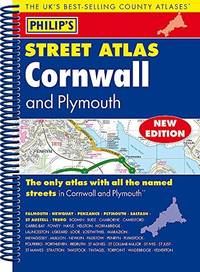
Philips Maps
Philips Street Atlas Cornwall and Plymouth: Spiral Edition
Philips. Spiral-bound. Used; Very Good. Simply Brit welcome to our online used book store where affordability meets great quality. Dive into a world of captivating reads without breaking the bank. We take pride in offering a wide selection of used books from classics to hidden gems ensuring theres something for every literary palate. All orders are shipped within 24 hours and our lightning fast-delivery within 48 hours coupled with our prompt customer service ensures a smooth journey from ordering to delivery. Discover the joy of reading with us your trusted source for affordable books that do not compromise on quality. 08/06/2015 Philips unknown
Bookseller reference : 4097488 ISBN : 1849073643 9781849073646
|
|
|
Philips Maps
Philips Street Atlas Suffolk: Spiral Edition
Philips 10/01/2012. Spiral-bound. Used; Very Good. WE SHIP WITHIN 24 HRS FROM LONDON UK 98% OF OUR ORDERS ARE RECEIVED WITHIN 7-10 DAYS. We believe you will be completely satisfied with our quick and reliable service. All orders are dispatched as swiftly as possible! Buy with confidence! Greener Books. Philips unknown
Bookseller reference : 4732448 ISBN : 1849072469 9781849072465
|
|
|
Philips Maps
Philips Street Atlas Buckinghamshire: Spiral Edition
Philips 11/09/2017. Spiral-bound. Used; Very Good. WE SHIP WITHIN 24 HRS FROM LONDON UK 98% OF OUR ORDERS ARE RECEIVED WITHIN 7-10 DAYS. We believe you will be completely satisfied with our quick and reliable service. All orders are dispatched as swiftly as possible! Buy with confidence! Greener Books. Philips unknown
Bookseller reference : 4688579 ISBN : 184907450x 9781849074506
|
|
|
Philips Maps
Philips Street Atlas of London: De Luxe Edition Red Reptile
Philips. Deluxe ed. Hardcover. Used; Very Good. Simply Brit welcome to our online used book store where affordability meets great quality. Dive into a world of captivating reads without breaking the bank. We take pride in offering a wide selection of used books from classics to hidden gems ensuring theres something for every literary palate. All orders are shipped within 24 hours and our lightning fast-delivery within 48 hours coupled with our prompt customer service ensures a smooth journey from ordering to delivery. Discover the joy of reading with us your trusted source for affordable books that do not compromise on quality. 03/22/2010 Philips hardcover
Bookseller reference : 4023518 ISBN : 1849071071 9781849071079
|
|
|
Philips Maps
Philips Street Atlas Buckinghamshire and Milton Keynes: Spiral Edition
Philips 07/07/2014. Spiral-bound. Used; Very Good. WE SHIP WITHIN 24 HRS FROM LONDON UK 98% OF OUR ORDERS ARE RECEIVED WITHIN 7-10 DAYS. We believe you will be completely satisfied with our quick and reliable service. All orders are dispatched as swiftly as possible! Buy with confidence! Greener Books. Philips unknown
Bookseller reference : 4481943 ISBN : 1849073333 9781849073332
|
|
|
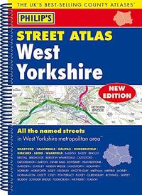
Philips Maps
Philips Street Atlas West Yorkshire: Spiral Edition
Philips. Paperback. Used; Very Good. Simply Brit welcome to our online used book store where affordability meets great quality. Dive into a world of captivating reads without breaking the bank. We take pride in offering a wide selection of used books from classics to hidden gems ensuring theres something for every literary palate. All orders are shipped within 24 hours and our lightning fast-delivery within 48 hours coupled with our prompt customer service ensures a smooth journey from ordering to delivery. Discover the joy of reading with us your trusted source for affordable books that do not compromise on quality. 09/03/2015 Philips paperback
Bookseller reference : 3955087 ISBN : 1849073635 9781849073639
|
|
|
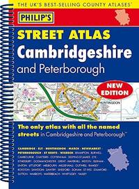
Philips Maps
Philips Street Atlas Cambridgeshire and Peterborough: Spiral Edition
Philips. Paperback. Used; Very Good. Simply Brit welcome to our online used book store where affordability meets great quality. Dive into a world of captivating reads without breaking the bank. We take pride in offering a wide selection of used books from classics to hidden gems ensuring theres something for every literary palate. All orders are shipped within 24 hours and our lightning fast-delivery within 48 hours coupled with our prompt customer service ensures a smooth journey from ordering to delivery. Discover the joy of reading with us your trusted source for affordable books that do not compromise on quality. 08/06/2015 Philips paperback
Bookseller reference : 3977324 ISBN : 1849073619 9781849073615
|
|
|
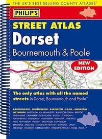
Philips Maps
Philips Street Atlas Dorset Bournemouth and Poole: Spiral Edition
Philips. Paperback. Used; Good. Simply Brit welcome to our online used book store where affordability meets great quality. Dive into a world of captivating reads without breaking the bank. We take pride in offering a wide selection of used books from classics to hidden gems ensuring theres something for every literary palate. All orders are shipped within 24 hours and our lightning fast-delivery within 48 hours coupled with our prompt customer service ensures a smooth journey from ordering to delivery. Discover the joy of reading with us your trusted source for affordable books that do not compromise on quality. 08/06/2015 Philips paperback
Bookseller reference : 3552123 ISBN : 1849073678 9781849073677
|
|
|
Philips Maps
Philips Street Atlas Staffordshire: Spiral Edition
Philips. Paperback. Used; Good. Simply Brit welcome to our online used book store where affordability meets great quality. Dive into a world of captivating reads without breaking the bank. We take pride in offering a wide selection of used books from classics to hidden gems ensuring theres something for every literary palate. All orders are shipped within 24 hours and our lightning fast-delivery within 48 hours coupled with our prompt customer service ensures a smooth journey from ordering to delivery. Discover the joy of reading with us your trusted source for affordable books that do not compromise on quality. 10/01/2012 Philips paperback
Bookseller reference : 3290413 ISBN : 1849072485 9781849072489
|
|
|
Philips Maps
Philips Street Atlas Ayrshire: Pocket
Philips. Paperback. Used; Good. Simply Brit welcome to our online used book store where affordability meets great quality. Dive into a world of captivating reads without breaking the bank. We take pride in offering a wide selection of used books from classics to hidden gems ensuring theres something for every literary palate. All orders are shipped within 24 hours and our lightning fast-delivery within 48 hours coupled with our prompt customer service ensures a smooth journey from ordering to delivery. Discover the joy of reading with us your trusted source for affordable books that do not compromise on quality. 03/11/2005 Philips paperback
Bookseller reference : 3266937 ISBN : 0540086754 9780540086757
|
|
|
Philips Maps
Philips Street Atlas Dorset Bournemouth and Poole: Spiral Edition
Philips 08/06/2015. Paperback. Used; Good. WE SHIP WITHIN 24 HRS FROM LONDON UK 98% OF OUR ORDERS ARE RECEIVED WITHIN 7-10 DAYS. We believe you will be completely satisfied with our quick and reliable service. All orders are dispatched as swiftly as possible! Buy with confidence! Greener Books. Philips paperback
Bookseller reference : 3383167 ISBN : 1849073678 9781849073677
|
|
|
Philips Maps
Philips World Atlas: Paperback
Philips. Paperback. Used; Very Good. Simply Brit welcome to our online used book store where affordability meets great quality. Dive into a world of captivating reads without breaking the bank. We take pride in offering a wide selection of used books from classics to hidden gems ensuring theres something for every literary palate. All orders are shipped within 24 hours and our lightning fast-delivery within 48 hours coupled with our prompt customer service ensures a smooth journey from ordering to delivery. Discover the joy of reading with us your trusted source for affordable books that do not compromise on quality. 03/07/2019 Philips paperback
Bookseller reference : 3826244 ISBN : 1849075166 9781849075169
|
|
|
Philips Travelling Maps
SOUTH AMERICA
London: George Phillip and Son. Good; Collectible - Ex-Library with Markings. 1930. Hardbound. Folded map that opens to 27" x 21" . George Phillip and Son hardcover
Bookseller reference : 45055
|
|
|
Philips' Companion Maps
PHILIPS' COMPANION MAPS FOR TOURISTS AND TRAVELLERS: EUROPE WITH INDEX
London: George Philip & Son. Good in Very Good dust jacket; Map in Shape Covers of Folder is . Worn/Scuffed. ca1910. Hardback. Map in Very Good Shape Covers of Folder is Worn/Scuffed . George Philip & Son hardcover
Bookseller reference : 87172
|
|
|
Phillips
Printed books, atlases & maps including travel, topography, art reference & architecture : to be sold by auction Thursday 20 February 1992 at 11 am and 2 pm
Auction catalogue. Fine pbk. 20135 eng
|
|
|
PHILLIPS, P. LEE / MAPS OF AMERICA
A List of Maps of America in the Library of Congress. Preceded By A List Of Works Relating To Cartography. First Edition
Washington: GPO 1901. HARDCOVER . 1138 p. Orig. burgundy buckram lightly rubbed and loosening first end paper loose pages uncut and partly unopened. VERY GOOD This subject-chronological monograph constitutes he first comprehensive listing of all maps of America North Central and South a relating to the maps of America in the Library of Congress. copy t included anywhere in the Library of Congress hardcover
Bookseller reference : 8162
|
|
|
Phillips, Keith P
The Flinders in Colour
No marks or inscriptions. No creasing to covers or to spine. A very clean very tight copy with bright unmarked boards and bumping to upper front corner and spine ends. 32pp. Captioned colour photographs of the Flinders mountain range near Adelaide, South Australia.

|
|
|
PHIQUEPAL D'ARUSMONT ; BOISSY, M. de
Carte du Canton de Miradoux (Atlas Général du Gers)
Carte du Canton dressée sous l'Administration de M. de Boissy, préfet du Gers, par les soins et sous la direction de M. Phiquepal d'Arusmont, Ingénieur en chef des Ponts et Chaussées, revue, corrigée et mise à jour par l'Administration des Ponts et Chaussées, 1 carte en trois couleurs, 92 x 65 cm, L. Chanche, Paris, 1886, échelle 1/40 000, avec le plan de la ville de Miradoux en cartouche (échelle 1 / 5000) Bon état (pliure centrale habituelle, petits accrocs marginaux n'affectant pas l'impression). Français

|
|
|
PHIQUEPAL D'ARUSMONT ; DELATTE, G.
Carte du Canton d'Eauze (Atlas Général du Gers)
Carte du Canton dressée sous l'Administration de M. G. Delatte, préfet du Gers, par les soins et sous la direction de M. Phiquepal d'Arusmont, Ingénieur en chef des Ponts et Chaussées, revue, corrigée et mise à jour par l'Administration des Ponts et Chaussées, 1 carte en trois couleurs, 92 x 65 cm, gravée par A. Simon, Paris, Imp. Becquet, L. Chanche, Paris, 1881, échelle 1/40 000, avec le plan de la ville d'Eauze en cartouche (échelle 1 / 5000) Etat très satisfaisant (pliure centrale habituelle, accroc en bas de carte affectant légèrement l'impression). Français

|
|
|
PHIQUEPAL D'ARUSMONT ; DELATTE, G.
Carte du Canton de Fleurance (Atlas Général du Gers)
Carte du Canton dressée sous l'Administration de M. G. Delatte, préfet du Gers, par les soins et sous la direction de M. Phiquepal d'Arusmont, Ingénieur en chef des Ponts et Chaussées, revue, corrigée et mise à jour par l'Administration des Ponts et Chaussées, 1 carte en trois couleurs, 92 x 65 cm, L. Chanche, Paris, 1884, échelle 1/40 000, avec le plan de la ville de Fleurance en cartouche (échelle 1 / 10 000) Etat très satisfaisant (pliures centrales habituelles, petits frottements en marge n'affectant pas l'impression). Français

|
|
|
PHIQUEPAL D'ARUSMONT ; DELATTE, G.
Carte du Canton de Montesquiou (Atlas Général du Gers)
Carte du Canton dressée sous l'Administration de M. G. Delatte, préfet du Gers, par les soins et sous la direction de M. Phiquepal d'Arusmont, Ingénieur en chef des Ponts et Chaussées, revue, corrigée et mise à jour par l'Administration des Ponts et Chaussées, 1 carte en trois couleurs, 92 x 65 cm, gravée par Hausermann et A. Simon, Paris, Imp. Becquet, L. Chanche, Auch, 1882, échelle 1/40 000, avec le plan de la ville de Montesquiou en cartouche (échelle 1 / 5000) Bon état (pliure centrale habituelle, petits accrocs marginaux n'affectant pas l'impression). Français

|
|
|
PHIQUEPAL D'ARUSMONT ; JOUBERT, M. E.
Carte du Canton d'Aignan (Atlas Général du Gers)
Carte du Canton dressée sous l'Administration de M. E. Joubert, préfet du Gers, par les soins et sous la direction de M. Phiquepal d'Arusmont, Ingénieur en chef des Ponts et Chaussées, revue, corrigée et mise à jour par l'Administration des Ponts et Chaussées, 1 carte en trois couleurs, 92 x 65 cm, gravée par A. Simon, Paris, Imp. Becquet, L. Chanche, Auch, 1880, échelle 1/40 000, avec le plan de la ville d'Aignan en cartouche (échelle 1 / 5000) Bel état (pliure centrale habituelle, parfait état par ailleurs). Français

|
|
|
Photographie N&B
Lauren Bacall
Photographie N&B signée par l'actrice | Etat : Très bon état (Ref.: JCO12)
Bookseller reference : 4345
|
|
|
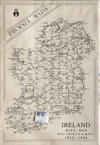
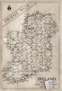
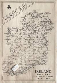
Phoenix Maps
Ireland Hill Map Sheet 123
Phoenix Maps Dublin 1855-1900; 1989. Scale: 1 inch to 1 mile. Fine/No Jacket. Folded map Scarcely used. Phoenix Maps, Dublin unknown
Bookseller reference : 27124 ISBN : 1855930587 9781855930582
|
|
|
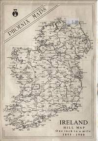
Phoenix Maps
Ireland Hill Map Sheet 124
Phoenix Maps Dublin 1855-1900; 1989. Scale: 1 inch to 1 mile. Fine/No Jacket. Folded map Scarcely used. Phoenix Maps, Dublin unknown
Bookseller reference : 27125 ISBN : 1855930633 9781855930636
|
|
|
Phoenix Maps
Ireland Hill Map Sheet 94
Phoenix Maps Dublin 1855-1900; 1989. Scale: 1 inch to 1 mile. Fine/No Jacket. Folded map Scarcely used. Phoenix Maps, Dublin unknown
Bookseller reference : 27122 ISBN : 1872259391 9781872259390
|
|
|
Phoenix Maps
Ireland Hill Map Sheet 122
Phoenix Maps Dublin 1855-1900; 1989. Scale: 1 inch to 1 mile. Fine/No Jacket. Folded map Scarcely used. Phoenix Maps, Dublin unknown
Bookseller reference : 27123 ISBN : 1855930188 9781855930186
|
|
|
Phoenix Maps
Ireland Hill Map Sheet 93
Phoenix Maps Dublin 1855-1900; 1989. Scale: 1 inch to 1 mile. Fine/No Jacket. Folded map Scarcely used. Phoenix Maps, Dublin unknown
Bookseller reference : 27121

|
|
|
photographs; cartes de visite
Collection of Nineteenth Century Photographs Cartes-de-Visite Cabinet Cards
England 1800. Near Fine. Two custom cases gilt-stamped morocco containing 34 cabinet cards 4.25 by 6.5 inches and 45 cartes-de-visite 2.5 by 4 inches. Cases are in excellent condition just a little scuffed along the edges; images mostly albumens are remarkably crisp and clean some of them in original glassine envelopes. Produced by Cromack of Scarborough Brigham also Scarborough Elliott and Fry Portman Square Frank M. Sutcliffe Whitby Yorkshire and others these formal portraits include men women and children sometimes the same image is repeated and sometimes the same face is repeated though in a different setting or posture. <br/><br/> unknown books
Bookseller reference : D4116
|
|
|
Photos + Maps
Iowa Journal of History-April 1961
The State Historical Society of Iowa January 1961. Trade Paperback . Used Good/yes . Scholarly journal cocked written in by previous owner a descendant of the keeper of the diary shows wear and aging. The State Historical Society of Iowa paperback
Bookseller reference : 227682
|
|
|
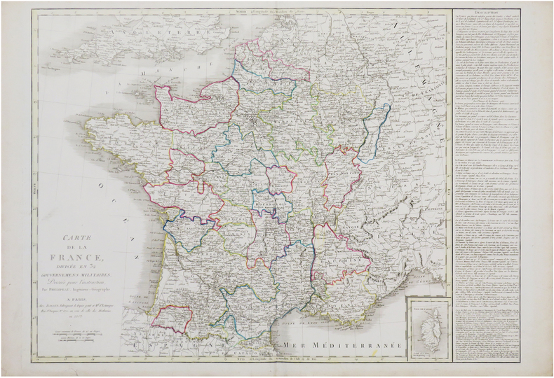
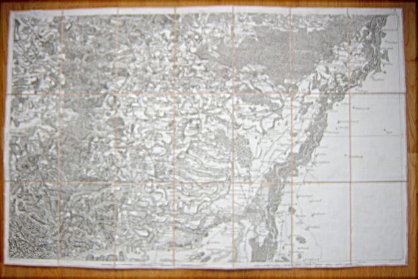
PHÉLIPEAU (René).
Carte de la France divisée en 32 gouvernemens militaires.
Paris, Basset, 1803. 527 x 729 mm.
Bookseller reference : LBW-7569
|
|
|
PICCOLI (Domenico).
[Plan d'une partie de la ville de Meduno et ses environs].
Venise, 1698. 49 x 73,5 cm, sur une feuille de 51 x 75 cm.
Bookseller reference : LBW-6637

|
|
|
PICART (Nicolas).
[PÔLE NORD] Pôle Arctique ou terre du septentrion.
[Paris, N. Picart, 1659]. 137 x 186 mm.
Bookseller reference : LBW-6204

|
|
|
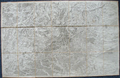
PICQUET (Charles) & COUTANS (Guillaume).
Atlas topographique en XVI feuilles des environs de Paris, à la distance d'environ 8 myriamètres, ou 18 lieues, dans sa moyenne étendue, dressé sur une échelle de 31 millimètres pour 2 kilomètres, 4 lignes pour 300 toises, par Dom G. Coutans, ex-Bénédictin ; revu, corrigé & considérablement augmenté, d'après nombre de cartes précieuses & plans particuliers, tant gravés que manuscrits. Par Charles Picquet, géographe-graveur ; dédié et présenté au Ier Consul Bonaparte.
Paris, Picquet et Deterville, An 8 - 1800 1 tableau d'assemblage de 392 x 285 mm, et 16 feuilles d'environ 395 x 630 mm, coupées en sections montées sur toile et repliées, avec onglets de vélin renseignés du titre et du numéro de la feuille ; au dos du tableau d'assemblage, étiquette de l'éditeur Charles Picquet et petite carte d'assemblage des 16 feuilles ; au dos des 16 feuilles, petite carte d'assemblage ; sous 2 emboîtages petits in-4 en demi-maroquin rouge de l'époque, avec dos ornés.
Bookseller reference : LBW-8983

|
|
|
PICQUET (Charles)
Carte de la Russie d'Europe donnant l'indication des Routes et Chemins de Poste, des Douanes avec la Division actuelle en Gouvernement, fidélement copiée sur celle Rédigée au Dépôt Impérial des Cartes à Saint Petersbourg en 1809.
1812 montées sur toile moutarde. carte en 4 feuilles, 115 x 117 cms, limites aquarellées. P. Librairie Géographique Hyacinthe Langlois, 1812,
Bookseller reference : 11795
|
|
|
PICQUET Charles (Géographe ordinaire du Roi), ORLEANS (Monseigneur le Duc d')
CARTE DE FRANCE - ILLE-ET-VILAINE
1857 carte entoilée noire (black map cloth-lined map) in-octavo, vignette de titre en couleurs sur le premier plat (label of title in colours on the front cover), 21 compartiments, dimensions (size in Inches) : 92 centimètres de largeur (width : 36,22) sur 60 de hauteur (height : 23,62), 1857 à Paris quai de Conti,
Bookseller reference : 11078
|
|
|
PICQUET, Charles
Carte de Neubrisack au marquisat de Durlach ; Carte des Cantons de Bâle, de Soleure et de la principauté de Porrentrui. (2 cartes entoilées sous étui commun).
2 cartes entoilées sous chemise et étui, carte de la France n° 164 (Neuf-Brisach), 77 x 59 cm, et n°165 (Basle), 79 x 59 cm, Charles Picquet, Géographe graveur du cabinet topographique de S.M. L'Empereur, Paris, s.d. (vers 1805)
Bookseller reference : 5495
|
|
|
PICQUET, Charles
Carte de la région de Strasbourg ; Carte de la région de Colmar. (2 cartes entoilées sous étui commun).
2 cartes entoilées sous chemise et étui commun, carte de la France n° 162 (Strasbourg), 92 x 52 cm, et n°163 (Colmar), 77 x 59 cm, Charles Picquet, Géographe graveur du cabinet topographique de S.M. L'Empereur, Paris, s.d. (vers 1805)
Bookseller reference : 5496
|
|
|
PICQUET, Charles
Carte de la Principauté des Deux-Ponts jusqu'à Landau et Lauter-bourg ; Carte de Otlingen à Philisbourg ((2 cartes entoilées sous étui commun).
2 cartes entoilées sous chemise et étui commun, carte de la France n° 161 (Landau), 92 x 59 cm, et n°173 (Philipsbourg), 46 x 59 cm, Charles Picquet, Géographe graveur du cabinet topographique de S.M. L'Empereur, Paris, s.d. (vers 1805)
Bookseller reference : 5497
|
|
|
PICQUENOT F.V.
Géographie Physique et Politique Des Établissements Français De L'océanie - Cours Supérieur -
Paris Augustin Challamel 1900 In-8 119 pp, 6 cartes couleurs dépliantes ( Tahiti Moorea, Tahiti et les iles de la société, Archipel Tuamotou, Archipel Nukahiva ou des Marquises, Archipel Tubuai ), dos fendu mais non débroché, petits manques aux bord des couvertures
Bookseller reference : 27985
|
|
|
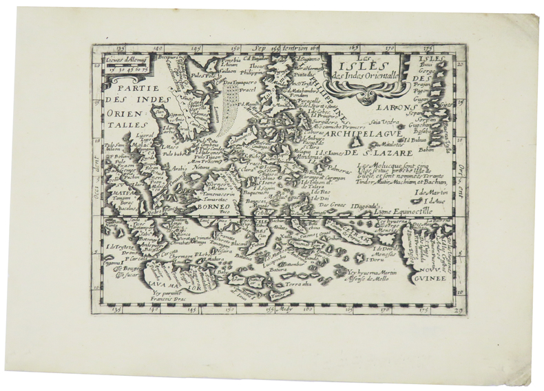
PICART (Nicolas).
Les isles des Indes Orientalle.
[Paris, N. Picart, 1659]. 133 x 185 mm.
Bookseller reference : LBW-5451
|
|
|
PICQUET (Charles).
Plan routier de la ville de Paris et de ses faubourgs, où se trouvent indiqués tous les changements opérés jusqu'à ce jour avec les projets d'embellissem.t arrêtés par le gouvernem.t.
Paris, Ch.les Picquet, 1er Frimaire An 13-22 nov.bre 1804. En 40 sections montées sur toile et pliées, formant une carte de 0,83 x 1,39 m, étiquette de l'éditeur au dos de la carte.
Bookseller reference : LBW-5881

|
|
|
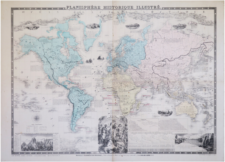
PICK (Eugène).
Planisphère historique illustré.
Paris, Eugène Pick, 1880. 0,76 x 1,02 m.
Bookseller reference : LBW-6284
|
|
|
PICARD Marcel
Tarots, pratiques et interprétations. La sagesse des arts divinatoires.
Paris, Albin Michel, 1987. 13 x 21, 346 pp., quelques illustrations, reliure souple d'éditions bon état.
Bookseller reference : 79968
|
|
|
Pickering, Charles; Hall, John Charles.
THE RACES OF MAN AND THEIR GEOGRAPHICAL DISTRIBUTION. By Charles Pickering; To Which is Prefixed, AN ANALYTICAL SYNOPSIS OF THE NATURAL HISTORY OF MAN, by John Charles Hall. New Edition.
pp. lxxii, 445 + Folding Colored Map + Twelve Engraved Plates showing the different major Human Races. Text browned, but not brittle. Blue printed endpapers with fourteen pages of publisher's advertisements. Original full cloth binding, decorated in blind, and lettered in gilt. Joints cracked. Hardbound. Very good. It is interesting to see this famous illustrated racial analysis being published during the American Civil War. **PRICE JUST REDUCED! W145
|
|
 Receive by email
 Download as PDF document
 RSS feed


