|
|
|
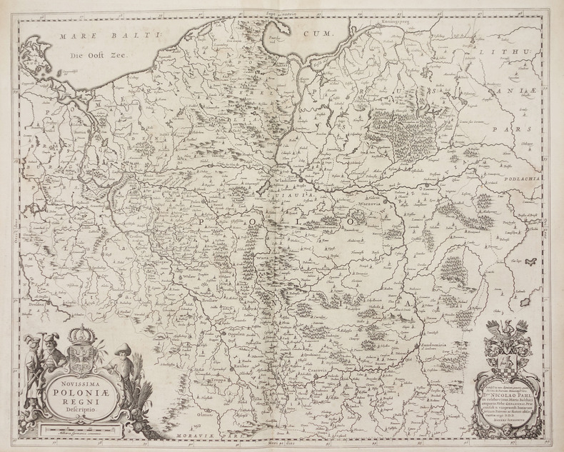
JANSSON (Joannes).
Novissima Poloniae regni descriptio.
[Amsterdam, 1658]. 432 x 539 mm.
Riferimento per il libraio : LBW-2739
|
|
|
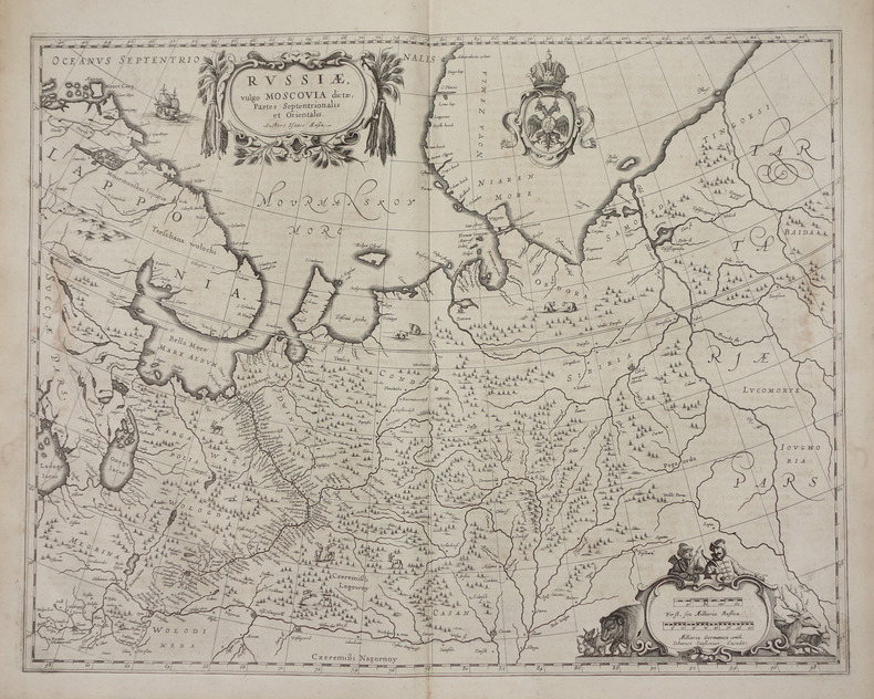
JANSSON (Joannes).
Russiae, vulgo Moscovia dictae, partes septentrionalis et orientalis.
[Amsterdam, 1658]. 438 x 540 mm.
Riferimento per il libraio : LBW-2722
|
|
|
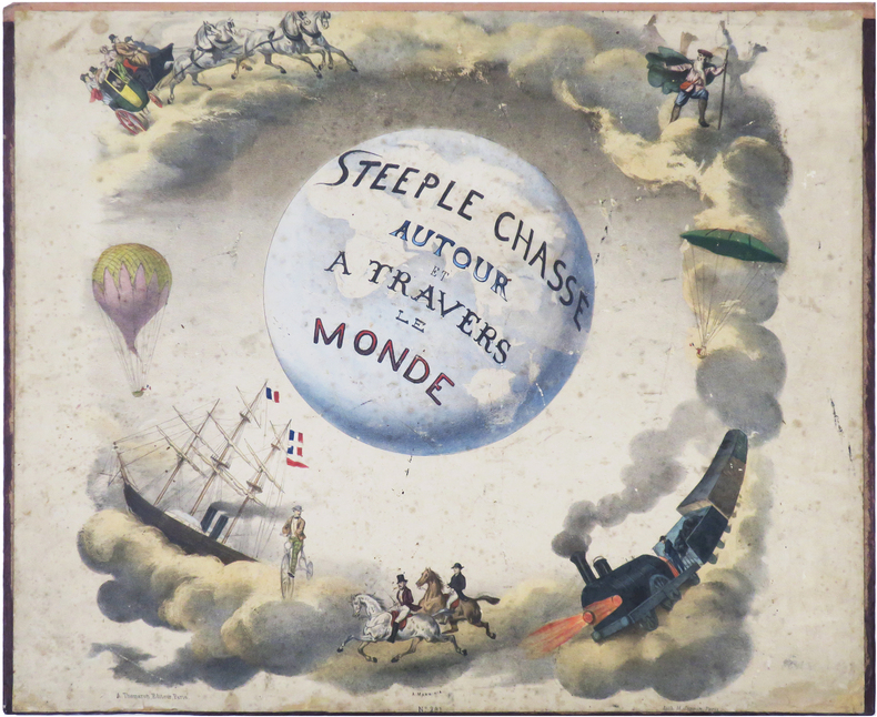
JANNIN (Nicolas Henri).
Steeple chasse autour et à travers le monde - Steeple chasse round the World.
Paris, A. Thomaron, [1860]. 40,5 x 80,7 cm, replié 40 x 48,8 cm, monté sur carton fort ; cabochons au dos du second plat.
Riferimento per il libraio : LBW-8957
|
|
|
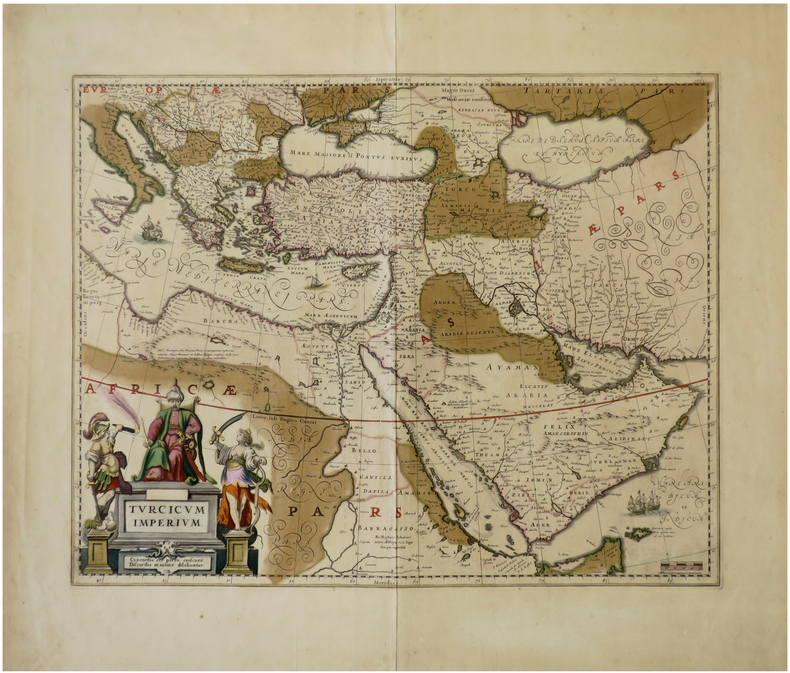
JANSSON (Johannes).
Turcicum Imperium.
[Amsterdam, circa 1640]. 410 x 517 mm.
Riferimento per il libraio : LBW-6792
|
|
|
Jansson, Jan
Nobilis Fluvius Albis maximâ curâ, ex variis famosisque Auctoribus collectus, et in lucem editus. Zweigeteilte in Kupfer gestochene Elbkarte auf 1 Blatt.
[Frankfurt am Main, Merian, 1637]. Je Darstellung 17,5 x 51,5 cm. Fachmännisch gerahmt 56,5 x 65,5 cm (Flachgoldleiste 3,5 cm breit).
Riferimento per il libraio : 84923

|
|
|
JANSSONIUS Johannes (1588-1664)
Aegyptus Antiqua divisa in Nomos. Authore P. Duval Abbeviliense…
Orientata con il Nord a destra, la mappa raffigura nel dettaglio la regione compresa tra la valle del Nilo e il Mar Rosso. Dall'Atlas MajorDoppio cartiglio, uno per il titolo e uno per la dedica in francese a "A Monsieur Monsieur Doviat Sgr. de Montreuille, Con.er du Roy, et Maistre Ordinaire en sa Chambre des Comptes Par son Très humble et obéisant Serviteur P. Duval Géographe de sa Maiesté". Johannes Janssonius, figlio dell'editore di Arnhem Jan Janssen, sposò Elisabeth Hondius, figlia di Jodocus Hondius, ad Amsterdam nel 1612. Dopo il suo matrimonio, si stabilì in questa città come libraio ed editore di materiale cartografico. Nel 1618 si stabilì ad Amsterdam accanto alla libreria di Willem Jansz. Blaeu, entrando in una seria competizione. Le sue attività non riguardavano solo la pubblicazione di atlanti e libri, ma anche di mappe singole e un vasto commercio di libri con filiali a Francoforte, Danzica, Stoccolma, Copenaghen, Berlino, Koningsbergen, Ginevra e Lione. Nel 1631 iniziò a pubblicare atlanti insieme a Henricus Hondius. Nei primi anni 1640 Henricus Hondius lasciò l'attività di pubblicazione di atlanti completamente a Janssonius. La concorrenza con Joan Blaeu, figlio e successore di Willem, nella produzione di atlanti spinse Janssonius ad ampliare il suo Atlas Novus finalmente in un'opera di sei volumi, in cui furono inseriti un atlante marino e un atlante del Vecchio Mondo. Dopo la morte di Joannes Janssonius, il negozio e la casa editrice furono continuati dagli eredi sotto la direzione di Johannes van Waesbergen (c. 1616-1681), genero di Joannes Janssonius. Le matrici degli atlanti di Janssonius furono in seguito vendute a Schenk e Valck. Map oriented with north on the right. It presents a colorful and detailed picture of the region between the fertile Nile River valley and the Red Sea. The map is adorned with a strapwork title cartouche with a credit to Pierre du Val. Includes a note in a decorative cartouche: "A Monsieur Monsieur Doviat Sgr. de Montreuille, Con.er du Roy, et Maistre Ordinaire en sa Chambre des Comptes Par son Très humble et obéisant Serviteur P. Duval Géographe de sa Maiesté".Published in Janssonius' Atlas Major. Johannes Janssonius (Arnhem, 1588-1664), son of the Arnhem publisher Jan Janssen, married Elisabeth Hondius, daughter of Jodocus Hondius, in Amsterdam in 1612. After his marriage, he settled down in this town as a bookseller and publisher of cartographic material. In 1618 he established himself in Amsterdam next door to Blaeu’s book shop. He entered into serious competition with Willem Jansz. Blaeu.. His activities not only concerned the publication of atlases and books, but also of single maps and an extensive book trade with branches in Frankfurt, Danzig, Stockholm, Copenhagen, Berlin, Koningsbergen, Geneva, and Lyon. In 1631 he began publishing atlases together with Henricus Hondius. In the early 1640s Henricus Hondius left the atlas publishing business completely to Janssonius. Competition with Joan Blaeu, Willem’s son and successor, in atlas production prompted Janssonius to enlarge his Atlas Novus finally into a work of six volumes, into which a sea atlas and an atlas of the Old World were inserted. After the death of Joannes Janssonius, the shop and publishing firm were continued by the heirs under the direction of Johannes van Waesbergen (c. 1616-1681), son-in-law of Joannes Janssonius. The copperplates from Janssonius’s atlases were afterwards sold to Schenk and Valck. Van der Krogt 1

|
|
|
JANSSONIUS Johannes (1588-1664)
Antiqua Urbis Roma Imago Accuratissima…
Grande pianta della città stampata su due fogli, ispirata alla celebre carta del Pirro Ligorio del 1561.Questa straordinaria ricostruzione di Roma durante il regno di Augusto, arricchita da una cospicua legenda con 269 richiami, costituisce il lavorò più ambizioso contenuto nel Civitates Orbis Terrarum, del quale oltretutto è una delle sole tre mappe a doppio foglio. Incisione in rame, finemente colorata a mano, in eccellente stato di conservazione. Opera tratta dal "Theatrum praecipuarum urbium" celebre teatro delle città del Janssonius, sullo stile del "Civitates Orbis Terrarum" di Braun & Hogenberg. La raccolta, pubblicata ad Amsterdam tra il 1652 ed il 1657, contiene 500 tavole raffiguranti città di ogni parte del mondo. Contrariamente al lavoro degli acerrimi rivali Blaeu, Janssonius si servì per la realizzazione dell'opera delle lastre di precedenti cartografi ed editori. In particolare nel 1653 egli acquisto da Abraham Hogenberg le lastre del "Civitates orbis Terrarum" che incorporò nella sua opera, ristampandole, con alcune modifiche. Per le piante delle città olandesi, ordinò delle nuove lastre basate sull'atlante che Johannes Blaeu diede alla luce nel 1649. Per molte delle opere contenute nel 5° volume, quello dedicato all'Italia e denominato "Theatrum celebriorum urbium Italiae..", si servì delle lastre realizzate da Jodocus Hondius per l'opera "Italia Hodierna.." del 1627. Nella pianta di Roma antica cambia il decoro del cartiglio in alto, mentre in basso ai lati del cartiglio sono aggiunte dei personaggi. Incisione in rame, finemente colorata a mano, in ottimo stato di conservazione. Map of the city printed on two sheets, inspired by the famous work by Pirro Ligorio, printed by Michele Tramezzino in 1561. This extraordinary reconstruction of Rome during the reign of Augustus, enriched by a conspicuous legend with 269 references, constitutes the most ambitious work contained in the Civitates Orbis Terrarum, of which it is one of only three double-sheet maps. Work taken from the "Theatrum praecipuarum urbium" famous theatre of the cities of Janssonius, in the style of Braun & Hogenberg's "Civitates Orbis Terrarum". The collection, published in Amsterdam between 1652 and 1657, contains 500 plates depicting cities from all over the world. Janssonius used the plates of previous cartographers and publishers to create the work. In particular, in 1653 he bought the plates of the "Civitates orbis Terrarum" from Abraham Hogenberg, who incorporated them into his work and reprinted them with some modifications. For many of the works contained in the 5th volume, the one dedicated to Italy and called "Theatrum celebriorum urbium Italiae...", he used the plates made by Jodocus Hondius for the work "Italia Hodierna..." of 1627. In the map of ancient Rome the decoration of the cartouche at the top changes, while at the bottom at the sides of the cartouche are added characters. Copper engraving, finely coloured by hand, in excellent condition.

|
|
|
JANSSONIUS Johannes (1588-1664)
Argonautica
Carta storico/geografica tratta dall'atlante di Georgius HORNIUS "Accuratissima orbis antiqui delineatio sive Geographia vetus sacra & profana", per la prima volta edito nel 1653. Le carte derivano da quelle di Ortelius, pubblicata nel "Parergon". Mappa dei viaggi di Giasone e degli Argonauti, mostra il Mediterraneo e il Mar Nero con specifico riferimento al percorso dell'Argo, seguendo principalmente la linea temporale e la geografia delle Argonautiche di Apollonio di Rodi. Molti degli elementi più fantastici del mito sono anche tracciati, tra cui le Symplegades o 'Rocce Erranti' all'imboccatura del Bosforo del Mar Nero, i mostri Scilla e Cariddi su entrambi i lati dello Stretto di Messina, l'isola di Eea casa della strega Circe al largo della costa napoletana, l'isola della ninfa Calipso al largo della costa calabrese meridionale, il paradisiaco Giardino delle Esperidi sulla costa settentrionale dell'Africa, e le città della Colchide sul Mar Nero, casa della futura moglie di Giasone, Medea, e del famoso Vello d'oro. Johannes Janssonius, figlio dell'editore di Arnhem Jan Janssen, sposò Elisabeth Hondius, figlia di Jodocus Hondius, ad Amsterdam nel 1612. Dopo il suo matrimonio, si stabilì in questa città come libraio ed editore di materiale cartografico. Nel 1618 si stabilì ad Amsterdam accanto alla libreria di Willem Jansz. Blaeu, entrando in una seria competizione. Le sue attività non riguardavano solo la pubblicazione di atlanti e libri, ma anche di mappe singole e un vasto commercio di libri con filiali a Francoforte, Danzica, Stoccolma, Copenaghen, Berlino, Koningsbergen, Ginevra e Lione. Nel 1631 iniziò a pubblicare atlanti insieme a Henricus Hondius. Nei primi anni 1640 Henricus Hondius lasciò l'attività di pubblicazione di atlanti completamente a Janssonius. La concorrenza con Joan Blaeu, figlio e successore di Willem, nella produzione di atlanti spinse Janssonius ad ampliare il suo Atlas Novus finalmente in un'opera di sei volumi, in cui furono inseriti un atlante marino e un atlante del Vecchio Mondo. Dopo la morte di Joannes Janssonius, il negozio e la casa editrice furono continuati dagli eredi sotto la direzione di Johannes van Waesbergen (c. 1616-1681), genero di Joannes Janssonius. Le matrici degli atlanti di Janssonius furono in seguito vendute a Schenk e Valck. Incisione in rame, finemente colorata a mano, in buone condizioni. Map taken from the HORNIUS, Georgius"Accuratissima orbis antiqui delineatio sive Geographia vetus sacra & profana" first published in Amsterdam in 1653. After Ortelius' map published in the "Parergon". Map of the journeys of Jason and the Argonauts, shows the Mediterranean and Black Sea with specific reference to the path of the Argo, mainly following the timeline and geography of Apollonius of Rhodes' Argonautica. Many of the myth's more fantastical elements are also plotted, including the Symplegades or 'Wandering Rocks' at the Bosporus mouth of the Black Sea, the monsters Scylla and Charybdis on either side of the Straits of Messina, the island of Aeaea home of the witch Circe off the Neapolitan coast, the island of the nymph Calypso off the southern Calabrian coast, the paradisiacal Garden of the Hesperides on the northern coast of Africa, and the cities of Colchis on the Black Sea, home of Jason's future wife Medea and the famous Golden Fleece. Johannes Janssonius (Arnhem, 1588-1664), son of the Arnhem publisher Jan Janssen, married Elisabeth Hondius, daughter of Jodocus Hondius, in Amsterdam in 1612. After his marriage, he settled down in this town as a bookseller and publisher of cartographic material. In 1618 he established himself in Amsterdam next door to Blaeu’s book shop. He entered into serious competition with Willem Jansz. Blaeu.. His activities not only concerned the publication of atlases and books, but also of single maps and an extensive book trade with branches in Frankfurt, Danzig, Stockholm, Copenhagen, Berlin, Koningsbergen, Geneva, and Lyon. In 1631 he began publishing atlases together with Henricus Hondius. In the early 1640s Henricus Hondius left the atlas publishing business completely to Janssonius. Competition with Joan Blaeu, Willem’s son and successor, in atlas production prompted Janssonius to enlarge his Atlas Novus finally into a work of six volumes, into which a sea atlas and an atlas of the Old World were inserted. After the death of Joannes Janssonius, the shop and publishing firm were continued by the heirs under the direction of Johannes van Waesbergen (c. 1616-1681), son-in-law of Joannes Janssonius. The copperplates from Janssonius’s atlases were afterwards sold to Schenk and Valck. Copperplate with fine later hand colour, in good conditions.

|
|
|
JANSSONIUS Johannes (1588-1664)
Erythraei Sive Rubri Maris Periplus
Carta storico/geografica tratta dall'atlante di Georgius HORNIUS "Accuratissima orbis antiqui delineatio sive Geographia vetus sacra & profana", per la prima volta edito nel 1653. Le carte derivano da quelle di Ortelius, pubblicata nel "Parergon". Un'insolita e attraente mappa del 1658 dell'Oceano Indiano, o Mare Eritreo, come era nell'antichità. Composta da Jan Jansson ispirandosi alla carta molto simile del 1597 pubblicata da A. Ortelius nel suo Parergon. Copre dall'Egitto e la valle del Nilo verso est passando per l'Arabia e l'India, fino al sud-est asiatico e Java. Cartograficamente, India, Arabia e Africa corrispondono approssimativamente alle convenzioni del periodo. Il sud-est asiatico è meno riconoscibile, ma la penisola malese, Sumatra e Giava sono chiaramente indicate. La maggior parte dei nomi dei luoghi utilizzati sono derivati da Tolomeo, che ha basato la sua descrizione della regione sulle registrazioni delle conquiste di Alessandro Magno. Due mappe più piccole nei quadranti superiore sinistro e destro sono di eccezionale interesse. La carta in alto a sinistra mostra l'Africa nord-occidentale ed è intitolata "Annonis Periplus". Questo è un riferimento alle leggendarie spedizioni del re cartaginese Hanno, che si dice sia stato il primo ad accedere all'Oceano Indiano navigando intorno alla punta meridionale dell'Africa. Per inciso, durante il viaggio, si dice anche che sia stato il primo a domare un leone. La carta in alto a destra mostra le regioni polari settentrionali come erano percepite all'epoca. Una massa che copre la calotta polare è identificata come "Hyperborea". A sinistra di questa, più o meno dove si trova oggi il Nord America, appare l'isola di Atlantide; mentre la Scizia, l'Europa (Thule) e l'Asia sono sulla destra. La Groenlandia e forse l'Islanda appaiono in basso. Questa mappa ha lo scopo di indicare la possibilità di un passaggio a nord-est verso l'Asia, che all'epoca era attivamente ricercato dai navigatori olandesi, inglesi e russi. Johannes Janssonius, figlio dell'editore di Arnhem Jan Janssen, sposò Elisabeth Hondius, figlia di Jodocus Hondius, ad Amsterdam nel 1612. Dopo il suo matrimonio, si stabilì in questa città come libraio ed editore di materiale cartografico. Nel 1618 si stabilì ad Amsterdam accanto alla libreria di Willem Jansz. Blaeu, entrando in una seria competizione. Le sue attività non riguardavano solo la pubblicazione di atlanti e libri, ma anche di mappe singole e un vasto commercio di libri con filiali a Francoforte, Danzica, Stoccolma, Copenaghen, Berlino, Koningsbergen, Ginevra e Lione. Nel 1631 iniziò a pubblicare atlanti insieme a Henricus Hondius. Nei primi anni 1640 Henricus Hondius lasciò l'attività di pubblicazione di atlanti completamente a Janssonius. La concorrenza con Joan Blaeu, figlio e successore di Willem, nella produzione di atlanti spinse Janssonius ad ampliare il suo Atlas Novus finalmente in un'opera di sei volumi, in cui furono inseriti un atlante marino e un atlante del Vecchio Mondo. Dopo la morte di Joannes Janssonius, il negozio e la casa editrice furono continuati dagli eredi sotto la direzione di Johannes van Waesbergen (c. 1616-1681), genero di Joannes Janssonius. Le matrici degli atlanti di Janssonius furono in seguito vendute a Schenk e Valck. Incisione in rame, finemente colorata a mano, in buone condizioni. Map taken from the HORNIUS, Georgius"Accuratissima orbis antiqui delineatio sive Geographia vetus sacra & profana" first published in Amsterdam in 1653. After Ortelius' map published in the "Parergon". An unusual and attractive 1658 map of the Indian Ocean, or Erythraean Sea, as it was in antiquity. Composed by Jan Jansson after a similar 1597 map published by A. Ortelius in his Parergon. Covers from Egypt and the Nile valley eastward past Arabia and India, to Southeast Asia and Java. Cartographically, India, Arabia, and Africa roughly correspond to the conventions of the period. Southeast Asia is less recognizable, but the Malay Peninsula, Sumatra, and Java are clearly noted. Most of the place names used throughout are derived from Ptolemy, who himself based his description of the region heavily on records from Alexander the Great's conquests. Two smaller maps in the upper left and right quadrants are of exceptional interest. The upper left chart shows northwestern Africa and is titled 'Annonis Periplus.' This is a reference to the legendary expeditions of the Carthaginian King Hanno, said to have been the first to access the Indian Ocean by sailing around the southern tip of Africa. Incidentally, en route, he is also said to have been the first to tame a lion. The upper right chart shows the northern polar regions as they were perceived at the time. A landmass covering the polar ice cap is indentified as 'Hyperborea.' To the left of this, roughly where North America rests today, the island of Atlantis appears; while Scythia, Europe (Thule) and Asia are on the right. Greenland and possibly Iceland appear at the bottom. This map is intended to point out the possibility of a Northeast Passage to Asia, which was at the time being actively sought after by Dutch, English, and Russian navigators. Johannes Janssonius (Arnhem, 1588-1664), son of the Arnhem publisher Jan Janssen, married Elisabeth Hondius, daughter of Jodocus Hondius, in Amsterdam in 1612. After his marriage, he settled down in this town as a bookseller and publisher of cartographic material. In 1618 he established himself in Amsterdam next door to Blaeu’s book shop. He entered into serious competition with Willem Jansz. Blaeu.. His activities not only concerned the publication of atlases and books, but also of single maps and an extensive book trade with branches in Frankfurt, Danzig, Stockholm, Copenhagen, Berlin, Koningsbergen, Geneva, and Lyon. In 1631 he began publishing atlases together with Henricus Hondius. In the early 1640s Henricus Hondius left the atlas publishing business completely to Janssonius. Competition with Joan Blaeu, Willem’s son and successor, in atlas production prompted Janssonius to enlarge his Atlas Novus finally into a work of six volumes, into which a sea atlas and an atlas of the Old World were inserted. After the death of Joannes Janssonius, the shop and publishing firm were continued by the heirs under the direction of Johannes van Waesbergen (c. 1616-1681), son-in-law of Joannes Janssonius. The copperplates from Janssonius’s atlases were afterwards sold to Schenk and Valck. Copperplate with fine later hand colour, in good conditions.

|
|
|
JANSSONIUS Johannes (1588-1664)
Insularum Britannicarum acurata delineatio ex Geographicis Conatibus Abrahami Ortelii
Mappa realizzata da Jansson delle antiche Isole Britanniche, così come si presentavano durante il terzo e il quarto secolo, che include un cartiglio decorativo con il titolo, navi a vela e un mostro marino.Sono presenti nomi di storici siti d'epoca romana, tra cui il muro di Adriano e il muro di Pio. Incisione di Peter Van Den Keere, preparata da Ortelius. Ortelius divide l'intera isola in Britannia Maior (le attuali Inghilterra, Galles e Cornovaglia) e Britannia Minor (Scozia). Joannes Janssonius, figlio dell'editore di Arnhem Jan Janssen, sposò Elisabeth Hondius, figlia di Jodocus Hondius, ad Amsterdam nel 1612. Dopo il suo matrimonio, si stabilì in questa città come libraio ed editore di materiale cartografico. Nel 1618 si stabilì ad Amsterdam accanto alla libreria di Willem Jansz. Blaeu, entrando in una seria competizione. Le sue attività non riguardavano solo la pubblicazione di atlanti e libri, ma anche di mappe singole e un vasto commercio di libri con filiali a Francoforte, Danzica, Stoccolma, Copenaghen, Berlino, Koningsbergen, Ginevra e Lione. Nel 1631 iniziò a pubblicare atlanti insieme a Henricus Hondius. Nei primi anni 1640 Henricus Hondius lasciò l'attività di pubblicazione di atlanti completamente a Janssonius. La concorrenza con Joan Blaeu, figlio e successore di Willem, nella produzione di atlanti spinse Janssonius ad ampliare il suo Atlas Novus finalmente in un'opera di sei volumi, in cui furono inseriti un atlante marino e un atlante del Vecchio Mondo. Dopo la morte di Joannes Janssonius, il negozio e la casa editrice furono continuati dagli eredi sotto la direzione di Johannes van Waesbergen (c. 1616-1681), genero di Joannes Janssonius. Le matrici degli atlanti di Janssonius furono in seguito vendute a Schenk e Valck. Scarce first state of Jansson's map of the Ancient British Isles as seen during the third and fourth centuries.. Includes decorative cartouche, sea monstersa and 7 sailing vessels. Roman place names as well as Hadrian's Wall and the Wall of Pius appear on the map, identifying the era represented. Engraved by Peter Van Den Keere. Prepared by A.Ortelius. Ortelius divides the entire island into Britannia Maior (present day England, Wales and Cornwall) and Britannia Minor (present day Scotland). Joannes Janssonius (Arnhem, 1588-1664), son of the Arnhem publisher Jan Janssen, married Elisabeth Hondius, daughter of Jodocus Hondius, in Amsterdam in 1612. After his marriage, he settled down in this town as a bookseller and publisher of cartographic material. In 1618 he established himself in Amsterdam next door to Blaeu’s book shop. He entered into serious competition with Willem Jansz. Blaeu.. His activities not only concerned the publication of atlases and books, but also of single maps and an extensive book trade with branches in Frankfurt, Danzig, Stockholm, Copenhagen, Berlin, Koningsbergen, Geneva, and Lyon. In 1631 he began publishing atlases together with Henricus Hondius. In the early 1640s Henricus Hondius left the atlas publishing business completely to Janssonius. Competition with Joan Blaeu, Willem’s son and successor, in atlas production prompted Janssonius to enlarge his Atlas Novus finally into a work of six volumes, into which a sea atlas and an atlas of the Old World were inserted. After the death of Joannes Janssonius, the shop and publishing firm were continued by the heirs under the direction of Johannes van Waesbergen (c. 1616-1681), son-in-law of Joannes Janssonius. The copperplates from Janssonius’s atlases were afterwards sold to Schenk and Valck.

|
|
|
JANSSONIUS Johannes (1588-1664)
Latium
Carta storico/geografica realizzata per l'atlante storico di Georgius Hornius "Accuratissima orbis antiqui delineatio sive Geographia vetus sacra & profana", per la prima volta edito nel 1653. Le carte derivano da quelle di Ortelius, pubblicata nel "Parergon". Johannes Janssonius, figlio dell'editore di Arnhem Jan Janssen, sposò Elisabeth Hondius, figlia di Jodocus Hondius, ad Amsterdam nel 1612. Dopo il suo matrimonio, si stabilì in questa città come libraio ed editore di materiale cartografico. Nel 1618 si stabilì ad Amsterdam accanto alla libreria di Willem Jansz. Blaeu, entrando in una seria competizione. Le sue attività non riguardavano solo la pubblicazione di atlanti e libri, ma anche di mappe singole e un vasto commercio di libri con filiali a Francoforte, Danzica, Stoccolma, Copenaghen, Berlino, Koningsbergen, Ginevra e Lione. Nel 1631 iniziò a pubblicare atlanti insieme a Henricus Hondius. Nei primi anni 1640 Henricus Hondius lasciò l'attività di pubblicazione di atlanti completamente a Janssonius. La concorrenza con Joan Blaeu, figlio e successore di Willem, nella produzione di atlanti spinse Janssonius ad ampliare il suo Atlas Novus finalmente in un'opera di sei volumi, in cui furono inseriti un atlante marino e un atlante del Vecchio Mondo. Dopo la morte di Joannes Janssonius, il negozio e la casa editrice furono continuati dagli eredi sotto la direzione di Johannes van Waesbergen (c. 1616-1681), genero di Joannes Janssonius. Le matrici degli atlanti di Janssonius furono in seguito vendute a Schenk e Valck. Incisione in rame, finemente colorata a mano, in ottime condizioni. Map realized for the historical atlas of Georgius Hornius "Accuratissima orbis antiqui delineatio sive Geographia vetus sacra & profana", for the first time published in 1653. Johannes Janssonius (Arnhem, 1588-1664), son of the Arnhem publisher Jan Janssen, married Elisabeth Hondius, daughter of Jodocus Hondius, in Amsterdam in 1612. After his marriage, he settled down in this town as a bookseller and publisher of cartographic material. In 1618 he established himself in Amsterdam next door to Blaeu’s book shop. He entered into serious competition with Willem Jansz. Blaeu.. His activities not only concerned the publication of atlases and books, but also of single maps and an extensive book trade with branches in Frankfurt, Danzig, Stockholm, Copenhagen, Berlin, Koningsbergen, Geneva, and Lyon. In 1631 he began publishing atlases together with Henricus Hondius. In the early 1640s Henricus Hondius left the atlas publishing business completely to Janssonius. Competition with Joan Blaeu, Willem’s son and successor, in atlas production prompted Janssonius to enlarge his Atlas Novus finally into a work of six volumes, into which a sea atlas and an atlas of the Old World were inserted. After the death of Joannes Janssonius, the shop and publishing firm were continued by the heirs under the direction of Johannes van Waesbergen (c. 1616-1681), son-in-law of Joannes Janssonius. The copperplates from Janssonius’s atlases were afterwards sold to Schenk and Valck.

|
|
|
JANSSONIUS Johannes (1588-1664)
Nova & accurata Tusciae Antiquae Descriptio
Carta storico/geografica tratta dall'atlante di Georgius HORNIUS "Accuratissima orbis antiqui delineatio sive Geographia vetus sacra & profana", per la prima volta edito nel 1653. Le carte derivano da quelle di Ortelius, pubblicata nel "Parergon". Johannes Janssonius, figlio dell'editore di Arnhem Jan Janssen, sposò Elisabeth Hondius, figlia di Jodocus Hondius, ad Amsterdam nel 1612. Dopo il suo matrimonio, si stabilì in questa città come libraio ed editore di materiale cartografico. Nel 1618 si stabilì ad Amsterdam accanto alla libreria di Willem Jansz. Blaeu, entrando in una seria competizione. Le sue attività non riguardavano solo la pubblicazione di atlanti e libri, ma anche di mappe singole e un vasto commercio di libri con filiali a Francoforte, Danzica, Stoccolma, Copenaghen, Berlino, Koningsbergen, Ginevra e Lione. Nel 1631 iniziò a pubblicare atlanti insieme a Henricus Hondius. Nei primi anni 1640 Henricus Hondius lasciò l'attività di pubblicazione di atlanti completamente a Janssonius. La concorrenza con Joan Blaeu, figlio e successore di Willem, nella produzione di atlanti spinse Janssonius ad ampliare il suo Atlas Novus finalmente in un'opera di sei volumi, in cui furono inseriti un atlante marino e un atlante del Vecchio Mondo. Dopo la morte di Joannes Janssonius, il negozio e la casa editrice furono continuati dagli eredi sotto la direzione di Johannes van Waesbergen (c. 1616-1681), genero di Joannes Janssonius. Le matrici degli atlanti di Janssonius furono in seguito vendute a Schenk e Valck. Incisione in rame, finemente colorata a mano, in buone condizioni. Map taken from the HORNIUS, Georgius"Accuratissima orbis antiqui delineatio sive Geographia vetus sacra & profana" first published in Amsterdam in 1653. After Ortelius' map published in the "Parergon". Johannes Janssonius (Arnhem, 1588-1664), son of the Arnhem publisher Jan Janssen, married Elisabeth Hondius, daughter of Jodocus Hondius, in Amsterdam in 1612. After his marriage, he settled down in this town as a bookseller and publisher of cartographic material. In 1618 he established himself in Amsterdam next door to Blaeu’s book shop. He entered into serious competition with Willem Jansz. Blaeu.. His activities not only concerned the publication of atlases and books, but also of single maps and an extensive book trade with branches in Frankfurt, Danzig, Stockholm, Copenhagen, Berlin, Koningsbergen, Geneva, and Lyon. In 1631 he began publishing atlases together with Henricus Hondius. In the early 1640s Henricus Hondius left the atlas publishing business completely to Janssonius. Competition with Joan Blaeu, Willem’s son and successor, in atlas production prompted Janssonius to enlarge his Atlas Novus finally into a work of six volumes, into which a sea atlas and an atlas of the Old World were inserted. After the death of Joannes Janssonius, the shop and publishing firm were continued by the heirs under the direction of Johannes van Waesbergen (c. 1616-1681), son-in-law of Joannes Janssonius. The copperplates from Janssonius’s atlases were afterwards sold to Schenk and Valck. Copperplate with fine later hand colour, in good conditions.

|
|
|
JANSSONIUS Johannes (1588-1664)
Roma Hodierna
Magnifica veduta a volo d'uccello di Roma con cartiglio decorativo con titolo, che mostra la città com'era nel 1550. Sono incluse varie strutture superstiti dell'antica Roma: le mura circostanti, il Pantheon, il Colosseo, l'Arco di Costantino e il Foro Romano. Nell'angolo sinistro in primo piano si possono vedere il Palazzo Papale e l'Obelisco dal circo di Caligola e Nerone. “La stampa, sebbene incisa ed edita ad Amsterdam nel 1657, riproduce Roma verso il 150, essendo copia della pianta del Braun Hogenberg, dalla quale si differenzia unicamente per i personaggi in primo piano […] In basso, entro due cartigli, una legenda di 101 numeri” (cfr. Marigliani, Le Piante di Roma, p. 153). Il modello originale è da ricercare però nella pianta di Giovanni Francesco Camocio del 1569 (o della precedente di Leon Pitor del 1568, come sostiene Scaccia Scarafoni) nella quale la città è ritratta a volo d'uccello dal Gianicolo. La pianta è inclusa nel Theatrum Celebriorum Urbium Italiae, Aliarumque In Insulis Maris Mediterranei di Janssonius, stampato ad Amsterdam nel 1657. Acquaforte e bulino, finemente colorata a mano, ossidazioni nei margini, per il resto in buono stato di conservazione. Non comune. Bibliografia Marigliani n. 53; Scaccia Scarafoni n. 165; Van der Krogt 4, 42:15. Fine example of Jansson's rare modern view of Rome, from his Theatrum Celebriorum Urbium Italiae, Aliarumque In Insulis Maris Mediterranei. Striking bird's-eye plan of Rome with decorative title cartouche, showing the city as it was c. 1550. Included are various surviving features of ancient Rome: the surrounding walls, the Pantheon, the Coliseum, the Arch of Constantine, and the Forum Romanum. In the left corner in the foreground can be seen the Papal Palace and the Obelisk from the circus of Caligula and Nero. The print, although engraved and published in Amsterdam in 1657, reproduces Rome around 1550, being a copy of Braun Hogenberg's plan, from which it differs only by the figures in the foreground [...] At the bottom, within two cartouches, a legend of 101 numbers" (cf. Marigliani, Le Piante di Roma, p. 153). The original model, however, is to be found in Giovanni Francesco Camocio's plan from 1569 (or Leon Pitor's earlier one from 1568, as Scaccia Scarafoni claims) in which the city is portrayed from a bird's eye view from the Janiculum. Jan Janssonius (also known as Johann or Jan Jansson or Janszoon) (1588-1664) was a renowned geographer and publisher of the seventeenth century, when the Dutch dominated map publishing in Europe. Born in Arnhem, Jan was first exposed to the trade via his father, who was also a bookseller and publisher. In 1612, Jan married the daughter of Jodocus Hondius, who was also a prominent mapmaker and seller. Jonssonius’ first maps date from 1616. In the 1630s, Janssonius worked with his brother-in-law, Henricus Hondius. Their most successful venture was to reissue the Mercator-Hondius atlas. Jodocus Hondius had acquired the plates to the Mercator atlas, first published in 1595, and added 36 additional maps. After Hondius died in 1612, Henricus took over publication; Janssonius joined the venture in 1633. Eventually, the atlas was renamed the Atlas Novus and then the Atlas Major, by which time it had expanded to eleven volumes. Janssonius is also well known for his volume of English county maps, published in 1646. Etching, with fine later hand colour, some foxing on the margins, otherwise good condition. Bibliografia Marigliani n. 53; Scaccia Scarafoni n. 165; Van der Krogt 4, 42:15.

|
|
|
JANSSONIUS Johannes (1588-1664)
Tabula Itineris decies mille Graecorum sub Cyro contra fratem suum Artaxerxem Regem Persarum, …
Bella carta storico-geografica che riporta il percorso dei Diecimila secondo l’Anabasi di Senofonte, ovvero la marcia da Sardi a Cunassa, e il ritorno da Cunassa in Grecia, dei mercenari greci assoldati da Ciro il giovane per usurpare il trono di Persia al fratello Artaserse.Senofonte era uno dei Diecimila.La battaglia tra i due esericti fu combattuta a Cunassa, nel 401 a.C.Anche se l'armata dei mercenari fu vittoriosa nella battaglia sostenuta a Cunassa contro l'esercito dell'imperatore, Ciro non sopravvisse allo scontro, e la sua morte privò la spedizione di ogni senso: i Greci, penetrati troppo a fondo nel territorio nemico, dovettero così ritirarsi verso un porto sicuro, in un ripiegamento che si preannunciava lunghissimo e pieno di insidie.Esemplare tratto da Accuratissima Orbis antiqui delineatio ... L'atlante del Mondo Antico di J. Janssonius, che ebbe diverse edizioni dal 1652 al 1741. Joannes Janssonius, figlio dell'editore di Arnhem Jan Janssen, sposò Elisabeth Hondius, figlia di Jodocus Hondius, ad Amsterdam nel 1612. Dopo il suo matrimonio, si stabilì in questa città come libraio ed editore di materiale cartografico. Nel 1618 si stabilì ad Amsterdam accanto alla libreria di Willem Jansz. Blaeu, entrando in una seria competizione. Le sue attività non riguardavano solo la pubblicazione di atlanti e libri, ma anche di mappe singole e un vasto commercio di libri con filiali a Francoforte, Danzica, Stoccolma, Copenaghen, Berlino, Koningsbergen, Ginevra e Lione. Nel 1631 iniziò a pubblicare atlanti insieme a Henricus Hondius. Nei primi anni 1640 Henricus Hondius lasciò l'attività di pubblicazione di atlanti completamente a Janssonius. La concorrenza con Joan Blaeu, figlio e successore di Willem, nella produzione di atlanti spinse Janssonius ad ampliare il suo Atlas Novus finalmente in un'opera di sei volumi, in cui furono inseriti un atlante marino e un atlante del Vecchio Mondo. Dopo la morte di Joannes Janssonius, il negozio e la casa editrice furono continuati dagli eredi sotto la direzione di Johannes van Waesbergen (c. 1616-1681), genero di Joannes Janssonius. Le matrici degli atlanti di Janssonius furono in seguito vendute a Schenk e Valck. Acquaforte, impressa su carta vergata coeva, finemente acquarellata, in ottimo stato di conservazione. A map of Persia, indicating major settlements, regions, and mountain ranges, as well as the march of the Ten Thousand . The Ten Thousand were a group of mercenary units, mainly Greek, drawn up by Cyrus the Younger to attempt to wrest the throne of the Persian Empire from his brother, Artaxerxes II. Their march to the Battle of Cunaxa and back to Greece (401 BC-399 BC) was recorded by Xenophon (one of its leaders) in his work, The Anabasis. This map was compliled by the French cartographer Pierre du Val, and published in Jansson's Atlas of the Antique World , Accuratissima Orbis antiqui delineatio... which went through several editions 1652-1741. Joannes Janssonius (Arnhem, 1588-1664), son of the Arnhem publisher Jan Janssen, married Elisabeth Hondius, daughter of Jodocus Hondius, in Amsterdam in 1612. After his marriage, he settled down in this town as a bookseller and publisher of cartographic material. In 1618 he established himself in Amsterdam next door to Blaeu’s book shop. He entered into serious competition with Willem Jansz. Blaeu.. His activities not only concerned the publication of atlases and books, but also of single maps and an extensive book trade with branches in Frankfurt, Danzig, Stockholm, Copenhagen, Berlin, Koningsbergen, Geneva, and Lyon. In 1631 he began publishing atlases together with Henricus Hondius. In the early 1640s Henricus Hondius left the atlas publishing business completely to Janssonius. Competition with Joan Blaeu, Willem’s son and successor, in atlas production prompted Janssonius to enlarge his Atlas Novus finally into a work of six volumes, into which a sea atlas and an atlas of the Old World were inserted. After the death of Joannes Janssonius, the shop and publishing firm were continued by the heirs under the direction of Johannes van Waesbergen (c. 1616-1681), son-in-law of Joannes Janssonius. The copperplates from Janssonius’s atlases were afterwards sold to Schenk and Valck. Koeman, C. Atlantes Neerlandici, Ja 2.

|
|
|
Janssonius, Johann
Brandenburgum Marchionatus cum Ducatibus Pomeraniae et Meklenburgi (um 1633). [Altkolorierter Kupferstich, gerahmt / handcoloured copper engraving, framed].
o.J. (Johann Janssonius, geb. 1588 in Arnhem, gest. vor dem 11. Juli 1664 in Amsterdam, eigentlich Jan Janszoon, weitere Schr
Riferimento per il libraio : 66675CB
|
|
|
Japan
Landkarte im Maßstab 1:3,168.000.
Ldn., Edward Stanford o. J. (um 1890). Flächenkol., lithogr. Landkarte in 20 Teile zerschnitt. u. auf Leinen aufgezogen, in Leporellofaltung, Ln.-Mappe m. aufkasch. Deckelbildchen der Fa. George Philip & Son, London, eine Teilkartenrückseite u. Innendeckel m. gefedertem Vorsatzpapier beklebt, am Einbd. geringe Gebrauchsspuren, am re. Kartenrand Klebeet. d. Fa. George Philip & Son, Map, Chart, and Geographical Depot London, Karte in sehr gutem Zustand.
Riferimento per il libraio : KART0060

|
|
|
Jason, David with Edworthy, Niall
David Jason - In His Element
No marks or inscriptions. No creasing to covers or to spine. A lovely clean crisp very tight copy with bright unmarked boards and no bumping to corners. Dust jacket not price clipped or torn or creased. 160pp. David Jason takes the reader to some of the most exotic locations on the planet as he indulges in his passion for diving.

|
|
|
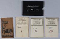
JAVA MOTOR CLUB - [THREE FOLDING LITHOGRAPH MAPS OF JAVA].
Automobielkaart van Java en Madoera Samengesteld en Uitgegeven Door de Koninklijke Vereeniging.
Semarang.: Hoofdkantoor. Circa1935. 3 folding colour lithographed maps on linen in a cloth covered slipcase lettered in white on the upper cover. Scale 1:500000. Each map has been numbered 1 to 3 by a prior owner on the reverse of the map with their signature. Sheets measure 55.5 x 83.4cm; 56 x 90cm and 56 x 82.3cm. The first map is a little stained on the reverse but the stains are not visible on the map itself. Very good copies in like slipcase. TOGETHER WITH Afstands Tabellen 1928 a separate 62pp booklet accompanies the folder of maps spine repaired with washi tissue. . Hoofdkantoor. hardcover
Riferimento per il libraio : 219096
|
|
|
JAÏS Pierre et LAHANA Henri
"Bridge simple et moderne; enfin l'espéranto du bridge : la méthode de la longue d'abord."
Paris, René Julliard, 1970. 14 x 21, 277 pp., cartonnage d'édition + jaquette, bon état.
Riferimento per il libraio : 34019
|
|
|
JAÏS Pierre et LEBEL Michel
La majeure cinquième, la nouvelle bible du bridge. Collection les bases du bridge moderne.
Editions du Rocher, 1976. 13 x 20, 409 pp., très nombreux exemples, broché, bon état.
Riferimento per il libraio : 21215
|
|
|
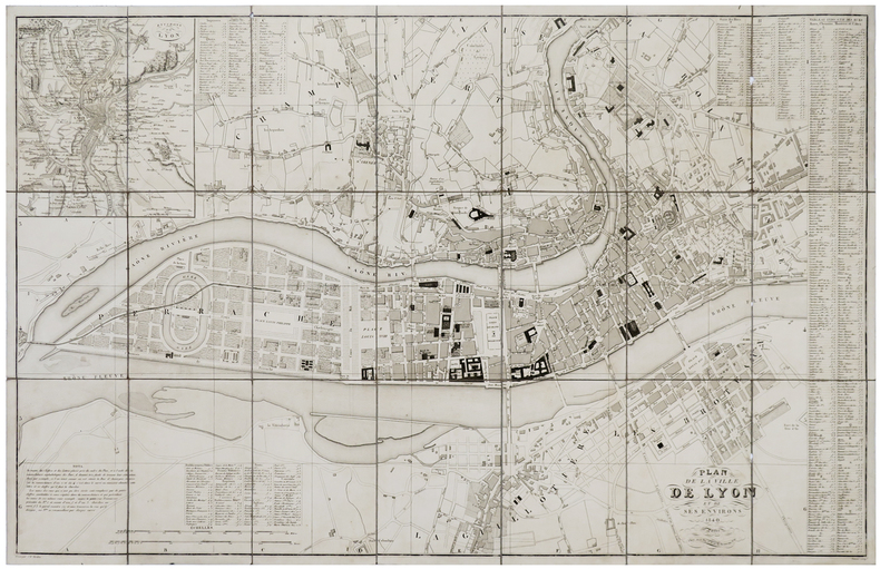
JEAN (Pierre).
[LYON] Plan de la ville de Lyon et de ses environs.
Paris, Jean, 1840. En 21 sections montées sur toile et pliées, formant un plan de 582 x 905 mm ; étiquette au dos avec titre manuscrit.
Riferimento per il libraio : LBW-6111
|
|
|
Jean-Pierre Seguin et Cécile de Jandin (Catalogue rédigé par) ; Julien Cain et Jean Adhémar (introduction de)
Cinq siècles de cartes à jouer en France. Bibliothèque nationale Galerie Mansart Septembre- Octobre 1963
Paris, bulletin du Vieux Papier / Fascicule 205 , 1963 0 un fascicule in-4°, 93 pp., couverture illustrée. (pages légèrement cornées). 423 n° décrits. Quelques illustrations en noir. Complet du feuillet d'errata. Peu courant.
Riferimento per il libraio : 024951
|
|
|
Jean-René Vernes
Le Bridge
Hatier 1982 1982. L'ouvrage 'Le Bridge' de Jean-René Vernes et Henri Samouiloff publié chez Hatier en 1982 présente une méthode d'évaluation des mains au bridge basée sur une étude statistique rigoureuse des donnes de compétition. Ce livre technique s'adresse aux bridgeurs cherchant à appliquer une approche systématique et théorique au jeu
Riferimento per il libraio : 500318405

|
|
|
Jean-Marie LHOTE
Les TAROTS
Un ouvrage de 89 pages, format 200 x 295 mm, illustré, relié cartonnage couleurs, publié en 1978, Editions Atlas, bon état
Riferimento per il libraio : LFA01368
|
|
|
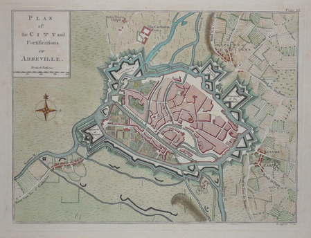
JEFFERYS (Thomas);
[ABBEVILLE] Plan of the city and fortifications of Abbeville.
London 1774 187 x 251 mm.
Riferimento per il libraio : LBW03d46
|
|
|
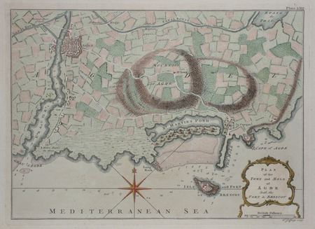
JEFFERYS (Thomas);
[AGDE] Plan of the town and mole of Agde with the fort de Brescou.
London 1774 197 x 276 mm.
Riferimento per il libraio : LBW03d43
|
|
|
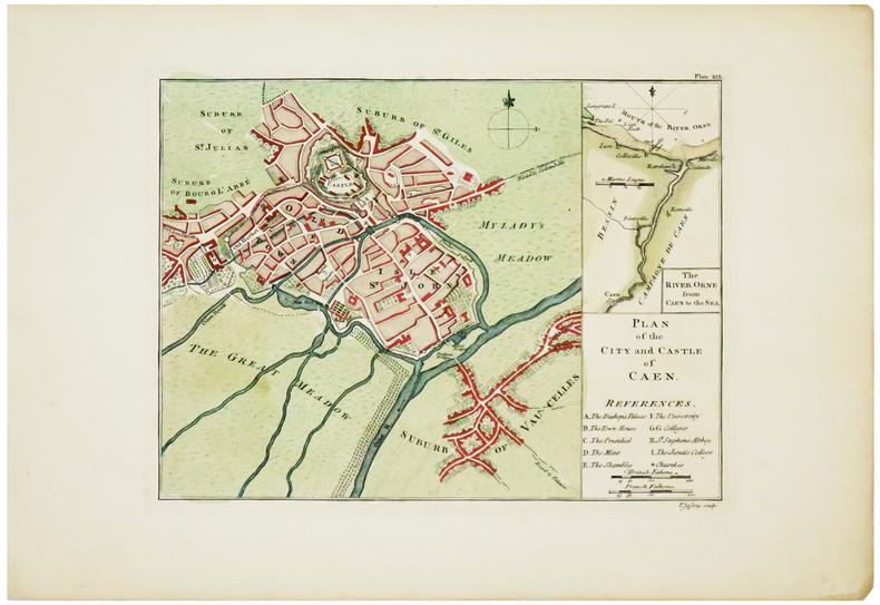
JEFFERYS (Thomas).
[CAEN] Plan of the city and castle of Caen.
[London, 1774]. 187 x 251 mm.
Riferimento per il libraio : LBW03d3d
|
|
|
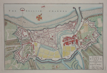
JEFFERYS (Thomas);
[DIEPPE] Plan of Dieppe with the new fortifications and projected works.
London 1774 209 x 312 mm.
Riferimento per il libraio : LBW03d47
|
|
|
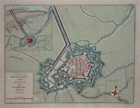
JEFFERYS (Thomas);
[GRAVELINES] A plan of Gravelines, with the new canal and the course of the river Aa to the sea.
London 1774 189 x 250 mm.
Riferimento per il libraio : LBW03d42
|
|
|
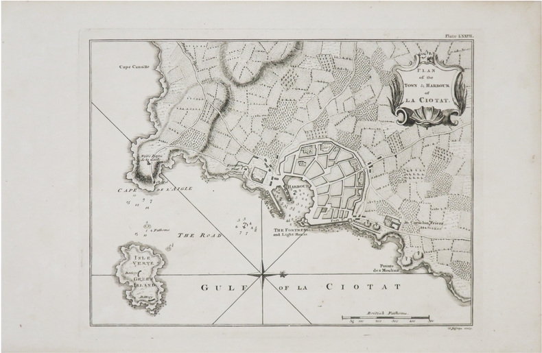
JEFFERYS (Thomas).
[LA CIOTAT] Plan of the town & harbour of La Ciotat.
[Londres, Thomas Jefferys, 1761]. 188 x 245 mm.
Riferimento per il libraio : LBW-8976
|
|
|
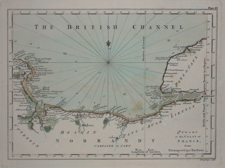
JEFFERYS (Thomas);
[NORMANDIE] 5th chart of the coast of France, from Fécamp to Cape Barfleur.
London 1774 180 x 248 mm.
Riferimento per il libraio : LBW03d48
|
|
|
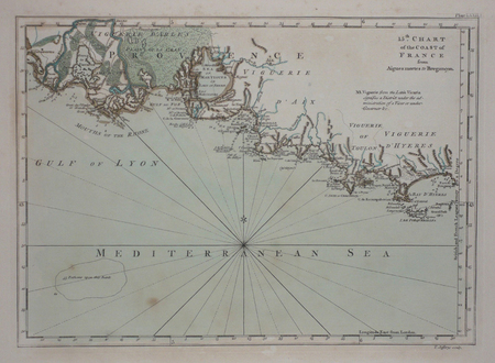
JEFFERYS (Thomas).
[PROVENCE] 15th chart of the coast of France from Aigues Mortes to Brégançon.
London, 1774. 180 x 248 mm.
Riferimento per il libraio : LBW03d44
|
|
|
Jefford, Andrew
Peat Smoke and Spirit : A Portrait of Islay and Its Whiskies
No marks or inscriptions. A very clean very tight copy with unmarked black cloth boards and no bumping to corners. Dust jacket not price clipped or marked or torn or creased with minor traces of storage. 406pp. History of the Scottish Isle of Islay and its whisky. The Island is home to seven of the world's most widely admired malt whisky distilleries on its shores and this study provides a most detailed analysis of Scotch malt whisky production. Maps on end papers.

|
|
|
Jenichen Balthasar (attivo dal 1560, morto nel 1599)
Roma
La rarissima veduta aerea di Roma di Balthasar Jenichen, pubblicata a Norimberga. La veduta di Jenichen deriva a sua volta da una xilografia della Cosmographia di Sebastian Münster (Basilea, 1550), che raffigura Roma così com'era intorno al 1490 (Per la veduta di Münster si veda A. Frutaz, Le piante di Roma, XCVIII)."Orientata con nord in basso. A proiezione obliqua; veduta prospettica. È una ripetizione del panorama comparso la prima volta col Bergomensis (1490) e, con lievi modificazioni, ripetuto poi nello Schedel, nel Munster e in altre edizioni tutte inspirate al panorama, detto di Mantova, e che rappresenta Roma sotto il Pontificato di Alessandro VI. Forse lo Jenicken ricalca un vecchio rame senza mai aver visto Roma, sicché non riesce ad interpretare la linea della cupola del Pantheon, colloca l'Aventino presso la Porta del Popolo e qua e là dissemina altri errori topografici. L'assenza del Colosseo ricollega la presente pianta più direttamente al Munster" (cfr. Scaccia Scarafoni, p. 74)."In alto a sinistra legenda con lettere di rimando in veduta (A-Z). È noto un solo altro esemplare con iscrizioni in caratteri gotici conservato al Paul Getty Museum ed un altro con iscrizioni in caratteri romani conservato presso la BVE. Si tratta pertanto di una pianta di estrema rarità e peraltro graficamente assai raffinata" (cfr. Marigliani p. 121, che erroneamente raffigura e attribuisce la copia con caratteri gotici allo Jenichen).Il lettering del nostro esemplare è in latino, mentre esiste una copia con caratteri gotici, di dimensioni ridotte. Un esempio (ex collezione Pecci-Blunt) si trova al Getty Museum, un altro è pubblicato su Marigliani, altro ancora è descritto da Scaccia Scarafoni alla Biblioteca Nazionale di Roma.La veduta dello Jenichen è sconosciuta a Frutaz, mentre Hollstein ne descrive solo 2 esemplari nelle collezioni dei gabinetti delle stampe di Berlino e Monaco. Scaccia Scarafoni descrive l'esemplare presso la Biblioteca Nazionale di Roma; Jenichen è stato il principale editore tedesco di carte topografiche. Insieme al connazionale Matthias Zündt si interessarono particolarmente alle cosiddette carte d'occasione - nate per documentare avvenimenti - e ne produssero diverse sulla scia e nella tradizione di quelle dei loro omologhi editori italiani. Data la loro natura effimera, sono tutte rare o introvabili.La veduta di Roma, priva di data, può essere ricondotta la periodo 1562-1590 in base alle informazioni sul periodo di attività dell'artista. Una datazione intorno al 1570 ci sembra più compatibile con alcuni dei lavori topografici - datati - dell'artista.Acquaforte e bulino, impressa su carta vergata coeva priva di filigrana, con margini, in perfetto stato di conservazione. Rarissima.BibliografiaScaccia Scarafoni, Le Piante di Roma, pp. 74-75, n. 129; Marigliani, Le piante di Roma nelle collezioni private, p. 121, n. 17; Hollstein XL B, p. 54, n. 150; G.K. Nagler, Lexicon, VI, p. 439, n. 2; Andresen II, Nr. 279; Passavant IV, p. 429, n. 27; Le Blanc, II, p. 429, n. 27. The very rare Balthasar Jenichen's etched bird's-eye view of Rome, published in Nuremberg. Jenichen's view in turn derived from a woodcut in Sebastian Münster's Cosmographia (Basel, 1550), which depicts Rome as it was about 1490 (For Münster's view, see A. Frutaz, Le piante di Roma, XCVIII).Münster's table with lettered names keyed to buildings and monuments on the view has been shifted from the foot to the upper left-hand corner in Jenichen and the present view. In its place at foot are eight quatrains of German verse on the rulers of Rome, the last line of which reads: Das spricht Balthasar Jenichen. Lettering in the present view is Latin, while there is a copy with Gothic lettering, reduced in size. One example (ex Pecci-Blunt collection's) is at the Getty Museum, another one is published in Marigliani - who erroneously attributes the copy with Gothic characters to Jenichen. Unknown by Frutaz; Hollstein describes only 2 example of this very rare work. Scaccia Scarafoni listed the further example at the Biblioteca Nazionale di Roma (that own also the copy with Gothic text).Jenichen was the leading German publisher of news-sheet maps. Jenichen and compatriot Matthias Zündt took particular interest in the conflict and produced views and maps of it that equaled and surpassed those of their Italian counterparts. Given their ephemeral nature, all are rare and desirable.The view of Rome, undated, can be traced back to the period 1562-1590 according to the artist's period of activity. A dating around 1570 seems to us to be more compatible with some of the artist's topographical and dated works.Etching and engraving, printed on contemporary laid paper, with margins, perfect condition.LiteratureScaccia Scarafoni, Le Piante di Roma, pp. 74-75, n. 129; Marigliani, Le piante di Roma nelle collezioni private, p. 121, n. 17; Hollstein XL B, p. 54, n. 150; G.K. Nagler, Lexicon, VI, p. 439, n. 2; Andresen II, Nr. 279; Passavant IV, p. 429, n. 27; Le Blanc, II, p. 429, n. 27.

|
|
|
JERUSALEMS TEMPEL -
Jerusalems tempel Såsom thet syntes öster uth Medh alla sine Föreårdar eller Chorer, efter Ben. Ariae Montani Afritning.
(Stockholm, 1703). (33 x 42 cm.). Kobberstukket kort over Tempelgården i perspektiv. En ganske lille reparation nederste i midterfolden. I passpartou.
Riferimento per il libraio : 53195
|
|
|
JERUSALEMS TEMPEL -
Jerusalems tempel Såsom thet syntes öster uth Medh alla sine Föreårdar eller Chorer, efter Ben. Ariae Montani Afritning.
(Stockholm, 1703). (33 x 42 cm.). Kobberstukket kort over Tempelgården i perspektiv. En ganske lille reparation nederste i midterfolden. I passpartou.
|
|
|
JESSUP Frank W.
A History of Kent. with Maps and Pictures. BRIGHT, CLEAN COPY IN UNCLIPPED DUSTWRAPPER
8vo., First Edition, with 30 plates on 16 and 15 maps in the text; green cloth, gilt back, a very good, bright, clean copy in unclipped dustwrapper, the latter lightly frayed at extremities. Bennett p.184.

|
|
|
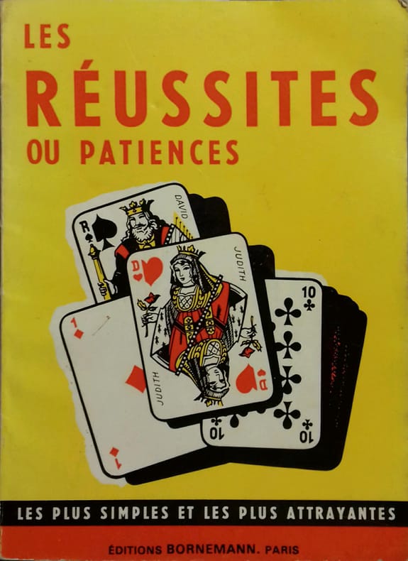
JEUX DE CARTES
Les réussites ou patiences.
Couverture rigide. Broché. 48 pages.
Riferimento per il libraio : 140082
|
|
|
JEUX DE CARTES
Règle du je de Piquet - Piquet ordinaire - Piquet à écrire - Piquet normand - Piquet voleur - Lois et conventions.
Paris, Delarue, sd (v. 1890) ; in-12, broché, couverture jaune illustrée. 36 pp.Bel exemplaire.
Riferimento per il libraio : 35503465
|
|
|
JEUX DE CARTES
Réponse d'un docteur de Sorbonnne à un chanoine de ...
(vers 1700).
Riferimento per il libraio : 18195

|
|
|
Jim Perry, Blank Endpaper FORMER OWNER STAMP, Illustrated By Photos Maps b/w
Stars Beyond The a Biographical Graveside Guide cemeteryS of Theda Bara Humphrey Bogart Bob Crane Marion Davies Sharon Tate Rudolph Valentino Peter Lorre Marilyn Monroe Bela Lugosi Errol Flynn Walt Disney Zazu Pitts Rosalind Russell ETC
Manhattan Beach CA Self-Published J. E. Perry 1978. Oblong Pictorial Paperback in B/W light creases Cover 1978 1st Edition Interior nice tight UNDERLINing Thruout VG/Good SOFTCOVER few notes in ink couple dog eared pgs . First Edition. Soft Cover. Manhattan Beach, CA Self-Published J. E. Perry paperback
Riferimento per il libraio : 23100
|
|
|
Jo Sturges and Denise Laing (editors)
The Pub Guide 2004
No marks or inscriptions. No creasing to covers or to spine. A very clean very tight copy with bright unmarked boards, minor traces of storage to front cover and no bumping to corners. 704pp. The state of play with pubs which were open in 2004.

|
|
|
JOANNE Paul
DAUPHINE ET SAVOIE 1883
1883 cart. éd. toil. verte in-12, 5 cartes, 2 plans, 3 panoramas, 462 p., 1883 hachette éd.,
Riferimento per il libraio : 751
|
|
|
JOANNE Adolphe
FRANCE NORMANDIE
1886 cart. toil. éd. in-8, 7 cartes repliées / onglet et 4 plans, 580 p., 1886 hachete éd.,
Riferimento per il libraio : 717
|
|
|
JOANNE (Adolphe)
Géographie du département de l'Ariège
Paris, Librairie Hachette, 1896, 66pp. in-12, rel. carto. édit, dos toilé bleu, ill. h.t 12 grav. et une carte coloriée h.t dépl.
Riferimento per il libraio : 3794
|
|
|
JOANNE (Adolphe)
Géographie du Lot
Paris, Librairie Hachette, 1879, 58 pp. in-12, rel. carto. édit, dos toilé bleu, ill. h.t 8 grav. et une carte coloriée h.t dépl.
Riferimento per il libraio : 3796
|
|
|
JOANNE (Adolphe)
Géographie de La Somme
Paris, Librairie Hachette, 1903, 68 pp. in-12, rel. carto. édit, dos toilé bleu, ill. h.t 11 grav. et une carte coloriée h.t dépl.
Riferimento per il libraio : 3797
|
|
|
JOANNE (Adolphe)
Géographie du Loiret
Paris, Librairie Hachette, 1903, 68 pp. in-12, rel. carto. édit, dos toilé bleu, ill. h.t 27 grav. et une carte coloriée h.t dépl.
Riferimento per il libraio : 3798
|
|
|
JOANNE (Adolphe)
Géographie du Tarn-et-Garonne
Paris, Librairie Hachette, 1885, 60 pp. in-12, rel. carto. édit, dos toilé bleu, ill. h.t 8 grav. et une carte coloriée h.t dépl.
Riferimento per il libraio : 3802
|
|
|
JOANNE (Adolphe)
Géographie de l'Oise
Paris, Librairie Hachette, 1902, 60 pp. in-12, rel. carto. édit, dos toilé bleu, ill. h.t 13 grav. et une carte coloriée h.t dépl.
Riferimento per il libraio : 3804
|
|
|

 Ricevere i risultati per e-mail
 Scaricare i risultati in PDF
 RSS feed
 Link
Link


