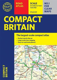
Paperback / softback. New. Fully up-to-date in a handy flexibound format Philip's Compact Britain Road Atlas features the super-clear digital cartography which was voted Britain's clearest and most detailed mapping in an independent consumer survey. paperback
Bookseller reference : A9781849075787 ISBN : 1849075786 9781849075787
Paperback / softback. New. Discover hidden gems around Birmingham with A-Z Secret Birmingham Walks. Featuring 20 walking routes in and around the city including lesser-known circuits and hidden details on popular walks. Accompanied by guided walking instructions and written by local experts A-Z Secret Birmingham Walks is the perfect way to explore the city in a new light. paperback
Bookseller reference : A9780008496302 ISBN : 0008496307 9780008496302
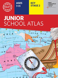
Paperback / softback. New. The market-leading atlas for pupils at primary schools Philip's RGS Junior School Atlas has been fully revised and updated for its 11th edition. paperback
Bookseller reference : A9781849075800 ISBN : 1849075808 9781849075800
Paperback / softback. New. This A-Z map of Nottingham is a full colour paperback atlas with 74 pages of continuous street mapping which extends to include: Arnold paperback
Bookseller reference : A9780008445188 ISBN : 0008445184 9780008445188
Paperback / softback. New. Prepared specifically to support social studies map skills geography skills plus history and heritage topics at upper primary and lower secondary levels throughout the Caribbean. paperback
Bookseller reference : A9780008361723 ISBN : 000836172x 9780008361723
Paperback / softback. New. A practical little walk guide to Northumbria endorsed by the Ramblers. All of the 20 walks are 5 miles or under in length and can easily be completed in less than 3 hours. Clear Ordnance Survey maps show the route along with easy-to-follow walk descriptions. paperback
Bookseller reference : A9780008101589 ISBN : 0008101582 9780008101589
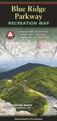
Sheet map folded. New. New Book; Fast Shipping from UK; Not signed; Not First Edition; The route is renowned for its many scenic overlooks hiking trails historical sites and cultural landmarks offering travelers a classic glimpse of the Appalachian Highlands. unknown
Bookseller reference : ria9780783499734_inp ISBN : 0783499736 9780783499734
Sheet map folded. New. New Book; Fast Shipping from UK; Not signed; Not First Edition; Waterproof Tear-Resistant Travel Map. A list of all National Scenic Historic and Recreation Trails sorted by state is also included to help you find the closest wilderness. The country is represented in subtle earth-tones with shad unknown
Bookseller reference : ria9781566959650_inp ISBN : 1566959659 9781566959650
Spiral bound. New. New Book; Fast Shipping from UK; Not signed; Not First Edition; Philip's created this new series for walkers cyclists and local explorers at a scale that provides greener options to uncover all the nature and hidden gems in your local area. From Chester to Winsford we cover all of Cheshire in int unknown
Bookseller reference : ria9781849076005_inp ISBN : 1849076006 9781849076005
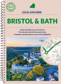
Spiral bound. New. New Book; Fast Shipping from UK; Not signed; Not First Edition; Philip's created this new series for walkers cyclists and local explorers at a scale that provides greener options to uncover all the nature and hidden gems in the local areas around Bristol and Bath. unknown
Bookseller reference : ria9781849076029_inp ISBN : 1849076022 9781849076029
Other cartographic. New. New Book; Fast Shipping from UK; Not signed; Not First Edition; Set your sights on a new climbing challenge with the Scratch Off Snowdonian Climbs Print! unknown
Bookseller reference : ria9781913834906_inp ISBN : 1913834905 9781913834906
Spiral bound. New. New Book; Fast Shipping from UK; Not signed; Not First Edition; Philip's created this new series for walkers cyclists and local explorers at a scale that provides greener options to uncover all the nature and hidden gems in your local area. From Aylesbury to Wolverton we cover Buckinghamshire in e unknown
Bookseller reference : ria9781849076340_inp ISBN : 1849076340 9781849076340
Paperback / softback. New. New Book; Fast Shipping from UK; Not signed; Not First Edition; A full-colour regional road atlas of the Midlands from A-Z Maps featuring 46 pages of continuous road mapping. paperback
Bookseller reference : ria9780008652838_inp ISBN : 000865283x 9780008652838
Spiral bound. New. <b>Explore Britain with this easy-to-use road atlas from Philip's the UK's best-selling road atlas brand. Easy-to-read mapping superb extra detail and a great lie-flat format make this the ultimate British road trip companion.</b> unknown
Bookseller reference : A9781849076548 ISBN : 1849076545 9781849076548
Paperback / softback. New. A full-colour regional road atlas from A-Z Maps. Featuring more than 50 pages of continuous mapping of regions in the east of England. paperback
Bookseller reference : A9780008652821 ISBN : 0008652821 9780008652821
Washington DC: National Geographic Society. Large foldout map illustrated in colour. Supplement to National Geographic July 2001. . Very Good. Pamphlet. First Edition. 2001. National Geographic Society unknown
Washington DC: National Geographic Society. Large foldout map illustrated in colour. Supplement to National Geographic December 1999. . Very Good. Pamphlet. First Edition. 1999. National Geographic Society unknown
Collins 02/03/2011. New Second edition. Paperback. Used; Very Good. WE SHIP WITHIN 24 HRS FROM LONDON UK 98% OF OUR ORDERS ARE RECEIVED WITHIN 7-10 DAYS. We believe you will be completely satisfied with our quick and reliable service. All orders are dispatched as swiftly as possible! Buy with confidence! Greener Books. Collins paperback
Bookseller reference : 2791408 ISBN : 0007393571 9780007393572
Collins. New edition. Map. Used; Very Good. Simply Brit welcome to our online used book store where affordability meets great quality. Dive into a world of captivating reads without breaking the bank. We take pride in offering a wide selection of used books from classics to hidden gems ensuring theres something for every literary palate. All orders are shipped within 24 hours and our lightning fast-delivery within 48 hours coupled with our prompt customer service ensures a smooth journey from ordering to delivery. Discover the joy of reading with us your trusted source for affordable books that do not compromise on quality. 06/16/2016 Collins unknown
Bookseller reference : 3899367 ISBN : 0007955111 9780007955114
Paris 1873. French naval chart sheet 3256 sheet size 72.5 x 105 cm engraved by Delamare black and white with coastal profiles in the lower part of the chart centrefold one or two marginal nicks and tears blank verso. This detailed chart of Isla Culebra now an island-municipality of Puerto Rico was derived from British Admiralty surveys. With no permmanent population for centuries the island was settled by the Spanish in the 1880s and ceded to the United States after the Spanish-American War. Map unknown
Paris 1873. French naval chart sheet 3273 sheet size 105.5 x 72 cm engraved by Nyon black and white centrefold one or two marginal nicks and tears blank verso. This detailed chart of Grenada was derived from British Admiralty surveys. Map unknown
Collins. New edition. Map. Used; Good. Simply Brit welcome to our online used book store where affordability meets great quality. Dive into a world of captivating reads without breaking the bank. We take pride in offering a wide selection of used books from classics to hidden gems ensuring theres something for every literary palate. All orders are shipped within 24 hours and our lightning fast-delivery within 48 hours coupled with our prompt customer service ensures a smooth journey from ordering to delivery. Discover the joy of reading with us your trusted source for affordable books that do not compromise on quality. 06/16/2016 Collins unknown
Bookseller reference : 2592614 ISBN : 0007955111 9780007955114
Paris 1873. French naval chart sheet 3245 sheet size 51 x 36 cm engraved by Régnier after a British Admiralty chart of 1871 black and white blank verso. Akkeshi Bay located in Kushiro Subprefecture on the east coast of Hokkaido the most northerly of the main islands of Japan. Map unknown
Paris 1873. French naval chart sheet 3119 50 x33 cm black and white blank verso. Chart of the island of Montserrat in the British West Indies featuring coastal profiles dominated by the Soufrière Hills volcano and an inset of Plymouth the former capital of the island which was destroyed in the volcanic eruptions of the mid 1990s. Map unknown
Paris 1872. French naval chart sheet 3068 sheet size 36 x 53 cm engraved by Régnier black and white blank verso. The anchorage at San Juan Bautista located on Cumberland Bay Robinson Crusoe Island; the main settlement in the Juan Fernández Islands off the coast of Chile. Map unknown
Paris 1920. French naval chart 63 x 91.5 cms black and white with beacons highlighted in yellow insets of Port dAbri the inner harbour at modern day Izmir and two coastal profiles slightly dusty lower margin one or two closed marginal tears blank verso. Engraved in 1866 after British charts by Copeland and Spratt this example of the map was printed in September 1920 during the Greek occupation of the Zone of Smyrna part of the territory awarded to Greece at the expense of the Ottoman Empire by the Allied powers after the Great War. Smyrna became an important base for Greek forces during the resulting Greco-Turkish War of 1919-1922 and in the bloody aftermath of the Greek withdrawal half the city was razed in the Great Fire of Smyrna also known as the Smyrna Catastrophe. Map unknown
 Receive by email
 Download as PDF document
 RSS feed