|
Collins Maps
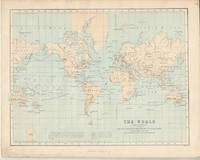
Collins World Atlas: Paperback Edition
HarperCollins Publishers Limited. Used - Very Good. Ships from the UK. Former library book; may include library markings. Used book that is in excellent condition. May show signs of wear or have minor defects. HarperCollins Publishers Limited unknown
Bookseller reference : 13797061-6 ISBN : 0007531788 9780007531783

|
|
|
Philip's Maps
Aberdeenshire : Aberdeen Ellon Fraserburgh Inverurie Peterhead Stonehaven
Octopus Publishing Group. Used - Good. Used book that is in clean average condition without any missing pages. Octopus Publishing Group unknown
Bookseller reference : 14803117-6 ISBN : 0540092916 9780540092918
|
|
|
PopOut Maps
Brighton and Hove PopOut Map
Sheet map folded. New. Let PopOut Map Brighton and Hove guide you around this lovely city. This genuinely pocket-sized pop up city map of Brighton features a detailed street map of Brighton as well as advice on the top things to see while you’re there. Ideal to pop in a pocket or bag for quick reference while exploring this gorgeous city. unknown
Bookseller reference : A9781914515637 ISBN : 1914515633 9781914515637

|
|
|
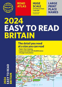
Philip's Maps
2024 Philip's Easy to Read: A4 Paperback
Paperback / softback. New. The detail you need - at a size you can read. Our newest edition of the bestselling 2024 Easy to Read Britain Road Atlas from Philip's has super-clear large-scale large-print maps that everyone can read easily. Practical and chunky A4-sized paperback with handy flaps to help plan any journey. paperback
Bookseller reference : A9781849076203 ISBN : 1849076200 9781849076203
|
|
|
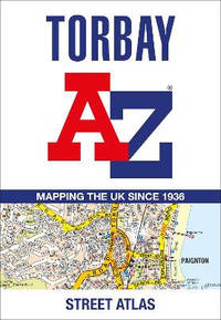
A-Z Maps
Torbay A-Z Street Atlas
Paperback / softback. New. Navigate your way around Torbay with this detailed and easy-to-use A-Z Street Atlas. <p>Printed in full-colour paperback format this atlas contains 38 pages of continuous street mapping. More than 5100 streets indexed. Large scale 4 inches to 1 mile map.</p> paperback
Bookseller reference : A9780008560461 ISBN : 0008560463 9780008560461
|
|
|
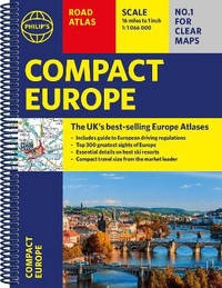
Philip's Maps
Philip's Compact Atlas Europe: A5 Spiral binding
Spiral bound. New. Clear and detailed mapping covers the whole of Europe including western Turkey. With scenic routes beaches theme parks ski resorts and World Heritage Sites alongside European driving regulations key travel information and an illustrated listing of the Top 300 not-to-be-missed sights. unknown
Bookseller reference : A9781849076487 ISBN : 1849076480 9781849076487
|
|
|
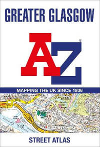
A-Z Maps
Greater Glasgow A-Z Street Atlas
Paperback / softback. New. Navigate your way in and around Glasgow with this detailed and easy-to-use A-Z Street Atlas. <p>Printed in full-colour paperback format this A4 atlas contains 168 pages of continuous street mapping. More than 23000 streets indexed.</p> paperback
Bookseller reference : A9780008560430 ISBN : 0008560439 9780008560430
|
|
|
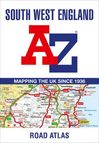
A-Z Maps
South West England A-Z Road Atlas
Paperback / softback. New. <p>This full-colour road atlas features 30 pages of continuous road mapping. Includes Cornwall Devon Dorset Plymouth Somerset and Torbay.</p> paperback
Bookseller reference : A9780008560577 ISBN : 0008560579 9780008560577
|
|
|
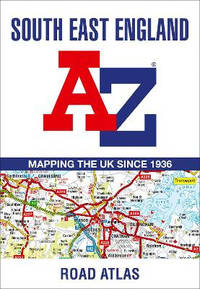
A-Z Maps
South East England A-Z Road Atlas
Paperback / softback. New. <p>This<strong> A-Z map of South East England</strong> is a full colour regional road atlas featuring 46 pages of continuous road mapping extending from Banbury and Felixstowe to the south coast and from Oxford and Southampton to Margate and Clacton-on-Sea in the east.</p> paperback
Bookseller reference : A9780008560584 ISBN : 0008560587 9780008560584
|
|
|
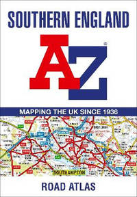
A-Z Maps
Southern England A-Z Road Atlas
Paperback / softback. New. <p>A full-colour regional road atlas featuring 39 pages of continuous road mapping. Covering an extensive area including Bristol Swindon Reading Slough Guildford Littlehampton Portsmouth Isle of Wight Bournemouth Cardiff Newport Weymouth Sidmouth Taunton and Weston-Super-Mare.</p> paperback
Bookseller reference : A9780008560560 ISBN : 0008560560 9780008560560
|
|
|
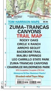
Tom Harrison Maps
Trail Map of Zuma-Trancas Santa Monica Mts CA Tom Harrison Maps
map. Good. Access codes and supplements are not guaranteed with used items. May be an ex-library book. unknown
Bookseller reference : 1877689874.G ISBN : 1877689874 9781877689871
|
|
|
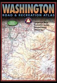
Benchmark Maps Staff
Washington Road and Recreation Atlas
Benchmark LLC. Used - Good. Used book that is in clean average condition without any missing pages. Benchmark LLC unknown
Bookseller reference : 38592933-75 ISBN : 0929591836 9780929591834
|
|
|
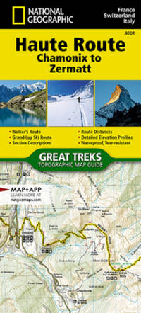
National Geographic Maps - Trails Illustrated
Haute Route Map Chamonix to Zermatt National Geographic Trails Illustrated Map 4001
map. Good. Access codes and supplements are not guaranteed with used items. May be an ex-library book. unknown
Bookseller reference : 1566958105.G ISBN : 1566958105 9781566958103
|
|
|
Philips Maps
Philips 2019 Complete Road Atlas Europe: A4 with practical flexi cover Philips Road Atlas
Philips. Flexibound. Used; Very Good. Simply Brit welcome to our online used book store where affordability meets great quality. Dive into a world of captivating reads without breaking the bank. We take pride in offering a wide selection of used books from classics to hidden gems ensuring theres something for every literary palate. All orders are shipped within 24 hours and our lightning fast-delivery within 48 hours coupled with our prompt customer service ensures a smooth journey from ordering to delivery. Discover the joy of reading with us your trusted source for affordable books that do not compromise on quality. 04/05/2018 Philips unknown
Bookseller reference : 4036277 ISBN : 1849074798 9781849074797
|
|
|
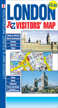
A-Z Maps
London a-Z Visitors' Map
Geographers' A-Z Map Company Limited. Used - Good. Used book that is in clean average condition without any missing pages. Geographers' A-Z Map Company, Limited unknown
Bookseller reference : 53108081-6 ISBN : 1843488884 9781843488880
|
|
|
Collins Maps
Collins Student Atlas Collins Student Atlas
Collins 02/12/2015. New edition. Paperback. Used; Very Good. WE SHIP WITHIN 24 HRS FROM LONDON UK 98% OF OUR ORDERS ARE RECEIVED WITHIN 7-10 DAYS. We believe you will be completely satisfied with our quick and reliable service. All orders are dispatched as swiftly as possible! Buy with confidence! Greener Books. Collins paperback
Bookseller reference : 4978707 ISBN : 0007591381 9780007591381

|
|
|
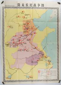
[NATIONAL MUSEUM OF CHINESE HISTORY]. 中国历史博物馆.
隋末农民战争图. Sui mo nong min zhan zheng tu. Chinese Education Map - Map of the Peasant War in Late Sui Dynasty.
北京. Beijing.: 地图出版社.Di tu chu ban she. 1st Edition 1st Printing. 1980. Large Chinese education map folded with original envelope scale 1:1500000 legend left lower corner showing the military advance routes and battle grounds led by several leaders of the agrarian rebels including 王薄 Wang Bo 窦建德 Dou Jiande 杜伏威 Du Fuwei and 翟让 Zhai Rang. Very good copy. <br> <br>Text in Chinese. Sheet measures 106.8 x 76.52cm. . 地图出版社.[Di tu chu ban she]. unknown
Bookseller reference : 176714
|
|
|
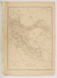
WELLER, EDWARD (1819-1884).
Persia. Map.
London.: Cassell Petter and Galpin. circa1863. Engraved map 43.1 x 30.3 cm 50.7 x 34.5 cm sheet central fold small edge tears one neatly repaired lower corner chipped slight age toning but in very good condition. Impressive large map of Persia Iran by noted map maker Edward Weller in original uncoloured state re-issued by the publisher for inclusion as map 26 in Cassell's Atlas. . Cassell, Petter and Galpin. unknown
Bookseller reference : 177017
|
|
|
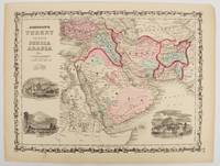
MIDDLE EAST ANTIQUE MAP
Johnson's Turkey in Asia Persia Arabia &c.
New York.: Johnson & Browning. circa1860. Engraved map 30.2 x 40.5 cm 34.5 x 45.5 cm sheet original hand-colour elaborate strapwork border three fine vignettes of Muscat Trebisond small marginal edge tears top corner chipped the map in very good condition. Most attractive decorative map of Arabia the Ottoman Empire Persia Afghanistan Beloochistan and surrounds by one of the most popular and successful 19th Century American atlas publishers. . Johnson & Browning. unknown
Bookseller reference : 177019
|
|
|
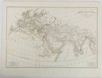
[ANCIENT WORLD - ANTIQUE MAP] (MALTE-BRUN, CONRAD), POIRSON, JEAN BAPTISTE; TARDIEU (AMBROISE).
Monde comm des Anciens.
Paris. circa1820. Engraved map with original outline hand-colour 21.1 x 31.5cm original folds a few spots and a little creased but in very good condition. Latin map of the Ancient world encompassing Europe India Arabia the Middle East and North Africa by the French cartographer Jean Baptiste Poirson 1761-1831 finely engraved. . unknown
Bookseller reference : 177230
|
|
|
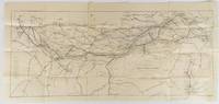
GEORGE PHILIP & SON LTD. (ENGRAVERS)
Map of the East Indian Railway showing stations and mileage by Shortest route.
Calcutta.: E. I. R. Press. circa1910. Folding engraved map 33.5 x 73.5 cm river systems in blue attractively bursting the borders of the map inset map of the network into Calcutta legend noting stations lines under construction and foreign railways; original folds two small fold splits with no loss slight overall toning more noticeable at the folds in very good condition. Attractive map capturing one of the busiest areas of a staggeringly vast railway network. The Barharwa-Azimganj-Katwa loop is marked under construction. Scarce. . E. I. R. Press unknown
Bookseller reference : 175858
|
|
|
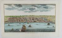
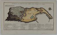
[INDONESIA - ANTIQUE PRINT] VAN DER SCHLEY, JAKOB.
Samboupo.
circa1750. Hand-coloured engraving 19.5 x 35.6 cm 25.5 x 41.6 cm sheet original folds two old paper repairs not affecting the image a trifle toned but in very good condition Attractive bird's-eye view town plan of Makassar in Sulawesi prepared for Abbé Prevost's monumental 'Histoire Générale des Voyages.' . unknown
Bookseller reference : 177186
|
|
|
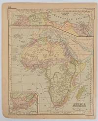
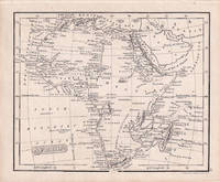
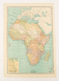
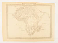
[AFRICA - MAP].
Africa and the Adjacent Islands.
New York.: Ivison Blakeman Taylor & Co. circa1877. Printed colour map 27.5 x 21.7 cm large inset of Northern Africa and a smaller of Southern Africa two small edge tears lower corner neatly strengthened the sheet toned but the map in good condition unrelated text printed on the verso. Map of Africa as a whole before the Imperial race for colonies in the 1880s with interesting insets of Northern and Southern Africa. . Ivison, Blakeman, Taylor & Co. unknown
Bookseller reference : 177229
|
|
|
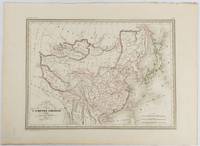
(MALTE-BRUN, CONRAD) THIERRY, ENGRAVERS.
Carte Générale de l'Empire Chinois et du Japon.
Paris. circa1837. Engraved map with original outline hand-colour 22 x 30 cm; 28.8 x 38.6 cm sheet marginal repair to the lower corner not affecting the map sheet lightly age-toned in very good condition preserved in a window mount. Fine map of China Japan and Central Asia noting Manchuria "Mandchourie" bordering Northern India and Turkestan in the West and Russia "Russie d'Asie" in the North. <br> <br>From the estate of the late collector and scholar Arthur Hacker with his pencilled catalogue mark on the verso. . unknown
Bookseller reference : 177519
|
|
|
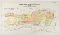
[NEW SOUTH WALES - 1912 COLOUR MAP].
Drildool Bore Water Trust District Plan shewing proposed Boundaries.
Sydney.: W.A. Gullick Govt. Printer. 1912. Large lithographed folding county map 78.8 x 45.4 cm the parishes highlighted in colour two small fold splits slight toning in very good bright condition. Attractive map from the Report on the first Interstate Conference on Artesian Water Sydney 1912 showing boundaries of water trust districts proposed boundaries with position and length of drains for the counties of Denham and Jamison in northern New South Wales boundaried by the Namoi River to the South. . [W.A. Gullick, Govt. Printer] unknown
Bookseller reference : 177249
|
|
|
Maps, Collins
Collins Primary Atlas
HarperCollins Publishers Limited. Used - Good. Ships from the UK. Used book that is in clean average condition without any missing pages. HarperCollins Publishers Limited unknown
Bookseller reference : 40143904-20 ISBN : 0008319456 9780008319458

|
|
|
[ANTIQUE MAP -- HORMUZ ISLAND. IRAN] (BELLIN, JACQUES NICOLAS & JAKOB VAN DER SCHLEY).
Das Eyland Ormus oder Jerun.
Leipzig. circa1747. Engraved map on laid paper in original uncoloured state 19 x 24 cm; 25.1 x 30.3 cm sheet original folds a trifle spotted and browning to one of the folds but in good condition. Fine map of the Iranian island of Hormuz in the Persian Gulf by Jacques Nicolas Bellin published in Prevost's "Histoire generale des Voyages .". Traditional Persian vessels can be seen bobbing in the foreground and numbers of merchant vessels to the East illustrating the strategic importance of the Strait of Hormuz and the competition for access to trading routes. Sites of fresh water are noted and the Portuguese fortress to the north of the island is delineated. A beautiful map. . unknown
Bookseller reference : 177131
|
|
|
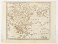
[GREECE].
Delos.
Amsterdam. circa1703. Engraved map on watermarked laid paper 16.5 x 26.5 cm plate-mark 26 x 42 cm sheet key in German inset detail of grave sites on the island of "Rhenee" Rineia and Apollonian relics lower corner creased and with a sealed tear to the verso no loss in very good condition. Fine engraving with large margins of the Greek island of Delos of great significance to classical antiquity and the mythological birthplace of the Greek deities Artemis and Apollo. . unknown
Bookseller reference : 176390
|
|
|
[MAP] [CARY, JOHN, AFTER]
Ireland from the best authorities
circa1796. Engraved map 18.3 x 22 cm 21.7 x 27 cm sheet original folds age toning and some offsetting inner edge darkened and discoloured but the map in good condition. Finely engraved map showing Ireland divided into counties lower coast of Scotland and Wales and the Isles of Man and Anglesea; also noting Nymph Bank 'discovered in 1735 by Capt. Doyle.' . unknown
Bookseller reference : 176602
|
|
|
MITCHELL SAMUEL AUGUSTUS.
Map of Africa engraved to illustrate Mitchell's New Intermediate Geography.
Philadelphia.: E. H. Butler. circa1869. Lithographed map with original hand-colour 21.2 x 27.6 cm two inset maps of Liberia and Sierra Leone; and Egypt showing the Suez Canal text and engravings for an unrelated entry on the verso; margins dusty top edge worn with small edge tears one affecting the border and marginal chip but in good condition. Detailed map of Africa before the escalation of colonial acquisition in the 1880s. . (E. H. Butler). unknown
Bookseller reference : 176603
|
|
|
MAP AFRICA FENNER REST.
Africa
London.: Robert Jennings. 1830. Engraved map 11.5 x 14.3 cm showing route of European explorers faint added outline colour in an early hand and manuscript note to the verso in the same ink edges age-toned but in very good condition. Detailed pre-colonial map of Africa "Regions Unexplored" marked and "no fresh water to be found" on the west coast. An early manuscript inscription on the verso refers to Lander's ."wanderings of Clapperton" the Scottish naval officer and explorer. Richard Lander had returned with Hugh Clapperton's journal following his death and the account was published in the same year as Fenner's "Pocket Atlas of Modern & Ancient Geography" for which this map was prepared. . (Robert Jennings) unknown
Bookseller reference : 176607
|
|
|
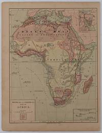
[AFRICA - PRE-COLONIAL ERA MAP]
Physical and Political Map of Africa.
New York.: Harper & Brothers. circa1877. Chromolithographed map with outlne handcolour 27.1 x 21 cm major towns marked with a red cross relief by hachures ocean currents marked two inset maps of the Suez canal and Mascarene Island two very small marginal edge tears not affecting the map slight toning unrelated text on the verso prepared for "Harper's School Geography" in very good condition Interesting map of Africa before the escalation of the European race for colonial possessions from 1880. The map shows: the European possessions of the Cape Colony Transvaal Republic Orange River Republic and Natal; regions of the continent as fertile belts and desert belts; and indicates agricultural and other production such as palm oil ivory skins and cattle. Major cities are shown with important trade centers highlighted with a red cross. Prepared for US students in "Harper's School Geography" longitude is shown from the Greenwich prime meridian at the head of the map and from the Washington prime meridian at the foot. A small outline map of Ohio is included for relative scale. . Harper & Brothers. unknown
Bookseller reference : 176015
|
|
|
BELLIN JACQUES NICOLAS COMPAGNON PIERRE.
Grundriss von dem Eylande Goree nach den Zeichnungen des Hrn Compagnon.
Leipzig.: Schwabe Johann Joachim. 1748. Engraved map on laid paper 20.5 x 36 cm plate -mark inc. captions 24 x 39 cm sheet size original fold later hand-colouring slight marginal spotting but in very good condition. Fine 18th century ground plan of Gorée Island off the coast of Senegal infamous for its association with slavery. The map shows encampments and forts with a detailed key. Originally published in Abbe Prevost's "Histoire générale des voyages." 1746 -1789 with maps and plans by the great cartographer Jacques-Nicolas Bellin this was prepared for volume two of the the German edition "Allgemeine Historie der Reisen." published in 1748. . (Schwabe, Johann Joachim) unknown
Bookseller reference : 175859
|
|
|
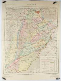
S. Q. HASAN, SURVEYOR GENERAL OF PAKISTAN.
Map of Punjab. Second Edition.
Rawalpindi.: Survey of Pakistan. 1973. Large folding map printed in colour 73.8 x 58 cm small inset plan "Administrative Index" noting the interests of: Afghanistan; Jammu & Kasmir; Baluchistan; and Sind; large key of References with the note in red "The State of Jammu & Kashmir is in dispute: its accession to India or Pakistan has not been decided through plebiscite under the United Nations." two fold tears affecting the margin and small fold splits to the map without loss four pinholes to the corners but in good condition. . Survey of Pakistan. unknown
Bookseller reference : 175114
|
|
|
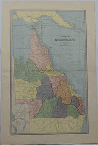
SCALLY, ALEX. J.
General Map of Queensland.
Sydney & Melbourne.: The Picturesque Atlas Publishing Company Limited Sydney & Melbourne. 1886-1888. Large printed colour map 60.9 x 37 cm 69.9 x 45.3 cm sheet central fold slight browning at the fold and to the generous margins in very good condition. Detailed map prepared for Andrew Garran's monumental "Picturesque Atlas of Australasia" 1886-1888 with the counties attractively coloured. New Guinea is shown to the North and borders with Northern Territory South Australia and New South Wales. The extent of the Great Barrier Reef is delineated along with the ocean "Border of Colony". Proposed and current railways are shown with an extensive place index printed on the verso of the map. . The Picturesque Atlas Publishing Company, Limited, Sydney & Melbourne. unknown
Bookseller reference : 175917
|
|
|
Harvey Maps Services Ltd
Lake District East XT25 Superwalker: Helvellyn Ullswater & Grasmere Superwalker XT25
Harvey Maps Services Ltd 2021. Paperback. New. 1 pages. 9.57x4.61x0.28 inches. Harvey Maps Services Ltd paperback
Bookseller reference : __1851376437 ISBN : 1851376437 9781851376438
|
|
|
OTTOMAN EMPIRE BALKANS & DANUBIA.
Turkey in Europe and Hungary.
Philadelphia.: Carey Mathew and Warner Benjamin. 1816. Engraved map 19 x 22.3 cm original folds some offsetting to the map marginal browning and staining small archival repairs to the outer margin but in good condition. Fine map Plate 19 prepared for Carey and Benjamin's "General Atlas.". . (Carey, Mathew and Warner, Benjamin). unknown
Bookseller reference : 175252
|
|
|
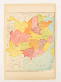
[CHINA - MAP].
China.
circa1900. Map printed in colour text in English provinces shaded in colour 28.3 x 23.2 cm central fold paper toned a small edge tear confined to the outer margin but in good condition. . unknown
Bookseller reference : 174904
|
|
|
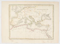
[LATE 19TH CENTURY MAP OF THE MEDITERRANEAN].
Mediterranean Sea.
circa1890s. Attractive late 19th Century map 19.6 x 24.9 cm 23.7 x 32.4 cm sheet tinted border and crudely applied but not unattractive outline hand colour some toning to the margin and the lower margin a trifle discoloured but in good condition. . unknown
Bookseller reference : 175249
|
|
|
WALKER J & C. ENGRAVERS.
Turkey containing the provinces in Asia Minor.
London.: Society for the Diffusion of Useful Knowledge. Baldwin & Cradock. 1830. Engraved map wth outline hand colour 29.7 x 42 cm relief shown in hachures key to abbreviations including "Ancient Ruins" the west and east extremities attactively engraved to burst through the border original folds map with occasional spotting more pronounced at the lower corner edges a little ragged small chip to the inner margin no loss to the map manuscript pagination in the lower corner but in good condition. . Society for the Diffusion of Useful Knowledge. Baldwin & Cradock. unknown
Bookseller reference : 175250

|
|
|
AFRICA MAP.
Africa.
New York.: Rand McNally & Co. 1899. Printed colour map 36.3 x 24.3 cm inset map of the Suez Canal and two smaller insets of the Cardagos Crayos Islands Mascarene Islands and Cape Verde Islands central fold and on the verso a printed panel listing the countries in Africa with their territorial governance area and population lower corner creased at the outer margin but in very good condition. An interesting late nineteenth-century map noting colonial governance. . Rand, McNally & Co. unknown
Bookseller reference : 174902
|
|
|
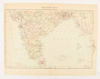
[INDIA - MAP.]
Southern India
London. circa1910. Printed colour map on conjoined pages 22.3 x 33.7 railways submarine cables and heights above sea level marked faded but in very good condition. Map showing the ruling divisions by shading borders with Burma and the Andaman and Nicobar Islands also shown. . unknown
Bookseller reference : 174841
|
|
|
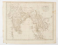
[SOUTH ASIA - MAP]. NEELE, SAMUEL JOHN.
Map of the East Indies from the Best Authorities.
London & Glasgow.: W. and D. Brownlie. 1805. Engraved map 18.7 x 23.9 cm original folds age toned and spotted inner margin a trifle ragged paper thinning in a few spots in good condition. Attractive map engraved for "A System of Geography; or A Descriptive Historical and Philosophical View of the Several Quarters of the World" published in 1805. . (W. and D. Brownlie) unknown
Bookseller reference : 175148
|
|
|
[MAP OF KUALA LUMPUR IN 1962].
Kuala Lumpur. Published under the direction of the Surveyor General Malaya.
Kuala Lumpur.: Survey Department Federation of Malaya. 1962. Very attractive large coloured folding map 108 x 83cm showing all the major hotels and rest houses throughout the country. Coloured references show rubber rice coconut and oil palm areas pineapple and miscellaneous cultivation areas mining land jungle built-up areas and shopping centres along with major features such as rivers principal roads minor roads and cart tracks railways lighthouses district state and international boundaries and triganometrical stations with heights. Scale 18 miles to an inch mile. Two inset maps of Northern Malaya and South Western Malaya are 9 miles to an inch. There are smaller inset maps of Ipoh; Malacca Singapore & Johor Bahru Penang Sungei Patani Kuala Lipis Kuantan Alor Star Kota Bharu Petaling Jaya Seremban Klang Batu Pahat Muar Segamat Johore Bahru and a small inset map of Malaya and adjacent territories. There is a large black & white table of approximate mileages. When folded the map is encased in the original printed manila covers measuring 21 x 14cm with a printed price of $2.50. A crisp bright map in very good condition. Survey Department Federation of Malaya No. 23. . Survey Department Federation of Malaya. unknown
Bookseller reference : 174808
|
|
|
HUGHES, WILLIAM.
The World on Mercators Projection showing both the Eastern & Western Maritime Route to Australia and the difference of Time at succesive Hour-Circles east & west of Greenwich.
London.: Virtue & Co. circa1874. Printed colour map 18.4 x 24.1 cm edge wear marginal spotting and on the verso but the map in very good condition. Unusual map showing time differences east and west of Greenwich before the atomic clock and well before satellites! The explanatory text notes aso that: "The space comprehended between the meridiens of 120 & 160 E. is repeated in order to show the relative position of England to Australia both eastward and westward." . Virtue & Co. unknown
Bookseller reference : 174897
|
|
|
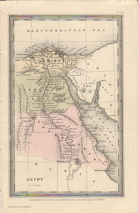
[EGYPT - MAP]. STARLING, THOMAS.
Egypt.
London.: Published for the Proprietors by Mr. Bull. 1833. Engraved map 14.1 x 8.8 cm original hand colour in very good condition. Fine miniature map with appealing hand colour denoting Lower Central and Upper Egypt. . Published for the Proprietors by Mr. Bull. unknown
Bookseller reference : 174939
|
|
|
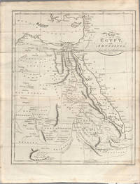
[EGYPT - MAP] NEELE, SAMUEL JOHN-ENGRAVER.
Map of Egypt and Abyssinia from the best Authorities.
London. circa1803. Engraved map 23 x 18.5 cm original folds small split to one fold affecting the margin only paper age- toned lower corner darkened and on the verso inked circles to the lower half in an early hand but in good condition. Finely engraved early 19th Century map also showing to the north Syria Palestine and Cyprus and Darfur and Mountains of the Moon Sources of the Nile to the South. . unknown
Bookseller reference : 174955
|
|
|
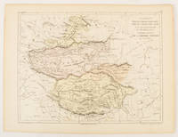
DUFOUR, AUGUSTE HENRI; BONAPARTE, ERHARD R. (ENGRAVERS); AND TANNEUR ET COMPANIE (LITHOGRAPHERS).
Thibet Thian-Chan- Nan-Lou Thian-Chan-Pe-Lou et Mongolie du Khoukhou-noor Partie Ouest de L'Empire Chinois.
Paris.: Gustave Barba Editeur. 1856. Lithographed map with original hand colour central fold 24.2 x 31.5 cm marginal toning plate number in manuscript in very good condition. Finely engraved Dufour map of Central Asia prepared for his "Atlas Populaire" showing East Turkestan Petite Boukharie and Kalmykia Dzoungarie Mongolia and Tibet. . Gustave Barba Editeur. unknown
Bookseller reference : 175109
|
|
|
[AFRICA - MAP]. RAPKIN, J.
Africa.
London.: The London Printing and Publishing Company. Circa1880s. Printed map 24 x 32.1 cm decorative border two original vertical folds paper toned mainly at the edges inner margin of the sheet ragged but in good order. A late edition of the map used for the well-known Tallis map this without the characteristic vignettes and on thinner paper. . The London Printing and Publishing Company. unknown
Bookseller reference : 174956
|
|
|
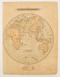
[MAP - EASTERN HEMISPHERE].
Eastern Hemisphere.
Harper & Brothers. 1875. Spherical map printed in colour 21.3 x 21.2 cm with shaded key to elevation and ocean currents unrelated text on the verso paper toned and margins soiled bottom edge ragged small sealed to to the inner margin but in sound condition. Map showing the five continents of Asia Africa Antarctica Europe and Australia. Published by Harper & Brothers for inclusion in their "School Geography". Plateau of Tibet very prominently marked. Gobi Desert and Plateau of Mongolia also marked India described as Hindostan Indo-China includes Thailand. . Harper & Brothers. unknown
Bookseller reference : 175128
|
|
 Receive by email
 Download as PDF document
 RSS feed


