|
Philip's Maps
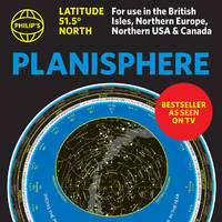
Philip's Planisphere Latitude 51.5 North: For use in Britain and Ireland Northern Europe Northern USA and Canada
Multiple-component retail product. New. The first thing that every stargazer needs - an hour-by-hour and night-by-night map of the stars you can see. <b>The bestselling specially-created moveable map of the stars dials up the constellations for really easy identification. </b> unknown
Bookseller reference : A9781849077101 ISBN : 184907710x 9781849077101
|
|
|
Philip's Maps
Philip's New World Atlas
hardcover. Good. Access codes and supplements are not guaranteed with used items. May be an ex-library book. hardcover
Bookseller reference : 0540054984.G ISBN : 0540054984 9780540054985
|
|
|
Maps, Hedberg
The Love Map
map. Good. Access codes and supplements are not guaranteed with used items. May be an ex-library book. unknown
Bookseller reference : 1885508948.G ISBN : 1885508948 9781885508942

|
|
|
National Geographic Maps
TOPO! 4 Upgrade Kit
cd_rom. Good. Access codes and supplements are not guaranteed with used items. May be an ex-library book. unknown
Bookseller reference : 0792289900.G ISBN : 0792289900 9780792289906
|
|
|
Compass Maps
New York New York Popout
paperback. Good. Access codes and supplements are not guaranteed with used items. May be an ex-library book. paperback
Bookseller reference : 1841393908.G ISBN : 1841393908 9781841393902

|
|
|
Popout Maps
Barcelona Popout Map
map. Good. Access codes and supplements are not guaranteed with used items. May be an ex-library book. unknown
Bookseller reference : 1845878590.G ISBN : 1845878590 9781845878597
|
|
|
National Geographic Maps - Adventure
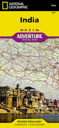
India Map National Geographic Adventure Map 3011
map. Good. Access codes and supplements are not guaranteed with used items. May be an ex-library book. unknown
Bookseller reference : 1566955963.G ISBN : 1566955963 9781566955966
|
|
|
National Geographic Maps Adventure
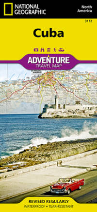
Cuba Map National Geographic Adventure Map 3112
map. Good. Access codes and supplements are not guaranteed with used items. May be an ex-library book. unknown
Bookseller reference : 1566956528.G ISBN : 1566956528 9781566956529
|
|
|
Franklin Maps (Firm)
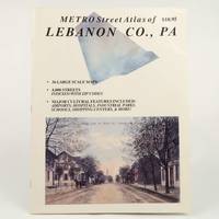
Metro Street Atlas of Lebanon County PA Metro Street Atlas Series 1999 PB
Franklin Maps 1999. unknown_binding. Very Good. 0x0x0. Very good condition. Clean text without highlighting or underlining. Tight spine. Light wear to the exterior. Franklin Maps unknown
Bookseller reference : 060925067 ISBN : 1877911674 9781877911675
|
|
|
[ZHANG YONGRU]. (EDITED BY).
袖珍中華人民共和國分省新圖. Zhenxiu Zhonghua renmin gongheguo fensheng xintu. Pocket Sized Atlas of People's Republic of China by Province.
大陸輿地社. 1952. Charming pocket size atlas with double page coloured map showing China as a whole and the provinces with inset maps of special geographical features and a description of key information about each province vertical text. Text in traditional Chinese characters names on map read from right to left or vertically. Light wear little light browning but maps very clean and bright very good condition 14.5 x 9.8cm. . 大陸輿地社. unknown
Bookseller reference : 215851

|
|
|
Cartes, Kate
Potty Training In 3 Days: The Parent's Guide For Help Your Toddler to Leave the Diaper and Use the Potty. Includes Simple Tricks for Results in Very Few Days
hardcover. Good. Access codes and supplements are not guaranteed with used items. May be an ex-library book. hardcover
Bookseller reference : 1802238972.G ISBN : 1802238972 9781802238976

|
|
|
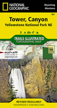
National Geographic Maps - Trails Illustrated
Tower Canyon: Yellowstone National Park NE Map National Geographic Trails Illustrated Map 304
map. Good. Access codes and supplements are not guaranteed with used items. May be an ex-library book. unknown
Bookseller reference : 1566954355.G ISBN : 1566954355 9781566954358
|
|
|
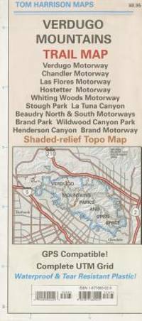
Tom Harrison Maps
Trail Map of Verdugo Mountain CA Tom Harrison Maps
Marketscope Books. New. Special order direct from the distributor Marketscope Books unknown
Bookseller reference : ING9781877689925 ISBN : 1877689920 9781877689925
|
|
|
Goebel, Michael/ 3 Maps (Corporate Author)/ Print
Overlapping Geographies of Belonging: Migrations Regions and Nations in the Western South Atlantic
like new. unknown
Bookseller reference : 26747188 ISBN : 0872292053 9780872292055

|
|
|
Portal, Roger; Maps by Serge Bonin
Les Slaves: Peuples et Nations
France: Librairie Armand Colin 1965. Hardcover. Near fine/Very good. Gilt stamped green cloth boards in dust jacket octavo illustrated in b&w and color. Book has handsome boards and tight binding text clean and unmarked. DJ has mild edgewear that includes two small tears mild sun toning. Text in French. Librairie Armand Colin hardcover
Bookseller reference : B61904

|
|
|
Franko Maps Ltd.
Virgin Islands Map & Coral Reef Creatures Guide Franko Maps Laminated Fish Card
map. Good. Access codes and supplements are not guaranteed with used items. May be an ex-library book. unknown
Bookseller reference : 1931494207.G ISBN : 1931494207 9781931494205
|
|
|
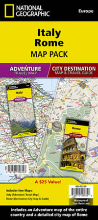
National Geographic Maps - Adventure
Italy Rome Map Pack Bundle National Geographic Adventure Map
map. Good. Access codes and supplements are not guaranteed with used items. May be an ex-library book. unknown
Bookseller reference : 1597756148.G ISBN : 1597756148 9781597756143
|
|
|
(Maps, Pittsburgh, Hazelwood, Glen Hazel)
Plat Map of Pittsburgh Including Parts of Hazelwood and Glen Hazel
Philadelphia 1890. Paperback. Very Good. 1890. 27 x 19 in. Very good. Folded once chip on left edge else fine. Color map includes parts of Hazelwood and Glen Hazel in Pittsburgh. Bordered by the Monongahela and includes part of Second Hazelwood and Salina Avenues. The Baltimore and Ohio Railroad part of Calvary Cemetery and other landmarks are labeled. paperback
Bookseller reference : z07880
|
|
|
Maps Pittsburgh Greenfield
Plat Map of Pittsburgh Including Parts of Greenfield
Philadelphia 1890. Paperback. Very Good. 1890. 27 x 19 in. Very good. Folded once some chipping to extremities else fine. Color map includes part of Greenfield in Pittsburgh. Extends between the Monongahela River and Hazelwood/ Rutherglen and Lowry. Second Woodlawn Sylvan and Lytle are also included. The Baltimore and Ohio Railroad and other landmarks are labeled. paperback
Bookseller reference : z07877

|
|
|
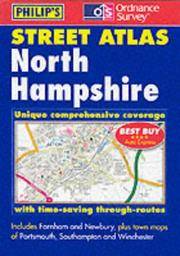
Philip's Maps
North Hampshire
Octopus Publishing Group. Used - Good. Ships from the UK. Former library book; may include library markings. Used book that is in clean average condition without any missing pages. Octopus Publishing Group unknown
Bookseller reference : 39853372-20 ISBN : 0540081027 9780540081028
|
|
|
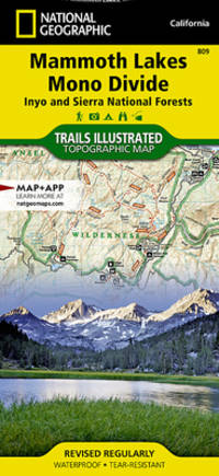
National Geographic Maps - Trails Illustrated
Mammoth Lakes Mono Divide Map Inyo and Sierra National Forests National Geographic Trails Illustrated Map 809
map. Good. Access codes and supplements are not guaranteed with used items. May be an ex-library book. unknown
Bookseller reference : 1566952662.G ISBN : 1566952662 9781566952668
|
|
|
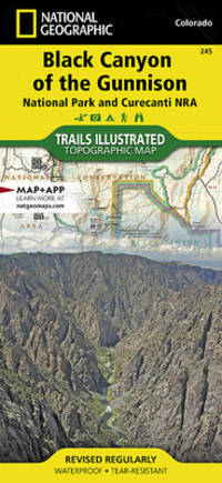
National Geographic Maps - Trails Illustrated
Black Canyon of the Gunnison National Park Curecanti National Recreation Area National Geographic Trails Illustrated Map National Geographic Trails Illustrated Map 245
map. Good. Access codes and supplements are not guaranteed with used items. May be an ex-library book. unknown
Bookseller reference : 1566953685.G ISBN : 1566953685 9781566953689
|
|
|
Nelles Maps
Japan Map by Nelles Nelles Maps
map. Good. Access codes and supplements are not guaranteed with used items. May be an ex-library book. unknown
Bookseller reference : 3865740502.G ISBN : 3865740502 9783865740502

|
|
|
Philip's Maps and Atlases
Road Atlas: France Belgium Luxembourg
spiral_bound. Good. Access codes and supplements are not guaranteed with used items. May be an ex-library book. unknown
Bookseller reference : 0540089540.G ISBN : 0540089540 9780540089543
|
|
|
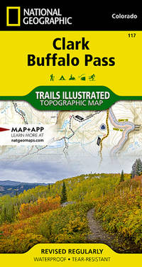
National Geographic Maps - Trails Illustrated
Clark Buffalo Pass Map National Geographic Trails Illustrated Map 117
map. Good. Access codes and supplements are not guaranteed with used items. May be an ex-library book. unknown
Bookseller reference : 1566952859.G ISBN : 1566952859 9781566952859
|
|
|
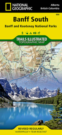
National Geographic Maps - Trails Illustrated
Banff South Map Banff and Kootenay National Parks National Geographic Trails Illustrated Map 900
map. Good. Access codes and supplements are not guaranteed with used items. May be an ex-library book. unknown
Bookseller reference : 1566956587.G ISBN : 1566956587 9781566956581
|
|
|
Thomas Bros. Maps
California road atlas & driver's guide
Thomas Bros. Maps 1991-01-01. Paperback. Good. 9'' x 12'' approx. Softcover bound book. with map in rear. At Least Good- 3 of 10 May have creases to the spine &/or creases to cover &/or small chips to the edges &/or minor tape &/or minor highlighting &/or minor underlining &/or Former owner's name/note inked &/or rubbing/chipping &/or old price stickers. May have a different cover than the current image shown. BUT will be readable and may very well not have much damage at all. Will ship in an envelope. . . . . . . . . . . . . . . . . . . . . . . . . . . . . . . . . . . . . . -. FREE Media Mail Shipping! Images available for any item just ask. Any images shown next to the listing that have our www.aCastleofBooks.com watermark on them are the exact item you will receive all other images are for reference only. Free delivery confirmation for domestic orders. Books with Author signatures are guaranteed authentic. We understand collectors needs in terms of accurate grading and proper packaging. We stand behind our descriptions 100%. All items will be shipped securely to insure that they arrive in exactly the same condition in which they left. May have small easily erasable pencil markings on first page. Our Packing Slips do not contain any pricing information so you may order items as Gifts or for Dropship without concern. We ship every Monday Wednesday & Friday morning. All items subject to prior sale. Why the odd prices We run a percent discount for our Biblio listings which insures Biblio has our lowest prices online but does give odd change. Thomas Bros. Maps paperback
Bookseller reference : 036239 ISBN : 0881304913 9780881304916

|
|
|
Philip's Maps
Philip's Family World Atlas
Philip's 1997-10-13. Hardcover. Very Good. 0.9992 in x 28.1786 in x 22.7827 in. Philip's hardcover
Bookseller reference : mon0000245206 ISBN : 0540072532 9780540072538

|
|
|
Philip's Maps
Phi Fam World Atl 95 0540063819
Philip's 15/05/1995 00:00:01. hardcover. Very Good. 1.2690 in x 28.4264 in x 22.5888 in. Philip's hardcover
Bookseller reference : mon0000265480 ISBN : 0540061530 9780540061532

|
|
|
Philip's Maps
Philip's 2018 Big Road Atlas Britain and Ireland - Spiral A3: Spiral binding Philips Road Atlas
Philip's 2017-06-01. Spiral-bound. Very Good. 0.9992 in x 38.9704 in x 28.7781 in. Philip's unknown
Bookseller reference : mon0000215182 ISBN : 1849074569 9781849074568
|
|
|
Philip's Maps,The Royal Geographical Society Ltd
Philip's Family World Atlas
Philip's 10/05/1999 00:00:01. hardcover. Very Good. 0.9992 in x 28.3784 in x 22.5828 in. Philip's hardcover
Bookseller reference : mon0000265303 ISBN : 054007697x 9780540076970

|
|
|
Philip's Maps
Europe Road Map Philip's Road Atlases & Maps
Philip's 20/12/2004 00:00:01. hardcover. Very Good. 1.5988 in x 23.9818 in x 12.5904 in. Philip's hardcover
Bookseller reference : mon0000278553 ISBN : 0540086851 9780540086856
|
|
|
Philip's Maps
Philip's 2018 Motorist's Road Atlas Britain and Ireland A3: Large-format paperback Philips Road Atlas
Philip's 01/06/2017 00:00:01. paperback. Very Good. 1.2990 in x 39.0703 in x 28.6782 in. Philip's paperback
Bookseller reference : mon0000284406 ISBN : 1849074607 9781849074605
|
|
|
Med Maps
Martha's Vineyard Pictorial Guide
paperback. Good. Access codes and supplements are not guaranteed with used items. May be an ex-library book. paperback
Bookseller reference : 1890463183.G ISBN : 1890463183 9781890463182
|
|
|
08. [Encyclopaedic Reference Book to Accompany Maps Above] Pilichowski, Czeslaw. Glo´wna Komisja Badania Zbrodni Hitlerowskich w
OBOZY HITLEROWSKIE NA ZIEMIACH POLSKICH 1939-1945: INFORMATOR ENCYKLOPEDYCZNY VOL I TEXT AND PHOTOS; THE SECOND VOLUME A PORTFOLIO OF FOLDING MAPS OFFERED SEPARATELY
Warszawa Warsaw: Pan´stw. Wydawn. Naukowe 1979. Pamphlet. 1st Edition. Original Cloth in dustjacket 8vo 678 2 pages 36 unnumbered leaves of plates with 164 illustrations. 25 cm. In Polish. Title translates to “Nazi camps in Poland 1939 - 1945. An Encyclopaedic Reference Book.†ISBN: 8301000651. <br> A massive encyclopedic record of Nazi camps prisons and ghettos in Poland based on extensive source material in Polish and foreign archives and research carried out by the General Commission for the Investigation of Nazi Crimes in Poland. The 5877 entries pages 87-601 are arranged in alphabetical order of location providing data on the period of existence character of and fundamental information about each site. Pages 11-86 comprise an introduction by Czeslaw Pilichowski "Hitlerowskie obozy i os´rodki przymusowego odosobnienia oraz ich rola w realizacji programu ludobo´jstwa i zaglady narodu polskiego" "Nazi Camps and Forced Detention Centers and Their Role in Implementing the Program of Genocide and Extermination of the Polish Nation". Includes a bibliography and indexes and summaries in Russian English French and German p. 657-676. The last 73 pages contain photographs. <br> SUBJECTS: World War 1939-1945 -- Prisoners and prisons German. -- Concentration camps -- Poland. Guerre mondiale 1939-1945 -- Prisonniers et prisons des Allemands. -- Camps d'internement -- Pologne. Obozy koncentracyjne -- Polska -- 1900-1945. OCLC: 5709074. <br> Top corners bumped some tears to dust jacket otherwise Very Good Condition in Very Good Dustjacket. Important Work. BK5 holo2-147-20. Warszawa (Warsaw): Pan´stw. Wydawn. Naukowe unknown
Bookseller reference : 41930 ISBN : 8301000651 9788301000653

|
|
|
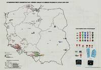
07. [7 Large Folding Maps of the Holocaust in Poland] Pilichowski, Czeslaw, editor; Glo´wna Komisja Badania Zbrodni Hitlerowskic
OBOZY HITLEROWSKIE NA ZIEMIACH POLSKICH 1939 - 1945. INFORMATOR ENCYKLOPEDYCZNY. VOLUME II: MAPY MAP VOLUME STANDS ON ITS OWN 7 LARGE FOLDING MAPS
Warszawa Warsaw: Pan´stw. Wydawn. Naukowe 1979. 1st Edition. Original black printed portfolio 8vo. Portfolio of seven large folding maps on on 4 sheets of heavy paper 3 are double sided 1 is singled sided. Primarily black and white with some color. Text in Polish. <br> Title translates to “Nazi camps in Poland 1939 - 1945. An Encyclopaedic Reference Book: Maps." Collection of 7 maps each 84 cm x 60 cm 33 x 24 inches produced by Jan Laskowski at the Main Commission for the Investigation of Nazi Crimes in Poland. The maps comprise Volume II of the work; Volume I is a heavily illustrated 676-page book of the same title which we offer separately. <br> The Seven maps all present are: <br> - Map 1 Single Sided: Hitlerowskie obozy na ziemiach polskich w latach 1939 - 1945. “Nazi camps in Poland in the years 1939 - 1945â€. Showing: concentration and extermination camps sub-camps of concentration camps extermination centers POW camps more important sub-camps working divisions commandos and temporary POW camps penal labor camps major labor camps prisons transit camps & ghettos. <br> - Map 2A: Getta na ziemiach polskich w okresie okupacji hitlerowskiej w latach 1939 - 1945 “Ghettos in Poland during the Nazi occupation in 1939 - 1945â€. <br> - Map 2B: Hitlerowskie obozy przejsciowe na ziemiach polskich w latach 1939 - 1945 “Nazi transit camps in Poland in 1939-1945â€. <br> - Map 3A: Hitlerowskie wiezienia i areszty na ziemiach polskich w latach 1939 - 1945 “Nazi prisons and arrests in Poland in 1939 - 1945â€. <br> - Map 3B: Hitlerowskie obozy pracy na ziemiach polskich w latach 1939 - 1945 “Nazi labor camps in Poland in the years 1939 - 1945â€. <br> - Map 4A: Hitlerowskie obozy jenieckie na ziemiach polskich w latach 1939 - 1945 “Nazi POW camps in Poland in 1939 - 1945â€. <br> - Map 4B: Hitlerowskie obozy koncentracyjne i osrodki zaglady na ziemiach polskich w latach 1939 - 1945 “Nazi concentration camps and extermination centers in Poland in 1939 - 1945â€. <br> Maps 2A & 2B have been described as a “Terrifying pair of maps showing the locations of German POW and internment camps in Poland during World War II highlighting the widespread locations of these establishments. In some parts of the map the information becomes so dense that three inset maps are shown. This map was designed by Jan Laskowski and printed in 1979 as part of a work on the Nazi extermination machine produced by PWN Warsaw a state-owned research-focused publishing house in Poland.<br> The map on the front is particularly interesting for its depiction of symbols used to classify internees in German camps. The uppermost of these depictions shows the combinations that can be made for different types of prisoners of different levels of importance. The armbands that would have been worn by these prisoners is shown as well as the prison uniforms. Other details are also shown. <br> The map lists hundreds of sites run by Nazi operators throughout the country. These include concentration camps death camps transitional camps and ghettos. The map is divided according to Poland's voivodeships with a key in the lower left. Names of cities too long to spell are also provided in the lower left. <br> This map was produced during a point in Poland's history during which it was actively revisiting the period during the Second World War. Leading social scientists devoted their time to trying to gather all the living as well as the recorded history of the events of the Holocaust and related atrocities before this information vanished. Leading these efforts particularly during the 1960s and 1970s was the Glówna Komisja Scigania Zbrodni przeciwko Narodowi Polskiemu known as the Chief Commission for the Prosecution of Crimes against the Polish Nation. They were active in publishing maps both for domestic educational purposes and for international remembrance and diplomatic efforts regarding the Holocaust. Jan Laskowski was a leading cartographer who produced a number of maps in this field. <br> These maps were produced as part of a series of maps that purported to combine to form an atlas of all of Hitler's crimes in Poland. Many of the large wall maps produced during this period could only show a fraction of the crimes or only the atrocities committed in one region. Thus a series of maps was needed to show all the points necessary which this present work contributes to. <br> Polish Reinterpretations of the Holocaust: Studying the effects of German occupation in Poland is a delicate subject. While it is certain that Poland suffered at least as badly as any other European nation during the Second World War reinterpretations of the Holocaust in the country have also been used to satisfy nationalistic tendencies. It has become evident to Western observers in the last several years that there is a strong nationalist movement in Poland that seeks to place blame for the Holocaust solely on the shoulders of non-Polish actors a movement originally fostered under Soviet rule. This movement has gone so far as to limit freedom of speech criminalizing with a three-year sentence the suggestion that Poland or its citizens in any form participated in the murders committed by Nazis. As such the term ‘Polish concentration camps’ has been deemed unacceptable with the government-approved term being ‘concentration camps on Polish territory.’ <br> All lines of evidence show that this map 2A & 2B was produced using the most accurate and impartial historical sources. The language on the map is simple naming only ‘Hitler's Atrocities’ and there is no evidence of a clear anti-German bias. However it is impossible to separate this map one of the most important productions of the remembrance movement during this period from the social situation in which it was produced. Maps like these can easily be converted into propaganda instruments and today's Polish leaders most of whom grew up during Soviet occupation will have formed their understanding of the Holocaust through maps like these. <br> Soviet Censorship: While the content of the map appears to have been produced free from bias the map still had to go through Soviet censorship. Mentioning prisoner of war camps in which primarily Soviet troops were interned would have been a prerequisite condition upon which the publication of the map rested. Further the lack of mention of any Soviet killings or camps requires no explanation….The map unlike many later maps makes no differentiation between the populations who suffered at the various camps. This represents the Soviet agenda that all nations suffered fought and won equally which sought to limit divisions in this post-identity state†Ruderman 2022. <br> SUBJECTS: World War 1939-1945 -- Prisoners and prisons German. -- Concentration camps -- Poland. Guerre mondiale 1939-1945 -- Prisonniers et prisons des Allemands. -- Camps d'internement -- Pologne. Obozy koncentracyjne -- Polska -- 1900-1945. OCLC: 830885973. <br> Light shelf wear to portfolio as expected. All maps in pristine condition with normal folds as issued. Very Good Condition. Complete and dramatic BR5 holo2-147-19-'cc. Warszawa (Warsaw): Pan´stw. Wydawn. Naukowe unknown
Bookseller reference : 41929
|
|
|
Franko Maps
Caribbean Map
map. Good. Access codes and supplements are not guaranteed with used items. May be an ex-library book. unknown
Bookseller reference : 1870727908.G ISBN : 1870727908 9781870727907
|
|
|
Falk Plan Maps
Hamburg City Plan Falk Plan German Edition
map. Good. Access codes and supplements are not guaranteed with used items. May be an ex-library book. unknown
Bookseller reference : 3884451057.G ISBN : 3884451057 9783884451052

|
|
|
Thomas Brothers Maps Staff
California Road Atlas and Driver's Guide : 1990 Edition
Thomas Brothers Maps. Used - Good. Used book that is in clean average condition without any missing pages. Thomas Brothers Maps unknown
Bookseller reference : 18250493-6 ISBN : 0881304182 9780881304183
|
|
|
Popout Maps
Paris PopOut Map PopOut Maps
Used - Good. Used book that is in clean average condition without any missing pages. unknown
Bookseller reference : 50261597-20 ISBN : 1910218065 9781910218068

|
|
|
Collins Maps
Collins Dublin Streetfinder Colour Map
HarperCollins Publishers Limited. Used - Very Good. Ships from the UK. Former library book; may include library markings. Used book that is in excellent condition. May show signs of wear or have minor defects. HarperCollins Publishers Limited unknown
Bookseller reference : 51058788-20 ISBN : 0007493797 9780007493791

|
|
|
Hema Maps
New Zealand Road Atlas
Hema Maps New Zealand Ltd 03/01/2007. Hardcover. Used; Very Good. WE SHIP WITHIN 24 HRS FROM LONDON UK 98% OF OUR ORDERS ARE RECEIVED WITHIN 7-10 DAYS. We believe you will be completely satisfied with our quick and reliable service. All orders are dispatched as swiftly as possible! Buy with confidence! Greener Books. Hema Maps New Zealand Ltd hardcover
Bookseller reference : 4928643 ISBN : 1877302457 9781877302459
|
|
|
[CARTES DE VISITE]. Darrah, William C.
CARTES DE VISITE IN NINETEENTH CENTURY PHOTOGRAPHY
Gettysburg PA: W.C. Darrah Publisher 1981. First edition. 4to. illustrated. A fine copy in a fine dust jacket. SIGNED by the author on the title page. W.C. Darrah, Publisher unknown
Bookseller reference : 54177

|
|
|
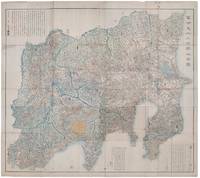
AKIYAMA EINEN OR NAGATOSHI .
富士見十三州輿地全圖. Fujimi Jūsanshū yochi zenzu. Map of the Thirteen Provinces From Where Mt. Fuji Is Visible.
Shūseidō 衆星堂. Reprint. Tenpō 14 1843. Large folding handcoloured map of the thirteen provinces from which Mt. Fuji can be viewed. 159 x 178cm. Folds into paper covered card covers measuring 40 x 24cm. Title label upper cover. A little browning along folds occasional spotting and soiling. A little worming causing approximately 1cm of loss in places. Two chops in lower section. A very striking and attractive map. This very large handsome map is a detailed map of the thirteen provinces from which one can see Mt. Fuji. Provinces shown are the eight provinces of the Kantō region Sagami 相模 Musashi 武蔵 Kazusa 上総 Shimofusa 下総 Awa 安房 Kōzuke 上野 Shimotsuke 下野 and Hitachi 常陸 and five other provinces Izu 伊豆 Suruga 駿河 Tōtōmi 遠江 Kai 甲斐 and Shinano 信濃. The map offers a large amount of detailed information such as province and county borders rivers high ways post towns checkpoints villages and scenic spots. <br> <br>The cartographer Akiyama Einen or Nagatoshi 秋山永年 came from Edo and the editor Funakoshi Seizō 船越清蔵 studio name: Shugu 守愚 1805-62 a Confucian scholar from Nagato Province now the western half of present-day Yamaguchi Prefecture. A dedication by Funahashi Akira 舟橋徴 is dated 1843. . Shūseidō 衆星堂 unknown
Bookseller reference : 159850
|
|
|
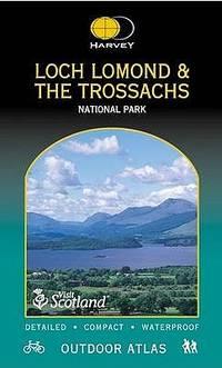
Harvey Maps
Loch Lomond and Trossachs National Park Outdoor Atlas
Harvey Map Services Ltd 2005. Spiral-bound. New. 112 pages. 9.49x5.67x0.39 inches. Harvey Map Services Ltd unknown
Bookseller reference : 2-1851374418 ISBN : 1851374418 9781851374410
|
|
|
Harvey maps
Brecon Beacons West Ultramap
Harvey Map Services Ltd 2017. Map. New. 1 pages. 7.48x3.78x0.24 inches. Harvey Map Services Ltd unknown
Bookseller reference : 2-1851375996 ISBN : 1851375996 9781851375998
|
|
|
Natkiel, Richard ( Maps ) ; Text by John Kirk & John Westwood
Atlas Of American Wars
Arch Cape Press. Very Good- in Very Good dust jacket. 1986. Hardcover. 051760468X . Foxing on top bottom and fore edge of book. . Arch Cape Press hardcover
Bookseller reference : 371771 ISBN : 051760468X 9780517604687

|
|
|
Accurate Maps
Columbia SC Atlas 4/E
paperback. Good. Access codes and supplements are not guaranteed with used items. May be an ex-library book. paperback
Bookseller reference : 1882993217.G ISBN : 1882993217 9781882993215
|
|
|
[Maps] David Fulton Surveyor Public Land
Hand-colored Map of Arkansas Surveying District 1840
<p>Surveyors Office Little Rock 30th Sept. 1840David Fulton Surveyor Public LandPrinted by W.J. Stone etc. Wash. for 28th Congress 2d Sess.</p><p><b>This is the scarce annotated and colored version of the map of the Arkansas Surveying District "shewing the extent of public surveys in said district on the 30th September 1840." </b> Unlike other versions of this map that have appeared this hand-colored version indicates by color the finished unfinished and relinquished townships and lines "the field notes of which have been sent to the General Land Office." The map also depicts the Arkansas and other Rivers Choctaw and Cherokee Boundary LinesLouisiana Line Little Rock and other landmarke. The size of the map is 18.5"x17.5" folded to 4"x7".</p><p><br /></p><p>Condition: Near fine. Possibly clipped from a larger volume; left margin i trimmed with several large tears t top not intruding into the image. Small light stain at boom no foxing or discoloration. </p><br /> Printed by W.J. Stone etc. Wash. for 28th Congress 2d Sess.
Bookseller reference : k210726b

|
|
|
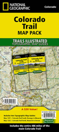
National Geographic Maps - Trails Illustrated
Colorado Trail Map Pack Bundle National Geographic Trails Illustrated Map
map. Good. Access codes and supplements are not guaranteed with used items. May be an ex-library book. unknown
Bookseller reference : 1566957400.G ISBN : 1566957400 9781566957403
|
|
 Receive by email
 Download as PDF document
 RSS feed


