CASSINI Giovanni Maria (1745 - 1824)MareMagnum

9 195 résultats
1794- EDIZIONE ORIGINALE, COLORITURA COEVA -Importante e decorativa mappa tratta dal "Nuovo Atlante Geografico Universale delineato sulle ultime osservazioni", edito a Roma dal 1792 fino al 1801, opera che la Calcografia Camerale commissionò al Cassini al fine di sostituire l’ormai obsoleto "Mercurio Geografico".Giovanni Maria Cassini, Chierico Regolare Somasco fu geografo e cartografo, ma anche intagliatore di architetture e prospettive - uno dei migliori discepoli di Giovanni Battista Piranesi - Cassini fu uno degli ultimi sferografi italiani del Settecento ed i suoi globi ebbero una notevole diffusione, come pure questo "Nuovo Atlante Geografico".Incisione in rame, coloritura coeva dei contorni, leggere bruniture, per il resto in ottimo stato di conservazione. L'Atlante del Cassini fu ristampato dalla Calcografia Camerale nel primo quarto del XIX secolo, prima del 1839. Solo gli esemplari di prima edizione come questo sono stampati su carta vergata coeva e sono colorati a mano in epoca. Le tirature del XIX secolo sono già su carta meccanica, priva di vergelle, e generalmente in bianco e nero. - FIRST EDITION, CONTEMPORARY OUTLINE COLOUR -The Italian painter and engraver, Giovanni Maria Cassini, produced this splendid map of as part of his epic three-volume atlas. Published in: Nuovo atlante geografico universale delineato sulle ultime osservazioni. Roma, Calcografia camerale, 1792-1801.Cassini was geographer and cartographer but he was also good at engraving architectural items and perspectives – he was one of the best disciples Giovanni Battista Piranesi had. Moreover, Cassini was one of the last artists to engrave spheres in the XVIII century and his globes were quite famous and widespread, and realized the most important Italian Atlas of the XVIII century; his maps always bear a cartouche, extremely rich in colours and details. Copperplate with fine original hand colour, some foxing, otherwise in very good condition.The Cassini's Atlas was reprinted by the Calcografia Camerale in the first quarter of XIXth century (before 1839). Only the first edition of the atlas is printed on contemporary laid paper, while the late issue are on XIXth century paper and often without colour.
réf. 058119Lisboa Na Regia Officina Typografica 1771 in 4 (28,5x20,5) 1 fort volume reliure pleine basane fauve de l'époque, dos à nerfs orné de caissons dorés, tranches teintées rouge, [3] 743 pages, ex-libris manuscrit: Luis Rodrigues d'Almeida. Texte sur 2 colonnes. Setima edição. Bon exemplaire
réf. 210818Paris, Delagrave, 1902 in-8, 256 pp., 8 planches en couleurs de costumes militaires, 4 portraits, carte dépliante, broché. Dos insolé. Rousseurs sur les planches.
réf. 2304SB058XVIIIe Roi de Portugal. Par Vicomte de Faria. Troisième édition. Imprimeries Réunies. Lausanne. 1917. 2 Volumes de 315x22 cm. Com vi 102 xv; iv ii ii 236 págs. xli folhas. Encadernações em percalina com ferros a ouro nas lombadas. Ilustrado com um retrato de D. António Prior do Crato em extratexto sobre papel couché. Inclui ainda nas folhas finais não numeradas brasões dos diversos ramos da família e árvores genealógicas em grandes folhas desdobráveis. Impresso em papel muito encorpado com grandes margens. Exemplar com manchas de humidade nas margens laterais e junto ao corte das folhas. Tem junto: NOS ARCHIVES CONCERNANT D. ANTONIO IER PRIEUR DE CRATO XVIIIE ROI DE PORTUGAL ET SA DESCENDANCE. Collection de notes récits lettres extraits et documents. Imprimeries Réunies. Lausanne. 1917. Ilustrado em extratexto nas últimas folhas em numeração romana com a reprodução de grande número de gravuras com retratos e documentos e fotografias de moedas com a efígie do Prior do Crato brasões louça da China pedras e inscrições sepulcrais e vistas de cidades da época. Exemplar com manchas falhas e ondulação do papel danos causados por humidade que não impedem a leitura. Apresenta restauros amadores nalgumas folhas e preserva a capa anterior de brochura. A primeira edição da obra «Descendance de D. António Prieur de Crato» reunia estas duas obras sob o mesmo título dividida em duas partes. A partir da segunda edição as partes foram separadas em dois volumes: O primeiro é composto por uma pequena biografia de D. António e por um pormenorizado levantamento da sua descendência tendo os mais proeminentes membros da família notas biográficas e a transcrição integral dos epitáfios gravadas nas respectivas sepulturas. O segundo contém uma vasta recolha de documentos que fundamentaram o estudo do autor. São ambas obras muito raras publicadas em tiragens muito reduzidas e valiosas pela sua qualidade tipográfica e importância como fonte para o estudo da figura de D. António e dos respectivos descendentes até ao século XX. Ref.: Catálogo da Livraria Duarte de Sousa Vol. 2 983. M-8-D-54 unknown
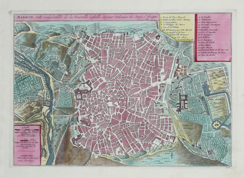
1702réf. LBW-1305Amsterdam Pierre Mortier 1702 227 x 321 mm.
réf. 9940in 12 demi-chagrin vert foncé à nerfs, titre, fers dorés, filets à froid charnière intérieure toile verte. Faux-titre, frontispice, titre illustré, 236 pages, 33 illustrations dans le texte, 1 panorama dépliant de la Mecque. Paris Hachette & Cie 1896.Edition originale. Quelques rousseurs éparses habituelles, sinon très bon état.GERVAIS COURTELLEMONT est un pionnier de la photographie en couleurs, grand voyageur il photographia l’Afrique du nord, la Turquie, l’Espagne, le Portugal, l’Inde, la Chine, l’indo chine…Converti à l’islam, il avait rapporté, en 1896 de la Mecque et de ses environs des photos inédites
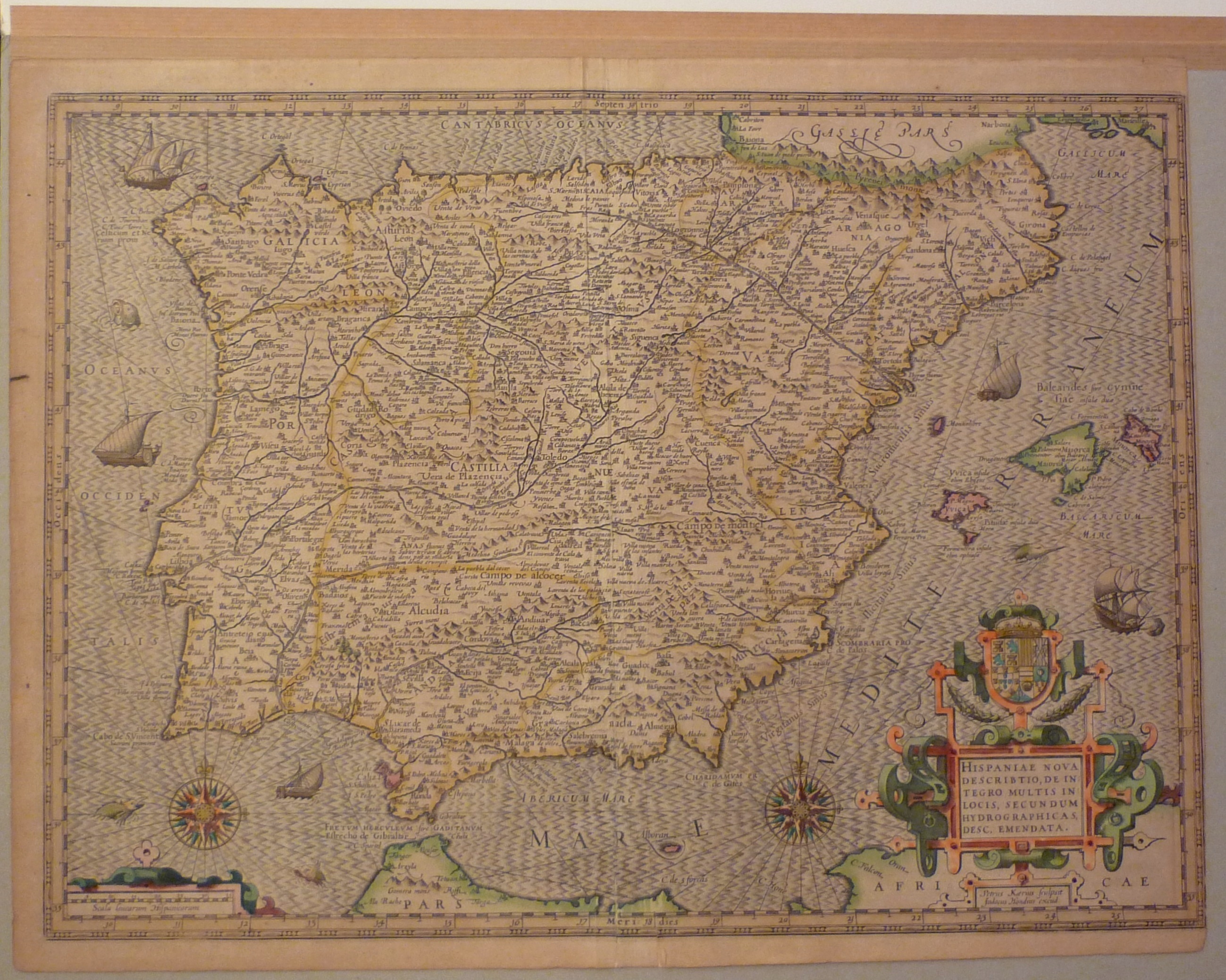
1595réf. 15169BB(Amsterdam, Hondius, 1595). Bildgrösse ohne Rand: 37,5x51,5 cm. Kolorierte Kupferstichkarte mit 2 kol. Rollwerk-Kartuschen am Unterrand. Mit Rand 40x53 cm. Rechts unten knapp beschnitten. Papier gebräunt.
1762In folio (58,5x50 cm). Esemplare in fine coloritura coeva ed in ottime condizioni di conservazione. Magnifica e vivida tiratura di questa celeberrima carta del territorio di del Portogallo e delle colonie brasiliane. La carta fu stampata dal successore e cognato del grande cartografo Matthaus Seutter (sposò una delle figlie di Seutter), il cartografo, editore ed incisore Tobias Conrad Lotter (1717 - 1777). Lotter, si formò alla bottega di Matthaus Seutter per il quale lavorò. Alla morte di Seutter ne rilevò l’attività che portò avanti fino al 1777 anno della sua morte. L’attività passo poi al figlio, Matthias Albrecht Lotter. Tobias Conrad fu uno dei più apprezzati cartografi del settecento. La carta riproduce il territorio di Gibilterra con la rocca. Un bel cartiglio animato, collocato al margine alto sinistro della carta, descrive il contenuto della mappa. Nel margine basso un cartiglio con legenda della carta e la mappa dei possedimenti coloniali portoghesi in Brasile. La carta venne incisa da Georg. Friderich Lotter nel 1762. Opera in bella tiratura ed in ottime condizioni di conservazione.
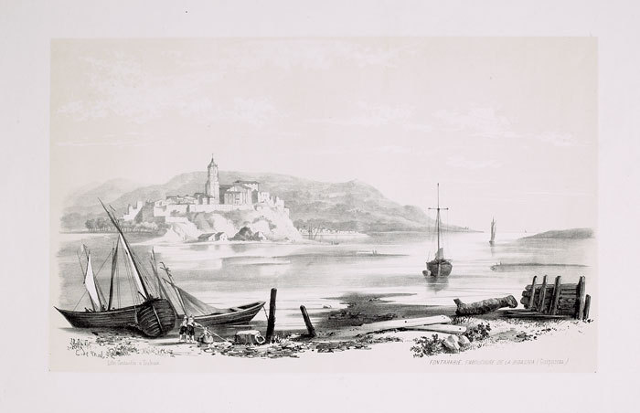
1843réf. LBW-654Toulouse 1843 233 x 398 mm.
1727Carta nautica tratta dal raro Recueil de Plusiereurs Plans des Ports et Rades de la Mer Mediterranée Dediée A Monseigneur le Grand Prieur de France, General des Galeres Levé et Dessigné sur les Lieux par les Srs. Michelot Hydrographe et Pilote Real des Galeres du Roy et Bremond Hydrographe du Roy et de la Ville, avec Pri.ge Du Roy (1727), atlante nautico di 37 tavole, stampato a Marsiglia. I piani nautici sono incisi da Pieter Starckman, uno dei più attivi intagliatori dell’epoca, collaboratore di molti cartografi ed editori. Secondo Shirley [cfr. Maps in the Atlases of the British Library, p. 1234] la prima edizione dell’opera contiene 21 tavole, mentre la ristampa, senza data, contiene 37 tavole delle quali alcune datate 1730. La terza, e ultima, contiene 38 tavole e reca la data 1732. Henry Michelot, dopo il successo riscosso con la pubblicazione della sua guida nautica Le Portulan de Partie de la Mer Méditerranée, ou Le vray Guide des Pilotes Costiers (1703), si unì a Laurent Bremond. All’inizio del XVIII secolo Henry Michelot e Laurens Bremond pubblicarono due importanti atlanti nautici del Mediterraneo e piani nautici ampiamente utilizzati dai naviganti costieri. Le carte sono interessanti e importanti per l’attendibilità derivata dall’esperienza di Michelot che, a differenza dei successivi “geografi del Dépôt des cartes et plans de la Marine” come Jacques-Nicolas Bellin, ha avuto una lunga esperienza in mare. Il primo atlante prodotto contiene 16 carte, su piccola scala, del Mediterraneo e della costa atlantica in prossimità dello stretto di Gibilterra, integrate da una o più profili costieri. Le date delle carte sono comprese tra il 1715 e il 1726; in questo periodo Michelot si firmava come Hydrographe et Pilote Real des Galères du Roy (idrografo e pilota della cambusa reale per il corpo della galea dei re). Poco si sa del co-creatore dell’opera Laurent Bremond. Nella raccolta nautica il suo nome succede sempre a quello di Michelot, e viene qualificato come Hydrographe du Roy et de la Ville (idrografo del re e della città). Bremond sembrerebbe essere stato l’editore e il venditore della raccolta nautica, la forza commerciale della società; titolare di una sorta di negozio vicino al porto. Tutte le carte sono chiaramente contrassegnate: Ce vendent a Marseille chez Laurens Bremond sur le Port au coin de Reboul (venduto a Marsiglia da Laurens Bremond nel porto all’angolo di Reboul). Incisione in rame, in ottimo stato di conservazione. Bibliografia S. Bifolco, Mare Nostrum (2019), pp. 270-271, tav. 122; Palau, 168325. Tooley, 438,80. Nautical chart taken from the rare Recueil de Plusiereurs Plans des Ports et Rades de la Mer Mediterranée Dediée A Monseigneur le Grand Prieur de France, General des Galeres Levé et Dessigné sur les Lieux par les Srs. Michelot Hydrographe et Pilote Real des Galeres du Roy et Bremond Hydrographe du Roy et de la Ville, avec Pri.ge Du Roy (1727), nautical atlas of 37 plates, printed in Marseilles. The nautical plans are engraved by Pieter Starckman, one of the most active engravers of the time, collaborator of many cartographers and publishers. According to Shirley [see Maps in the Atlases of the British Library, p. 1234] the first edition of the work contains 21 plates, while the reprint, undated, contains 37 plates, some of which are dated 1730. The third and last edition contains 38 plates and is dated 1732. Henry Michelot, after the success achieved with the publication of his nautical guide Le Portulan de Partie de la Mer Méditerranée, ou Le vray Guide des Pilotes Costiers (1703), joined Laurent Bremond. In the early 18th century Henry Michelot and Laurens Bremond published two important nautical atlases of the Mediterranean and nautical plans widely used by coastal mariners. The charts are interesting and important for the reliability derived from the experience of Michelot who, unlike later "geographers of the Dépôt des cartes et plans de la Marine" such as Jacques-Nicolas Bellin, had long experience at sea. The first atlas produced contains 16 maps, on a small scale, of the Mediterranean and the Atlantic coast near the Strait of Gibraltar, supplemented by one or more coastal profiles. The dates of the charts are between 1715 and 1726; at this time Michelot signed himself as Hydrographe et Pilote Real des Galères du Roy (hydrographer and pilot of the royal galley for the kings' galley corps). Little is known about the co-creator of the work Laurent Bremond. In the nautical collection his name always succeeds that of Michelot, and he is qualified as Hydrographe du Roy et de la Ville (hydrographer of the king and the city). Bremond would seem to have been the publisher and seller of the nautical collection, the commercial force of the company; owner of a sort of store near the port. All charts are clearly marked: Ce vendent a Marseille chez Laurens Bremond sur le Port au coin de Reboul (sold in Marseille by Laurens Bremond in the port at the corner of Reboul). Copper engraving, in excellent condition. Literature S. Bifolco, Mare Nostrum (2019), pp. 270-271, tav. 122; Palau, 168325. Tooley, 438.80.
1560Carta geografica della Penisola Iberica. Restauri
Barcelona, por Lorenço Déu, 1633. 4to.; 7 hs., 236 ff., 28 hs. y una lámina con el escudo ducal de Segorbe y Cardona. Encuadernación de época, en pergamino.
1902réf. 001736Paris - Lisboa Livraria Aillaud 1902
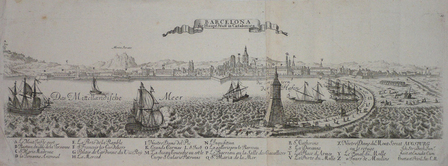
réf. LBW061f5Augsbourg circa 1720 En deux feuilles jointes de 160 x 498 mm.
1889réf. 244951889 Berlin, Wasmuth, 1889-1892.. Erstausgabe, 2°, 4 Bl. 74 S. 120 Taf. in den dicken original Pappmappen mit rotem Leinenrückenstreifen, die Textlieferungen S. 43-74 fehlen, die Mappen und die Blätter nur sehr schwacht altersfleckig, insg. guter Zustand y compris Zweiter Band. Bd. II. (Bd. 2 apart).davon 1 Doppelblatt mit Chromolithographie. Groß-Folio 49 x 33 cm, Halbleinenmappe der Zeit, mit goldgeprägtem Titel, mit großformtigen Abbildungen nach Originalphotographien von Baudenkmälern u.a. aus Valenzia, Batalha, Cordova, Salamanca, Segovia, Sevilla, Toledo, Zaragoza, Santiago da Compostela, Burgos, Guadalajara, Alcala de Henares, Belem bei Lissabon, Alcobaca, Escurial, Madrid, Braga, Porto, Gerona,etc
réf. 193008Paris, Bossange, 1828 2 vol. in-8, [2]-399 pp. et 390 pp., bradel papier vert foncé, pièces de titre, tranches mouchetées de vert (rel. moderne). Rousseurs, petits cernes clairs (T. I).
Lisboa, na officina de Miguel Deslandes, a custa de Antonio Leyte Pereyra, 1686. 4to. 4 hojas, 421 pp. (i.e. 511), seguido de páginas numeradas 146 a 178 (46 pp.). Error de páginación: de la pp. 116 pasa a la pp. 127. Impresión a doble columna. Ejemplar en buen estado. Encuadernación de época en piel, con lomera ornada y tejuelo.
réf. SKU1009897Chivalry Bookshelf. HARDCOVER. VG. Sewn in ribbon marker intact. Binding solid pages a bit toned along top edge but crisp and clean no markings found. Dust jacket bright and shiny with a bit of ruffling along the top light scuffs and dents. Extremities lightly bumped with minimal tip wear. Chivalry Bookshelf hardcover
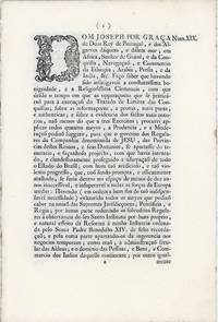
1759réf. 43057Lisboa: Impressa na Secretaria de Estado dos Negocios do Reino 1759. Removed from a larger volume. A very good fresh crisp copy tiny stain to fore edge pinprick to upper margin. 7 1 pp. 11.5 x 8 inches. Issued on the anniversary of the supposed plot against the King of Portugal by the Jesuits the "Lei de expulsão da Companhia de Jesus de Portugal e seus Domínios" of September 3 1759 promugated on October 3 1759 condemned the Jesuits as rebels and traitors banishing them from all Portuguese territiories under pain of death along with anyone who either helped or communicated with them. It was the culmination of a long list of actions by the Marquês de Pombal who was behind these laws and who had written in a letter to Conde de Unhão in February before the law was published that "nothing can be omitted or ought to be omitted to disarm the Jesuits' diabolical machinations so that they may not be reborn and any hidden roots remain in our land." This was reflected in the document which accused the Jesuits of attempting to assassinate the king ruin the kingdom destroy Portugal and "clandestinely pursuing the usurpation of the entire state of Brazil with such an artificial and so violent progress that if it was not promptly and effectively shut down".the Company of Jesus' goal would be accomplished. "within a space of less than ten years and become inaccessible and insurmountable." Dated and signed in print: "Dada no palacio de Nossa Senhora da Ajuda aos tres de setembro de mil setecentos cincoenta e nove. Rey." And then "Lisboa 3 de outubro de 1759 Rodrigo Xavier Alvares de Moura. Foi impressa na Secretaria de Estado dos Negocios do Reino." Printed as Section XIX of "Collecçaõ dos Breves Pontificios e Leys Regias . sobre a liberdade das pessoas . dos Indios do Brasil" Lisbon Impressa na Secretaria de estado por especial ordem de Sua Magestade 1759. See Gauz: Portuguese and Brazilian Books in the John Carter Brown Library 759/1. Impressa na Secretaria de Estado dos Negocios do Reino unknown
1759réf. 43057Lisboa: Impressa na Secretaria de Estado dos Negocios do Reino 1759. Removed from a larger volume. A very good fresh crisp copy tiny stain to fore edge pinprick to upper margin. 7 1 pp. 11.5 x 8 inches. Issued on the anniversary of the supposed plot against the King of Portugal by the Jesuits the "Lei de expulsão da Companhia de Jesus de Portugal e seus Domínios" of September 3 1759 promugated on October 3 1759 condemned the Jesuits as rebels and traitors banishing them from all Portuguese territiories under pain of death along with anyone who either helped or communicated with them. It was the culmination of a long list of actions by the Marquês de Pombal who was behind these laws and who had written in a letter to Conde de Unhão in February before the law was published that "nothing can be omitted or ought to be omitted to disarm the Jesuits' diabolical machinations so that they may not be reborn and any hidden roots remain in our land." This was reflected in the document which accused the Jesuits of attempting to assassinate the king ruin the kingdom destroy Portugal and "clandestinely pursuing the usurpation of the entire state of Brazil with such an artificial and so violent progress that if it was not promptly and effectively shut down".the Company of Jesus' goal would be accomplished. "within a space of less than ten years and become inaccessible and insurmountable." Dated and signed in print: "Dada no palacio de Nossa Senhora da Ajuda aos tres de setembro de mil setecentos cincoenta e nove. Rey." And then "Lisboa 3 de outubro de 1759 Rodrigo Xavier Alvares de Moura. Foi impressa na Secretaria de Estado dos Negocios do Reino." Printed as Section XIX of "Collecçaõ dos Breves Pontificios e Leys Regias . sobre a liberdade das pessoas . dos Indios do Brasil" Lisbon Impressa na Secretaria de estado por especial ordem de Sua Magestade 1759. See Gauz: Portuguese and Brazilian Books in the John Carter Brown Library 759/1. Impressa na Secretaria de Estado dos Negocios do Reino unknown books
1893réf. biblio14First edition. Gurney & Jackson. 1893. Octavo. xx 472pp. Double-page frontispiece map 52 plates further text emgravings. Half calf marbled boards. Marbled endpapers. Spine in six compartments with gilt embellishment leather labels with gilt lettering bound and signed by Sangorski & Sutcliffe. Slight foxing to preliminary pages occasional spotting. From the library of Humphrey Adam Gilbert 1886-1961 of Bishopstone Hereford hunter shooter and fisher; author of a Tale of a Wye Fisherman with his signature dated 1932 to first blank. Gurney & Jackson hardcover
1769réf. 4064Couverture rigide Chez Georges Rey, et Compagnie, Libraires do Poço Novo 1769 20x15 cm
réf. 6708Nova-Goa, Imprensa Nacional, 1862. 1 volume in-8, reliure moderne demi-basane à coins, 248 pp., couvertures imprimées conservées, mais piquées, intérieur propre et frais, bon exemplaire.
Paris, Baudouin Frères, 1827. Cuatro volúmenes en 4to.; 4 hojas, XV pp., 403 pp. y dos facsímiles de documentos, uno de ellos plegado + 2 hojas, 421 pp., 1 h. y dos láminas plegadas + 2 hs., 406 pp. y dos láminas plegadas + 2 hs., 379 pp., dos láminas plegadas y un gran estado plegado. Ejemplar sin el Atlas de mapas. Encuadernación uniforme de época en media piel, con lomeras ornadas con dorados y gofrados en seco y doble tejuelo.
1801réf. 18134Kiel / Helmstädt u. Braunschweig, neue Academische Buchhandlung / Fleckeisen, 1801-04. 8°, XII, 285 Seiten, 1 Blatt; IV, 265 Seiten, 1 Blatt und 1 mehrfach gefaltete, gestochene Karte (Portugal); XVI, 316 Seiten, 1 Blatt. Pappbände der Zeit mit goldgeprägtem Rückenschild und handschriftlichem Rückenschild.