1 388 résultats
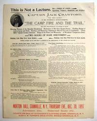
1897réf. 29536New York 1897. Broadsheet 9 1/2" x 12". With a small oval half-tone portrait. On recto at the bottom printed in red: 'Norton Hall Granville N.Y. Thursday Eve. Dec. 30 1897.' Near Fine. A rare announcement of a public entertainment-- "Not a Lecture. But a Budget of Jewels Sparkling Pathetic Humorous and Original"-- by this popular Western hero who on his first outing as a reporter in 1875 promoted the Black Hills Gold Rush. John W. Crawford 1847-1917 was a "poet-scout" who memorialized Custer and Wild Bill Hickok in verse. He "was one of the original discoverers of gold on French Creek in the Black Hills in 1876." After a stint with Buffalo Bill's Wild West Show which he left when he accidentally shot himself in the groin blaming it on Buffalo Bill's drinking he moved to New Mexico to scout for the Army against the Apache. He "did more than any other man in the Territory in bringing before the public the immense mineral wealth of New Mexico." This broadsheet not only publicizes Captain Jack's Entertainment but also promotes "The Capt. Jack Crawford Alaska Prospecting and Mining Co." Testimonials to Crawford are printed here along with an invitation for the recipient to receive a Company prospectus. OCLC 778631567 3- Yale SMU U AK as of February 2023. unknown books
1937réf. 64691London UK: Constable & Co. Ltd. 1937. 8vo. xii 307 1 pp. Photo frontisp. 31 photo plates 1 large folding colour map. Blue publisher’s cloth gilt lettering on spine blue topstain as issued slight foxing to front fore-edge of textblock w/ d.j. photo cover art of Hudson’s adventures 1 minor chip & small closed tear lower fore-edge front cover minor dustsoiling still a VG/VG copy. First edition 1st printing stated of this excellent memoir of the noted Pacific Northwest photographer and cameraman for the Seattle Post-Intelligencer who began shooting his own silent films in 1912 for the International News accompanied the Harvard-Smithsonian Expedition to the Arctic on board the Polar Bear under Captain Louis Lane filming the trip. The trip was unsuccessful as the Polar Bear became trapped in the ice and they had to hike out to safety at the same time reporting on the safety of the crew of the Karluk which had also gone missing. His account of the expedition with photo made the New York Times front page. Hudson 1877-1945 was also well-known for his photographs in china photographic studio in Pullman WA as well as the earliest known surviving moving picture footage of the 1909 Alaska-Yukon-Pacific Exposition in Seattle. See: The Will Hudson Collection Will E. Hudson: Dean of Newsreel Men Whatcom Museum 2004; Ebbert Webber Dora Orlett Lobaugh Hudson Papers 1877-1959 WSU Libraries Manuscripts Archives & Spec. Coll. Cage 100 Finding Aid 2012. Constable & Co., Ltd., hardcover
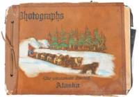
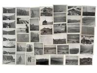
1945réf. 191491945. Alaska photograph album of United States Army troops stationed near Seward Alaska circa 1945 documenting military life and operations in a strategic northern deployment during the closing period of World War II. The material provides primary visual evidence of troop activity infrastructure development and social life within a remote military environment supporting research into wartime logistics soldier experience and the role of Alaska in U.S. military defense during the conflict. Photograph album containing 58 black and white silver gelatin prints most measuring approximately 3.5 x 6 inches depicting soldiers engaged in both formal and informal activities. Images include groups of men standing at attention with rifles constructing wooden buildings in rugged terrain and participating in daily routines within camp settings. A series of photographs documents a dance event for troops featuring a jazz band with music stands marked "153" alongside an emblem suggesting a possible connection to the 153rd Infantry Regiment which was stationed in Alaska during the period. Additional images show steamships including the S.S. Baranof S.S. Alaska S.S. Denali and S.S. Columbia navigating the Inside Passage and areas near Taku Glacier indicating transportation and supply routes. The album also contains a "memory leaves" section with handwritten notes and addresses from fellow servicemen reflecting interpersonal networks and efforts to maintain contact beyond deployment. 58 photographs mounted in an album with decorated leather covers featuring a hand-painted image of Alaskan sled dogs titled "The Malamute Limited." During World War II Alaska served as a critical military zone due to its geographic proximity to the Pacific theater with troop deployments focused on defense infrastructure and logistics in challenging environmental conditions. This album captures both operational and social dimensions of that presence including labor recreation and movement through the region. Light handling wear to album and photographs contents well-preserved; overall very good condition. A cohesive and detailed visual record of U.S. Army life in wartime Alaska. unknown
1945réf. 191491945. Alaska photograph album of United States Army troops stationed near Seward Alaska circa 1945 documenting military life and operations in a strategic northern deployment during the closing period of World War II. The material provides primary visual evidence of troop activity infrastructure development and social life within a remote military environment supporting research into wartime logistics soldier experience and the role of Alaska in U.S. military defense during the conflict. Photograph album containing 58 black and white silver gelatin prints most measuring approximately 3.5 x 6 inches depicting soldiers engaged in both formal and informal activities. Images include groups of men standing at attention with rifles constructing wooden buildings in rugged terrain and participating in daily routines within camp settings. A series of photographs documents a dance event for troops featuring a jazz band with music stands marked "153" alongside an emblem suggesting a possible connection to the 153rd Infantry Regiment which was stationed in Alaska during the period. Additional images show steamships including the S.S. Baranof S.S. Alaska S.S. Denali and S.S. Columbia navigating the Inside Passage and areas near Taku Glacier indicating transportation and supply routes. The album also contains a "memory leaves" section with handwritten notes and addresses from fellow servicemen reflecting interpersonal networks and efforts to maintain contact beyond deployment. 58 photographs mounted in an album with decorated leather covers featuring a hand-painted image of Alaskan sled dogs titled "The Malamute Limited." During World War II Alaska served as a critical military zone due to its geographic proximity to the Pacific theater with troop deployments focused on defense infrastructure and logistics in challenging environmental conditions. This album captures both operational and social dimensions of that presence including labor recreation and movement through the region. Light handling wear to album and photographs contents well-preserved; overall very good condition. A cohesive and detailed visual record of U.S. Army life in wartime Alaska. unknown books
1917réf. List1730Chicago: Poole Brothers 1917. Folding map measuring 38 ½ x 26 ¾ inches. Tape repairs to verso some tears at folds and edges still bring and attractive good to very good overall with excellent restoration potential. A map of the canneries in Alaska British Columbia and Washington operated by the Deming and Gould Company who were influential in the growth of the Alaskan salmon trade. The map's date of printing 1917 suggests that perhaps it was related to the war effort as salmon demand increased during this period. The Demings based in Chicago were influential in the growth of the salmon trade in Alaska and the Pacific Northwest founding Pacific American Fisheries Inc. in 1899 and continuing in various iterations until their sale of the firm in 1934 due to president E.B. Deming's ailing health. The map shows seventeen different canneries several on the Alaska peninsula and the one in Bellingham. We find no record of this imprint only a later and small version held at the University of Washington. Poole Brothers unknown
1917réf. List1730Chicago: Poole Brothers 1917. Folding map measuring 38 ½ x 26 ¾ inches. Tape repairs to verso some tears at folds and edges still bring and attractive good to very good overall with excellent restoration potential. A map of the canneries in Alaska British Columbia and Washington operated by the Deming and Gould Company who were influential in the growth of the Alaskan salmon trade. The map's date of printing 1917 suggests that perhaps it was related to the war effort as salmon demand increased during this period. The Demings based in Chicago were influential in the growth of the salmon trade in Alaska and the Pacific Northwest founding Pacific American Fisheries Inc. in 1899 and continuing in various iterations until their sale of the firm in 1934 due to president E.B. Deming's ailing health. The map shows seventeen different canneries several on the Alaska peninsula and the one in Bellingham. We find no record of this imprint only a later and small version held at the University of Washington. Poole Brothers unknown books
réf. 4499KODIAK ALASKA HUNTING PHOTOGRAPH ARCHIVE. An archive of nearly 100 black and white photographs emanating from a mens hunting trip to Kodiak Alaska about 1950. There are images of men with fishing rods and rifles and dead bears crabs fish moose and seals. Some photographs show the men inside the cabin relaxing reading sleeping and cooking. There are also photographs of the early planes that brought tourists Alaskan scenery and small Alaskan towns. The images are in three sizes 5 x 7 5 x 3 and 2 x 4 and all are in fine condition with minor faults such as chipped corners. A fine frontier photography archive. unknown
réf. 4499KODIAK ALASKA HUNTING PHOTOGRAPH ARCHIVE. An archive of nearly 100 black and white photographs emanating from a mens hunting trip to Kodiak Alaska about 1950. There are images of men with fishing rods and rifles and dead bears crabs fish moose and seals. Some photographs show the men inside the cabin relaxing reading sleeping and cooking. There are also photographs of the early planes that brought tourists Alaskan scenery and small Alaskan towns. The images are in three sizes 5 x 7 5 x 3 and 2 x 4 and all are in fine condition with minor faults such as chipped corners. A fine frontier photography archive. unknown books
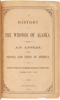
1875réf. 18480San Francisco. 1875. Fighting the Fur Seal Monopoly in Alaska A propagandistic appeal by the unsuccessful bidders for a fur seal contract for the repeal of the so-called monopoly of the Alaska Commercial Company. Claims to present only the "facts" and calls on the people and press of America to petition Congress for the repeal the government granted to the Company for a monopoly in the fur seal trade. Includes a brief historical sketch of Alaska focusing on how her natural riches came into the hands of a few money-hungry robber barons and paints a dismal picture of the "serfdom" of the civilized natives on the fur seal islands of St. George and St. Paul. Original printed front wrapper bound into modern half morocco and marbled boards. Light staining to wrapper internally quite clean. A very good copy. TOURVILLE 269. RICKS p.26. WICKERSHAM 1793. hardcover
1875réf. 18480San Francisco. 1875. Fighting the Fur Seal Monopoly in Alaska A propagandistic appeal by the unsuccessful bidders for a fur seal contract for the repeal of the so-called monopoly of the Alaska Commercial Company. Claims to present only the "facts" and calls on the people and press of America to petition Congress for the repeal the government granted to the Company for a monopoly in the fur seal trade. Includes a brief historical sketch of Alaska focusing on how her natural riches came into the hands of a few money-hungry robber barons and paints a dismal picture of the "serfdom" of the civilized natives on the fur seal islands of St. George and St. Paul. Original printed front wrapper bound into modern half morocco and marbled boards. Light staining to wrapper internally quite clean. A very good copy. TOURVILLE 269. RICKS p.26. WICKERSHAM 1793. hardcover books
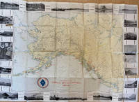
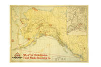
1939réf. 286138Seattle: Farwest Lithograph and Printing Co 1939. Map. Color Lithograph. 21" x 28". This beautifully colored map of Alaska and the Gulf of Alaska shows the Alaskan boat lines from Seattle and was first drawn by Edward Camy for the Alaska Steamship Company in 1934. A great pictographic map includes an inset showing the Alaska Railways route from Seward to Fairbanks and the Richardson Automobile Highway. The bottom of the map shows a series of cartoons of events on the ship. In good condition a great example of Alaska. Farwest Lithograph and Printing Co unknown
1939réf. 286138Seattle: Farwest Lithograph and Printing Co 1939. Map. Color Lithograph. 21" x 28". This beautifully colored map of Alaska and the Gulf of Alaska shows the Alaskan boat lines from Seattle and was first drawn by Edward Camy for the Alaska Steamship Company in 1934. A great pictographic map includes an inset showing the Alaska Railways route from Seward to Fairbanks and the Richardson Automobile Highway. The bottom of the map shows a series of cartoons of events on the ship. In good condition a great example of Alaska. Farwest Lithograph and Printing Co unknown books
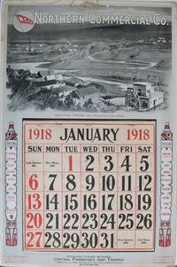
1918réf. 137331San Francisco: International Printing Co. 1918. Undetermined. very good. Colour calendar on heavy cardstock. 21" X 14". Occasional very light chipping and to edges. Corners bumped with some creasing. A few other light creases to edges. Full calendar pad Jan - Dec present with penciled notation in most days. Original string hanger present. Colours bright and unfaded. This poster is in very good condition. A scarce advertising calendar for the Northern Commercial Company N.C.Co. a retail company which maintained rural village stores across Alaska and in the Yukon. N.C.Co also operated steamships through Alaskan trade routes. The image on the poster features mining at Iditarod Alaska. Two totem poles on either side of the calendar pad list several stations of the N.C.Co. including Fairbanks Dawson Yukon Territory Bettles Iditarod and many others. The verso of the calendar is a full-page map of Alaska showing sea routes and locations of N.C.Co posts. A later incarnation of the business still maintains 30 stores across rural Alaska. See two other examples in this catalogue. 1918 International Printing Co. unknown
Three different formats. Thirteen photographs. Original photographs, black-white. Mostly full-page format, without a framing. With commentaries at the back sides (Swedish Language). Photographs with some minor crinkles at corners and little rubbing. Partly a bit faded at the edges but mostly still with good contrasts. Paper is a bit bent. Appropriate to its age and origin still in good condition. The thirteen photographs include different views on the former copper smelting town Hadley at the Prince of Wales Island (Alaska, US). In Hadley once the mined copper ores have been melted and processed, later the extracted copper was shipped to other places. The photographs exist in three different formats: a small one (ca. 16,4 x 21,5 cm), a middle size (ca. 19,1 x 24,1 cm) and a bigger format (ca. 20 x 25,2 cm). The black-white photographs still own their contrast although a few of them are fading a little bit at the edges. The thirteen photographs give us very different perspectives on this historical place: smelter buildings seen from the near and distanced overviews from a ship. Detailled views on the pier with rails, on a building in construction (in snow), on a ship at the pier and on a cleared piece of land probably for new buildings. One photograph is even showing one of the ships (for travelling) called "Marion". A main overview owns a small stamp and note at the front: "Alaska Smelting & Refining Co. / General View Smelter Buildings". Most of the photographs own commentaries on the back sides in swedish language. Some with two or three lines, a few with ten lines of text (Please see the given fotografic examples). The photographs very probably have been made by a swedish engineer working at Hadley. There has been copper mining and extracting in Sweden long before Alaska became a part of the US. One photograph shows two little girls with blond hair staying in the wood. It seems to be a family portrait, maybe they have been the daughters of this swedish man. There is also an envelope (newer one by Svenska Handelsbanken) with the handwritten swedish title: "Fotografier fran Hadley Alaska". Very rare historical material from Alaska in the first two decades of the 20th century!
1930réf. 3726Juneau Ak.: Winter & Pond 1930. Good. Panoramic photograph 10 x 34.5 inches. A few heavy creases a handful of short closed tears minor surface soiling and rubbing. An early-20th century panoramic image showing the development of the Alaskan capital city of Juneau produced by prolific local studio Winter & Pond. The image features the downtown portion of Juneau complete with paved streets telephone and electrical wires and hundreds of houses set between nearby Mount Juneau and the Gastineau Channel. "Lloyd Winter and Percy Pond preserved the legacy of Alaska's past through their photographs taken over a period of 50 years. The studios of Winter and Pond Company in Juneau Alaska provided local residents and visitors with a rich perspective of Alaska that is now considered a unique reflection of the state in the early 20th century. During the company's existence Alaska expanded mining fishing and resource development into profitable ventures that transformed it from a frontier district to a thriving territory of the United States. The portraits that Winter and Pond produced show the diversity of Alaska's people through the years from the gold rush of the Klondike in 1898 to the end of the mining operations in the Juneau Gold Belt District during the 1940s" - Alaska State Library's Historical Note for the Winter and Pond Collection. OCLC reports a few different Winter & Pond views of Juneau from 1909 to 1928 with the present example likely dating from a bit later but nonetheless rare. Winter & Pond unknown
1930réf. 3726Juneau Ak.: Winter & Pond 1930. Good. Panoramic photograph 10 x 34.5 inches. A few heavy creases a handful of short closed tears minor surface soiling and rubbing. An early-20th century panoramic image showing the development of the Alaskan capital city of Juneau produced by prolific local studio Winter & Pond. The image features the downtown portion of Juneau complete with paved streets telephone and electrical wires and hundreds of houses set between nearby Mount Juneau and the Gastineau Channel. "Lloyd Winter and Percy Pond preserved the legacy of Alaska's past through their photographs taken over a period of 50 years. The studios of Winter and Pond Company in Juneau Alaska provided local residents and visitors with a rich perspective of Alaska that is now considered a unique reflection of the state in the early 20th century. During the company's existence Alaska expanded mining fishing and resource development into profitable ventures that transformed it from a frontier district to a thriving territory of the United States. The portraits that Winter and Pond produced show the diversity of Alaska's people through the years from the gold rush of the Klondike in 1898 to the end of the mining operations in the Juneau Gold Belt District during the 1940s" - Alaska State Library's Historical Note for the Winter and Pond Collection. OCLC reports a few different Winter & Pond views of Juneau from 1909 to 1928 with the present example likely dating from a bit later but nonetheless rare. Winter & Pond unknown books
1942réf. 218151942. Photograph archive circa 1920s-1944 documenting the construction of the Alaska Highway and related military infrastructure during World War II. The material records wartime military logistics and infrastructure development through photographs of road construction engineering operations heavy machinery and military transport routes in Alaska and western Canada during the war. The photographs include terrain modification machinery deployment bridge construction and coordinated labor by military and civilian crews working under wartime conditions. Archive comprises 30 black-and-white photographs including approximately 21 captioned images issued by the Public Roads Administration and War Information Board dating from circa 1942-1944 alongside 10 earlier vernacular snapshots from the 1920s-1930s. Sizes range from approximately 2.5 x 1.5 inches to 5.5 x 3.5 inches. Official photographs depict graded roadways cutting through mountainous and forested terrain heavy machinery including tractors and graders clearing timber and earth and crews working in challenging conditions such as permafrost excavation. Several images show pontoon bridges early roadbeds and military vehicles including jeeps and convoys positioned along newly constructed routes. Captions reference wartime labor and engineering activity. Vernacular photographs depict earlier regional life including individuals traveling by sled posing with fish working in sawmills and operating equipment. Additional scenes include a Chinese barber shaving a client and frontier couples posed outdoors with handwritten verso captions referencing locations such as Juneau and Valdez. The photographs record the rapid development of the Alaska Highway following the strategic urgency created by World War II particularly after the attack on Pearl Harbor and military concerns in the Aleutian region. Official photographs focus on wartime infrastructure projects while the vernacular photographs record prewar labor and daily life in Alaska and the Yukon. The archive includes military construction transportation systems sawmill labor travel and regional commercial activity before and during wartime expansion. Light curling and handling wear to vernacular photographs; minor edge wear and occasional markings to official prints; overall very good condition. A visual archive of wartime engineering and northern frontier life during a period of military expansion. unknown
1942réf. 218151942. Photograph archive circa 1920s-1944 documenting the construction of the Alaska Highway and related military infrastructure during World War II. The material records wartime military logistics and infrastructure development through photographs of road construction engineering operations heavy machinery and military transport routes in Alaska and western Canada during the war. The photographs include terrain modification machinery deployment bridge construction and coordinated labor by military and civilian crews working under wartime conditions. Archive comprises 30 black-and-white photographs including approximately 21 captioned images issued by the Public Roads Administration and War Information Board dating from circa 1942-1944 alongside 10 earlier vernacular snapshots from the 1920s-1930s. Sizes range from approximately 2.5 x 1.5 inches to 5.5 x 3.5 inches. Official photographs depict graded roadways cutting through mountainous and forested terrain heavy machinery including tractors and graders clearing timber and earth and crews working in challenging conditions such as permafrost excavation. Several images show pontoon bridges early roadbeds and military vehicles including jeeps and convoys positioned along newly constructed routes. Captions reference wartime labor and engineering activity. Vernacular photographs depict earlier regional life including individuals traveling by sled posing with fish working in sawmills and operating equipment. Additional scenes include a Chinese barber shaving a client and frontier couples posed outdoors with handwritten verso captions referencing locations such as Juneau and Valdez. The photographs record the rapid development of the Alaska Highway following the strategic urgency created by World War II particularly after the attack on Pearl Harbor and military concerns in the Aleutian region. Official photographs focus on wartime infrastructure projects while the vernacular photographs record prewar labor and daily life in Alaska and the Yukon. The archive includes military construction transportation systems sawmill labor travel and regional commercial activity before and during wartime expansion. Light curling and handling wear to vernacular photographs; minor edge wear and occasional markings to official prints; overall very good condition. A visual archive of wartime engineering and northern frontier life during a period of military expansion. unknown books
1945réf. 215781945. AArchive of 64 original black-and-white photographs documenting American military operations and engineering activities in the Aleutian Islands during World War II. Photographs measure approximately 4.5" x 3.5" and provide an extensive visual record of one of the most remote and environmentally challenging theaters of the war. The images chronicle the daily work of U.S. Army personnel and Army Engineers stationed across the Aleutian chain where military forces confronted not only the threat of enemy action but also some of the harshest conditions faced by American troops anywhere during the conflict. Soldiers appear throughout the archive wearing cold-weather gear field jackets heavy boots and M1 steel helmets while working patrolling and constructing infrastructure amid windswept volcanic landscapes. A significant portion of the collection documents the enormous logistical effort required to sustain military operations in the islands. Engineers are shown surveying terrain operating equipment cutting and processing timber and building facilities essential to maintaining isolated military outposts. Several striking photographs depict large timber-log chutes descending steep hillsides toward the shoreline apparently designed to move heavy equipment and supplies through terrain where conventional transportation proved difficult. Other images record lumber operations construction projects and the continual adaptation of military infrastructure to the rugged environment. The archive also contains numerous panoramic views of the Aleutian landscape itself. Snow-covered mountains barren volcanic ridges isolated coastlines glacial valleys and treeless tundra dominate many photographs illustrating why the campaign became as much a battle against geography and weather as against enemy forces. The Aleutian chain stretching deep into the North Pacific and containing dozens of active and dormant volcanoes represented one of the most isolated regions under American military control during the war. Naval and maritime operations are likewise represented. Several photographs show transport and supply vessels anchored offshore or approaching remote coastal installations highlighting the dependence of Aleutian bases upon sea-borne logistics. Military camps consisting of Quonset huts and tent encampments appear throughout the collection while one particularly notable image captures an aircraft flying above a military installation underscoring the importance of aerial reconnaissance and patrol operations in protecting the northern approaches to Alaska. Although often overshadowed by campaigns in Europe and the Central Pacific the Aleutian campaign held considerable strategic importance. Following the Japanese occupation of Attu and Kiska in 1942 American forces undertook a costly effort to secure the islands and maintain control of the northern Pacific. These photographs document the infrastructure manpower and determination required to operate in a theater where extreme weather isolation and difficult terrain shaped every aspect of military life. A substantial and visually compelling archive documenting the engineering logistical and environmental realities of America's northernmost front during World War II. Photographs remain in very good condition with minor surface wear and occasional light creasing. unknown
1945réf. 215781945. AArchive of 64 original black-and-white photographs documenting American military operations and engineering activities in the Aleutian Islands during World War II. Photographs measure approximately 4.5" x 3.5" and provide an extensive visual record of one of the most remote and environmentally challenging theaters of the war. The images chronicle the daily work of U.S. Army personnel and Army Engineers stationed across the Aleutian chain where military forces confronted not only the threat of enemy action but also some of the harshest conditions faced by American troops anywhere during the conflict. Soldiers appear throughout the archive wearing cold-weather gear field jackets heavy boots and M1 steel helmets while working patrolling and constructing infrastructure amid windswept volcanic landscapes. A significant portion of the collection documents the enormous logistical effort required to sustain military operations in the islands. Engineers are shown surveying terrain operating equipment cutting and processing timber and building facilities essential to maintaining isolated military outposts. Several striking photographs depict large timber-log chutes descending steep hillsides toward the shoreline apparently designed to move heavy equipment and supplies through terrain where conventional transportation proved difficult. Other images record lumber operations construction projects and the continual adaptation of military infrastructure to the rugged environment. The archive also contains numerous panoramic views of the Aleutian landscape itself. Snow-covered mountains barren volcanic ridges isolated coastlines glacial valleys and treeless tundra dominate many photographs illustrating why the campaign became as much a battle against geography and weather as against enemy forces. The Aleutian chain stretching deep into the North Pacific and containing dozens of active and dormant volcanoes represented one of the most isolated regions under American military control during the war. Naval and maritime operations are likewise represented. Several photographs show transport and supply vessels anchored offshore or approaching remote coastal installations highlighting the dependence of Aleutian bases upon sea-borne logistics. Military camps consisting of Quonset huts and tent encampments appear throughout the collection while one particularly notable image captures an aircraft flying above a military installation underscoring the importance of aerial reconnaissance and patrol operations in protecting the northern approaches to Alaska. Although often overshadowed by campaigns in Europe and the Central Pacific the Aleutian campaign held considerable strategic importance. Following the Japanese occupation of Attu and Kiska in 1942 American forces undertook a costly effort to secure the islands and maintain control of the northern Pacific. These photographs document the infrastructure manpower and determination required to operate in a theater where extreme weather isolation and difficult terrain shaped every aspect of military life. A substantial and visually compelling archive documenting the engineering logistical and environmental realities of America's northernmost front during World War II. Photographs remain in very good condition with minor surface wear and occasional light creasing. unknown books
1922Abundant black and white illustrations and reproductions of photos. Features: The Human Fly - Excellent photo-illustrated article on Jack Williams, a man who scales lofty buildings with no equipment other than his fingers and toes - article with great photos ; The Last Fight of the Five Hundred - Part II - Tragedy befalls French troops overwhelmed by the overwhelming force of Mustapha Kemal Pasha's rebel Kurds and Turks during the siege of Urfa; The Disappearance of Ivan Varlamoff - an epic fight in Uleaborg, Finland; Locked in a Freezing Chamber - a meat inspector's ordeal in South Africa; "UMRI" - the tragic story of a panther, once a police officer's pet, which becomes a terror of the district in India; The "White Man's Grave" - Filming The "Gold Coast" of Africa - article with great photos; The Friend of the Birds - photo-illustrated article on Jack Miner, Ontario's friend of the Canada Goose; My Jiu-Jitsu Combats - Captain S.L. McLaglen is a Jiu-Jitsu expert; A Treasure-Hunt in the Land of Thirst - Part III - an exciting trip to the "Mysterious Richtersveld" of Southern Africa - article with photos; Adrift in the Atlantic - Grenfell of Labrador sets down a remarkable experience related by a former engineer of his; A Man's Luck (conclusion) - the author met the girl of his dreams and tried to build a dream home for them in Alaska, but he keeps being jailed; A Film-Hunter in the Amazon - Part V - Probably the most adventurous expedition ever undertaken in the interests of the movies - article with excellent photos; The "King of the Brushwood" - the brigand chief of Corsica; Roping a Bear - foolish youngster ropes a cinnamon bear; A Barbed Wire Frontier - people not allowed to pass between Hungary and Czechoslovakia; and more. pp. 8 [ads], [3] 88, 9-16 [ads]. Clean and unmarked with light wear. A quality vintage copy of this wonderful issue. Book
1922Abundant black and white illustrations and reproductions of photos. Features: The Last Fight of the Great Green Eel - three-day battle with a Conger eel in Trinidad; De Rougemont Right After All! - Shortly after his passing, the incredible stories by Louis de Rougement of adventures with the wild blacks (aborigines) of Australia are proven true! - article with great photos; The Lure of the Jewel - The Forcing of the Duke of Brunswick's safe; Crossed Trails - A remarkable tale of linked lives; The Midnight Visitor - A grim tale of the famous North-West Mounted Police of Canada; Trapped in a Well - two men in Nebraska set out to deepen a well; The Moffat County Mystery - an odd tale from Colorado; A Film-Hunter on the Amazon - Part II - Probably the most adventurous expedition ever undertaken in the interest of film-making - article with interesting photos; A Christmas Hunt in East Africa - sometimes 'exiles' can have a good Christmas; A Double Escape a thrilling royal tiger hunt in India; A Man's Luck - Part V - the true story of a man who set out to build an Alaskan home for the girl of his dream but kept being jailed; The Accursed Lake - The strange story of David Burton and Charles Snisted in New Zealand; The Living Death - an explorer's grim story from the South American jungle; Anthropop - Apology; and more. pp. 8 [ads], [2] 268-351, 9-16 [ads]. Clean and unmarked with light wear. A quality vintage copy of this wonderful issue. Book
1928réf. 022784Paris Éditions MORNAY 1928 un volume in-4°, (10) 237 pp., couverture crème illustrée en couleur. (entaille de 5cm en milieu de couverture, dos fendu en plusieurs endroits, bruni en queue et comportant trois petits manques de papier). 123 compositions ( vignette de titre, frontispice, très nombreuses lettrines, culs-de-lampe et ornements ) rehaussées à la main à la gouache et à l'aquarelle de Clarence GAGNON. Un des plus beaux livres publiés aux éditions Mornay. Tirage limité à 725 exemplaires numérotés, un des 650 sur Rives (n° 288). Intérieur très frais. Exemplaire à relier.
1917réf. 37386Chicago: Poole Bros. 1917. 1917. ALASKA. First edition. A full-color folded map of Alaska showing both the coastal and seagoing routes that leave from Seattle to Alaska by the Alaska Steamship Company. Points of interest are indicated in red and include the Klondike Region Fairbanks Gold Placers Mt. McKinley National Park Kennecott Copper Mines etc. In the upper right corner is an 11" x 8" inset black & white map of the Copper River & Northwestern RY. and the Alaska Railroad showing Copper River Region in Alaska Prince William Sound the Richardson Automobile Highway Mt. McKinley National Park and Government Telegraph Line and Tributary Territory. Map has a few tears at folds some soiling to the map's surface and general wear from handling and use. Overall a good map of Alaska. Poole Bros., 1917. unknown
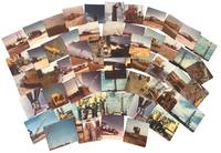
1966réf. 233371966. Cook Inlet offshore drilling photo archive of 57 chromogenic color photographs documenting the transport assembly and field operation of oil platform equipment in Alaska in 1966 including derrick sections drill pipe draw works components service trucks staging yards flare fire and rig floor assembly during the period when offshore construction expanded rapidly across the basin between 1964 and 1968. Alaska's first offshore platform was erected in Cook Inlet in 1964 exploration drilling peaked in 1966 and the photographs place the group within the short formative period when Cook Inlet became the proving ground for Alaska's offshore petroleum industry. The photographs record named individuals large platform components drill pipe derrick sections service trucks and specialized machinery moving from yard to worksite and from transport into operation. Photo archive of 57 chromogenic color photographs Kodacolor snapshot prints ranging from 3.5 x 3.5 to 3.5 x 4.5 inches Cook Inlet Alaska 1966. The derrick and draw works sections are hauled on heavy trucks across dirt roads rig components unloaded in open staging yards drill pipe rising within the derrick structure and crews in hard hats and work clothes working at the base of drilling machinery. Several photographs isolate specific stages of petroleum work rather than completed structures including a float identified on the verso as "Flatt & Doghouse" a "Tool box & work area on float" machinery captioned "Unloading Draworks from our truck #103 to Gary Bobs Road truck" pipe identified as "13000 ft pipe in deric" and repeated views of muddy haul roads flare fire active equipment and rig floor assembly from both elevated and ground level vantage points. The versos preserve contemporaneous functional captions and named personnel including "Front view with Jerry Blackwood driving" "Little Red & Ramdro discussing plans" "Putting Deric on the floor" "two trucking the Deric" "Bottom 1/2 of the Deric. This is the way we haul it" and "My truck hauling top 1/2 deric pulled over for the day too muddy to proceed to location" giving the archive unusual specificity at the level of individual labor and task sequence. A yard sign for Canadian Superior places part of the group within the corporate landscape of Cook Inlet petroleum development. Cook Inlet's offshore fields were the first large scale petroleum infrastructure projects in Alaska waters and the photographs preserve the hauling stages yard transfer pipe handling rig erection truck transport and field conditions through which the basin moved from exploration into sustained production. Named workers truck numbers hauling stages yard transfer pipe handling rig erection and field conditions place the group within the daily labor structure of offshore oil development rather than in finished platform views alone. The seller's Spurr attribution merits caution since later platform compendia place Platform Spurr in Trading Bay in 1968 but that discrepancy does not alter the archive's value as a 1966 record of Cook Inlet drilling logistics and offshore construction practice. Front surfaces show scattered paper residue or adhesion from prior storage with light wear minor discoloration and ordinary handling marks. Overall good condition. A 1966 Cook Inlet drilling archive centered on truck haulage derrick assembly pipe handling named workers and offshore construction logistics during the basin's first major oil boom. unknown