Hults, AlaskaBiblio.com
1 450 résultats
réf. 1591981247.Gpaperback. Good. Access codes and supplements are not guaranteed with used items. May be an ex-library book. paperback
2000réf. mon0000002277Univ of Washington Pr 2000T. paperback. Very Good. 0.2500 in x 11.2500 in x 8.7500 in. 1st edition. Paperback. General wear but clean and solid. Ships from a smoke-free home. Hand-wrapped and packaged in cardboard. Univ of Washington Pr paperback
réf. DADAX1878425757New unknown
réf. DADAX0548085951New unknown
réf. DADAX0964568276New unknown
1988réf. Q-0899091865Alaska Publishing Properties 1988-01-01. Paperback. New. In shrink wrap. Looks like an interesting title! Alaska Publishing Properties paperback
réf. 0882402102.Gpaperback. Good. Access codes and supplements are not guaranteed with used items. May be an ex-library book. paperback
1983réf. Q-0882402293Alaska Northwest Books 1983-09-01. Paperback. New. In shrink wrap. Looks like an interesting title! Alaska Northwest Books paperback
réf. SONG1889963089Used: Good unknown
2013réf. DADAX1304117383Lulu.com 2013-06-08. null. paperback. New. 8.50x0.60x10.98. Buy with confidence. Excellent Customer Service & Return policy. Lulu.com paperback
réf. a104032Palmer Alaska. 2008 first edition. Matanuska Susitna Borough. 133 color arial maps. Oblong large folio - 11 x 18 inches. Plastic spiral binding. VG maps are in Fine condition. from a non-circulating depository library so light library markings. . unknown
réf. DADAX1589016629New unknown
1995réf. Q-0882404709Alaska Northwest Books 1995-11-01. Paperback. New. In shrink wrap. Looks like an interesting title! Alaska Northwest Books paperback
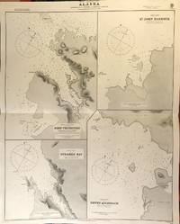
réf. 56417London: British Admiralty 1890 1925. . An engraved chart on heavy stock uncolored sheet size 27 x 34 inches. Published 2nd Aug. 1890; Small corrections printed to 1925 and mss. to 1927. Original horizontal fold a nice clean copy small additions in red pen. In lower right: "Engraved by Edwd. Weller". Chart number is 1433. Small typed label on verso giving chart & folio info. Published under the Superintendence of Captain W.J.L. Wharton. Four charts: Port Protection Steamer Bay St. John Harbour and Dewey Anchorage. Currently residents of Port Protection are featured in the National Geographic Channel reality series: Life Below Zero: Port Protection and its spinoff: Lawless Island. London: British Admiralty, 1890 (1925). unknown
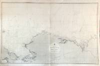
réf. 56479London: British Admiralty 1856 1932. An engraved chart on heavy stock uncolored sheet size 40 x 27.5 inches. Published Febr. 20th 1856; New Edition Dec. 1908. Large Corrections to Sept. 1932. Original vertical fold a very good copy some light wrinkling a few additions in red and some route marks in pencil. In lower right: "Engraved 1856". Chart number is 2435. Small typed label on verso giving chart & folio info. A large-scale chart extending from the Chukchi Peninsula in Asia to Liverpool Bay and Cape Bathurst in the Canadian Arctic. The course of the Mackenzie River is shown as well as the Porcupine River and Yukon River. The tip of Wrangell Island is shown at the left edge. London: British Admiralty, 1856 (1932). unknown
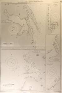
réf. 56413London: British Admiralty 1894 1928. . An engraved chart on heavy stock uncolored sheet size 27.5 x 40 inches. Published 6th August 1894; New Edition Aug. 1898; Large Corrections 14th Sept. 1928; Small corrections mss. to 1929. Clean and attractive original horizontal fold some small additions in red pen. In lower right: "Engraved by Edwd. Weller". Chart number is 2110. Small typed label on verso giving chart & folio info. Published under the Superintendence of Captain W.J.L. Wharton. Five anchorages in Frederick Sound and Clarence Strait: large plans of Gambier Bay and Port Chester; smaller plans of Woewodski and Eliza Harbours Fanshaw Bay and Cleveland Passage and Chasina Anchorage. First published 1894 this is a printing of 1928. London: British Admiralty, 1894 (1928). unknown
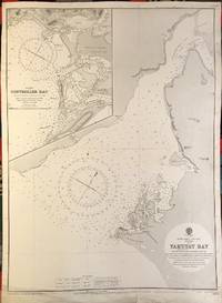
réf. 56391London: British Admiralty 1902 1922. . An engraved chart on heavy stock uncolored sheet size 20 x 27.5 inches. Published 13th Dec. 1902; New Edition 8th Jan. 1915. Small corrections printed to 1922 and mss. to 1929. Unfolded. Some wear and a short tears to lower margin basically clean and very good some revisions and additions in red pen. In lower right: "Engraved by Davies & Company". Chart number is 3313. Small typed label on verso giving chart & folio info. Published under the Superintendence of Rear Admiral Sir W.J.L. Wharton. Inset map of Controller Bay. Yakutat Bay has had various names; James Cook called it "Bering Bay" as indicated on this chart. Jean-François de La Pérouse who visited it in 1786 named it "Baie de Monti" for one of his officers; also in 1786 Captain Nathaniel Portlock named it "Admiralty Bay". The Spanish referred to it as "Almirantazgo" and it was also called "Port Mulgrave" when Alessandro Malaspina and José de Bustamante y Guerra sailed into the bay on their Malaspina Expedition 1789-94. London: British Admiralty, 1902 (1922). unknown
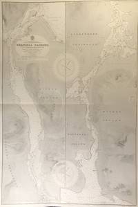
réf. 56415London: British Admiralty 1899 1930. . An engraved chart on heavy stock uncolored sheet size 27.5 x 40 inches. Published 20th Feb. 1899; New Edition 17th Jan. 1930. Original horizontal fold a clean and attractive copy some small additions in red pen. In lower right: "Engraved 1899" and "Zc 1930". Chart number is 3022. Small typed label on verso giving chart & folio info. Published under the Superintendence of Rear Admiral Sir W.J.L. Wharton. Divided vertically into two charts this extends from Frederick Sound to Sumner Strait showing the Lindenberg Peninsula Mitkof Island Woewodski Island. Previously known as Wrangell Strait this channel is 22 miles long. London: British Admiralty, 1899 (1930). unknown
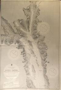
réf. 56427London: British Admiralty 1897 1925. . An engraved chart on heavy stock uncolored sheet size 40 x 27.5 inches. Published 6th March 1897; Large Corrections to June 1907; Small corrections printed to 1925 and mss. to 1930. Original vertical fold a clean and attractive copy some small additions in red pen. In lower right: "Engraved by Davies & Company". Chart number is 2462. Small typed label on verso giving chart & folio info. Published under the Superintendence of Rear Admiral W.J.L. Wharton. A highly detailed chart showing the north part of Admiralty Island and Chichagof Island Chatham Strait Glacier Bay; Inset map at the top: Continuation of Lynn Canal. Originally published 1897 this is an edition of 1925. London: British Admiralty, 1897 (1925). unknown
réf. 56426London: British Admiralty 1898 1926. . An engraved chart on heavy stock uncolored sheet size 27.5 x 40 inches. Published 23rd July 1898; Large Corrections to 6th August 1926; Small corrections mss. to 1927. Original horizontal fold a clean and attractive copy some small additions in red pen. Some wrinkling of paper at centre but not very noticeable on the printed side. In lower right: "Engraved 1898." and "Zc 1926". Chart number is 2288. Small typed label on verso giving chart & folio info. Published under the Superintendence of Rear Admiral Sir W.J.L. Wharton. A detailed and attractive chart of this major inlet. London: British Admiralty, 1898 (1926). unknown
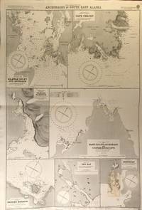
réf. 56419London: British Admiralty 1900 1925. An engraved chart on heavy stock uncolored sheet size 27.5 x 40 inches. Published 31st December 1900; New Edition January 1916; Small corrections printed to 1925 and mss. to 1927. Clean and attractive original horizontal fold some small additions in red pen. In lower right: "Engraved by Edwd. Weller". Chart number is 3138. Small typed label on verso giving chart & folio info. Published under the Superintendence of Rear Admiral Sir W.J.L. Wharton. Maps of seven anchorages: Klawak Inlet and Approach Cape Chacon Tamgas Harbour Mary Island Anchorage and Custom House Cove Hassler Harbour Yes Bay and Redfish Bay. Originally published in 1900 this is a 1925 printing. The small plan of Redfish Bay has corrections on a paste-over partly printed in red. Klawak is now known as Klawock and had a variety of names used by the Tlingit Klawerak Tlevak Clevak and Klawak. London: British Admiralty, 1900 (1925) unknown
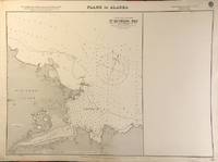
réf. 56403London: British Admiralty 1900 1923. . An engraved chart on heavy stock uncolored sheet size 27.5 x 20 inches. Published 10th Aug. 1900; New Edition July 1909; Small corrections printed to 1923. Unfolded. A nice clean copy. In lower right: "Engraved by Davies & Company". Chart number is 3143. Small typed label on verso giving chart & folio info. Published under the Superintendence of Rear Admiral Sir W.J.L. Wharton. One plan only of St. Michael Bay Norton Sound - South Shore St. Michael Island. London: British Admiralty, 1900 (1923). unknown
1987394 pages. Footnotes, bibliography and index. Many great black and white photographic plates. "The epic northern adventure of the men who rushed for gold, the workers who toiled in winter storms and thawing muck carving the grade and laying rail, and the ingenious characters who dreamed, schemed, promoted, and finally built the White Pass and Yukon Railway." - from dust jacket. Clean and unmarked with moderate wear. A sound copy of this informative work. Book
1980Features: Solar Eclipse of 1980 - scientists race totality; Devils, Quolis, Dunnarts and Thylacines - a survey of Tasmanian mammals; Journey into Northern China - impressions of a scientist; A Geologist in Alaska - John C. reed on 45 years in the boondocks; Nebraska Miocene Giant Turtle - complete skeleton reveals new species; Niger - Tenere Expedition - geographical and archeological observations; Transglobe Expedition Now in Antarctica - British explorers circling globe on polar axis; Exploring Canada's Ellice River - observing Arctic tundra flora and fauna; New support for Archeological Discovery; Malaysia-Singapore Waterway Border - United Nations Law of the Sea problems. Moderate wear. Unmarked. A sound copy. Book
1980Features: South Nahanni River Valley Expedition - a canoe-and-climb journey in Canada's Northwest Territories; Exploration of Today's World; Martin and Osa Johnson - exploration was their way of life; Arnold Hauerslev-Haverlee - an unorthodox explorer; Continued Exploration of Venus; Medical Detective in Africa - solution of an explosive medical mystery in Mali; Meteorites and Man-made Satellites - when they fall to earth; Observing Marine Mammals in Alaska - students gain field experience; Goal - to Penetrate Tibet - a hazardous 19th century attempt - Mr. T.T. Cooper. Moderate wear. Unmarked. A sound copy. Book