Hinz, Rev. JohnMareMagnum

1944194 pages. Average wear. Binding intact. Bright gilt lettering upon front board and spine. Children's scribbling upon blank leaves at end of book. Book
1973Features: Accursed and frightful Potter's Point - a look at the forerunners, and many times the sires of the later colorful and often dangerous people who made the Old West famous; Mud Glacier Gold - Marcum's lost gold in Alaska; Village of my red brother - Mormon Indian missionaries; Seattle's Little-known Dymano - Hans Pederson and the early development of Seattle; Battle of Prairie Dog Creek; The Solid Muldoon; Ghostly Fort Dilts; Coal Oil Jimmy's Gang; Geronimo's Long Debt for a Pony - Jimmy Stevens; Missouri Scout - Greyson Welsh; and more. Clean, bright and unmarked with very light wear. Excellent copy. Magazine
réf. 8595P., Paul Ducrocq, 1875 ; in-8. VI-371pp. -Frontispice et 61 illustrations in-texte, dont plusieurs à pleines pages, 1 carte dépliante en couleurs. Percaline bordeaux d'éditeur, plat sup. orné d'une plaque noir et or, second plat orné en noir, tranches dorées. Quelques rousseurs sans gravité, légers frottements et décolorations sur les plats. Bon exemplaire cependant.
1894Browning to endpapers, as from a DJ; All edges gilt. Decorative boards with gilt lettering and gilt pictorial design ; 8vo; 410 pages
1887pp. 337 + 12 Color chromolithograph plates of birds, drawn by Robert & John L. Ridgway. The great bird plates have some damp stain, but could be easily washed. + Plus 9 line drawn plates of fish. Folio. Disbound. Arctic Series of Publications issued in Connection with the Signal Service, U.S. Army, No. III. The bird illustrators deserve special note. Robert Ridgway (1850-1929) was one America's leading ornithologists. At the age of 17, he was appointed zoologist on a geological survey of the 40th parallel. From 1874 until his death, he served as ornithologist and curator of the Smithsonian Institute. Ridgway established a system of color standards and nomenclature that is still used today. Robert's younger brother John was chief illustrator for United States Geological Survey and an artist for the California Institute of Technology and Carnegie Institution of Washington. Check References: Nissen, ZBI, 4184 and 2962; Bennett, p. 107; Wickersham 7836; Ricks p. 222; Arctic Bibliography 18091 & 18092; Ayer Zimmer, pages. 463 & 643 644. **PRICE JUST REDUCED! W155
réf. 0882402870.Gpaperback. Good. Access codes and supplements are not guaranteed with used items. May be an ex-library book. paperback
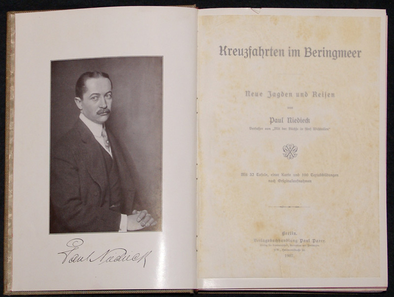
1907réf. STLD0140Berlin, Paul Parey 1907. Gr.-8°. X(2), 253(1) S., 3 Bll. (Verlagsanz.). Mit 32 Tafeln, einer Karte (in Buchlasche) und 100 Textabb. nach Originalaufnahmen. OLeinenbd. m. mont. photogr. Deckelbild und Titelprägung in Gold u. Schwarz sowie umseit. Rotschnitt. Bindung geringf. gelockert, Einbd. u. einzelne Ss. stockfleckig, Karte etw. angeschmutzt u. m. Einriss. Thiebaud 684; GV 103, 113. Erste Ausgabe. Mit 2 Hauptkapiteln über Kamtschatka und Alaska. Enthält einige ethnologische Betrachtungen sowie einen Bericht über die Erzeugnisse Alaskas. Im Anhang mit einer Übersicht der vom Verfasser auf seiner Reise gesammelten Tiere. - Die Karte zeigt die Grenzregion zwischen Sibirien und Alaska mit der eingezeichneten Route der Bering-Meer-Expedition von 1906.
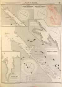
réf. 56412London: British Admiralty 1907 1921. . An engraved chart on heavy stock uncolored sheet size 40 x 27.5 inches. Published 2nd April 1907; Small corrections printed to 1921. Original vertical fold. A nice clean copy some small additions in red pen. In lower right: "Engraved by Davies & Company.". Chart number is 3637. Small typed label on verso giving chart & folio info. Published under the Superintendence of Rear Admiral A. Mostyn Field. Plans of anchorages in Chatham Strait and Frederick Sound: Red Bluff Bay Herring Bay and Chapin Bay Hoggatt Bay Gut Bay and Surprise Harbour and Murder Cove. Murder Cove was so named for the killing of two gold prospectors in retaliation for the killing of two Tlingit tribesmen which precipitated the fighting between the Tlingit and the US Government known as the Kake War. London: British Admiralty, 1907 (1921). unknown
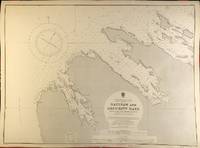
réf. 56398London: British Admiralty 1900 1929. . An engraved chart on heavy stock uncolored sheet size 27.5 x 20 inches. Published 13th July 1900; New Edition - Large Corrections 15th November 1929. Clean and attractive never folded. In lower right: "Engraved 1900" and "Zc 1929". Chart number is 3132. Small typed label on verso giving chart & folio info. Published under the Superintendence of Rear Admiral Sir W.J.L. Wharton. Saginaw Bay has recently 2019 been renamed to Skanax Bay following a petition from Tlingit tribal leaders complaining of its association with the 1869 Kake War during which a U.S. warship The Saginaw destroyed three Tlingit communities. London: British Admiralty, 1900 (1929). unknown
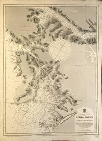
réf. 56389London: British Admiralty 1895 1925. An engraved chart on heavy stock uncolored sheet size 20 x 27.5 inches. Published 26th Aug. 1895; Large corrections to Nov. 1900; Small corrections printed to 1925 and mss. to 1930. Clean and attractive never folded some small additions in red pen. In lower right: "Engraved by Edwd. Weller". Chart number is 2337. Small typed label on verso giving chart & folio info. Published under the Superintendence of Rear Admiral W.J.L. Wharton. Sitka Sound was named Ensenada de Susto by Juan de la Bodega on 15 August 1775. It was later named Norfolk Sound by James Cook. In 1801 Fleurieu published a map naming it Baie Tchinkîtâné in an attempt to use Tlingit toponyms. London: British Admiralty, 1895 (1925). unknown
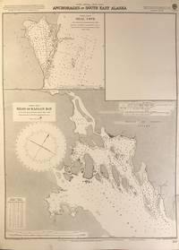
réf. 56402London: British Admiralty 1898 1925. An engraved chart on heavy stock uncolored sheet size 20 x 27.5 inches. Published 2nd Aug. 1898; New Edition Nov. 1921; Small corrections printed to 1925 and mss. to 1926. Clean and attractive never folded short tears to margin at lower right some small additions in red pen. In lower right: "Engraved by Davies & Company". Chart number is 837. Small typed label on verso giving chart & folio info. Published under the Superintendence of Rear Admiral Sir W.J.L. Wharton. Two maps: Seal Cove Gravina Island and Head of Kasaan Bay at Prince of Wales Island. London: British Admiralty, 1898 (1925). unknown
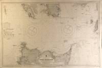
réf. 56409London: British Admiralty 1911 1924. An engraved chart on heavy stock uncolored sheet size 40 x 27.5 inches. Published 11th April 1911; New Edition 30th May 1921; Small corrections printed to 1924 and mss. to 1927. Original vertical fold clean and attractive some small additions in red pen. In lower right: "Engraved by Davies & Company". Chart number is 3754. Small typed label on verso giving chart & folio info. Published under the Superintendence of Rear Admiral H.E. Purey-Cust. Good detail of the northern end of Graham Island in the Haida Gwaii formerly Queen Charlotte Islands. The Dixon Entrance remains a contentious area today with ongoing disputes about the precise location of the boundary line between Canada and the USA. This 1924 map shows a dotted line just south of Prince of Wales Island with the text: "Approximate Boundary between British Columbia and Alaska". London: British Admiralty, 1911 (1924). unknown
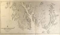
réf. 56418London: British Admiralty 1896 1925. . An engraved chart on heavy stock uncolored sheet size 46 x 28 inches. Published 15th Dec. 1896; Large Corrections to July 1907; Small corrections printed to 1925 and mss. to 1929. Original vertical folds a clean and attractive copy some small additions in red pen. In lower right: "Engraved by Davies & Compy.". Chart number is 2458. Small typed label on verso giving chart & folio info. Published under the Superintendence of Rear Admiral W.J.L. Wharton. A large and detailed chart extending from the Dixon Entrance north to Wrangell Island; the chart extends east to the Portland Canal and the edge of British Columbia including Observatory Inlet and Salmon Cove visited by Captain Vancouver in 1793 and so named because he set up his observatory there in order to calibrate the chronometers. Good detail of Prince of Wales Island and Clarence Strait. Originally published in 1896 this is a 1925 printing. London: British Admiralty, 1896 (1925). unknown
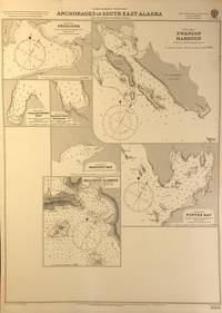
réf. 56401London: British Admiralty 1898 1920. An engraved chart on heavy stock uncolored sheet size 20 x 27.5 inches. Published 11th Nov. 1898; Large corrections to April 1904; Small corrections printed to 1920. Clean and attractive never folded some small additions in red pen. In lower right: "Engraved by Edwd. Weller". Chart number is 3008. Small typed label on verso giving chart & folio info. Published under the Superintendence of Rear Admiral Sir W.J.L. Wharton. Maps of seven anchorages at Lynn Canal Glacier Bay and Chatham Strait: Fritz Cove Swanson Harbour William Henry Bay Barlow Cove Anchorage Bartlett Bay Killisnoo Harbour and Funter Bay. London: British Admiralty, 1898 (1920). unknown
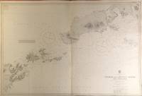
réf. 56420London: British Admiralty 1903 1929. . An engraved chart on heavy stock uncolored sheet size 40 x 27.5 inches. Published 23rd April 1903; New Edition 1st March 1929. Clean and attractive original vertical fold some small additions in red pen. In lower right: "Engraved 1903" and "Zc 1929". Chart number is 3336. Small typed label on verso giving chart & folio info. Published under the Superintendence of Rear Admiral Sir W.J.L. Wharton. A detailed chart of the Fox Islands Group in the Eastern Aleutians. London: British Admiralty, 1903 (1929). unknown
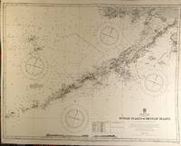
réf. 56422London: British Admiralty 1890 1924. . An engraved chart on heavy stock uncolored sheet size 34 x 27 inches. Published 9th July 1890; New Edition 19th Jan. 1917. Small corrections printed to 1924 and mss. to 1929. Clean and attractive original vertical fold some additions in red pen. In lower right: "Engraved by Davies & Company". Chart number is 1500. Small typed label on verso giving chart & folio info. Published under the Superintendence of Captain W.J.L. Wharton. A detailed chart of the Aleutian Islands chain from Alaska to Seguam Island. Several engraved vignettes of shorelines at the bottom. Originally published 1890 this is a 1924 printing. London: British Admiralty, 1890 (1924). unknown
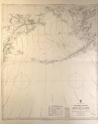
réf. 56408London: British Admiralty 1884 1928. . An engraved chart on medium stock uncolored sheet size 27 x 34 inches. Published 28th Oct. 1884; New Edition 15th Jan. 1923. Large Corrections 14th Sept. 1928. Original horizontal fold a clean and attractive copy some small additions in red pen. In lower right: "Engraved by Davies & Company". Chart number is 2460. Small typed label on verso giving chart & folio info. Published under the Superintendence of Captain W.J.L. Wharton. Good details of the Aleutian Islands and Bering Sea Eastern Siberia and the Bering Strait at the top. London: British Admiralty, 1884 (1928). unknown
réf. 56396London: British Admiralty 1898 1924. . An engraved chart on heavy stock uncolored sheet size 20 x 27.5 inches. Published 22nd March 1898; Small corrections printed to 1924 and mss. to 1927. Unfolded. A nice clean copy. In lower right: "Engraved by Edwd. Weller". Chart number is 1524. Small typed label on verso giving chart & folio info. Published under the Superintendence of Rear Admiral Sir W.J.L. Wharton. Maps of Juneau Anchorage Wrangell Harbour Ratz Harbour Tongass Narrows and Tolstoi Bay. Upper right map Wrangell Harbour is corrected with a paste-over printed in black & red. London: British Admiralty, 1898 (1924). unknown
1910réf. 113798Seattle Washington: Printed by the Pacific Press Inc. nd c1910. Softcover. very good. 1st Edition. 157pp. 2pp. indexpp. Octavo. Illustrations from photos. Original black cloth taped backed blue wrappers minor fading. very good Tourville 156. Illustrated report giving a history of the commission detailed statement of all disbursements summary of receipts and disbursements and description and costs of buildings and major exhibits. 1910 Printed by the Pacific Press, Inc. paperback
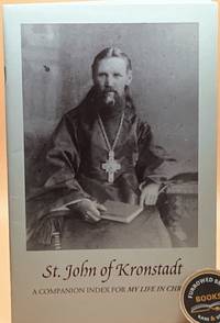
1997réf. 260406001St. Herman of Alaska Brotherhood 1997. Paperback. Like New. St. Herman of Alaska Brotherhood; Sergieff St John of Kronstadt : A Companion Index for: My life in Christ. Platina CA : St. Herman of Alaska Brotherhood/St. Paisius Missionary School 1997. "This index is a companion to the 1897 English Edition of My Life in Christ first published in England and reprinted by Holy Trinity Monastery Jordanville New York." ISBN listed to cp as 1887904549 but recent searches on this return a completely different title. Staple-bound in publisher's glossy b&w photographic wrappers. 2 3-32. Foreword by Abbot Herman; life of St. John 10 pp; index pp 21-32. Condition notes: near fine clean copy of a surprisingly rare pamphlet. Light wear. We personally inspect every book we offer. St. Herman of Alaska Brotherhood paperback
réf. 0882401866.Gpaperback. Good. Access codes and supplements are not guaranteed with used items. May be an ex-library book. paperback
195258 pages. Dozens of great black and white photos. Features: Great vintage ads including Alaska salmon, Remington ammo, Ketchikan Spruce Mills, and many more; The opening of the Hart Highway in B.C.; I Saw Soapy Smith of Skagway Killed - Frank H. Reid gave his life to rid the city of organized anarchy - many photos with article; He Wrestled a Wolf; Blarney Stone at Sitka; Dawson; From Ketchikan to Barrow; Sourdough Pete (cartoon); The S.S. Humboldt; Honk the caribou - an honorary member of the Army; and more. Complete and intact. Above-average wear. Bit of writing on front cover. A worthy vintage copy. Magazine
194842 pages. Many black and white photos. Features: Pounding Waves and Creaking Timbers - first of three chapters of "Master of the Moonrise"; The Whistle Pig - the marmot that scared the bear did not heed its own warning; Frontier Town - a Ketchikan old-timer who was there in 1898 presents some interesting recollections; No One at Home at Kulukak - Silence, complete, awful silence in a remote place can be a terrible thing; First Impressions - The first of two chapters of "Cannery Village"; and more. Unmarked. Moderate evidence of moisture exposure. Somewhat above-average wear. A worthy reference copy. Magazine
1963192 pages. A very informative vintage driving travel guide to the entire province of British Columbia and parts beyond, complete with black and white photos and dozens of sensational ads for tourist-related service businesses. Unmarked with average wear. Binding sound. Take a wonderful step back in time! Book
1954184 pages. Index. Thirty-one pages of black and white photographic plates. Signed and inscribed by Hinton upon front free endpaper. Presents the Yukon's lively history from the gold rush through to construction of the Alaska Highway. Average wear. Binding intact. Some sunning to back strip. A sound copy. Book