1 401 résultats
18292 voll. 8°, pp.X-283 (5); 231, br.ed., dorsi rinf. In barbe. Queste Lettere, che videro la luce anonime nel 1802 e col falso luogo di stampa di Filadelfia (Melzi II 121 e Parenti, Diz.dei luoghi di stampa falsi, p.84, Olschki 14342), è dedicata dall'editore Giuseppe Giusti a Domenico Navasques, segretario del duca di Lucca. Brunet VI 28121 cita la 2°ediz. con data Lucca, 1819, forse errata, perchè la nostra dovrebbe essere la 2°ediz., in quanto nella dedica al Navasques, datata 31 ago.1829, Giuseppe Giusti parla di quest' "opera che ora con aggiunte e correzioni favoritemi dalla gentilezza dell'Autore, per mia cura rivede la luce..". Si tratta di 27 lettere (+ la lettera del Lucchesini) di cui 22 sull'India: caste, libri sacri (veda), luoghi di venerazione, culto di animali e alberi sacri, bramini, metempsicosi, culto di Linga o phallo e feste, costumi e teologia della costa del Malabar, Baniani e loro costumi, spedale per animali infermi a Suratte, astrologia giudiziaria, costumi indiani (matrimonio, poligamia,"abbruciarsi delle vedove", ballerine..), astronomia, arti, medicina, architettura e scultura, Parsi o Guebri, musulmani, Compagnia inglese. Le ultime 5 lettere sono dedicate al viaggio in Arabia, Mar Rosso, Giza, Egitto, isola di Stanchio etc.
1932In-8, tela editoriale (con fioriture), pp. XXIX,(3),396,(2), completo di tutte le tavole, i diagrammi, le carte, come da indice, compresa 1 grande carta geografica a colori più volte ripiegata del “South Arabian Desert”. “In the Qara Mountains: ‘Ain ar Rizat - Dhufar - Nejd - Along the southern fringe of the sands - A geographical note on Rub’ Al Khali, etc.”. Solo qualche rara e lieve fioritura, altrimenti ben conservato.
1968réf. 225491968. Arabian American Oil Company. Aramco Handbook: Oil and the Middle East revised in 1968 documents the information system through which Aramco explained Saudi Arabia Middle Eastern petroleum and its own industrial operations to an English-language readership. Published while the company remained owned by four American oil corporations the handbook combines petroleum geology corporate history political geography and cultural instruction into a unified account of Saudi modernization under oil development. Its organization reveals how Aramco presented itself as both an industrial enterprise and an interpreter of Saudi society using maps photographs diagrams historical narratives and rules of social conduct to prepare foreign personnel for work in the Kingdom. The volume provides primary-source evidence for research into United States-Saudi relations corporate communication petroleum infrastructure expatriate labor and the production of cultural knowledge within a multinational oil concession. Saudi acquisition of Aramco began during the following decade and reached full government ownership in 1980 placing this edition before the company's transition to Saudi control. Arabian American Oil Company. Aramco Handbook: Oil and the Middle East. Dhahran Saudi Arabia: Arabian American Oil Company July 1 1968. Revised edition. Printed in Haarlem Netherlands by Joh. Enschedé en Zonen. 276 pages. Profusely illustrated with color maps black-and-white photographs and diagrams. Original red cloth stamped in gilt and black; no dust jacket noted. 4to. The handbook is divided into five principal sections addressing the historical background of Saudi Arabia and the Middle East the development of the regional petroleum industry the Aramco venture Saudi government and society and Arab culture and customs. A tribal map identifies numerous communities across the Arabian Peninsula including al-Mutair and al-Murrah while a diagrammatic map of the "Conquest of Najd" traces Ibn Saud's military expansion through arrows and battle annotations. Petroleum sections explain drilling refining transportation and export infrastructure including the Trans-Arabian Pipeline illustrated by parallel lengths of pipe extending across open terrain and accompanied by discussion of the decision to construct substantial portions above ground. Photographic essays show communal dining urban and industrial environments and other aspects of public life. The "Social Etiquette" section introduces such greetings as as-salÄmu ʿalaykum and kayf ḥÄlak presenting cultural instruction as part of the company's management of encounters between expatriate employees and Saudi residents. Bibliographic records confirm the 1968 Dhahran edition as an extensively illustrated corporate reference work on petroleum and the Middle East. The handbook's research value lies partly in the tension between the breadth of its documentation and the institutional perspective governing its interpretation. Its maps and photographs preserve substantial information about infrastructure geography labor social practice and the physical expansion of the Saudi petroleum industry while its text consistently casts Aramco as the principal agent joining Saudi Arabia to global markets. Cultural sections reduce complex regional and social differences to practical guidance for foreign employees and historical narratives place political consolidation and oil development within a corporate account of orderly progress. The volume should therefore be read both as a reference source and as evidence of how an American-owned concession represented its authority during a consequential phase of Saudi economic transformation. Light rubbing affects the boards with slight fraying at the spine ends and minor handling wear to the text-block edges; interior clean and binding sound. Very good. A detailed corporate record of the maps infrastructure historical narratives and cultural instruction through which Aramco explained-and justified-its place in Saudi Arabia's petroleum economy. unknown
1968réf. 225491968. Arabian American Oil Company. Aramco Handbook: Oil and the Middle East revised in 1968 documents the information system through which Aramco explained Saudi Arabia Middle Eastern petroleum and its own industrial operations to an English-language readership. Published while the company remained owned by four American oil corporations the handbook combines petroleum geology corporate history political geography and cultural instruction into a unified account of Saudi modernization under oil development. Its organization reveals how Aramco presented itself as both an industrial enterprise and an interpreter of Saudi society using maps photographs diagrams historical narratives and rules of social conduct to prepare foreign personnel for work in the Kingdom. The volume provides primary-source evidence for research into United States-Saudi relations corporate communication petroleum infrastructure expatriate labor and the production of cultural knowledge within a multinational oil concession. Saudi acquisition of Aramco began during the following decade and reached full government ownership in 1980 placing this edition before the company's transition to Saudi control. Arabian American Oil Company. Aramco Handbook: Oil and the Middle East. Dhahran Saudi Arabia: Arabian American Oil Company July 1 1968. Revised edition. Printed in Haarlem Netherlands by Joh. Enschedé en Zonen. 276 pages. Profusely illustrated with color maps black-and-white photographs and diagrams. Original red cloth stamped in gilt and black; no dust jacket noted. 4to. The handbook is divided into five principal sections addressing the historical background of Saudi Arabia and the Middle East the development of the regional petroleum industry the Aramco venture Saudi government and society and Arab culture and customs. A tribal map identifies numerous communities across the Arabian Peninsula including al-Mutair and al-Murrah while a diagrammatic map of the "Conquest of Najd" traces Ibn Saud's military expansion through arrows and battle annotations. Petroleum sections explain drilling refining transportation and export infrastructure including the Trans-Arabian Pipeline illustrated by parallel lengths of pipe extending across open terrain and accompanied by discussion of the decision to construct substantial portions above ground. Photographic essays show communal dining urban and industrial environments and other aspects of public life. The "Social Etiquette" section introduces such greetings as as-salÄmu ʿalaykum and kayf ḥÄlak presenting cultural instruction as part of the company's management of encounters between expatriate employees and Saudi residents. Bibliographic records confirm the 1968 Dhahran edition as an extensively illustrated corporate reference work on petroleum and the Middle East. The handbook's research value lies partly in the tension between the breadth of its documentation and the institutional perspective governing its interpretation. Its maps and photographs preserve substantial information about infrastructure geography labor social practice and the physical expansion of the Saudi petroleum industry while its text consistently casts Aramco as the principal agent joining Saudi Arabia to global markets. Cultural sections reduce complex regional and social differences to practical guidance for foreign employees and historical narratives place political consolidation and oil development within a corporate account of orderly progress. The volume should therefore be read both as a reference source and as evidence of how an American-owned concession represented its authority during a consequential phase of Saudi economic transformation. Light rubbing affects the boards with slight fraying at the spine ends and minor handling wear to the text-block edges; interior clean and binding sound. Very good. A detailed corporate record of the maps infrastructure historical narratives and cultural instruction through which Aramco explained-and justified-its place in Saudi Arabia's petroleum economy. unknown books
1885réf. 145461885. Vintage original albumen photograph of a Colonial French Algeria Bedouin Warrior with his camel published circa 1875. Image size: 8.25" x 11." In this image we can see a Bedouin traditionally dressed in a thoab and kufiyya. The warrior is standing in the desert holding the reins of his camel. The camel is saddled with the Bedouin's sword visible on his side flank. In the background is a single fort tower in the bare desert. Overall in very good condition. unknown
1885réf. 145461885. Vintage original albumen photograph of a Colonial French Algeria Bedouin Warrior with his camel published circa 1875. Image size: 8.25" x 11." In this image we can see a Bedouin traditionally dressed in a thoab and kufiyya. The warrior is standing in the desert holding the reins of his camel. The camel is saddled with the Bedouin's sword visible on his side flank. In the background is a single fort tower in the bare desert. Overall in very good condition. unknown books
1870réf. 146911870. Set of two large vintage albumen prints in sepia tone depicting life in the desert landscape of Aden c. 1870 now Yemen. Both photos depict the rugged landscape and village life typical in this region of the Arabian Penninsula. The first image foreground presents Arab men gathering with their camels around a well in the foreground while a carriage and horse wait at a bridge in the background. The reservoir of Attawila which dominates the image had been designed in medieval times to capture rain water during flash floods for drinking; while the resevoir fell out of use in the 16th century the British colonial forces who occupied and ruled Yemen revived their function in the 19th century. Today the monuments draw tourist attention. The second image shows travelers in motion on a dirt road leading to the city walls set between the precipices of Aden. Defensive ramparts traverse the mountain top. The first image measures approximately 8"x11" and is mounted on a photographer's matt with labels " Aden B.F.R. Rives." The second image measures approximately 7"x10" mounted on blue photographer's matt with label "Aden.- Route conduisant a la ville arabe d' Aden.-" Both overall in very good condition. unknown
1870réf. 146911870. Set of two large vintage albumen prints in sepia tone depicting life in the desert landscape of Aden c. 1870 now Yemen. Both photos depict the rugged landscape and village life typical in this region of the Arabian Penninsula. The first image foreground presents Arab men gathering with their camels around a well in the foreground while a carriage and horse wait at a bridge in the background. The reservoir of Attawila which dominates the image had been designed in medieval times to capture rain water during flash floods for drinking; while the resevoir fell out of use in the 16th century the British colonial forces who occupied and ruled Yemen revived their function in the 19th century. Today the monuments draw tourist attention. The second image shows travelers in motion on a dirt road leading to the city walls set between the precipices of Aden. Defensive ramparts traverse the mountain top. The first image measures approximately 8"x11" and is mounted on a photographer's matt with labels " Aden B.F.R. Rives." The second image measures approximately 7"x10" mounted on blue photographer's matt with label "Aden.- Route conduisant a la ville arabe d' Aden.-" Both overall in very good condition. unknown books
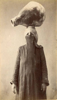
1890réf. 142871890. De Michele Luigi woman carrying a water pot circa 1890 records a common form of domestic labor in late nineteenth century Egypt through the commercial portrait photography of the period. The subject stands wearing a face veil and long garments while balancing a large water vessel on her head preserving specific details of dress posture and water carrying practice without identifying the sitter by name. Black and white carte de visite photograph measuring 2 1/2" x 4". The woman is shown full length balancing a large water pot on her head and wearing a veil covering most of the face. The reverse bears the photographer's stamp "Fotografia Egiziana / Luigi De Michele." The studio attribution places the image within the commercial photographic trade that produced portraits and occupational or ethnographic views for local and foreign circulation in nineteenth century Egypt. Images of women carrying water appeared frequently in the photographic market for Egyptian views where photographers often presented daily labor and regional dress as recognizable subjects for travelers and collectors. This example retains a named studio attribution and a clearly defined activity rather than a generic landscape or architectural subject. Excellent condition. A late nineteenth century Egyptian CDV preserving a studio view of women's water carrying labor and dress. unknown
1890réf. 142871890. De Michele Luigi woman carrying a water pot circa 1890 records a common form of domestic labor in late nineteenth century Egypt through the commercial portrait photography of the period. The subject stands wearing a face veil and long garments while balancing a large water vessel on her head preserving specific details of dress posture and water carrying practice without identifying the sitter by name. Black and white carte de visite photograph measuring 2 1/2" x 4". The woman is shown full length balancing a large water pot on her head and wearing a veil covering most of the face. The reverse bears the photographer's stamp "Fotografia Egiziana / Luigi De Michele." The studio attribution places the image within the commercial photographic trade that produced portraits and occupational or ethnographic views for local and foreign circulation in nineteenth century Egypt. Images of women carrying water appeared frequently in the photographic market for Egyptian views where photographers often presented daily labor and regional dress as recognizable subjects for travelers and collectors. This example retains a named studio attribution and a clearly defined activity rather than a generic landscape or architectural subject. Excellent condition. A late nineteenth century Egyptian CDV preserving a studio view of women's water carrying labor and dress. unknown books
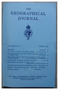
1931réf. 145811931. Arabia RUTTER Eldon. The Hejaz. The Geographical Journal. Vol. LXXVII. No. 2. London: Royal Geographical Society 1931. 13 pages including 2 sketch-maps plus photographic plates. In original blue wrappers as issued. This is a captivating account of the Rutter's expedition in Arabia namely the Hejaz at the time a forbidden country to unbelievers concerning all aspects of the Hejaz including its geographical features the territorial disputes and tribal factions as well as the population that inhabits this spectacular region. Mr. Rutter outlines his pilgrimage disguised as a Muhammadan pilgrim through the Hejaz frontier at Halli. An engaging travel account illustrated with a full-page sketch map of the Hejaz showing Mr. Rutter's route to Mecca and Medina an in-text sketch diagram depicting his route from Mecca to At Taif and several amazing photographic plates showing the Kaaba the House of Allah the Great Mosque of Mecca the Prophet's tomb at Medina and Bab es Salaam in the Mosque of Medina. This is a complete issue containing all the ads seldom found in such good and original condition. In very good condition. unknown
1931réf. 145811931. Arabia RUTTER Eldon. The Hejaz. The Geographical Journal. Vol. LXXVII. No. 2. London: Royal Geographical Society 1931. 13 pages including 2 sketch-maps plus photographic plates. In original blue wrappers as issued. This is a captivating account of the Rutter's expedition in Arabia namely the Hejaz at the time a forbidden country to unbelievers concerning all aspects of the Hejaz including its geographical features the territorial disputes and tribal factions as well as the population that inhabits this spectacular region. Mr. Rutter outlines his pilgrimage disguised as a Muhammadan pilgrim through the Hejaz frontier at Halli. An engaging travel account illustrated with a full-page sketch map of the Hejaz showing Mr. Rutter's route to Mecca and Medina an in-text sketch diagram depicting his route from Mecca to At Taif and several amazing photographic plates showing the Kaaba the House of Allah the Great Mosque of Mecca the Prophet's tomb at Medina and Bab es Salaam in the Mosque of Medina. This is a complete issue containing all the ads seldom found in such good and original condition. In very good condition. unknown books
1928réf. 144801928. Lees G. M. The Physical Geography of South-Eastern Arabia 1928. Original geographical and geological report documenting the British geologist's expeditions through Oman and southeastern Arabia during 1925-1926 including investigations of mountainous and desert regions that had received limited systematic European surveying. George Martin Lees an assistant geologist with the Anglo-Persian Oil Company undertook fieldwork examining the geological formations tectonic structure and physical geography of Oman. His findings were presented before the Royal Geographical Society on January 16 1928 and subsequently published in The Geographical Journal. The report combines geographical surveys with observations on the water supply of Bahrain and the Qatar Peninsula archaeological discoveries of flint implements natural history collections and descriptions of the Mahri and Gara nomadic populations of southern Arabia. Lees G. M. The Physical Geography of South-Eastern Arabia. London: Royal Geographical Society 1928. Original 30-page illustrated report published in The Geographical Journal Vol. 71 No. 5 May 1928. Retained in its original blue printed wrappers with titles on the front and the original advertisements present. Illustrated with four sketch maps and photographic plates. The report examines the physical geography and geological tectonics of southeastern Arabia particularly the mountainous interior and surrounding desert regions of Oman. Lees describes his surveying expeditions geological observations and the geographical characteristics of areas previously imperfectly recorded on European maps. Supplementary material addresses water resources in Bahrain and Qatar the discovery of prehistoric flint implements and collections of birds and insects. His observations concerning the Mahri and Gara tribes include information on the inhabitants of the southern Arabian territories through which his expeditions passed. Lees's investigations preceded the extensive petroleum exploration and geological mapping undertaken across southeastern Arabia during the following decades. His employment with the Anglo-Persian Oil Company placed his geological fieldwork within the early history of commercial interest in the region's subsurface resources while his surveys contributed geographical information on Oman's mountain systems geological formations and interior routes. The archaeological and zoological observations extend the report beyond geology recording evidence of prehistoric human activity and regional wildlife. The original 1928 publication retains its blue wrappers and advertisements and is in very good condition. unknown
1928réf. 144801928. Lees G. M. The Physical Geography of South-Eastern Arabia 1928. Original geographical and geological report documenting the British geologist's expeditions through Oman and southeastern Arabia during 1925-1926 including investigations of mountainous and desert regions that had received limited systematic European surveying. George Martin Lees an assistant geologist with the Anglo-Persian Oil Company undertook fieldwork examining the geological formations tectonic structure and physical geography of Oman. His findings were presented before the Royal Geographical Society on January 16 1928 and subsequently published in The Geographical Journal. The report combines geographical surveys with observations on the water supply of Bahrain and the Qatar Peninsula archaeological discoveries of flint implements natural history collections and descriptions of the Mahri and Gara nomadic populations of southern Arabia. Lees G. M. The Physical Geography of South-Eastern Arabia. London: Royal Geographical Society 1928. Original 30-page illustrated report published in The Geographical Journal Vol. 71 No. 5 May 1928. Retained in its original blue printed wrappers with titles on the front and the original advertisements present. Illustrated with four sketch maps and photographic plates. The report examines the physical geography and geological tectonics of southeastern Arabia particularly the mountainous interior and surrounding desert regions of Oman. Lees describes his surveying expeditions geological observations and the geographical characteristics of areas previously imperfectly recorded on European maps. Supplementary material addresses water resources in Bahrain and Qatar the discovery of prehistoric flint implements and collections of birds and insects. His observations concerning the Mahri and Gara tribes include information on the inhabitants of the southern Arabian territories through which his expeditions passed. Lees's investigations preceded the extensive petroleum exploration and geological mapping undertaken across southeastern Arabia during the following decades. His employment with the Anglo-Persian Oil Company placed his geological fieldwork within the early history of commercial interest in the region's subsurface resources while his surveys contributed geographical information on Oman's mountain systems geological formations and interior routes. The archaeological and zoological observations extend the report beyond geology recording evidence of prehistoric human activity and regional wildlife. The original 1928 publication retains its blue wrappers and advertisements and is in very good condition. unknown books
réf. 14676Late 19th or early 20th century Koummya Arabic dagger with cast brass scabbard. The scabbard has silver engraved motifs and metal accents. The dagger measures 18" along the curve and has a hand carved wood handle with brass encasement rounding the hilt. The blade is curved sharp and slides securely into the sheath. It shows use but no damage. In good condition. unknown
réf. 14676Late 19th or early 20th century Koummya Arabic dagger with cast brass scabbard. The scabbard has silver engraved motifs and metal accents. The dagger measures 18" along the curve and has a hand carved wood handle with brass encasement rounding the hilt. The blade is curved sharp and slides securely into the sheath. It shows use but no damage. In good condition. unknown books
1928réf. 144851928. Varthema Ludovico di. The Itinerary of Ludovico di Varthema of Bologna from 1502 to 1508 1928. Limited first Argonaut Press edition of one of the earliest European firsthand accounts of Mecca and Medina originally published in Italian in 1510. Varthema an Italian traveler from Bologna entered the Islamic holy cities in 1503 after joining a pilgrim caravan from Damascus under the assumed Muslim name Yunus serving among its Mamluk military escort. His account is among the earliest recorded descriptions of the Hajj and Mecca by a European visitor who was not originally Muslim detailing pilgrimage ceremonies religious customs urban life and encounters with merchants and local authorities. His subsequent travels extended through Yemen the Persian Gulf Persia India and parts of Southeast Asia recording commercial networks religious practices military organization and maritime trade during the opening decades of Portuguese expansion into the Indian Ocean. The 1928 edition reproduces John Winter Jones's 1863 English translation prepared for the Hakluyt Society together with Sir Richard Carnac Temple's historical examination of Varthema's travels in southern Asia. Varthema Ludovico di. The Itinerary of Ludovico di Varthema of Bologna from 1502 to 1508. As Translated from the Original Italian Edition of 1510 by John Winter Jones F.S.A. in 1863 for the Hakluyt Society with A Discourse on Varthema and His Travels in Southern Asia by Sir Richard Carnac Temple. London: The Argonaut Press 1928. First Argonaut Press edition limited to 975 numbered copies printed on Japon vellum. One volume quarto 4to pp. lxxxvi 122 last blank 2 colophon blank. Illustrated with one plate five full-page maps within the pagination a facsimile of the original 1510 title page and a title-page vignette printed in blue and black; includes an index. Edited by N. M. Penzer. Original quarter vellum over blue-grey buckram boards spine lettered and ruled in gilt with rectangular gilt devices on both covers. Retains the original ribbon marker and an ownership bookplate centered on the front pastedown. Varthema's narrative follows his passage through Egypt and Syria to Medina and Mecca then southward through Yemen and Aden onward to Hormuz and Persia and across the Indian Ocean to India and Southeast Asia. His descriptions address the religious observances of the Muslim pilgrims Bedouin encounters regional customs and laws commercial products trading practices and methods of warfare. Varthema's travels took place during a period of increasing Portuguese intervention in Indian Ocean commerce shortly after Vasco da Gama's voyage around the Cape of Good Hope established a new maritime route between Europe and India. His account records the established Muslim trading networks connecting the Arabian Peninsula Persian Gulf Indian ports and Southeast Asian markets before Portuguese naval power substantially altered regional commerce. First printed in Rome in 1510 the narrative circulated in successive European editions and translations becoming an early source for European geographical knowledge of Arabia and the Indian Ocean. Sir Richard Carnac Temple's accompanying discourse examines the historical and geographical evidence for Varthema's itinerary distinguishing his observations from earlier travel accounts and evaluating his descriptions of southern Asia. The original vellum and buckram binding retains its gilt decoration ribbon marker and ownership bookplate. Overall in very good condition. unknown
1928réf. 144851928. Varthema Ludovico di. The Itinerary of Ludovico di Varthema of Bologna from 1502 to 1508 1928. Limited first Argonaut Press edition of one of the earliest European firsthand accounts of Mecca and Medina originally published in Italian in 1510. Varthema an Italian traveler from Bologna entered the Islamic holy cities in 1503 after joining a pilgrim caravan from Damascus under the assumed Muslim name Yunus serving among its Mamluk military escort. His account is among the earliest recorded descriptions of the Hajj and Mecca by a European visitor who was not originally Muslim detailing pilgrimage ceremonies religious customs urban life and encounters with merchants and local authorities. His subsequent travels extended through Yemen the Persian Gulf Persia India and parts of Southeast Asia recording commercial networks religious practices military organization and maritime trade during the opening decades of Portuguese expansion into the Indian Ocean. The 1928 edition reproduces John Winter Jones's 1863 English translation prepared for the Hakluyt Society together with Sir Richard Carnac Temple's historical examination of Varthema's travels in southern Asia. Varthema Ludovico di. The Itinerary of Ludovico di Varthema of Bologna from 1502 to 1508. As Translated from the Original Italian Edition of 1510 by John Winter Jones F.S.A. in 1863 for the Hakluyt Society with A Discourse on Varthema and His Travels in Southern Asia by Sir Richard Carnac Temple. London: The Argonaut Press 1928. First Argonaut Press edition limited to 975 numbered copies printed on Japon vellum. One volume quarto 4to pp. lxxxvi 122 last blank 2 colophon blank. Illustrated with one plate five full-page maps within the pagination a facsimile of the original 1510 title page and a title-page vignette printed in blue and black; includes an index. Edited by N. M. Penzer. Original quarter vellum over blue-grey buckram boards spine lettered and ruled in gilt with rectangular gilt devices on both covers. Retains the original ribbon marker and an ownership bookplate centered on the front pastedown. Varthema's narrative follows his passage through Egypt and Syria to Medina and Mecca then southward through Yemen and Aden onward to Hormuz and Persia and across the Indian Ocean to India and Southeast Asia. His descriptions address the religious observances of the Muslim pilgrims Bedouin encounters regional customs and laws commercial products trading practices and methods of warfare. Varthema's travels took place during a period of increasing Portuguese intervention in Indian Ocean commerce shortly after Vasco da Gama's voyage around the Cape of Good Hope established a new maritime route between Europe and India. His account records the established Muslim trading networks connecting the Arabian Peninsula Persian Gulf Indian ports and Southeast Asian markets before Portuguese naval power substantially altered regional commerce. First printed in Rome in 1510 the narrative circulated in successive European editions and translations becoming an early source for European geographical knowledge of Arabia and the Indian Ocean. Sir Richard Carnac Temple's accompanying discourse examines the historical and geographical evidence for Varthema's itinerary distinguishing his observations from earlier travel accounts and evaluating his descriptions of southern Asia. The original vellum and buckram binding retains its gilt decoration ribbon marker and ownership bookplate. Overall in very good condition. unknown books
1926réf. 144221926. Gröber Karl. Bird's Eye View of Mecca 1926. Original copperplate photogravure depicting Mecca Islam's holiest city and the destination of the annual Hajj pilgrimage. The elevated view records the historic urban setting of Mecca home to the Masjid al-Haram the Sacred or Grand Mosque and the Kaaba toward which Muslims worldwide direct their daily prayers. Published in 1926 the image dates from the early rule of Abdulaziz Ibn Saud over the Hejaz following his conquest of Mecca in 1924 and assumption of the title King of the Hejaz in 1926. The illustration preserves a photographic view of the holy city during a period of political transition decades before the extensive urban redevelopment and mosque expansions of the later twentieth century. Gröber Karl photographer. Bird's Eye View of Mecca. 1926. Original copperplate photogravure after a photograph by Gröber published as an illustration in the first edition of a 1926 book containing his text and photogravures. Sheet measures approximately 8.25" x 10.25" with a printed area of approximately 8.5" x 6.25". The elevated perspective presents a panoramic view of Mecca recording the city's buildings and urban topography. The copperplate photogravure process reproduces the tonal gradations and architectural detail of the original photograph. Mecca had been under Ottoman sovereignty until the Arab Revolt of 1916 after which it formed part of the Hashemite Kingdom of the Hejaz before coming under Saudi control in 1924. Gröber's 1926 publication belongs to this transitional period in the city's modern history. The original photogravure provides a contemporary visual record of Mecca before the major architectural alterations and expansions undertaken in subsequent decades. unknown
1926réf. 144221926. Gröber Karl. Bird's Eye View of Mecca 1926. Original copperplate photogravure depicting Mecca Islam's holiest city and the destination of the annual Hajj pilgrimage. The elevated view records the historic urban setting of Mecca home to the Masjid al-Haram the Sacred or Grand Mosque and the Kaaba toward which Muslims worldwide direct their daily prayers. Published in 1926 the image dates from the early rule of Abdulaziz Ibn Saud over the Hejaz following his conquest of Mecca in 1924 and assumption of the title King of the Hejaz in 1926. The illustration preserves a photographic view of the holy city during a period of political transition decades before the extensive urban redevelopment and mosque expansions of the later twentieth century. Gröber Karl photographer. Bird's Eye View of Mecca. 1926. Original copperplate photogravure after a photograph by Gröber published as an illustration in the first edition of a 1926 book containing his text and photogravures. Sheet measures approximately 8.25" x 10.25" with a printed area of approximately 8.5" x 6.25". The elevated perspective presents a panoramic view of Mecca recording the city's buildings and urban topography. The copperplate photogravure process reproduces the tonal gradations and architectural detail of the original photograph. Mecca had been under Ottoman sovereignty until the Arab Revolt of 1916 after which it formed part of the Hashemite Kingdom of the Hejaz before coming under Saudi control in 1924. Gröber's 1926 publication belongs to this transitional period in the city's modern history. The original photogravure provides a contemporary visual record of Mecca before the major architectural alterations and expansions undertaken in subsequent decades. unknown books
1748réf. 143711748. Mallet Allain Manesson. "Arabes" 1748 presents two male figures identified as Arabs through the conventions of European geographical and costume illustration derived from Mallet's Description de l'Univers. Mallet's original work first published in Paris in 1683 combined maps city views portraits and images of dress with accounts of the customs religions and governments attributed to different nations; its second volume treated Asia. The engraving records the visual vocabulary through which Arab clothing and appearance were presented to European readers within this encyclopedic geographical tradition. Mallet Allain Manesson. "Arabes." 1748. Engraving. Overall page 10" x 7.25"; image 5.5" x 7.5". Beneath a decorative banner lettered "Arabes" two standing men wear contrasting garments against a mountainous landscape. One wears a buttoned tunic overcoat pointed shoes and a large turban; he holds a decorative cane while resting his other hand at his belt. The second wears a decorated collared tunic beneath an overcoat pointed shoes and a tall head covering from which a long length of fabric descends. The paired figures allow differences in headwear garment ornament and accessories to be compared within a single composition. The plate derives from an illustrated geographical work conceived by Mallet a French military engineer and mathematics teacher whose Description de l'Univers organized contemporary geographical knowledge alongside images of the "divers habillemens" of different peoples. The "Arabes" composition therefore records an eighteenth-century European printed conception of Arab dress rather than serving as direct ethnographic documentation of a specific Arab population or locality. Overall very good condition. The combination of costume detail and explicit ethnic captioning documents how Arab peoples were visually categorized for European audiences in early modern geographical publishing. unknown
1748réf. 143711748. Mallet Allain Manesson. "Arabes" 1748 presents two male figures identified as Arabs through the conventions of European geographical and costume illustration derived from Mallet's Description de l'Univers. Mallet's original work first published in Paris in 1683 combined maps city views portraits and images of dress with accounts of the customs religions and governments attributed to different nations; its second volume treated Asia. The engraving records the visual vocabulary through which Arab clothing and appearance were presented to European readers within this encyclopedic geographical tradition. Mallet Allain Manesson. "Arabes." 1748. Engraving. Overall page 10" x 7.25"; image 5.5" x 7.5". Beneath a decorative banner lettered "Arabes" two standing men wear contrasting garments against a mountainous landscape. One wears a buttoned tunic overcoat pointed shoes and a large turban; he holds a decorative cane while resting his other hand at his belt. The second wears a decorated collared tunic beneath an overcoat pointed shoes and a tall head covering from which a long length of fabric descends. The paired figures allow differences in headwear garment ornament and accessories to be compared within a single composition. The plate derives from an illustrated geographical work conceived by Mallet a French military engineer and mathematics teacher whose Description de l'Univers organized contemporary geographical knowledge alongside images of the "divers habillemens" of different peoples. The "Arabes" composition therefore records an eighteenth-century European printed conception of Arab dress rather than serving as direct ethnographic documentation of a specific Arab population or locality. Overall very good condition. The combination of costume detail and explicit ethnic captioning documents how Arab peoples were visually categorized for European audiences in early modern geographical publishing. unknown books
1890réf. 143771890. Saharan camel caravan circa 1890s records a group of approximately two dozen Arab men traveling with loaded camels across a desert landscape during the period of expanding European colonial control in North Africa. The image preserves specific evidence of overland travel: riders move together across open terrain several camels carry substantial loads of material goods and a man in the foreground rides with a small child. These details document the continued use of camel transport for people and goods in the Sahara during the late nineteenth century. Vintage photograph circa 1890s mounted on a split card. Approximately two dozen men appear with camels in the desert with the caravan extending across the composition. In the foreground one man carries a small child while riding; elsewhere bundles and other goods are secured to several camels. The photograph provides no visible information supplied here identifying the travelers precise location route photographer or purpose of the journey and the scene should therefore not be assigned to a particular caravan network or colonial territory without further evidence. The photograph dates from a period when European powers were extending or consolidating colonial authority across North Africa: France had ruled Algeria since the nineteenth-century conquest and established a protectorate over Tunisia in 1881 while European competition for territory continued across the region into the early twentieth century. Against that chronology the photograph records the people animals goods and transportation practices visible in a Saharan caravan without establishing a direct relationship between these particular travelers and a colonial administration. Mounted on a split card; overall very good condition. The foreground pairing of an adult rider and child combined with the heavily laden pack animals preserves unusually specific visual evidence of both human travel and the movement of goods across the late nineteenth-century Sahara. unknown
1890réf. 143771890. Saharan camel caravan circa 1890s records a group of approximately two dozen Arab men traveling with loaded camels across a desert landscape during the period of expanding European colonial control in North Africa. The image preserves specific evidence of overland travel: riders move together across open terrain several camels carry substantial loads of material goods and a man in the foreground rides with a small child. These details document the continued use of camel transport for people and goods in the Sahara during the late nineteenth century. Vintage photograph circa 1890s mounted on a split card. Approximately two dozen men appear with camels in the desert with the caravan extending across the composition. In the foreground one man carries a small child while riding; elsewhere bundles and other goods are secured to several camels. The photograph provides no visible information supplied here identifying the travelers precise location route photographer or purpose of the journey and the scene should therefore not be assigned to a particular caravan network or colonial territory without further evidence. The photograph dates from a period when European powers were extending or consolidating colonial authority across North Africa: France had ruled Algeria since the nineteenth-century conquest and established a protectorate over Tunisia in 1881 while European competition for territory continued across the region into the early twentieth century. Against that chronology the photograph records the people animals goods and transportation practices visible in a Saharan caravan without establishing a direct relationship between these particular travelers and a colonial administration. Mounted on a split card; overall very good condition. The foreground pairing of an adult rider and child combined with the heavily laden pack animals preserves unusually specific visual evidence of both human travel and the movement of goods across the late nineteenth-century Sahara. unknown books
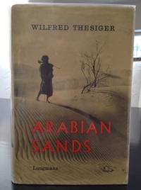
1960réf. 144741960. Thesiger Wilfred. Arabian Sands 1960. First edition second impression of the British explorer's account of his journeys through southern Arabia between 1945 and 1950 including two crossings of the Rub' al Khali or Empty Quarter in 1946-1947 and 1947-1948. Thesiger 1910-2003 known among his Arab companions as Mubarak bin London traveled with Bedouin guides across Oman the deserts of southern Arabia Abu Dhabi and the Trucial Coast recording tribal customs camel journeys desert navigation territorial disputes and the practical demands of survival in an arid environment. His account includes detailed descriptions of the Bedouin communities with whom he traveled particularly their hospitality tribal loyalties conflicts and knowledge of desert routes and water sources. Written before extensive oil development transformed much of southeastern Arabia the narrative records social and geographical conditions during the final years preceding the region's rapid economic and infrastructural changes. Thesiger Wilfred. Arabian Sands. London: Longmans 1960. First edition second impression first published 1959. One volume 326 pp. measuring approximately 9" x 6". Original cloth hardcover in illustrated dust wrapper. Illustrated with 68 photographic illustrations seven maps and a large folding map housed in the rear pocket. The narrative includes chapters devoted to Abu Dhabi the Trucial Coast and the Empty Quarter describing Thesiger's journeys through the territories of present-day Oman Saudi Arabia the United Arab Emirates and Yemen. His photographs record Bedouin companions desert encampments camel caravans regional landscapes and settlements encountered during his travels. The maps trace the principal routes and geographical features of the Arabian interior. Before undertaking his Arabian journeys Thesiger served in the Sudan Political Service and participated in military campaigns in Abyssinia and the Western Desert during the Second World War. His subsequent travels in Arabia were conducted largely on foot and by camel accompanied by Bedouin guides whose knowledge of tribal territories wells and desert conditions made the crossings possible. His descriptions of Abu Dhabi and the Trucial Coast predate the formation of the United Arab Emirates in 1971 and the extensive urban development financed by petroleum revenues. Arabian Sands preserves both Thesiger's observations and the experiences of his Arab traveling companions including Salim bin Kabina and Salim bin Ghabaisha who accompanied him on major portions of his journeys. The dust wrapper shows edge wear and a small 1 cm tear along the upper edge of the verso. Otherwise the book is in very good condition retaining its original dust wrapper photographic illustrations maps and folding map in the rear pocket. unknown