PALGRAVE (William Gifford).Livre Rare Book

1 400 résultats
1866réf. PHO-2081Paris, Hachette., 1866. 2 vol. in-8° de XVI, 346 pp. ; 429, 1 bl., [1] pp. Front. 1 carte et 4 plans h.-t. Demi-chagrin rouge, dos à 4 faux-nerfs, titre et tom. dorés (Reliure de l'époque). Reliure usée, des rousseurs. La p. de titre du tome I est reliée après l'introduction. Bon exemplaire. Édition originale de la traduction. Complet du portrait de l’auteur et des plans.
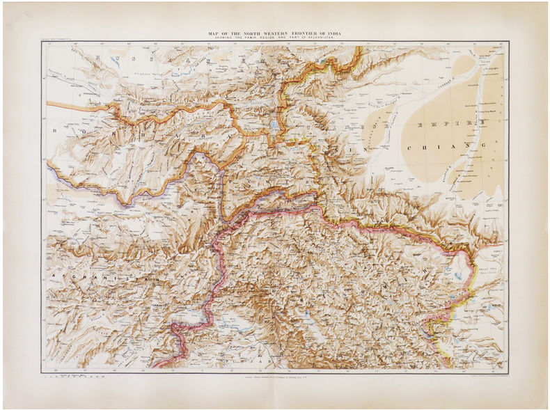
1896réf. LBW-6821London, Edward Stanford, 1896. 470 x 640 mm.
1910Very Good Turkish, Ottoman (1500-1928) Paperback. With a pictorial cover. Large roy. 8vo. (23 x 18 cm). In Ottoman script [and French on the cover]. 355-442 pp., ills. Bilingual cover is written 'Medeniyet Ordusu Yemen çöllerinde' and 'L!Armee dans le Desert de Yemen' bilingual in Turkish with Arabic script and in French. [i.e. The Ottoman civilized army in the desert of Yemen]. Extremely rare.
19308vo., First Edition, on laid paper, with large folding map on japon, half-title and title very lightly spotted, lower corner of half-title and several following leaves lightly creased; handsomely bound in full dark red crushed morocco, sides with gilt frame border, back with raised bands, second and fourth compartments lettered and ruled in gilt, all other compartments tooled and ruled in gilt, gilt top, hand-made endpapers, ribbon marker, fore-edge faintly spotted else an attractive copy ideal as a gift or for presentation. With a double-page genealogy of the House of Sa'ud. Published in Benn's series 'The Modern World'. Bright copy of a key work by the great Arabist.
1866réf. 80646Paris, Librairie Hachette et Cie 1866 Deux volumes. In-8 24 x 15 cm.Reliures demi-chagrin cerise, dos à nerfs, caissons ornés, 429-346 pp. Bien complet de la carte et des 4 plans en noir hors-texte. Humidité clair marginale en fin du premier volume. Coins lég. émoussés. Bon exemplaire
1780réf. 144401780. Irwin Eyles. A Series of Adventures in the Course of a Voyage up the Red Sea 1780. Early Dublin edition of Irwin's firsthand account of his 1777 journey along the Arabian and Egyptian coasts of the Red Sea and through the deserts of Upper Egypt. Born in Calcutta and employed by the British East India Company Irwin undertook the journey after his dismissal from Company service in 1776 traveling to England to seek redress. His eleven-month passage involved encounters with pirates detention difficult desert crossings and travel through territories seldom described firsthand by European visitors. Written as a series of letters addressed to an unnamed lady the narrative records maritime commerce Bedouin encounters local customs and relations between European travelers and Arab populations in the late eighteenth century. Irwin's account also documents the practical difficulties of traveling between British India and Europe through the Red Sea and Ottoman-controlled Egypt. Irwin Eyles. A Series of Adventures in the Course of a Voyage up the Red Sea on the Coast of Arabia and Egypt; and of a Route through the Deserts of Thebais Hitherto Unknown to the European Traveller in the year MDCCLXXVII in Letters to a Lady. Dublin: Sleater Whitestone Potts Colles Wilson Jenkins Flin et al. 1780. Early Dublin edition. One volume 576 pages described as quarto 4to. Bound in antique full leather with gilt decoration to the spine and original title label. Retains the original folding map of the Red Sea with two additional maps lacking. The narrative follows Irwin's passage from India toward England including his experiences along the Arabian coast and his overland journey from Cosseir Quseir through the Egyptian desert toward the Nile Luxor Cairo and Alexandria. His letters describe encounters with local inhabitants the difficulties of desert transportation and conditions in the ports and settlements through which he traveled. The text also includes Irwin's poems "Ode to the Desert" and "Ode to the Nile." The work is referenced in Blackmer Collection 865 and Atabey Collection 609. Published in 1780 Irwin's narrative belongs to the early literature of British travel through the Arabian Peninsula and Egypt when the East India Company's expanding commercial interests made the Red Sea an increasingly consequential passage between India and Europe. His descriptions of Bedouin groups including episodes characterized by the historian Kathryn Tidrick as a prolonged account of Bedouin treachery also preserve the prejudices and expectations through which British travelers interpreted Arab societies. The letters combine personal misadventure with geographical observations and descriptions of regional transportation commerce and encounters between foreign travelers and local authorities. The rear board has been reattached with dark stitching while the front hinge has a 3½" split but remains firm. Corners are bumped and worn with wear and some chipping to the head and foot of the spine. Interior pages remain in very good condition; overall good condition. An early Dublin printing retaining its folding Red Sea map and Irwin's account of travel through Arabia and Egypt in 1777. unknown
1780réf. 144401780. Irwin Eyles. A Series of Adventures in the Course of a Voyage up the Red Sea 1780. Early Dublin edition of Irwin's firsthand account of his 1777 journey along the Arabian and Egyptian coasts of the Red Sea and through the deserts of Upper Egypt. Born in Calcutta and employed by the British East India Company Irwin undertook the journey after his dismissal from Company service in 1776 traveling to England to seek redress. His eleven-month passage involved encounters with pirates detention difficult desert crossings and travel through territories seldom described firsthand by European visitors. Written as a series of letters addressed to an unnamed lady the narrative records maritime commerce Bedouin encounters local customs and relations between European travelers and Arab populations in the late eighteenth century. Irwin's account also documents the practical difficulties of traveling between British India and Europe through the Red Sea and Ottoman-controlled Egypt. Irwin Eyles. A Series of Adventures in the Course of a Voyage up the Red Sea on the Coast of Arabia and Egypt; and of a Route through the Deserts of Thebais Hitherto Unknown to the European Traveller in the year MDCCLXXVII in Letters to a Lady. Dublin: Sleater Whitestone Potts Colles Wilson Jenkins Flin et al. 1780. Early Dublin edition. One volume 576 pages described as quarto 4to. Bound in antique full leather with gilt decoration to the spine and original title label. Retains the original folding map of the Red Sea with two additional maps lacking. The narrative follows Irwin's passage from India toward England including his experiences along the Arabian coast and his overland journey from Cosseir Quseir through the Egyptian desert toward the Nile Luxor Cairo and Alexandria. His letters describe encounters with local inhabitants the difficulties of desert transportation and conditions in the ports and settlements through which he traveled. The text also includes Irwin's poems "Ode to the Desert" and "Ode to the Nile." The work is referenced in Blackmer Collection 865 and Atabey Collection 609. Published in 1780 Irwin's narrative belongs to the early literature of British travel through the Arabian Peninsula and Egypt when the East India Company's expanding commercial interests made the Red Sea an increasingly consequential passage between India and Europe. His descriptions of Bedouin groups including episodes characterized by the historian Kathryn Tidrick as a prolonged account of Bedouin treachery also preserve the prejudices and expectations through which British travelers interpreted Arab societies. The letters combine personal misadventure with geographical observations and descriptions of regional transportation commerce and encounters between foreign travelers and local authorities. The rear board has been reattached with dark stitching while the front hinge has a 3½" split but remains firm. Corners are bumped and worn with wear and some chipping to the head and foot of the spine. Interior pages remain in very good condition; overall good condition. An early Dublin printing retaining its folding Red Sea map and Irwin's account of travel through Arabia and Egypt in 1777. unknown books
1955Exemplaire sur vélin Plumex numéroté (n° 3361), Edition illustrée de 80 aquarelles par Van Dongen, 3 vol. fort in-4 carré cartonnage éditeur réalisé d'après des maquettes de Paul Bonet, NRF, Gallimard, Fasquelle, Paris, 1955 Bon exemplaire bien complet des étuis, et des prospectus d'origine (2 prospectus du tome I et 1 prospectus du tome II). Bon état (accroc à un rhodoïde, un étui lég. frotté) pour cet exemplaire de l'édition en cartonnage Bonet illustré par Van Dongen. Français
1949Light rubbing to spine ends. Hinges professionally repaired. ; Profusely illustrated, partly in color: maps, charts, photographs ; 8vo; 648 pages
London and Cambridge, MacMillan and Co., 1866, volumi 2, in-8, legatura editoriale in piena tela verde con figura di beduino che conduce un cammello impressa in oro al centro dei piatti anteriori, titolo e numero di volumi in oro ai dorsi, pp. XII, [2], 466, [2] - [8], 398, [2]. Con ritratto dell'autore in antiporta al primo volume, una grande carta geografica dell'Arabia più volte ripiegata e 4 piante ripiegate f.t. Esemplare più che buono: solo la cerniera del piatto anteriore del primo volume è usurata all'interno, nel punto di contatto fra la controguardia anteriore e la prima carta di guardia.
1926réf. 144751926. Cheesman Robert Ernest. In Unknown Arabia 1926. First edition of the British military officer explorer and ornithologist's account of his 1923-1924 expedition through eastern Arabia including Bahrain Hufuf the Al-Hasa oasis Jabrin and Uqair. Undertaken during the territorial consolidation of Abdulaziz Ibn Saud's rule Cheesman's expedition combined geographical surveying with zoological collecting in regions of the Arabian interior that had received limited European scientific investigation. He mapped the Arabian coast between the Gulf of Salwa and Uqair established geographical positions in the Hufuf region and investigated the location of ancient Gerrha a trading center associated with the classical history of eastern Arabia. His observations and survey results were presented to Ibn Saud at his court in Hufuf. Cheesman also collected more than 300 natural history specimens in the Al-Hasa region including mammals and birds contributing to the scientific documentation of Arabian fauna. His discoveries included the gerbil species subsequently named Gerbillus cheesmani in his honor. Cheesman Robert Ernest. In Unknown Arabia. London: Macmillan & Co. 1926. First edition. One volume 447 pp. illustrated with 67 photographic illustrations and three maps including a large folding colored map of Arabia depicting Qatar and Trucial Oman. Library binding with a small sticker on the front endpaper. With a foreword by Major-General Sir Percy Cox the narrative follows Cheesman's travels from Bahrain through Uqair and Hufuf into the desert regions surrounding Jabrin. The photographic illustrations depict settlements archaeological remains desert terrain local inhabitants and natural history subjects encountered during the expedition. The geographical observations are accompanied by scientific appendices addressing mammals birds reptiles amphibians fish insects botany geology and meteorology. The large folding map records the geographical setting of the expedition including the eastern Arabian coast and neighboring territories of the Persian Gulf. Cheesman's expedition took place during Ibn Saud's expansion of political control over the Arabian Peninsula following his conquest of Al-Hasa from the Ottoman Empire in 1913 and before the establishment of the Kingdom of Saudi Arabia in 1932. His surveys contributed to the Royal Geographical Society's mapping of eastern Arabia particularly the routes between Uqair and Jabrin while his zoological collections expanded contemporary knowledge of the peninsula's wildlife. The account also records settlements desert transportation water sources and relations with local authorities during the early years of Saudi territorial consolidation. This copy contains pencil annotations on page 71 light foxing rubbing to the binding edges and small tears along the lower edges of pages 40 and 42. The large folding map has a 2" separation along the centerfold near the edge and margins. Otherwise complete retaining all photographic illustrations and the folding colored map; overall in good condition. unknown
1926réf. 144751926. Cheesman Robert Ernest. In Unknown Arabia 1926. First edition of the British military officer explorer and ornithologist's account of his 1923-1924 expedition through eastern Arabia including Bahrain Hufuf the Al-Hasa oasis Jabrin and Uqair. Undertaken during the territorial consolidation of Abdulaziz Ibn Saud's rule Cheesman's expedition combined geographical surveying with zoological collecting in regions of the Arabian interior that had received limited European scientific investigation. He mapped the Arabian coast between the Gulf of Salwa and Uqair established geographical positions in the Hufuf region and investigated the location of ancient Gerrha a trading center associated with the classical history of eastern Arabia. His observations and survey results were presented to Ibn Saud at his court in Hufuf. Cheesman also collected more than 300 natural history specimens in the Al-Hasa region including mammals and birds contributing to the scientific documentation of Arabian fauna. His discoveries included the gerbil species subsequently named Gerbillus cheesmani in his honor. Cheesman Robert Ernest. In Unknown Arabia. London: Macmillan & Co. 1926. First edition. One volume 447 pp. illustrated with 67 photographic illustrations and three maps including a large folding colored map of Arabia depicting Qatar and Trucial Oman. Library binding with a small sticker on the front endpaper. With a foreword by Major-General Sir Percy Cox the narrative follows Cheesman's travels from Bahrain through Uqair and Hufuf into the desert regions surrounding Jabrin. The photographic illustrations depict settlements archaeological remains desert terrain local inhabitants and natural history subjects encountered during the expedition. The geographical observations are accompanied by scientific appendices addressing mammals birds reptiles amphibians fish insects botany geology and meteorology. The large folding map records the geographical setting of the expedition including the eastern Arabian coast and neighboring territories of the Persian Gulf. Cheesman's expedition took place during Ibn Saud's expansion of political control over the Arabian Peninsula following his conquest of Al-Hasa from the Ottoman Empire in 1913 and before the establishment of the Kingdom of Saudi Arabia in 1932. His surveys contributed to the Royal Geographical Society's mapping of eastern Arabia particularly the routes between Uqair and Jabrin while his zoological collections expanded contemporary knowledge of the peninsula's wildlife. The account also records settlements desert transportation water sources and relations with local authorities during the early years of Saudi territorial consolidation. This copy contains pencil annotations on page 71 light foxing rubbing to the binding edges and small tears along the lower edges of pages 40 and 42. The large folding map has a 2" separation along the centerfold near the edge and margins. Otherwise complete retaining all photographic illustrations and the folding colored map; overall in good condition. unknown books
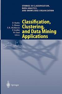
2004réf. DBS-9783540220145Springer 2004. 1st. New. Springer unknown
2004réf. DBS-9783540220145Springer 2004. 1st. New. Springer unknown
1780réf. GRA237Paris, Dezauche, 1780 Carte gravee sur cuivre, frontieres coloriees avec cartouche, 47 x 63 l'image. Elle montre aussi les Balkans, l'Afrique du Nord, l'Italie ..
1710réf. 144631710. Cluverius Philipp. Arabia Eudaemon ex Plinio Lib VI 1710. Original hand-colored copperplate map of the Arabian Peninsula drawing upon the geographical descriptions of Arabia recorded by the Roman natural historian Pliny the Elder in Book VI of his Naturalis Historia. The title referring to Arabia Felix or "Fortunate Arabia" recalls the classical geographical division of the peninsula into Arabia Felix Arabia Deserta and Arabia Petraea. The map belongs to the European tradition of historical cartography in which ancient Greek and Roman geographical accounts continued to inform printed maps well into the eighteenth century. Its depiction of the peninsula records the transmission of classical geographical knowledge through early modern European atlas production. Cluverius Philipp attributed. Arabia Eudaemon ex Plinio Lib VI. 1710. Original hand-colored copperplate engraving measuring approximately 8½" x 12". The map presents the Arabian Peninsula according to classical geographical sources incorporating historical place names and geographical divisions associated with the ancient understanding of Arabia. Its engraved delineation and hand coloring distinguish the landmass and geographical features. The map follows the cartographic work of Philipp Clüver 1580-1622 whose Introductionis in Universam Geographiam was repeatedly published in European editions throughout the seventeenth and early eighteenth centuries. Clüver's geographical writings combined classical literary sources with the cartographic scholarship of his period and his maps circulated widely through successive editions of his geographical handbook. The reference to Pliny in the title identifies the ancient textual source underlying this depiction of Arabia preserving geographical terminology inherited from Roman antiquity rather than presenting an exclusively contemporary survey of the peninsula. The map has general age-related toning with vibrant hand coloring remaining intact. Overall in very good condition. unknown
1710réf. 144631710. Cluverius Philipp. Arabia Eudaemon ex Plinio Lib VI 1710. Original hand-colored copperplate map of the Arabian Peninsula drawing upon the geographical descriptions of Arabia recorded by the Roman natural historian Pliny the Elder in Book VI of his Naturalis Historia. The title referring to Arabia Felix or "Fortunate Arabia" recalls the classical geographical division of the peninsula into Arabia Felix Arabia Deserta and Arabia Petraea. The map belongs to the European tradition of historical cartography in which ancient Greek and Roman geographical accounts continued to inform printed maps well into the eighteenth century. Its depiction of the peninsula records the transmission of classical geographical knowledge through early modern European atlas production. Cluverius Philipp attributed. Arabia Eudaemon ex Plinio Lib VI. 1710. Original hand-colored copperplate engraving measuring approximately 8½" x 12". The map presents the Arabian Peninsula according to classical geographical sources incorporating historical place names and geographical divisions associated with the ancient understanding of Arabia. Its engraved delineation and hand coloring distinguish the landmass and geographical features. The map follows the cartographic work of Philipp Clüver 1580-1622 whose Introductionis in Universam Geographiam was repeatedly published in European editions throughout the seventeenth and early eighteenth centuries. Clüver's geographical writings combined classical literary sources with the cartographic scholarship of his period and his maps circulated widely through successive editions of his geographical handbook. The reference to Pliny in the title identifies the ancient textual source underlying this depiction of Arabia preserving geographical terminology inherited from Roman antiquity rather than presenting an exclusively contemporary survey of the peninsula. The map has general age-related toning with vibrant hand coloring remaining intact. Overall in very good condition. unknown books
18718vo. 38 pages. From the "Library of Peter Hopkirk". Bound in marbled paper wrappers. With the book plate of the library of Peter Hopkirk to verso of the title page. In very good condition. Rare published annexed letters from W. P. Andrew, Chairman of the Scinde, Punjab, and Delhi Railway Company, "addressed to members of her Majesty's Government, to the Grand Vizier of the Turkish Empire, and to the British Ambassador at Constantinople, in reference to the proposed Euphrates Valley Railway". Andrew is the author of " Memoir of the Euphrates Valley Route to India" and "The Indus and its Provinces". Following is the list of letters: "His Highness Aali Pasha, Grand Vizier of Constantinople", dated 15th May, 1870 "The Under Secretary of State of India", dated 18th August, 1870 "The Under Secretary of State for Foreign Affairs", dated 17th September, 1870 "The Most Noble the Marquis of Harington, Post Master General", dated 19th September, 1870 "The Under Secretary of State for War", dated 21st September, 1870 "His Excellency the Right Honourable Sir Henry G. Elliott, G.C.B., British Ambassador at Constantinople", dated 25th October, 1870 "Scinde, Punjaub and Delhi Railway Companies", dated 14th July, 1863
1875deciphered and translated into the Hebrew and English Languages. 2 photographic plates, 4 large folding lithographed plates, viii, 44 pages, Octavo, frontis of Captain Renczynski, bound in red cloth with gilt lettering on spine, some sunning to boards and spine, otherwise a nice and tight copy of this rare book.The Moabite Stone is a dark-colored, basalt monument about four feet high by two feet wide, dating to the reign of King Mesha in about 850 B.C. This artifact is another important source that corroborates the biblical account of the early Israelites. It currently resides in the Louvre Museum, Paris. A very interesting piece of Judaica and an item of Archeological interest. Extremely Scarce.
1752Detailed analysis of Banian and Parsi creationist beliefs, including the first humans, the first and second age of the world, God's communication to the world through Bremaw's book (Banian), ceremonial law, order of government, the derivation and meaning of 'Banian,' and 'Persee,' and more. This is the first printed summary of Hindu doctrines and practices to appear in Europe. Topics examined include idolatry, fire worship, immortality, rapture, vegetarianism, the Indian caste system and Hindu theory of world cycles - specifically Satya Yuga and Treta Yuga, as well as Persian migration to the East Indies, the prophet Zerdusht (Zarthusthra, Zarthost), so forth. A fascinating early treatise. Henry Lord's book was the first in English to be entirely devoted to discussion of Indian religions, and represents the first serious attempt to go beyond reports by travellers of the strange religious beliefs and practices that they had observed in India. Initially publishing his account in 1630, Lord was a chaplain, rather than a missionary, and made a serious attempt to understand the religions rather than condemn them. The display was used as a source by later European writers on Indian religions, most notably François Bernier. "Lord was sometime resident in India at Surat and Preacher to the Honourable Company of Merchants trading to East India (Cox I p.270)." Folio, measuring approximately 13.5 inches x 9 inches. 42 pages, numbered from 315 to 356, plus title page. In itself complete, this account is from Churchill's eight-volume work which contained numerous travel narratives, and was titled "A Collection of Voyages and Travels, Some Now First Printed from Original Manuscripts. Others Now First Published in English." These are the original pages printed in 1752. Mild foxing, otherwise in very good condition, clean and bright with wide margins, a lovely example of early printing. Attractively bound in recent green cardstock covers with label.
In 24°, piena perg. coeva, tit. manoscritto al dorso, pp.297. Bel front. finemente inc. (sul retro applicata etichetta di donazione: Abate Giovachino Mugnoz Spagnuolo donò alla Comune di Bologna 1844) raffigurante arabo in costume. Unito: Volfangi Drechsleri "Historia arabum". Per un errore tipografico dalla p.269 si salta alla p. 280, quindi pp.270-279 omesse. Leggera uniforme brunit. della carta, due piccolissimi fori di tarlo (minima perdita di testo) alle ultime 2 cc. ma buon es. Raro e interessantissimo testo anonimo sugli usi e costumi dei paesi asiatici e arabici.
1976In english, with the arabic text 1 vol. in-8 br., Heidelberg, 1976, 94 pp. Exceptionnel exemplaire dédicacé par Yvonne Dold-Samplonius au mathématicien René Thom Honoré par la Médaille Fields en 1958, le mathématicien français René Thom (1923 - 2002) est le célèbre fondateur de la théorie des catastrophes. Bon exemplaire Anglais
réf. 205959Paris, Dentu, an X - 1802 in-8, viij-457 pp., avec une carte dépliante, basane fauve racinée, dos lisse orné de guirlandes et fleurons dorés, pièce de titre brique, pointillé doré sur les coupes, tranches jaunes, gardes de papier bleu (reliure de l'époque). Petit manque à la coiffe inférieure, épidermures sur le plat supérieur.
PARIS, Chez Vincent, 1772 - In-8 - EDITION ORIGINALE - Reliure plein veau marbré de l'époque (coins usés) - Dos à nerfs à caissons fleuronnés - Pièce de titre en maroquin rouge - Tranches mouchetées - Roulettes sur les coupes - VI-733 pages - Ex-libris cachet "de Talhouet" - Bon exemplaire - Envoi rapide et soigné
réf. 55859Deuxième édition complète, 2 vol. in-8 reliure demi-chagrin brun, dos à 5 nerfs dorés, Tomes 2 et 3 des "Oeuvres complètes de Volney", Parmantier, Libraire, Froment, Libraire, Paris, 1825, 2 ff., 447 pp. avec 2 planches dépliantes et 2 cartes dépliantes ; 2 ff., 436 pp. avec 2 planches dépliantes et 1 carte dépliante