1 482 résultats
In 24°, piena perg. coeva, tit. manoscritto al dorso, pp.297. Bel front. finemente inc. (sul retro applicata etichetta di donazione: Abate Giovachino Mugnoz Spagnuolo donò alla Comune di Bologna 1844) raffigurante arabo in costume. Unito: Volfangi Drechsleri "Historia arabum". Per un errore tipografico dalla p.269 si salta alla p. 280, quindi pp.270-279 omesse. Leggera uniforme brunit. della carta, due piccolissimi fori di tarlo (minima perdita di testo) alle ultime 2 cc. ma buon es. Raro e interessantissimo testo anonimo sugli usi e costumi dei paesi asiatici e arabici.
1635In 16°(mm 110x55); pagg. 247. Frontespizio figurato in rame. Piena pergamena semirigida coeva, dorso liscio con titolo manoscritto al dorso. Seconda edizione curata tipograficamente dai Blaeu. Interessante opera di carattere storico geografico sugli usi e costumi dei paesi arabi, riguardante la storia araba e islamica, la topografia del luogo e leggi; include un resoconto di viaggio a Gerusalemme e Siria di Johannes Cootwijk ed un'appendice del calendario mussulmano. Vi sono le descrizioni di numerose città arabe come Baghdad, Bokhara, Damascus, Medina, Mecca, Aleppo, etc. L'opera è così suddivisa: Gabriel Sionita, "De nonnullis orientalium urbibus, nec non indigenarum religione ac moribus, tractatus brevis"; Christophe Richer, "De moribus atque institutis turcarum, arabum, aliarumque, quae Mahumedem sequuntur, gentium; Johannis Cotovici, "Itinerario hierosolymitano et syriaco, de sacris, ritibus, moribus et institutis mahometaeorum"; T. F. Noonan, The road to Jerusalem, pp. 198-202: "Jan van Cootwijk, dottore in legge ad Anversa, compì il suo viaggio in Terra Santa nel 1596; questo fu poi dato alle stampe, in latino, solo nell'anno 1619. L'Itinerarium si segnala perché, slegandosi dal viaggio ideale narrato da altri suoi contemporanei, descrive in modo realistico e problematico (con tono ansioso e metodico) quello che era diventato il pellegrinaggio ai Luoghi Santi, dopo che, nel 1571, i Turchi avevano tolto Cipro a Venezia". Johann Ludwig Gottfried, "Excerpta ex Lodovici Godofredi archontologia cosmica";"Arabiae topographia et alia, ex Adriani Romani theatro urbium"; Wolfgang Drechsler, "Historia Arabum". Buon esemplare che presenta ossidazione interna generale, e una traccia di tarlo al margine interna, alone a talune pagg. alla fine del tomo.16 °(mm 110x55). pp. 247. Copper engraving title with a full length portrait of an Arabian holding a cartouche, floriated woodcut initials. Contemporary vellum. This important and interesting work describes the antique cities such as Baghdad, Bokhara, Damascus, Medina, Mecca, Aleppo, etc. Second edition. The opera is divided in: Gabriel Sionita, "De nonnullis orientalium urbibus, nec non indigenarum religione ac moribus, tractatus brevis"; Christophe Richer, "De moribus atque institutis turcarum, arabum, aliarumque, quae Mahumedem sequuntur, gentium; Johannis Cotovici, "Itinerario hierosolymitano et syriaco, de sacris, ritibus, moribus et institutis mahometaeorum". Good copy, genuine. Some paper discoloration and a water stain at last 23 pages
réf. 17930aafZürich, Silva, 1971, in-4°, 121 S., illustriert mit Fotos vom Verfasser, Original-Pappband.
19308vo., First Edition, on laid paper, with large folding map on japon, half-title and title very lightly spotted, lower corner of half-title and several following leaves lightly creased; handsomely bound in full dark red crushed morocco, sides with gilt frame border, back with raised bands, second and fourth compartments lettered and ruled in gilt, all other compartments tooled and ruled in gilt, gilt top, hand-made endpapers, ribbon marker, fore-edge faintly spotted else an attractive copy ideal as a gift or for presentation. With a double-page genealogy of the House of Sa'ud. Published in Benn's series 'The Modern World'. Bright copy of a key work by the great Arabist.
1994réf. 2952Antiikki- ja taidekirjat 1994. Facsimile Edition. Softcover. Very Good. Discover a richly illustrated facsimile edition of the original 1936 Arabia factory catalogue from Finland republished in 1994. This historical price list and product catalogue features many Arabia tableware and porcelain designs from the period. It faithfully reproduces the original catalogue in full and contains extensive detailed information. Text in Finnish. 120 pp. Antiikki- ja taidekirjat paperback
2006réf. 7492Suomen Antiikki- ja Taidekirjat 2006. Facsimile Edition. Softsover. Very Good. This three-book set offers detailed insights into Arabia porcelain. The set includes: 1 Arabia taideteollisuusosaston esineet riisiesineet = Artiklar från konstindustriavdelningen risartiklar = Articles from the Applied Art Pieces in Ricetechniquee: Facsimile edition 2005. ISBN 952-5240-07-X. Text in Finnish product details also in Swedish and English. 2 Arabia talousposliini ja -fajanssi = Hushållsporslin och -fajans = Porcelain and Faeince: Facsimile edition 2006. ISBN 952-5240-08-8. Text in Finnish product details also in Swedish and English. 314 pages. 3 Hintaluettelo : Talousposliineja 1936 = Price List: Economy Porcelain 1936: Facsimile edition 2005 ISBN 951-96328-3-2. Text in Finnish product details also in Finnish. 120 pages. Each volume is richly illustrated and filled with detailed information offering comprehensive coverage of Arabia's production and design. One book's cover has a small stain and all covers show light signs of use. Suomen Antiikki- ja Taidekirjat unknown
19904to; 224 pp, colorillus, many full-page, map. original cloth, dj, fine. A picture of this book is available upon request by email. Good overview of natural history with excellent photos, references, and index of Latin names.
1780réf. 144401780. Irwin Eyles. A Series of Adventures in the Course of a Voyage up the Red Sea 1780. Early Dublin edition of Irwin's firsthand account of his 1777 journey along the Arabian and Egyptian coasts of the Red Sea and through the deserts of Upper Egypt. Born in Calcutta and employed by the British East India Company Irwin undertook the journey after his dismissal from Company service in 1776 traveling to England to seek redress. His eleven-month passage involved encounters with pirates detention difficult desert crossings and travel through territories seldom described firsthand by European visitors. Written as a series of letters addressed to an unnamed lady the narrative records maritime commerce Bedouin encounters local customs and relations between European travelers and Arab populations in the late eighteenth century. Irwin's account also documents the practical difficulties of traveling between British India and Europe through the Red Sea and Ottoman-controlled Egypt. Irwin Eyles. A Series of Adventures in the Course of a Voyage up the Red Sea on the Coast of Arabia and Egypt; and of a Route through the Deserts of Thebais Hitherto Unknown to the European Traveller in the year MDCCLXXVII in Letters to a Lady. Dublin: Sleater Whitestone Potts Colles Wilson Jenkins Flin et al. 1780. Early Dublin edition. One volume 576 pages described as quarto 4to. Bound in antique full leather with gilt decoration to the spine and original title label. Retains the original folding map of the Red Sea with two additional maps lacking. The narrative follows Irwin's passage from India toward England including his experiences along the Arabian coast and his overland journey from Cosseir Quseir through the Egyptian desert toward the Nile Luxor Cairo and Alexandria. His letters describe encounters with local inhabitants the difficulties of desert transportation and conditions in the ports and settlements through which he traveled. The text also includes Irwin's poems "Ode to the Desert" and "Ode to the Nile." The work is referenced in Blackmer Collection 865 and Atabey Collection 609. Published in 1780 Irwin's narrative belongs to the early literature of British travel through the Arabian Peninsula and Egypt when the East India Company's expanding commercial interests made the Red Sea an increasingly consequential passage between India and Europe. His descriptions of Bedouin groups including episodes characterized by the historian Kathryn Tidrick as a prolonged account of Bedouin treachery also preserve the prejudices and expectations through which British travelers interpreted Arab societies. The letters combine personal misadventure with geographical observations and descriptions of regional transportation commerce and encounters between foreign travelers and local authorities. The rear board has been reattached with dark stitching while the front hinge has a 3½" split but remains firm. Corners are bumped and worn with wear and some chipping to the head and foot of the spine. Interior pages remain in very good condition; overall good condition. An early Dublin printing retaining its folding Red Sea map and Irwin's account of travel through Arabia and Egypt in 1777. unknown
1780réf. 144401780. Irwin Eyles. A Series of Adventures in the Course of a Voyage up the Red Sea 1780. Early Dublin edition of Irwin's firsthand account of his 1777 journey along the Arabian and Egyptian coasts of the Red Sea and through the deserts of Upper Egypt. Born in Calcutta and employed by the British East India Company Irwin undertook the journey after his dismissal from Company service in 1776 traveling to England to seek redress. His eleven-month passage involved encounters with pirates detention difficult desert crossings and travel through territories seldom described firsthand by European visitors. Written as a series of letters addressed to an unnamed lady the narrative records maritime commerce Bedouin encounters local customs and relations between European travelers and Arab populations in the late eighteenth century. Irwin's account also documents the practical difficulties of traveling between British India and Europe through the Red Sea and Ottoman-controlled Egypt. Irwin Eyles. A Series of Adventures in the Course of a Voyage up the Red Sea on the Coast of Arabia and Egypt; and of a Route through the Deserts of Thebais Hitherto Unknown to the European Traveller in the year MDCCLXXVII in Letters to a Lady. Dublin: Sleater Whitestone Potts Colles Wilson Jenkins Flin et al. 1780. Early Dublin edition. One volume 576 pages described as quarto 4to. Bound in antique full leather with gilt decoration to the spine and original title label. Retains the original folding map of the Red Sea with two additional maps lacking. The narrative follows Irwin's passage from India toward England including his experiences along the Arabian coast and his overland journey from Cosseir Quseir through the Egyptian desert toward the Nile Luxor Cairo and Alexandria. His letters describe encounters with local inhabitants the difficulties of desert transportation and conditions in the ports and settlements through which he traveled. The text also includes Irwin's poems "Ode to the Desert" and "Ode to the Nile." The work is referenced in Blackmer Collection 865 and Atabey Collection 609. Published in 1780 Irwin's narrative belongs to the early literature of British travel through the Arabian Peninsula and Egypt when the East India Company's expanding commercial interests made the Red Sea an increasingly consequential passage between India and Europe. His descriptions of Bedouin groups including episodes characterized by the historian Kathryn Tidrick as a prolonged account of Bedouin treachery also preserve the prejudices and expectations through which British travelers interpreted Arab societies. The letters combine personal misadventure with geographical observations and descriptions of regional transportation commerce and encounters between foreign travelers and local authorities. The rear board has been reattached with dark stitching while the front hinge has a 3½" split but remains firm. Corners are bumped and worn with wear and some chipping to the head and foot of the spine. Interior pages remain in very good condition; overall good condition. An early Dublin printing retaining its folding Red Sea map and Irwin's account of travel through Arabia and Egypt in 1777. unknown books
1928réf. 144801928. Lees G. M. The Physical Geography of South-Eastern Arabia 1928. Original geographical and geological report documenting the British geologist's expeditions through Oman and southeastern Arabia during 1925-1926 including investigations of mountainous and desert regions that had received limited systematic European surveying. George Martin Lees an assistant geologist with the Anglo-Persian Oil Company undertook fieldwork examining the geological formations tectonic structure and physical geography of Oman. His findings were presented before the Royal Geographical Society on January 16 1928 and subsequently published in The Geographical Journal. The report combines geographical surveys with observations on the water supply of Bahrain and the Qatar Peninsula archaeological discoveries of flint implements natural history collections and descriptions of the Mahri and Gara nomadic populations of southern Arabia. Lees G. M. The Physical Geography of South-Eastern Arabia. London: Royal Geographical Society 1928. Original 30-page illustrated report published in The Geographical Journal Vol. 71 No. 5 May 1928. Retained in its original blue printed wrappers with titles on the front and the original advertisements present. Illustrated with four sketch maps and photographic plates. The report examines the physical geography and geological tectonics of southeastern Arabia particularly the mountainous interior and surrounding desert regions of Oman. Lees describes his surveying expeditions geological observations and the geographical characteristics of areas previously imperfectly recorded on European maps. Supplementary material addresses water resources in Bahrain and Qatar the discovery of prehistoric flint implements and collections of birds and insects. His observations concerning the Mahri and Gara tribes include information on the inhabitants of the southern Arabian territories through which his expeditions passed. Lees's investigations preceded the extensive petroleum exploration and geological mapping undertaken across southeastern Arabia during the following decades. His employment with the Anglo-Persian Oil Company placed his geological fieldwork within the early history of commercial interest in the region's subsurface resources while his surveys contributed geographical information on Oman's mountain systems geological formations and interior routes. The archaeological and zoological observations extend the report beyond geology recording evidence of prehistoric human activity and regional wildlife. The original 1928 publication retains its blue wrappers and advertisements and is in very good condition. unknown
1928réf. 144801928. Lees G. M. The Physical Geography of South-Eastern Arabia 1928. Original geographical and geological report documenting the British geologist's expeditions through Oman and southeastern Arabia during 1925-1926 including investigations of mountainous and desert regions that had received limited systematic European surveying. George Martin Lees an assistant geologist with the Anglo-Persian Oil Company undertook fieldwork examining the geological formations tectonic structure and physical geography of Oman. His findings were presented before the Royal Geographical Society on January 16 1928 and subsequently published in The Geographical Journal. The report combines geographical surveys with observations on the water supply of Bahrain and the Qatar Peninsula archaeological discoveries of flint implements natural history collections and descriptions of the Mahri and Gara nomadic populations of southern Arabia. Lees G. M. The Physical Geography of South-Eastern Arabia. London: Royal Geographical Society 1928. Original 30-page illustrated report published in The Geographical Journal Vol. 71 No. 5 May 1928. Retained in its original blue printed wrappers with titles on the front and the original advertisements present. Illustrated with four sketch maps and photographic plates. The report examines the physical geography and geological tectonics of southeastern Arabia particularly the mountainous interior and surrounding desert regions of Oman. Lees describes his surveying expeditions geological observations and the geographical characteristics of areas previously imperfectly recorded on European maps. Supplementary material addresses water resources in Bahrain and Qatar the discovery of prehistoric flint implements and collections of birds and insects. His observations concerning the Mahri and Gara tribes include information on the inhabitants of the southern Arabian territories through which his expeditions passed. Lees's investigations preceded the extensive petroleum exploration and geological mapping undertaken across southeastern Arabia during the following decades. His employment with the Anglo-Persian Oil Company placed his geological fieldwork within the early history of commercial interest in the region's subsurface resources while his surveys contributed geographical information on Oman's mountain systems geological formations and interior routes. The archaeological and zoological observations extend the report beyond geology recording evidence of prehistoric human activity and regional wildlife. The original 1928 publication retains its blue wrappers and advertisements and is in very good condition. unknown books
1710réf. 144631710. Cluverius Philipp. Arabia Eudaemon ex Plinio Lib VI 1710. Original hand-colored copperplate map of the Arabian Peninsula drawing upon the geographical descriptions of Arabia recorded by the Roman natural historian Pliny the Elder in Book VI of his Naturalis Historia. The title referring to Arabia Felix or "Fortunate Arabia" recalls the classical geographical division of the peninsula into Arabia Felix Arabia Deserta and Arabia Petraea. The map belongs to the European tradition of historical cartography in which ancient Greek and Roman geographical accounts continued to inform printed maps well into the eighteenth century. Its depiction of the peninsula records the transmission of classical geographical knowledge through early modern European atlas production. Cluverius Philipp attributed. Arabia Eudaemon ex Plinio Lib VI. 1710. Original hand-colored copperplate engraving measuring approximately 8½" x 12". The map presents the Arabian Peninsula according to classical geographical sources incorporating historical place names and geographical divisions associated with the ancient understanding of Arabia. Its engraved delineation and hand coloring distinguish the landmass and geographical features. The map follows the cartographic work of Philipp Clüver 1580-1622 whose Introductionis in Universam Geographiam was repeatedly published in European editions throughout the seventeenth and early eighteenth centuries. Clüver's geographical writings combined classical literary sources with the cartographic scholarship of his period and his maps circulated widely through successive editions of his geographical handbook. The reference to Pliny in the title identifies the ancient textual source underlying this depiction of Arabia preserving geographical terminology inherited from Roman antiquity rather than presenting an exclusively contemporary survey of the peninsula. The map has general age-related toning with vibrant hand coloring remaining intact. Overall in very good condition. unknown
1847réf. 146851847. Firmin Didot. Three steel engravings published in L'Univers Pittoresque in 1847 depicting the Sultan of Lahij's palace a greeting between two Arab men and a saddled camel prepared for travel. The group belongs to the illustrated French literature through which nineteenth-century European readers encountered the Arabian Peninsula combining architectural views with scenes of customary greeting and travel. The Lahij image is especially useful for documenting how the residence of the sultanate near Aden was visually presented to European audiences before the major political changes that reshaped southern Arabia later in the century. Firmin Didot. Chateau Du Saltan d'Aden a Lahadj; Salut des Arabes; Chameau scelle pour le Voyage. Paris: Firmin Didot 1847. Three original steel engravings each approximately 5 x 8.2 inches. Chateau Du Saltan d'Aden a Lahadj shows the Sultan of Lahij's castle set within a cultivated and mountainous landscape with palm trees and surrounding countryside. Salut des Arabes depicts two Arab men greeting one another with a handshake. Chameau scelle pour le Voyage shows a saddled camel in a desert setting emphasizing the animal's role in overland travel. Comparable examples of these subjects are attributed to the engraver Lemaitre in the contemporary print market. The three prints preserve a French illustrated view of southern Arabia that moves between political architecture social custom and transportation. Their publication in 1847 places them within the period when Aden had already come under British control while neighboring Lahij retained its own sultanate giving the palace view a specific political geography distinct from the port colony itself. Some age-related toning and pinholes in the upper margins; the first engraving has remnants of a sticker at the upper right corner. The third engraving shows former staple marks and an approximately 4 cm loss along the upper edge not affecting the image. Overall very good condition. unknown
1926réf. 144751926. Cheesman Robert Ernest. In Unknown Arabia 1926. First edition of the British military officer explorer and ornithologist's account of his 1923-1924 expedition through eastern Arabia including Bahrain Hufuf the Al-Hasa oasis Jabrin and Uqair. Undertaken during the territorial consolidation of Abdulaziz Ibn Saud's rule Cheesman's expedition combined geographical surveying with zoological collecting in regions of the Arabian interior that had received limited European scientific investigation. He mapped the Arabian coast between the Gulf of Salwa and Uqair established geographical positions in the Hufuf region and investigated the location of ancient Gerrha a trading center associated with the classical history of eastern Arabia. His observations and survey results were presented to Ibn Saud at his court in Hufuf. Cheesman also collected more than 300 natural history specimens in the Al-Hasa region including mammals and birds contributing to the scientific documentation of Arabian fauna. His discoveries included the gerbil species subsequently named Gerbillus cheesmani in his honor. Cheesman Robert Ernest. In Unknown Arabia. London: Macmillan & Co. 1926. First edition. One volume 447 pp. illustrated with 67 photographic illustrations and three maps including a large folding colored map of Arabia depicting Qatar and Trucial Oman. Library binding with a small sticker on the front endpaper. With a foreword by Major-General Sir Percy Cox the narrative follows Cheesman's travels from Bahrain through Uqair and Hufuf into the desert regions surrounding Jabrin. The photographic illustrations depict settlements archaeological remains desert terrain local inhabitants and natural history subjects encountered during the expedition. The geographical observations are accompanied by scientific appendices addressing mammals birds reptiles amphibians fish insects botany geology and meteorology. The large folding map records the geographical setting of the expedition including the eastern Arabian coast and neighboring territories of the Persian Gulf. Cheesman's expedition took place during Ibn Saud's expansion of political control over the Arabian Peninsula following his conquest of Al-Hasa from the Ottoman Empire in 1913 and before the establishment of the Kingdom of Saudi Arabia in 1932. His surveys contributed to the Royal Geographical Society's mapping of eastern Arabia particularly the routes between Uqair and Jabrin while his zoological collections expanded contemporary knowledge of the peninsula's wildlife. The account also records settlements desert transportation water sources and relations with local authorities during the early years of Saudi territorial consolidation. This copy contains pencil annotations on page 71 light foxing rubbing to the binding edges and small tears along the lower edges of pages 40 and 42. The large folding map has a 2" separation along the centerfold near the edge and margins. Otherwise complete retaining all photographic illustrations and the folding colored map; overall in good condition. unknown
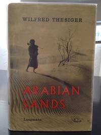
1960réf. 144741960. Thesiger Wilfred. Arabian Sands 1960. First edition second impression of the British explorer's account of his journeys through southern Arabia between 1945 and 1950 including two crossings of the Rub' al Khali or Empty Quarter in 1946-1947 and 1947-1948. Thesiger 1910-2003 known among his Arab companions as Mubarak bin London traveled with Bedouin guides across Oman the deserts of southern Arabia Abu Dhabi and the Trucial Coast recording tribal customs camel journeys desert navigation territorial disputes and the practical demands of survival in an arid environment. His account includes detailed descriptions of the Bedouin communities with whom he traveled particularly their hospitality tribal loyalties conflicts and knowledge of desert routes and water sources. Written before extensive oil development transformed much of southeastern Arabia the narrative records social and geographical conditions during the final years preceding the region's rapid economic and infrastructural changes. Thesiger Wilfred. Arabian Sands. London: Longmans 1960. First edition second impression first published 1959. One volume 326 pp. measuring approximately 9" x 6". Original cloth hardcover in illustrated dust wrapper. Illustrated with 68 photographic illustrations seven maps and a large folding map housed in the rear pocket. The narrative includes chapters devoted to Abu Dhabi the Trucial Coast and the Empty Quarter describing Thesiger's journeys through the territories of present-day Oman Saudi Arabia the United Arab Emirates and Yemen. His photographs record Bedouin companions desert encampments camel caravans regional landscapes and settlements encountered during his travels. The maps trace the principal routes and geographical features of the Arabian interior. Before undertaking his Arabian journeys Thesiger served in the Sudan Political Service and participated in military campaigns in Abyssinia and the Western Desert during the Second World War. His subsequent travels in Arabia were conducted largely on foot and by camel accompanied by Bedouin guides whose knowledge of tribal territories wells and desert conditions made the crossings possible. His descriptions of Abu Dhabi and the Trucial Coast predate the formation of the United Arab Emirates in 1971 and the extensive urban development financed by petroleum revenues. Arabian Sands preserves both Thesiger's observations and the experiences of his Arab traveling companions including Salim bin Kabina and Salim bin Ghabaisha who accompanied him on major portions of his journeys. The dust wrapper shows edge wear and a small 1 cm tear along the upper edge of the verso. Otherwise the book is in very good condition retaining its original dust wrapper photographic illustrations maps and folding map in the rear pocket. unknown
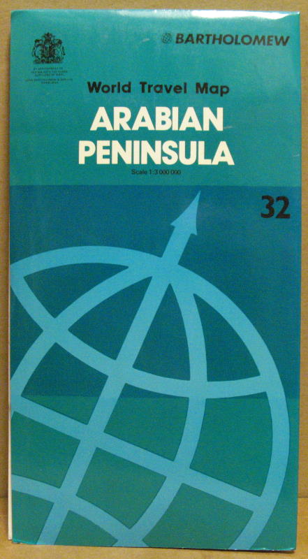
1983réf. 67838Edinbourgh, John Bartholomew & Son Ltd., 1983. 4°; folded, colored map 1:3.000.000, 91,5 x 79 cm. incl. 10 insets; [Englisch]; good conditions
1710réf. 144631710. Cluverius Philipp. Arabia Eudaemon ex Plinio Lib VI 1710. Original hand-colored copperplate map of the Arabian Peninsula drawing upon the geographical descriptions of Arabia recorded by the Roman natural historian Pliny the Elder in Book VI of his Naturalis Historia. The title referring to Arabia Felix or "Fortunate Arabia" recalls the classical geographical division of the peninsula into Arabia Felix Arabia Deserta and Arabia Petraea. The map belongs to the European tradition of historical cartography in which ancient Greek and Roman geographical accounts continued to inform printed maps well into the eighteenth century. Its depiction of the peninsula records the transmission of classical geographical knowledge through early modern European atlas production. Cluverius Philipp attributed. Arabia Eudaemon ex Plinio Lib VI. 1710. Original hand-colored copperplate engraving measuring approximately 8½" x 12". The map presents the Arabian Peninsula according to classical geographical sources incorporating historical place names and geographical divisions associated with the ancient understanding of Arabia. Its engraved delineation and hand coloring distinguish the landmass and geographical features. The map follows the cartographic work of Philipp Clüver 1580-1622 whose Introductionis in Universam Geographiam was repeatedly published in European editions throughout the seventeenth and early eighteenth centuries. Clüver's geographical writings combined classical literary sources with the cartographic scholarship of his period and his maps circulated widely through successive editions of his geographical handbook. The reference to Pliny in the title identifies the ancient textual source underlying this depiction of Arabia preserving geographical terminology inherited from Roman antiquity rather than presenting an exclusively contemporary survey of the peninsula. The map has general age-related toning with vibrant hand coloring remaining intact. Overall in very good condition. unknown books
1926réf. 144751926. Cheesman Robert Ernest. In Unknown Arabia 1926. First edition of the British military officer explorer and ornithologist's account of his 1923-1924 expedition through eastern Arabia including Bahrain Hufuf the Al-Hasa oasis Jabrin and Uqair. Undertaken during the territorial consolidation of Abdulaziz Ibn Saud's rule Cheesman's expedition combined geographical surveying with zoological collecting in regions of the Arabian interior that had received limited European scientific investigation. He mapped the Arabian coast between the Gulf of Salwa and Uqair established geographical positions in the Hufuf region and investigated the location of ancient Gerrha a trading center associated with the classical history of eastern Arabia. His observations and survey results were presented to Ibn Saud at his court in Hufuf. Cheesman also collected more than 300 natural history specimens in the Al-Hasa region including mammals and birds contributing to the scientific documentation of Arabian fauna. His discoveries included the gerbil species subsequently named Gerbillus cheesmani in his honor. Cheesman Robert Ernest. In Unknown Arabia. London: Macmillan & Co. 1926. First edition. One volume 447 pp. illustrated with 67 photographic illustrations and three maps including a large folding colored map of Arabia depicting Qatar and Trucial Oman. Library binding with a small sticker on the front endpaper. With a foreword by Major-General Sir Percy Cox the narrative follows Cheesman's travels from Bahrain through Uqair and Hufuf into the desert regions surrounding Jabrin. The photographic illustrations depict settlements archaeological remains desert terrain local inhabitants and natural history subjects encountered during the expedition. The geographical observations are accompanied by scientific appendices addressing mammals birds reptiles amphibians fish insects botany geology and meteorology. The large folding map records the geographical setting of the expedition including the eastern Arabian coast and neighboring territories of the Persian Gulf. Cheesman's expedition took place during Ibn Saud's expansion of political control over the Arabian Peninsula following his conquest of Al-Hasa from the Ottoman Empire in 1913 and before the establishment of the Kingdom of Saudi Arabia in 1932. His surveys contributed to the Royal Geographical Society's mapping of eastern Arabia particularly the routes between Uqair and Jabrin while his zoological collections expanded contemporary knowledge of the peninsula's wildlife. The account also records settlements desert transportation water sources and relations with local authorities during the early years of Saudi territorial consolidation. This copy contains pencil annotations on page 71 light foxing rubbing to the binding edges and small tears along the lower edges of pages 40 and 42. The large folding map has a 2" separation along the centerfold near the edge and margins. Otherwise complete retaining all photographic illustrations and the folding colored map; overall in good condition. unknown books
1960réf. 144741960. Thesiger Wilfred. Arabian Sands 1960. First edition second impression of the British explorer's account of his journeys through southern Arabia between 1945 and 1950 including two crossings of the Rub' al Khali or Empty Quarter in 1946-1947 and 1947-1948. Thesiger 1910-2003 known among his Arab companions as Mubarak bin London traveled with Bedouin guides across Oman the deserts of southern Arabia Abu Dhabi and the Trucial Coast recording tribal customs camel journeys desert navigation territorial disputes and the practical demands of survival in an arid environment. His account includes detailed descriptions of the Bedouin communities with whom he traveled particularly their hospitality tribal loyalties conflicts and knowledge of desert routes and water sources. Written before extensive oil development transformed much of southeastern Arabia the narrative records social and geographical conditions during the final years preceding the region's rapid economic and infrastructural changes. Thesiger Wilfred. Arabian Sands. London: Longmans 1960. First edition second impression first published 1959. One volume 326 pp. measuring approximately 9" x 6". Original cloth hardcover in illustrated dust wrapper. Illustrated with 68 photographic illustrations seven maps and a large folding map housed in the rear pocket. The narrative includes chapters devoted to Abu Dhabi the Trucial Coast and the Empty Quarter describing Thesiger's journeys through the territories of present-day Oman Saudi Arabia the United Arab Emirates and Yemen. His photographs record Bedouin companions desert encampments camel caravans regional landscapes and settlements encountered during his travels. The maps trace the principal routes and geographical features of the Arabian interior. Before undertaking his Arabian journeys Thesiger served in the Sudan Political Service and participated in military campaigns in Abyssinia and the Western Desert during the Second World War. His subsequent travels in Arabia were conducted largely on foot and by camel accompanied by Bedouin guides whose knowledge of tribal territories wells and desert conditions made the crossings possible. His descriptions of Abu Dhabi and the Trucial Coast predate the formation of the United Arab Emirates in 1971 and the extensive urban development financed by petroleum revenues. Arabian Sands preserves both Thesiger's observations and the experiences of his Arab traveling companions including Salim bin Kabina and Salim bin Ghabaisha who accompanied him on major portions of his journeys. The dust wrapper shows edge wear and a small 1 cm tear along the upper edge of the verso. Otherwise the book is in very good condition retaining its original dust wrapper photographic illustrations maps and folding map in the rear pocket. unknown books
1847réf. 146851847. Firmin Didot. Three steel engravings published in L'Univers Pittoresque in 1847 depicting the Sultan of Lahij's palace a greeting between two Arab men and a saddled camel prepared for travel. The group belongs to the illustrated French literature through which nineteenth-century European readers encountered the Arabian Peninsula combining architectural views with scenes of customary greeting and travel. The Lahij image is especially useful for documenting how the residence of the sultanate near Aden was visually presented to European audiences before the major political changes that reshaped southern Arabia later in the century. Firmin Didot. Chateau Du Saltan d'Aden a Lahadj; Salut des Arabes; Chameau scelle pour le Voyage. Paris: Firmin Didot 1847. Three original steel engravings each approximately 5 x 8.2 inches. Chateau Du Saltan d'Aden a Lahadj shows the Sultan of Lahij's castle set within a cultivated and mountainous landscape with palm trees and surrounding countryside. Salut des Arabes depicts two Arab men greeting one another with a handshake. Chameau scelle pour le Voyage shows a saddled camel in a desert setting emphasizing the animal's role in overland travel. Comparable examples of these subjects are attributed to the engraver Lemaitre in the contemporary print market. The three prints preserve a French illustrated view of southern Arabia that moves between political architecture social custom and transportation. Their publication in 1847 places them within the period when Aden had already come under British control while neighboring Lahij retained its own sultanate giving the palace view a specific political geography distinct from the port colony itself. Some age-related toning and pinholes in the upper margins; the first engraving has remnants of a sticker at the upper right corner. The third engraving shows former staple marks and an approximately 4 cm loss along the upper edge not affecting the image. Overall very good condition. unknown books
19608°, con 36 ill. f.t. ed 8 cartine, leg. ed. cart. con sovracc.
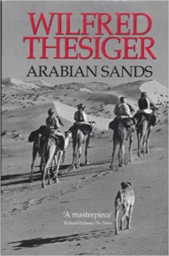
19658vo., Fifth Impression, with frontispiece, 68 plates on 46, 3 maps in the text and large folding map in red and black in pocket at end, free endpapers lightly browned; ivory cloth, backstrip lettered in gilt and black, a very good, bright, clean copy in unclipped dustwrapper. The author's first and most celebrated book, chronicling his years of travel after WWII 'without European companions and living as an Arab'. EARLY PRINTINGS ARE SCARCE IN THIS CONDITION.
19838vo., with frontispiece, 68 plates on 46, 3 maps in the text and large folding map at end, neat inscription on front free endpaper; black cloth, gilt back, a near fine copy in unclipped dustwrapper. Much-needed reissue of the author's most celebrated work first published in 1959. This edition is now scarce in its own right.
1998réf. 140450Dubai. UAE. Motivate Publishing. 1998. 306 pages and a lot of plates with illustrations. Black hardcover and an illustrated dustjackert. 25x17 cm
1986réf. Q-0333428897MacMillan 1986-01-01. Hardcover. New. New. In shrink wrap. Looks like an interesting title! MacMillan hardcover