KIEPERT (Heinrich).Livre Rare Book
1 509 résultats
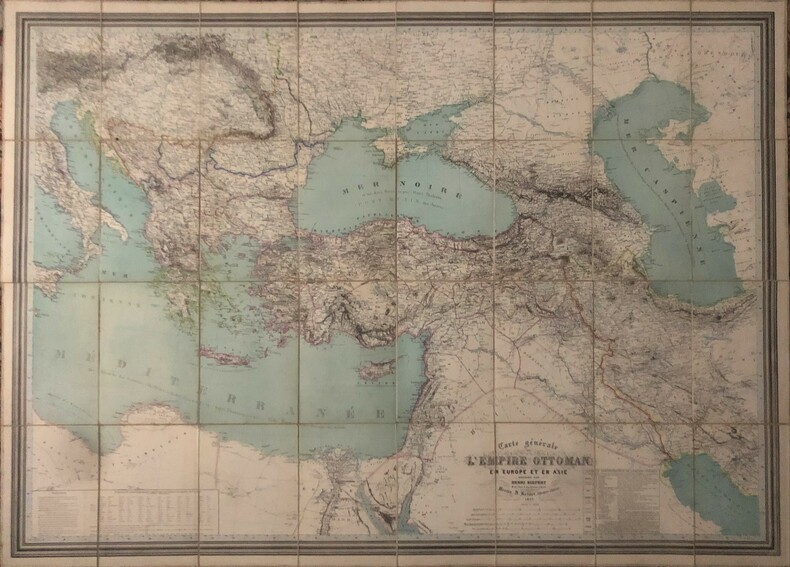
1867réf. PHO-611Carte générale de l'Empire Ottoman en Europe et en Asie. Berlin, D. Reimer, 1867. Carte gravée (93x129 cm) aux contours rehaussés de couleurs, repliée au format in-8, en feuilles entoilées, sous emboîtage (240x170mm)emboîtage fendu avec petit manque ,titre sur la tranche.
1826Accompagnée d'un Essai historique et statistique sur ce royaume, d'un aperçu géographique, sur les divisions politiques actuelles des pays compris entre l'Inde anglaise, l'Empire chinois et les limites orientales de l'Europe et de l'Afrique, et suivi d'un Tableau Statistique du Royaume de Perse, comparé aux principaux Etats du sud-ouest de l'Asie, 1 carte entoilée dépliante sous chemise et étui cartonné, décembre 1826, Planche 27 de l'Atlas Universel, Chez Brué, rue des Francs-Maçons, Paris, décembre 1826, 71,3 x 53 cm Jolie carte couvrant de l'Egypte et de l'Anatolie à l'Indoustan et aux contreforts de l'Himalaya, avec une belle vue de la Péninsule arabique de la Perse (Iran), du Beloutchistan et de l'Hindoustan (partie du Pakistan moderne), de l'Afghanistan, etc... Etat très satisfaisant (petite tache, double petit accroc marginal affectant lég. le texte en haut de feuille, fort accroc à l'étui, bon état par ailleurs) pour cette carte de très grand intérêt. Français
1826réf. 62065Accompagnée d'un Essai historique et statistique sur ce royaume, d'un aperçu géographique, sur les divisions politiques actuelles des pays compris entre l'Inde anglaise, l'Empire chinois et les limites orientales de l'Europe et de l'Afrique, et suivi d'un Tableau Statistique du Royaume de Perse, comparé aux principaux Etats du sud-ouest de l'Asie, 1 carte entoilée dépliante sous chemise et étui cartonné, décembre 1826, Planche 27 de l'Atlas Universel, Chez Brué, rue des Francs-Maçons, Paris, décembre 1826, 71,3 x 53 cm
1930Echelle 1/3.300.000e, tirage en 6 couleurs, 1 carte sous couverture éditeur, Cartes Taride n°148 au format 100 x 70 cm, s.d. (circa 1930) Bel exemplaire (infime mq. en marge, parfait état par ailleurs), rare en aussi bel état Français
2026réf. x-1032864559Taylor & Francis Ltd 2026. Paperback. New. 400 pages. 7.00x0.84x10.00 inches. Taylor & Francis Ltd paperback
1931Mm 180x285 "Pubblicazioni dell'Istituto per l'Oriente" - Volume nella sua brossura originale con copertina a stampa, vii-264 pagine. Copia in ottime condizioni; spedizione in 24 ore dalla conferma dell'ordine.
1931Very Good Latin In modern cloth bdg. Roy. 8vo. (24 x 17 cm). In Latin. [xi], 264 p. Chrestomathia Arabica meridionalis epigraphica. Edita et glossario instructa. First and Only Edition.
1997réf. 116764Editions Chronique, 1997, gr. in-8°, 128 pp, 196 photos, 14 cartes en couleurs, biblio, index, cart. illustré de l'éditeur, bon état (Coll. Chroniques de l'histoire)
2004réf. DBS-9783540220145Springer 2004. 1st. New. Springer unknown
2004réf. AME_9783540220145Springer 2004. 1st. Paperback. New/New. _ Springer paperback
2004réf. DBS-9783540220145Springer 2004. 1st. New. Springer unknown
2004réf. BN285030Springer Berlin Heidelberg Springer Berlin 2004. 2004. Softcover. Classification Clustering and Data Mining Applications Classification Clustering and Data Mining Applications Phipps Arabie Wolfgang A. Gaul David Banks Frederick R. Mcmorris Leanna House Springer Berlin Heidelberg, Springer Berlin paperback
réf. 9810213549.Gpaperback. Good. Access codes and supplements are not guaranteed with used items. May be an ex-library book. paperback
1996réf. x-9810213549World Scientific Pub Co Inc 1996. Paperback. New. 500 pages. 6.00x1.36x9.00 inches. World Scientific Pub Co Inc paperback
1996réf. x-9810212879World Scientific Pub Co Inc 1996. Paperback. New. illustrated edition. 490 pages. 9.00x6.75x1.25 inches. World Scientific Pub Co Inc paperback
réf. 1837379-nnew. unknown
réf. 1837379like new. unknown
19418vo. 17 pages including a sketch map map, plus photographic plates for illustration. Original condition with blue wrappers, titles to front, and containing all the ads. This is a complete issue, seldom found in such good and original condition. Delving beyond the geographical wonders of Makran's waterless rivers and mountain ranges, aside from the objective of geologically mapping a strip along the coast 50 miles wide, from Jask to the Baluchistan border, Harrison describes the native way of life. By examining the then sultan-governed region in a series of inland traverses, he encounters and interacts with the Baloch people as well as Muslims. Of the Balochs, Harrison provides a substantial account of customs including survival and sustenance in a harsh land, graves, costume, date harvesting, and much more. Illustrations show graves, a cliff dwelling, mat huts, the badlands near Bandini, and a mud volcano. One of Makran's outstanding features described is the water-courses seldom contained water and had subsequently become the natural roads for travel, where the means were limited to camels or donkeys. Other geological aspects were perplexing findings, and described in scientific terms. Of the scientific explorers of Persian Baluchistan, J.V. Harrison, D.Sc., occupied a leading role. By the time of this account, the author had been for twenty years a member of the Anglo-Iranian Oil Company and had made numerous expeditions to the area, the first being in 1917. In the present account he describes a journey made in 1932, part of a multi-year undertaking with plans made for as far ahead as 1937.
1885réf. 145461885. Vintage original albumen photograph of a Colonial French Algeria Bedouin Warrior with his camel published circa 1875. Image size: 8.25" x 11." In this image we can see a Bedouin traditionally dressed in a thoab and kufiyya. The warrior is standing in the desert holding the reins of his camel. The camel is saddled with the Bedouin's sword visible on his side flank. In the background is a single fort tower in the bare desert. Overall in very good condition. unknown
1885réf. 145461885. Vintage original albumen photograph of a Colonial French Algeria Bedouin Warrior with his camel published circa 1875. Image size: 8.25" x 11." In this image we can see a Bedouin traditionally dressed in a thoab and kufiyya. The warrior is standing in the desert holding the reins of his camel. The camel is saddled with the Bedouin's sword visible on his side flank. In the background is a single fort tower in the bare desert. Overall in very good condition. unknown books
1890réf. 143771890. Saharan camel caravan circa 1890s records a group of approximately two dozen Arab men traveling with loaded camels across a desert landscape during the period of expanding European colonial control in North Africa. The image preserves specific evidence of overland travel: riders move together across open terrain several camels carry substantial loads of material goods and a man in the foreground rides with a small child. These details document the continued use of camel transport for people and goods in the Sahara during the late nineteenth century. Vintage photograph circa 1890s mounted on a split card. Approximately two dozen men appear with camels in the desert with the caravan extending across the composition. In the foreground one man carries a small child while riding; elsewhere bundles and other goods are secured to several camels. The photograph provides no visible information supplied here identifying the travelers precise location route photographer or purpose of the journey and the scene should therefore not be assigned to a particular caravan network or colonial territory without further evidence. The photograph dates from a period when European powers were extending or consolidating colonial authority across North Africa: France had ruled Algeria since the nineteenth-century conquest and established a protectorate over Tunisia in 1881 while European competition for territory continued across the region into the early twentieth century. Against that chronology the photograph records the people animals goods and transportation practices visible in a Saharan caravan without establishing a direct relationship between these particular travelers and a colonial administration. Mounted on a split card; overall very good condition. The foreground pairing of an adult rider and child combined with the heavily laden pack animals preserves unusually specific visual evidence of both human travel and the movement of goods across the late nineteenth-century Sahara. unknown
1890réf. 143771890. Saharan camel caravan circa 1890s records a group of approximately two dozen Arab men traveling with loaded camels across a desert landscape during the period of expanding European colonial control in North Africa. The image preserves specific evidence of overland travel: riders move together across open terrain several camels carry substantial loads of material goods and a man in the foreground rides with a small child. These details document the continued use of camel transport for people and goods in the Sahara during the late nineteenth century. Vintage photograph circa 1890s mounted on a split card. Approximately two dozen men appear with camels in the desert with the caravan extending across the composition. In the foreground one man carries a small child while riding; elsewhere bundles and other goods are secured to several camels. The photograph provides no visible information supplied here identifying the travelers precise location route photographer or purpose of the journey and the scene should therefore not be assigned to a particular caravan network or colonial territory without further evidence. The photograph dates from a period when European powers were extending or consolidating colonial authority across North Africa: France had ruled Algeria since the nineteenth-century conquest and established a protectorate over Tunisia in 1881 while European competition for territory continued across the region into the early twentieth century. Against that chronology the photograph records the people animals goods and transportation practices visible in a Saharan caravan without establishing a direct relationship between these particular travelers and a colonial administration. Mounted on a split card; overall very good condition. The foreground pairing of an adult rider and child combined with the heavily laden pack animals preserves unusually specific visual evidence of both human travel and the movement of goods across the late nineteenth-century Sahara. unknown books
1949A spectacular detailed fold-out color map, measuring 11 x 11 inches (28 x 28cm), in original condition. The map is taken from "A Further Journey Across the Empty Quarter", published in June 1949 issue of the Royal Geographical Society, illustrating Thesiger's journey through western and northern Rub al Khali from November 1947 to May 1948. Wilfred Thesiger is perhaps the last, and certainly one of the greatest of the British travellers among the Arabs, his narrative is vividly written. After leaving Arabia he travelled extensively in the Karakoram and the Hindu Kush (the setting of his meeting with Eric Newby immortalised in Newby's A Short Walk in the Hindu Kush), the mountains of Kurdistan and the marshlands of Iraq. But he says that none of these places moved him as did the deserts of Arabia. He spent five years in the region travelling on camels and on foot across some ten thousand miles of a vast empty land. What he found, as in his time with the people of the Iraq marshes which he described in his book The Marsh Arabs, was a way on life on the threshold of destruction.