6.355 Ergebnisse
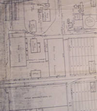
Best.-Nr. 58-0488Ogden Utah: Southern Pacific Company 1928 rev. 1947. Blueline print 24 inches x 54 inches. From Vine Street to Surprise Valley Road. Some industries along tracks detailed listing of spurs and signals. 1 inch = 100 feet. Ogden, Utah: Southern Pacific Company, 1928, rev. 1947. unknown
Best.-Nr. 58-0481Ogden Utah: Southern Pacific Company 1928 rev. 1933. Blueprint 24 inches x 56 inches. From Vine Street to 3800 feet west of City Limits. With red lines indicating trackage owned by industry. Small typewritten index to industry 11 entries indexed to map by letter. Scale 1 inch = 100 feet. Ogden, Utah: Southern Pacific Company, 1928, rev. 1933. unknown
Best.-Nr. 58-0485Ogden Utah: Southern Pacific Company 1928. Blackline print 24 inches x 55 inches. 9 inch tear no missing material. From Surprise Valley Road to Nevada Street. Industries indicated indicated on map. Scale 1 inch = 100 feet. Ogden, Utah: Southern Pacific Company, 1928. unknown
Best.-Nr. 58-0483Ogden Utah: Southern Pacific Company 1928 rev. 1933. Blueprint 24 inches x 54 inches. From Vine Street to Surprise Valley Road. With typewritten Index to Industry 17 listings indexed by letter. With Reno Flour Mill Home Lumber Co Swift & Co PHP. Scale 1 inch = 100 feet. Ogden, Utah: Southern Pacific Company, 1928, rev. 1933. unknown
Best.-Nr. 58-0489Ogden Utah: Southern Pacific Company 1928 rev. 1948. Blueline print 24 inches x 56 inches. From Nevada Street and Fourth Street to H Street and Overland Street. Listing of signals and spurs. No industries indicated. With Humphrey Tract East Reno Heights. 1 inch = 100 feet. Ogden, Utah: Southern Pacific Company, 1928, rev. 1948. unknown
Best.-Nr. 58-0486Ogden Utah: Southern Pacific Company 1928 rev. 1947. Blueline print 24 inches x 56 inches. From Vine Street to 3800 feet west of City Limits. With red pencilling indicating switching limits. With detailed listing of spurs and signals. Scale 1 inch = 100 feet. Ogden, Utah: Southern Pacific Company, 1928, rev. 1947. unknown
Best.-Nr. 58-0484Ogden Utah: Southern Pacific Company 1928. Blueprint 24 inches x 55 inches. From Surprise Valley Road to Nevada Street. With typewritten Index to Industry 32 listings indexed by letter with description of type of industry. With Union Paving Co Nevada Transfer and Wholesale Smith & Peterson. Scale 1 inch = 100 feet. Ogden, Utah: Southern Pacific Company, 1928. unknown
Best.-Nr. 58-0551San Francisco Calif.: Southern Pacific Company 1960. Blueline print 24 inches x 55 inches. Sheet two of two. From Deming Vegetable Co-op Warehouse and 1/2 mile west to 3500 feet south. Includes railroad tracks spurr tracks track measurements no other structures than warehouse. Scale 1 inch = 100 feet. San Francisco, Calif.: Southern Pacific Company, 1960. unknown
Best.-Nr. 58-0550San Francisco Calif.: Southern Pacific Company 1960. Blueline print 24 inches x 55 inches. Sheet one of two. From station point Sage to one mile south. Includes railroad tracks road no structures. Scale 1 inch = 100 feet. San Francisco, Calif.: Southern Pacific Company, 1960. unknown
Best.-Nr. 56-0309Oakland Calif.: Southern Pacific Company 1933. Map. Blueprint 24" x 55". As 56-0308 with additional extensive red pencil notes detailing use and state of various tracks. Proposed Trackage to serve Shell Chemical Co. Includes Poinsetta Land Co Pittsburg Ave Sacto Northern Railway line Bella Monte Subdivision Scale 1" = 100'. Oakland, Calif.: Southern Pacific Company, 1933. unknown
Best.-Nr. 56-0308Oakland Calif.: Southern Pacific Company 1933. Map. Blueprint 24" x 55". Proposed Trackage to serve Shell Chemical Co. Includes Poinsetta Land Co Pittsburg Ave Sacto Northern Railway line Bella Monte Subdivision Scale 1" = 100'. Oakland, Calif.: Southern Pacific Company, 1933. unknown
Best.-Nr. 56-0337Ogden Utah: Southern Pacific Company 1929. Map. Blueprint 24" x 55" From Tulare Street to Richmond Road and Lassen Street. Includes legend of buildings in Lassen Lumber and Box Company and Fruit Growers' Supply Company. With extensive overlapping land use notes. Scale 1" = 200'. Ogden, Utah: Southern Pacific Company, 1929. unknown
Best.-Nr. 56-0355San Francisco Calif.: Southern Pacific Company 1921 revised 1936. Map. Blueprint 24" x 62". From West Street to beyond Mill Creek. Includes Southern California Edison Co Material Yard for County of Tulare original townsite Brown's Addition Drouillard's Addition Spaulding Lumber Co. Scale 1" = 100'. San Francisco, Calif.: Southern Pacific Company, 1921, revised 1936. unknown
Best.-Nr. 56-0379San Francisco Calif.: Southern Pacific Company 1958 rev. 1961. Blueline print 24" x 62". Sheet three of three. From approx half a mile north of Pittsburg Des Moines Steel to Keifer Road. Includes Pittsburg Des Moines Steel Co railroad lines power lines. Scale 1" = 100'. San Francisco, Calif.: Southern Pacific Company, 1958, rev. 1961. unknown
Best.-Nr. 56-0232San Francisco Calif.: Southern Pacific Company 1931 revised 1940. Map. Blueline print. 24 x 56 inches. Map of Alameda from west of Oak Street to High Street. Includes Boyle Manufacturing Co Pacific Coast Engineering Co all streets. Scale: 1 inch = 100 feet. San Francisco, Calif.: Southern Pacific Company, 1931, revised 1940. unknown
Best.-Nr. 56-0397San Francisco Calif.: Southern Pacific Company 1927 rev. 1961. Blueline print 24" x 56". Sheet one of two. From Pacheco Slough and railroad tracks approx 1 mile north along County Highway. Includes detailed plan of Associated Oil Company site with Cooper Shop Can and Shook warehouse Research Lab Experimental Refinery. Scale 1" = 100'. San Francisco, Calif.: Southern Pacific Company, 1927, rev. 1961. unknown
Best.-Nr. 56-0398San Francisco Calif.: Southern Pacific Company 1927 rev. 1956. Blueline print 24" x 56". Sheet two of two. From compressor building condensers to beyond AT&SF steel bridge over county road and railroad tracks. Includes very detailed plan of Associated Oil Company site with reservoir numerous tanks Edeleanu plant Residuum Coolers Salt Water pond and less detailed Standard Oil Company site. Scale 1" = 100'. San Francisco, Calif.: Southern Pacific Company, 1927, rev. 1956. unknown
Best.-Nr. 56-0404Oakland Calif.: Southern Pacific Company 1927 rev. 1944. Blueline print 24" x 56". With pencil marks indicating switching limits. From Straights of Carquinez to East Sixth Street H Street to South Street. Includes Kullman Salz & Co G.W. Hume Co River Steamer Landing Martinez-Benicia Auto Ferry. Scale 1" = 100'. Oakland, Calif.: Southern Pacific Company, 1927, rev. 1944. unknown
Best.-Nr. 56-0228San Francisco Calif.: Southern Pacific Company 1926 revised illegible. Map. Blueline print. 24 x 56 inches. Map of San Leandro from Peralta Ave. to Castro St. Includes Caterpillar Tractor California Packing Corp San Leandro Creek. Scale: 1 inch = 100 feet. San Francisco, Calif.: Southern Pacific Company, 1926, revised? (illegible). unknown
Best.-Nr. 56-0439San Francisco Calif.: Southern Pacific Company 1953. Blueline print 18" x 15" with red and green highlighting indicating present and proposed limits. From Central Avenue to Teague Avenue and Cornelia Avenue to Hammer Field. Not drawn to scale. San Francisco, Calif.: Southern Pacific Company, 1953. unknown
Best.-Nr. 56-0447Tucson Ariz.: Southern Pacific Company 1951 rev. 1959. Blueline print 24" x 56". Includes Hayden Junction employee' cottages complex with railroad track plans 1500' east and 3000' west of complex. With station points Hayden Junction Burns. Scale 1" = 100'. Tucson, Ariz.: Southern Pacific Company, 1951, rev. 1959. unknown
Best.-Nr. 56-0285San Francisco Calif.: Southern Pacific Company 1950. Map. Blueline print 24" x 73". Includes station points at Dresser Farwell and Brightside. Includes Schedule of Property listing approx. 10 transfers 1870-1950 with additional notes from U.S. Land Office Records 1868-1877. Scale 1" = 400'. San Francisco, Calif.: Southern Pacific Company, 1950. unknown
Best.-Nr. 56-0284San Francisco Calif.: Southern Pacific Company 1953. Map. Blueline print 24" x 73" with red pencil notation. Title indicates "Proposed trackage to serve Ford Motor Company." Scale 1" = 200' With inset regional map scale 1" = 1000'. San Francisco, Calif.: Southern Pacific Company, 1953. unknown
Best.-Nr. 58-0555San Francisco Calif.: Southern Pacific Company 1938. Blueline print 24 x 56 inches. Yard limits and switching zones indicated in red and blue pencil. From Station Point Graves to southeastern City Limits. Includes City of Salinas. With Schedule of Property listing approx 65 transfers 1872-1938. Scale: 1 inch = 400 feet. San Francisco, Calif.: Southern Pacific Company, 1938. unknown
Best.-Nr. 58-0531San Francisco Calif.: Southern Pacific Company n.d. Blackline print 24 inches x 56 inches. From Empire Avenue beyond Buena Vista Street to beyond Center Street and Burbank Boulevard. Includes Lockheed Aircraft Corporation Providencia Rancho San Rafael. Scale 1 inch = 200 feet. San Francisco, Calif.: Southern Pacific Company, [n.d.] unknown