6.355 Ergebnisse
Best.-Nr. 58-0537San Francisco Calif.: Southern Pacific Company 1961. Blueline print 24 inches x 55 inches. From Riverside Street and Second Street in Dairyland to Broadway and Sixth Street in Califa Home Tract. Includes Ten Tree Tract Fairmead Colony. Scale 1 inch = 400 feet. San Francisco, Calif.: Southern Pacific Company, 1961. unknown
Best.-Nr. 56-0448San Francisco Calif.: Southern Pacific Company 1945. Blueline print 24" x 56" with red pencil indicating switching limits. From Rancho San Leandro Walnut Street to the northwest to Rancho Arroyo de la Alameda Meek Soto Tract Meek Orchard County Road 2688 to the southeast. Includes San Lorenzo Hayward Cherryland. With Schedule of Property listing 18 transfers 1869 - 1945. Scale 1" = 400'. With insert sketch of parcel scale 1" = 100'. San Francisco, Calif.: Southern Pacific Company, 1945. unknown
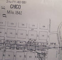
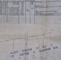
Best.-Nr. 58-0528San Francisco Calif.: Southern Pacific Company 1960. Blackline print 24 inches x 55 inches. From Diamond Match Company at Stirling City Bridge to beyond Chico Vecino. Diamond Match buildings detailed. Includes Schedule of Property listing approx 35 transfers 1866-1960. Scale 1 inch = 400 feet. San Francisco, Calif.: Southern Pacific Company, 1960. unknown
Best.-Nr. 58-0499San Francisco Calif.: Southern Pacific Company 1932 rev. 1960. Set of Three Blueline prints each 24 inches x 56 inches. Includes Sobrante Park San Pablo Rancho San Pablo Bay. No buildings detailed. With Schedule of Property listing approx 55 transfers 1876 - 1960. Scale 1 inch = 100 feet. San Francisco, Calif.: Southern Pacific Company, 1932, rev. 1960. unknown
Best.-Nr. 56-0253San Francisco Calif.: Southern Pacific Company 1943. Map. Blueline print 24" x 56" with red highlighting. Includes Chiquita Colony Woodland Ave Park Maze Colony Covell. With Schedule of Property records of approx. 30 transfers 1873-1948. Scale 1" = 400'. San Francisco, Calif.: Southern Pacific Company, 1943. unknown
Best.-Nr. 58-0540San Francisco Calif.: Southern Pacific Company 1959. Blueline print 24 inches x 55 inches. From 4000 feet west of Station Point Los Medanos to Cakebread Lake Antioch City Limit. Streets near track in Antioch listed no buildings indicated. Includes Schedule of Property listing approx 30 transfers 1872-1959. Scale 1 inch = 400 feet. San Francisco, Calif.: Southern Pacific Company, 1959. unknown
Best.-Nr. 58-0535San Francisco Calif.: Southern Pacific Company 1942 rev. 1960. Blackline print 24 inches x 55 inches. From Kearney Street and Park Avenue to 4000 feet beyond Fruitvale Avenue along railroad track. With San Jose Brick Company Sainsevaine Villa. With Schedule of Property listing approx 75 transfers 1877-1960. Scale 1 inch = 200 feet. San Francisco, Calif.: Southern Pacific Company, 1942, rev. 1960. unknown
Best.-Nr. 56-0224San Francisco Calif.: Southern Pacific Company 1962. Map. Blueline print. 24 x 56 inches. Map of Ostrom including Olivehurst Tract Subdivision with Schedule of Property Acquisition Date Original Grantor/Grantee Instrument of Transfer and Remarks of Sale for 3 transfers 1866-1915. Scale: 1 inch = 400 feet. San Francisco, Calif.: Southern Pacific Company, 1962. unknown
Best.-Nr. 56-0303San Francisco Calif.: Southern Pacific Company n.d. Map. Blueline print 24" x 55" with red pencil indicating switching limits. From Cliff Drive to the west to Bay of Monterey and Bay St to the east. Scale 1" = 200'. Includes inset Index map of area with Rancho Refugio scale 1 inch = 1 mile. San Francisco, Calif.: Southern Pacific Company, [n.d.] unknown
Best.-Nr. 56-0441San Francisco Calif.: Southern Pacific Company n.d. Blueline print 24" x 55". From approx one mile south of station point Giant to station point Giant. No structures other than station and warehouse indicated map primarily details track measurements and signals. Includes Schedule of Property listing 12 transfers 1873-1894. Scale 1" = 100'. San Francisco, Calif.: Southern Pacific Company, [n.d.] unknown
Best.-Nr. 58-0526San Francisco Calif.: Southern Pacific Company n.d. Blackline print 24 inches x 56 inches. From Lincoln Avenue to Grand Boulevard Crossway Road to Bayshore Highway. Includes station points Broadway and Burlingame Buri Buri Burlingame Grove Lyon & Hoag Subdivision San Mateo Heights. Scale 1 inch = 200 feet. San Francisco, Calif.: Southern Pacific Company, [n.d.] unknown
Best.-Nr. 56-0343San Francisco Calif.: Southern Pacific Company 1936. Map. Blueline print 24" x 55". Includes Normal Junction Alma School. Map is primarily railroad track with measurement markings. Includes Schedule of Property with 30 transfers 1903-1936. Scale 1" = 400'. San Francisco, Calif.: Southern Pacific Company, 1936. unknown
Best.-Nr. 58-0536San Francisco Calif.: Southern Pacific Company n.d. Blueline print 24 inches x 55 inches. From Contra Costa County Line past Benecia along railroad tracks to 4000 feet beyond edge of Army Point. With US Military Reservation Land Suisun Bay. Scale 1 inch = 400 feet. Includes Index Map of main Southern Pacific line from Benecia to Sacramento scale 1 inch = 2 miles. San Francisco, Calif.: Southern Pacific Company, [n.d.] unknown
Best.-Nr. 58-0554San Francisco Calif.: Southern Pacific Company n.d. Blueline print 24 x 56 inches. Yard and switching limits indicated in black and green pencil. From Bolsa de Scorpinas to Rincon del Sanjon Racho. Includes Station Point Cooper Bolsa del Potrero y Morocojo. No structures shown. With Schedule of Property listing 3 transfers 1872. Scale: 1 inch = 400 feet. San Francisco, Calif.: Southern Pacific Company, [n.d.] unknown
Best.-Nr. 58-0548San Francisco Calif.: Southern Pacific Company 1932. Blueline print 24 inches x 55 inches. From approx 2 miles northwest of Albany to southeastern Albany city limits. Includes map of Albany with all streets and structrues. With Schedule of Property listing approx 55 transfers 1886-1932. Scale 1 inch = 400 feet. San Francisco, Calif.: Southern Pacific Company, 1932. unknown
Best.-Nr. 56-0301San Francisco Calif.: Southern Pacific Company n.d. Map. Blueline print 24" x 55" with red pencil indicating switching limits. Includes station points Santa Cruz Casino Seabright Cliffside. Scale 1" = 400'. San Francisco, Calif.: Southern Pacific Company, [n.d.] unknown
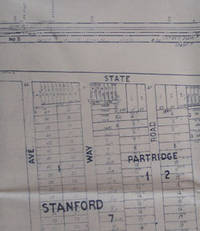
Best.-Nr. 56-0220San Francisco Calif.: Southern Pacific Company 1939. Map. Blueline print. 24 x 56 inches. With orange and red pencilled notes. Map of Palo Alto from Menlo Avenue to Churchill Avenue including Stanford University. With Schedule of Property Acquisition Date Original Grantor/Grantee Instrument of Transfer and Remarks of Sale for approximately 25 transfers 1863-1939. Scale: 1 inch = 200 feet. San Francisco, Calif.: Southern Pacific Company, 1939. unknown
Best.-Nr. 56-0310San Francisco Calif.: Southern Pacific Company 1954. Map. Blackline print 24" x 55" with pencil sketch of Spruce Ave. Includes Buri Buri Rancho San Mateo Ave station point Tanforan. With Schedule of Purchase listing approx 30 transfers 1862-1954. Scale 1" = 200'. San Francisco, Calif.: Southern Pacific Company, 1954. unknown
Best.-Nr. 56-0459San Francisco Calif.: Southern Pacific Company 1936. Blueline print 24" x 56". Sheet two of three. Switching limits indicated in orange green blue and red pencil. From Chestnut Street to Cherokee Lane. Includes station point Woodbridge Burr's Addition Lawrence Homestead. With Schedule of Property listing approx 60 transfers 1882 - 1936. Scale 1" = 400'. With inset map Woodbridge to Valley Sprint scale 1 inch = 2 miles. San Francisco, Calif.: Southern Pacific Company, 1936. unknown
Best.-Nr. 58-0544San Francisco Calif.: Southern Pacific Company n.d. Blueline print 24 inches x 55 inches. From approx 2 miles south of North fork of Pitt River to outer city limits of Alturas. With all streets along tracks in Alturas. Scale 1 inch = 400 feet. San Francisco, Calif.: Southern Pacific Company, [n.d.] unknown
Best.-Nr. 56-0305San Francisco Calif.: Southern Pacific Company 1953. Map. Blueline print 24" x 55" with red pencil indicating switching limits. From Meder Creek to the west to Cliff Drive to the east. Includes Rancho Refugio. With Schedule of Property listing 9 transfers 1905-1953. Scale 1" = 200'. San Francisco, Calif.: Southern Pacific Company, 1953. unknown
Best.-Nr. 58-0539San Francisco Calif.: Southern Pacific Company 1956. Blueline print 24 inches x 55 inches. Both tracks through Auburn detailed in full. Includes Station points Auburn - Nevada Street Auburn abandoned station Flint. With some structures along track in downtown. Scale 1 inch = 400 feet. San Francisco, Calif.: Southern Pacific Company, 1956. unknown
Best.-Nr. 58-0556San Francisco Calif.: Southern Pacific Company 1948. Blueline print 24 inches x 56 inches. From Nacional Rancho to approx 4 miles southeast. Includes Station Point Spreckels Junction Llano de Buena Vista Rancho. With Schedule of Property listing approx 25 transfers 1872-1948. Scale 1 inch = 400 feet. San Francisco, Calif.: Southern Pacific Company, 1948. unknown
Best.-Nr. 56-0246San Francisco Calif.: Southern Pacific Company 1935. Map. Blueline print 24" x 56". Map of Mountain View CA with Switching Limits. Includes zoned highway acres Bonita Tract subdivision. W/ Schedule of Property approx. 10 transfers 1864-1935. Scale 1" = 200'. San Francisco, Calif.: Southern Pacific Company, 1935. unknown
Best.-Nr. 58-0530San Francisco Calif.: Southern Pacific Company 1934. Blackline print 24 inches x 55 inches. No structures or industries indicated map consists primarily of railroad track signals and measurements. With Schedule of Property indicating approx 10 transfers 1866-1934. Scale 1 inch = 400 feet. San Francisco, Calif.: Southern Pacific Company, 1934. unknown