6911 risultati
1940rif. 64697San Francisco CA: San Francisco Bay Exposition Co. Published by Pacific House Lithographed by H.S. Crocker Co. Inc. & Schwabacher-Frey Inc. 1940. One oblong atlas folio map 25.5 x 19 in. colour lithographed on beautiful thick paper stock minor age toning slight dustsoiling on right portion still a VG bright original pictorial map. First edition of this separate issue souvenir map issued by the Golden Gate International Exposition GGIE World’s Fair which first opened in 1939 and carried over to 1940 celebrating the stunning series of giant murals painted in 1939 by Covarrubias for the Pacific House presenting the Pacific Ocean as an idyllic yet with remote and exotic areas prior to World War II. This splendid and vibrant pictorial map vividly presents the ranges of building methods and Indigenous Peoples dwellings from Yurts in Mongolia to peaked longhouses of the Maori in New Zealand not dissimilar to the cedar Longhouses of the Northwest Coast tribes along with thatched huts teepees and the pueblos of the Mesoamerican peoples of the Southwest. The six original murals ranged in size from 9 x 13 feet ”Native Dwellings” and “Transportation” while the other four such as “Flora & Fauna” measured 16 x 24 feet. Originally the set of six was exhibited until 1953 at the American Museum of Natural History shipped back to San Francisco in 1949 when the original “Art Forms of the Pacific” mysteriously went missing and exhibited at the Ferry Building until 2001. Covarrubias 1904-1957 was a noted Mexican muralist illustrator caricaturist painter and ethnologist who not only produced artwork and caricatures for the Mexican Ministries of Education and Communication but also later became noted artist and caricaturist for Vanity Fair and the New Yorker set designer and commissioned later by the GGIE to produce the murals series. San Francisco Bay Exposition Co., Published by Pacific House, Lithographed by H.S. Crocker Co. Inc. & Schwabacher-Frey, Inc., unknown
1940rif. 64698San Francisco CA: San Francisco Bay Exposition Co. Published by Pacific House Lithographed by H.S. Crocker Co. Inc. & Schwabacher-Frey Inc. 1940. One oblong atlas folio map 25.5 x 19 in. colour lithographed on beautiful thick paper stock minor age toning slight dustsoiling on right portion still a VG bright original pictorial map. First edition of this separate issue souvenir map issued by the Golden Gate International Exposition GGIE World’s Fair which first opened in 1939 and carried over to 1940 celebrating the stunning series of giant murals painted in 1939 by Covarrubias for the Pacific House presenting the Pacific Ocean as an idyllic yet with remote and exotic areas prior to World War II. This splendid and vibrant pictorial map focuses the inventive ways in which Indigenous Peoples across the Pacific Rim traveled to new places from elephant back in India to catamarans in Tonga and Samoa reindeer sledge in Siberia to dogsled and dugout canoe in Alaska and Northwest Coast Peoples. The GGIE is represented by an illustration of a Sikorsky S-42 flying boat for Pan Am as the Treasure Island site following the World’s Fair was originally intended to be converted into an airport prior to World War II. The six original murals ranged in size from 9 x 13 feet ”Native Dwellings” and “Transportation” while the other four such as “Flora & Fauna” measured 16 x 24 feet. Originally the set of six was exhibited until 1953 at the American Museum of Natural History shipped back to San Francisco in 1949 when the original “Art Forms of the Pacific” mysteriously went missing and exhibited at the Ferry Building until 2001. Covarrubias 1904-1957 was a noted Mexican muralist illustrator caricaturist painter and ethnologist who not only produced artwork and caricatures for the Mexican Ministries of Education and Communication but also later became noted artist and caricaturist for Vanity Fair and the New Yorker set designer and commissioned later by the GGIE to produce the murals series. San Francisco Bay Exposition Co., Published by Pacific House, Lithographed by H.S. Crocker Co. Inc. & Schwabacher-Frey, Inc., unknown
1909rif. 53081Seattle & Berkeley CA: Ellis A. Davis 1909. Folio. 190 pp. Illust. & decorated title 100s of photo illusts. over 100 colour maps many double page 1 very large folding colour map tipped-in on rear pastedown a couple minor closed tears at creases. Red cloth silver lettering & decoration embossed on front cover minor bumping to corners bumping & minor fraying head & foot of spine very faint tidemark to fore-edges still a VG- copy very clean and bright textblock. First edition of this well-illustrated commercial atlas intended to promote the Pacific Northwest during the Alaska-Yukon Exposition carefully listing most of the major and minor cities their counties industries local products and 100s of photos of buildings logging railroads shipping and more. The atlas includes detailed economic statistical maps of Oregon Washington and Idaho; street maps of Spokane WA Portland OR Seattle WA Boise ID and more. The large folding colour map at rear is of Oregon State -- these atlases were also issued with Idaho Washington and Oregon & Washington colour maps separately. Ellis A. Davis, hardcover
1902rif. 63438The Dalles OR: Benj. A. Gifford 1902. Oblong 8vo. 9.5 x 6.5 in. 37 leaves unnumbered. including 18 boudoir-sized collotype photographs printed on matte-finish paper stock w/ Benj. Gifford copyright notice lower fore-edge of image captions & negative number indicated all printed with excellent contrast w/in the negative also included 18 printed caption tissue guards. Dark gray ribbed softcovers yapp fore-edges w/ folding clasp flap at fore-edge of front cover decorative white lettering front cover punch-sewn w/ colour silk braid at gutter margin minor chipping to foot of spine into lower left front cover minor shelfwear creasing to yapp fore-edges still a VG- copy w/ ownership markings on title for Lillie D. Stewart a railroad company stenographer living in Denver CO at the beginning of the 20th Century and she paid $ 1.50 for the booklet. First edition of this very scarce and nicely printed collotype photographic views of the Columbia River Gorge sold from Gifford’s studio in The Dalles OR. Gifford 1859-1936 is considered perhaps Oregon’s most famous photographer and his beautiful images included here depict Rooster Rock sternwheeler at the Dalles Latourelle Falls Cape Horn the Pillars of Hercules Multnomah Falls shot 12 years prior to the historic Benson Footbridge at Multnomah Falls constructed by Robert Lee Ringer in 1914. Other images include the Sternwheeler Regulator Warren’s Salmon Cannery Sternwheeler Bailey Gatzert approaching the Cascade Locks Fish Wheel on the Columbia the Oregon Railway & Navigation Chicago-Portland Special leaving Tunnel 2 and the Native American burial ground of Memaloose Island. Gifford first worked in Portland until 1895 then opened a studio in The Dalles and later returned to Portland in 1910 where he continued to operate both studios until about 1920. Later his son Ralph I Gifford took over operation of the studio and continued to operate the business. Worldcat locates 1 copy OSU. Benj. A. Gifford, paperback
1843rif. 9124New York: Greeley & McElrath 1843. Third edition. 23.5x15.5cm 112pp. Printed in two columns with tables ads on inner wrappers. Stitched in original printed brown wraps. Damp staining to upper corner of first 35 or so pages more pronounced at title and near the front. Spine cocked and with ends chipped chipping along edges of wraps. Pencil annotation to front cover. A very good copy. Third edition following the 1841 and 1843 Poughkeepsie printings of this popular text issued as an "Extra" of the New York Tribune. The book is essentially an account of the first overland to Oregon migration of emigrants bound for the territory led by Farnham and known as the "Peoria Party." They left Independence Missouri on May 20th 1839 and as a substantially smaller group arrived in Oregon on September 23 1839 with Marcus Whitman. Scarce in the original wrappers. Howes F50. Wagner-Camp 85:3. Washington 89 20. Greeley & McElrath unknown
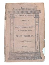
1960rif. 64757Portland OR: Portland Linotyping Company 512 NW 17th Ave. ca. 1960. Oblong folio. 14.25 x 10.25 in. iv 2 206 i.e. 250 pp added supplement pages in assorted sections. printed throughout w/ peach-coloured border at lower fore-edge type specimens included throughout with each section divided by thick cardstock divider and thumb tab. Original publisher’s blue buckram 16-ring binder gilt lettering stamped on front cover & spine slight shelfwear NF copy from the library of David Kohl 1946-2025 former art teacher at the Hong Kong International School musician artist and historian. First edition of this exceedingly scarce and massive type font specimen book issued by the Portland Linotyping Company who specialized in commercial trade typesetting for many local Pacific Northwest regional newspapers magazines and job printers. This particular type specimen catalogue was intended to be expanded as per the additional 34 supplement pages and note on colophon specifying “New type faces are being constantly added to our library and when they become available new insert sheets will be printed and distributed to the holders of our specimen books.” Their Linotype Composition faces encompassed Baskerville to Condensed Gothic Garamond to Oldstyle Antique as well as Spartan Book and Times Roman; Monotype Composition included Bodoni Copperplate Gothic Garamond Modern Rockwell Antique and 20th-Century Medium; while the Handset Display typefaces ranged from Aurora Condensed to Bulmer Italic Craw Modern to a series of Gothics as well as Optima Italic P.T. Barnum and more. Through the 1960’s under Ray Sneddon 1926-2017 the company would evolve into Phototypesetting and further into film and computer-based advertising typefaces for PNW designers and ad agencies. Sneddon was recruited out of Canada and in 1958 he became printer owner/operator of Portland Linotyping Company where he remained overseeing the operation until his retirement in 1989. No copies in Worldcat. Portland Linotyping Company, 512 NW 17th Ave., hardcover
rif. 2299San Francisco: H. S. Crocker & Co. 1883. . Large 8vo printed color-lithographed wrappers; lacking one inch at the head of the spine and one half inch at the foot. Institutionally common. Scarce in trade. San Francisco: H. S. Crocker & Co., 1883. unknown
rif. 2299San Francisco: H. S. Crocker & Co. 1883. . Large 8vo printed color-lithographed wrappers; lacking one inch at the head of the spine and one half inch at the foot. Institutionally common. Scarce in trade. San Francisco: H. S. Crocker & Co., 1883. unknown books
rif. PC71Thirteen unmounted gelatin silver prints ca. 155x205 cm 6x8 in. All with pencil titles in English on versos. This interesting collection of photos of New South Wales includes views of the Sydney Harbour taken from the deck of HMS “Powerful” Circular Quay taken from RMS “Orontes” two images of Bondi Beach and three rare views of the Parramatta River taken on a day of the famous scull boat race between George Towns and Jim Stanbury one of two races between them either in 1905 or in 1906. The photos show the Parramatta river full of canoes paddle boats and “steamers going up to the starting point” as well as “the Parramatta River after the finish of the Stanbury-Towns boat race the boats hurrying back to town.” The other images show the Hacking River taken from the Moombara district Port Hacking southern Sydney Jamberoo village on the Illawarra South Coast of New South Wales; Nowra Bridge over the Shoalhaven River built in 1881 and the Bomaderry Creek near Nowra South Coast. The last view shows the harbour of Hobart with HMS “Challenger” on the right taken from the deck of RMS “Orontes.” “George Towns was the Australian Single Sculls World Champion from 1901 to 1905 and 1906 to 1907. He was the last of the seven Australian World Sculling Champion who between them held the title almost uninterrupted from 1876 to 1909” Wikipedia. His two races with another famous Australian sculler James Stanbury 1868-1945 took place on 22 July 1905 and 28 July 1906. “Stanbury was a tough proposition as he had been World Champion from 1891 to 1896 and had held off several challenges before losing to Gaudaur. The race was agreed to be run on 22 July 1905 on the Parramatta with a stake of £500 a side. The water was smooth and the weather was fine with just a light breeze. Again large crowds were on hand to witness what was expected to one of the great sculling contests. At the start Stanbury at once went to the front and by Uhr’s Point was a length and a half ahead. Towns then spurted but could make no impression on the leader. For every effort Towns made Stanbury responded and he crossed the line by two lengths in a time of 19m.47s. Often when one sculler was beaten by another he was offered a return match to have the chance to get even – or go two down. Stanbury offered Towns and they had another Championship race on the same course almost a year later on 28 July 1906. After the start Towns took an early lead but was soon overhauled by Stanbury who then continued to widen the gap until he was two lengths ahead but at Cabarita he started to show signs of distress. It was evident that his right shoulder was troubling him and about which rumours had been circulating. He had to slow down considerably and Towns then managed to catch up. Stanbury’s shoulder finally gave out and from there on the race was a procession. Towns won by about twenty lengths in a time of 19m.53s. This was Stanbury’s final Championship race; he had raced in seven and won five” Wikipedia. unknown
rif. 56-0260Stockton Calif.: Southern Pacific Company 1922 revised 1935. Map. Blueprint 24" x 36." From Bear River to Creegan. With Key to Industry with 52 listings including Union Oil Co Merced Growers' Packing Assoc. Scale 1" = 400'. Stockton, Calif.: Southern Pacific Company, 1922, revised 1935. unknown
rif. 56-0287San Francisco Calif.: Southern Pacific Company 1938 revised 1944. Map. Blueline print 24" x 56" From WP crossing to Luther. Includes Monarch Match Co Levin Machinery and Salvage Co California Concrete Products Co. Scale 1" = 100'. San Francisco, Calif.: Southern Pacific Company, 1938, revised 1944. unknown
rif. 56-0437San Francisco Calif.: Southern Pacific Company 1920 rev. 1949. Blueline print 24" x 56". From Belmost Avenue to Cedar Street and E Street to Tulare Avenue. Includes PG&E Co Grant Pacific Rock Co Producers & Growers Market of Central California West Compress Co Sun Maid Raisin Growers Association. Scale approx 1" = 400'. San Francisco, Calif.: Southern Pacific Company, 1920, rev. 1949. unknown
rif. 56-0259Stockton Calif.: Southern Pacific Company 1922 revised 1945. Map. Blueline print 24" x 36." From Bear River to Creegan. Includes Key to Industry approx. 80 listings. Scale 1" = 400'. Stockton, Calif.: Southern Pacific Company, 1922, revised 1945. unknown
rif. 56-0296San Francisco Calif.: Southern Pacific Company 1920 revised 1924. Map. Blueline print 24" x 55". From Morris St to McLellan Ave and Valbrick. Includes Southern Pacific Yard Guadalupe Creek Washington Square Shell Oil Co. With Index to Industries with approx. 65 entries. Scale 1" = 400'. San Francisco, Calif.: Southern Pacific Company, 1920, revised 1924. unknown
rif. 56-0254San Francisco Calif.: Southern Pacific Company 1947. Map. Blueline print 23" x 35" with red pencilling. Includes index of approx. 120 industries. Includes Barium Products Co E.D.J. Lying Warehouse Pacific Fruit Express Tri-Valley Packing U.S. Army. Scale 1" = 600'. San Francisco, Calif.: Southern Pacific Company, 1947. unknown
rif. 56-0461San Francisco Calif.: Southern Pacific Company 1929 rev. 1937. Blueline print 24" x 36". From Kettleman Lane to Mokelumne River and Cherokee Lane to Grant Avenue. With Index to Industries listing 59 entries referenced to map by number. Includes American Fruit Growers United Packing Compnay Main Street. Scale 1" = 400'. San Francisco, Calif.: Southern Pacific Company, 1929, rev. 1937. unknown
rif. 56-0334San Francisco Calif.: Southern Pacific Company 1926 revised 1930. Map. Blueline print 23" x 36" with extensive multicolor pencilling indicating zones and yard limits. Two 12" tears and two smaller no missing material. "See Revised Map" written in large letters across side. From French Camp to Calaveras River and Sinclair Ave to Pacific. Includes Index to Industries wiith 122 listings. Scale approx. 1" = 1200'. With 8.5" x 11" switching charges sheet attached. San Francisco, Calif.: Southern Pacific Company, 1926, revised 1930. unknown
rif. 56-0429San Francisco Calif.: Southern Pacific Company 1925 rev. 1949. Blueline print 24" x 56". From meeting of Franklin canal and Rio Grande to approx 1 1/2 miles east of city limits and from Juarez border to Arizona Street Tularosa Street. WIth Index to Industries approx 175 entries indexed to map by number. Scale 1" = 600'. San Francisco, Calif.: Southern Pacific Company, 1925, rev. 1949. unknown
rif. 58-0504San Francisco Calif.: Southern Pacific Company 1927 rev. 1943. Blueline print 24 inches x 55 inches. Colored pencilling indicates zones. From San Pablo Bay to Page Street Ferry Point to 52nd Street. With San Pablo Richmond Stege Bates Proposed Richmond Inner Harbor. With Index to Industries approx 135 entries. Scale 1 inch = 1000 feet. Typewritten listing of switching zones and zone milage affixed. San Francisco, Calif.: Southern Pacific Company, 1927, rev. 1943. unknown
rif. 56-0218Tucson Ariz.: Southern Pacific Company 1950. Map. Blueline print. 24 x 56 inches. With list and map of approximately 300 Phoenix industries. Scale: 1 inch = 500 feet. Tucson, Ariz.: Southern Pacific Company, 1950. unknown
rif. 56-0323San Francisco Calif.: Southern Pacific Company 1926 revised. 1937. Map. Blueline print 24" x 36" with 3" tear no missing material. From French Camp to Calveras River and Pacific Ave to Sinclair Ave. With Stockton Channel State Hospital Grounds College of Pacific. Includes Index to Industry with 180 listings. Scale approx. 1" = 1200'. San Francisco, Calif.: Southern Pacific Company, 1926, revised. 1937. unknown
rif. 56-0346San Francisco Calif.: Southern Pacific Company 1954. Map. Blueline print 22" x 77". From Casa Grande Road to Davis - Monthan Air Force Base. Includes city of Tucson station points Petrie Tucson P.F.E. Yard Wilmot. Scale 1" = 1000'. San Francisco, Calif.: Southern Pacific Company, 1954. unknown
rif. 56-0333San Francisco Calif.: Southern Pacific Company 1926. Map. Blueline print 23" x 36" with extensive multicolor pencilling indicating zones and yard limits. Two tears ears along entire length joined together with no longer adhering tape no missing material. From French Camp to Calaveras River and Sinclair Ave to Pacific. Includes Index to Industries wiith 107 listings. Scale approx. 1" = 1200'. San Francisco, Calif.: Southern Pacific Company, 1926. unknown
rif. 56-0211Tucson Ariz.: Southern Pacific Company 1925. Map. Blueline print. 24 x 55 inches. Red mauve and yellow highlighting. With extensive list of Phoenix industries. Scale: 1 inch = 500 feet. Tucson, Ariz.: Southern Pacific Company, 1925. unknown
rif. 56-0399San Francisco Calif.: Southern Pacific Company 1932 rev. 1938. Blueline print 18" x 34". From Saco Oil Junction Oil City to beyond Edison and Magunden. Includes Seguro Maltha Oil City Nome Bakersfield Bakersfield Corrals Algoso Magunden Edison SFRD Icing Plant. Scale 1" = 1500'. San Francisco, Calif.: Southern Pacific Company, 1932, rev. 1938. unknown