765 résultats
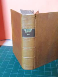
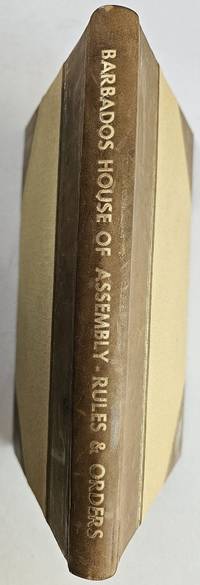
1867réf. BK0152Barbados: Office of "The Official Gazette" No. 14 Broad Street 1867. 30 pp. with unnumbered index 42 pp. Half leather over cloth boards. Ink ownership inscription "W. Brandford Griffith / 1869" on a preliminary blank. Scattered foxing and light toning. A locally printed manual for the Barbados House of Assembly with the ownership inscription of William Brandford Griffith then both a member of the Assembly and the island's auditor-general. Griffith served in the Assembly from 1861 to 1874 and was appointed auditor-general in 1863; he subsequently held several other colonial offices before becoming governor of the Gold Coast in 1885. The rules numbered through 271 and accompanied by an extensive alphabetical index set out the conduct of the Assembly's public business. The index includes procedures for issuing election writs and returning the names of elected members to the governor and council together with the course to be followed when writs had not been executed. Although published well after emancipation these rules governed an Assembly whose electorate remained restricted by property qualifications. Free men of color had gained voting rights subject to those qualifications in 1831 and Samuel Jackman Prescod entered the Assembly in 1843. Planters and merchants nevertheless continued to dominate both the Assembly and the Legislative Council during the period in which Griffith served. OCLC records the 1867 edition OCLC 823344433 but we have been unable to identify a current institutional holding. . Office of "The Official Gazette," No. 14, Broad Street unknown books
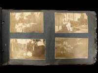
1914réf. 231551914. Caribbean photograph album likely compiled by a person connected to the Panama Canal Zone and the Caribbean documenting how steamship mobility port circulation and U.S. imperial presence linked Jamaica Venezuela Trinidad Barbados Cuba Puerto Rico the Bahamas Florida and Panama in the years after the canal opened. The felt cover lettered "PANAMA" and bearing the Seal of the Canal Zone places the album within the new travel geography created by U.S. control of the Canal Zone and the canal's 1914 opening when Panama became a central hinge between Atlantic and Pacific movement and a major point of contact between North American travelers and Caribbean port cities. Photos show passengers on steamers and docks markets and streets forts and government buildings and repeated encounters between white visitors and Afro Caribbean and mixed-heritage residents across multiple colonial and semi-colonial settings. Panama Canal Zone travel photograph album. Caribbean and circum-Caribbean locations including Kingston Jamaica; La Guaira and Caracas Venezuela; Trinidad; Key West and Palm Beach Florida; Havana Cuba; Barbados; Panama City Balboa and Colón Panama; Nassau Bahamas; and San Juan Puerto Rico. Likely circa mid 1910s to early 1920s. Oblong felt-covered album measuring 6.5" x 11" with "PANAMA" stitched in large letters on the front cover and photographs pasted to grey leaves. Contains more than 160 black-and-white photographs most approximately 2.5 x 4.5 inches many with handwritten captions identifying locations activities and occasional names. The sequence opens in Kingston with captions including "Kingston JA" and "on the steamer" then moves through island and mainland stops; "Port of Spain Trinidad" "Market at Barbados" "Rapid Transit Barbados" "Havana Cuba" "San Juan Porto Rico" "Morro Castle" "Balboa" and "Colon R.P." Repeated figures especially a young college-aged woman and an older woman appear throughout. Notable images include a group of locals in shallow water at Barbados sifting for tossed coins from rowboats; a large crowd scene in San Juan gathered for what appears to be a public speech or civic event; battlements cannon and stone defenses in Havana; vernacular dwellings and children in impoverished conditions in Balboa; posed visitor photographs in what is labeled a "bull ring"; and numerous street dockside market and architectural views that juxtapose local populations with hotels public buildings ruins and newer urban construction. The album's historical force comes from the way it captures the social landscape of Caribbean travel under early twentieth-century U.S. power. After 1914 the Canal Zone intensified Panama's role within a wider American maritime sphere while Caribbean travel increasingly moved through port infrastructures shaped by empire commerce military strategy and tourism; this album records that world at eye level with photographs of docks steamers fortifications government sites public squares and local street life rather than limiting themselves to family snapshots alone. At the same time the images preserve the unequal human encounters built into that system especially where visitors photograph Black children boatmen market crowds and working neighborhoods as part of the travel experience. Felt cover worn and soiled with losses at edges and stitching strain; leaves brittle with chipping and tears; photographs generally present and legible with silvering fading corner wear and occasional losses or lifting. Overall fair to good condition. A substantial early twentieth-century visual record of Canal Zone connected Caribbean travel with dense captioning and wide geographic reach from Jamaica and Barbados to Havana San Juan and Panama. unknown
1914réf. 231551914. Caribbean photograph album likely compiled by a person connected to the Panama Canal Zone and the Caribbean documenting how steamship mobility port circulation and U.S. imperial presence linked Jamaica Venezuela Trinidad Barbados Cuba Puerto Rico the Bahamas Florida and Panama in the years after the canal opened. The felt cover lettered "PANAMA" and bearing the Seal of the Canal Zone places the album within the new travel geography created by U.S. control of the Canal Zone and the canal's 1914 opening when Panama became a central hinge between Atlantic and Pacific movement and a major point of contact between North American travelers and Caribbean port cities. Photos show passengers on steamers and docks markets and streets forts and government buildings and repeated encounters between white visitors and Afro Caribbean and mixed-heritage residents across multiple colonial and semi-colonial settings. Panama Canal Zone travel photograph album. Caribbean and circum-Caribbean locations including Kingston Jamaica; La Guaira and Caracas Venezuela; Trinidad; Key West and Palm Beach Florida; Havana Cuba; Barbados; Panama City Balboa and Colón Panama; Nassau Bahamas; and San Juan Puerto Rico. Likely circa mid 1910s to early 1920s. Oblong felt-covered album measuring 6.5" x 11" with "PANAMA" stitched in large letters on the front cover and photographs pasted to grey leaves. Contains more than 160 black-and-white photographs most approximately 2.5 x 4.5 inches many with handwritten captions identifying locations activities and occasional names. The sequence opens in Kingston with captions including "Kingston JA" and "on the steamer" then moves through island and mainland stops; "Port of Spain Trinidad" "Market at Barbados" "Rapid Transit Barbados" "Havana Cuba" "San Juan Porto Rico" "Morro Castle" "Balboa" and "Colon R.P." Repeated figures especially a young college-aged woman and an older woman appear throughout. Notable images include a group of locals in shallow water at Barbados sifting for tossed coins from rowboats; a large crowd scene in San Juan gathered for what appears to be a public speech or civic event; battlements cannon and stone defenses in Havana; vernacular dwellings and children in impoverished conditions in Balboa; posed visitor photographs in what is labeled a "bull ring"; and numerous street dockside market and architectural views that juxtapose local populations with hotels public buildings ruins and newer urban construction. The album's historical force comes from the way it captures the social landscape of Caribbean travel under early twentieth-century U.S. power. After 1914 the Canal Zone intensified Panama's role within a wider American maritime sphere while Caribbean travel increasingly moved through port infrastructures shaped by empire commerce military strategy and tourism; this album records that world at eye level with photographs of docks steamers fortifications government sites public squares and local street life rather than limiting themselves to family snapshots alone. At the same time the images preserve the unequal human encounters built into that system especially where visitors photograph Black children boatmen market crowds and working neighborhoods as part of the travel experience. Felt cover worn and soiled with losses at edges and stitching strain; leaves brittle with chipping and tears; photographs generally present and legible with silvering fading corner wear and occasional losses or lifting. Overall fair to good condition. A substantial early twentieth-century visual record of Canal Zone connected Caribbean travel with dense captioning and wide geographic reach from Jamaica and Barbados to Havana San Juan and Panama. unknown books
réf. HIS4162MS.l.n.d. (1763, Conseil Supérieur de la Martinique). In-12, relié, plein veau moucheté, dos à nerfs orné, pièce de titre, filets sur chasses et coiffes, 190pp. Plusieurs ex-libris à la plume sur garde blanche et sur garde de fin. Frottements d'usage. Intérieur frais. Bon exemplaire
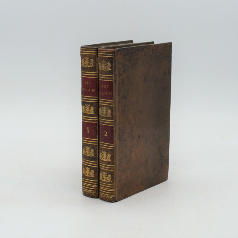
1819réf. 15556Pillet ainé Paris 1819 2 vol. 2 tomes en un vol. in-8 de XV 416 pp. et 2 ff.n.ch. 350 pp. 1 f.n.ch. (errata), demi-veau de l'époque, dos lisse orné, tranches marbrées (coiffes restaurées).
1797réf. 0006092Boston: S. Hall and Thomas & Andrews 1797. First Edition. Hardcover. Good. 7 Maps. Octavo new full brown calf red spine label new endpapers minor foxing. Ex libris Robert Breck in 1798 on title-page and on flyleaf minor repairs to folds of frontispiece folding map. . Capt. Thomas Hutchins the U. S. General Geographer supplied his notes to assist Morse the "Father of American Geography" in the completion of this work. This copy includes the map of "Georgia Western Territory" which was not incorporated in many of the copies. Howes M839; Evans 32509; not in Graff; Sowerby 3964; Sabin 50923 John Carter Brown 3902; Buck ILLINOIS 53. Contains 7 maps. S. Hall, and Thomas & Andrews hardcover
1817réf. PHO-1170Paris, F. Bechet ; A. Égron, février 1817; 2 volumes in-8 ,xxxii,403,[2]; [4],394,[2]pp., relié plein veau raciné époque , dos lisse orné avec pièces de titre et tomaisons rouges, dos lisses. Édition originale.
1856réf. 0006868New York: D. Appleton 1856. First edition. Hardcover. fine. 12mo xii 412 pages original light brown embossed cloth. These observations are related in a series of 61 letters. These were originally composed in Spanish then translated into English by Joseito. "I have thereby been enabled to impart entirely new data and reliable information instead of merely copying from books already known. . I applied myself to natives who besides an intimate knowledge of affairs in general possessed a sound judgment and an investigating disposition. It has beeen indeed a very happy incident to have found them. . That part of my work which treats on judicial matters and the secrets of the management of the tribunals will especially attract the attention of my readers. - Introductory Letter." Sabin 17816; Treiles BIBLIO. CUBANA vo. 4 p.17. D. Appleton hardcover
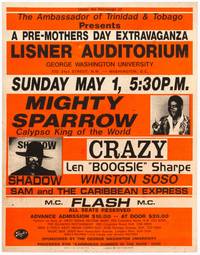
1988réf. 564096Landover Maryland / Washington D.C.: Special Effects Inc. / George Washington University 1988. Softcover. Very Good. Poster. Measuring 22" x 28". Printed in orange and black on thick coated card stock. Staple holes some foxing and soil a very good copy of a scarce poster advertising a 1988 performance by some of the world's greatest Calypso artists. Special Effects Inc. / George Washington University unknown books
réf. PD19Oblong Folio album ca. 285x36 cm. 49 black paper album leaves. With ca. 260 mounted gelatin silver photographs of various size including ca. 20 large photos from ca. 245x32 cm 9 ½ x 12 ½ in to ca. 155x225 cm 6 x 8 ¾ in and 21 panoramas ca. 85x29 cm 3 ¼ x 11 1 /2 in or slightly smaller. The rest of the photos are from ca. 12x17 cm 4 ¾ x 6 ¾ in to ca. 4x6 cm 1 ½ x 2 ¼ in; most photos are ca. 8x14 cm 3 ¼ x 5 ½ in. No captions. About twenty photos with period ink notes “D.K.M. 10” in the corners. Period style black half morocco with cloth boards; decorative gilt-tooled borders on both boards and spine. Album leaves brittle several with tears and losses on extremities two large photos with tears and losses on extremities two small photos with losses of one corner each one photo has been apparently previously removed a few photos smildly faded or with mild silvering but overall a very good album of interesting photos. Historically significant album with lively amateur snapshots and original studio photos taken and collected by a family of American tourists during a Caribbean cruise in the early 1910s onboard the steamship “Moltke” of the Hamburg America Line Hamburg-Amerikanische Packetfahrt-Aktien-Gesellschaft or HAPAG. Launched in 1901 S.S. “Moltke” went on regular cruises around the Caribbean and the Mediterranean until it was seized by Italy in 1915 in the course of WW1. Her Caribbean or West Indies cruises departed from New York and included stops in Cuba Puerto Rico Jamaica Panama Canal Venezuela Trinidad Barbados Martinique St. Thomas Dutch West Indies Bermuda & Bahamas. The album opens with several large views and panoramas of Havana harbour and waterfront featuring Castillo del Morro the iconic building of Lonja del Comercio commodities and stock exchange and S.S. “Moltke.” The other photos show Havana streets and passers-by the interior of a Catholic church &c. Over twenty photos are the views of the city and harbour of Charlotte Amalie on St. Thomas Island – then the capital of the Danish West Indies since 1917 the U.S. Virgin Islands. The images show the city harbour from the distance and close-up a sign of “St. Thomas Bay & Rum Co.” is seen on one of the photos the statue of King Christian IX erected in the Emancipation Garden in 1909 removed in 2021 streets residential neighbourhoods on sloping hills a local market an official residence with the waving Danish flag garden of a Catholic convent with one of the monks posing alone and with a young tourist &c. Over thirty identified views of Puerto Rico a U.S. colony since 1898 a Commonwealth controlled by the U.S. since 1952 show San Juan: Plaza de Armas with the City Hall completed in 1842 Palacio de la Real Independencia now housing the Department of State of Puerto Rico Castillo San Felipe del Morro in the San Juan Bay Plaza Colon with Christopher Columbus monument San Juan harbour city streets and shops building of the “Hotel y Banos” a passenger train with the travellers walking at the front native cart drivers passers-by &c. A large group of photos ca. sixty depict the French Island of Martinique with a series of views of Fort-de-France: statues of Empress Josephine erected in 1859 destroyed in 2020 and Victor Schloelcher erected in 1904 removed in 2020 St. Louis Cathedral with the spire still under construction city streets and harbour “Hotel de l’Europe” distinctive cliffs on the coast near Fort-de-France &c. The views of Martinique include over twenty images of the ill-fated town of St. Pierre which perished during Mount Pelee’s eruption in May 1902. The photos include one view of St. Pierre before the destruction as well as general views of the ruins and desolation with posing tourists. Several images show the ruins of the Co-Cathedral of Our Lady of Assumption the downtown core with a grid of destroyed buildings and charred trees wrecked ships in the harbour a surviving bridge and the remains of the victims. A couple of images feature the top of Mount Pelee with a distinctive lava spine or the “Needle of Pelee” which was formed in October 1902 and collapsed in March 1903. Among the identified photos of Nassau Bahamas are the views of the famous silk cotton tree St. Matthews Anglican church completed in 1802 and the interior of Fort Charlotte. The other images show sugar cane plantations and native workers Caribbean residences streets and markets ports the American coastal steamer “Colonia” a series of scenes from a street carnival procession portraits of local market goers families diving children &c. Several images portray the tourists on board the S.S. Moltke including a group portrait with a lifebuoy of “Moltke Hamburg”. Overall a historically significant visual source on the history of American tourism to the Caribbean in the early 20th century with interesting views of the aftermath of the destruction of St. Pierre by the volcanic eruption. hardcover
1813réf. PHO-1916Paris, F. Schoëll, Libraire, 1813. In-8 (20,5 x 13,5 cm), XXVI-411 pp.,3ff-480pp-4ff (table et errata), illustré de 3 cartes dépliantes et 6 tableaux dépliants, demi-maroquin moderne à long grain bleu nuit, dos lisse, auteur, titre et tomaison dorés, filet et roulette dorés, fers à froid rousseurs.
1809réf. 11691Chaumerot Paris 1809 1 vol. In-8 de 3 ff.n.ch. 407 pp.; demi-basane racinée de l'époque, dos lisse orné, pièce de titre.
1818réf. 14917Gide fils Paris 1818 2 vol. 2 vol. in-8 de VIII 406 pp. et 2 ff.n.ch. 390 pp., plein bradel papier ancien, dos lisse, pièces de titre.
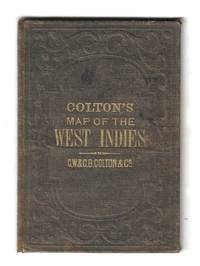
1855réf. 78137New York: G.W. & C.B. Colton 1855. Hand-colored lithograph map of the Caribbean showing Florida and Central America with insets of Bermuda and the city and harbor of Havana. This example is colored according to national allegiance with British territories in red Spanish in yellow and so on. The map is printed on a 17” x 14 ¾” sheet of banknote paper and folds into brown cloth-covered boards with gilt titles. Some light foxing with a few small spots. There is a bit of creasing along the right margin not affecting the image. The boards are rubbed and faded with some light soiling as well. G.W. & C.B. Colton unknown
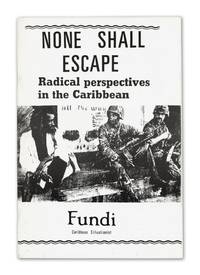
réf. 140948802London: News from Everywhere 1988. First edition. Fine. First edition. 21 pp. Staple bound in publisher's printed wraps. Fine condition; lacking folding map originally laid in. Rare with only nine copies located in OCLC. Ford 245. The key text of the one-man Caribbean Situationist movement which was inspired by the '60s Paris-centered avant garde Marxist group the Situationist International. It comprises the three essays "Radical Perspectives in the Caribbean" "What Padmore Passed Through" about Pan-Africanist leader George Padmore and "The Adventures of Westmoreland" about labor struggles in a southwestern parish in Jamaica. News from Everywhere unknown
réf. 140948802London: News from Everywhere 1988. First edition. Fine. First edition. 21 pp. Staple bound in publisher's printed wraps. Fine condition; lacking folding map originally laid in. Rare with only nine copies located in OCLC. Ford 245. The key text of the one-man Caribbean Situationist movement which was inspired by the '60s Paris-centered avant garde Marxist group the Situationist International. It comprises the three essays "Radical Perspectives in the Caribbean" "What Padmore Passed Through" about Pan-Africanist leader George Padmore and "The Adventures of Westmoreland" about labor struggles in a southwestern parish in Jamaica. News from Everywhere unknown books
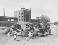
réf. PF38Quarto album ca. 282x175 cm 11 x 7 in. 24 card stock leaves. With 94 mounted original gelatin silver photographs ca. 9x115 cm 3 ¾ x 4 ½ in. Ca. 77 photos with period English ink captions on the mounts. Period hunter green full-cloth album with the gilt-tooled sunburst motif and the generic title “Photographs” on the front cover. Paper inventory label and pencil trances on the front cover worn edges two photos missing but otherwise a very good album with strong interesting photographs. Historically interesting album with excellent original photographs apparently taken by a British tourist during a voyage from England to present-day India the Mediterranean and the Caribbean at the turn of the twentieth century. The album follows a wide-ranging journey that begins in Calcutta then the capital of British India and continues through Varanasi Lucknow Agra and Delhi capturing the movement of the travelers across northern India. From there the route turns south to Madras and Colombo in Sri Lanka where the party embarked on a long sea passage. Traveling by steamer through the Suez Canal with recorded stops at Port Said and Malta the voyage gradually leads to the Caribbean. The final portion of the album centers on their time in Havana and is especially notable for its firsthand visual record of the aftermath of the 1902 eruption of Mount Pelée which devastated the city of Saint-Pierre on Martinique. The album contains ninety-four well-executed photographs with most images of colonial India. About thirty early vibrant views portray iconic landmarks of Calcutta Tagore Castle Varanasi Monkey Temple Manikarnia Ghat Jaipur temples Agra exterior and entrance of Taj Mahal Delhi Sixty-four pillars interior the Great Mosque Jama Masjid jumping wells city gates Lucknow Gate of Kaiser Bagh the Residency Madurai Meenakshi Amman Temple and Madras the Great Pagoda Parthasarathy Temple. Especially interesting are over twenty candid urban scenes showing a snake charmer playing pungi an elephant transporting passengers boys gathering coal near railway tracks steamer passengers crossing the Ganges at embarkation point and dozens of Indians strolling through native markets guiding ox carts or gathered for communal prayer. The rest of the Indian photos comprise excellent nature and street views as well as a portrait of the apparent well-dressed compiler posing by his/her companion at a Bombay Harbor. About fifteen lively vernacular photos from Sri Lanka include views of the Galle Road Maligakane Temple the Galle Face Hotel and vibrant street scenes with locals in traditional attire strolling through the bustling thoroughfares. The Caribbean series contains over twenty-five excellent photos with the most interesting images documenting the infamous 1902 eruption of Mount Pelée and the ruins of Saint-Pierre Martinique. Other important identified photographs feature the sunken USS Maine in Havana Harbor an event that helped prompt the Spanish–American War as well as views of Castillo de los Tres Reyes del Morro Havana Wharf and Havana street scenes. The series also includes views of Kingston Harbor in Jamaica together with other lively candid scenes. The collection further contains several photographs of Port Said and Valetta mostly showing harbor and sea views. Overall a historically interesting album with excellent original gelatin silver photographs taken during a voyage from British India to the Mediterranean Sea and the Caribbean at the turn of the twentieth century. hardcover
1721réf. 158844 parties en 2 vol. in-12 de 11 ff.n.ch. 200 pp. 178 pp. et 5 ff.n.ch. 316 pp. (pagination continue), veau granité de l'époque, dos à nerfs ornés, pièces de titre et de tomaison, tranches rouges (restaurations aux coiffes et mors).
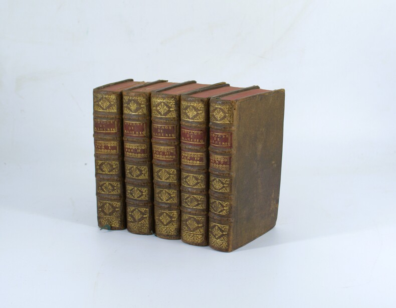
1722réf. PHO-2275Guillaume Cavelier, Paris, 1722, 5 volumes (6) in-12 (17x10cm), T1 ; xxxvi-5ff.-522pp., 21 planches, T2 ; 3ff.-598pp., 20 planches, T3 ; iv-549pp., 31 planches, T4 ; vi-558pp., 14 planches, T5 ; vi-524pp., 6 planches, 90 planches et cartes. Veau époque, dos à nerfs orné avec pièces de titre et tomaison en maroquin rouge, filets aux coupes. Frottements, 3 planches avec manques au tome 1, déchirure sans manque carte de la Martinique Édition Originale.
1751réf. 14635Nourse Londres 1751 2 vol. 2 parties en deux vol. in-12 de 2 ff.n.ch. 285 pp. et 1 f.n.ch. 248 pp.; veau fauve de l'époque, dos lisse orné, pièces de titre et de tomaison, tranches marbrées.
1798réf. PHO-1492Paris, chez Buisson, an VII (1798),4 volumes ; Texte 3 volumes in-8 demi percale et un Atlas in-4, demi cuir époque, dos lisse avec auteur et titre ,44 planches, certaines en double page ou dépliantes, gravées par Antoine-François Tardieu d'après John Gabriel Stedman, la planche 25 détachée, mouillure claire en marge sur 4 planches, frottements coins et coupes usés, exlibris Aldo Maffey, journaliste et écrivain italien.
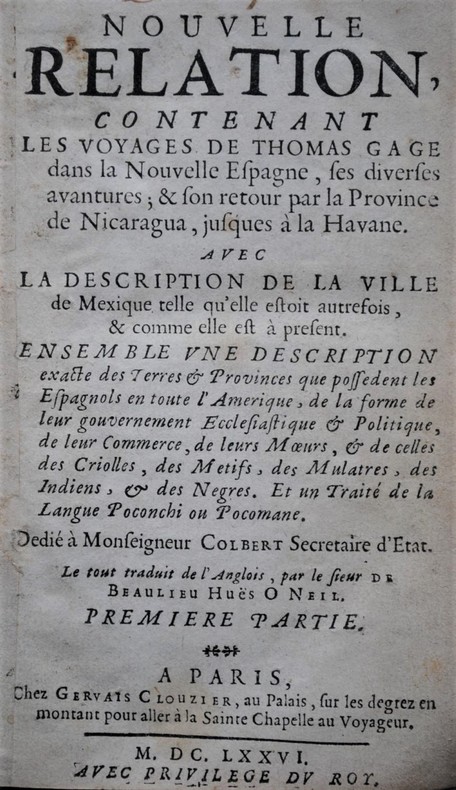
1676réf. P2-5A-3Paris : Gervais Clouzier, 1676. 4 parties en deux volumes, 8° (160 x 100 mm) , plein veau époque, dos à nerfs ornés avec titre et tomaison , différence de reliure, 13ffnch.-246pp-2ffnch et 4ffnch.240pp. , 4ffnch.-297pp.-2ffnch. Et 4ffnch.-153pp.-2ffnch. , coins et coupes usés , reliure solide , mouillure sur quelques feuillets (t3-4).
1751réf. PHO-1273LONDRES (CHEZ NOURSE) 1751 2 VOL. RELIES EN 1, IN-12°, 17 X 10 CMS, RELIÉ VEAU MOUCHETÉ, DOS A 5 NERFS ORNÉ DE FLEURONS DORÉS, TR. ROUGE. 2FF-285PPS; 1FF-148PPS. PREMIÈRE ÉDITION FRANÇAISE TRADUITE PAR RAULIN, ANCIEN OFFICIER DES DRAGONS.
réf. PE22Oblong Folio album ca. 285x37 cm 11 ¼ x 14 ¾ in. 50 black paper leaves 22 blank. With 218 mounted gelatin silver photos from ca. 8x135 cm 3 x 5 ¼ in to ca. 6x8 cm 2 ¼ x 3 ¼ in. No captions. With 15 loosely inserted photos including 5 duplicates: three large images ca. 22x34 cm 8 ½ x 13 ¼ in ten photos ca. 1520 cm 6x8 in and two smaller images. Period maroon full sheep album with a gilt-lettered title on the front cover. Binding rubbed on extremities the first leaf detached from the stub and loosely inserted several images slightly faded two large loosely inserted photos with creases and tears on extremities but overall a very good album. Interesting collection of original snapshot gelatin silver photos taken by an American or British family in the early 19th century which includes about 112 lively images of Bermuda and its people. The photos of Bermuda include a series of views of the Town of St. George showing the harbour with the Ordnance Island a graveyard with a pink Salvation Army church in the background St. Peter’s church and clock tower the oldest surviving Anglican church in continuous use outside of British Isles Stewart Hall city streets and historical houses &c. The identified views of Hamilton the territorial capital show the Princess Hotel taken from the harbour and city wharf. The other pictures of Bermuda show streets roads harbours with sailboats and naval ships coastal views private city houses and countryside residences portraits of local cart drivers local children the album’s compiler and his companions scenes on board a passenger steamer &c. The second half of the album with over a hundred photos depicts the compiler’s family life and their travels around Europe and the United States. The identified images show the “Peacock Hotel” Rowsley Derbyshire the Cliff Palace 11th-12th-century cliff dwelling in Montezuma County Colorado and the Garden of the Gods park in Colorado Springs. A portrait of an elderly lady features a sign that says “Cave of the Winds Pleases Everybody” most likely referring to the Cave of the Winds in the Pikes Peak region of Colorado. The other photos include scenes from an auto trip coastal views family portraits views of European cities likely in France &c. The loosely inserted photos are mostly views of the exterior and interior of a manor most likely in England. Overall an interesting collection of original snapshot photos of Bermuda in the early 20th century. unknown
1794réf. PHO-1886John Stockdale, Londres, 1794-1801, 3 volumes in-4 (275 X 225 mm), reliés plein veau marbré époque (restauration ancienne), pièce de titre rouge et de tomaison vert. Tome I, liv-494 pp., Tome II 520 pp, Tome III (1801) xix 443 pp., illustré de 3 frontispices, 11 cartes dont une en double feuille et dépliante (720 X 620) (cartes des Indes occidentales), 2 dépliantes Saint Domingo (250 X 225) et Jamaïque et 8 planches h.t., ex-libris en page de garde, déchirures aux pliures et brunissures en marge de la grande carte, frottements, griffures, pièces de titre et tomaison avec petits manques, quelques brunissures sur les titres et quelques feuillets.