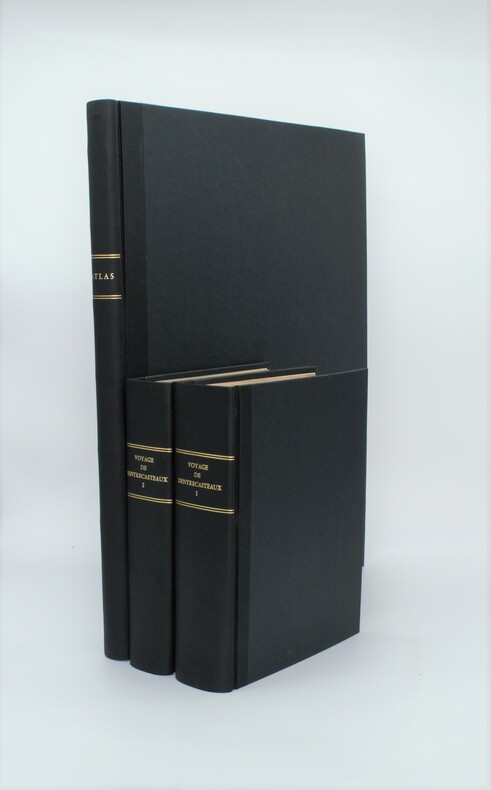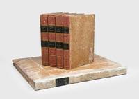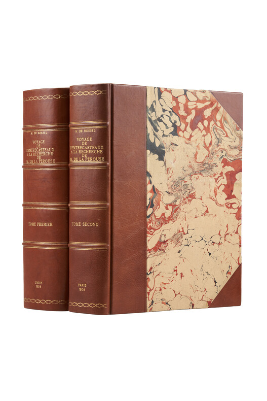
1808rif. PHO-1626Paris, Imprimerie impériale, 1808. 2 grands et forts volumes in-4 (32x24), lvi, 704 p., 33 pl. ; viii, 692 p., relié demi basane et coins moderne, dos avec auteur, titre, tomaison, lieu et date, exlibris en page de garde, non rogné, tome 2 non coupé, petite mouillure au tome 2, petites rousseurs aux illustrations du tome 1. Exemplaire sur papier bleuté, complet de son illustration mais sans son atlas de cartes
1807rif. PHO-1A Paris, Dépôt général des Cartes et Plans de la Marine et des Colonies, 1807 et De L’Imprimerie Impériale, 1808 RARE ENSEMBLE COMPLET en 3 volumes TEXTE ; 2 forts vol. in-4° ; (2)-LVI-704 pp.-32 pl. h.-t. repliées in-fine (I-XXXII)/(2)-VIII-692 pp.-1 pl. h.-t. Repliée sur papier bleuté , relié demi cuir , dos lisse avec titre et tomaison , tranches mouchetées , mouillure angulaire sur 7 planches, petites rousseurs sur les planches . ATLAS ; 1 volume grand in-folio (560x445) ,page de titre-1 fnch. (Table )-39 cartes et vues h.-t. , dont 29 à double page ,dressées par l'ingénieur hydrographe C. F. Beautemps Beaupré et gravées sur cuivre par E. Collin , relié demi cuir , dos lisse ,cachets répétés , petites rousseurs .
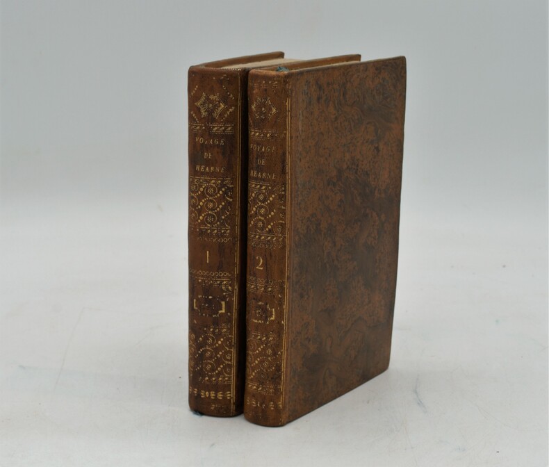
rif. PHO-1184Paris, chez Patris , an VII (1799), 2 volumes in-8, lviii-373 pp ,332 pp.-xix , relié plein basane raciné , dos lisse orné avec titre et tomaison , tranches jaunes mouchetées ,T1, titre , extrait du 3eme voyage du capitaine Cook , A la Pérouse , préface , grande carte de la route de Samuel Hearne (60x80cm)déchirure sans manque , introduction, 2 planches et 2 cartes ,T2 , 3 cartes et 2 planches , table des chapitres , errata et placements des planches , intérieur très frais. Complet des 9 planches et cartes , 1 carte volante , manque page 17 à 32 .
1800rif. PHO-1086Texte In-8 (200 x 130 mm) Relié demi-basane, dos orné pièce de titre et de tomaison ,T1 manque coiffe sup.,T2 ,manque coiffes, papier bruni. 440 pp et 332 pp suivi de 109 pp de vocabulaire et table des planches contenues dans l’atlas, table des chapitres du volume et errata. ATLAS Atlas pour servir à la relation du voyage à la recherche de La Pérouse, fait par ordre de l’Assemblée constituante, Pendant les années 1791, 1792, et pendant la 1ere et 2eme année de la République Française. Paris : H. J. Jansen, An VIII de la République (1800). — In-folio, 510 x 335 : titre, 1 carte, 43 planches. Demi toile , dos lisse avec titre , planches 6 détachée et 35 détachée et émargée , dédicace «à Mr V. Rey, secrétaire général de la Nouvelle Calédonie,1903»
1829rif. PHO-1047Paris: Imprimerie Royale, 1829.1 vol. in-4 de 2ff-titre, table-124pp. , relié demi cuir , dos lisse avec pièce de titre ,1 grande carte trigonométrique des côtes occidentales de France, dépliante, dressée par Michel Daussy , mors frottés, intérieur à grande marge , très beau papier d’une grande fraîcheur
1990rif. LFA-126739701Revue de 50 pages, format 205 x 280 mm, illustrée, brochée couverture couleurs, bon état
rif. VOY918M1822-1824, Étienne Ledoux, Paris. Complet. 14 volumes in-8, demi-basane havane de l' époque, dos lisse orné, titre et tomaison dorés. Fronttispices illustrés. [2]-XII-469-[2], [6]-473-[2], [6]-498-[2], [6]-445-[2], [6]-474-[2], [6]-496-[2], [6]-478-[2], [6]-473-[2], [6]-489-[2], [6]-475-[2], [6]-479-[2], [6]-481-[2], [6]-474-[2], [6]-426-[2]. Volumes non coupés. Frottements diffus des dos, coins et coiffes. Pièces de titre et tomais parfois effacées. Intérieur globalement agréable. Usure normale du papier. Ensemble satisfaisant
rif. QWA-15029F. Bechet, 1847, gr. in-8 rel. 1/2 peau marron (15,5 x 24), VIII-352 p., E.O., gravures h.-t., reliure d'époque modeste usagée en bordure, intérieur avec rousseurs éparses, assez bon état.
1799rif. PHO-333Paris, Jansen, an VIII (1799) 2 vol. in-8 ,demi-veau havane, dos lisse orné (rel. Légt post., mors usagés et rongés) et un atlas in-folio en seconde édition (1817) brochure moderne en papier marbré. Texte :Tome I : xvi pp. (dont faux-titre et titre), 440 pp.Tome II : 332 pp. (dont le faux-titre et le titre), 109 pp., (1)f. Atlas : titre gravé, grande carte sur double page (Mer des Indes et une partie de celle du Sud, par Darbié du Bocage - volante) et 43 planches (vues, scènes, costumes, portraits et types, faune et flore) gravées sur cuivre par Dien, Copia, Pérée, etc., d'après Piron, Redouté, Audebert, etc. représentant des personnages, des scènes de vie, des armes, des vues, la faune et la flore. Nombreuses piqûres et taches d'humidité, mais papier solide, à bonnes marges.
rif. ORD-14195Préface du Contre-Amiral de Brossard. Paris. Gelly. Les Gentishommes de la Mer. (1970). 2 volumes in-8 (168 x 216mm) pleine peau maroquinée rouge, dos à 4 nerfs, titre et caissons or, frise et filets bordant les plats, gardes marbrées, tête dorée, étui bordé de maroquin rouge, 278 et 262 pages, nombreuses illustrations hors texte en noir ou en couleurs souvent à double page. Exemplaire sur vergé d'Arches. Très bon état.
1797rif. LBW-3733[Paris, 1797]. 684 x 492 mm.
rif. QWA-5125Maurice Nadeau / Papyrus, 1980 206 p., in-8 br., une carte des voyages de La Pérouse, très bon état
1977rif. LFA-126717915Un ouvrage de 269 pages, format 245 x 160 mm, illustré, relié cartonnage sous jaquette couleurs, publié en 1977, bon état
1990rif. LFA-126713447Un ouvrage de 319 pages, format 145 x 230 mm, relié cartonnage sous jaquette couleurs, publié en 1990, bon état
1797rif. 181908Paris: L'Imprimerie de la Republique 1797. One of the great documents of French exploration" in the original boards First edition an attractive set with strong impressions of the plates. La Pérouse's work is a "magnificent production and some authorities consider the engraving and craftsmanship to be superior even to that in the Cook-Webber atlas It is one of the finest narratives of maritime exploration ever written and certainly deserves to hold a place of high honour among the great travel accounts of the 18th century" Howell. La Pérouse's 1741-c.1788 expedition left France in 1785 to seek an inter-oceanic passage examining the parts of the Pacific not yet explored by Cook conducting scientific observations on the various peoples and regions assessing the extent of Spanish settlement in California and determining the possibilities of French expansion in the Pacific. En route to Kamchatka La Pérouse was the first to navigate safely and chart the Japan Sea and the strait between the island of Sakhalin and the northernmost island of Japan which bears his name. At Kamchatka he received instructions to proceed to Australia arriving at Botany Bay in January 1788 just hours after Captain Phillip had arrived with the First Fleet. After leaving later the same year the expedition was never seen again. Evidence slowly came to light that both ships were wrecked on the reefs around the islands north-west of Australia. This account is based on dispatches sent from Australia and Kamchatka before this. The atlas volume contains maps of Russian Asia Japan San Francisco Monterey and the Sandwich Islands. The most significant results of La Pérouse's voyage are the charts of the Asiatic side of the Pacific and the details of "the peculiarities he observed in the Native Americans of the northwest coast of North America are especially valuable" Sabin. It also features the first representation of the crested quail. The engraved portrait of La Pérouse counted as the 70th plate is here bound as the frontispiece in Volume I as often. The atlas was published in two forms: on regular usually trimmed and large or thick paper. Forbes and Lada-Mocarski give the measurements for the large paper issue variously at 620 x 455 and 563 x 420 mm. Provenance: Amandine Doré 1911-2012 the French painter illustrator and writer her pencilled signature on the front free endpaper of Volume I dated 1955 her signature and initialled booklabel on the front endpapers of the atlas. Doré produced works for travel narratives such as Mexique pay a trois etages 1955. 5 vols comprising 4 quarto text vols 307 x 256 mm and folio atlas 585 x 440 mm. Engraved portrait of La Perouse after Tardieu. Atlas: engraved allegorical title page by Moreau le Jeune 69 engraved plates and maps some double-page or folding many with original tissue guards loosely inserted. Original pulled paste paper boards flat paper covered spines tinted pink twin dark green spine labels original sheep corners housed together in light brown slipcase; atlas original pulled paste paper boards flat vellum spine covered with white paper dark green morocco spine label recent sheep corners. Text with occasional marginal pencillings or notes. Text vols: bookplate removed from front pastedown of vol. I rubbed a few superficial chips to spines and early recolouring vol. I starting before title; atlas: spine and sides extensively rubbed superficial split to foot of front joint marginal tear to Plate 28 and two others. A very good copy. Anker 276; Ferguson 251 dated 1798; Forbes 272; Hill 972; Lada-Mocarski 52; Sabin 38960; Streeter VI: 3493. Richard Reed in Howell Anniversary Catalogue 72 1982. hardcover
1799rif. 53594Leipsick No publisher 1799. Contemp. hcalf. Spine gilt and with gilt lettering. XXXVI562 pp. 5 engraved plates and 1 large folded engraved world map: "Mappemonde ou Carte réduite des Parties connues du Globe pour servir au Voyage de la Pérouse." 52 x 425 cm. A few margins of text at beginning and at end stained. The portrait lacks. Sabin 38959. unknown
1798rif. 53622Paris Plassin 1798. 8vo. and folio 44 x 30 cm. Textvolumes bound in 4 contemporary half calf. Gilt spines with gilt lettering. Tome-label on volume one eroded. Stamp on title-pages. 4LXVIII368;4414;316120 = Tables;4328 pp. A few scattered brownspots. Atlasvolume bound in matching hcalf. Spine gilt and rubbed. Lower compartment of spine with wear and tear. Engraved portrai of Pérouse as frontispiece. Engraved pictorial titlepage with cupids and naviogational instruments dessinée par Moreau le Jeune and 69 engraved maps plans and plates of which 32 are large folded engraved maps. Mild foxing to some parts of some maps occasionally mild dampstains to some plates marginal browning and some spotting. One map with a repair to folding. Second edition of the textvolumes the first appeared the year before 1797 and first edition of plates. 69 plates to the first 70 to the second."In 1785 Jean-Francois de Galaup Comte de la Perouse began preparations for an extensive sea voyage. His aim was to explore the Pacific regions of North and South America Asia and Australasia. The sponsor of the expedition was the French king Louis XVI who was inspired by Captain James Cook's Pacific voyages. Louis ordered the French expedition to show the world that France could also dominate in ocean exploration. The expedition consisted of two ships - La Boussole and L'Astrolabe. They carried a total of 225 crew officers and scientists. The ships left France in August 1785 and sailed south around Cape Horn. The voyage was expected to last four years. During the voyage La Perouse sent back regular reports to France. The expedition mapped coastlines and explored uncharted areas of ocean. The expedition's scientists also spent time onshore at various ports observing the habits and customs of local people and collecting natural history specimens. The expedition's progess until September 1787 was published by the French government as Voyage de La Perouse autour du monde La Perouse's voyage around the world. It was reprinted many times and translated into several languages. In 1791 when La Perouse had not returned to France or made any contact by dispatch the French government sent out a search party. It was commanded by Rear Admiral Joseph Antoine Bruni d'Entrecasteaux and consisted of two ships Recherche and Esperance. The complete disappearance of La Perouse caught the imagination of the European public. Songs stories and plays were written about the possible fate of the expedition including a popular play called Perouse or The desolate island. It was not until 1964 that the wreck of La Boussole was finally discovered on Vanikoro's reefs. At last the fate of La Perouse and his crew was known. The expedition is commemorated in the name of a Sydney suburb on the shores of Botany Bay - La Perouse." State Library of New South Wales Website.Sabin 38960. unknown
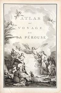
1790rif. 66877Paris. c. 1790. An extremely decorative title page featuring a huge scrolled map assorted angels and winged cherubs together with various seated and standing peoples of the world undoubtedly encountered during the La Perouse voyages. Size: 445 x 295 mm. Copperplate engraving. Good condition. unknown
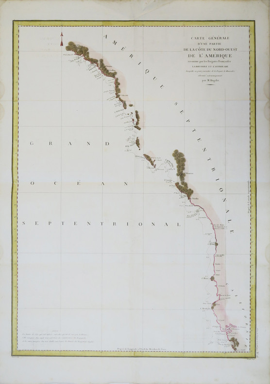
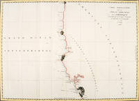
1797rif. 56360Paris. 1797. From the Voyages of La Pérouse who set sail from France in 1785 to continue the discoveries of Captain Cook. He was shipwrecked in 1788 but his narrative maps and views survived and were published in 1797. Thirty-eight years later the scattered remains of La Boussole and L'Astrolabe was discovered wrecked on a vicious reef on an atoll in the New Hebrides. Attractive sea chart covering coast from Mt. St. Elias to Monterey Bay. Relief shown by hachures. Shows route of La Perouse. Published in 'Atlas Du Voyage De La Pérouse'. Size: 575 x 845 mm. Copper engraving. Hand coloured. Very good condition; some light stains along the lower horizontal fold; a tear and some foxing to the upper margin; wide margins. unknown
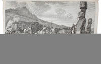
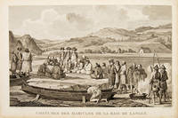
1797rif. 55666Paris. 1797. Scene showing inhabitants of Lituya Bay Alaska in fishing season. From the Voyages of La Perouse who set sail from France in 1785 to continue the discoveries of Captain Cook. He was shipwrecked in 1788 but his narrative maps and views survived and were published in 1797. Atlas Du Voyage De La Pérouse. Size: 400 x 255 mm. Copper engraving. Uncoloured. Very good condition. slight browing around edges but not effecting image. unknown
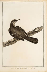
1797rif. 55672Paris. 1797. Print of an Alaskan Merle Bird. From the Voyages of La Pérouse who set sail from France in 1785 to continue the discoveries of Captain Cook. He was shipwrecked in 1788 but his narrative maps and views survived and were published in 1797. Atlas Du Voyage De La Pérouse. Size: 255 x 400 mm. Copper engraving. Uncoloured. Very good condition. Slight browing around edges but not effecting image. unknown
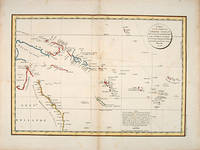
1797rif. 55868Paris: 1797. Interesting chart of part of the south-western Pacific showing the routes taken by the Spanish explorer Don Francisco Antonio Maurelle in 1781 along the northern coast of New Guinea and across the Pacific to Fiji and Tonga. Maurelle was credited with the discovery of the Hermit Islands on this voyage. The map includes the north-eastern coast of Australia and parts of the coast of New Guinea. The map shows the 1781 route of his ship "The Princesa" through the Bismarck Archipelago north of New Guinea through the Archipel de Salomos i.e. Solomon Islands and then east across the Pacific to the Iles de Amis i.e. the Friendly Islands now Tonga where he discovered I. Vavao i.e. Vava'u with one of the best anchorages in the South Pacific. The map includes the Iles de Navigateurs i.e. Samoa I. Fidji i.e. Fiji Iles de Esprit i.e. Vanuatu or the New Hebrides Isles and Nouvelle Caledonie i.e. New Caledonia. Many small islands are depicted with notes regarding their sightings by Abel Tasman William Bligh and Maurelle. A note on the chart states that the publisher has placed the islands according to the longitude of other navigators rather than on Maurelle's figures which were considered estimates only and also that Maurelles chart was based on a French chart by Jacques Nicolas Bellin published in 1742. The French cartographers at the time did not consider the Spanish charts to be sufficiently accurate so they preferred to make their own corrections. Size: 490 x 340 mm. Copper engraving. Hand coloured. Good condition. Watermark slight browning and an old repair to the central fold. Good margins. unknown
1797rif. 55667Paris. 1797. From the Voyages of La Perouse who set sail from France in 1785 to continue the discoveries of Captain Cook. He was shipwrecked in 1788 but his narrative maps and views survived and were published in 1797. Atlas Du Voyage De La Pérouse. Size: 400 x 255 mm. Copper engraving. Uncoloured. Very good condition. slight browing around edges but not effecting image. unknown
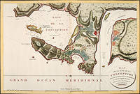
1797rif. 56362Paris: 1797. Fine sea chart of the bay and Bio Bio River region with great topographical and hydrological detail. Villages and Fort St. Pierre are depicted. From the Voyages of La Pérouse who set sail from France in 1785 to continue the discoveries of Captain Cook. He was shipwrecked in 1788 but his narrative maps and views survived and were published in 1797. Thirty-eight years later the scattered remains of La Boussole and L'Astrolabe was discovered wrecked on a vicious reef on an atoll in the New Hebrides. Copper engraving. Very good condition; slight browning to the centrefold. Hand coloured. Size: 57 x 42 cm. unknown
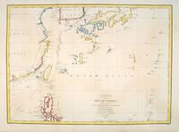
1797rif. 55879Paris:. 1797. From the Voyages of La Pérouse who set sail from France in 1785 to continue the discoveries of Captain Cook. He was shipwrecked in 1788 but his narrative maps and views survived and were published in 1797. Fine large chart shows the southern coast of China Japan Korea Formosa & the Philippines and the Marianas as well as many small islands in the region. Locates the tracks of the Boussoles the Astrolabe the ships of La Perouse on his voyage from Manila to Kamtschatka. Chart shows very detailed soundings and all known harbours straits and island chains. Engraved by BOUCLET. Atlas Du Voyage De La Pérouse Size: 675 x 490 mm. Copper engraving. Hand coloured. Fine condition. Slight browning to the lower margin. Good margins. unknown