La Perouse, Jean Francois de GalaupBiblio.com
178 risultati
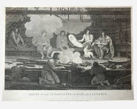
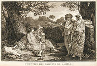
1797rif. 55644Paris. 1797. A very beautiful print showing four elegant figures relaxing in a shady glade two women recline and two stand chatting. This print is from the Voyages of La Perouse who set sail from France in 1785 to continue the discoveries of Captain Cook. He was shipwrecked in 1788 but his narrative maps and views survived and were published in 1797. Atlas du Voyage de la Perouse Copper engraving. Good margins crisp clear impression very good condition. slight browning around edges but not effecting image Uncoloured. Size: 40 x 25.5 cm. unknown
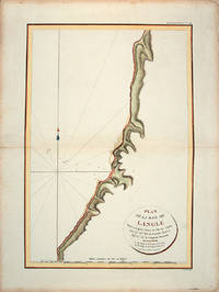
1797rif. 55866Paris: L'Imprimerie de la Republique.Atlas Du Voyage De La Pérouse. 1797. From the Voyages of La Pérouse who set sail from France in 1785 to continue the discoveries of Captain Cook. He was shipwrecked in 1788 but his narrative maps and views survived and were published in 1797. Tomari Region Russia ; Sakhalin Russia Full Title: Plan de la Baie de Langle. Situee a la partie ouest de l'Ile de Tchoka par 47048'36" de latitude nord et 139057'54" de longitude orientale. L. Aubert scripsit. Atlas du Voyage de la Perouse no. 49. Paris: L'Imprimerie de la Republique An V 1797. Engraved by AUBERTL. Size: 255 x 400 mm. Copper engraving. Hand coloured. Very good condition. unknown
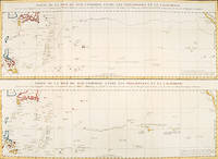
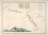
1797rif. 56361Paris: 1797. An interesting large sheet with two maps covering the same area. The top chart shows the routes of the Spanish galleons from Acapulco to the Philippines. The bottom chart shows La Perouse's route from Monterey through Hawaii and the Marianas to Macao. From the Voyages of La Pérouse who set sail from France in 1785 to continue the discoveries of Captain Cook. He was shipwrecked in 1788 but his narrative maps and views survived and were published in 1797. Thirty-eight years later the scattered remains of La Boussole and L'Astrolabe was discovered wrecked on a vicious reef on an atoll in the New Hebrides. Full title: "Partie de la Mer du Sud comprise entre les Philippines et la Californie d'apres de Carte Espagnole trouvee sur le Galion pris par l'Amiral Anson en 1743 qui represente l'etat des connaissances a cette epoque et les routes que suivaient ordinairement les Galions dans leur traversee de Manille a Acapulco. Partie de la Mer du Sud comprise entre les Philippines et la California d'apres une autre Carte Espagnole communiquee a La Perouse dans sa relache a Monterey sur laquelle il avait trace sa route ainsi que les Iles qu'il avait reconnues avec des notes sur celles qu'il n'avait pas retrouvee." Copper engraving. Very good condition; some light stains along the lower horizontal fold; a tear and some foxing to the upper margin; wide margins. Hand coloured. Size: 79 x 55.5 cm. unknown
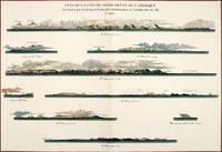
1797rif. 56368Paris: 1797. Nine profiles showing Mt. Beautems Mt. Crillon Mt.St. Hyacinthe Port Guibert Iles des Espagnols Iles Necker Necker Islands Ile Sn. Carlos Pointe des Brisants present Estevan Point and Baie Clonard Beresford Bay. The map is from the Voyages of La Pérouse who set sail from France in 1785 to continue the discoveries of Captain Cook. He was shipwrecked in 1788 but his narrative maps and views survived and were published in 1797. Thirty-eight years later the scattered remains of La Boussole and L'Astrolabe was discovered wrecked on a vicious reef on an atoll in the New Hebrides. Atlas Du Voyage De La Pérouse. Paris: Copper engraving. Very good condition; slight browning along the centrefold and foxing to wide margins a tear to the bottom margin along the centrefold not affecting the image. Hand coloured. Size: 58.5 x 43 cm. unknown
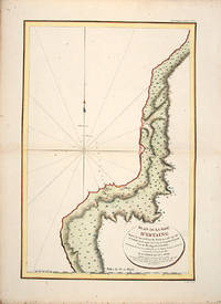
1797rif. 55865Atlas Du Voyage De La Pérouse. 1797. From the Voyages of La Pérouse who set sail from France in 1785 to continue the discoveries of Captain Cook. He was shipwrecked in 1788 but his narrative maps and views survived and were published in 1797. Uglegorsk Region Russia Full Title: Plan de la Baie d'Estaing. Situee a la cote de l'ouest de Tchoka par 48059'38" de latitude nord et par 14000'42" de longitude orientale prise du mouillage de l'Astrolabe. Cette Baie fut decouverte le 20 juillet 1787 par les Fregates Francaises la Boussole et l'Astrolabe commandees par MM. de La Perouse et de Langle. L. Aubert scripsit. Atlas du Voyage de la Perouse no. 51. Paris: L'Imprimerie de la Republique An V 1797. Engraved by AUBERTL. Size: 255 x 400 mm. Copper engraving. Uncoloured. Very good condition. unknown
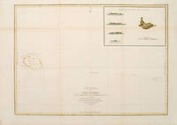
1797rif. 55873Paris: 1797. From the Voyages of La Pérouse who set sail from France in 1785 to continue the discoveries of Captain Cook. He was shipwrecked in 1788 but his narrative maps and views survived and were published in 1797. Sea chart showing Necker Island a small island in the Pacific Ocean part of the Nortwestern Hawaiian Islands. La Perouse was the first European to visit the island in 1786. Map inset in the right top corner showing profiles of the island from different angles. Atlas Du Voyage De La Pérouse. Size: 680 x 485 mm. Copper engraving. Hand coloured. Very good condition. Faint waterstain to the left vertical fold. Good margins. Watermarks. Folds as issued. unknown
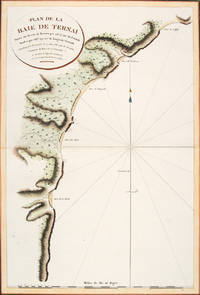
1797rif. 56364Atlas Du Voyage De La Pérouse. Paris: L'Imprimerie de la Republique. 1797. A crisp clear map of the Bay of Ternai in Tartary. Relief shown by hachures; depths by soundings. From the Voyages of La Pérouse who set sail from France in 1785 to continue the discoveries of Captain Cook. He was shipwrecked in 1788 but his narrative maps and views survived and were published in 1797. Thirty-eight years later the scattered remains of La Boussole and L'Astrolabe was discovered wrecked on a vicious reef on an atoll in the New Hebrides. Copper engraving. Fine condition; slight browning and foxing to wide margins not affecting the image. Hand coloured. Size: 42.5 x 56.5 cm. 16½ x 22 inches unknown
1740rif. 52760Atlas du Voyage de la Pérouse. c. 1740. A beautiful picture with four people in the foreground and others in the background against a backdrop of the sea. Engraved by Thomas. Atlas du Voyage de la Pérouse. Original copper engraving. Fine condition. Black & white. Size: 39.6 x 26.5 cm. unknown
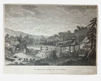
1798rif. 003681G. G & J. Robinson. LA PAROUSE John Francis Galaup; DUCHÉ DE VANCY Jean Baptiste; HEATH James: Tombs of Baie de Castries. An engraving from Charts and Plates to La Pérouse's Voyage London: G. G. & J. Robinson 1798. Copper engraving 310 × 230 mm plate on laid paper with good margins; plate mark visible; light overall toning and a few faint spots with a shallow horizontal fold as issued otherwise in very good condition. A view of the tombs at Baie de Castries showing a small settlement with two figures in the foreground and the distinctive raised wooden burial structures. Bais de Castries described in contemporary sources as lying on the eastern coast of Tartary corresponds to the North Pacific explored by La Perouse in 1787 in the region now identified with the northwest coast of America southeast Alaska. The drawing was made by Jean-Baptiste Louis Claude Théodore duc de Vancy one of the official artists attached to the expedition of Jean-François de Galaup comte de La Pérouse whose role was to record landscapes sites and customs encountered during the voyage. La Perouse and his crew wouldn't make it back to Paris with it latterly being discovered that his ship was wrecked at Vanikoro now the Solomon Islands. The plate was engraved in London by James Heath among the leading line engravers of the late eighteenth century and published by G. G. & J. Robinson for the atlas volume Charts and Plates to La Pérouse's Voyage Round the World issued in 1798 as part of the English edition of the expedition's results. . Very Good. Soft cover. 1st Edition. 1st Printing. 1798. G. G & J. Robinson paperback
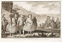
1798rif. 003682G. G & J. Robinson. LA PEROUSE Jean Francois; DUCHÉ DE VANCY Jean Baptiste; HEATH James. Dress of the Inhabitants of Baie de Castries. An engraving from the atlas volume of plates of the voyage of Jean-François de Galaup comte de La Pérouse published in London by G. G. & J. Robinson Paternoster Row 1798. Copper-engraving plate no. 54 after a drawing by the Duché de Vancy engraved by Heath with the imprint "Published as the Act directs Nov. 1st 1798". 330x220mm light uniform toning mild marginal soiling a little show-through from the verso but a clean well-defined impression with good margins. Overall very good. Image depicting domestic life costume and material culture of the Indigenous inhabitants of Baie de Castries on the north-west coast of America then described as the eastern coast of "Tartary" in contemporary French and British geographical usage. This plate forms part of the celebrated series of engravings prepared for the posthumous publication of La Pérouse's voyage 1785-1788 documenting the French expedition's survey of the North Pacific including Alaska the Sea of Japan Kamchatka and the northwest coast of America. The draughtsman Jean-Baptiste Claude Duché de Vancy served as official artist to the expedition while Heath was one of the principal London engravers engaged for the English edition of the atlas. The scene records the built environment clothing and domestic practices observed at Baie de Castries during La Pérouse's brief but historically important visit in 1786 shortly before the expedition's disappearance in the South Pacific. . Very Good. Soft cover. 1st Edition. 1st Printing. 1798. G. G & J. Robinson paperback
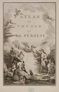
rif. 98498Paris Imprimerie de la République An V An V 1797. . First edition. 4 text vols 4to 30 x 23 cms and folio atlas 58 x 45 cms engraved portrait of La Pérouse after Tardieu atlas with engraved allegorical title-page by Moreau le Jeune titled Atlas du voyage de La Pérouse without imprint and 69 engraved plates comprising folding world map 35 views and natural history plates 33 maps or coastal profiles of which 20 double-page. Text volumes contemporary half-calf marbled boards chip to head of spine vol. I light marginal water-staining vol. II and title-page vol. III bound without half-titles joints vol. I cracked but sound lightly rubbed some scraping to boards; atlas 19th-century red morocco-backed boards neatly rebacked royal cypher of Prince Philippe of Belgium to cover and spine marginal repair to tear circa 7 cms to blank outer margin plate 15 not touching image occasional light foxing at beginning and end a very good set. The first edition of one of the most important scientific explorations ever undertaken to the Pacific and the northwest American coast and the first scientific voyage to California. 'The voyage round the world under the command of La Pérouse was intended as the French equivalent of Captain Cook's Third Voyage and was enthusiastically endorsed by the Academy of Sciences and particularly by Louis XVI. The most significant results of the voyage are the charts of the then imperfectly known Asiatic coast of the Pacific' Forbes. La Pérouse was the first explorer to navigate and chart the Japan sea and the strait between the island of Sakhalin and the northernmost island of Japan which bears his name. At Kamchatka he received instructions to proceed to Australia to assess the extent of British plans. He arrived at Botany Bay in January 1788 just hours after Governor Phillip had arrived with the First Fleet. La Pérouse's habit of forwarding copies of journals and drawings when opportunity offered ensured their survival for as is well known the accomplishments of the voyage have been overshadowed by the disappearance of the entire expedition. The folio atlas contains magnificent maps of Russian Asia Japan the Pacific North-West Coast Hawaii San Francisco and Monterey; the views include a fine series of botanical and ornithological plates including the California quail. Of particular interest to Hawaii is the plate that depicts French ships off Makena Maui. It is the first fully developed view of that island. Hill 972; Forbes 272; Lada-Mocarski 52; Ferguson 251; Brunet III 828-829; Sabin 4797. Paris, Imprimerie de la République, An V, An V [1797]. hardcover
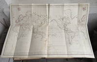
1799rif. 53594Leipsick No publisher 1799. Contemp. hcalf. Spine gilt and with gilt lettering. XXXVI562 pp. 5 engraved plates and 1 large folded engraved world map: "Mappemonde ou Carte réduite des Parties connues du Globe pour servir au Voyage de la Pérouse." 52 x 425 cm. A few margins of text at beginning and at end stained. The portrait lacks. Sabin 38959. unknown
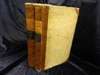
1798rif. 53622Paris Plassin 1798. 8vo. and folio 44 x 30 cm. Textvolumes bound in 4 contemporary half calf. Gilt spines with gilt lettering. Tome-label on volume one eroded. Stamp on title-pages. 4LXVIII368;4414;316120 = Tables;4328 pp. A few scattered brownspots. Atlasvolume bound in matching hcalf. Spine gilt and rubbed. Lower compartment of spine with wear and tear. Engraved portrai of Pérouse as frontispiece. Engraved pictorial titlepage with cupids and naviogational instruments dessinée par Moreau le Jeune and 69 engraved maps plans and plates of which 32 are large folded engraved maps. Mild foxing to some parts of some maps occasionally mild dampstains to some plates marginal browning and some spotting. One map with a repair to folding. Second edition of the textvolumes the first appeared the year before 1797 and first edition of plates. 69 plates to the first 70 to the second."In 1785 Jean-Francois de Galaup Comte de la Perouse began preparations for an extensive sea voyage. His aim was to explore the Pacific regions of North and South America Asia and Australasia. The sponsor of the expedition was the French king Louis XVI who was inspired by Captain James Cook's Pacific voyages. Louis ordered the French expedition to show the world that France could also dominate in ocean exploration. The expedition consisted of two ships - La Boussole and L'Astrolabe. They carried a total of 225 crew officers and scientists. The ships left France in August 1785 and sailed south around Cape Horn. The voyage was expected to last four years. During the voyage La Perouse sent back regular reports to France. The expedition mapped coastlines and explored uncharted areas of ocean. The expedition's scientists also spent time onshore at various ports observing the habits and customs of local people and collecting natural history specimens. The expedition's progess until September 1787 was published by the French government as Voyage de La Perouse autour du monde La Perouse's voyage around the world. It was reprinted many times and translated into several languages. In 1791 when La Perouse had not returned to France or made any contact by dispatch the French government sent out a search party. It was commanded by Rear Admiral Joseph Antoine Bruni d'Entrecasteaux and consisted of two ships Recherche and Esperance. The complete disappearance of La Perouse caught the imagination of the European public. Songs stories and plays were written about the possible fate of the expedition including a popular play called Perouse or The desolate island. It was not until 1964 that the wreck of La Boussole was finally discovered on Vanikoro's reefs. At last the fate of La Perouse and his crew was known. The expedition is commemorated in the name of a Sydney suburb on the shores of Botany Bay - La Perouse." State Library of New South Wales Website.Sabin 38960. unknown
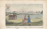
1827rif. 4011312Livorno: Tipografia Vignozzi 1827. Three leaves a little short at the margins printer's error a little foxing but very good. Three volumes duodecimo three frontispieces and three plates all with good contemporary handcolouring; contemporary quarter roan binding lettered in gilt marbled boards with vellum tips. Attractive early Italian edition of La Pérouse's voyage containing six charming coloured plates three of which are not recorded in the standard bibliographies. The first of these unrecorded plates is a costume study captioned "Uomo e Donna volgari della Concezione"; the second a view of Macao and the third depicts the death of botanist and savant Robert de Lamanon amidst a melée in Samoa during 1787. Neither Ferguson Forbes nor McLaren note the three plates additional to the frontispieces. Forbes did not in fact manage to inspect a copy of the book. Ferguson cites his own copy while McLaren consulted the Nan Kivell copy held by the National Library. This edition was part of a larger collection of voyages published in uniform duodecimo format with the series title Biblioteca Istruttiva e Piacevole ovvero raccolta dei più interessanti viaggi. Forbes confirms that each of the voyages was available separately. The spines in this set number the volumes within the series. . Tipografia Vignozzi unknown
1799rif. 3812959Stockholm: Johan Pfeiffer 1799. A few light spots but a very good copy. Small octavo; in attractive original Scandinavian half calf binding. Rare Swedish edition of the voyage of La Pérouse whose fame was so widespread that there was a ready market for accounts of his voyage across Europe and beyond. Within four years of the publication of the official French edition in 1797 translations appeared in London Edinburgh Paris Stockholm Leipzig Berlin Copenhagen Haarlem St. Petersburg Boston and Amsterdam. This Swedish version was prepared by Samuel Ödmann from the octavo French edition. He also provides a preface. Not in the catalogue of the Hill collection; Ferguson knew the book only from copies in the Mitchell Library and the Kroepelien Collection Oslo. . Johan Pfeiffer unknown
1798rif. 28466London: G. G. & J. Robinson. Fair No dust jacket as issued. First Edition. Disbound. Scarce with the world map. Disbound. Binding poor. Boards detached. 19th century full leather binding leather deteriorating. A very worn earlier leather spine is also partially present with a worn gilt title "CHARTS / & / PLATES / TO / PEROUSE". This earlier spine is still on the back of the text block and the later 19th century leather binding wrapped over the top of it. Boards with heavy dust stains rubbing and abrasions white spider droppings soiling to an area on front board. The plates are generally good throughout with throughout a moderate dampstain and tidemark to the lower inner corner of the leaves this dampstained area of each leaf generally measuring in triangular dimensions about 175mm x 120mm by 200mm along the hypotenuse. One plate number #55 "Niskani Aoucantouri & Erougantoi / Orotchis" and also the verso of the preceding plate #54 have scattering of black mould spots but these are atypical and the other plates are cleaner. One plate #24 "A Woman of Port des Francais" has a 15mm abrasion in the middle of the plate across the face of the central subject. There is also a sprinkle of black mould spots on the rear pastedown endpaper. Provenance: Early owner's name on list of plates page illegible to me possibly W D Valpy 19th century label "Oamaru / Mechanics' Institute" on inside of front board. 20th century rubber stamp on verso of title leaf "North Otago Museum Oamaru". Suitable for rebinding. Photos shown in this listing have been selected to try and show the worst faults of the volume and to give a good representation of the condition of the volume. Additional photos can be sent of any plates or part of the volume.; Title page dated 1798 but this volume was issued in 1799 along with 2 text volumes not included. Atlas volume only. Lacking the portrait frontispiece. 1-2 engraved title leaf 1-2 "List of the Charts and Plates to La Perouse's Voyage" 69 plates maps and illustrations. Board detached. Page dimensions: 415 x 268mm. Some of the plates are double page with 1 chart across the 2 pages. Some of the double page plates have 2 or 3 smaller plans or illustrations e.g. Plate #10 has these 3 illustrations: "Plan of Easter Island" "Views of Easter Island" and "Plan of Cook's Bay". This copy includes the large folding map of the world which is "frequently lacking" Forbes. The folding world map Plate No. 1 measures 925 x 620mm and has outline hand-colouring. The plates includes several charts of the Sandwich Islands and of the coast of California. Davidson "Book Collector's Notes" pp.101-2 - "preference should always be given to the Robinson issue of 1799 as it is the best translation and includes the largest number of plates and charts." - page 102; Ferguson 288; Forbes "Hawaiian" 311 - "the large folding 'Map of the World . . .' is for unknown reasons frequently lacking." ; Hill 975; Hordern House "Parsons Collection" Part II 214 . 1798. G. G. & J. Robinson unknown
rif. H492Berlin und Hamburg 1800. Bibliothek der neuesten und interessantesten Reisebeschreibungen Band 23. 8vo. 410 S. mit 1 gest. Frontispiz 1 Portraitvignette auf dem Titel 2 Kupfertafeln 1 gef. Karte; 344 S. mit gest Frontispiz 1 Titelvignette 1 gefalt. Karte. Halblederbände der Zeit mit RSchild etwas berieben Rotschnitt guter Zustand. unknown
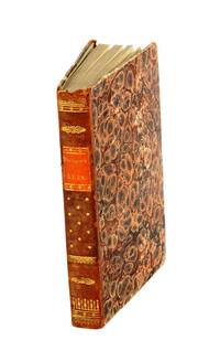
1797rif. 18688Paris: Imprimerie de la République 1797. Contemporary uniform gold-tooled marbled calf richly gold-tooled spines with a red title-label and a small green volume number label both lettered in gold gold-tooled board edges marbled endpapers. 4to 30 x ca. 23 cm. and large folio ca. 57 x 40 cm. Ad 1: with an engraved portrait of De la Pérouse by Tardieu and tables in the text. The atlas contains an engraved title page 1 large double-page folding map of De la Pérouse's journey 20 double-page maps and 48 full-page maps views and illustrations. Ad 2: with tables in the text. The atlas contains an engraved title page 1 double-page map and 43 full-page plates. Ad 3: with 33 folding engraved plates and with tables in the text. The atlas contains an engraved title page an engraved table of contents 37 large double-page folding maps 2 large double-page folding views and 10 full-page maps and illustrations. The three atlases for ads 1-3 are bound together in a large folio matching contemporary gold-tooled marbled calf binding. 9 volumes: ad 1 in 4 volumes; ad 2 in 2 volumes; ad 3 in 2 volumes with the atlases of the 3 works bound together in 1 volume. With:2 LABILLARDIÉRE Jacques Julien Houton de. Voyage à la recherche de Lapérouse.Paris H.J. Jansen An VIII = 1799-1800.3 ENTRECASTEAUX Antoine Raymond Joseph de Bruni chevalier d'. Voyage envoyé à la recherche de Lapérouse.Paris Imprimerie Impériale 1808. Three first editions of descriptions of the rarest and most interesting 18th-century expeditions bound as a set in beautiful contemporary uniform bindings. A milestone set in the history of exploration of the Pacific.Ad 1: Record of an important French scientific expedition in which participated a number of scientists and artists. De la Pérouse left France in 1785 with two frigates the Astrolabe and Boussole to explore the Pacific and the west coast of North America. He was sent there to explore the regions not explored by Captain Cook. Furthermore he was to seek for an interoceanic passage to scientifically observe the various countries peoples and products and to obtain reliable information about the fur trade and the extent of the Spanish settlements in California. This way De la Pérouse made a valuable contribution to the history of geographical discovery particularly concerning the American coast and its natives. The account describes expeditions to Easter Island Hawaii Macao Formosa the Aleutian Islands Samoa Tonga and Australia. The best results were obtained in exploring and mapping the unknown territories on the Asiatic side of the Pacific. This includes the discovery of the strait - still bearing De la Pérouse's name - between the island of Sakhalin and the northernmost island of Japan. De la Pérouse sent his accounts to France from Kamchatka and Botany Bay. But after the expedition left Botany Bay it was never heard from again. Two expeditions were sent out to look for him: the first was led by Dillon in 1827 the second by Dumont d'Urville in 1828. Only 39 years later the remnants of De la Pérouse's two frigates were discovered on the reef of Vanikoro one of the Santa Cruz Islands by Peter Dillon. The maps included in the present travel account is a large general map of the journey detailed maps of different isles several views and beautiful illustrations of plants birds ships people etc.Ad 2: Account of the naturalist De Labillardiére who accompanied one of the futile searches for De la Pérouse. The present expedition was sent out under d'Entrecasteaux and Huon de Kermadec in 1791-1794. Although the expedition was not successful it is of considerable importance because of the scientific observations and surveys of the coasts of Tasmania New Caledonia the north coast of New Guinea and the southwest coast of Australia it produced. De Labillardière's account of the Tongans is among the best contributions to their ethnology. The illustrations include views a portrait of a native illustrations of jewellery and 14 engraved botanical plates after Redouté.Ad 3: Scientific account of a search for De la Pérouse the same expedition as described in the work mentioned above ad 2. The expedition did not succeed but d'Entrecasteaux made important geographical discoveries and his account is extraordinarily rich in cartographical and astronomical material. The Recherche and the Espérance were under his command second captain was Huon de Kermadec after whom the islands north of New Zealand were named. The d'Entrecasteaux Islands near New Guinea were discovered and named for the admiral who later died of colic near the north coast of New Guinea. The beautiful large maps in the atlas depict wonderfully detailed illustrations of isles and coasts along the South Sea. The French Revolution divided the expedition: the royalists joined the Dutch on Java and the Republicans fell into the hands of the British Royal Navy. Also captured were the expedition's journal charts and natural history specimens. Sir Joseph Banks ordered that they be delivered to the coast of France under a flag of truce. With two small book plates on the front endpapers of Clemens Platen-Hallermund and IvR in every volume. Occasionally very slightly foxed in the margins and with a few minor tears in the bottom margin of some leaves otherwise in very good condition. Beautiful copies of an extremely rare and complete set of De la Pérouse's expedition and two descriptions of one of the two expeditions in search of De la Pérouse.l Ad 1: Chadenat 106; Cox I 67; Hill p. 173; Lada-Mocarski 52; Nissen ZBI 281; Sabin 38960; ad 2: Chadenat 99; Cox I 68; Nissen ZBI 2331; Sabin 38420; cf. Hill p. 168 English ed.; ad 3: Chadenat 5056; Hill p. 97 only 32 plates in text vols.; Poggendorf I 671; Sabin 22671. Imprimerie de la République, unknown
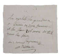
1781rif. H1RDFKW35E6FAt sea 1781. Short manuscript note in ink on a small sheet of laid paper 12 x 13.5 cm. An exceptionally rare autograph note signed by the great French explorer La Pérouse. The extraordinary story and achievements of La Pérouse are well known and recounted in the handsome official account of his expedition. However because he was lost without trace mid-voyage manuscript material relating to his life is very rare indeed. In the present note La Pérouse asks that his boat be given an impressive 286 "aunes" of canvas which is needed on board. An "aune" is an old-fashioned French measure usually translated as ell or cubit: its length could vary but the normal French/Parisian aune was about 118 cm meaning that La Pérouse is in fact asking for about 340 metres of canvas. The sheer quantity of the request speaks to La Pérouse having written the note while in charge of a large vessel.The document is counter-signed and noted as "delivered" by one "Deletombe": it seems very likely that this is Philippe-André-Joseph de Létombe who arrived in the United States in 1781 and was the French Consul in Boston and a correspondent of Thomas Jefferson. If this identification is correct the note would possibly date from La Pérouse's cruising in the West Indies and along the coast to Hudson Bay in 1781 and 1782.With old folds clearly and legibly written and docketed; in very good condition. unknown
1797rif. 55878Paris: 1797. From the Voyages of La Pérouse who set sail from France in 1785 to continue the discoveries of Captain Cook. He was shipwrecked in 1788 but his narrative maps and views survived and were published in 1797. An attractive map of the regions North of Japan withs two inset maps: Extrait de la carte publiee par Scheuchzer -- Extrait de la carte de l'Histoire du Japon de Kampfer. Relief shown pictorially; depths by soundings. Oriented with north toward right. Atlas Du Voyage De La Pérouse. Size: 675 x 490 mm. Copper engraving. Hand coloured. Very good condition. A faint vertical waterstain. Good margins. unknown
rif. REIS0790Berlin und Hamburg 1800. 2 Bde. 8°. Gest. Taf. gest. Titelbl. Titelbl. 1 nn. Bl. 410 S. mit 2 gest. Taf.; gest. Taf. gest. Titelbl. Titelbl. 344 S. mit e. gef. gest. Karte mit e. Porträtmedaillon des Perouse am Kupfertitel des ersten u. e. Illustrationsvignette am Kupfertitel des zweiten Teiles. Halblederbände d. Zeit mit je zwei Rückenschildchen u. Rückenzierlinien in Goldprägung Einbanddeckel mit Kiebitzpapier überzogen Vorsätze aus zweifärbig bedrucktem Buntpapier Ecken und Kanten bestoßen Ecken teilw. aufgespalten Einbanddeckel berieben fliegende Vorsatzblätter fehlen. Mit je e. Bibliotheksschildchen Joseph Bermann auf den vorderen Innendeckeln. Henze III146; vgl. Bibliotheca geographica 98; ADB 7166ff. Als zweiter und dritter Band der Reihe 'Bibliothek der neuesten und interessantesten Reisebeschreibungen' erschienene Ausgabe der 'Voyage de la Perouse autour du monde'. La Perouse 1741-1788 französischer Geograph und Weltumsegler unternahm diese umfassende Erforschung und Kartographierung des pazifischen Raums im Auftrag der französischen Krone. Am 1. August 1785 stachen die beiden Schiffe von Brest aus in See. Die erste Station war Teneriffa. Im Januar 1786 wurde Patagonien erreicht. Über Kap Hoorn und die Osterinsel ging es nach Hawaii und weiter nach Alaska. La Pérouse der sich zu den Aufklärern zählte verzichtete als erster Europäer bewusst auf die Inbesitznahme noch unerforschter Inseln. In Alaska knüpfte er wichtige Kontakte mit Indianern bevor er die Küste Kaliforniens bereiste. Beide Expeditionsschiffe 'Astrolabe' und 'Bousolle' mit ihrer Besatzung erlitten vermutlich im Bereich der Salomonen Schiffbruch und kehrten nicht nach Frankreich zurück. - Herausgegeben und redigiert wurde das Werk von Louis Marie Antoine Destouff de Milet-Mureau 1756-1825 die deutsche Übersetzung stammt von Johann Reinhold Forster 1729-1798 und C. L. Sprengel. Der vielseitige Naturwissenschaftler und Entdecker J. R. Forster hatte wenige Jahre zuvor James Cook auf dessen zweiter Südseereise begleitet. Erster Band mit nur zwei von drei Kupfertafeln. Berlin und Hamburg 1800. unknown
1797rif. 151Paris: Imprimerie de la République 1797. First Edition. Folio Leaf. Very Good. Hérault / Bouclet. Elephant Folio. Leaf measures 33.25" x 23.25" while the printed chart is 26.5" x 19.5". Fold at center as issued. Condition is Very Good with very light foxing within the plate and slightly darker foxing in the top right margin. A dampstain the size of a fifty-cent piece at the lower right corner outside the border rule and not affecting print impression. La Pérouse was France's answer to Captain James Cook. Directed by King Louis XVI to explore and chart the Pacific in 1785 La Pérouse set sail from France with the frigates Boussole and Astrolabe . and never returned. After years of speculation and expeditions sent in search of the ships their 1788 shipwrecked-fate in the South Seas was finally ascertained. Prior to disappearing La Pérouse dispatched a courier homeward overland via Russia with his narrative charts and artist-depictions to-date. His achievements were published in 1797 including this chart. This chart covering the coastline from Cape Rond Tillamook Head northward to the Baie de Clonard present-day Queen Charlotte Islands or Haida Gwaii was the only chart of the region other than works by or based on Cook's efforts. Three Spanish voyages and Cook's third voyage had visited the west coast of now-known Vancouver Island before La Pérouse. As depicted in this chart the land mass is not yet known by the place-name "Vancouver" nor is it recognized as an island. LADA-MOCARSKI 52 claims the best charting by La Pérouse is on the Asian side of the Pacific. Indeed it must be noted that La Pérouse like Cook missed both the Columbia River and the Strait of Juan de Fuca. See WAGNER Cartography of the Northwest Coast of America 840. Imprimerie de la République unknown
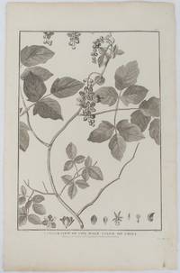
1798rif. 175968London. 1798. Engraving on watermarked wove paper 33.3 x 24.9 cm plate mark 42 x 26.6 cm sheet edges a little browned and dusty but a very good dark impression. Fine botanical illustration of the climbing chili prepared for the 'Account of the Voyage of Jean-François Galaup-La Pérouse' 1785-1788 the great but ill-fated French voyage of discovery and exploration. Guillaume Prevost was botanical artist on the ship L'Astrolabe and from a noted family of botanical artists. . unknown
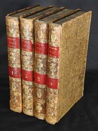
rif. 11090Paris: Chez Plassan Imprimeur-Libraire rue du Cimetiere Andre-des-Arcs no 10. 1798. No binding. Good. Second edition first octavo. Four octavo text volumes 205 x 125 mm. full contemporary mottled calf ornate gilt panelled boards spines with ornate gilt ruled band each compartment with further gilt decoration red calf gilt title labels to spines marbled endpapers with typographic half and full titles to each volume pp. 4 lxviii 368; 4 414; 316 148; 4 328 lower right corner of title to third volume torn away without loss; one folio atlas volume 465 x 310 mm. recent full cloth with calf gilt title label affixed to upper board with engraved portrait of La Pérouse after Tardieu engraved allegorical title-page by Moreau le Jeune 69 plates including 18 double page maps a folding world map 35 views and natural history plates 33 maps or coastal profiles all uncut in good condition. The first octavo edition of La Perouse's voyage one of the most important scientific explorations ever undertaken to the Pacific and the northwest American coast and the first scientific voyage to California. It is accompanied by the atlas volume published the previous year 1797. Jean-Francois de Galoup Comte de La Pérouse 1741-88 led a French scientific expedition to the Pacific in 1785-88. He was one of the most noted naval commanders and navigators in France and was selected by King Louis XVI to complete Captain James Cook's exploration of the Pacific especially regarding a possible north-west passage. In a rare moment of co-operation the British Admiralty furnished scientific equipment to measure variations in magnetic north and for determining longitude. The two corvettes called 'La Boussole' and 'L'Astrolabe' left Brest on 1 August 1785. Rounding Cape Horn they undertook repairs in Chile before heading to the Sandwich Islands Hawaii and Alaska. From here he turned south exploring the west coast of North America into California refitting again at Monterey. They then headed across the Pacific Ocean on 23 September 1786 reaching Macao on 1 January 1787. He then travelled to Manilla Taiwan and north along the Asian coastline towards Korea Japan and Kamchatka. There he received orders from Paris to head for Australia. De Lesseps was sent back to Paris with various reports and charts to date. He arrived at Botany Bay on 24 January 1788 and had good relations with the English First Fleet settlers who had only just arrived. They remained there for six weeks and left on 10 March never to be seen again. Fortunately for us La Perouse was meticulous in sending copies of his detailed logs and surveying via other ships as well as overland. When the French Government realised that it had been lost they decided to publish this account as in many other ways it is regarded as one the greatest French voyages of exploration. Despite attempts to discover its fate it was not until 1827 that the vessels were discovered shipwrecked on the island of Vanikoro one of the remote Santa Cruz Islands. The exact fate of the survivors has been the source of considerable speculation ever since. The largest contribution the expedition made was to the knowledge of the Asiatic coast of the Pacific. Especially the waters in and around Japan. The atlas includes superb charts of this and the west coast of North America including charts of San Francisco Bay Monterey Bay and San Diego. Also the first chart of Samoa. There are several views including the first of Maui in the Sandwich Islands. They are complimented by a series of botanical and ornithological engravings including the California quail. Provenance: Libraria de Antanao 2002; Juan and Peggy Rada Collection. Falk 1983 1797.5-13; Ferguson 1941-69 268; Fitzpatrick 1986 pp. 25-31; Hill 1974 p. 173-4; Howes 1962 L93; Howgego 2003 L20; refer Lada-Mocarski 1969 52; refer Nordenskiold Collection 1979 132; refer Phillips 1909- 688; Sabin 1868-1936 38960; refer Shirley 2004 Atlases G.Lpr 1a; Suarez Chez Plassan, Imprimeur-Libraire, rue du Cimetiere Andre-des-Arcs, no 10. 1798 unknown
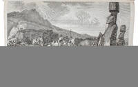
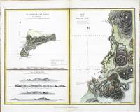
rif. 8108London: G. G. & J. Robinson. 1799. No binding. Good. 380 x 500 mm. recent wash colour in good condition. This map features Easter Island in the Pacific Ocean. From the English edition of the 'Atlas du Voyage de La Perouse' published by G. G. & J. Robinson. The island is best known for the famous stone heads. This map records the visit of the French Admiral and explorer La Pérouse. Jean-Francois de Galoup Comte de La Pérouse 1741-88 led a French scientific expedition to the Pacific in 1785-88. He was one of the most noted naval commanders and navigators in France and was selected by King Louis XVI to complete Captain James Cook's exploration of the western Pacific. In a rare moment of co-operation the British Admiralty furnished scientific equipment to measure variations in magnetic north and for determining longitude. Fortunately for us La Perouse was meticulous in sending copies of his detailed logs and surveying via other ships as well as overland. His last contact was in the spring of 1788 with a British ship in Botany Bay Australia. The expedition was never heard from again. When the French Government realised that it had been lost they decided to publish an account as in many other ways it is regarded as one the greatest French voyages of exploration. It was not until 1827 that their fate was known. They had been shipwrecked on the island of Vanikoro and many of the survivors were killed. Hill p. 174; Howes 1962 L93; Howgego 2003 L20; Suarez 2004 p. 169 fig. 164. G. G. & J. Robinson. 1799 unknown