Philip's MapsBiblio.com

1747 resultados
ref. GOR006722255Paperback. Very Good. paperback
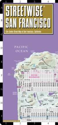
ref. Q-0935039201Streetwise Maps 2015-01-01. Map. New. In shrink wrap. Looks like an interesting title! Streetwise Maps unknown
ref. REDBR74RGR2YTrakker Maps. paperback. Good. in x in x in. Trakker Maps paperback
ref. DADAX041513935XNew unknown
1974ref. Q-030729031xRandom House 1974-01-01. Hardcover. New. In shrink wrap. Looks like an interesting title! Random House hardcover
ref. 054009191X.Gspiral_bound. Good. Access codes and supplements are not guaranteed with used items. May be an ex-library book. unknown
ref. DADAX1579129439New unknown
ref. DADAX0313287058New unknown
2011ref. 1-0792233794National Geographic Maps 2011. Paperback. New. lam map en edition. 1 pages. 50.00x4.33x4.33 inches. National Geographic Maps paperback
1970ref. Q-1199360163Harper & Row Publishers 1970-01-01. hardcover. New. In shrink wrap. Looks like an interesting title! Harper & Row, Publishers hardcover
2001ref. Q-1860469264Harvill Press 2001-01-01. Hardcover. New. In shrink wrap. Looks like an interesting title! Harvill Press hardcover
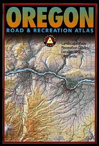
2013ref. Q-0929591976Benchmark Maps Firm 2013-01-01. Paperback. New. In shrink wrap. Looks like an interesting title! Benchmark Maps (Firm) paperback
1999ref. Q-0881309826Thomas Brothers Maps 1999-03-01. Spiral-bound. New. In shrink wrap. Looks like an interesting title! Thomas Brothers Maps unknown
ref. 1581740646.Gpaperback. Good. Access codes and supplements are not guaranteed with used items. May be an ex-library book. paperback
ref. 8170530962.Gpaperback. Good. Access codes and supplements are not guaranteed with used items. May be an ex-library book. paperback
2004ref. Q-092959150xBenchmark Maps 2004-01-01. Paperback. New. In shrink wrap. Looks like an interesting title! Benchmark Maps paperback
ref. 1581743521.Gspiral_bound. Good. Access codes and supplements are not guaranteed with used items. May be an ex-library book. unknown
ref. 1928955363.Gunknown_binding. Good. Access codes and supplements are not guaranteed with used items. May be an ex-library book. unknown
1862ref. 2109160014D Appleton and Company 1862. Hardcover. Good. 1962 printing. Bound in publisher's cloth. Hardcover. Shelf wear. Spine ends chipped with loss. Some folded maps torn. D Appleton and Company hardcover
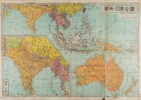
1572ref. 159290東京 Tokyo.: 金鈴社 Kinrei-sha. 昭和十八 October 101943. Two maps printed in colour on a single side of a folded sheet. The map titled "Complete Map of India and Australia" shows the region covering Australia southern India western mainland south-east Asia Indonesia the Philippines and New Guinea. The other map titled "India and Burma" shows the region covering India Afghanistan the western section of China Burma and Thailand on the lower left side. New Zealand is in an inset map in the lower right corner. As the note on the cover says "Including the detailed descriptions of the Solomons New Guinea and southern islands" this map shows the theatres of the Pacific War and the surrounding areas. The map indicates agricultural and mineral resources as well as cities roads railways sea routes national borders etc. Cover and publication details printed on two panels on the reverse. Some marking and browning. . 金鈴社 [Kinrei-sha]. unknown
1816ref. 175252Philadelphia.: Carey Mathew and Warner Benjamin. 1816. Engraved map 19 x 22.3 cm original folds some offsetting to the map marginal browning and staining small archival repairs to the outer margin but in good condition. Fine map Plate 19 prepared for Carey and Benjamin's "General Atlas.". . (Carey, Mathew and Warner, Benjamin). unknown
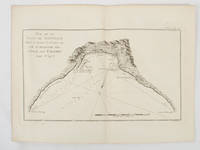
1774ref. 174257Paris.: Chez Saillant et Nyon rue Saint-Jean-de-Beauvais Chez Panckoucke Hotel de Thou rue des Poitevins. 1774. Engraved map on laid paper 18.5 x 31cm 25.6 x 34.4cm sheet size central fold slight marginal toning but a very good dark impression. Map of Bonthain Bay situated southeast of Macassar on the island of Celebes finely re-engraved for the French edition of Captain James Cook's First Voyage 1768-1771 "Relation des voyages.pour faire des decouvertes dans l'hemisphere meridional et successivement executes par le commodore Byron le capitaine Carteret le capitaine Wallis & le capitaine Cook.". . Chez Saillant et Nyon, rue Saint-Jean-de-Beauvais, [Chez] Panckoucke, Hotel de Thou, rue des Poitevins. unknown
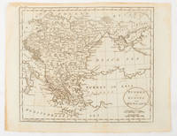
1851ref. 174952London & New York.: Tallis J & F. 1851. Lithographed map 24.5 x 32.3 cm borders picked out in original hand colour four inset vignette illustrations decorative Greek key border edge worn and discoloured paper toned but the attractive map in good condition. Attractive decorative map prepared for "Tallis's illustrated atlas and modern history of the world." one of the last great illustrated series of world maps. The fine vignettes are of Mt. Olympus Rhodes a ketch in the Mediterranean Sea and two costumed Ottomans. . Tallis, J & F. unknown
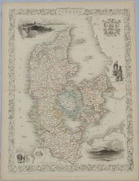
1850ref. 175779London & New York.: John Tallis & Company. Circa1850s. Lithographed map with original outline hand colour 34.5 x 24.7 cm including border and captionsfive fine vignette illustrations decorative border central fold edges with light toning in very good condition. Attractive decorative map with fine vignettes of Copenhagen Sleswig and Elsinore figures in costume the coat of arms of Denmark and an amiable equine pair by the great mapmaker and publisher John Tallis. . John Tallis & Company. unknown
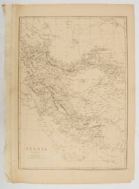
1863ref. 177017London.: Cassell Petter and Galpin. circa1863. Engraved map 43.1 x 30.3 cm 50.7 x 34.5 cm sheet central fold small edge tears one neatly repaired lower corner chipped slight age toning but in very good condition. Impressive large map of Persia Iran by noted map maker Edward Weller in original uncoloured state re-issued by the publisher for inclusion as map 26 in Cassell's Atlas. . Cassell, Petter and Galpin. unknown