[Maps]; [New York City]Biblio.com
1616 resultados
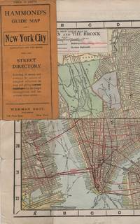
1913ref. 41637New York: Wehman Brothers Publishers 1913. Very good. An impressive color map of the island of Manhattan and the Bronx. Scale is 1" equals 1/2 mile and includes railroads subways elevated railroads surface railroads and proposed railroads. An uncommon early 20th Century New York City street map. Folding color map. Measuring approximately 18" x 36" when unfolded. In original printed card wrapper. Verso a thorough printed street index. Mild handling wear toning. A few tiny holes near fold corners. Overall well preserved; very good. Wehman Brothers Publishers unknown
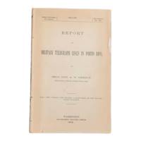
1900ref. 6902Washington D.C.: Government Printing Office 1900. First edition. 8vo 100pp. Color folding map 42x108cm attached at rear. Stitched lacking wrappers or disbound from a larger publication paper toned with light chipping. Map clean. A good copy. Senate Document No. 429 56th congress. This report was given by Adolphus Washington Greely 1844-1935 then Brigadier General and Chief Signal Officer of the U.S. Army. Greely was in charge of maintaining communications networks during the Spanish-American War and oversaw construction and maintenance of telegraph lines in Puerto Rico Cuba and the Philippines. The map in this report is "Map of the Island of Porto Rico Showing the lines of signal communication telegraph telephone and heliograph operated by the Signal Corps U.S. Army with Military Posts." It was prepared by major William A. Glassford under the direction of Greely. OCLC cites 11 holdings. . Government Printing Office unknown
1944ref. 63900Washington D.C. & New York NY: Navy distribution by Educational Services Section; Prepared and distributed by Army Information Branch Army Service Forces 1944. Oblong double atlas folio. 47 x 34.5 in. One large double-sided colour lithograph map and panoramic cutaway view minor dustsoiling light age toning very minor creasing at folds still a NF copy. First edition of this splendid educational panorama with cutaway view of a World War II Balao-class submarine conning tower lines have been altered to prevent enemy identification when surfacing which improved upon the Gato class with higher yield-strength steel pressure hull skins and increased depth to 400 feet. The four inset maps on verso track the campaigns in the Philippine Islands with maps for Manila Bay and Cebu Leyte & Samar separately as well as maps tracking the Western Front progress in 1944 just 4 months after D-Day. Navy distribution by Educational Services Section; Prepared and distributed by Army Information Branch, Army Service Forces, unknown
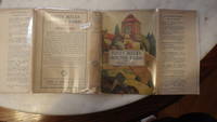
1953ref. 309567NY: BALLANTINE BOOKS. Near Fine in Very Good dust jacket. 1953. First Edition. Hardcover. Near fine in a Vg. dj. Barely discernable 2"-inch tear at upper seam of rear panel of dj. A few short edge tears & small chips as well as traces of shelfsoiling to dj. Novel of the Virginia Calvary in the Shenandoah Valley during the Civil War. LR . BALLANTINE BOOKS. hardcover
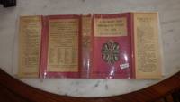
1912ref. 30210HBDJ STATED 1ST PUBLISHED THIS EDITION 1912 SMALL PURPLE EMBOSSED CLOTH CVRLITE RUB WEAR VG/VG AS-IS BACK OF DJ MENTIONS OVER 960 VOLUMES ENDS WITH ZOLA 226 PGS INDEX LIST OF TITLES OUTER SPINE CVR HAS SMALL NICK DEALS WITH COUNTRIES OF ASIA WHOSE HISTORY & GEOGRAPHY ARE ALIKE RELECTED IN MAPS. & CHARTS THAT FOLLOW Philipine Islands JAVA EAST INDIES AUSTRALIA MADRAS CEYLON SIBERIA KOREA MANCHURIA JAPAN SINGAPORE FAR EAST ETC J. M.DENT EVERYMAN’S LIBRARY LONDON hardcover
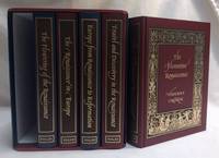
2001ref. 299994London: The Folio Society 2001-01-01. Hardcover. Near Fine/Very Good Slipcase. 9x7x7. Complete five-volume box set with slipcase. All 5 books are in near fine condition: texts unmarked and clean; pages and illustrations bright and crisp; bindings tight sturdy and square; exteriors look like new. Box is in very good condition has bump to back bottom corner light bump to front bottom corner and minimal rubbing. From a private collection. Ships from Dinkytown in Minneapolis Minnesota. Due to the size/weight of this book extra charges may apply for international shipping. The Folio Society hardcover
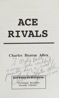
1995ref. Q-0964540401Baywood Publishing 1995-01-01. paperback. New. In shrink wrap. Looks like an interesting title! Baywood Publishing paperback
ref. 188670595X.Gmap. Good. Access codes and supplements are not guaranteed with used items. May be an ex-library book. unknown
1997ref. Q-0002555093HarperCollins 1997-01-01. Hardcover. New. In shrink wrap. Looks like an interesting title! HarperCollins hardcover
1927ref. 29334HBDJ VG/VG- 1927 on Title pg 1ST edition Hardcover. Condition: Fine-. Dust Jacket Condition: Very Good. SMALL Dark burgundy cloth with Gold gilt Spine Cvr. Hinges & Binding strong. . 12mo 188 pg INDEX o/w VG Copy in dusty but o/w VG DJ with Spine DJ endchips. Hard Cover. FINE-/Very Good. 12mo Ghostly Castles Seat of its 1st Kings St. cloud St. Germaine MalmaisonVersailles Fountainebleau ETC Robert McBride NY hardcover
1972ref. 30289HBDJ 1972 Revised VG-/VG AS-IS Blue cloth lettered in White Interior Nice tight light Wear SOME INK NOTES AND UNDERLINING but has FoX Stains 108 pgs DJ light wear & SCUFFING Extremities DJ 8vo - over 51â„4" - 83â„4" with 2 FOLD OUT Maps According to Churchward Lemurians developed homes with transparent roofs lived to be hundreds of years old and were capable of telepathy astral travel and teleportation. ATLANTIS they became greedy petty and "morally bankrupt" and the gods "became angry because the people had lost their way and turned to immoral pursuits" Orser says. As punishment he says the gods sent "one terrible night of fire and earthquakes" that caused Atlantis to sink into the sea. LONDON, Illinois: Theosophical Publishing House, hardcover
ref. SKU1748713Academic Press 2017-04-20. paperback. New. 6x1x9. New Book Ships with Tracking Academic Press paperback
ref. SKU0620141Academic Press 2017-04-20. paperback. New. 6x0x9. New Textbook Ships with Tracking Academic Press paperback
ref. 0875304435.Gpaperback. Good. Access codes and supplements are not guaranteed with used items. May be an ex-library book. paperback
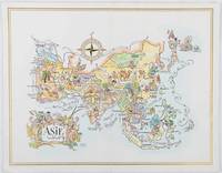
1964ref. 195995Pan American World Airways. 1964. Colour pictographic/pictorial map of Asia 23.2 x 30.1 cm gilt double-rule border printed on a folding decorative menu card 32 x 50 cms open highlighted in gilt text in English French and Japanese central fold and later central vertical crease in very good condition. Pan Am menu card for First Class passengers dubbed "The President Special" the deluxe cuisine by fabled Maxim's of Paris "Good food is the basis for true happiness". Passengers were feted with gourmet meals on bone china with silver cutlery. The witty pictorial cover-map of Asia was by French artist and commercial illustrator Jacques Liozu 1910-1974 also known for his larger scale maps. . Pan American World Airways. unknown
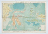
1572ref. 160554Tokyo 東京: 統制社Tosei-sha. 昭和 Showa 18. 1943. Colour folding map 54 x 75.5cm with original envelope. Envelope a little torn some occasional browning very good. The 13th map in this Standard Maps of Greater East Asia series of 20 maps. All text in Japanese. Shows railways shipping routes administrative boundaries airfields ports lighthouses mines oil wells etc. . 統制社(Tosei-sha) unknown
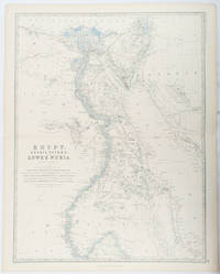
1861ref. 177021Edinburgh & London.: William Blackwood & Sons. 1861. Engraved map with original outline hand-colour 57 x 43.8 cm 61.1 x 49 cm sheet central fold very slight edge toning but the map in very good bright condition. First edition. Fine large folding map: the Nile delta and river with attractive original outline colour railways and canals marked and name references to biblical and classical geography. Published for inclusion as map 39 in "Keith Johnston's royal atlas of modern geography" . William Blackwood & Sons. unknown
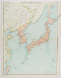
1922ref. 215880Edinburgh.: John Bartholomew & Son Ltd. 1922. Large double page map 54.2 x 43 cms map original fold some edge toning and to the fold but in very good condition. Large map prepared as plate 65 for “The Times Survey Atlas of the World” in 1922 and was prepared at the Edinburgh Geographical Institute under the direction of J G Bartholomew. The map shows Japan's territory inclusive of Korea southern Sakhalin and Taiwan. . John Bartholomew & Son Ltd. unknown
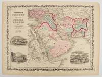
1860ref. 177019New York.: Johnson & Browning. circa1860. Engraved map 30.2 x 40.5 cm 34.5 x 45.5 cm sheet original hand-colour elaborate strapwork border three fine vignettes of Muscat Trebisond small marginal edge tears top corner chipped the map in very good condition. Most attractive decorative map of Arabia the Ottoman Empire Persia Afghanistan Beloochistan and surrounds by one of the most popular and successful 19th Century American atlas publishers. . Johnson & Browning. unknown
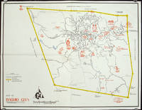
1960ref. 206510circa1960. Printed pictorial map 44.8 x 58 cm 46.7 x 60.3 cms sheet original folds a little wear but in very good condition. Attractive 1960s tourist map of Baguio city when it was the "Summer Capital" of the Philippines. Tourist attractions are shown pictorially in red blue triangles denote wood carving shops the city boundaries outlined in yellow sealed and unsealed roads are also shown. . unknown
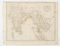
1805ref. 175148London & Glasgow.: W. and D. Brownlie. 1805. Engraved map 18.7 x 23.9 cm original folds age toned and spotted inner margin a trifle ragged paper thinning in a few spots in good condition. Attractive map engraved for "A System of Geography; or A Descriptive Historical and Philosophical View of the Several Quarters of the World" published in 1805. . (W. and D. Brownlie) unknown
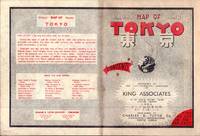
1954ref. 194113Tokyo.: Charles E. Tuttle Company. 1954. Printed four colour map 92 x 71cm; 102.5 x 74.5cm sheet folding into pictorial wrappers 25.6 x 19 cm inset map of the Marounouchi District and on the verso an extensive grid reference in English and Japanese and over four panels a map of the streetcar railway and subway system scant spotting to cover two small fold splits without loss and toning most evident at the folds in very good condition. Comprehensive 1950s map of Tokyo by US publisher Charles E. Tuttle "Here at last is the map that makes order out of chaos.extending as far as Haneda Airport Grant Hights Harbor Area and Nakano Ward" blurb. . Charles E. Tuttle Company. unknown
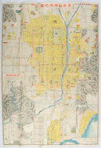
1922ref. 171899京都. Kyoto.: 山中書房. Yamanaka Shobō. 大正 11 1922. Attractive colour folding map of Kyoto with a quite detailed illustrated tourist guide printed in blue and white on the reverse some light browning holes at some folds good copy. 78.5 x 54cm This 1922 colour folding tourist map of Kyoto offers sightseeing information each panel showing a photographic monochrome image of the site discussed. The two inset maps on the Kyoto map show Otsu city on the shore of Lake Biwa and the Arashiyama area north of Kyoto. The main map highlights the major temples and famous sights in red geographic features such as rivers and hills are shown and an inset chart shows distances of sights from the nearby stations. The information on the reverse gives more detail on the famous sights a calendar of events seasonal highlights and details of the Imperial graves around Kyoto. . 山中書房. [Yamanaka Shobō]. unknown
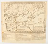
1739ref. 174921London.: The Gentleman's Magazine. circa1739. Engraved map 22.2 x 31.4 31.1 x 33 cm sheet size elaborate explanatory key in three columns at the foot original folds sealed 2 cm tear to the lower part of the inner margin one other small fold tear no loss inner margin of the key trimmed with some loss an original fault paper browned and spotted on the verso but an historic map in good condition. . [The Gentleman's Magazine]. unknown
1840ref. 174957London.: Charles Knight & Co. circa1840s. Lithographed map with original outline hand-colour 31.9 x 39.1 cm small marginal tears neatly repaired with archival material but no loss small surface abrasion affecting the border at the foot edgewear and browning inked pagination in an early hand but in very good condition. A handsome map with fine topographical engraving also showing the borders with Hungary Russia and Persia. . Charles Knight & Co. unknown