[LAND SURVEY DEPARTMENT]. 陸地測量部.Biblio.com
1616 resultados
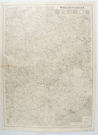
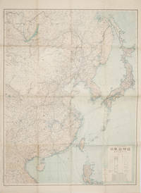
1419ref. 160524Tokyo.: 大日本帝國陸地測量部. 昭和14 1939. Large colour folding Japanese WWII map. Scale 1:5000000 featuring Japan Korea Taiwan Karafuto Eastern China parts of French Indochina and the Northern Philippines US colony in detail. Legend includes territorial boundaries national and regional and shows some borders as unclear i.e. Taiwan and bordering region along Northeast China the Soviet Union and Mongolia air routes submarine communication cables linking major costal cities i.e. Hong Kong Xiamen Shanghai Nagasaki etc. airports radio stations mining fields and more. A small chart shows the names of mountains rivers and lakes also included adjacent to legend. Some small holes at folds creases and some minor loss edges generally very good. Text in Japanese. 109 x 77.8cm. . 大日本帝國陸地測量部. unknown
1572ref. 172829大阪. Osaka.: 大阪毎日新聞社. Osaka Mainichi Shinbunsha. 昭和 13 1938. Black and white map folded showing Hankow one of the three cities which merged to become Wuhan 54.5 x 49cm scale 1:2000000. Some light browning tiny closed tear upper margin neatly repaired with conservation standard tape. Good copy. This Hankow/Hankou War Situation Map is a supplement map of Osaka Mainichi Newspaper on 25 August 1938. The two inset maps show the region around Nanjing and Hong Kong. It gives detailed place names of Hankow area. . 大阪毎日新聞社. [Osaka Mainichi Shinbunsha]. unknown
1819ref. 162103Tokyo.: Tōseisha. Showa 18 1943. Folding colour map of Australia 54.2 x 76.4cm. Some foxing particularly along folds and upper right margins a few repaired tears and small holes at folds.With original sleeve. The 15th map in the Standard Maps of Greater East Asia series of 20 maps. Shows the natural resources such as sheep gold pearl diary regions opals etc. Tasmania appears as an inset in the bottom right corner. Text in Japanese. . Tōseisha. unknown
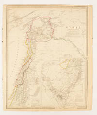
1843ref. 174934London.: Chapman & Hall. 1843. Engraved map with outline hand colour 39.4 x 31.4 cm inset map "Continuation from the Dead Sea to Mount Sinai" with finely engraved notes and a key to the Divisions under control of the Turkish Government manuscript pagination in an early hand to the top right edge tear nicks and browning but in very good condition. A most attractive map with detailed notes published when Syria was still under control of the Ottoman Empire. . Chapman & Hall. unknown
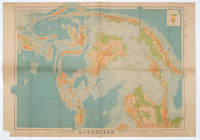
1572ref. 160533Tokyo.: 日本名所圖繪社.Nihon Meisho Zuesha. 昭和 17 1942. Folding Japanese coloured map of the Malay Archipelago and Thailand during World War II scale 1:8500000. Legend in lower corner indicates altitudes. Ink annotation in Japanese left edge. Pin holes at three corners upper right corner torn with loss evenly browned otherwise very good. Text in Japanese and English. 52.8 x 75.6cm. This map shows most of Thailand former Indochina Hainan Province and South China Sea Sumatra and Java Sea Borneo the Philippine Islands Celebes Timor New Guinea and parts of Micronesia. Natural resources such as tobacco spices wood sugar metal mines tin iron and etc. rice and other resources are indicated on the map. . 日本名所圖繪社.[Nihon Meisho Zuesha]. unknown
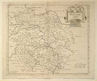
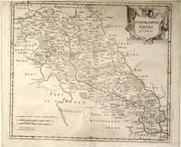
ref. 64216London.: Gibson. Early 18th Century. Black and white map from Camden's Britannia showing towns roads rivers and landforms 38 x 46.5 cm. . [Gibson.] unknown
ref. 64139London.: Gibson. Early 18th Century. Engraved map on watermarked paper central fold 38 x 46.5 cm decorative title cartouche towns roads rivers and landforms shown; from Gibson's edition of Camden's Britannia upper edge trimmed by the original binder causing minor loss to the border at the inner edge but in very good condition. . [Gibson.] unknown
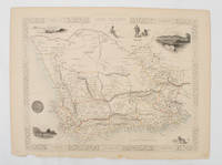
1851ref. 174666London.: Tallis John. 1851. Lithographed map 24.2 x 32 cm districts picked out in original hand colour inset vignette illustrations decorative border lower margin ragged but the attractive map in very good condition. Attractive decorative map from "Tallis's illustrated atlas and modern history of the world." one of the last great illustrated series of world maps. The fine vignettes are of Cape Town Graham Town and entrance to the Knysha Heads. . (Tallis, John). unknown
1896ref. 59118Chicago: J. Blegen 1896. 12mo. 69 1 pp. With 1 large folding double-sided map “The World” on recto “United States” on verso with illustrated ads for steamship lines and Milwaukie road on recto above World map edgewear rubbing at crease folds some creasing at fore-edges couple very minor closed tears at folds. Quarter-brown cloth over beige boards decorative blue border blue lettering minor soiling edgewear still VG copy. First edition of this very scarce travel guide and pocket map issued by Blegen 1842-1927 a Norwegian-American steamship travel agent from the 1890’s into the 20th Century. His concise guidebook offered railway fares from Chicago Ocean steamship rates from New York Montreal New Orleans and San Francisco along with postage rates death mortality statistics for major American cities Brownsville TX sported 45 per 1000 while Salt Lake was 8 per 1000 coin equivalents and even a guide to sanatoriums and health spas in Europe. No physical printed copies located in Worldcat only digital or print-on-demand copies. J. Blegen, hardcover
1910ref. 63113London & Norwich UK: Coleman & Co. Ltd. John Bartholomew & Co. Fletcher & Son Ltd. Litho ca. 1910. Sixteen parts. 64 pp unpaginated. double-page colour-lithograph maps throughout sized 9.5 x 7.2 when unfolded. Self-printed colour lithograph softcovers decorated title cover on front of each installment Wincarnis tonic advertisement in full colour on back cover edgewear thumbing minor chipping to a few fore-edges & corners still a G set. First edition thus of this uncommon and complete set of promotional maps for automobile travelers and bicyclists in Edwardian England whose drivers and riders were often fueled by the “delicious tonic and restorative recommended by over 8000 medical men.” The 16 maps featuring sections from London to Cornwall South Wales to Manchester and Lincolnshire to Yorkshire offered an accurate and compact set of travel maps documenting main roads secondary roads “other roads typically nearly impassable local lanes & livestock paths railways and rivers. Wincarnis was first introduced as a medicinal treatment in the Victorian era was a liqueur derived from a mix of secret herbs & spices meat extract malt extract infused with cloves nutmeg and citrus and although not openly marketed as alcoholic featured a significant 17-18% alcohol content. Therapeutic use was widely encouraged and severe motoring and bicycle accidents often included drivers and riders under the influence. Following the 1914 Parliamentary “Commission on Patent Medicines” investigation numerous changes and rules were changed regarding marketing and sales of such products as well as curtailing of hyping the “Restorative” properties. Worldcat locates 2 sets 1 undated - Hartley Library; 1 set misdated -- Wellcome; See: Drinking for Health: Proprietary Tonic Wines Chapter 10 Drinking in Victorian and Edwardian Britain: Beyond the Spectre of the Drunkard National Library of Medicine 2018. Coleman & Co., Ltd., John Bartholomew & Co., Fletcher & Son, Ltd. Litho, paperback
1914ref. 63899Columbus OH: The Columbus Lithograph Co. Commissioners of Public Printing of Ohio 1914. One linen-backed dissected folding map. 8vo. 4 x 8.25 in. which folds out into 32 panel 28.5 x 32.5 in. colour lithograph map w/ illustration of steam locomotive and electric railway in lower right corner rail lines demarcated in colours very minor age toning at folds slight creasing edgewear still a NF copy preserved in the original black cloth portfolio case w/ “Ohio Railway Map” stamped in gilt on front cover. First edition thus of this Progressive Era Ohio railroad map demarcating the steam railroads such as the Baltimore & Ohio RR Cincinnati Georgetown & Portsmouth RR Detroit Toledo & Ironton Ry Erie Railroad New York Central Pennsylvania RR in colours with index below. Also included are identifying routes of the electric railways operating at the time along with telegraph companies express companies and even the Pullman Car Company. The Columbus Lithograph Co., Commissioners of Public Printing of Ohio, hardcover
1936ref. 64218Chicago IL: The Pullman Company Poole Bros. Inc. Railroads of the United States Canada & Mexico 1936. 4to. 24 pp unpaginated. which folds out into giant oblong atlas folio pictorial colour map 32 x 27 in. on verso illustration borders and self-printed over on recto in orange & black w/ photo illustrations slight age toning slight shelfwear couple very slight closed tears still VG bright copy. First edition of this delightful promotional map issued by Pullman & the Poole Bros. for advocating rail travel from British Columbia to Central Mexico Atlantic to Pacific along the Gulf of Mexico and Baja California. The cartographer and cartoonist has filled each area of the map with charming little pictorial vignettes highlighting historic sites National Parks recreational sports and other leisure activities. The Pullman Sleeping Car diagram depicts sections with drawing-room two compartments and double bedrooms with promotional photos. Worldcat locates 4 copies Boston Pub Osher Map Lib. U of MO St. Louis SMU. The Pullman Company, Poole Bros., Inc.], Railroads of the United States, Canada & Mexico, unknown
1959ref. 61207New York: Platt & Munk Co. Inc. 1959. Oblong folio. 15 x 11 in. Approx. 75 pieces puzzle pictorial map illustration of 48 state products. Colour-illustrated box w/ label affixed on front cover announcing “Now includes Alaska the 49th State! but puzzle w/o additional image of Alaska red white & blue ribbing fore-edges minor scuffing 1 corner w/ tear & old scotch tape repair w/ former ownership marking of “Kathy” on lid still a VG copy and publisher’s ad for “Let’s Fly Away with Mother Goose” laid-in. Later printing of this surprisingly scarce pictorial map puzzle originally issued by Platt & Munk in 1932 featuring the artwork depicting Sequoia trees & fruits in California mining & sheep in Utah cattle & sheep in Montana hogs corn & wheat in Nebraska and citrus cotton oil & cattle in Texas. White 1884-1948 was an artist who trained & lived in Brooklyn NY and spent much of his later career through World War II as an instructor in fashion design and art renderings at the 5th Avenue Fashion Art Design School which preceded FIT and also featured other instructors such as Louis A. Eisele. Platt & Munk Co., Inc., unknown
1920ref. 52936Syracuse NY: Empire New England Company Inc. ca. 1920. Double Elephant folio. 51 x 59 in. Large colour-printed map dissected and mounted on linen backing brass grommets at upper fore-edge for hanging title stamped on verso minor edgewear at creases very minor lifting at seams minor dustsoiling to outer linen when folded still a VG exemplar. First edition thus of this scarce education map of post-World War I South American geography. The map details the principal railways water routes major cities steamship routes and geographical and political details. The Empire New England Company was active in upstate New York from about 1915 until the end of the 1920s selling educational supplies maps textbooks and more. The New World School Maps could be purchased individually or in cases which held between 6-10 individual maps for school uses according to company literature of the period. Worldcat locates 1 copy Buffalo & Erie County Public Library smaller size - 1931 ed. Empire New England Company, Inc., unknown
1935ref. B3841New York: Harcourt Brace and Company 1935. Dust jacket missing Very Good condition. Edition: Third Printing. Binding: Original full cloth with blue lettering flat spine. Size: Small 4to Illustration: With profuse black and white illustrations. Category: Book Arctic & Antarctic Harcourt, Brace and Company hardcover
ref. 194New York: G. P. Putnam's Sons1884. First edition. Hardcover book bound in the publisher's original full decorative cloth-gilt. 20.5 cm. 329 pp. Contains four folding maps by Leonard Forbes Beckwith. In near fine condition. No ownership marks/writing present within. Hinges tight pages bright. Light edge wear to the cloth covers. hardcover
ref. 1849070962.Gpaperback. Good. Access codes and supplements are not guaranteed with used items. May be an ex-library book. paperback
ref. 1566958326.Gmap. Good. Access codes and supplements are not guaranteed with used items. May be an ex-library book. unknown
ref. 093065742X.Gpaperback. Good. Access codes and supplements are not guaranteed with used items. May be an ex-library book. paperback
2025ref. DADAX1566958326National Geographic 2025-11-01. 2025. map. New. 4.25x3.00x9.25. Buy with confidence. Excellent Customer Service & Return policy. National Geographic unknown
2014ref. SBBI-mon0000110237Collins 2014. map. Good. Our good condition books are generally good for reading but not for gifting or collecting. They could have imperfections such as creasing fanning inscriptions margin notes yellowing staining on edge or cover or pages bumps scuffs etc etc sometimes multiple of these. It's a wide category that encompasses anything that isn't almost-new down to anything that is slightly better than poor. We would NOT recommend gifting Good books - these should be considered reading copies. Our books are dispatched from a Yorkshire former cotton mill. We list via barcode/ISBN so please note that the images are stock images and may not be the exact copy you receive furthermore the details about edition and year might not be accurate as many publishers reuse the same ISBN for multiple editions and as we simply scan a barcode or enter an ISBN we do not check the validity of the edition data when listing. If you're looking for an exact edition please don't order at least not without checking with us first although we don't always have time to check. We aim to dispatch prompty the service used will depend on order value and book size. We can ship to most countries see our shipping policies. Payment is via Abe only. Collins unknown
ref. 052899932X.Gpaperback. Good. Access codes and supplements are not guaranteed with used items. May be an ex-library book. paperback
2025ref. SONG1566958326National Geographic 2025-11-01. 2025. map. Used: Good. 4.25x3.00x9.25. Buy with confidence. Excellent Customer Service & Return policy. National Geographic unknown
ref. 30286HBDJ 1968 EARLY Edition VG/VG- AS-IS Original publisher's blue paper-covered boards pictorial dustjacket large 8vo: xij 108pp. fold-in map in Middle and in back footnotes bibliographical notes. Verynear fine copy.Octavo. 5.5 x 8.5 in. lived to be hundreds of years old and were capable of telepathy astral travel and teleportation.ATLANTIS they became greedy petty and "morally bankrupt" and the gods "became angry because the people had lost their way and turned to immoral pursuits" Orser says. As punishment he says the gods sent "one terrible night of fire and earthquakes" that caused Atlantis to sink into the sea. LONDON, Illinois: Theosophical Publishing House, hardcover
1993ref. 2082402113507248Mitsumura Maps Nire Publishing 1993. Soft Cover. Fine. Number of books: 30 Mitsumura Maps, Nire Publishing paperback