National Geographic MapsBiblio.com

1215 resultados
2023ref. ANAIS-1566959128National Geographic Maps 2023-11-21. 2023. map. Good. 9.5X6.5X1.5. Buy with confidence. Excellent Customer Service & Return policy. National Geographic Maps unknown
ref. 025907957X.Gpaperback. Good. Access codes and supplements are not guaranteed with used items. May be an ex-library book. paperback
ref. 0881309206.Gpaperback. Good. Access codes and supplements are not guaranteed with used items. May be an ex-library book. paperback
ref. 0259994545.Gpaperback. Good. Access codes and supplements are not guaranteed with used items. May be an ex-library book. paperback
ref. 1566957370.Gmap. Good. Access codes and supplements are not guaranteed with used items. May be an ex-library book. unknown
ref. 0540082910.Gpaperback. Good. Access codes and supplements are not guaranteed with used items. May be an ex-library book. paperback
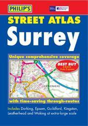
2003ref. SBBI-mon0000149654Philip's 2003. hardcover. Good. Our good condition books are generally good for reading but not for gifting or collecting. They could have imperfections such as creasing fanning inscriptions margin notes yellowing staining on edge or cover or pages bumps scuffs etc etc sometimes multiple of these. It's a wide category that encompasses anything that isn't almost-new down to anything that is slightly better than poor. We would NOT recommend gifting Good books - these should be considered reading copies. Our books are dispatched from a Yorkshire former cotton mill. We list via barcode/ISBN so please note that the images are stock images and may not be the exact copy you receive furthermore the details about edition and year might not be accurate as many publishers reuse the same ISBN for multiple editions and as we simply scan a barcode or enter an ISBN we do not check the validity of the edition data when listing. If you're looking for an exact edition please don't order at least not without checking with us first although we don't always have time to check. We aim to dispatch prompty the service used will depend on order value and book size. We can ship to most countries see our shipping policies. Payment is via Abe only. Philip's hardcover
ref. DADAX173431503211th Edition 2021 0000-00-00. Benchmark Maps. paperback. New. 10.51x0.71x15.12. Buy with confidence. Excellent Customer Service & Return policy. 11th Edition, 2021 paperback
ref. 1583559191.Gbundle. Good. Access codes and supplements are not guaranteed with used items. May be an ex-library book. unknown
ref. 3906593363.Gmap. Good. Access codes and supplements are not guaranteed with used items. May be an ex-library book. unknown
ref. SONG184907495XPhilip's 2019-06-13. paperback. Used: Good. 8.82x0.39x10.94. Buy with confidence. Excellent Customer Service & Return policy. Philip's paperback
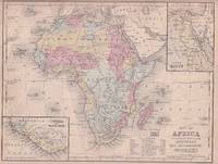
1869ref. 176603Philadelphia.: E. H. Butler. circa1869. Lithographed map with original hand-colour 21.2 x 27.6 cm two inset maps of Liberia and Sierra Leone; and Egypt showing the Suez Canal text and engravings for an unrelated entry on the verso; margins dusty top edge worn with small edge tears one affecting the border and marginal chip but in good condition. Detailed map of Africa before the escalation of colonial acquisition in the 1880s. . (E. H. Butler). unknown
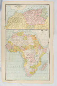
1894ref. 177068Chicago.: Geo. F. Cram. 1894. Chromolithographed maps 54.3 x 34.1 cm sheet central fold a few small edge tears and marginal age toning but in very good condition. Detailed maps prepared for George F. Cram's 1894 "Standard American Atlas": one of the first American firms to publish a world atlas. Maps of Oceania and South Africa printed on the verso. . Geo. F. Cram. unknown
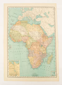
1899ref. 174902New York.: Rand McNally & Co. 1899. Printed colour map 36.3 x 24.3 cm inset map of the Suez Canal and two smaller insets of the Cardagos Crayos Islands Mascarene Islands and Cape Verde Islands central fold and on the verso a printed panel listing the countries in Africa with their territorial governance area and population lower corner creased at the outer margin but in very good condition. An interesting late nineteenth-century map noting colonial governance. . Rand, McNally & Co. unknown
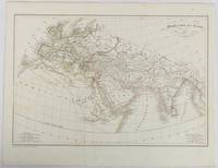
1820ref. 177230Paris. circa1820. Engraved map with original outline hand-colour 21.1 x 31.5cm original folds a few spots and a little creased but in very good condition. Latin map of the Ancient world encompassing Europe India Arabia the Middle East and North Africa by the French cartographer Jean Baptiste Poirson 1761-1831 finely engraved. . unknown
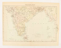
1910ref. 174841London. circa1910. Printed colour map on conjoined pages 22.3 x 33.7 railways submarine cables and heights above sea level marked faded but in very good condition. Map showing the ruling divisions by shading borders with Burma and the Andaman and Nicobar Islands also shown. . unknown
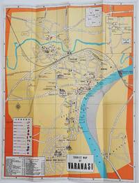
1960ref. 178269Circa1960. Folding colour tourist map of Varanasi in Uttar Pradesh province two inset maps of India and a gude map of Sarnath legend and key select Ghats shown railways "western style" and "Indian style" hotels marked in very good condition. 42.9 x 33.1 cm. . unknown
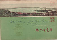
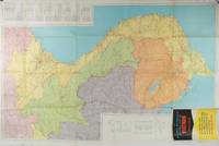
1962ref. 160933杭州.Hangzhou.: 浙江人民出版社.Zhejiang renmin chu ban she. 2nd Edition 3rd Printing. 1962. Folding colour tourist brochure for Hangzhou. One side shows large map of Hangzhou the other 5 more detailed maps chops and previous owner's annotations upper cover small hole at one fold some light wear and browning good. Text in both traditional and simplified Chinese. Sheet size 53.9 x 38.3cm folded size 13.5 x 19.2cm. One side includes a legend an inset showing tourist spots surrounding Hangzhou a table shows lists of Hangzhou's hospitality industry e.g. hotels cinemas swimming pools restaurants department stores etc. The other side includes five individual tourist maps: Viewing Fish at Flower Pond 花港觀魚 Lingyin Temple 靈隱 Hangzhou Bus Map 杭州市公交路线图 Lonely Mountain 孤山 Dreaming of the Tiger Spring 虎跑. . 浙江人民出版社.[Zhejiang renmin chu ban she]. unknown
1970ref. 197689Chicago.: Rand McNally. circa1970. Very large folding colour map 136 x 89 cms folding to 30.5 x 22.8 cm legend and glossary with a gazetteer in an upper corner to North and South Vietnam Cambodia and Laos small fold split no loss in very good condition. Extremely detailed map of Indochina scale of 1 inch to approximately 20 miles with roads paths trails railroads airports marked and indexes to cities and towns and population totals in South Vietnam North Vietnam Cambodia and Laos. Includes a glossary of foreign terms and a brief gazetteer. . Rand McNally. unknown
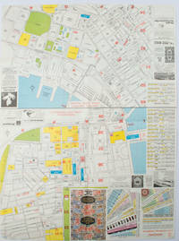
1977ref. 161880Hong Kong.: A-O-A Ltd. June/July1977. Coloured tourist maps of Hong Kong printed both sides on a sheet folded. One general area map of Hong Kong and three detailed street maps featuring Kowloon Peninsula Tsimshatsui and Central District. Generally in very good condition text in traditional Chinese English and Japanese. Sheet measures 58.2 x 43cm. The tourist maps include currency rate tourist advice advertisements for foreign and local brands and shops e.g. A-O-A Gambling Handbook for Macau Duty Free shopping centres Chinese Arts & Crafts centres acupuncture clinic etc. The maps of Central and TST have the names of many hotels businesses post offices etc marked on them. . A-O-A Ltd. unknown
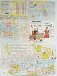
1976ref. 161881Hong Kong.: Walter K. Hoffman. January/February1976. Coloured tourist map brochure of maps of Hong Kong printed both sides six maps in total folded. Brochure also includes advertisements currency rates. Minor tears along folds otherwise in good condition. Text in traditional Chinese English and Japanese. Sheet measures 58.2 x 43.4cm. Sheet includes 6 individual maps: Map of British Crown Colony of Hong Kong Map of the Urban Area with routes for public transportation Map of Tsimshatsui large scale street map Map of Central District large scale street map Map of Wanchai large scale street map Map of Causeway Bay large scale street map Map of Portuguese Overseas Province of Macau. On the maps of Central and TST the names of many businesses hotels etc are marked. . Walter K. Hoffman. unknown
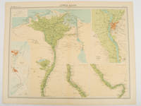
1920ref. 47836London.: The Times. 1920. Map printed in colour 47 x 59.5 cm sheet showing cultivated land in green and desert in cream five insets: Port Said Suez Environs of Cairo and two showing continuations of the Nile; original fold two small edge tears but in very good condition. Attractive large map prepared as plate 79 from "The Times Survey Atlas and Gazeteer of the World". . The Times. unknown
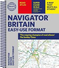
2024ref. DADAX1849076545Philip's 2024-11-07. spiral_bound. New. 10.31x0.79x12.13. Buy with confidence. Excellent Customer Service & Return policy. Philip's unknown
ref. 1849073945.Gpaperback. Good. Access codes and supplements are not guaranteed with used items. May be an ex-library book. paperback
ref. 1527718301.Gpaperback. Good. Access codes and supplements are not guaranteed with used items. May be an ex-library book. paperback