11.782 resultados
1813ref. 715CG(Zürich, Füssli Komm., 1813). 3 Umrissradierungen. I: 150 x 17 cm. - II: 62 x 17 cm. - III: 37 x 12,5 cm.
1798ref. 15651London, J. Johnson, 1798. 3 volumes in-8 de X-532; X-498 et VIII-446-57 pages, plein veau moucheté, dos à 5 nerfs ornée de filets, roulettes, grecques, fleurons et titre dorés, pièces de titre noires, filet doré encadrant les plats. Ex libris.
ref. 135184aafParis, Chez Didot, M. DCC. XLVI (1746), in-8vo, 2 ff. + 360 p. + 10 planches dont 6 grandes cartes dépl., reliure en veau de l’époque, dos à cinq nerfs, pièce de titre en maroquin rouge, tranches rouges, bel exemplaire.
1889ref. 20817Paris, A. Hennuyer, 1889. Petit in-4 de XXXIII-[1]-618 pages, demi-chagrin rouge, dos à nerfs, tête dorée.
1493ref. 591DGNürnberg, Anton Koberger, 1493. Kol. Holzschnitt. Blattgrösse: 45 x 62 cm.
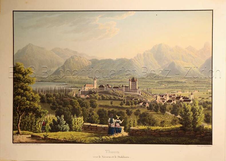
1830ref. 627DG(Zürich, Keller & Füssli), um 1830. Altkolorierte Aquatinta von Rudolf Bodmer (1805-1841). Bildgrösse: 16 x 24,1 cm. Blattgrösse: 19,4 x 27 cm.
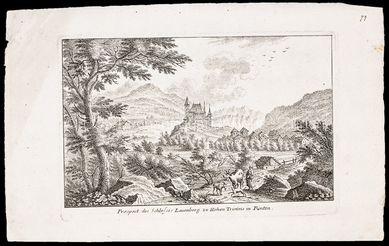
ref. 1007CGRadierung. Plattengrösse: 17 x 25 cm. Papiergrösse: 21,3 x 34,6 cm.
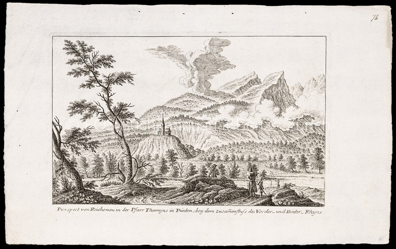
ref. 1008CGRadierung. Plattengrösse: 17 x 25 cm. Papiergrösse: 22 x 34,5 cm.
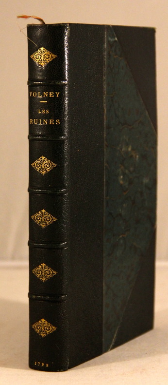
1792ref. 3813A Paris, Chez Desenne; Volland; Plassan, 1792. 1 vol. in-8 de XVI-392 p. Reliure moderne demi-maroquin noir à coins, dos à nerfs orné de fleurons dorés, tête dorée. Belle condition seuls les coins sont très légèrement frottés.
1710ref. 31679Amsterdam, Covens et Mortier, c. 1710-33. 49x60,5 cm. Kobberstukket Danmarkskort med Skåne, Halland og Blekinge. På svært papir og med original fuld håndkolorering. Frisk eksemplar.
1710Amsterdam, Covens et Mortier, c. 1710-33. 49x60,5 cm. Kobberstukket Danmarkskort med Skåne, Halland og Blekinge. På svært papir og med original fuld håndkolorering. Frisk eksemplar.
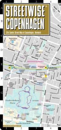
ref. 1931257590-11-1Streetwise Maps Inc. Fol Lam Ma. Very Good. It's a well-cared-for item that has seen limited use. The item may show minor signs of wear. All the text is legible with all pages included. It may have slight markings and/or highlighting. Streetwise Maps Inc unknown
1939Very Good English Original green cloth. Title gilt in black "Egyptian Touring Association" and "ETA logo" to the front board. Foolscap 8vo. (17,5 x 13 cm). In English. 110 p. with rich separate advertisements, and a fine folded b/w map titled "Desert motor-routes" on a scale of 1:4,000,000. Slightly fading on cloth, otherwise a fine copy. First and only edition of this rare complete and very detailed desert motor-routes' guide for the Anglo-Egyptian motorists, printed by the Egyptian Touring Association in Cairo, including details about hospitals, "what to do in cases of accidents on the roads", free legal defence, hotels, garages as well as itineraries, pedestrian crossings, speed limits in the country, parking regulations of Sharia Kasr el Nil, Adly Pasha, no-lights area, railway bridges, postal rates, exchange rates, rates of freight on motor cars by sea and rail, kilometers into miles, transcontinental road London - Istanbul with other useful information. This guide was explained in the introduction as "This handbook has been compiled for the benefit of members and is issued to them free. Extra copies may be obtained from the Head Office, 3 Sh. Cattawi Bey, Kasr el Nil, Cairo, at the price of P.T. 10. It contains a good deal of useful information regarding touring of all kinds in Egypt and abroad including a list of recommended hotels and garages throughout the country. "The president of the Association which was founded in 1932, was H.E. Sir Miles Lampson (1880-1964). He was a British diplomat who was appointed High Commissioner for Egypt and Sudan in 1934. As a result of the Anglo-Egyptian Treaty in December 1936, to which Lampson was a signatory, Britain loosened its grip on Egypt and the post title was changed to Ambassador to Egypt and High Commissioner for Sudan in 1936. Lampson continued in this office until 1946. Vice presidents were Sir Stenson Cooke and J. A. Crawford. According to the ETA's service page of the guide, the purpose of the association can be determined as "Association was formed to provide a long-felt want in Egypt, that is, a touring club in the true sense of the word, devoted to the interests of all kinds of travelers. It's a non-profit making co-operative organization with the aim of making the path of the motorist, the airman, the camper, and every other kind of traveler pleasanter and smoother. The E.T.A. is officially recognized by the Egyptian Government and already in its short existence has grown enormously, being able to offer the following very real services to its members: Expert and detailed advice on all touring matters. Expert advice on motoring matters and vetting of cars. Free itineraries to all parts of Egypt and abroad. Reminders are sent to all members when a car and driving license is due for renewal. Renewal of car and driving licenses. Free legal defense for motoring offenses. Triptyques, carnets, and all documents for foreign touring, including passport arrangements. Agents at Alexandria, PortSaid, Suez, and the principal ports to look after the incoming and outgoing motorist and relieve him of all worry. A full stock of maps and guide books of Egypt and other countries. Up-to-date information on the state of roads and desert tracks. Welcome and help from the 100 odd touring clubs of the A.I.T. [i.e. the Alliance Internationale de Tourisme], of which the E.T.A. is a member. Recommended hotels and garages throughout Egypt and the Near East. Insurance for members can be effected at the most advantageous rates, and advice is given. Cars can be driven to any part of Egypt, by experienced drivers. Guides are provided. Other benefits, it is hoped, will be given in due of course.". Not located in OCLC. "1938-39 Edition" of the series (not published more than two years) is located in OCLC in no. 862336537.
1835ref. 000014144London: Cha. F. Cheffins 1835. Map. Ex-Library. 29 3/8" x 61.5". Linen-backed map done on two sheets. Map printed in black pink yellow and green hand-colored. Housed in a 8" x 5.5" green case with gilt lettering and a gilt device on the front board the front of the case states "London & Birmingham Railway. Map of the Line. above the device Incorporated 6th May 1833". A portion of the map backed with green goat in order to have it enter and exit the case more smoothly. A large and beautiful representation of the London to Birmingham railway line with the stops outlined at the bottom edge of the map. With two engraved vignettes showing the depots in Birmingham and in London. An early example of this captivating map. A bookplate and one stamp on the verso of the map otherwise no markings. The bookplate states that the map was a gift donated by James J. Hill a wealthy bibliophile from St. Paul to the University of Wisconsin Library. The map has three small spots of loss to its folds. The case has wear and light discoloration. Cha. F. Cheffins unknown
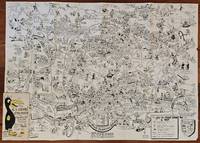
1954ref. BK0099Darmstadt Gemany: Stars and Stripes 1954. Folding pictorial map approximately 2 3¼ x 33 inches unfolded in original illustrated wrappers. OCLC 59284292. Near fine with some wear to wrappers. A wonderfully busy cartoon map of Frankfurt made for American servicemen stationed in Germany during the early Cold War. Byrel "Lefty" Burgess a career U.S. Army engineer and cartoonist fills the city with G.I.s military police beer halls historic buildings street jokes and visual gags while giving particular attention to the extensive American military presence in and around Frankfurt. American sites include barracks the 97th General Hospital WAC quarters Frankfurt High School the PX and residential areas occupied by servicemen and their families. The map ranges from Höchst and Bad Vilbel to Harheim and Offenbach mixing useful street information with caricatures and annotations. Burgess labels historic sites including the Saalhof Karmeliter Kloster Dominikaner Kloster and Drei Königs Kirche while military life and Frankfurt's drinking culture provide much of the humor. Along the upper edge references to places back home-including Texas Chicago Los Angeles Pike's Peak and the Rocky Mountains-reinforce the map's intended audience of Americans temporarily living overseas. Burgess served in the Army Corps of Engineers; he later produced a similarly humorous map of Seoul in 1957. OCLC 59284292. . Stars and Stripes unknown
1954ref. BK0099Darmstadt Gemany: Stars and Stripes 1954. Folding pictorial map approximately 2 3¼ x 33 inches unfolded in original illustrated wrappers. OCLC 59284292. Near fine with some wear to wrappers. A wonderfully busy cartoon map of Frankfurt made for American servicemen stationed in Germany during the early Cold War. Byrel "Lefty" Burgess a career U.S. Army engineer and cartoonist fills the city with G.I.s military police beer halls historic buildings street jokes and visual gags while giving particular attention to the extensive American military presence in and around Frankfurt. American sites include barracks the 97th General Hospital WAC quarters Frankfurt High School the PX and residential areas occupied by servicemen and their families. The map ranges from Höchst and Bad Vilbel to Harheim and Offenbach mixing useful street information with caricatures and annotations. Burgess labels historic sites including the Saalhof Karmeliter Kloster Dominikaner Kloster and Drei Königs Kirche while military life and Frankfurt's drinking culture provide much of the humor. Along the upper edge references to places back home-including Texas Chicago Los Angeles Pike's Peak and the Rocky Mountains-reinforce the map's intended audience of Americans temporarily living overseas. Burgess served in the Army Corps of Engineers; he later produced a similarly humorous map of Seoul in 1957. OCLC 59284292. . Stars and Stripes unknown books
1889ref. 9062St. Paul Minn: W.C. Riley 1889. 8vo 140 15pp ads and blank journal at rear. Illustrations maps large folding map in pocket at rear as issued. Original leather over card covers stamped in gilt on front with red page edges. Gift inscription on ffep in pencil dated 1907 else clean internally. A beautiful fine copy. Beautiful copy of this illustrated tourist's guide to Yellowstone giving descriptions of the attractions and features of the park with maps a brief history and rules and regulations. Riley issued a just few of these according to OCLC between 1886 and 1890. Scarce and more so in this condition - the nicest we've seen. . W.C. Riley unknown
1992ref. 047410Pachuca Mexico: Consejo de Recursos Minerales 1992 Book. As New. Hardcover. 1st US Ed. The state of Zacatecas is one of Mexico's most historically and economically significant mining regions often highlighted in specialized geological reports including this comprehensive Geological-Mining Monograph of the State of Zacatecas with its detailed text stratigraphic charts and geological maps often in 1:250000 scale that serve as a guide for exploration and academic study of this major mining region. Published by the Consejo de Recursos Minerales now part of the Mexican Geological Survey - SGM 155 p. illus charts col large format fold out maps in rear pockets. As new except for an ownerhip stamp NOTE : Very Heavy 1.5 kg/ large format volume. 35 x24 x24 cm. Consejo de Recursos Minerales hardcover
1857ref. 32586Edward Stanford London unknown circa 1857 First Edition thus. Paperback. maps show slight toning a few stains & marks to back of linen otherwise in very good condition case bumped and rubbed with scuffed corners. approximately 54 x 54 inches. dissected linen backed colour map in two parts: North - from Konigr Ungar & Scharzes Meer to Serbia Bulgarien and Schwarzes Meer: South - Vusitrin & Griechenland to Scharzes Meer Meer von Marmara Kleinasien & Archiplagus Weiss. Both 71 X 137 cm legend in English on the North map boundaries carriage trails battlefields harbours in German scale of English miles 69 to one degree boxed set linen backed maps with marbled paper ends cloth covered slipcase Edward Stanford hardcover
2013ref. SBBIH-CSRDX7VJO4PYPopOut Maps 2013. map. Good. Our good condition books are generally good for reading but not for gifting or collecting. They could have imperfections such as creasing fanning inscriptions margin notes yellowing staining on edge or cover or pages bumps scuffs etc etc sometimes multiple of these. It's a wide category that encompasses anything that isn't almost-new down to anything that is slightly better than poor. We would NOT recommend gifting Good books - these should be considered reading copies. Our books are dispatched from a Yorkshire former cotton mill. We list via barcode/ISBN so please note that the images are stock images and may not be the exact copy you receive furthermore the details about edition and year might not be accurate as many publishers reuse the same ISBN for multiple editions and as we simply scan a barcode or enter an ISBN we do not check the validity of the edition data when listing. If you're looking for an exact edition please don't order at least not without checking with us first although we don't always have time to check. We aim to dispatch prompty the service used will depend on order value and book size. We can ship to most countries see our shipping policies. Payment is via Abe only. PopOut Maps unknown
2013ref. SBBIH-HVYSHSVIWKIDPopOut Maps 2013. map. Very Good. Most of our very good books have only minor imperfections such as shelf wear consistent with a new book that's sat on a bookshop shelf for a year or two. Occasionally we may miss other minor imperfections as we have to grade books at speed. Our books are dispatched from a Yorkshire former cotton mill. We list via barcode/ISBN so please note that the images are stock images and may not be the exact copy you receive furthermore the details about edition and year might not be accurate as many publishers reuse the same ISBN for multiple editions and as we simply scan a barcode or enter an ISBN we do not check the validity of the edition data when listing. If you're looking for an exact edition please don't order at least not without checking with us first although we don't always have time to check. We aim to dispatch prompty the service used will depend on order value and book size. We can ship to most countries see our shipping policies. Payment is via Abe only. PopOut Maps unknown
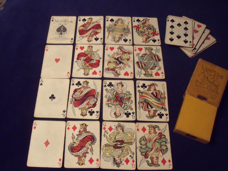
1896ref. 963189652 cartes - joker manquant - Portrait de création originale de style" Art Nouveau" - 1896 - Fabricant: United Playing cards - Cincinnati - Jeu légèrement usé - boite d'origine complète un peu ternie , mais complète avec son timbre de scellement .
1857ref. 1033631857 Jeu de dominos-cartes célébrant l'histoire du Premier et du Second Empire jusqu'à la fin de la Guerre de Crimée.Paris (?) : Krum & Cie, vers 1857, chromolithographie avec passage d'or, 28 cartes (complet) 79 x 56 mm, figures doubles variables, coins carrés dos rose.
ref. 18568Augsbourg, s.d. (1730), Nuremberg, sans date (1730). Quatre cartes entoilées, 60 x 54 cm, repliées dans un étui, dont trois en couleurs. Etui en basane fauve d'époque, roulette dorée sur les plats, dos orné avec le titres des cartes.
Engraved map in original outline colour. Flanked by two mounted columns of French text. Very fine map of Arabia by the “Ingénieur-Geographe du Roy” Louis Brion de la Tour (1756-1823) showing Turkey, Palestine, present-day Iraq and Iran, the Caucasus region as well as the Arabian Peninsula. Cf. National Maritime Museum Cat. I, 264. Not in Al Ankary; Al-Qasimi.