VAUGONDY, ROBERT de - RUSSIA.Livre Rare Book
Volkart:Livre Rare Book
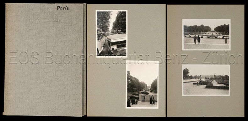
Paris.
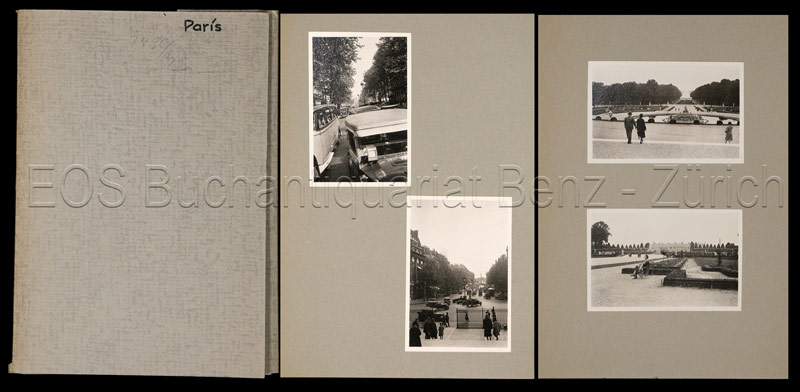
1930ref. 743CGum 1930. 36 Fotografien, montiert auf farb. Halbkarton. Format: ca. 8 x 6 u. 6 x 8 cm.
EOS Buchantiquariat Benz · CH-8001 Zürich, SuíçaCHF 250,00≈ € 270,65
12.067 resultados
1750ref. 16523A large engraved cont. handcoloured map of the Northern part of Russia from Novaja Semlja in the north to the Caspian Meer in the South, from Finland to Jakusskkáy, measuring 48,5 x 62 cm. Folded in center. A few tears in margins.
1930ref. 743CGum 1930. 36 Fotografien, montiert auf farb. Halbkarton. Format: ca. 8 x 6 u. 6 x 8 cm.
1945ref. 023064Dublin: The Talbot Press 1945. Book. Fine. Hardback. First Edition. 8vo. 273 pages. Original dust jacket bright without browning; a little rubbing and general wear lightly scuffed to head/tail of the spine and corners small chip to centre of front spine fold and several marginal tears repaired to the reverse with archival materials now protected in a clear removable archival sleeve. Hard-back binding very good. Contents clean and tight no inscriptions no foxing. A fine first edition copy in a very good jacket. Scarce first edition. The Talbot Press Hardcover
1976Une feuille 88x118 cm.
1780Pianta del rione tratta dalla celebre guida di Roma di Dominique Magnan La ville de Rome, ou, Description abrégée de cette superbe ville: divisée en quatre volumes: et ornée de 425 planches en taille douce. A Rome: De l'imprimerie d'Archange Casaletti ... : Chez Venan. Monaldini, Bouchard et Gravier : Gregoire Settari ..., 1778. Dominique Magnan (1731–1796), dotto abate francese del convento della Trinità dei Monti, dell'ordine dei minimi, a Roma, che fu profondamente coinvolto nella vita intellettuale della sua comunità durante la seconda metà del XVIII secolo. Ha studiato all'università di Avignone, poi si è unito ai Minimi di La Ciotat all'età di 20 anni, dove ha iniziato la sua carriera come collezionista di monete e medaglie antiche. Nominato professore di teologia a Marsiglia, ha continuato il suo lavoro. Si mise in contatto con i più famosi antiquari dell'epoca, sia in Italia che in Germania, e acquisì rapidamente una vasta reputazione. I suoi primi libri hanno ricevuto il plauso della critica. Ma i suoi lavori più significativi erano sulla numismatica sebbene fortemente criticati dagli specialisti dell'epoca in quanto la copertura universale e completa del soggetto poteva mantenere la confusione tra monete autentiche e false. Bibliografia: Rossetti, G-1285; Schudt 363. Map taken from the famous guide of Rome by Dominique Magnan La ville de Rome, ou, Description abrégée de cette superbe ville: divisée en quatre volumes: et ornée de 425 planches en taille douce. A Rome: De l'imprimerie d'Archange Casaletti ... : Chez Venan. Monaldini, Bouchard et Gravier : Gregoire Settari ..., 1778. Dominique Magnan (1731–1796), a learned French abbot of the Trinità dei Monti convent, of the order of the minims, in Rome, who was deeply involved in the intellectual life of his community during the second half of the 18th century. He studied at the University of Avignon, then joined the Minims of La Ciotat at age 20, where he began his career as a collector of ancient coins and medals. Appointed professor of theology in Marseille, he continued his work. He got in touch with the most famous antiquaries of the time, both in Italy and Germany, and speedily acquired an extensive reputation. His first books received critical acclaim. But his most significant works were on numismatics though heavily criticized by specialists of the time in that universal and complete coverage of the subject could maintain confusion between authentic coins and the fake ones. Bibliografia: Rossetti, G-1285; Schudt 363.
1951No marks or inscriptions. No creasing to covers or to spine. A very clean copy with bright unmarked boards and no bumping to corners. 64pp. Introduction in English and French. Colour photograhs with dual language captions of Paris around 1951.
1867- Librairie du Petit Journal, Paris 1867, 107,5x71cm, une feuille repliée. - First edition. Map of Paris divided in 20 arrondissements, wich were created in 1859. A very good copy with the 20 districts totally heightened in colors by a contemporary hand. The map is skillfully reinforced at the back. [FRENCH VERSION FOLLOWS] Edition originale. Plan de Paris divisé en 20 arrondissements, lesquels furent créés en 1859. Bel exemplaire avec les vingt quartiers entièrement aquarellés à l'époque. Carte habilement consolidée aux pliures du verso.
2002No marks or inscriptions. No creasing to covers or to spine. A very clean very tight copy with bright unmarked boards and no bumping to corners. 144pp. Leisure, culture, eating, history and much more about Paris. Text in English and Frence.
1913Previous owner's bookplate inside front cover. No other marks or inscriptions. No creasing to covers or to spine. A very clean very tight copy with dull green cloth boards, very minor mark to lower front corner, slightly dusty page edges, trace of rubbing to spine ends and no bumping to corners. Large fold-out map at rear in excellent condition. 363pp. Detailed guide to Paris and her architecture and collections, just before the First World War. With sixty-four illustrations, two plans and map.
1987No marks or inscriptions. Clean bright laminated boards with no bumping to corners. A lovely clean crisp tight copy. 259pp. Phaidon Cultural Guide. Laminated boards. Very well illustrated in colour.
Paris, A. V. Vallad fils et Cie., 1886. 4to.; 12-45 pp., 20 hojas sin paginar, 20 planos impresos en color y un plano plegado. Encuadernación original en tela estampada.
ref. 159775028X.Gmap. Good. Access codes and supplements are not guaranteed with used items. May be an ex-library book. unknown
ref. SONG159775028XNational Geographic Maps 2014-11-05. 2014. map. Used: Good. 4.25x0.25x8.50. Buy with confidence. Excellent Customer Service & Return policy. National Geographic Maps unknown
1952Feuille repli?e.
1953Feuille repli?e.
1930ref. 743CGum 1930. 36 Fotografien, montiert auf farb. Halbkarton. Format: ca. 8 x 6 u. 6 x 8 cm. + Wichtig: Für unsere Kunden in der EU erfolgt der Versand alle 14 Tage verzollt ab Deutschland / Postbank-Konto in Deutschland vorhanden +, Fotos und Mappe
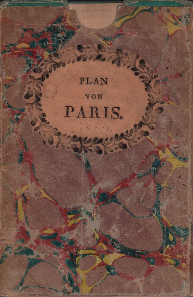
1836ref. 78791München, in der literarisch artistischen Anstalt, 1836. 1 mehrfach gefalteter teilkolor. lithogr. Plan im Maßstab 1:16.000 mit eingeschaltetem kl. Umgebungsplan im Maßstab 1: 350.000. Blattgröße ca. 46 x 60 cm. Mit türkisfarb. Papierstreifen gefaßt. In marmor. Karton-Schuber der Zeit (16 x 10,5 cm).
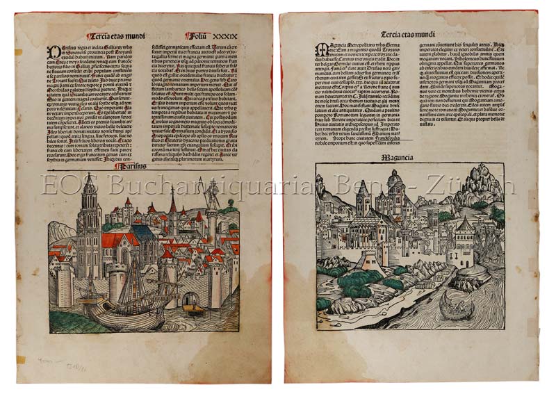
1493ref. 591DGNürnberg, Anton Koberger, 1493. Kol. Holzschnitt. Blattgrösse: 45 x 62 cm. + Wichtig: Für unsere Kunden in der EU erfolgt der Versand alle 14 Tage verzollt ab Deutschland / Postbank-Konto in Deutschland vorhanden +
1922ref. 5331Cambridge: Cambridge University Press 1922. Loose sheet mounted on linen. Good-. Eric Teichman. Map printed in color measuring 26.5 x 25 inches. With a Tibetan glossary. Provides Teichman's routes as well as other routes along with villages monasteries or groups of farms. Edgewear with light stains here and there. In. From Travels of a Consular Officer in Eastern Tibet Together With A History of the Relations between China Tibet and India and mounted on linen. The map was clearly used perhaps in the field as evidence of wear including a split in the paper not the linen on which it's mounted suggests. From the collection of Asian books and maps formed by Albert Ravenholt. On verso Ravenholt has written "Teichman's Kam 28 degrees 25' - 33 degrees 20'. [Cambridge University Press] unknown
ref. 66109CBo.J. [3 Warenabbildungen] (Rigobert Bonne, geb. 06.12.1727 in Raucourt in den Ardennen, gest. 02.09.1794 in Paris, französischer Mathematiker und
Darstellung: 48 x 54 cm. Blatt: 54 x 82 cm *Breitrandiges Exemplar in sauber und sehr guter Erhaltung. Landkarten de
Format: 48 x 63,5 cm. (Blattgröße: 54 x 80 cm). *Tadelloses breitrandiges Blatt. Landkarten fr
1750A large engraved cont. handcoloured map of the Northern part of Russia from Novaja Semlja in the north to the Caspian Meer in the South, from Finland to Jakusskkáy, measuring 48,5 x 62 cm. Folded in center. A few tears in margins.
1750Carta geografica colorata a mano (55x80), larghi margini, qualche macchia al margine inferiore. Geographic map, hand coloured, (55x80), some brownings at the lower margin.
1786(Paris, ca. 1786). 25,3x31 cm. Engraved map of Northern Russia, the european part. In original handcolouring. The map engraved by E. Dussy.