11.782 resultados
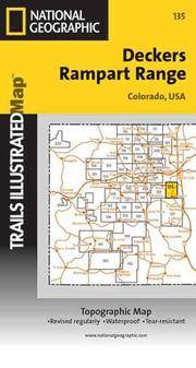
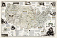
2013ref. 1-1597755451Natl Geographic Maps 2013. Paperback. New. lam map edition. 1 pages. 25.00x1.50x1.30 inches. Natl Geographic Maps paperback
1914ref. 63899Columbus OH: The Columbus Lithograph Co. Commissioners of Public Printing of Ohio 1914. One linen-backed dissected folding map. 8vo. 4 x 8.25 in. which folds out into 32 panel 28.5 x 32.5 in. colour lithograph map w/ illustration of steam locomotive and electric railway in lower right corner rail lines demarcated in colours very minor age toning at folds slight creasing edgewear still a NF copy preserved in the original black cloth portfolio case w/ “Ohio Railway Map” stamped in gilt on front cover. First edition thus of this Progressive Era Ohio railroad map demarcating the steam railroads such as the Baltimore & Ohio RR Cincinnati Georgetown & Portsmouth RR Detroit Toledo & Ironton Ry Erie Railroad New York Central Pennsylvania RR in colours with index below. Also included are identifying routes of the electric railways operating at the time along with telegraph companies express companies and even the Pullman Car Company. The Columbus Lithograph Co., Commissioners of Public Printing of Ohio, hardcover
1928ref. 70989Chicago IL: Illinois Commerce Commission 1928. First edition. Mammoth lithograph map 52 ½ x 34 inches showing the railroad lines throughout the state and cities and towns they pas through with an inset detailed map of Chicago and vicinity 15 ¼ x 8 ½ inches and boxed panels for identification of the various railroads and "Passenger Terminals in Chicago" verso prints an index to counties and towns. Relatively uncommon OCLC locating 12 copies 6 in Illinois 4 in Wisconsin. Folded into 12mo printed light brown wrappers; several closed marginal tears into map one two-inch horizontal fold break else very good. Illinois Commerce Commission unknown
1928ref. 70989Chicago IL: Illinois Commerce Commission 1928. First edition. Mammoth lithograph map 52 ½ x 34 inches showing the railroad lines throughout the state and cities and towns they pas through with an inset detailed map of Chicago and vicinity 15 ¼ x 8 ½ inches and boxed panels for identification of the various railroads and "Passenger Terminals in Chicago" verso prints an index to counties and towns. Relatively uncommon OCLC locating 12 copies 6 in Illinois 4 in Wisconsin. Folded into 12mo printed light brown wrappers; several closed marginal tears into map one two-inch horizontal fold break else very good. Illinois Commerce Commission unknown books
1859ref. 189711Calcutta.: Surveyor Generals Office. 1870. Reissue of 1859 edition. Lithographed map 57.2 x 93 cms; 61.1 x 96 cms sheet original folds old paper repairs to the verso and a sealed marginal tear central folds archivally strengthened some toning to the folds and creasing but the map in remarkably good clean condition. Impressive large Calcutta printing from the Survey of India showing Rajasthan Uttar Pradesh and surrounding states with extremely detailed delineation of settlements roads railways rivers and major points of interest the Taj Mahal is highlighted. . Surveyor Generals Office. unknown
ref. LBW024decirca 1690 115 x 256 mm.
ref. 0925873551.Gpaperback. Good. Access codes and supplements are not guaranteed with used items. May be an ex-library book. paperback
1889ref. 70991NY and Chicago: Rand McNally 1889. Engraved map 23 x 28 inches recto showing Lower Manhattan Brooklyn Jersey City and Hoboken lines for Manhattan Elevated Railway Suburban Rapid Transit Brooklyn Elevated R.R. and Kings Co. Elevated R.R. printed in dark red Bartholdi's Statue marked on Bedloes Island verso showing Upper Manhattan and printing a large more detailed inset of Lower Manhattan from Washington Square to the Battery 12 ½ x 13 inches and a boxed index to the street car lines 8 x 6 inches. Printed several times 1886-1889 this printing located in four copies on OCLC Newberry New York Public Boston Public Columbia. Folded into 16mo printed brown wrappers subtitle: Showing Street Car Lines Elevated Railroads Docks Ferries Steam Boat Lines etc.; some soiling several tiny corner fold breaks wrappers separated along the spine but still a good copy. Rand, McNally unknown
1970ref. 197689Chicago.: Rand McNally. circa1970. Very large folding colour map 136 x 89 cms folding to 30.5 x 22.8 cm legend and glossary with a gazetteer in an upper corner to North and South Vietnam Cambodia and Laos small fold split no loss in very good condition. Extremely detailed map of Indochina scale of 1 inch to approximately 20 miles with roads paths trails railroads airports marked and indexes to cities and towns and population totals in South Vietnam North Vietnam Cambodia and Laos. Includes a glossary of foreign terms and a brief gazetteer. . Rand McNally. unknown
ref. 1332329969.Gpaperback. Good. Access codes and supplements are not guaranteed with used items. May be an ex-library book. paperback
1895Outside dimensions 14.5" x 10.5" Railroads and Street Car lines indicated. Centerfold. Light wear. Please see our photo for details. Book
1902Outside dimensions 14.5" x 10.5" Circa 1902. Railroads and Street Car Lines indicated. Centerfold. Light wear. Please see our photo for details. Book
1902Outside dimensions 14.5" x 10.5". Circa 1902. Railroads, Elevated Railroads, Broadway Cable Road, and Horse Cars indicated. Centerfold. Light wear. Please see our photo for details. Book
1902Outside dimensions 14.5" x 10.5". Circa 1902. Centerfold. Light wear. Please see our photo for details. Book
1902Outside dimensions 14.5" x 10.5". Circa 1902. Centerfold. Light wear. Please see our photo for details. Book
1902Outside dimensions 14.5" x 10.5". Circa 1902. Centerfold. Light wear. Please see our photo for details. Book
1902Outside dimensions 14.5" x 10.5". Circa 1902. Centerfold. Light wear. Please see our photo for details. Book
1902Outside dimensions 14.5" x 10.5". Circa 1902. Centerfold. Light wear. Please see our photo for details. Book
1902Outside dimensions 14.5" x 10.5". Circa 1902. Centerfold. Light wear. Please see our photo for details. Book
1902Outside dimensions 14.5" x 10.5". Circa 1902. Centerfold. Light wear. Please see our photo for details. Book
1902Outside dimensions 14.5" x 10.5". Circa 1902. Centerfold. Light wear. Please see our photo for details. Book
1902Outside dimensions 14.5" x 10.5". Circa 1902. Centerfold. Light wear. Please see our photo for details. Book
1902Outside dimensions 14.5" x 10.5". Circa 1902. Centerfold. Light wear. Please see our photo for details. Book
1900ref. 70990Chicago and New York: Rand McNally & Co. 1900. Engraved map 28 x 21 inches county and state borders in red inset map "Minneapolis St. Paul and Vicinity" 4 x 4 inches locating list of chief cities along left margin with population figures to the nearest thousand or hundred title at head: "Rand McNally & Co.'s Minnesota." Folded into printed brown wrappers 12mo. 46 pp. Very good. Rand, McNally & Co. unknown books
1889ref. 70991NY and Chicago: Rand McNally 1889. Engraved map 23 x 28 inches recto showing Lower Manhattan Brooklyn Jersey City and Hoboken lines for Manhattan Elevated Railway Suburban Rapid Transit Brooklyn Elevated R.R. and Kings Co. Elevated R.R. printed in dark red Bartholdi's Statue marked on Bedloes Island verso showing Upper Manhattan and printing a large more detailed inset of Lower Manhattan from Washington Square to the Battery 12 ½ x 13 inches and a boxed index to the street car lines 8 x 6 inches. Printed several times 1886-1889 this printing located in four copies on OCLC Newberry New York Public Boston Public Columbia. Folded into 16mo printed brown wrappers subtitle: Showing Street Car Lines Elevated Railroads Docks Ferries Steam Boat Lines etc.; some soiling several tiny corner fold breaks wrappers separated along the spine but still a good copy. Rand, McNally unknown books