ORTELIUS (Abraham);Livre Rare Book
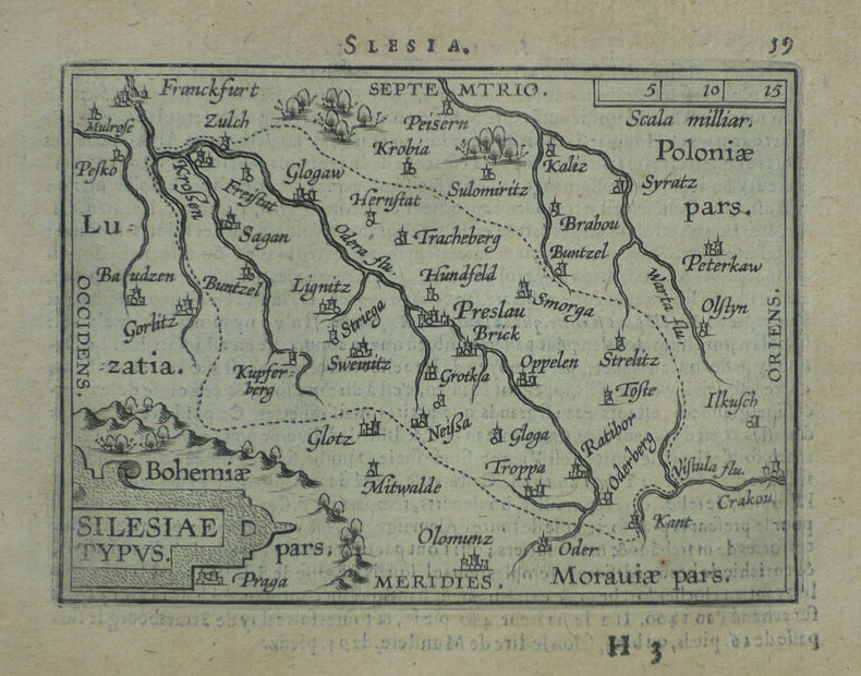
Silesiae typus.
1598ref. LBW-1391Anvers 1598 81 x 106 mm.
Librairie Le Bail · Paris, França€ 150,00
12.595 resultados
ref. 7552Houghton Mifflin Printed in Great Britain. HBNoDJ 1923 1st editionGreen Silk Covers lettered in Gold GiltCover some stains & small amount clear tape & some wear Hinge starting slightly interior Nice & TightVG-/G- AS-IS NODJ. Houghton Mifflin, Printed in Great Britain unknown
1598ref. LBW-1391Anvers 1598 81 x 106 mm.
ref. 8170530962.Gpaperback. Good. Access codes and supplements are not guaranteed with used items. May be an ex-library book. paperback
1987No marks or inscriptions. No creasing to covers or to spine. A very clean very tight copy with bright unmarked boards and no bumping to corners. 104pp. Guide for visitors to Germany. How to understand the street/road signs.
1959No marks or inscriptions. A very clean very tight copy with bright unmarked boards and no bumping to corners. Dust jacket not price clipped or marked or torn or creased with minor traces of rubbing and handling. 400pp. A guide to places to visit and stay in Britain, the Channel Isles, Orkney and Scilly
1750Paris, s.e., s.d. (vers 1750); 220/160 mm, 1 pp., une feuille. Planche provenant certainement d'un livre de voyage du XVIIIème siècle. Bon état.
1750ref. A170Paris, s.e., s.d. (vers 1750) ; 220/160 mm, 1 pp., une feuille. Planche provenant certainement d'un livre de voyage du XVIIIème siècle. Bon état.
ref. 2780s.l., s.d. (années 40), 1 carte postale de 10 x 14 cm
ref. 87670Autrefois, 2008, 82 p., broché, bon état.
ref. SLIVCN-9782970030812FADA EDITIONS
Undated facsimile reprint of map of Shropshire originally issued in the early 1600s. eng
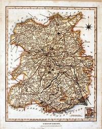
1827ref. 61872London.: J. Wilkes. 1827. Attractive hand coloured map of Shropshire 27.5 x 21.5 cm. very occasional light foxing on reverse but not visible on the image itself. A most attractive map. . [J. Wilkes.] unknown
ref. 0007395426.Gpaperback. Good. Access codes and supplements are not guaranteed with used items. May be an ex-library book. paperback
ref. 0007555008.Gpaperback. Good. Access codes and supplements are not guaranteed with used items. May be an ex-library book. paperback
ref. 0007555016.Gpaperback. Good. Access codes and supplements are not guaranteed with used items. May be an ex-library book. paperback
ref. 0007395450.Gpaperback. Good. Access codes and supplements are not guaranteed with used items. May be an ex-library book. paperback
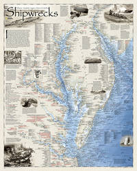
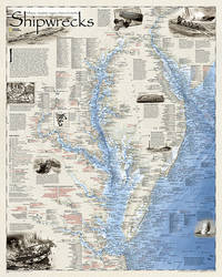
2012ref. 1-1597754188Natl Geographic Society Maps 2012. Paperback. New. rol map edition. 1 pages. 31.70x2.00x0.30 inches. Natl Geographic Society Maps paperback
2012ref. 1-159775420XNatl Geographic Society Maps 2012. Paperback. New. map edition. 1 pages. 36.60x3.00x3.00 inches. Natl Geographic Society Maps paperback
1942ref. 2083002116201149Oriental Maps Suzuki Harumi 1942. Soft Cover. Fine. The book is in fine condition. Oriental Maps Suzuki Harumi paperback
ref. Q-015181905XHarcourt Brace & Co. NY. hardcover. New. New. In shrink wrap. Looks like an interesting title! Harcourt Brace & Co., NY hardcover
1982Mm 150x225 Volume in copertina rigida originale, xv-378 pagine. Copia ottima, spedizione in 24 ore dalla conferma dell'ordine.
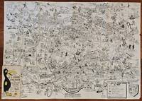
1954ref. BK0099Darmstadt Gemany: Stars and Stripes 1954. Folding pictorial map approximately 2 3¼ x 33 inches unfolded in original illustrated wrappers. OCLC 59284292. Near fine with some wear to wrappers. A wonderfully busy cartoon map of Frankfurt made for American servicemen stationed in Germany during the early Cold War. Byrel "Lefty" Burgess a career U.S. Army engineer and cartoonist fills the city with G.I.s military police beer halls historic buildings street jokes and visual gags while giving particular attention to the extensive American military presence in and around Frankfurt. American sites include barracks the 97th General Hospital WAC quarters Frankfurt High School the PX and residential areas occupied by servicemen and their families. The map ranges from Höchst and Bad Vilbel to Harheim and Offenbach mixing useful street information with caricatures and annotations. Burgess labels historic sites including the Saalhof Karmeliter Kloster Dominikaner Kloster and Drei Königs Kirche while military life and Frankfurt's drinking culture provide much of the humor. Along the upper edge references to places back home-including Texas Chicago Los Angeles Pike's Peak and the Rocky Mountains-reinforce the map's intended audience of Americans temporarily living overseas. Burgess served in the Army Corps of Engineers; he later produced a similarly humorous map of Seoul in 1957. OCLC 59284292. . Stars and Stripes unknown books
1954ref. BK0099Darmstadt Gemany: Stars and Stripes 1954. Folding pictorial map approximately 2 3¼ x 33 inches unfolded in original illustrated wrappers. OCLC 59284292. Near fine with some wear to wrappers. A wonderfully busy cartoon map of Frankfurt made for American servicemen stationed in Germany during the early Cold War. Byrel "Lefty" Burgess a career U.S. Army engineer and cartoonist fills the city with G.I.s military police beer halls historic buildings street jokes and visual gags while giving particular attention to the extensive American military presence in and around Frankfurt. American sites include barracks the 97th General Hospital WAC quarters Frankfurt High School the PX and residential areas occupied by servicemen and their families. The map ranges from Höchst and Bad Vilbel to Harheim and Offenbach mixing useful street information with caricatures and annotations. Burgess labels historic sites including the Saalhof Karmeliter Kloster Dominikaner Kloster and Drei Königs Kirche while military life and Frankfurt's drinking culture provide much of the humor. Along the upper edge references to places back home-including Texas Chicago Los Angeles Pike's Peak and the Rocky Mountains-reinforce the map's intended audience of Americans temporarily living overseas. Burgess served in the Army Corps of Engineers; he later produced a similarly humorous map of Seoul in 1957. OCLC 59284292. . Stars and Stripes unknown
1982Fair English Paperback. Pbo. Roy. 8vo. (23 x 16 cm). In Turkish. With folding plans. Navigational maps, nautical charts and publications catalogue of department of course, hydrography and oceanography of Naval Forces. Seyir, Hidrografi ve Osinografi Dairesi Baskanligi seyir haritalari ve notik yayinlar katalogu.
1973Inscribed on title page from the Chief Minister James R Mancham to Tom Pendry MP. No other marks or inscriptions to contents. No creasing to covers or to spine. A very clean very tight copy with bright cream boards, faint coloured mark to rear and no bumping to corners. 128pp. An account of the Islands of the Seychelles published for the visitor. Very well illustrated. Text in English and French.