12.595 resultados
1948Feuille repli?e.
ref. ORD-1167Carte postale E.M. 1431. Vers 1905. Carte postale (140 x 91mm) timbrée sur le recto (timbre presque entièrement déchiré). Vue très anîmée des bâtiments avec une grande foule d'ouvriers. Bon exemplaire.
Madrid, Dirección General del Instituto Geográfico y Catastral, 1950. 2ª edición. Mapa publicado por sectores (sector 214). Escala 1:50.000. 56x76 cms. Mapa entelado y plegado. Buen ejemplar.
Madrid, 1860. Un mapa de 84 x 111 cm., plegado a 21 x 14 cm., coloreado, con planos particulares de Soria; Contornos de Soria; Ágreda; Medinaceli; Almazán, y Plano de Osma y El Burgo. Encuadernación original en cartoné y media tela.
1764(København, 1764). Kobberstukket prospekt af slottet. (17x24,5 cm.). Stukket af J. Haas. På skrivepapir. Lidt marginale brunpletter.
1764ref. 53316(København, 1764). Kobberstukket prospekt af slottet. (17x24,5 cm.). Stukket af J. Haas. På skrivepapir. Lidt marginale brunpletter.
1935ref. PHO-938London. George Routledge & Sons. 1935. grand in-8 , illustré de 1 frontispice ,31 planches HT ,figures et cartes dans le texte ainsi qu’un tableau généalogique .
1900Broch?. 32 pages. 49x31 cm. Repli?.
ref. 1527748766.Gpaperback. Good. Access codes and supplements are not guaranteed with used items. May be an ex-library book. paperback
1968ref. 147122Couverture souple. Broché. 272 pages.
2003Fine Turkish Paperback. Roy. 8vo. (24 x 17 cm). In Turkish. 786 p., plan and color ills. Sokak sokak Istanbul kent atlasi: 1/7.500. A very detailed city street atlas of Istanbul. All sorts of tourist information is shown on the maps using symbols - cemeteries, hotels, rail stations, cafes, banks, museums, etc. This is an excellent, detailed, current atlas and highly recommended. 583 map pages and 199 pages of street index.
2004Fine Turkish Paperback. Roy. 8vo. (24 x 17 cm). In Turkish. 224 p., plan, color ills. Sokak sokak Ankara kent atlasi: 1/10.000. Ankara city atlas (guide) street by street with a huge plan.
ref. 20484La Nouvelle édition, 1945. In quarto au format 18.5 x 24 cm, couverture unie titré en rouge et noirXXII planches au trait, 127 pages. Complet de la carte du monde dépliante d'1,50 mètre par 65 cm, laquelle est remarquablement conservée. Dos réparé, petits manques, première garde contrecollée sur le second plat, tenue bien carrée. Rare.
1959104 page softcover book plus three large colour maps entitled: Soil Map of Vancouver Island - Duncan/Nanaimo; Courtenay/Campbell; Qualicum/Alberni. Stored in slip case. Report No. 6 of the British Columbia Soil Survey 1959. Gift inscription upon front panel of slip case. Prior owner's name upon each component of contents. Average wear to maps and book. Taped tear along bottom edge of slip case which remains functional. Good working copy of this excellent reference. Book
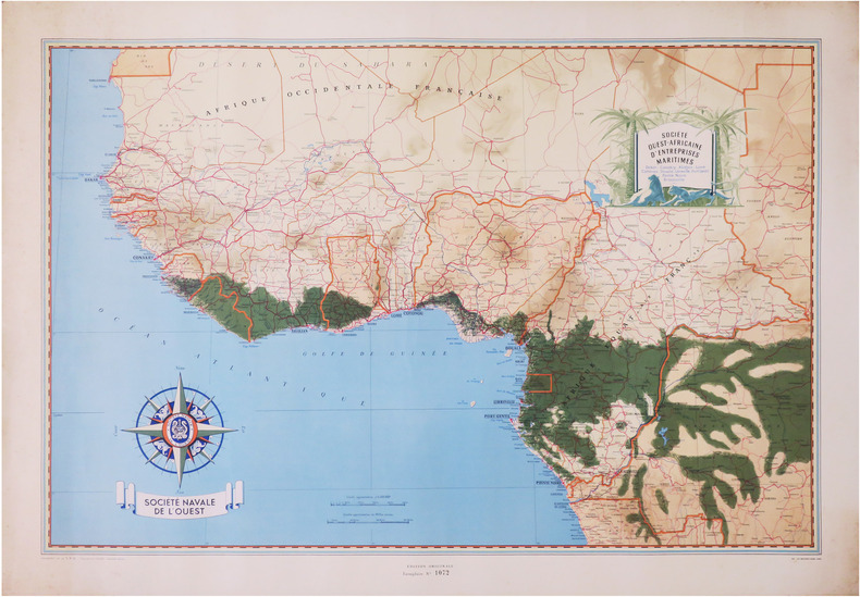
1950ref. LBW-8669Paris, Société Navale de l'Ouest, [vers 1950]. 650 x 960 mm.
1956ref. pl199-94Dryden Press 1956. Hardcover. Used - Very Good. Year: 1956. Publisher: Dryden Press. This preowned item is in very good condition with very minimal wear and tear visible ex. Corner dings small tears/rips bent pages scuffs/scratches etc. Additional materials such as CD's and access codes may or may not be included. If the book has a dust jacket it may not be included. Free tracking provided. International shipping available. Dryden Press hardcover
1969No marks or inscriptions. No creasing to covers or to slightly arched spine. A very clean very tight copy with bright unmarked boards and no bumping to corners. 107pp. Illustrated.
ref. 1851374728.Gmap. Good. Access codes and supplements are not guaranteed with used items. May be an ex-library book. unknown
1969Very light wear to covers. eng
1881ref. 74181Washington DC: U. S. Congress. Very Good. 1881. Pamphlet. Snake Upper Red and Minnesota Rivers Minnesota; Reservoirs at sources of Rock River Wisconsin and Illinois. Letter from the Secretary of War transmitting surveys .United States. War Department. 1881. 16 pages maps 2 folded ; 23 cm. Washington Govt. Print. Off. 1881. Disbound Pamphlet. The contents are nice and the 2 folding maps are bright and clean. . U. S. Congress unknown books
1881ref. 74181Washington DC: U. S. Congress. Very Good. 1881. Pamphlet. Snake Upper Red and Minnesota Rivers Minnesota; Reservoirs at sources of Rock River Wisconsin and Illinois. Letter from the Secretary of War transmitting surveys .United States. War Department. 1881. 16 pages maps 2 folded ; 23 cm. Washington Govt. Print. Off. 1881. Disbound Pamphlet. The contents are nice and the 2 folding maps are bright and clean. . U. S. Congress unknown
2014ref. R300323394Bibliothèque de l'image. 2014. In-8. Relié. Bon état, Couv. convenable, Dos satisfaisant, Intérieur frais. 187 pages - nombreuses photos en noir et blanc et en couleurs hors texte. Jaquette légèrement passée et déchirée en coiffe de pied.. Avec Jaquette. . . Classification Dewey : 741.68-Illustrations des cartes postales
1986No marks or inscriptions. No creasing to covers or to spine. A lovely clean very tight copy with bright unmarked covers and no bumping to corners. 256pp.
1764(København, 1764). Kobberstukket prospekt af Slangerup. (17x25 cm.). Fint frisk eksemplar trykt på skrivepapir.
1764(København, 1764). Kobberstukket prospekt af Slangerup. (17x24,5 cm.). Stukket af J. Haas. På skrivepapir. Lidt marginale brunpletter.