12.245 resultados
1862ref. 2109160014D Appleton and Company 1862. Hardcover. Good. 1962 printing. Bound in publisher's cloth. Hardcover. Shelf wear. Spine ends chipped with loss. Some folded maps torn. D Appleton and Company hardcover
1961ref. 103929S. l. [Paris] s.n. 1961 1 vol. broché 1 feuillet in-4 imprimé en noir sur papier rose. Tract-manifeste pour l'unique numéro de Sédition (octobre 1961), revue née de la rencontre de militants du trotskisme (Bernard Pêcheur, Marc Gauthier), de l’ultra-gauche (Louis Janover, Grandizo Munis) et du surréalisme (Gérard Legrand). Document provenant de la bibliothèque de Georges Bataille avec tampon à l'encre noire "Bibliothèque de Georges Bataille".
ref. SLIVCN-3770007879875KEROZENN
ref. ING9781566958325Natl Geographic Society Maps. New. Special order direct from the distributor Natl Geographic Society Maps unknown
2025ref. DADAX1566958385National Geographic 2025-11-05. 2025. map. New. 4.50x0.30x10.30. Buy with confidence. Excellent Customer Service & Return policy. National Geographic unknown
2019ref. 1-1566958326Natl Geographic Society Maps 2019. Paperback. New. fol map edition. 568 pages. 9.50x4.75x1.00 inches. Natl Geographic Society Maps paperback
ref. 1566958326.Gmap. Good. Access codes and supplements are not guaranteed with used items. May be an ex-library book. unknown
2025ref. DADAX1566958326National Geographic 2025-11-01. 2025. map. New. 4.25x3.00x9.25. Buy with confidence. Excellent Customer Service & Return policy. National Geographic unknown
ref. 1566958385.Gmap. Good. Access codes and supplements are not guaranteed with used items. May be an ex-library book. unknown
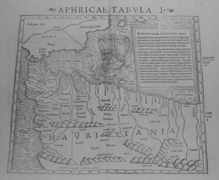
1552ref. LBW01b4b[Bâle, 1552]. 268 x 333 mm.
ref. 23331Tongres, Société scientifique et littéraire du Limbourg, 1911. 15 x 23, 81 pp., broché, état moyen (couverture déchirée avec plusieurs manques, cachets du Collège jésuite Saint Stanislas à Mons, quelques pages salies).
1840ref. 10343Paris, Fortin, Masson et Cie, 1840. 2 volumes in-8 de [4]-360-[2]-6 (catalogue) et [8]-570-[2] pages, demi-chagrin noir, dos à 4 petits nerfs avec titre et tomaison dorés et encadrements à froid, tranches mouchetées. Reliure un peu frottée, rares rousseurs, tampon répété aux pages de titre et sur ff. vierges.
19361 feuille repli?e 109,5 x 50 cm.
ref. 3579Museum Plantin-Moretus/Prentenkabinet, Antwerpen, 2015. In-12, format à l'italienne, cartonnage éditeur illustré en couleur, 112 pp. Anvers imaginé. L'âge d'or en cartes et en estampes - Préface. - La ville d'Anvers dans son évolution cartographique, par Piet Lombaerde. - Anvers imaginé. L'âge d'or en cartes et en estampes, par Katelijne Geerts - Planches.
México, Asociación Nacional Automovilística, 1947. 4to. mayor; 416 pp. Edición bilingüe, español-inglés, impresa a doble columna. Numerosas ilustraciones y anuncios entre el texto y 18 mapas plegados fuera de texto. Cubiertas originales.
ref. 68661new york, ellis island immigration museum, 16 postcards and folded poster/booklet in cardboard case, 21 x 16 cm, EN. *prima staat.
1853ref. 57412(Hamburg, 1853). Zus. 332 S. Mit 1 gefalt. Plan. u. Tab. Gr.-8vo. Neuer Pp. mit mont. RSch.
Engraved map (73 x 52 cm), hand-coloured in outline. This finely engraved map, published in Vaugondy’s “Atlas Universel”, extends to the Caspian Sea in the north, in the west to show Greece, east to the Indus River, and south to include the Red Sea and the Nile River valley. Almost the whole of Arabia is blank and unexplored, but parts of Oman and the cities and places along the Arabian Gulf are indicated. In good condition. National Maritime Museum Cat. I, 317. Al Ankary 185.
1874pp. 541, (3) [Publisher's catalogue] + Color lithograph folding map of Jerusalem and Color lithograph Frontis + Ninety full page engravings. Map has 1 1/2" tear in left margin with no loss. Some engravings have dampstaining in margins. Text elaborately ruled throughout. Lacks front and rear marbled fly leaves. 225mm. Front board detached. Spine very worn. Virtually disbound. This perhaps should best be considered a candidate for rebinding. **PRICE JUST REDUCED! HOLY LAND BX 1
1600Pianta archeologica a proiezione verticale con alzato, priva di data ed indicazioni editoriali. Si tratta di una fedele replica della pianta archeologica pubblicata da Nicolas van Aelst ed incisa da Ambrogio Brambilla, probabilmente edita a Roma tra la fine del ’500 e l’inizio del secolo successivo. Caldana sottolinea che “l’anonimo incisore è bravo quasi quanto l’autore dell’originale, le differenze sono minime, salvo le misure che nella copia sono leggermente inferiori; imitata persino la calligrafia dei toponimi meno che per alcuni, scritti in lettere maiuscole”. Dal punto di vista editoriale, l’esistenza di un esemplare con l’imprint di Gian Giacomo de Rossi, descritto da Hülsen (1933) nella raccolta del castello di Wolfegg, certifica che il rame fosse in possesso della tipografia romana. Sempre Caldana sostiene, ma senza fondamento, che la pianta fu fatta incidere da Giuseppe de Rossi nel 1637, in occasione della ristampa della pianta di Roma moderna. Crediamo invece che il rame sia più antico e che, come per molte lastre del secolo precedente, solo successivamente venga acquisito dalla tipografia de Rossi. In alto, lungo il bordo superiore, è inciso il titolo: ANTIQUAE URBIS PERFECTA ET NOVA DELINEATIO. Lungo il margine inferiore si trova una legenda numerica di 90 rimandi a luoghi e monumenti notabili distribuita, su quindici colonne. Orientazione nei quattro lati al centro con il nome dei punti cardinali: SEPTENTRIO, MERIDIES, OCCIDENS, ORIENS il nord è a sinistra. Nella tavola sono presenti ulteriori indicazioni toponomastiche. Acquaforte e bulino, privo di indicazioni editoriali. Esemplare nel primo stato di due, avanti l'indirizzo di De Rossi. Magnifico esemplare di questa rara pianta archeologica di Roma. In perfetto stato di conservazione. Bibliografia Bifolco-Ronca, Cartografia e topografia italiana del XVI secolo, p. 2368, tav. 1217, I/II; Caldana (2013): n. I.28; Hülsen (1915): pp. 55-56, VIIIc, n. 41; Hülsen (1933): p. 106, VIIIc, n. 41a; Scaccia Scarafoni (1939): p. 28, n. 24. Archaeological map with vertical projection with elevation, without date and printing details. It is a faithful replica of the map published by Nicolas van Aelst and engraved by Ambrogio Brambilla, probably published in Rome between the end of the 16th century and the beginning of the following century. Caldana underlines that "the anonymous engraver is almost as good as the author of the original, the differences are minimal, except for the measurements that in the copy are slightly smaller; even the calligraphy of the place names is imitated, less so for some, written in capital letters". From the editorial point of view, the existence of a copy with the imprint of Gian Giacomo de Rossi, described by Hülsen (1933) in the collection of Wolfegg Castle, certifies that the copper was in the possession of the Roman printing house. Caldana also maintains, but without foundation, that the map was engraved by Giuseppe de Rossi in 1637, on the occasion of the reprinting of the modern Rome map. We believe instead that the copper is older and that, as for many plates of the previous century, it was only later acquired by de Rossi's printing house. At the top, along the upper edge, is engraved the title: ANTIQUAE URBIS PERFECTA ET NOVA DELINEATIO. Along the lower margin there is a numerical legend of 90 references to notable places and monuments distributed on fifteen columns. Orientation on the four sides in the centre with the name of the cardinal points: SEPTENTRIO, MERIDIES, OCCIDENS, ORIENS the north is on the left. In the map there are further toponymic indications. Etching and engraving; exemple in the first state of two, before the De Rossi's address. Magnificent example of this rare archaeological map of Rome. In perfect state of conservation. Literature Bifolco-Ronca, Cartografia e topografia italiana del XVI secolo, p. 2368, tav. 1217, I/II; Caldana (2013): n. I.28; Hülsen (1915): pp. 55-56, VIIIc, n. 41; Hülsen (1933): p. 106, VIIIc, n. 41a; Scaccia Scarafoni (1939): p. 28, n. 24.
1657Grande pianta della città stampata su due fogli, ispirata alla celebre carta del Pirro Ligorio del 1561.Questa straordinaria ricostruzione di Roma durante il regno di Augusto, arricchita da una cospicua legenda con 269 richiami, costituisce il lavorò più ambizioso contenuto nel Civitates Orbis Terrarum, del quale oltretutto è una delle sole tre mappe a doppio foglio. Incisione in rame, finemente colorata a mano, in eccellente stato di conservazione. Opera tratta dal "Theatrum praecipuarum urbium" celebre teatro delle città del Janssonius, sullo stile del "Civitates Orbis Terrarum" di Braun & Hogenberg. La raccolta, pubblicata ad Amsterdam tra il 1652 ed il 1657, contiene 500 tavole raffiguranti città di ogni parte del mondo. Contrariamente al lavoro degli acerrimi rivali Blaeu, Janssonius si servì per la realizzazione dell'opera delle lastre di precedenti cartografi ed editori. In particolare nel 1653 egli acquisto da Abraham Hogenberg le lastre del "Civitates orbis Terrarum" che incorporò nella sua opera, ristampandole, con alcune modifiche. Per le piante delle città olandesi, ordinò delle nuove lastre basate sull'atlante che Johannes Blaeu diede alla luce nel 1649. Per molte delle opere contenute nel 5° volume, quello dedicato all'Italia e denominato "Theatrum celebriorum urbium Italiae..", si servì delle lastre realizzate da Jodocus Hondius per l'opera "Italia Hodierna.." del 1627. Nella pianta di Roma antica cambia il decoro del cartiglio in alto, mentre in basso ai lati del cartiglio sono aggiunte dei personaggi. Incisione in rame, finemente colorata a mano, in ottimo stato di conservazione. Map of the city printed on two sheets, inspired by the famous work by Pirro Ligorio, printed by Michele Tramezzino in 1561. This extraordinary reconstruction of Rome during the reign of Augustus, enriched by a conspicuous legend with 269 references, constitutes the most ambitious work contained in the Civitates Orbis Terrarum, of which it is one of only three double-sheet maps. Work taken from the "Theatrum praecipuarum urbium" famous theatre of the cities of Janssonius, in the style of Braun & Hogenberg's "Civitates Orbis Terrarum". The collection, published in Amsterdam between 1652 and 1657, contains 500 plates depicting cities from all over the world. Janssonius used the plates of previous cartographers and publishers to create the work. In particular, in 1653 he bought the plates of the "Civitates orbis Terrarum" from Abraham Hogenberg, who incorporated them into his work and reprinted them with some modifications. For many of the works contained in the 5th volume, the one dedicated to Italy and called "Theatrum celebriorum urbium Italiae...", he used the plates made by Jodocus Hondius for the work "Italia Hodierna..." of 1627. In the map of ancient Rome the decoration of the cartouche at the top changes, while at the bottom at the sides of the cartouche are added characters. Copper engraving, finely coloured by hand, in excellent condition.
1588Grande pianta della città stampata su due fogli, ispirata alla celebre carta del Pirro Ligorio, tratta dal Civitates Orbis Terrarum. Questa straordinaria ricostruzione di Roma durante il regno di Augusto, arricchita da una cospicua legenda con 269 richiami, costituisce il lavorò più ambizioso contenuto nel Civitates Orbis Terrarum, del quale oltretutto è una delle sole tre mappe a doppio foglio. L’opera è inserita nel Civitates Orbis Terrarum, il primo atlante devoto esclusivamente alle piante e vedute delle principali città del mondo. Il primo volume delle Civitates Orbis Terrarum fu pubblicato a Colonia nel 1572. Il sesto e ultimo volume apparve nel 1617. Questo grande atlante di città – cartografia urbana - curato da Georg Braun e inciso in gran parte da Franz Hogenberg, conteneva 546 prospettive, vedute a volo d'uccello e vedute cartografiche di città di tutto il mondo. Franz Hogenberg realizzò le tavole dei primi quattro volumi e Simon van den Neuwel (Novellanus, attivo dal 1580) quelle dei volumi V e VI. Georg Braun (1541-1622), un ecclesiastico di Colonia, fu il principale redattore dell'opera e fu molto aiutato nel suo progetto dalla vicinanza e dal continuo interesse di Abraham Ortelius, il cui Theatrum Orbis Terrarum del 1570 fu, come raccolta sistematica e completa di mappe di stile uniforme, il primo vero atlante. Le Civitates, in effetti, erano destinate ad accompagnare il Theatrum, come indicato dalla somiglianza dei titoli e dai riferimenti contemporanei sulla natura complementare delle due opere. Tuttavia, le Civitates erano progettate per avere un approccio più popolare, senza dubbio perché la novità di una raccolta di piante e vedute di città rappresentava un'impresa commerciale più rischiosa di un atlante mondiale, per il quale c'erano stati diversi precedenti di successo. Franz Hogenberg (1535-1590) era figlio di un incisore di Monaco che si era stabilito a Malines. Incise la maggior parte delle tavole del Theatrum di Ortelius e la maggior parte di quelle delle Civitates, e potrebbe essere anche indicato come il responsabile dell'origine del progetto. Oltre un centinaio di artisti e cartografi diversi, il più importante dei quali fu l'artista di Anversa Georg Hoefnagel (1542-1600), fornirono i disegni per le tavole delle Civitates. Hoefnagel non solo contribuì alla maggior parte del materiale originale per le città spagnole e italiane, ma rielaborò e modificò anche quello di altri collaboratori. Dopo la morte di Hoefnagel, il figlio Jakob continuò il lavoro per le Civitates. Gli autori della raccolta si proponevano di raffigurare "non icones et typi urbium", cioè non immagini generiche e tipizzate, "sed urbes ipsae admirabili caelaturae artificio, spectantium oculis subiectae appareant": non intendeva alludere o idealizzare, ma rappresentare fedelmente sulla carta, riprodurre esattamente, e in tempo reale, ciò che l'occhio vede, come annunciato nella prefazione al primo volume delle Civitates Orbis Terrarum. Incisione in rame, bella coloritura coeva, leggeri restauri perfettamente eseguiti per il resto in buono stato di conservazione. A good example, with fine original colour, of the Braun & Hogenberg Plan of Rome, first published in the 1588 edition of the Civitates Orbis Terrarum.Braun & Hogenberg's view is based upon the work of Pirro Ligorio. However, the title banner and lower key embellishments are completely revised, the former lacking the strapwork used by Braun & Hogenberg and replaced with a tapestry style fringe, while the lower key is now embellished with images of two nobles.Rome is shown from the west in a bird's-eye view that was a major achievement in its day. It includes the most important buildings from antiquity, several aqueducts, the Aurelian Wall and large arterial streets. The three figures in Roman garb in the foreground underscore the aim of meticulous reconstruction.Mont Testaccio is shown on the far side of the Tiber in the lower right-hand edge of the picture, with the Pyramid of Cestius above it to the right. At the center of the illustration the Marcellus Theatre can be identified above the island in the Tiber, with the vast Circus Maximus, used for chariot races, just above it to the right. Above that is the Palatine represented with intricately detailed buildings, an indication of the confusion at the time about how the seat of imperial power actually looked.To the north the Coliseum flanks the Palatine. In the lower left-hand part of the picture field is the Campus Martius, with the stadium of Domitian at the center, site of the modern Piazza Navona. Slightly higher up is the Pantheon with its monumental dome, looking as it does today. On the lower left edge the two great imperial mausoleums are shown as they would have appeared during the Roman epoch. Above the mausoleum of Augustus and below, at the bend in the river, is that of Hadrian.In the lower left-hand corner, the Mons Vaticanus with the Circus built by Caligua and a Neronian palace are recognizable outside the city. The baths of Diocletan dominate the northeastern part of the city. The Castra Praetoria, the barracks of the Praetorian Guard, is shown below the city walls in the upper left-hand corner. The work is included in the Civitates Orbis Terrarum, the first atlas devoted exclusively to plans and views of the world's major cities. Printed in six volumes between 1572 and 1617 it was so successful and widespread that several editions translated into Latin, German and French were printed. The first volume of the Civitates Orbis Terrarum was published in Cologne in 1572. The sixth and the final volume appeared in 1617. This great city atlas, edited by Georg Braun and largely engraved by Franz Hogenberg, eventually contained 546 prospects, bird-eye views and map views of cities from all over the world. Fransz Hogenberg produced the plates for the first four books, and Simon van den Neuwel (Novellanus, active since 1580) those for volumes V and VI. Georg Braun (1541-1622), a cleric of Cologne, was the principal editor of the work, and was greatly assisted in his project by the close, and continued interest of Abraham Ortelius, whose Theatrum Orbis Terrarum of 1570 was, as a systematic and comprehensive collection of maps of uniform style, the first true atlas. The Civitates, indeed, was intended as a companion for the Theatrum, as indicated by the similarity in the titles and by contemporary references regarding the complementary nature of two works. Nevertheless, the Civitates was designs to be more popular in approach, no doubt because the novelty of a collection of city plans and views represented a more hazardous commercial undertaking than a world atlas, for which there had been a number of successful precedents. Franz Hogenberg (1535-1590) was the son of a Munich engraves who settled in Malines. He engraved most of the plates for Ortelius's Theatrum and the majority of those in the Civitates, and may have been responsible for originating the project. Over a hundred of different artists and cartographers, the most significant of w... Fauser, A. 11932; Huelsen (1915) n. 38; Caldana, Roma Antica, p. 84, n. I.17.
1873ref. 9509Paris 1873. French naval chart sheet 3273 sheet size 105.5 x 72 cm engraved by Nyon black and white centrefold one or two marginal nicks and tears blank verso. This detailed chart of Grenada was derived from British Admiralty surveys. Map unknown
1873ref. 9508Paris 1873. French naval chart sheet 3256 sheet size 72.5 x 105 cm engraved by Delamare black and white with coastal profiles in the lower part of the chart centrefold one or two marginal nicks and tears blank verso. This detailed chart of Isla Culebra now an island-municipality of Puerto Rico was derived from British Admiralty surveys. With no permmanent population for centuries the island was settled by the Spanish in the 1880s and ceded to the United States after the Spanish-American War. Map unknown