Crosher, G.R.MareMagnum

12.228 resultados
1973Ex-library copy with usual (minimal) marks and stamps. A very clean very tight copy with bright unmarked boards, upper corner of front end paper clipped and no bumping to corners. Dust jacket not price clipped or marked or torn with minor traces of handling. 178pp. A study of the areas around the Icknield Ways, the two ancient green lanes that run from Goring on the Thames to beyond Royston at the edge of East Anglia.
1688Rarissimo almanacco per l'anno bisestile del 1688 di Vincenzo Maria Coronelli. L'opera è dedicata all'Abate Rezzonico, il cui ritratto è in alto a sinistra. Membro di una nota famiglia comasca, eletto governatore dello Stato Pontificio, nel 1687 assunse anche il titolo di patrizio della Serenissima. Per ogni giorno dell'anno sono ricordati gli eventi più importanti legati alla storia della Republica di Venezia.Il calendario è circondato da una bella cornice ornamentale incisa, nel tipico stile del Coronelli, dove entro delle monete sono raffigurate le piante di 24 città della Grecia, sotto il controllo di Venezia.L'opera, una separata pubblicazione, si vendeva presso la bottega dell'editore Domenico Padoani, situata a Rialto.Coronelli aveva già realizzato un calendario simile nel 1666. L'opera è assai rara e ne abbiamo riscontrato un solo esemplare conservato alla Marciana di Venezia.Incisione in rame, in ottimo stato di conservazione. Extremely rare almanac for the year 1688 by Vincenzo Maria Coronelli. The work is dedicated to Abbot Rezzonico, whose portrait is in the upper left. Member of a famous family of Como, was elected governor of the Papal States, in 1687 he also assumed the title of patrician of Venice. This almanac, for each day of the year, remember the most important events related to the history of the Republic of Venice. The calendar is surrounded by a beautiful ornamental engraved frame, in the typical style of the Coronelli, where the coins are represented by plants of 24 cities of Greece, mostly in Morea, under the control of Venice. The work, a separate publication, was published by the workshop of Domenico Padoani, in Rialto. Coronelli had already made a similar work in 1666. The almanac is very rare and we have found only one example preserved in the Marciana of Venice. Copper engraving, in excellent condition.
1770ref. 16440Paris, Desnos, 1770. Petit in-12 de [12]-XXVIII-[12]-143-[1], plein maroquin grenat, dos lisse orné de de fleurons et roulettes dorés, pièce de titre verte foncée, triple filet doré en encadrement des plats, filet doré sur les coupes et roulette dorée sur les chasses, tranches dorées.
1943ref. 144341943. Archive of nine large original World War II maps used by a United States Army soldier in the European Theater of Operations during the Allied liberation of Western Europe. Lithographed military maps variously issued by U.S. Army and War Office agencies 1943-1944. Large formats ranging from approximately 19" x 24" to 42" x 34". These maps document the cartographic infrastructure of Allied ground and air operations in the climactic campaigns of 1944-1945. The German sheets-many designated for "Army/Air" or restricted War and Navy Department use-reflect the intensive aerial reconnaissance bombing coordination and mechanized advance into the industrial and administrative heartland of the Third Reich. Cities such as Berlin Magdeburg Kassel and Düsseldorf were central to armaments production rail networks and military command making accurate and rapidly updated mapping indispensable. The Paris map corresponds to the Allied advance culminating in the Liberation of Paris in August 1944 marking the symbolic reclamation of a major European capital from Nazi control. Several sheets note reliance on prewar German cartography 1938 editions supplemented by wartime intelligence underscoring how Allied forces repurposed and revised enemy geographic data for invasion and occupation planning. Crucially these maps also capture a political geography that was almost immediately transformed by postwar settlement and Soviet expansion into Central and Eastern Europe. Within two years of their issue Germany was divided into occupation zones and by 1949 into separate states aligned with Western and Soviet blocs. Cities such as Berlin Halle Saale Magdeburg and Wernigerode fell within the Soviet zone and subsequently the German Democratic Republic fundamentally altering administrative boundaries transportation networks and the ideological framing of space. Cartographic production in these regions shifted accordingly with new editions reflecting socialist state structures and restricted internal mapping policies characteristic of the emerging Eastern Bloc. Thus these 1943-1944 sheets preserve a transitional moment: Nazi Germany still territorially intact on paper yet already subjected to Allied military penetration and poised on the brink of partition. As artifacts carried by an American soldier they embody both the tactical prosecution of total war and the immediate redrawing of Europe into Cold War spheres of influence. The archive includes operational maps of Magdeburg Sheet M.53 1:250000 "First Edition" 1943 with manuscript annotation Kassel Sheet L52 "Emergency Road Map" First Edition color based on 1938 mapping with wartime intelligence updates Düsseldorf Sheet K52 similar issue with fading highlighting and manuscript marks Hanover Sheet L53 1943 Berlin Sheet N53 "Army/Air" 1943 Halle Saale Sheet M52 marked "War and Navy Department Agencies only. Not for sale or distribution" 1943 Wernigerode Sheet 4130 First Edition War Office 1944 Jülich G.S.G.S. No. 4507 War Office 1944 35" x 30" and a large U.S.-issued map of Paris 42" x 34" 1944. All were retained by the soldier following his service. Very good overall with expected wartime folds and handling; several sheets with manuscript annotations highlighting fading or moderate water exposure notably Wernigerode stiffened from dampness; no major losses observed. A substantial and research-rich archive of original Allied operational maps materially linking frontline navigation aerial bombardment liberation campaigns and the swift geopolitical reconfiguration of Germany and Europe under the expanding Soviet Eastern Bloc. unknown books
1943ref. 144341943. Archive of nine large original World War II maps used by a United States Army soldier in the European Theater of Operations during the Allied liberation of Western Europe. Lithographed military maps variously issued by U.S. Army and War Office agencies 1943-1944. Large formats ranging from approximately 19" x 24" to 42" x 34". These maps document the cartographic infrastructure of Allied ground and air operations in the climactic campaigns of 1944-1945. The German sheets-many designated for "Army/Air" or restricted War and Navy Department use-reflect the intensive aerial reconnaissance bombing coordination and mechanized advance into the industrial and administrative heartland of the Third Reich. Cities such as Berlin Magdeburg Kassel and Düsseldorf were central to armaments production rail networks and military command making accurate and rapidly updated mapping indispensable. The Paris map corresponds to the Allied advance culminating in the Liberation of Paris in August 1944 marking the symbolic reclamation of a major European capital from Nazi control. Several sheets note reliance on prewar German cartography 1938 editions supplemented by wartime intelligence underscoring how Allied forces repurposed and revised enemy geographic data for invasion and occupation planning. Crucially these maps also capture a political geography that was almost immediately transformed by postwar settlement and Soviet expansion into Central and Eastern Europe. Within two years of their issue Germany was divided into occupation zones and by 1949 into separate states aligned with Western and Soviet blocs. Cities such as Berlin Halle Saale Magdeburg and Wernigerode fell within the Soviet zone and subsequently the German Democratic Republic fundamentally altering administrative boundaries transportation networks and the ideological framing of space. Cartographic production in these regions shifted accordingly with new editions reflecting socialist state structures and restricted internal mapping policies characteristic of the emerging Eastern Bloc. Thus these 1943-1944 sheets preserve a transitional moment: Nazi Germany still territorially intact on paper yet already subjected to Allied military penetration and poised on the brink of partition. As artifacts carried by an American soldier they embody both the tactical prosecution of total war and the immediate redrawing of Europe into Cold War spheres of influence. The archive includes operational maps of Magdeburg Sheet M.53 1:250000 "First Edition" 1943 with manuscript annotation Kassel Sheet L52 "Emergency Road Map" First Edition color based on 1938 mapping with wartime intelligence updates Düsseldorf Sheet K52 similar issue with fading highlighting and manuscript marks Hanover Sheet L53 1943 Berlin Sheet N53 "Army/Air" 1943 Halle Saale Sheet M52 marked "War and Navy Department Agencies only. Not for sale or distribution" 1943 Wernigerode Sheet 4130 First Edition War Office 1944 Jülich G.S.G.S. No. 4507 War Office 1944 35" x 30" and a large U.S.-issued map of Paris 42" x 34" 1944. All were retained by the soldier following his service. Very good overall with expected wartime folds and handling; several sheets with manuscript annotations highlighting fading or moderate water exposure notably Wernigerode stiffened from dampness; no major losses observed. A substantial and research-rich archive of original Allied operational maps materially linking frontline navigation aerial bombardment liberation campaigns and the swift geopolitical reconfiguration of Germany and Europe under the expanding Soviet Eastern Bloc. unknown
1968251 pages. Index of names. Bibliography. Maps. "Almost 50 years after the event, the Alliled intervention in Russia following the Bolshevik seizure of power in 1917 remains a conroversial issue. For that reason, and because so much government documentary material has remained inaccessible, it has been badly neglected by professional historians... Provides a wealth of completely new material... The obscure beginnings of the intervention, November 1917 to August 1918, are thoroughly explained, and the role of Japan and Czechoslovakia Corps in the military strategy of the Allies is examined." - from dust jacket. Usual library markings. Above-average wear. Front hinge open. Reading copy only. Book
1410 x 1755 mm. Grenzkolorierte Kupferstichkarte in 9 Blättern, Maßstab ca. 1:900.000. Jedes Blatt in 12 Segmenten auf Leinen aufgezogen. Blatt 9 mit dem Plan "Wien mit seinen Umgebungen". Gefaltet in zeitgenöss. marmoriertem Umschlag und Originalschuber des Verlags mit goldgepr. Rückenschildchen "Kaiserthum Oesterreich". Letzte Auflage dieser ausgezeichneten, erstmals 1809 erschienenen monumentalen Gesamtkarte der Habsburgermonarchie - der "bis dahin weitaus größte[n] gedruckte[n] Karte der Österreichischen Monarchie" (Austria Picta). In dieser Auflage neu dargestellt sind die "im Münchner Vertrag festgelegten Grenzen zwischen Bayern und Österreich" (Dörflinger, S. 607). In ihrem grundlegenden Umfang noch 1805 entworfen, wurde die Karte vom Pressburger Frieden am 26. Dezember 1805 und dann von einem langen Streit zwischen Kartograph und Verlag überholt, sodass die neun Blätter "jenen Raum dar[stellen], der bis Dezember 1805 zur Österreichischen Monarchie gehörte - also auch Tirol und Vorarlberg, Venetien und Dalmatien sowie die Vorlande, wobei sich diese Territorien noch zusätzlich durch ihre dichte Topographie von den angrenzenden nicht-österreichischen Gebieten optisch deutlich abheben [...] Von ganz ausgezeichneter Qualität [ist] der Stich von Joseph Stöber, der die stellenweise Überfüllung mit Einzelheiten weitgehend mildert. Den Großteil von Blatt 9 nimmt die Nebenkarte 'Wien mit seinen Umgebungen' (Maßstab ca. 1:90.000) ein, die das Gebiet zwischen Korneuburg und Vöslau/Ebreichsdorf bzw. zwischen Langenlebarn/Breitenfurt und Fischamend/Ebergassing - also vor allem den südlichen und südöstlichen Teil des Umlandes von Wien - abbildet" (ebda., S. 605f.). - Umschlag und Schuber gering berieben. Vereinzelt kleine Randläsuren an den einzelnen Segmenten. Insgesamt wohlerhalten. Dörflinger 603ff., KIC 31. Vgl. Austria Picta 34.4 (Aufl. von 1811).
1945Feuille repli?e.
1838Paris, Delamarche, 1838; 336/475 mm, 1 pp., une valeur. Carte provenant d'un atlas du 19ème siècle. Bon état.
1960Cartonn?e 126x92 cm. Repli?e.
1989Very faint marking to title page. No other marks or inscriptions. Creasing and minor rubbing to covers. Very clean very tight pages. 128pp. History and tourist guide to Tunisia, very well illustrated.
1975No marks or inscriptions. A very clean very tight copy with unmarked black cloth boards and no bumping to corners. Dust jacket not price clipped or marked with small repaired tears to upper edge and slight rubbing/creasing to both edges. Extremely scarce in the UK. 243pp. A sightseeing study through New York's five boroughs highlighting the best known and most interesting of a great public art - the outdoor statue, through West Side, Madison Square, Central Park, Manhattan, Staten Island, Greenwich, Brooklyn, the Bronx and Queens.
1813ref. 4796Nuremberg, bey Christoph Fembo, 1813. 1 carte coloriée et repliée de 50 x 60 cm.
1838ref. A83Paris, Delamarche, 1838 ; 336/475 mm, 1 pp., une valeur. Carte provenant d'un atlas du 19ème siècle. Bon état.
ref. P24636Carte routière : Allemagne Centre-Ouest, N° 417
ref. SLIVCN-9782896428403CARACTERE EDITIONS (CA)
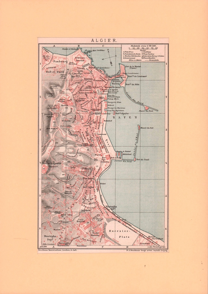
1899ref. 26541Leipzig, F. A. Brockhaus, 1899. Ca. 21,5 x 13,5 cm.
2001No marks or inscriptions. A very clean very tight copy with bright unmarked boards and no bumping to corners. Dust jacket not price clipped or marked or torn or creased with very minor traces of storage. 79pp. Lavish photographs in promotional tourist guide to the Algarve region of Portugal.
1890ref. LBW-8652Paris, [1890]. 198 x 258 mm.
41,5 x 53 cm. (Blatt: 49 x 60 cm). *Aus der lateinischen Ausgabe des Altlas von W. Blaeu "Theatrum Orbis Terrarum". Die nicht genordete, sondern nach Westen ausgerichtete Karte, zeigt das Gebiet von Oberschwaben mit dem Bodensee mit den Allgäuer und Vorarlberger Alpen linksseitig und der Donau im rechten Drittel des Blattes. - Sauber und sehr gut erhalten. Landkarten de
1552ref. 243961552 Ex-libris (sérigraphie) au format 15,5 x 22 cm. Microscopiques frottements en coins.
ref. LBW03d73Paris Benard circa 1850 225 x 293 mm.
1887ref. 2210070050NY: John B. Alden Publisher 1887 1887-01-01. Hardcover. Very Good. Bound in publisher's cloth. Hardcover. No dust jacket. Good binding and cover. Clean unmarked pages. 191 pages : color illustrations color maps ; 16 cm. "including one hundred and thirty-eight colored maps diagrams tables etc NY: John B. Alden, Publisher, 1887 hardcover
1970ref. 2433190324008Colonial Dames of America 1970-01-01. Hardcover. Very Good. Signed by Author. Nice looking book has minor edge wear. Colonial Dames of America hardcover
ref. 2280Ed. de la Marque, no 2 - s.d. - in-16o (à l'italienne) : 4 pp. de texte + 12 cartes sous pap. protecteur - couv. décollée.