STANFORD (Edward).Livre Rare Book
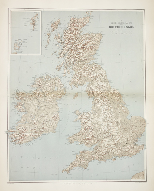
12.070 resultados
1896ref. LBW-2864London, Edward Stanford, [1896]. 605 x 478 mm.
1994No marks or inscriptions. No creasing to covers. A very clean very tight copy with bright unmarked boards, very minor traces of storage and no bumping to corners. 57pp. A mainly illustrated tribute to the beauty and diversity of the Australian city of Sydney.
ref. 0195620410.Ghardcover. Good. Access codes and supplements are not guaranteed with used items. May be an ex-library book. hardcover
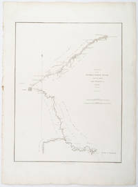
1796ref. 209283London.: George Nicol. 1796. Engraved copperplate map on Whatman paper 43.8 x 33.6 cm; 57 x 42 cm sheet including plate markscale in nautical and English miles; light undulation to sheet marginal toning and edgewear but in very good condition. Finely engraved and detailed map of two routes to Pekin Beijing along the White River Baihe from the Gulf of Petcheli and along the Imperial Highway from Jehol and includes commentary locating palaces and gardens type of cultivation "many barges" and "the road shaded by willow trees". The map elegantly drawn by Henry William Parish was published in George Staunton's account of Earl Macartney's embassy to China 1792-1794. . George Nicol. unknown
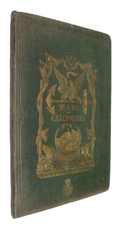
1851Washington, Jno. T. Towers, 1851. 4to. In publishers original full pictoral green cloth. Front and back board with embossed title and ornamentation, showing an eagle holding a banner and anchor beneath whom Columbia sits holding the shield of California with a bear asleep at her feet. Front board in gold. Lower front board with gilt stamp. Stamp to front free end-paper and title-page. Light wear to extremities and internally with light occassional miscolouring. 44. pp. + 11 lithographic plates including frontispiece and 6 folding maps.
1851ref. 53713Washington, Jno. T. Towers, 1851. 4to. In publishers original full pictoral green cloth. Front and back board with embossed title and ornamentation, showing an eagle holding a banner and anchor beneath whom Columbia sits holding the shield of California with a bear asleep at her feet. Front board in gold. Lower front board with gilt stamp. Stamp to front free end-paper and title-page. Light wear to extremities and internally with light occassional miscolouring. 44. pp. + 11 lithographic plates including frontispiece and 6 folding maps.
ref. 0366016326.Gpaperback. Good. Access codes and supplements are not guaranteed with used items. May be an ex-library book. paperback
1929pp. cvi, 596, (24)[Advertisements] + numerous large folding maps. Endpapers advertising Thos. Cook & Sons Travel Organization. Discrete stamped ownership of Mrs. Alvin F. Fix, York, Pa. on title page and elsewhere. Mr. Fix was a PA Democrat. Delegate to Democratic National Convention from Pennsylvania, 1936. 12mo. Original full red cloth binding. Hardbound. Nice copy. TRAVEL/1
1928pp. cvi, 596, (32)[Advertisements] + numerous large folding maps. Endpapers advertising Thos. Cook & Sons Travel Organization. Inked ownership of Helen M. Hafer, Hanover, PA. Paris bookseller's label. 12mo. Original full red cloth binding, lettered in gold. Original dust jacket, chipped with small loss. Hardbound. Nice copy. TOURISM; CLOTHING; VOYAGE; PASSPORTS; CYCLING; AIR LINES; RAILWAYS; FOLDING MAPS; HAFER; HANOVER TRAVEL/1
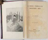
1897ref. 176109London.: Macmillan and Co. Limited. 1897. Photographic frontispiece of 'The Shah returning to Teheran' and numerous full page photographic illustrations four folding printed colour maps marginal spotting xii 275 pages 23 x 15 cm original red glazed red cloth boards occasional spotting the cloth a little marked and flecked the spine sunned but in very good condition. An extensive and intrepid modern Grand Tour account through Constantinople and Turkey to Persia and Central Asia with 34 striking photographic plates. Clive Bigham was an Honorary Attaché to the British Embassy at St. Petersburg and war correspondent in the Near East travelled at the very height of the Armenian troubles when the strict orders had been issued by Turkey that Asia Minor was to be closed to Europeans. Burrell 94. This item is held off-site. Please note there may be a few days delay while it is brought into our shop for viewing or mailing to you. Thank you for your understanding. When referring to this item please quote stockid 176109 . Macmillan and Co. Limited. hardcover
ref. 0265666813.Gpaperback. Good. Access codes and supplements are not guaranteed with used items. May be an ex-library book. paperback
1881ref. ABE-EBAY-197700219739London: Kegan Paul 1881. Hardcover. Good. A Polar Reconnaissance. Being the Voyage of the ""Isbjörn"" to Novaya Zemlya in 1879. By Albert H. Markham. With Maps and Illustrations. London: C. Kegan Paul 1881. 10 engravings 6 of them full-page plates 2 folding maps. Top and bottom of spine significantly chipped other extremities rubbed spine sun-faded a little scuffing and staining. Pages yellowed with an occasional bit of foxing smudge minor blemish; there are a couple of light pencil marks; a blank page at the end has a few pencil notes. Binding cracked and weak one signature is detached a couple of others are loosening. Owner bookplate James Richardson. Kegan Paul hardcover
1766ref. LBW-765London, A. Dury, 1766. 420 x 573 mm.
1800ref. LBW-6863Londres, J. Stockdale, 1800. 230 x 255 mm.
1750Pianta di Roma a proiezione verticale, orientata con il nord in alto.Incisa da R. Benning per il cartografo inglese John Rocque e basata sulla pianta di Giovan Battista Nolli del 1748."Come annunciato nel titolo (ripetuto anche in italiano e francese), si tratta di una diretta derivazione della pianta piccola del Nolli che l'autore ha voluto riportare nella scala in cui aveva già pubblicato la pianta della città di Londra. In basso a sinistra indice delle fabriche più ragguardevoli contenute nella pianta con 170 voci suddivise in sei colonne. In basso a destra dedica a Sir. Bouchier Wrey. Le emergenze architettoniche sono campite in nero ed il resto degli isolati a tratteggio diagonale. In basso a sinistra il nome dell'incisore R. Benning sc. La stessa pianta fu rstampata nel 1773 dal Sawyer" (cfr. Marigliani p. 274).Acquaforte, finemente colorata a mano, in buono stato di conservazione. Non comune. Vertical projection map of Rome, oriented with the north at the top.Published in 1750 by John Roque, from the earlier plan by Goivanni Battista Noli published in 1748 (These dates are printed on the map).As announced in the title (also repeated in Italian and French), this is a direct derivation of the small map of Nolli that the author wanted to bring back to the scale in which he had already published the map of the city of London. At the bottom left index of the most remarkable fabrications contained in the plan with 170 entries divided into six columns. Bottom right dedication to Sir. Bouchier Wrey. The architectural buildings are in black and the rest of the blocks are in diagonal hatching. Bottom left the name of the engraver R. Benning sc. The same plan was printed in 1773 by Sawyer (see Marigliani p. 274).Etching, finely colored by hand, in good condition. Not common. C. Marigliani, "Le Piante di Roma delle collezioni private", n. 192; Scaccia Scarafoni, "Le Piante di Roma", n. 230.
1766ref. LBW-764London, A. Dury, 1766. 430 x 569 mm.
1942pp. ix, 220 + Plus three large pocket folding airport weather maps. Illustrated with numerous photographs, charts, diagrams and maps. Endpapers beginning to brown. XLib stamp on front pastedown. 8vo. Original full cloth binding. Original dust jacket, torn with slight loss. Nice copy. WWII 2
ref. 1527772446.Gpaperback. Good. Access codes and supplements are not guaranteed with used items. May be an ex-library book. paperback
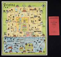
1934ref. 158433Peiping.: Peiyang Press. circa1934. Coloured folding plan of Peking with original envelope. 60 x 50cm. A few neat repairs at folds two panels evenly browned on reverse. A very good copy of a scarce pictorial plan with its envelope. This delightful and scarce pictorial map of Peking with landmarks and streets in romanised Chinese with occasional Chinese characters is surprisingly scarce. Although apparently issued in several editions in the 1920s and 30s it appears relatively infrequently on the market. The divisions of the Legation District are indicated by their flags - this edition shows the German Legation by use of the black white and red bands of the German flag. This flag which was no longer used after 1935 helps date this edition. Other landmarks and attractions shown included theatres foreign shopping area adjacent to the legations quarter Liu Li Chang Curio District the racecourse the many city gates etc. . Peiyang Press. unknown
ref. 64630Imp. Chaix, s.d. [1890] Spectaculaire affiche destinée aux colonnes Morris où la Justice aux yeux bandés déverse une pluie d'argent sur les spéculateurs qui s'affairent devant le Palais Brongniart. Exemplaire plié, en bon état malgré de petites déchirures au centre, sans manques.
ref. 64630Imp. Chaix, s.d. [1890] Spectaculaire affiche destinée aux colonnes Morris où la Justice aux yeux bandés déverse une pluie d'argent sur les spéculateurs qui s'affairent devant le Palais Brongniart. Exemplaire plié, en bon état malgré de petites déchirures au centre, sans manques.
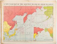
1942ref. 206849Chicago.: Chicago Daily Tribune. 28 January1942. Printed colour map 40.3 x 53.6 cm; 46.5 x 60 cm sheet inset map of the North Pacific back cover from a section of the Chicago Daily Tribune newspaper pages 21-34 January 28 1942; central fold edgewear and browning with a few minor tears not affecting the map in very good condition. Based on a Rand McNally map and issued less than two months after the bombing of Pearl Harbour by the Japanese. The Tribune briskly got to work issuing maps for readers showing the beginnings of the war with Japan. Later maps were also published for sale separately but remarkably few have survived. The map shows "the nearness of our Aleutian Island chain west of Alaska to the islands of Japan. At Dutch Harbor and other points in the Aleutians are actual and potential sea and air bases lying on the shortest route from northwestern United States to Japan." The inset map at lower right situates the areas in the larger map in respect to the countries bordering the North Pacific Ocean. Included with the map is the complete newspaper section from which it is the final full page. Covering sport and the market with half a dozen popular comic strips including "Dick Tracy" and "Little Orphan Annie" it shows a domestic United States a world away from what had been seen as a European War. ". the historic Chicago Tribune was an innovator in color inks and printing but also a pioneer in bringing colorful art in the form of illustrations photographs cartoons and advertisements to the average person in an everyday medium." see The Janet A. Ginsburg Chicago Tribune Collection Michigan State University Libraries." . Chicago Daily Tribune. unknown
ref. 66506CBo.J. [3 Warenabbildungen] (John Cary, geb. ca. 1754, gest. 1835, englischer Kartograph, Graveur, Globenmacher und Verleger).
1793London, W. Faden, 1793. (75 x 62 cm.). Engraved map of Ireland for travelling use, sectioned and laid down on linen. With 2 large fine engraved cartouches and handcoloured in outline.
1793ref. 55054London, W. Faden, 1793. (75 x 62 cm.). Engraved map of Ireland for travelling use, sectioned and laid down on linen. With 2 large fine engraved cartouches and handcoloured in outline.